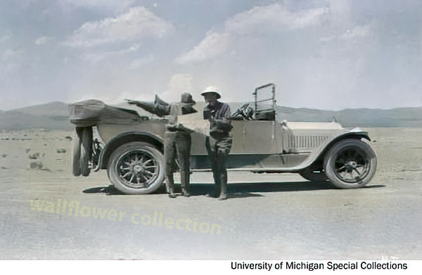
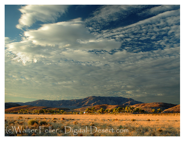
The March 1915 issue of Motor magazine contained an article by A. L. Westgard on “Motor Routes to the California Expositions.” The following is an excerpt from that article:
Owing to the recent improvement of the transcontinental routes, it is no longer necessary to load one’s car down with all sorts of paraphernalia to combat the many difficulties which formerly were strewed along the path, nor is it, in this day of dependable motor cars, necessary to carry a multiplicity of parts. Still, it is well to outfit with reasonably limited equipment to provide against mud, possible breakdowns, and climatic changes.
To begin with, limit your personal outfit to a minimum, allowing only a suitcase to each person, and ship your trunk. Use khaki or old loose clothing. Some wraps and a tarpaulin to protect you against cool nights and provide cover in the case of being compelled to sleep outdoors are essential. Amber glasses, not too dark, will protect your eyes against the glare of the desert. You will, of course, want a camera, but remember that the high lights of the far west will require a smaller shutter opening and shorter exposure than the eastern atmosphere.
Carry sixty feet of 5/8-inch Manila rope, a pointed spade, a small ax with the blade protected by a leather sheet, a camp lantern, a collapsible canvas bucket with spout, and a duffle bag for the extra clothing and wraps. Start out with new tires all around, of the same size if possible, and two extra tires also, with four extra inner tubes. Select a tire with tough fabric; this is economical and will save annoyance. Use only the best grade of lubricating oil and carry a couple of one-gallon cans on running-board as extra supply, because you may not always be able to get the good oil you ought to use.
And, mark this well, carry two three-gallon canvas desert water bags, then see that they are filled each morning. Give your car a careful inspection each day for loose bolts or nuts and watch grease cups and oil cups. Carry two sets of chains and two jacks, and add to your usual tool equipment a coil of soft iron wire, a spool of copper wire, and some extra spark plugs.
West of the Missouri carry a small commissary of provisions, consisting of canned meat, sardines, crackers, fresh fruit or canned pineapples, and some milk chocolate for lunches. The lack of humidity in the desert sections, combined with the prevalence of hard water west of the Missouri River is liable to cause the hair to become dry and to cause chaps and blisters on the face and hands as well as cause the fingernails to become brittle and easily broken. To prevent this, carry a jar of outing cream and a good hair cleanser. Use them every night.
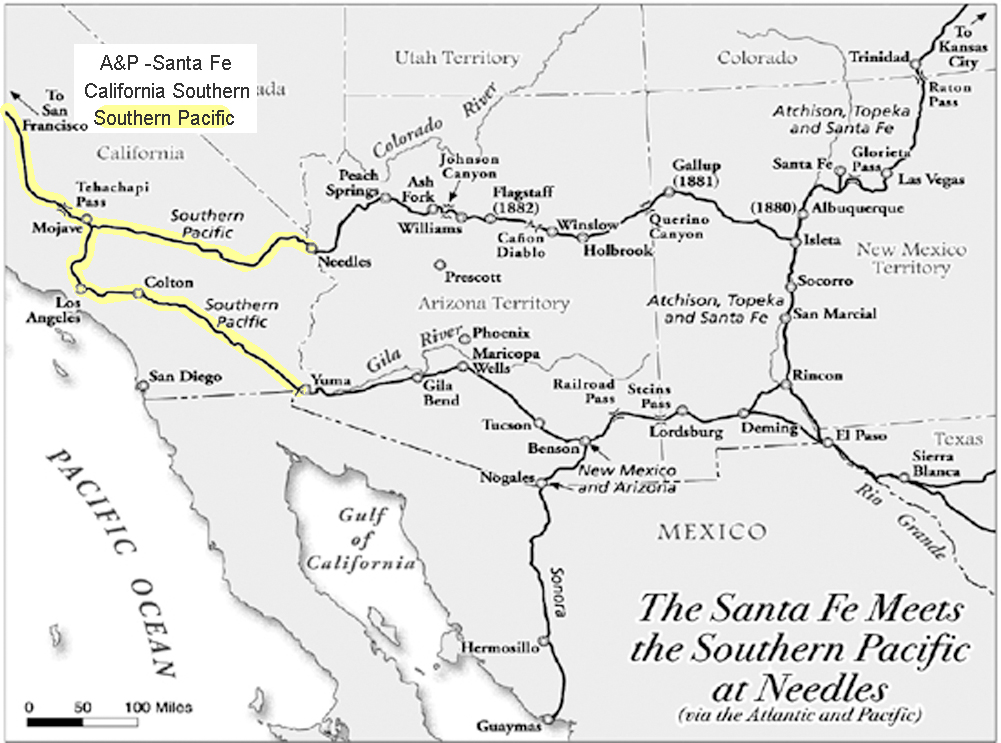
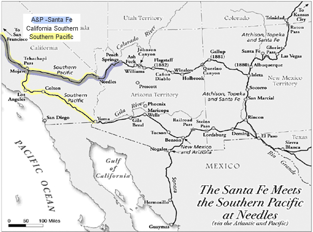
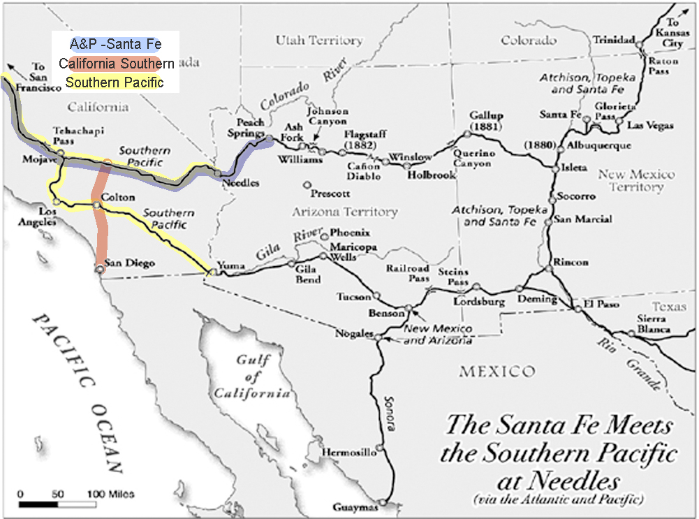
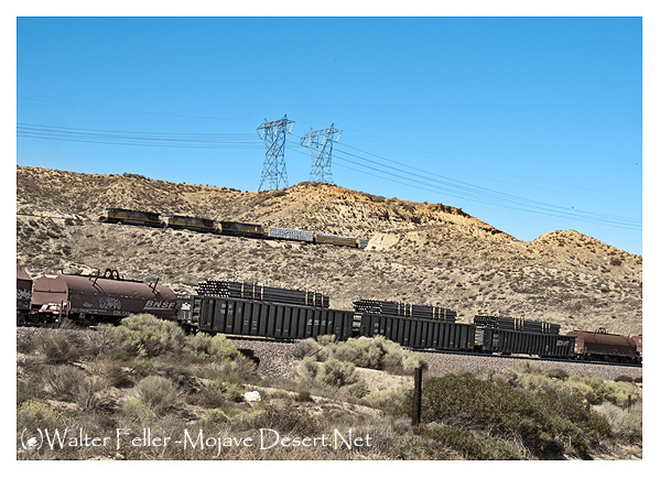
The Southern Pacific had a monopoly on Southern California’s Transcontinental Railroads. Nothing came in or went out on any other rails than Southern Pacific rails.
However, the Southern Pacific at Needles needed to connect with the bridge at the Colorado River to the Atlantic and Pacific. In order to do this, they worked out an agreement wherein the Atlantic & Pacific could use their rails to ship to and from San Francisco. Southern California still remained in a monopoly.
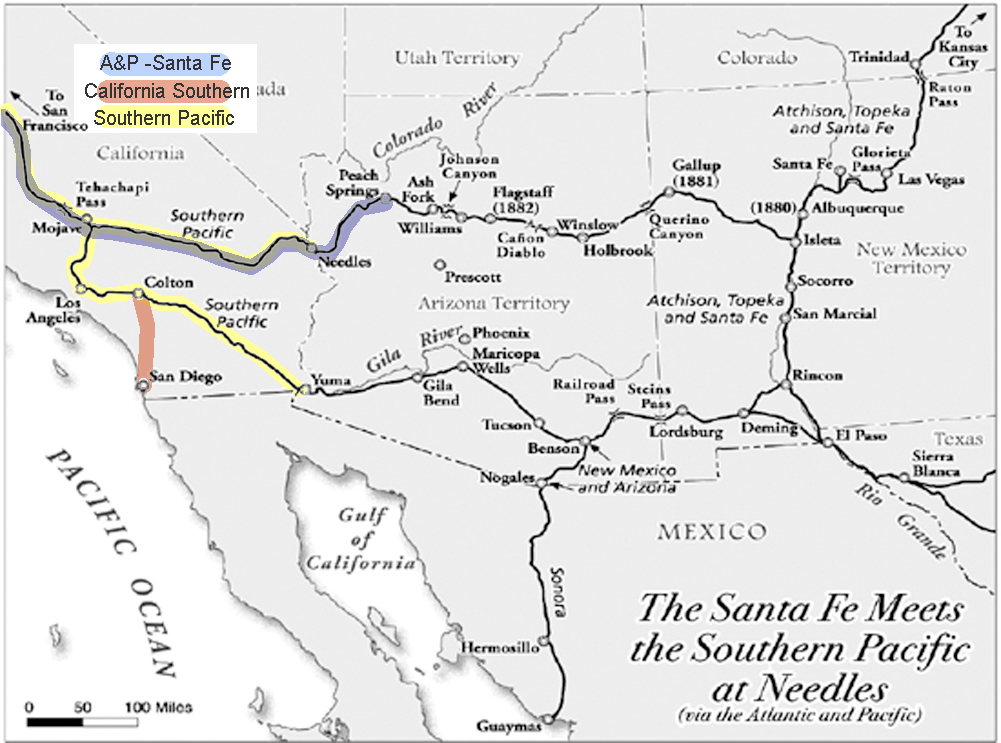
San Diego wanted a share in the rapid growth of the state. With the high cost of getting there, most tourists simply stopped in Los Angeles.
The California Southern, backed by investors from Boston, built from San Diego to Colton, but the Southern Pacific delayed their progress further north for over a year in what became known as the ‘Frog War.’ ‘Frog’ is the term for a rail crossing rail assembly so that either track can cross the other.
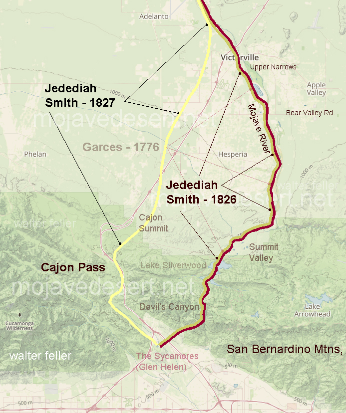
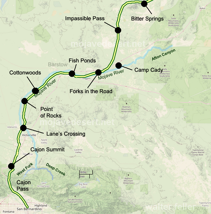
Formidable, but not impossible, building through the Cajon Pass to the Mojave River, through the upper and lower narrows, and then along in the same direction to Waterman, now known as Barstow. San Diego now had the benefit of a link to a transcontinental railroad and Southern California had a competitive transportation network.
MAPS AND SURVEY – 1913 BY ARTHUR R. HINKS, M.A., F.R.S.
CHAPTER III route traversing The Explorer’s Route Map
The first care of a traveler who passes through an unknown, or partially explored country, is to make a record of where he has been, and of the main features of the country along the route by which he has traveled. Often singlehanded, encumbered by transport, compelled to keep to the track, and unable to leave his party, he cannot hope to make anything in the nature of a map, in the ordinary sense of the term. But for his own guidance, to avoid getting lost, he is compelled to determine his position day by day in much the same way that the position of a ship is determined at sea, by observation of the Sun and the stars, so that he is able to say roughly in what latitude, and perhaps in what longitude his halting places were. Moreover, as he goes along he is able to make such observations of the shape and course of his path as to enable another man coming after him not only to arrive more or less at the same place but to follow the same route. And finally, he can keep a sort of running record of the things that lie immediately to the side of his path. All this is done by the construction of a “route traverse” or “route map.”
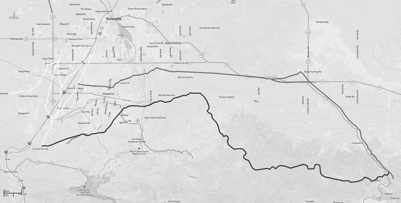
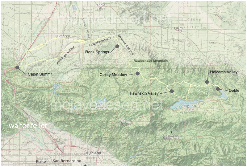
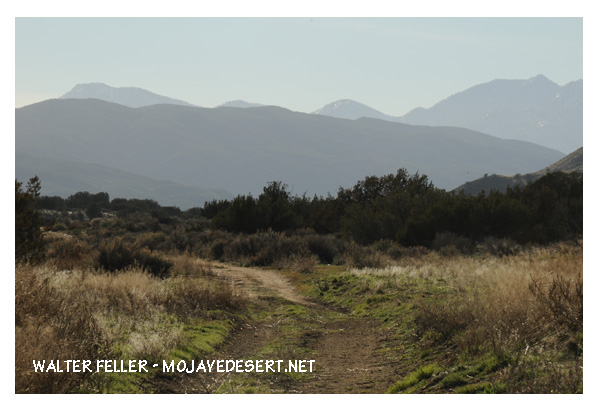
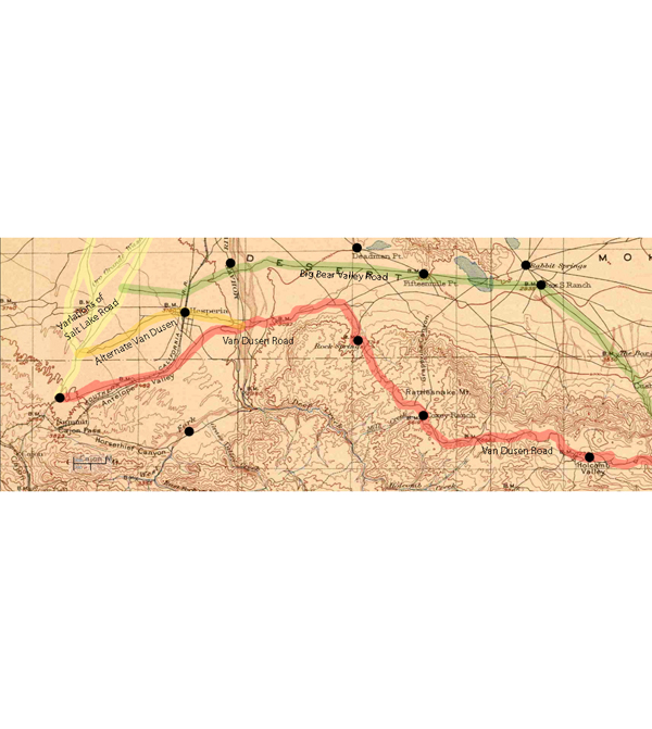
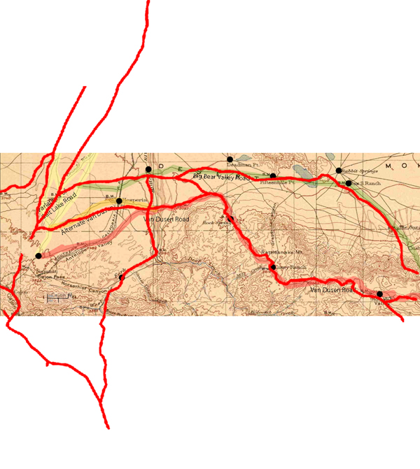
Van Dusen Road/ Coxey Truck Trail from Cajon Summit to Holcomb Valley
He (Hoffman) saw nothing between Summit Valley in the river he considered a likely site. In fact, Hoffman condemned the entire route as unsuited for travel.
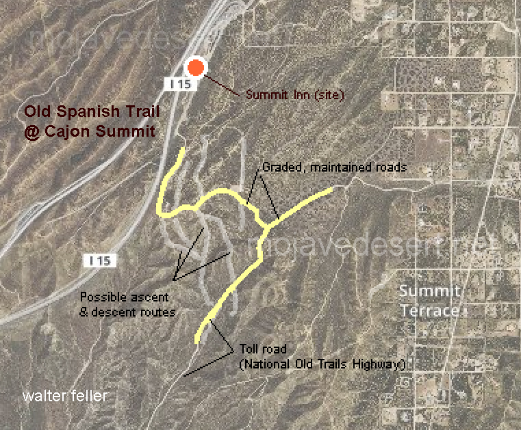
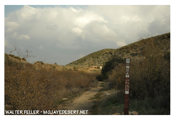
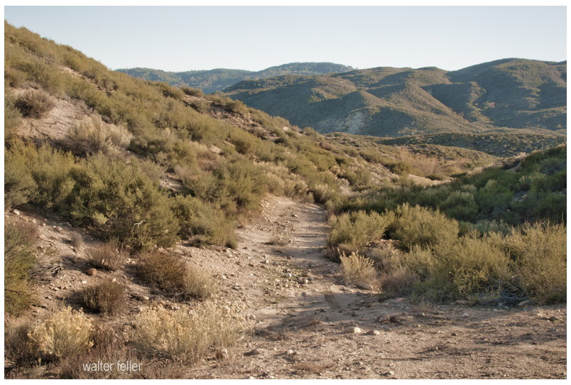
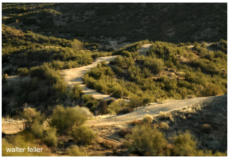
Traces of old trails and graded roads near the Cajon summit.
The direct route over the summit and down the pass eliminates the steep climb and descent over the San Bernardino Mountains.
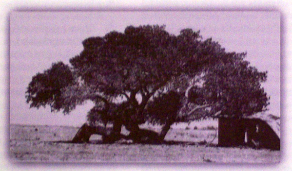
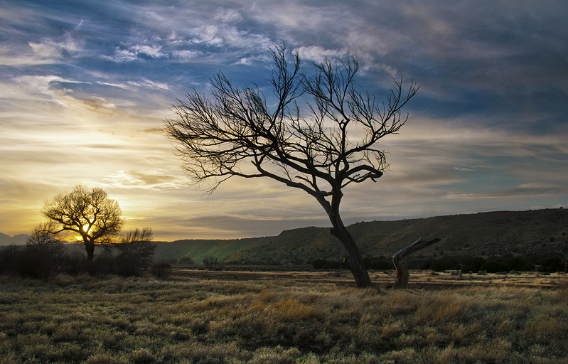
Cottonwood tree at the massacre site in Summit Valley
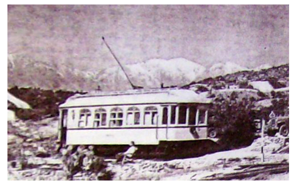
Chard Walker watching trains pass from the terrace beside the Decanso in 1954. From his book, “Railroading in the Pass”
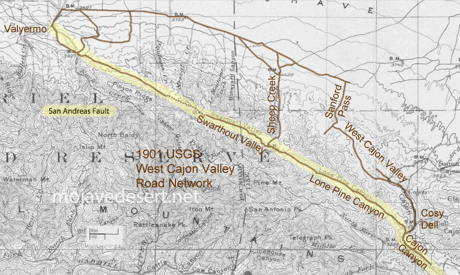
It seems that people have made use of the San Andreas Fault long before automobile or even wagon roads were developed along its seam. Shown is a 1901 U.S.G.S. map where I have traced the route leading from near Blue Cut in the Cajon Pass, just about straight northwest to Valyermo. The dotted line portion shown at the Big Pines saddle may have been either a mule trail or a road possibly impassible or without increased effort by wagon or auto. Indians likely used the features of the fault as a footpath to do as we all do; go from here to there.
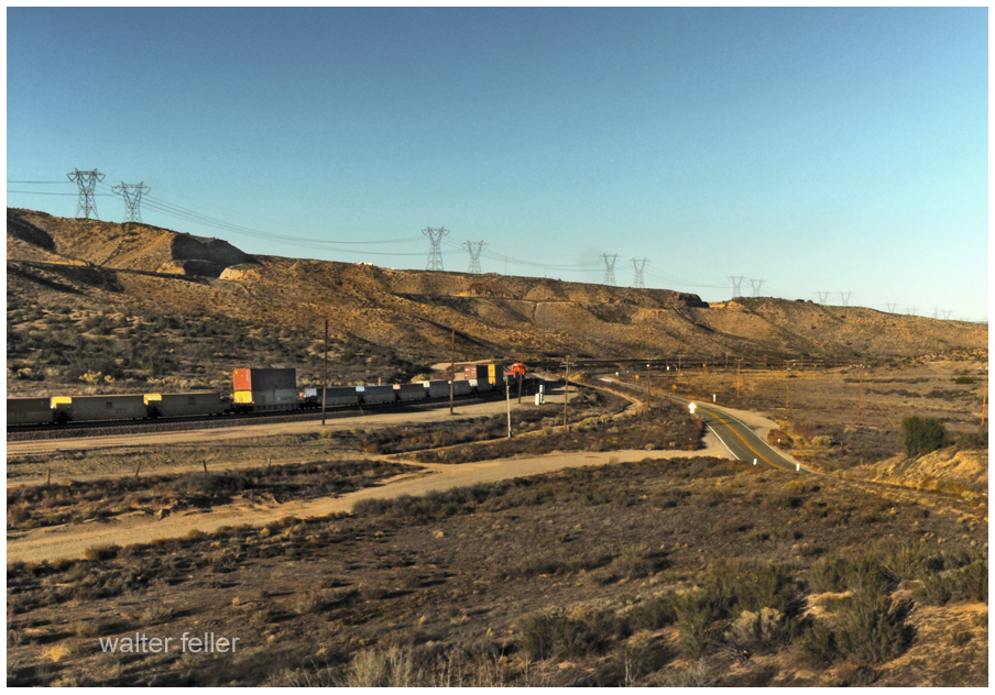
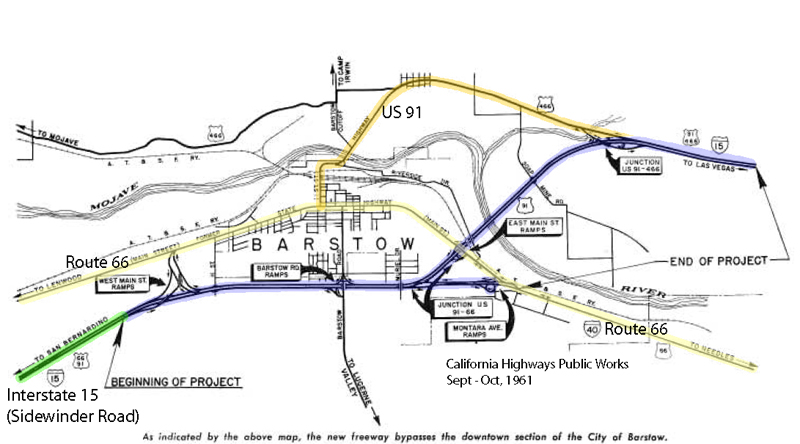
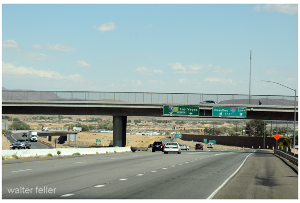
Bits from an interesting 1961 article about by-passing downtown Barstow and modernizing transportation infrastructure at the geographical descendant of ‘Forks-in-the-Road‘ of pioneering times. Speaks to the morphology of the transportation corridor from the classic Route 66 to the modern Interstate 15 Freeway. Also, see Sidewinder Road for maps between Victorville and Barstow.
On July 5, nine miles of the Barstow Freeway, known locally as the “Barstow By-Pass”, were opened to traffic by construction contractors Gordon H. Ball and Ball & Simpson.
The project is an extension of the 24-mile freeway from Victorville to Barstow which was opened in January 1959. It makes available the improvement to full freeway standards of an important link of Federal Interstate Route 1 S (U.S. 91) and the first step of freeway improvement of Interstate Route 40 (U.S. 66) toward Needles.
California Highways, Sep/Oct 1961.
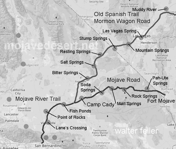
Modern ‘Forks-in-the-Road’ junction at Interstate 15 & 40 FreewaysForks-of-the-Road – Where the Salt Lake Road and Mojave Road come together and become the Mojave River Trail
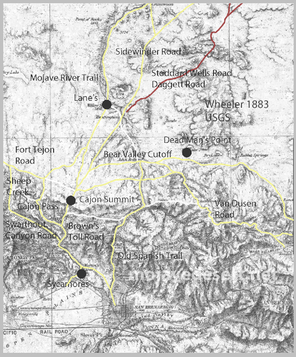
Not all-inclusive, this 1901 map shows basic transportation routes between the Cajon Summit on the west and east from there through either the San Bernardino Mountains or Lucerne Valley to where the two roads meet in the Big Bear Valley.
This map below was made in 1883 and shows an earlier and geographically expanded version of the routes.
1883 map of route network in the upper Mojave River region (note; no railroad)
The 1883 map is more inclusive and contains a couple of items I want to keep track of. There are differences but the road segments look about the same.
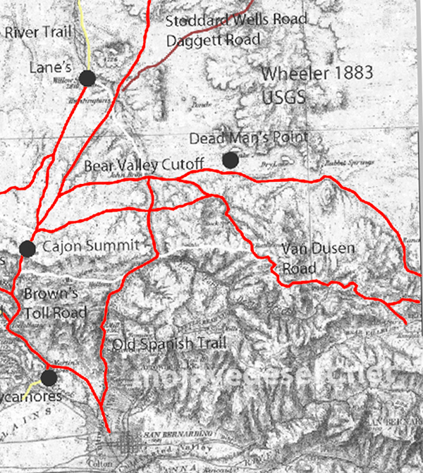
I made a copy of the 1883 roads layer and made it red to stand out better.
There are some nuances between the two maps, and right now the Oro Grande Wash area seems considerably off, fiddling with it some I can get a better fit–but not at these rates. The 1901 would be the more accurate depiction of what went on out there even if it were 35 years or so after the fact.
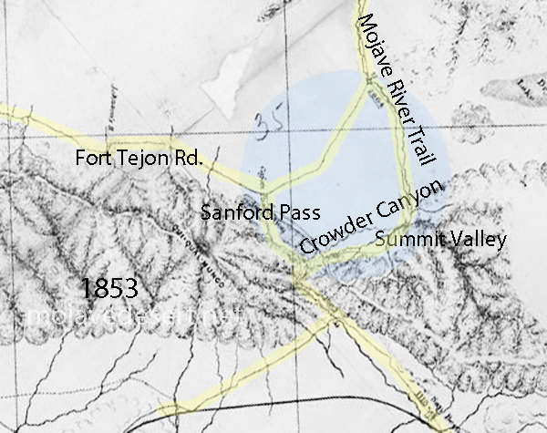
Williams USGS survey map 1853
Note that in the above map the variations of trails from across the valley leading to the Cajon Summit seem not to have been developed at this time and instead the trail along the Mojave River is shown.
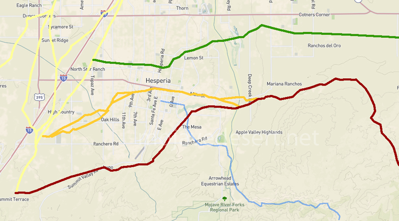
1901 trail routes transposed over modern street map through Hesperia
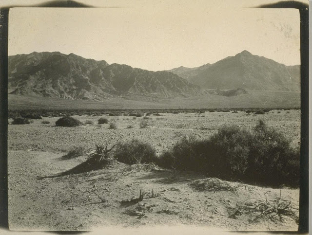
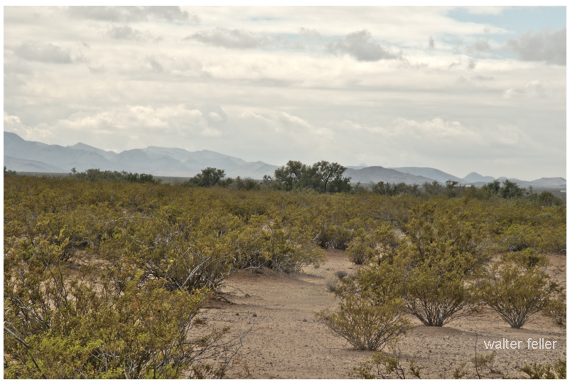
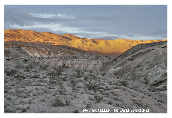
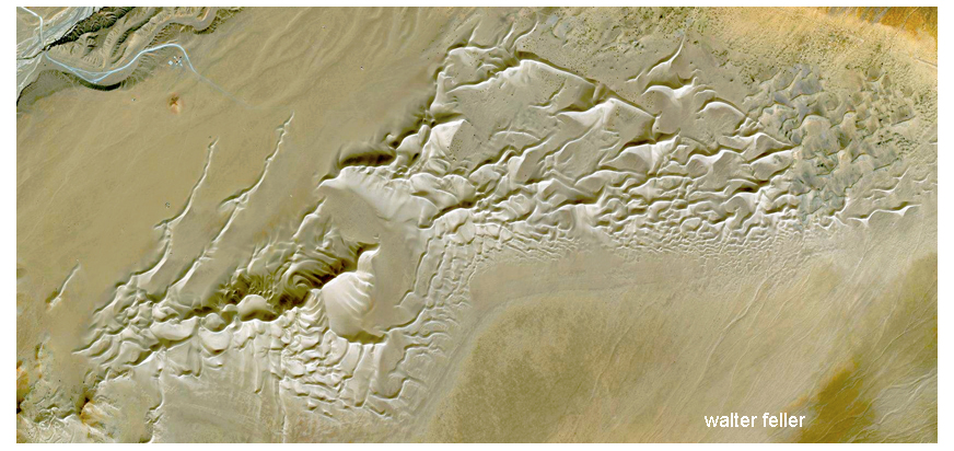
“It is often said that America has no real deserts. This is true in the sense that there are no regions such as are found in Asia and Africa where one can travel a hundred miles at a stretch and scarcely see a sign of vegetation—nothing but barren gravel, graceful, wavy sand dunes, hard, wind-swept clay, or still harder rock salt broken into rough blocks with upturned edges. In the broader sense of the term, however, America has an abundance of deserts—regions which bear a thin cover of bushy vegetation but are too dry for agriculture without irrigation…. In the United States the deserts lie almost wholly between the Sierra Nevada and the Rocky Mountain ranges, which keep out any moisture that might come from either the west or the east. Beginning on the north with the sagebrush plateau of southern Washington, the desert expands to a width of seven hundred miles in the gray, sage-covered basins of Nevada and Utah. In southern California and Arizona the sagebrush gives place to smaller forms like the salt-bush, and the desert assumes a sterner aspect. Next comes the cactus desert extending from Arizona far south into Mexico. One of the notable features of the desert is the extreme heat of certain portions. Close to the Nevada border in southern California, Death Valley, 250 feet below sea-level, is the hottest place in America. There alone among the American regions familiar to the writer does one have the feeling of intense, overpowering aridity which prevails so often in the deserts of Arabia and Central Asia. Some years ago a Weather Bureau thermometer was installed in Death Valley at Furnace Creek, where the only flowing water in more than a hundred miles supports a depressing little ranch. There one or two white men, helped by a few Indians, raise alfalfa, which they sell at exorbitant prices to deluded prospectors searching for riches which they never find. Though the terrible heat ruins the health of the white men in a year or two, so that they have to move away, they have succeeded in keeping a thermometer record for some years. No other properly exposed out-of-door thermometer in the United States, or perhaps in the world, is so familiar with a temperature of 100° F. or more. During the period of not quite fifteen hundred days from the spring of 1911 to May, 1915, a maximum temperature of 100° F. or more was reached in five hundred and forty-eight days, or more than one-third of the time. On July 10, 1913, the mercury rose to 134° F. and touched the top of the tube. How much higher it might have gone no one can tell. That day marks the limit of temperature yet reached in this country according to official records. In the summer of 1914 there was one night when the thermometer dropped only to 114° F., having been 128° F. at noon. The branches of a pepper-tree whose roots had been freshly watered wilted as a flower wilts when broken from the stalk.”
—The Chronicles of America.—Volume I. “The Red Man’s Continent,” by Ellsworth Huntington.
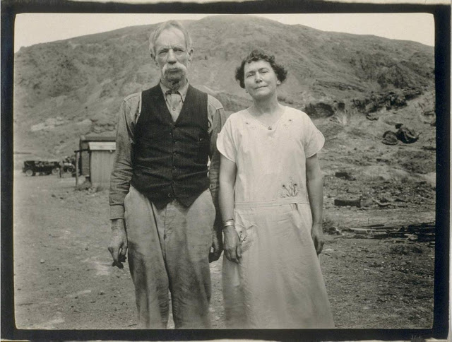
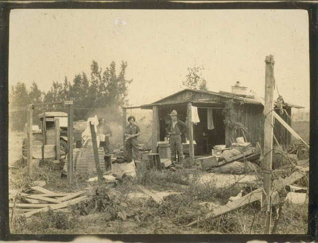
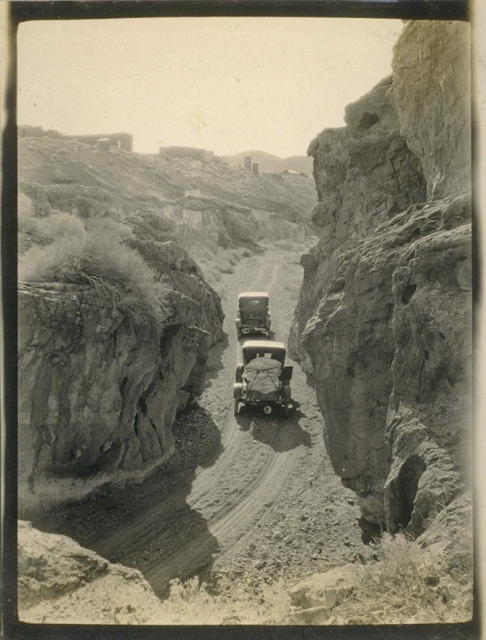
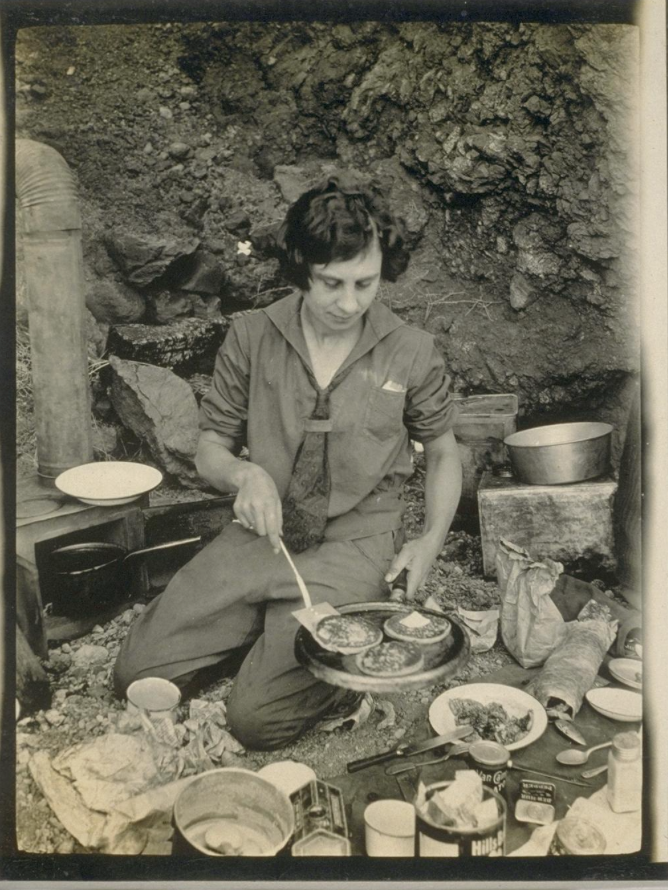
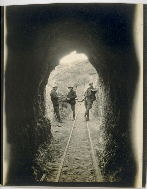
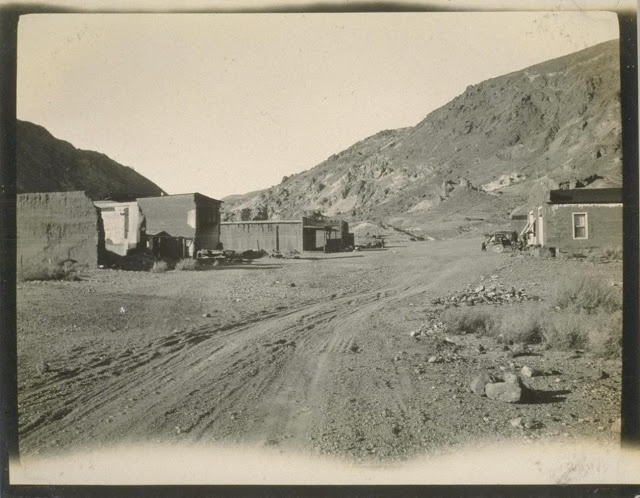
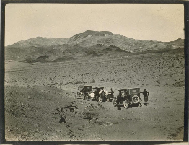
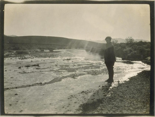
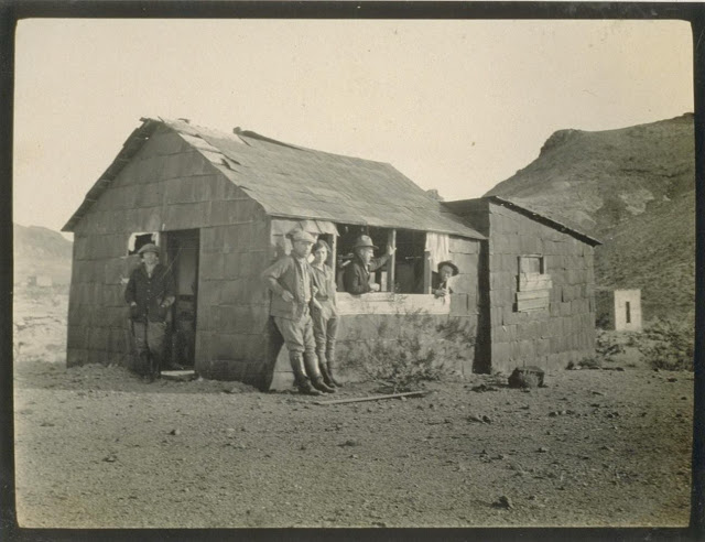
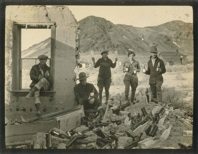
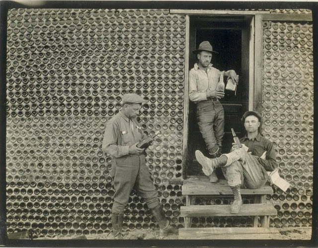
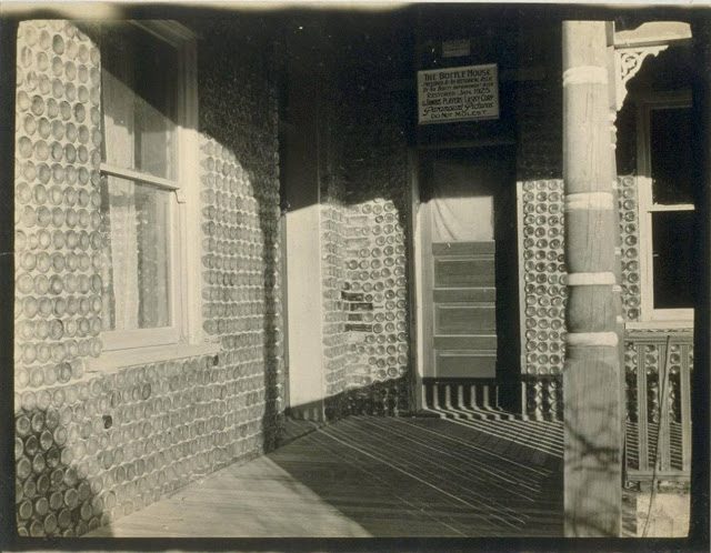
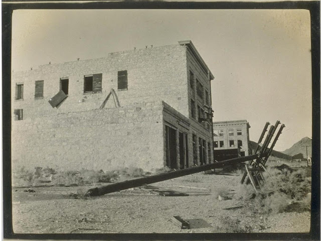
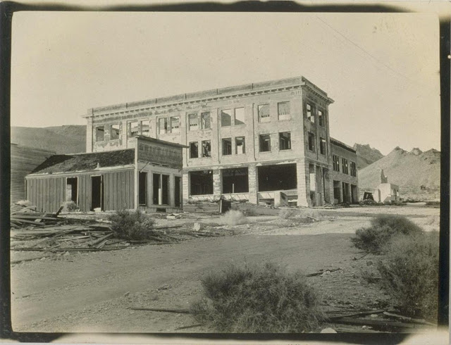
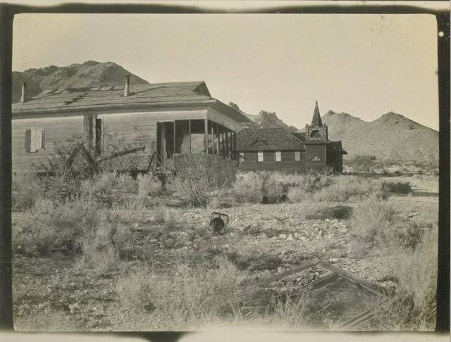
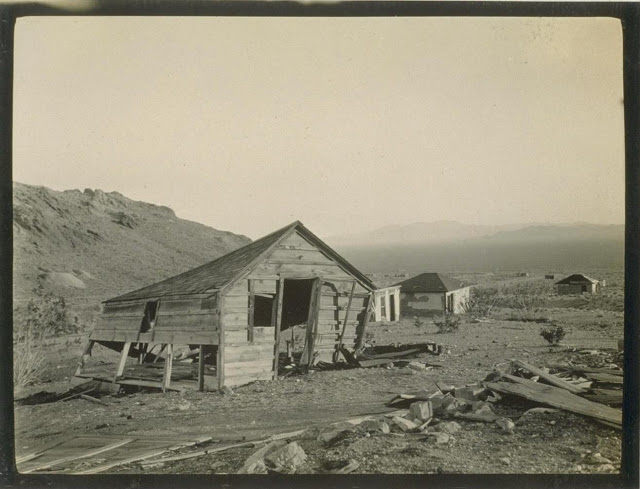
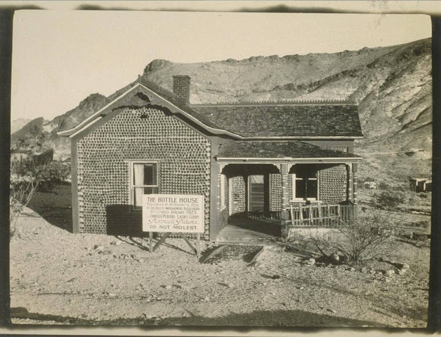
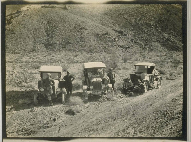
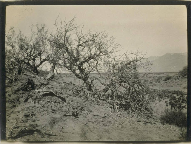
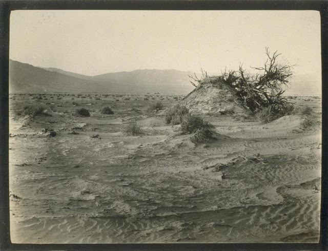
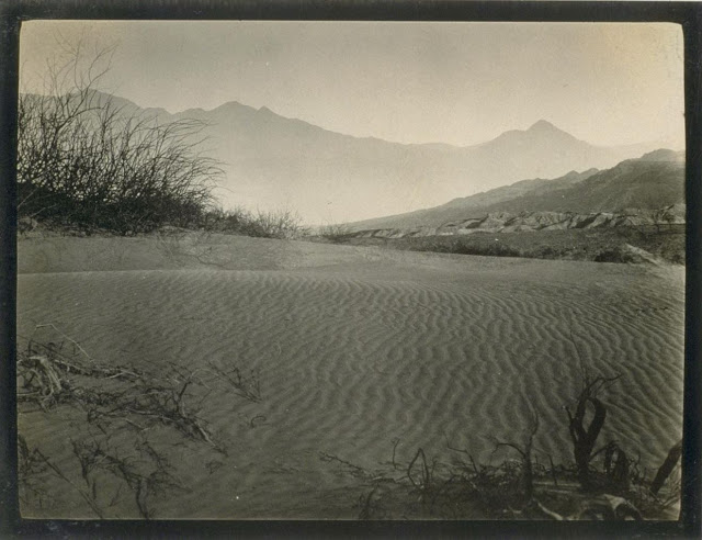
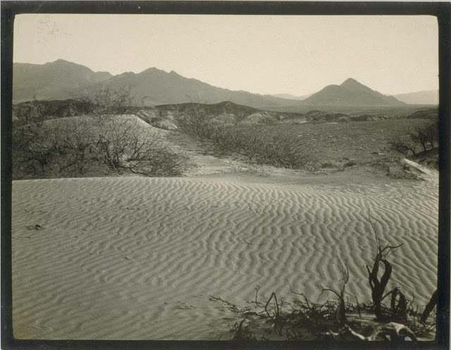
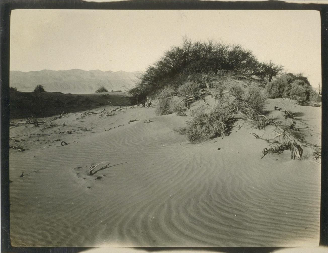
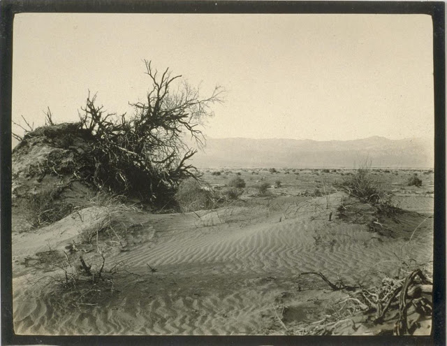
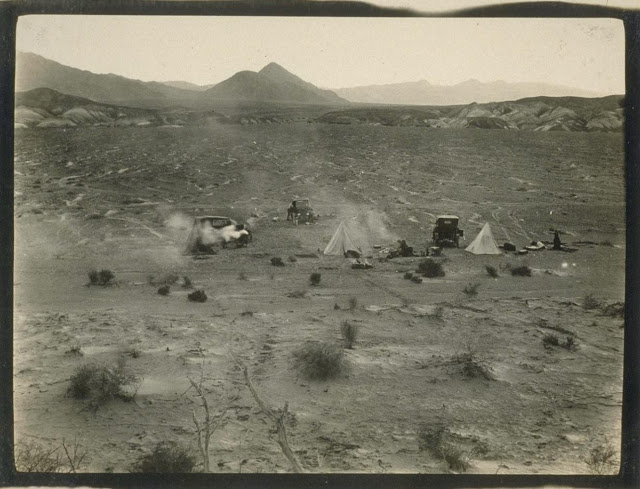
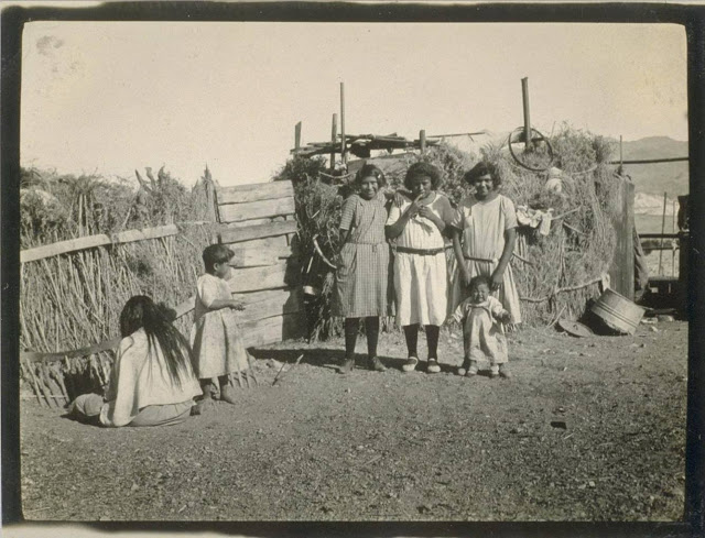
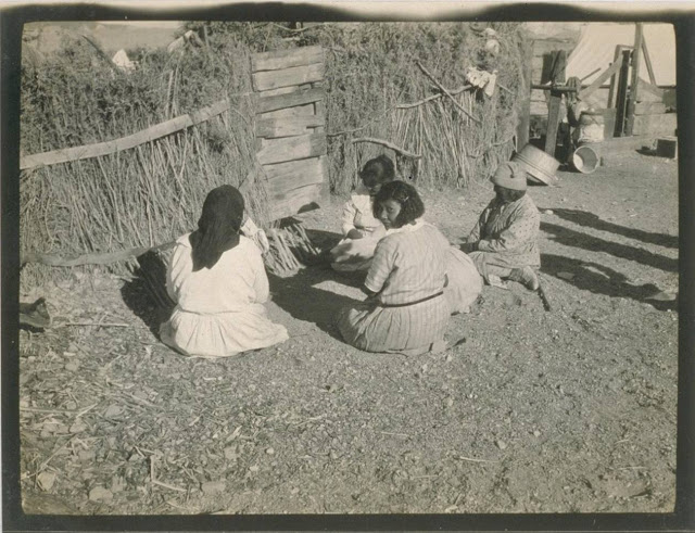
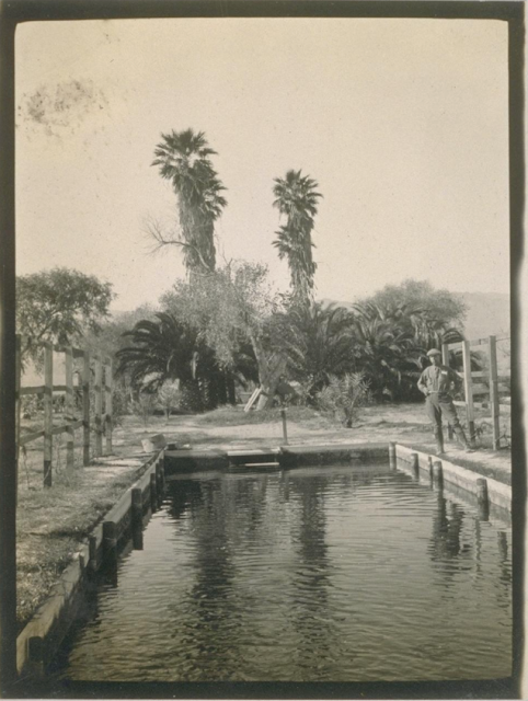
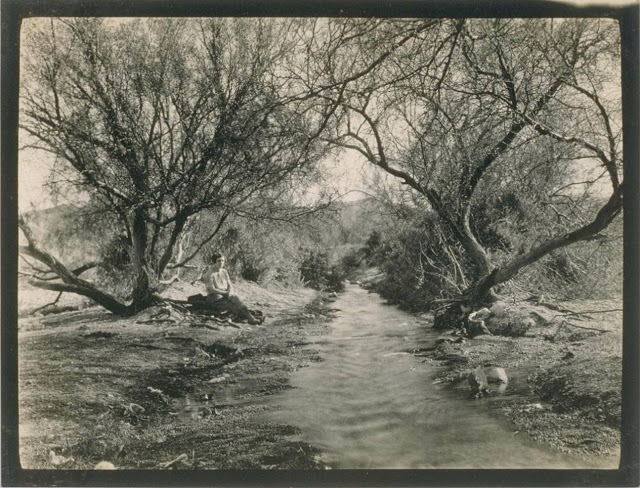
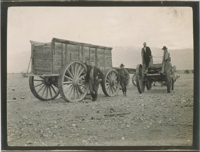
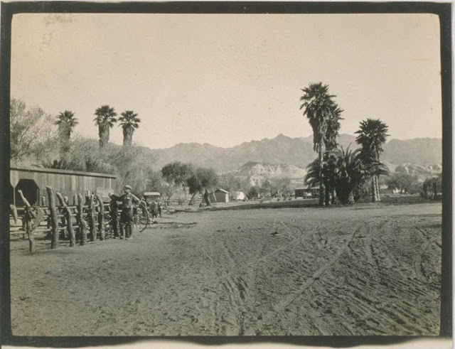
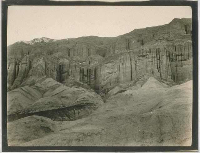
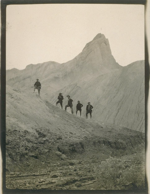
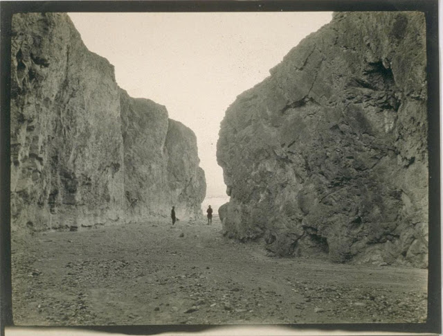
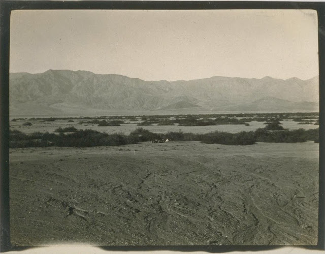
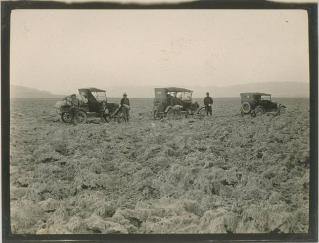
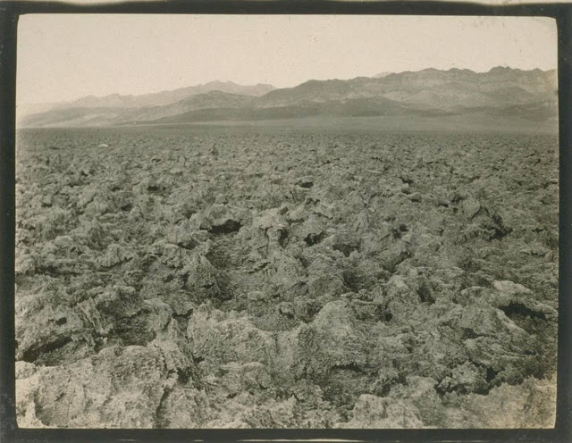
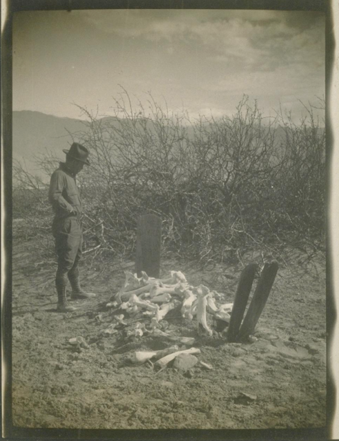
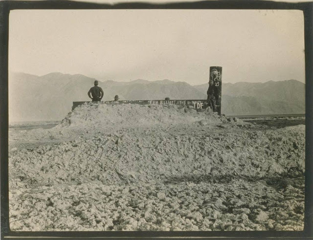
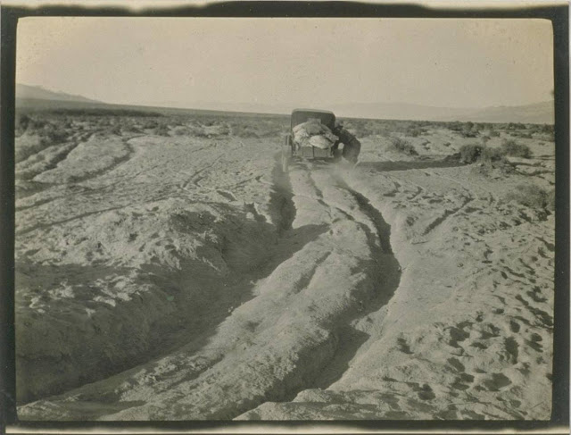
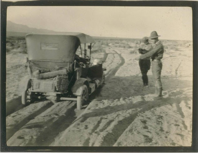
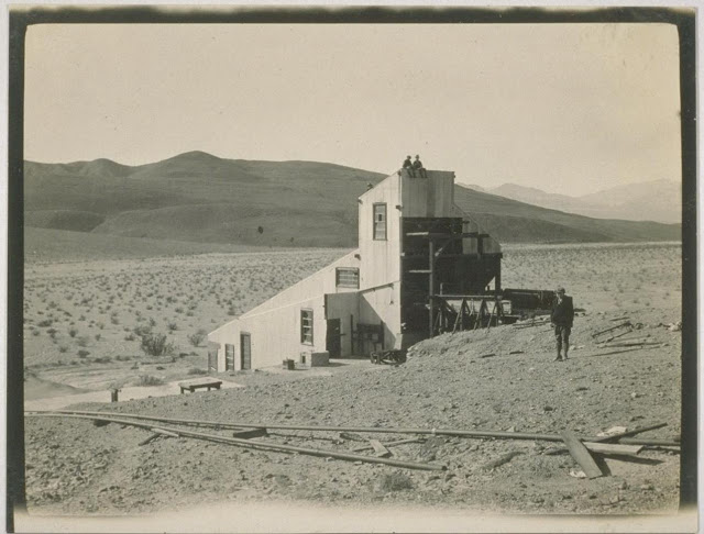
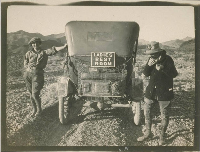
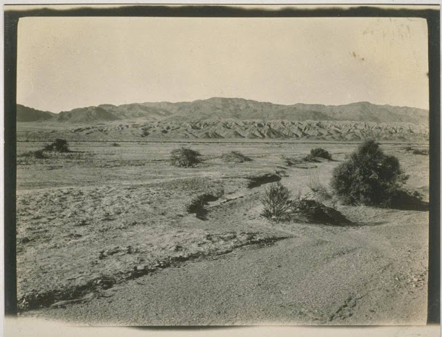
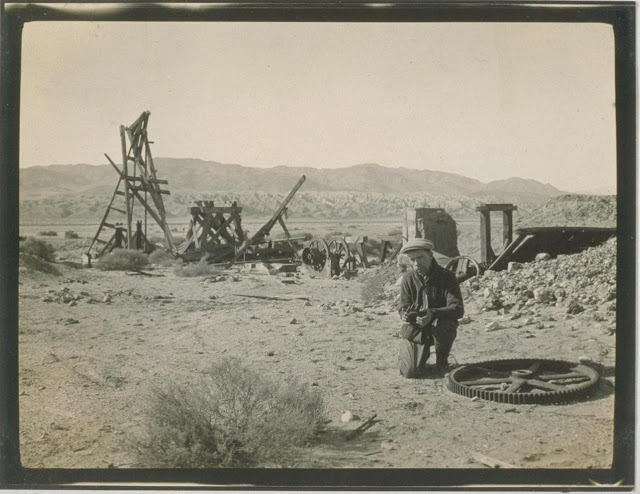
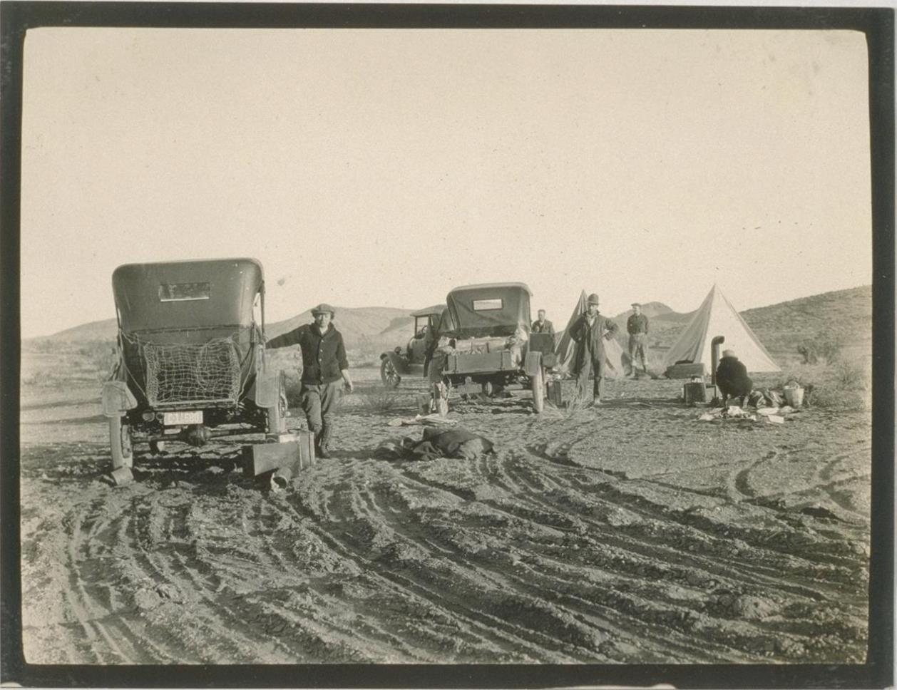
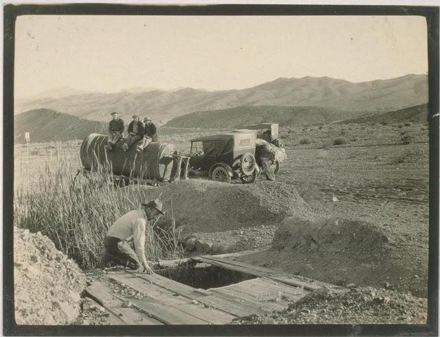
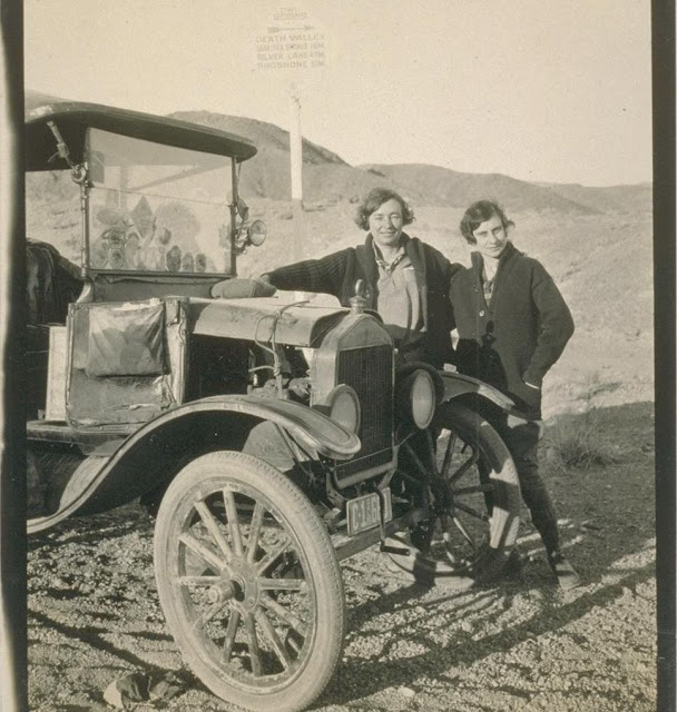
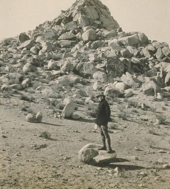
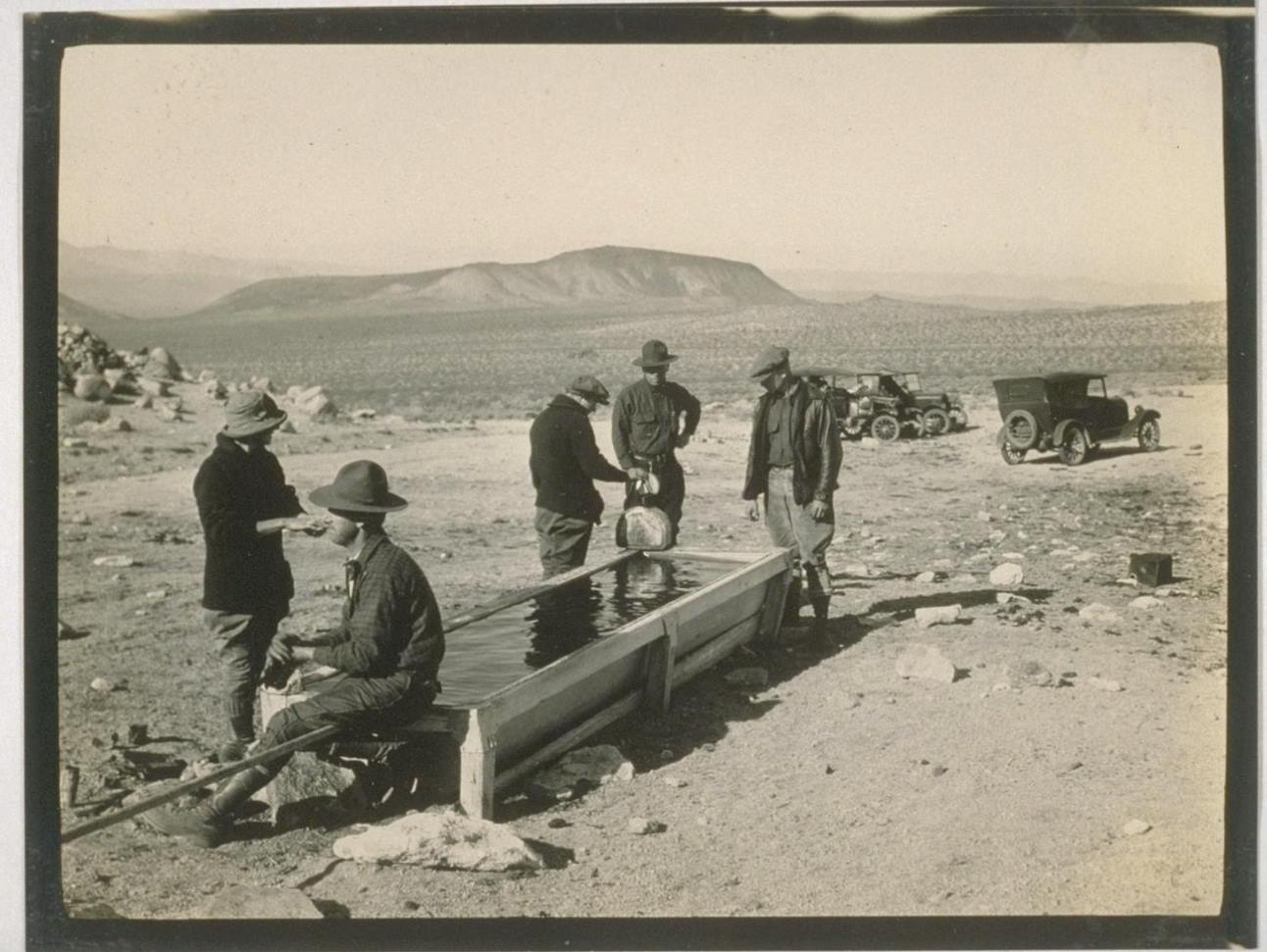
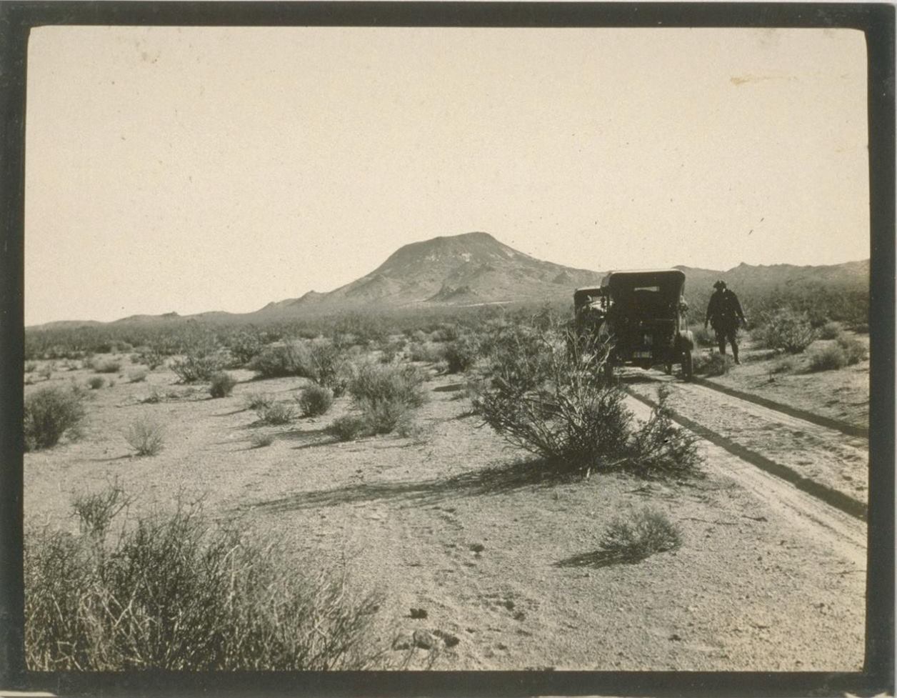
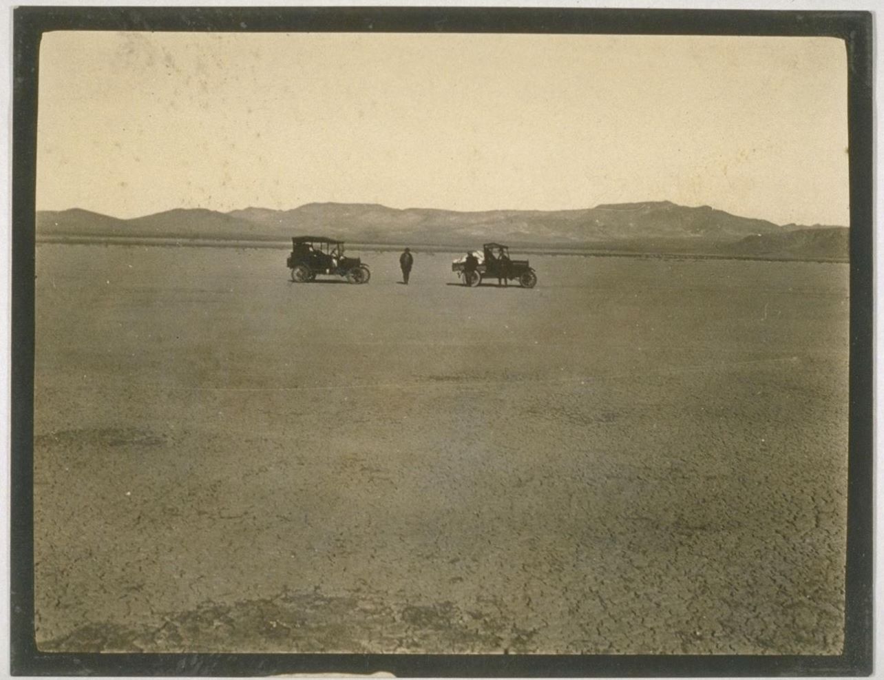
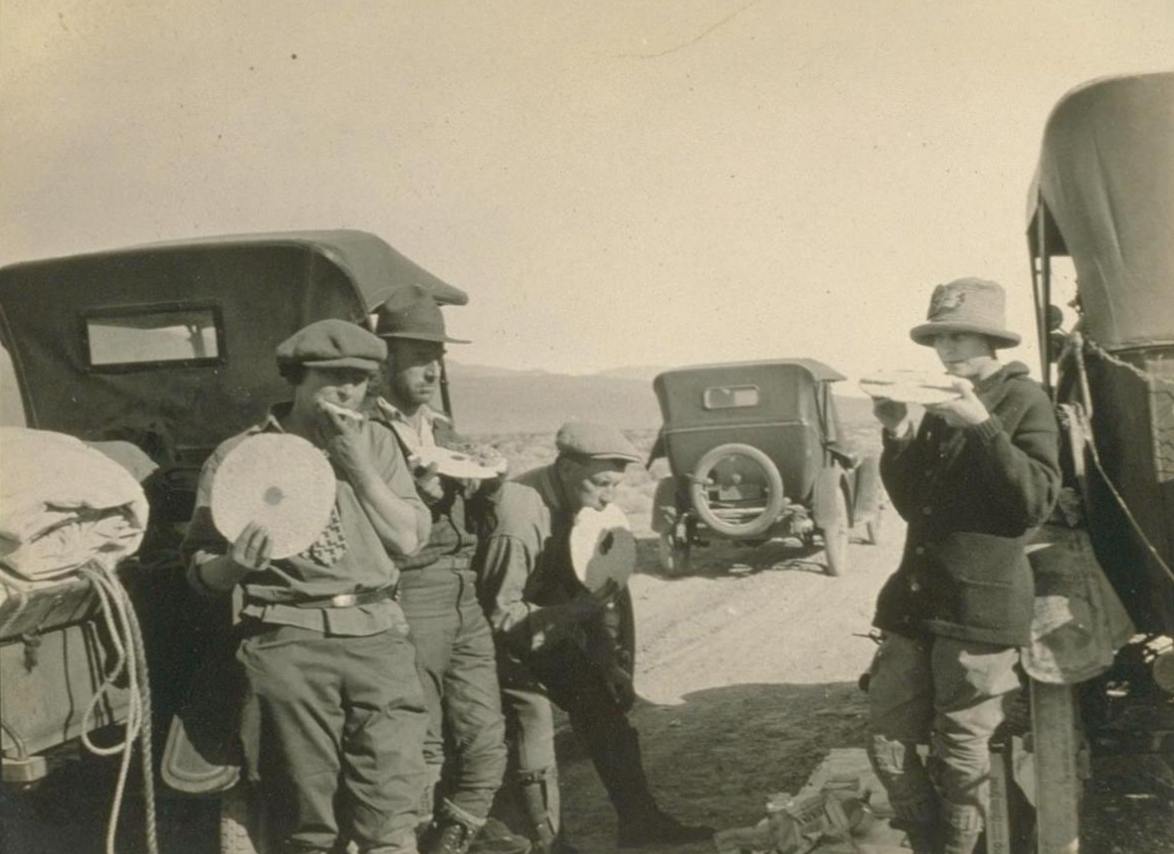
The Death Valley Automobile Trip photograph album containing 76 prints appears to be the record of a sightseeing trip made from Los Angeles to Death Valley in 1926. Neither the diarist nor the photographer is identified. The album displays no one emphasis: it consists of a broad range of photographs, from automobiles and sightseers to the landscape, abandoned mines, schoolhouses, hotels, and homesteads of Death Valley. . .
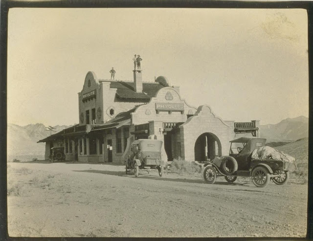
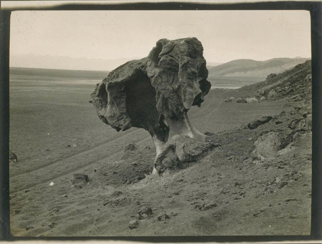
Rhyolite ghost townDevil’s Throne, Mushroom Rock
death-valley-automobile-trip-1926-24
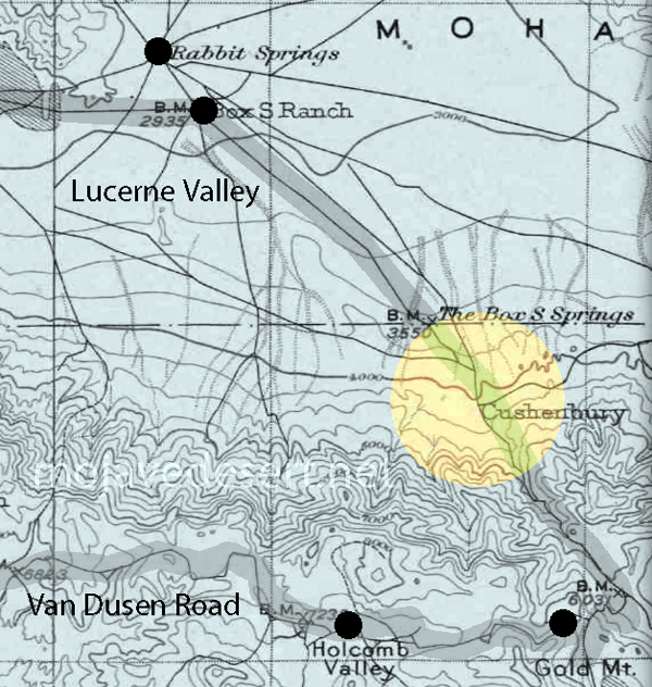
“As miners and ranchers moved into the area looking for wealth, the foothills quickly filled. The first of these documented miners was a man named John Cushenbury. In the 1860s he discovered silver and limestone near the spring, and thus began the rush of miners and “get-rich-quick” dreamers. However, like most get rich quick dreams this was also short-lived leaving ruminants of the small community scattered throughout the area today. This area was Cushenbury City and sported a healthy population for about a year or two.”
It was time to choose the first people. Everyone gathered to make their pleas and arguments. Rabbit’s ideas were mean and stupid. Rabbit wanted to be the first people. He became angry and kicked a large rock into the river changing its course. This is how the Virgin River came to meet the Colorado. . . . And why we are not rabbits.- Paiute legend
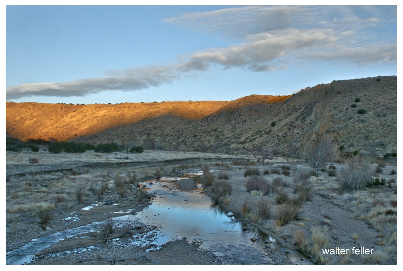
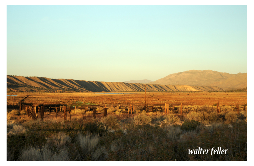
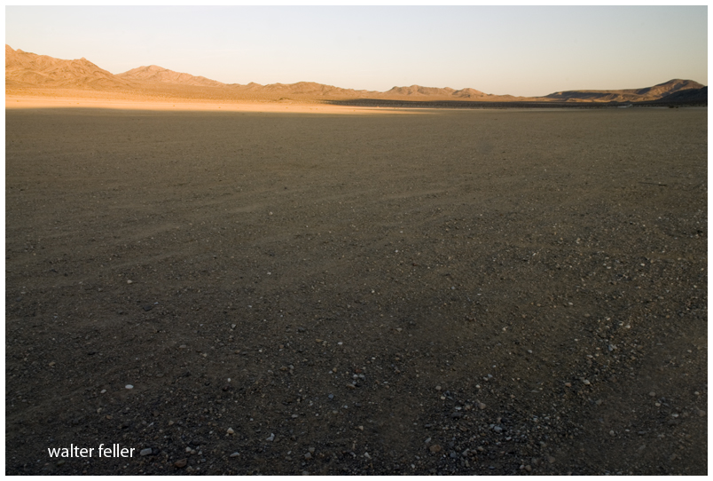
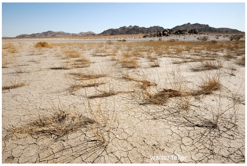
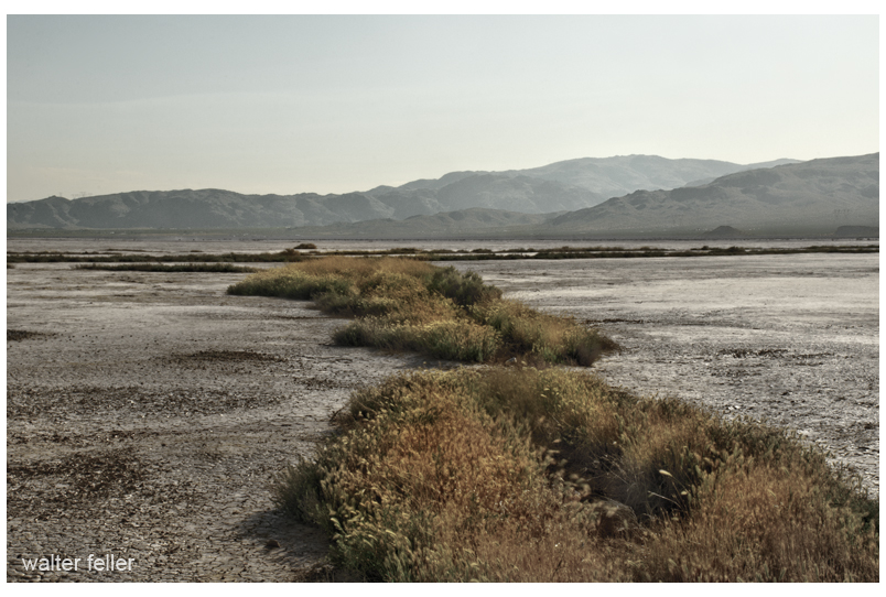
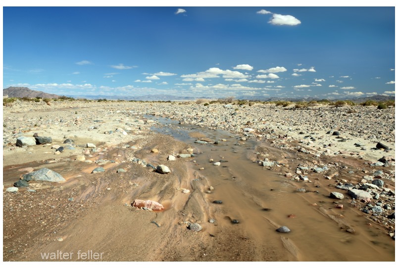
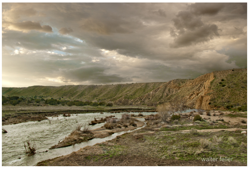
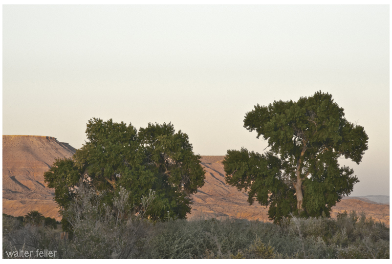
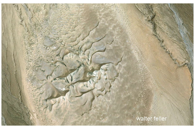
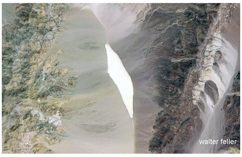
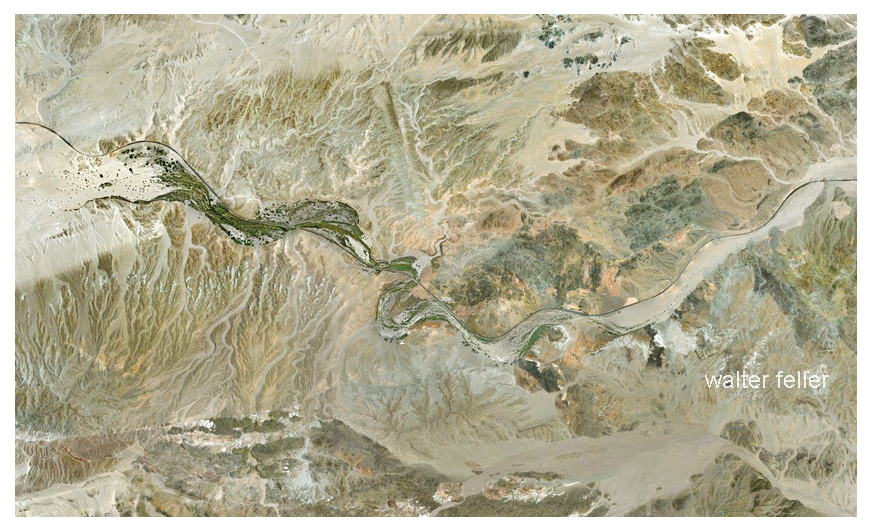
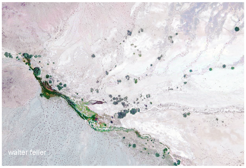
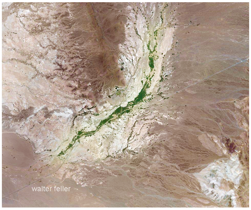
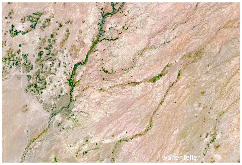
Rather than growing wider and emptying into the sea the Mojave River becomes smaller and smaller finding its way in the sand between the cobbles and rocks curling into crescent -shaped dark meanders and swales transitioning to dry sand and finally, collections of same sized stones.
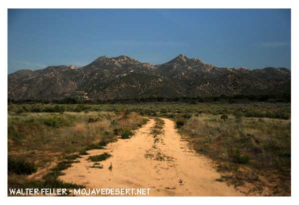
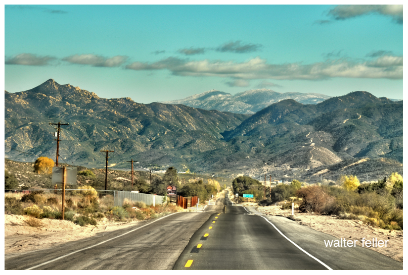
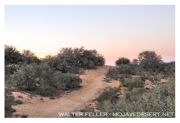
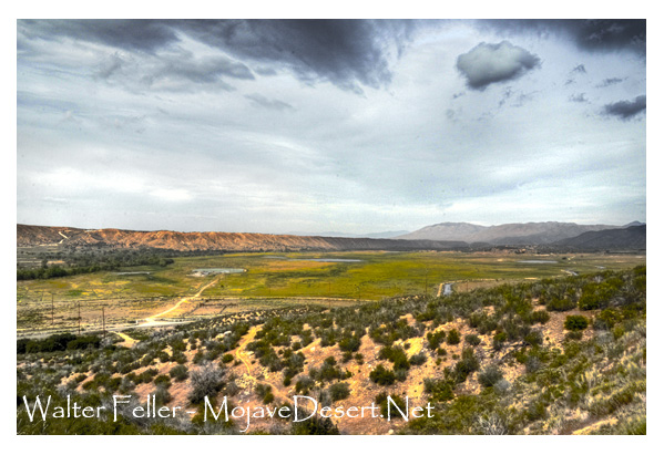
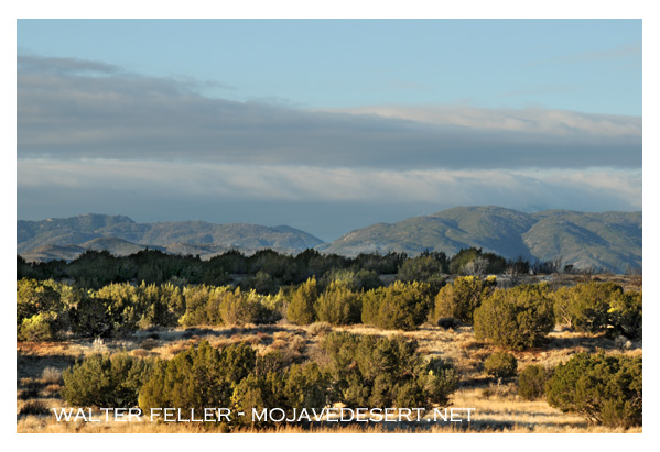
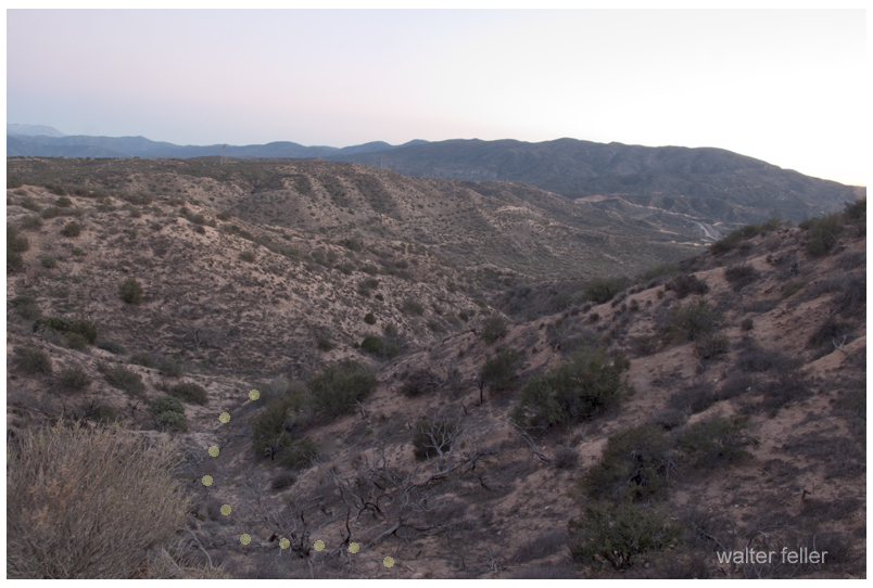
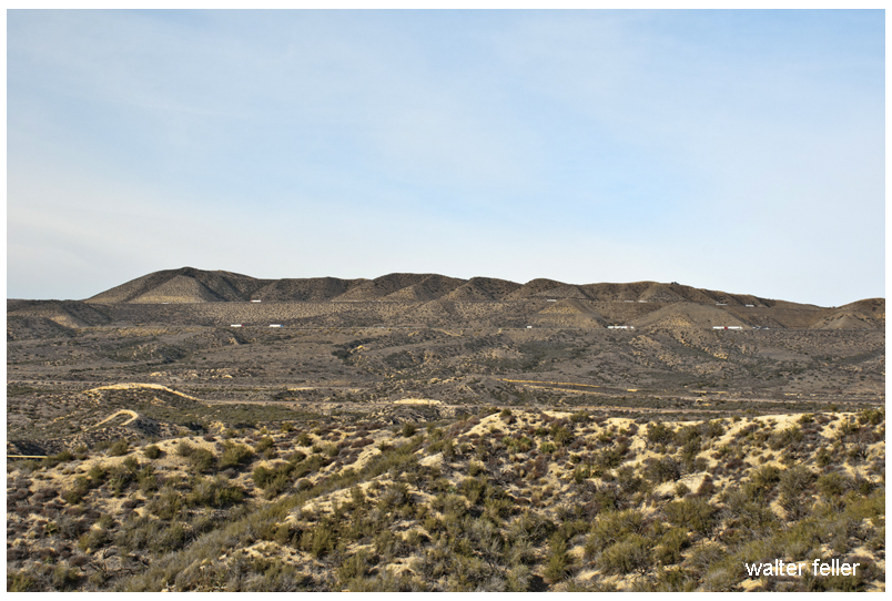
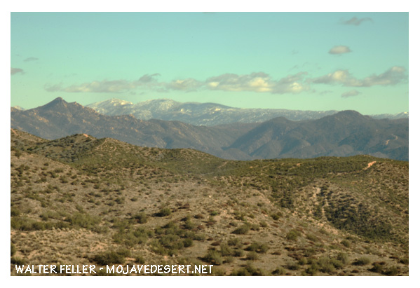
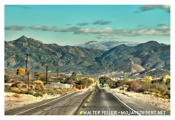
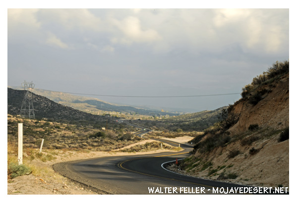
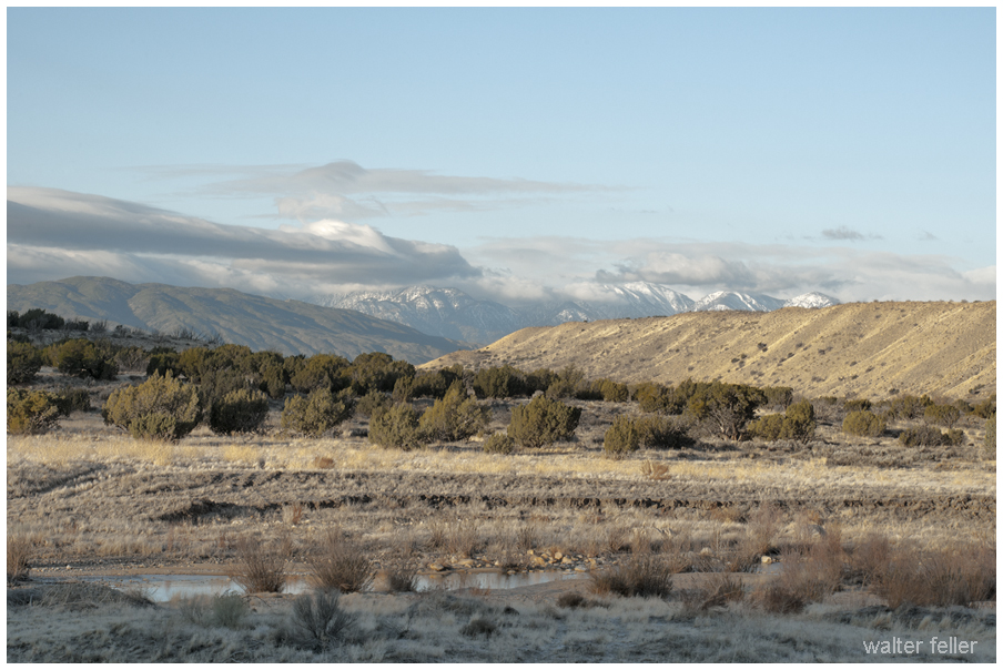
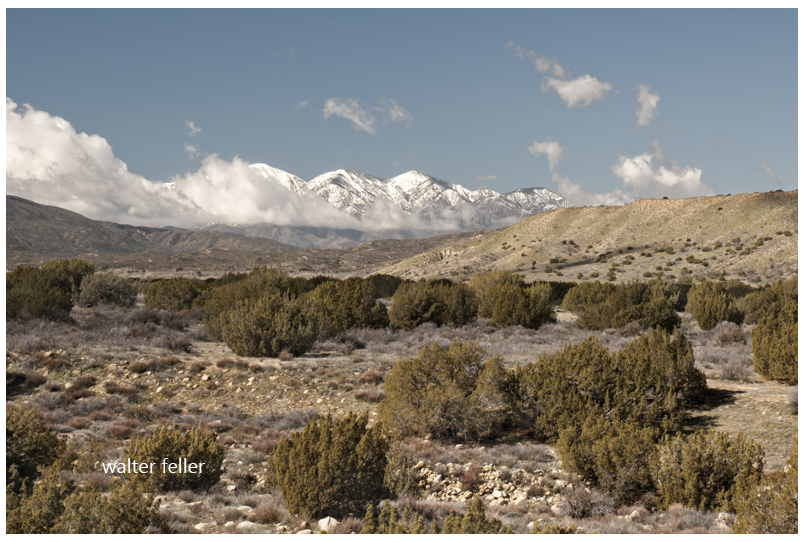
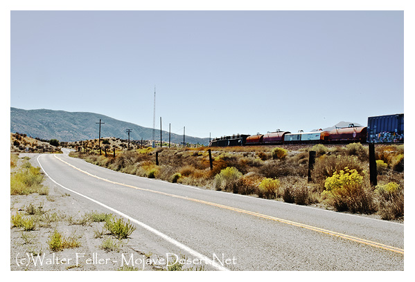
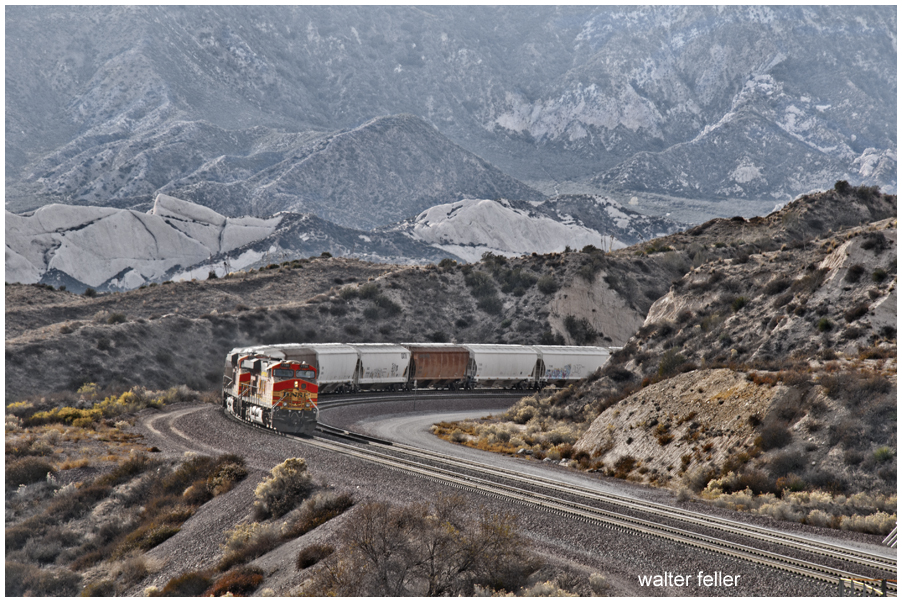
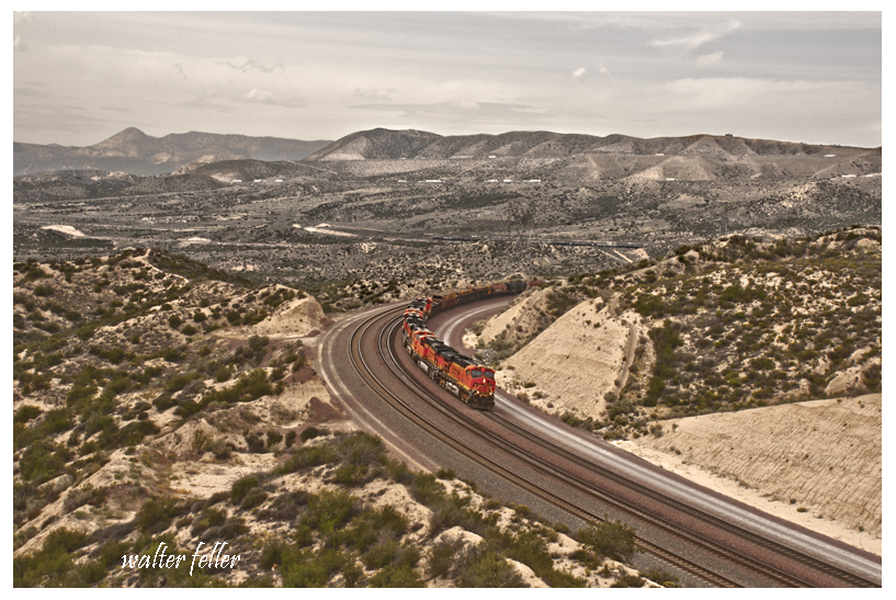
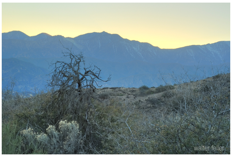
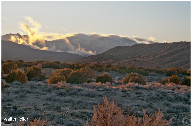
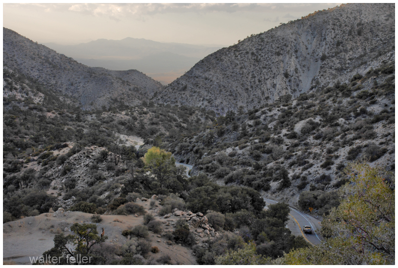
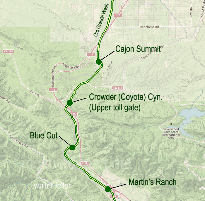
Just east of the Cajon Summit is where the historic traffic corridor in and out of the Mojave Desert narrows and the various alignments come within hollering distance of each other as they cross over the divide between the high desert and Cajon Canyon.
Traces and fragments of footpaths, trails, wagon roads and early highways can be found next to our modern freeway and here they become interwoven, laced and worn or grown over. None of all of this, by any means, obscures the vision of countless travelers of past ages passing this point.
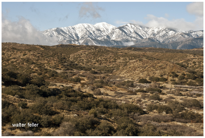
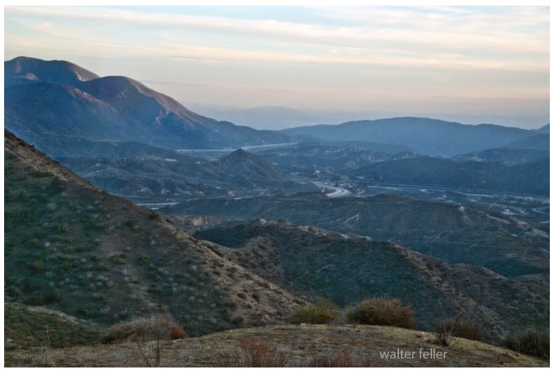
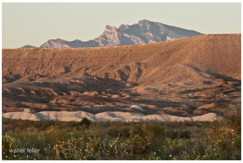
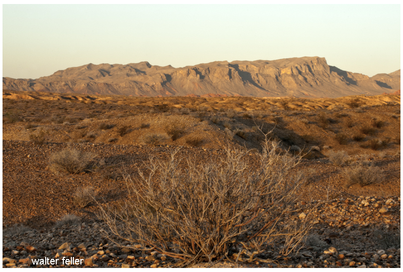
I suppose, if there is any hard and clear boundary to the Mojave Desert that this is where it is. Over time, the Mojave River has cut away the bluff in Summit Valley, east of the Cajon Pass, as the Mojave Desert moves with the rest of the Mojave Block as it separates from the San Bernardino mountain range.
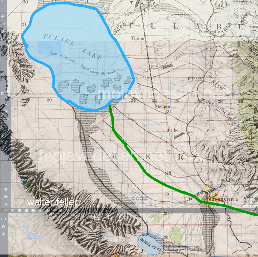
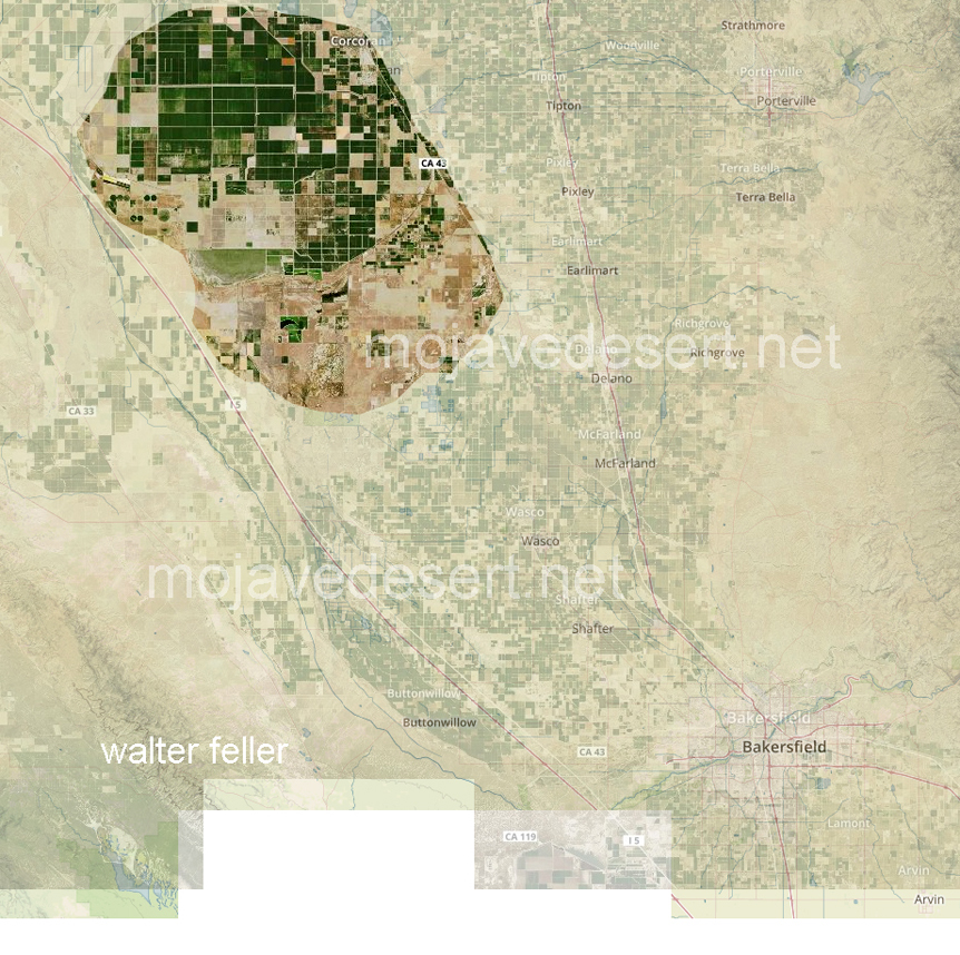
Not so well known is that both men, when they left the mission at San Gabriel made their way north to the San Joaquin Valley and the shore of Tulare Lake. In tracking the paths of both men in relation to our modern geography it is soon discovered that this lake does not seem to exist.
What happened to Tulare Lake?
The answer to this mystery of a disappearing lake is simple, yet inelegant and predictable:
At the onset of American settlement in the area in the late 1840s, the lake was the largest body of fresh water west of the Great Lakes. Its destruction by the late 1800s because of diking and water diversion for irrigation was one of the most dramatic signs of a major theme in the state’s history: the rapid transformation of the wild California landscape into one dominated almost completely by human action.
From Report of the Board of Commissioners on the Irrigation of the San Joaquin, Tulare, and Sacramento Valleys of the State of California.
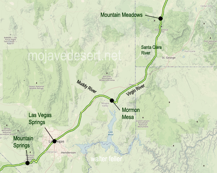
Campsite near confluence of Muddy and Virgin rivers.
“These Indians are Pa utch but not as wild as those above the Mt. their women and children did not run off. I saw at their Lodges a large cake of rock salt weighting 12 or 15 lbs and on enquiry found that they procured it a cave not far distant.”
Lake Mead near St. Thomas
Journal of Jedediah Smith – 1826
http://mojavedesert.net/jedediahsmith/journal-1-02.html
“I turned off to the right across a level piece of ground about 1/2 mile to the foot of a hill which appears to be two or three mile long and 100 or 150 feet high its course being about parallel with the River which is here running S E or E S E.”
“One of my men found a singular substance Some hard and transparent pieces of stone about twice as large as a large pea were firmly fixed in the side of a flat stone. Appearance of an abundance of Iron ore are seen here. and most certainly if a country produces minerals in proportion to its barrenness this must be rich in mineral productions.”
“The River entering a low but rugged mountain below I found it would be necessary to turn off from it to the left and as my guides informed me that it was more than a days travel to the next accessible point on the river between which place and this no water could be found”
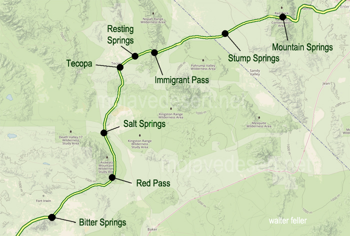
I have heard that the Paiute Indians have a legend–a story they would tell about a giant who crossed the desert with an olla full of water in each arm. With each step he would leave his footprint in the ground, and water would spill from the olla into the hole as he walked on. The giant was so large that these waterholes were one day’s walk between each for a normal-sized man. The Indian learned this and used these waterholes to travel great distances and trade with other Peoples beyond the desert. As time went on and things went the way things do, one such trail became the Mojave Road. — Editor
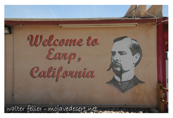
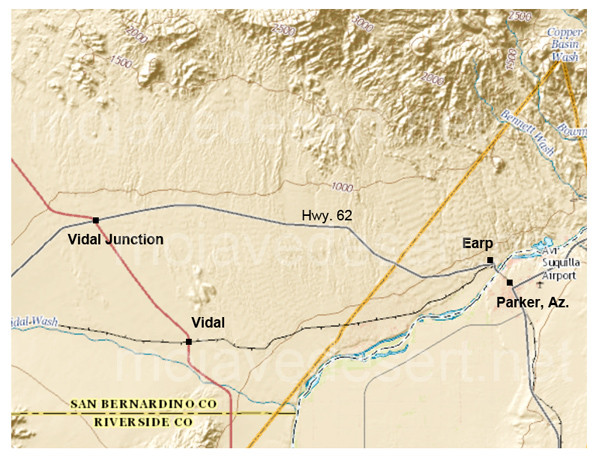
Earp, California is an unincorporated community in San Bernardino County in the Sonoran/Mojave Desert transition next to the Colorado River at the California/Arizona state line in Parker Valley.
Welcome to Earp, California
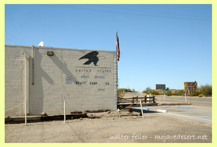
Earp post office at the eastern end of Highway 62, ZIP 92242.
In 1910 the little town was named Drennan. In 1929 Drennan was renamed Earp in 1929 in honor of the nefarious Old West lawman and entrepreneur Wyatt Earp. Wyatt and Josephine Sarah Marcus, his common-law wife, lived in the area seasonally from about 1906 staking more than 100 claims near the base of the Whipple Mountains.
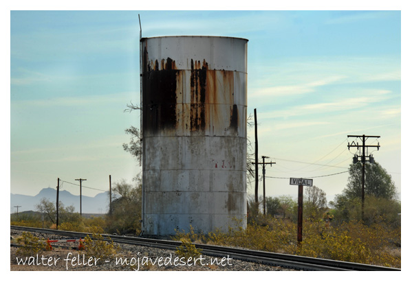
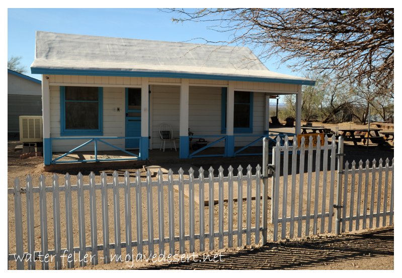
Downtown Vidal, California
Wyatt Earp, the legendary law man, gunfighter, gambler, businessman and miner along with his wife, Josephine, inhabited this “dream-come-true” cottage from 1925 through 1928, winter and spring months, while he worked his “Happy Days” mines in the Whipple Mountains a few miles north of this site. This is the only permanent residence they owned in their long lives.
They bought a small cottage in nearby Vidal and lived there during the fall, winter and spring months of 1925 – 1928, while he worked his “Happy Days” mines in the Whipple Mountains a few miles north. It was the only place they owned the entire time they were married. They spent the winters of his last years working the claims but lived in Los Angeles during the summers, where Wyatt died on January 13, 1929.
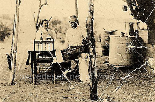
Josie & Wyatt and dog at Happy Days mine west of Parker, Az.
Vidal/Parker area map
Even when it is windy …
The devil wanted a place on earth, sort of a summer home. A place to spend his vacation whenever he wanted to roam.
So he picked out Barstow, a place both wretched and rough. Where the climate was to his liking and the people were hardened and tough.
He dried up the streams in the canyons and ordered no rain to fall. He dried up the lakes in the valley then baked and scorched it all.
Then over his barren desert he transplanted shrubs from hell. The cactus, thistle and prickly pear. The climate suited them well.
Now, the home was much to his liking, but animal life, he had none. So he created crawling creatures that all mankind would shun.
First he made the rattlesnake with its forked poisonous tongue; Taught it to strike and rattle and how to swallow its young.
The he made scorpions and lizards and the ugly old Horned Toad. He placed spiders of every description under rocks by the side of the road.
The he ordered the sun to shine hotter, hotter and hotter still. Until even the cactus wilted and the old Horned Toad looked ill.
Then he gazed on his earthly kingdom as any creator would. He chuckled a little up his sleeve and admitted that it was good.
‘Twas summer now and Satan lay by a prickly pear to rest. The sweat rolled off his swarthy brow so he took off his coat and vest.
“By Golly,” he finally panted, “I did my job too well, I’m going Back where I came from. Barstow is hotter than Hell.”
by Betty J. Tucker – Desert Magazine April, 1971
(photos – Walter Feller)
The road and scenery through Titus Canyon in Death Valley produces all the ups and downs of a young love, then steadies out into the young matronly area. Further on, it matures and gains
the stature of sedate old age.
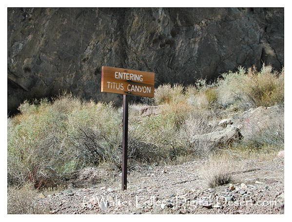
Titus Canyon Road
That’s a pretty good life span for a mere 25 miles. The only problem is that occasionally heavy rains rip out the road, so be sure and check with the rangers. Trailers cannot be taken on this road and I wouldn’t recommend trucks and campers, although we saw one go through. At times the high center of the road forces you into some creative driving.We did it in a dune buggy.
The road into Titus Canyon leaves the Beatty Road and crosses the desert between the Bullfrog Hills and the Grapevine Mountains. Then it begins to climb. This road is one way and it is easy to see why. The steep uphill grades and sharp hairpin curves are not conducive to meeting oncoming traffic. There was that thrill of a first young love—the frightening steepness and sheer drop-offs, but still so breathtakingly beautiful that I wasn’t even afraid. The dune buggy has such a short wheelbase it takes the sharpest corners with ease.
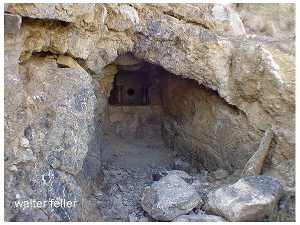
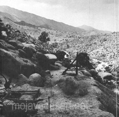
After cresting at Red Pass, elevation 5,250, we dropped down into a beautiful green valley. Here, nestled comfortably in the yellow flowered brittle bush was the ruins of Leadfield.
He blasted some tunnels and liberally salted them …
This child was the brainchild of C. C. Julian who would’ve sold ice to an Eskimo. He wandered into Titus Canyon with money in mind. He blasted some tunnels and liberally salted them with lead ore he had brought from Tonopah. Then he sat down and drew up some enticing maps of the area. He moved to usually dry and never deep Amargosa River miles from its normal bed.
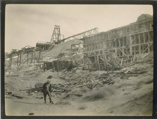
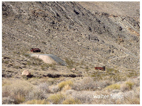
Leadfield ghost town
He drew pictures of ships steaming up the river hauling out the bountiful ore from his mines. Then he distributed handbills and lowered Eastern promoters into investing money. Miners flocked in at the scent of a big strike and dug their hopeful holes. They built a few shacks. Julian was such a promoter he even conned the US government into building a post office here.
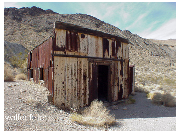
Leadfield post office
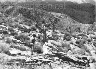
So for six months, August, 1926 to February, 1927, over 300 people lived here and tried to strike it rich. They dug and lost.
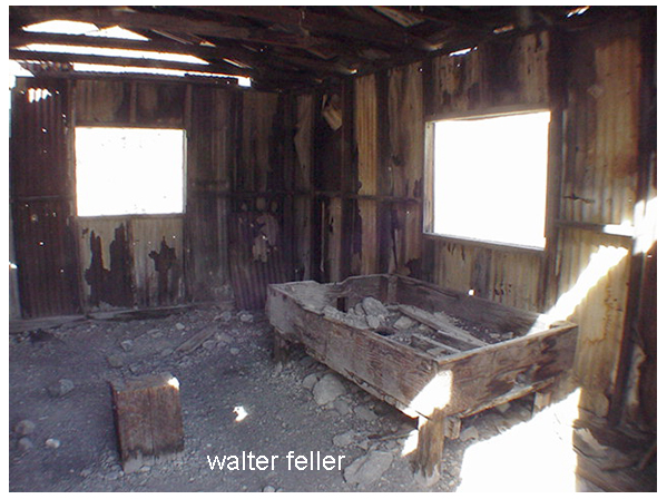
What remains of this fiasco is rather amazing to behold. It most certainly looks like the ghost of a prosperous mine. The false front, cream-colored, corrugated tin post office is still in good shape. There is a built-in wooden desk in some small shelves on the walls. Of the narrow trail there are two more lime green corrugated tin buildings.
Blacksmith’s shop – the wooden block for his anvil and coke bin
Near it is the blacksmith’s building. The wooden block that held his anvil is there as is the bin full of coke. Both of these buildings are lined with asbestos. There are several small holes where the miners tried to find the promised ore, plus a couple of rather large shafts.
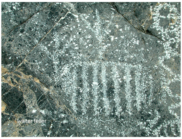
2 1/2 miles below Leadfield is Klare Spring, the major water supply for the town. Miners stood there in frequent baths here and hold water back to camp. Beside this spring you will find Indian petroglyphs.
Klare Springs
We sat on a couple of sun warmed rocks and had a snack. The water trickled by any couple of ravens performed a spectacular air ballet for us. It was an easy to remember that Titus Canyon got its name through a tragedy.
Titus took half of the stock and went to look for more water.
In 1907, Morris Titus, a young mining engineer, and two of his friends, Mullan and Weller, left Rhyolite intending to cross Death Valley and do some prospecting in the Panamints. They found the waterhole dry that they had hoped to use. They had only 20 gallons of water for themselves, 19 burros and two horses. Eventually they found a hole where they could get a cup bowl every four hours. While Mullan and Weller waited, Titus took half of the stock and went to look for more water. He never came back. Next day Weller took the remaining stock and set out to look for Titus. He, too, disappeared. Mullan was found a month later and taken to Rhyolite, more dead than alive. As Titus was known to carry large quantities of gold with him, his family instigated an extensive search. No sign was ever found of him. Some thought he might have broken through a salt crust and gone into the mire below. Whatever happened, he has a most beautiful monument in having this particular canyon named after him.
by Van P. Wilkinson – Desert Magazine – July, 1971
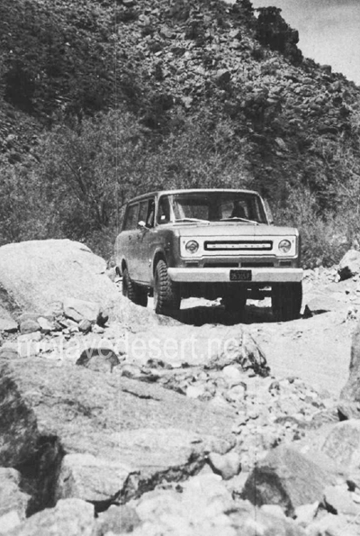
Relics lure as many folks into California’s wilderness today as did the precious ores of the 1800s. To get a piece of the action then, the needs were demanding and basic: a weatherproof disposition, an impenetrable faith against stark wilderness, and an inventive craftiness to second-guess nature. Today, it’s a mite simpler: a topographical map, an off-road vehicle, and a slight case of frenzied persistence.
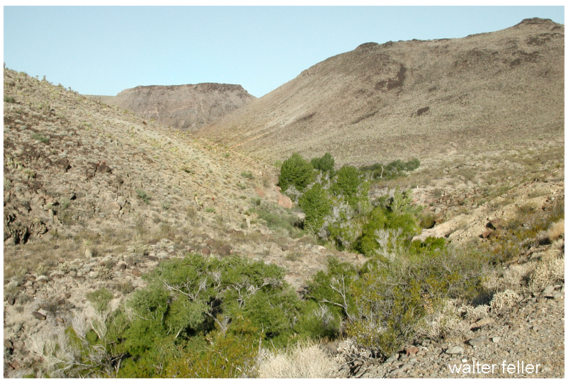
Rattlesnake Canyon
Rattlesnake Canyon is a handy one-day hunting ground for the slightly-more than-motivated. Here, you’ll find noteworthy mining remains, a scattering of solder-top-age cans and purple glass, and many short 4WD excursions to seldom visited wild areas.
Historically, the San Bernardino Mountains were prospected and mined over a hundred years before the gold migration to the Mother Lode in 1849.
Indians and Spanish found in the San Bernardinos not only beauty and shelter, but trading commodities such as furs and minerals. Holcomb Valley gold, discovered in the early 1860s, created some new geographical problems peculiar to this northeasterly mountain location. The great Mojave Desert trough of Victor, Apple, Lucerne and Johnson valleys was closer than the southwesterly mountain slopes into the “civilized” basins of San Bernardino, Redlands and Riverside.
While selecting appropriate shipping routes from the Big Bear Lake vicinity, trailblazers and last-chance prospectors joined forces in the 1860s and began serious exploring and mapping of the canyons east and north down to the desert flatlands.
Like all venturers, these men named areas as often by whim as by rationale. Rattlesnakes are common in high desert canyons leading into the mountains, and there are no less than three canyons and three springs in this region which still bear that viperous name. The Rose Mine is located in another Rattlesnake Canyon (Burns Canyon to Pioneertown); the Balanced Rock Mine east of the Old Mormon Trail is located near another Rattlesnake Spring (between Apple Valley and Fawnskin).
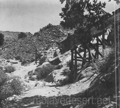
Once used to haul ore from the wooden chute the old wagon road is now covered with weeds and shouts of the wagon masters are no longer heard.
By 1870, the Black Hawk and Silver Reef Mining Districts had been established just a few miles west ofOld Woman Springs. It is safe to assume that the initial digs in our Rattlesnake Canyon were made between I860 and 1880. Generous samples of pre-automation cans and shallow tunnels marked with hand-hewn primitiveness hint at this.
Looking west toward the Bighorn Mountains (below) are seen the shaft, headframe and tailings of the mining operation. Photos by Van P. Wilkinson
Getting into Rattlesnake Canyon today is not altogether simple. The westerly entrance, via Old Woman Springs, is through private property and prohibited. On Old Woman Springs Road toward Yucca Valley, a set of telephone poles flanks the road on the north side. At one point about three miles east of Old Woman Springs there is a support pole on the south side of the road, where the asphalt curves. At this bend, where a taut cable crosses over the road, is the dirt road leading southwesterly into the Bighorn Mountains.
Gentle, dipping and dusty, this road covers some four miles across the alluvial fan toward the mouth of Rattlesnake Canyon. The trail narrows and winds near two private corrals at Two Hole Spring. Then, abruptly, the road dives into the rocky, sandy wash of the canyon. From here to the major mining area (some five miles), it’s either high-clearance 2WD with non-slip differential or 4WD. Why? Because the tracks follow the granular riverbed and at times over breadbasket-sized boulders.
You’ll know you’re on the right path when you reach a cattle gate at the canyon mouth. A sign reads, “Close Gate.” Please do so—stray cattle yield lost revenue and irate ranchers.
Not more than 200 yards on up the southwesterly side of the canyon is Rattlesnake Spring, surrounded by a cattle shed and feed supplies. It was in this area that a couple of glaring bulls blocked the path of our truck while protecting a wary herd-Be careful.
The road dodges and cuts along the wide canyon floor for about two miles, narrow and sandy enough in many places to prohibit campers. Great banks of quartz sediment and loose conglomerate choke the canyon’s south side in a few places as the Bighorn Mountain slopes begin to near the road. The northerly canyon banks show random mineral prospects and dune-buggy scars.
Mica, quartz-veined granite and schist are common ingredients along Rattlesnake Canyon’s steep sides. Multi-colored quartz specimens lay eroded in various sizes, good for rock gardens or the rock tumbler.
Ruins of a miner’s shack
Some three miles from the gate, the canyon walls move in and the road worsens. The tracks bend in several S’s; in this spot, rainfall or flooding would erase the path and trap a vehicle.
Then, the canyon widens at a gentle cluster of desert willows. Up the northeast canyon bank is a narrow 4WD trail leading to several shafts tunnels and collapsed out-buildings of the central mining activity. One quarter of a mile further up the canyon, another, almost identical trail (but wider) leads in the same direction to a flattened prospector’s shack.
About one-quarter of a mile along the canyon the road ends for all but the bravest with a very narrow 4WD vehicle; it is past this “road’s end” about 200 yards that a tunnel strikes west into the canyon wall. Here, in the tailings, is a collector’s “relic’in reward.”
The tailings of the 80-foot tunnel are small, but the abundance of undisturbed cans amidst the debris is amazing. Evidently, those who made it this far in the past were not after relics, just cattle or adventure.
However, the dumps and discards at the area of major activity have been partially investigated. The shafts were probably started in this region before 1900, but have been worked on and off since then—deepened and reinforced. The tunnels at this site are relatively new, and a nearby claim indicates that someone was still investing money in Rattlesnake Canyon as late as 1967.
A steep trail leads south from the flattened prospector’s shack, presumably paralleling the canyon trail to Mound Spring and the Rose Mine region. This is the direction from which explorers came in the 1860s. Another trail, marked on the map, heads southwesterly from Rattlesnake Canyon up a subsidiary wash toward Granite Peak. Neither of these is for amateurs.
Whether you find in the Bighorn Mountains a chance to test your off-road navigation, or whether you find a relic to add to your collection, there’s one certainty: you’ll be bitten by the lure of Rattlesnake Canyon.
About 2009 I read an article titled “Cottonwood Springs” in the December 1959 Desert Magazine (50 years old) written by a gentleman named Walter Ford.
I wasn’t sure where the place was, although the photo included in the piece sparked some kind of vague memory. I couldn’t quite remember where it was though.
It is the same for many other places using common names; Arrastre Canyon, Grapevine Canyon, Round Mountain, etc. I have been told that there are 7 different ranges named “Granite Mountains.”
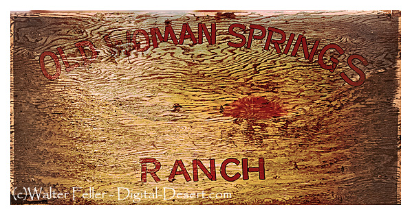
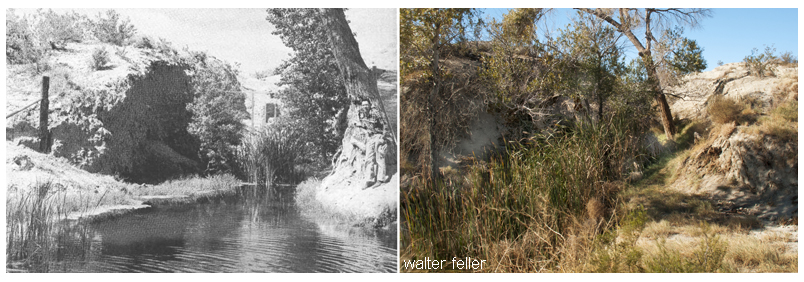
Old Woman Springs Ranch
The springs were described as located along the Twentynine Palms–Victorville route. Mr. Ford mentioned speaking with A. W. Johnson, a long-time prospector of the area. Johnson said he was visiting the spring in 1914, and mention that you could find Indian artifacts such as grinding stones, broken pottery, and arrowheads being plentiful, and they were there for the taking. The author also mentioned a train running through the desert landscape and then making a sweeping, graceful turn near a sign that read Cottonwood Station. There’s only one place in the Mojave Desert that fit, and that was confirmed near the end of the article- Old Woman Springs. Eureka! I wondered though, why was the spring renamed Cottonwood Spring some 50 years ago, and again renamed Old Woman Springs?
In 1855 Colonel Henry Washington of the U.S. Army came through the then-unnamed Johnson Valley surveying the baseline. Near the west end of the valley, he found two elderly Indian women alone at a spring. Names of places came cheap, and I’m sure someone thought the name was appropriate, so the name was recorded for all posterity to ponder. The two Indian women may have been left there to watch young children traveling with the band. The rest were probably in the nearby mountains gathering piñon nuts and hunting, as hunter-gatherers were known to do. The children may have been hiding—watching, as the curious party passed through the valley. The springs, as far as anyone knows, were quiet for the next 40 or so years.
People & Places
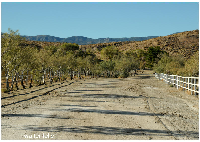
The broad avenue leading into the OWSR
It is through the people, within the times they lived, interacting with the land and their relationship to each other that we learn of and possibly understand the unique character of places in our desert.
Charlie Martin is to Albert Swarthout as Albert is to Dale Gentry. Dale Gentry is to Cottonwood Springs as Swarthout is to Old Woman Springs Ranch and Martin to the Heart Bar. Now that all that is out of the way, let’s begin in the San Bernardino Mountains with Charlie Martin and the Heart Bar Ranch.
Charlie Martin
At over 200 pounds Charlie Martin was tough, as hard as a horseshoe, and ran with a dubious crowd. In Martha Wood Coutant’s book, Heart Bar Ranch, he was reported to have operated a resort for his criminal friends at his place in Glen Martin. Brothers Bill and Jim McHaney were frequent guests, and of the brothers, Jim would come to have his own gang after being run out of the mountains. Charlie, at one time a rustler and later a police chief of San Bernardino, is interesting to note that this apparent conflict in careers could have worked in the good citizen’s favor. Who else would better narrow the playing field of bad guys but the host of them all? Maybe that’s how Jim McHaney and his gang were forced to find a new range?
According to historian Willenna Hansen, Charlie killed at least two people. The first, after a loud argument, broke into a gunfight. Both combatants fired on each other. The victim kept missing Charlie and Charlie didn’t. The second killing was when Charlie was unarmed and approached a claim jumper known only as the Frenchman. He came after Charlie with a knife and started stabbing him. Charlie beat him off with his fists and made his way back to his wagon where he left his revolver. He shot the Frenchman square in the forehead without taking his gun out of the holster. There were no witnesses, so this time Charlie would be tried for murder. In court, his defense consisted only of him taking off his shirt for the jury to observe the 40-some, still-healing, stab wounds on his arms, chest, and back. The verdict returned was self-defense.
The Heart Bar Ranch
Charlie Martin had a number of irons in the fire. He came to believe that his fortune may lie in cattle ranching. He approached Mr. Button regarding a loan for $900. Button, possibly considering Charlie Martin’s reputation, decided he’d rather be his partner than loan him the money. It was in early 1884 when they registered the Heart Bar brand in San Bernardino. Over the next dozen years or so Martin had a variety of partners in the Heart Bar—however; nobody knows what may have come of Mr. Button.
Albert Swarthout
Albert “Swarty” Swarthout was born February 11, 1872, in San Bernardino, California. He was the youngest of five children born of George and Elizabeth Swarthout, Mormon pioneers who came to the area in 1851. George and his two brothers became cattlemen in the San Bernardino Valley. Albert never knew his father, because George died two months after he was born. It was too late; Albert already had cattle in his blood. He grew up dreaming of having his own cattle empire someday.
Box ‘S’ Ranch in Lucerne Valley, Ca.
Swarty married Lillie Furstenfeld of Hesperia on February 10, 1895, at her parent’s house in Alhambra, California. Soon afterward they moved to Lucerne Valley and homesteaded what became the Box S Ranch. It didn’t take long for Albert to figure out the area was no place for a cattle ranch. They moved back to San Bernardino where he used his family’s connections to get a job as a forest ranger. He used the opportunity to become familiar with the mountains and meadows in the San Bernardino Mountain Range.
The Old Woman Springs Ranch
Old Woman Springs Ranch
Al Swarthout, after giving up his claim to the Box S, homesteaded Old Woman Springs. With a 400 acre ranch and rights to 1600 acres of grazing being used as winter range for the Heart Bar in mind, Swarty was poised to begin his cattle empire. Martin and Swarthout entered into a partnership in 1907.
Corral and sheds
There were good years and bad years, and a few in-between years. The Swarthouts lived at the Heart Bar headquarters at Big Meadows during the summer and moved down to Old Woman Springs in the winter, driving stock back and forth through Rattlesnake Canyon between the two ranges. Charlie and Swarty seemed to get along pretty well, and Charlie took to Al’s son Donald becoming quite the uncle, taking him camping and riding often. Charlie tired of it all, and in 1914 sold off his share of the ranch to Albert’s next partner.
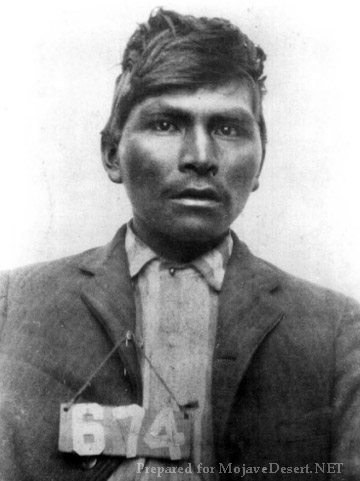
The Manhunt for Willie Boy
Willie Boy
Swarthout kept a tight, hardworking outfit. Those who worked for Swarty liked and respected him, and he treated them as friends. Willie Boy, who in 1909 killed his fiance’s father and became the subject of the last manhunt in the area, according to V.C. Hemphill-Gobar in her book, Range One East, had worked for Swarty. She continues that it had been rumored he stopped by the ranch looking for help. Swarty said he wished he had been there for him. He felt he may have been able to talk Willie Boy into giving up without further bloodshed. Al wasn’t bragging, he knew and was friends with the ranch hand turned desperado. The reader should note that this subject in itself is controversial, with some believing that Willie Boy made good on his escape and lived to old age as a rancher in Nevada.
Steady Development through Tumultuous Times
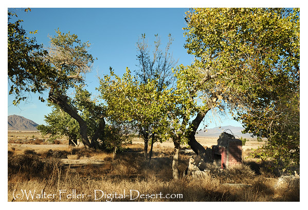
West lake
After another series of partner changes in Heart Bar Ranch ownership, Swarty took an out in 1918. However, in 1922 Swarthout and Dale Gentry formed a partnership and bought the
ranch outright between them.
Over the years before, and during the years after this final partnership was formed, Swarty developed the ranch property; more buildings were built, springs and wells developed, and a field of alfalfa maintained. Even with this much water available, no more than 12 acres of alfalfa could be grown. Martha Wood Coutant states, “It would get so hot, and the crop would have to be harvested by hand quickly before it ‘shattered’ and became useless to cattle.”
Swarty and his friend Julian “Junie” Gobar from Lucerne Valley had figured out a clever irrigation system wherein the most productive spring produced roughly 150 miner’s inches (nearly 1700 gallons per minute) of water flow. The accomplishment was highly regarded by hydraulic engineers of the day.
The grotto
By 1938 the end of the Heart Bar was unavoidable. The price of beef was down and stack was getting mixed in with the herds of other ranches. Many cattle were dying from drinking water poisoned by the cyanide from gold recovery operations further up the mountain. Swarthout and Gentry were arguing and agreed to bring it all to an end. The ranch went into litigation. However, a decision regarding the properties wasn’t reached until 1947. It was decided Gentry would get the Big Meadows property in the mountains and Swarthout the Old Woman Springs property in the desert. Swarty thought it was fair—Gentry did not. Albert agreed to trade halves straight across. The deed was drawn up, done and both went their separate ways. Albert Swarthout at the time was in his mid-70s and still a very active individual. He and Lillie stayed at Big Meadows until 1952, after which they moved to San Bernardino.
Dale Gentry
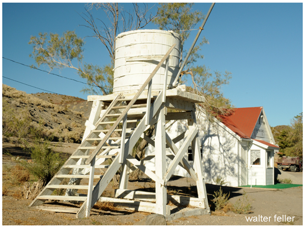
Water tower and train depot
Throughout the 1950s Dale Gentry was the owner of the Old Woman Springs Ranch. There was plenty of water and 400 acres of land to do with as he wished. As a young man living in Hawaii, he had worked on a pineapple plantation. He admired the steam-powered locomotives that carried the product in from the fields. Now that he had the money and the room for it, he purchased an engine, tender, two flat cars a boxcar, and a caboose. They were brought to the ranch along with ten miles of narrow gauge track. Next, a water tower, depot, and roundhouse were built, and Gentry enjoyed giving rides to his visitors at the ranch.
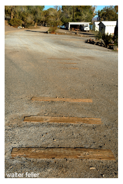
Railroad ties from Dale Gentry’s Cottonwood Express
Other than six or so railroad ties found embedded in the dirt service road awhile back, there is no trace that Gentry’s “Cottonwood & Southern Railway”, ever existed. There are the buildings; the water tower, a depot, the engine room, but when I first toured the ranch in the late 1990s I figured they could be the result of another wild-eyed desert story—Of course they are.
Closing the Gate
From the highway, the ranch looks much the same as it could have 100 years ago when it was a part of Swarty’s dream brought to reality. It’s not a stretch imagining him among the cottonwoods with his friend Junie figuring ways of getting more water to more cattle on the range. Not long ago one may be able to imagine Dale Gentry’s steam engine gracefully rounding the curve, hauling a dozen or so happy passengers out to his station at the renamed Cottonwood Springs. Perhaps from there, with little effort, could look further back in time, hundreds, or maybe even a thousand years, when hunter-gatherers would leave their mothers to watch over the children while they went into the mountains for food.
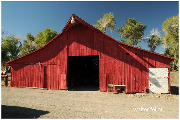
Big red barn
Charlie Martin passed away in 1927 of cancer after serving several years as Chief of Police of the City of San Bernardino.
Albert Swarthout died November 10, 1963, at the age of 91.
Dale Gentry seems to have driven his train off into distant and dusty memories.
And, nobody knows what may have come of Mr. Button.
The Old Woman Springs Ranch is a private property located in the Johnson Valley, 15 miles east of Lucerne Valley on State Route 247, the Old Woman Springs Highway.
adapted from ~ Cottonwood Springs — Desert Magazine – April 1959 – Walter Ford