Tag: Mojave River

  • Two Sides of the Same Story:

    Settlers and Seekers in the Mojave Desert

    The Mojave Desert has always been a land of extremes—of survival and ambition, of quiet persistence and sudden booms. Two cornerstone texts help tell this story: “Pioneer of the Mojave” by Richard D. Thompson and “Desert Fever” by Vredenburgh, Harthill, and Shumway. Though they cover different periods and perspectives, together they trace the transformation of the Mojave from a sparse frontier to an industrialized desert landscape.

    Pioneer of the Mojave introduces us to Aaron G. Lane, one of the first permanent settlers along the Mojave River in the 1850s. His crossing became a lifeline for travelers, freighters, and military expeditions. Lane’s story represents the early days, when survival hinged on access to water, good judgment, and cooperation with those passing through. His efforts in agriculture, trade, and hospitality helped anchor the Mojave as something more than space on a map.

    But the story doesn’t end with the settlement.

    Desert Fever picks up where the pioneers left off, charting the feverish rush for gold, silver, borax, and copper that swept across the California desert in the late 19th and early 20th centuries. Boomtowns sprang up where campsites once stood. Trail stops like Daggett and Calico became freight hubs. Water from the Mojave River—once used to grow alfalfa—was now hauled to stamp mills and ore crushers.

    Both books share the same landscape, but their characters have different goals. Lane and his peers sought stability. The miners and speculators who came later chased their fortunes, often leaving ghost towns in their wake. What links them is the land itself—unforgiving but full of possibility.

    By exploring both books side by side, we see the Mojave Desert not just as a backdrop but as a central character in its own evolving history.


    Suggested Section Links (for below this intro):

    • Pioneer of the Mojave → [Link to your Lane’s Crossing or full PDF/summary]
    • Desert Fever → [Link to chapter index or embedded content]
    • Related topics: [Mojave River history], [Daggett], [Panamint City], [Mining in the Mojave]

  • Hesperia Land & Water

    Founding Figures and Early Land Purchases

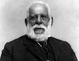
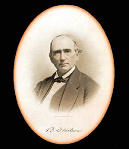
    The Hesperia Land and Water Company was established during Southern California’s great land boom of the mid-1880s. In 1885, Dr. Joseph P. Widney – a prominent Los Angeles figure and former president of USC – joined with his brother, Judge Robert M. Widney, and the Chaffey brothers (George and William Chaffey, renowned for developing Ontario, California) to form the company. That year, Joseph Widney acquired approximately 35,000 acres of Mojave Desert land (previously assembled by Max Strobel in 1869–1870) and laid out a townsite for a new colony. They named the settlement “Hesperia,” derived from a Greek term meaning “western land,” which reflected its location at the western edge of the desert.

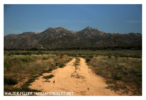
    The town plan featured broad streets – reportedly laid out in a grid with unusually wide rights-of-way, lined with shade trees – as part of an envisioned modern desert utopia. The initial tract included most of Township 4 North and parts of 5 North, Range 4 West, spanning the Mojave River’s west mesa and upper valley.

    Early on, the developers sold about 2,000 acres (including a strategic dam site at the Upper Mojave Narrows) to help start the adjacent railroad town of Victor (Victorville), while reserving the mesa lands for Hesperia’s development. By late 1885 the California Southern Railroad (Santa Fe) had completed its line up through the Cajon Pass, and a small depot at Hesperia was in service, positioning the area for incoming settlers and tourists.

    Development of the Hesperia Irrigation System and Water Rights
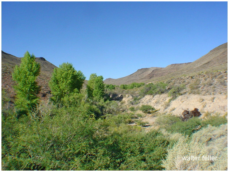
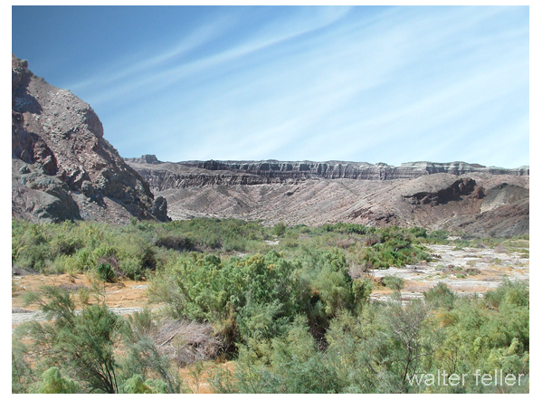
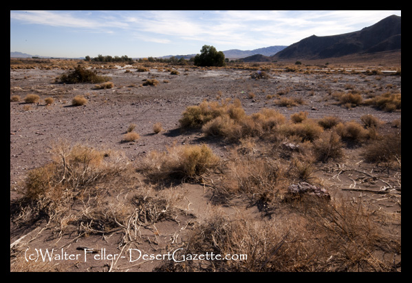
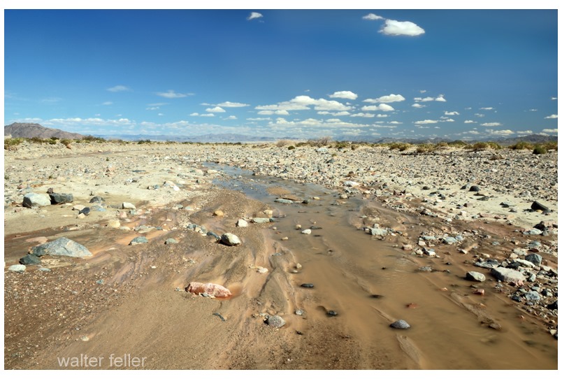
    Securing a reliable water supply was crucial to the colony’s agricultural ambitions. In early 1886, the company staked an ambitious claim to the flows of Deep Creek (the east fork of the Mojave River). Following frontier water law, Hesperia Land & Water placed a stone monument on the creek in 1886 to give public notice of its appropriation: an enormous 5,000 miner’s inches of water (per minute) to be diverted for use on the Hesperia lands. This volume, equivalent to around 125 cubic feet per second, was touted as enough water for tens of thousands of people, far anticipating the needs of the few settlers then present. The claim, which accounted for virtually all of Deep Creek’s flow, was intended to ensure Hesperia’s future growth and establish priority over downstream users. Indeed, the filing for 5,000 miner’s inches in 1886 would become the basis of Hesperia’s water rights for decades, and the company later asserted that it had continuously used this water each year for 20 years – thereby “proving up” its rights. The initial water works, begun in 1887, were hailed as a marvel of engineering: the so-called Hesperia Ditch and pipeline system. Engineers excavated a diversion channel in solid rock high in Deep Creek Canyon and built a diversion dam and intake above the Forks (where Deep Creek joins the West Fork Mojave). From there, water was carried about four miles in an open, concrete-lined canal along the canyon wall. At the Mojave River, the flow dropped into an inverted siphon – a 14-inch diameter riveted steel pipeline that ran 1¼ miles under the riverbed and up the opposite side to the Hesperia Mesa. The pipeline then extended several more miles across the mesa, totaling five miles of pipe, and emptied into an earthen reservoir near today’s Lime Street (this reservoir had a capacity of about 58 acre-feet). By 1888, the Hesperia irrigation system was operational, capable of delivering roughly 40 second-feet of water to the mesa. The colony used the water to plant orchards (notably apples) and other crops; at peak in the late 1880s, about 1,000 acres of farmland in Hesperia were under irrigation from this system.

    Securing the water was not without conflict. Almost as soon as Hesperia’s plans became known, farmers and landowners downstream along the Mojave River (in Victorville, Oro Grande, and beyond) objected strenuously to this large upstream diversion. They feared Hesperia’s ditch would diminish the Mojave’s flow that sustained their ranches. Legal challenges and threats were raised even “before a spade was turned”, but Robert Widney and his company pressed ahead regardless. The Hesperia canal was completed and water was flowing by 1888, despite the protests. However, the dispute over Deep Creek water rights simmered and would resurface in later years. Hesperia’s appropriation was recorded with San Bernardino County and stood as a senior claim. Still, competing schemes would test it, most dramatically the Arrowhead Reservoir project in the early 1900s (discussed below) that aimed to impound the headwaters for use outside the desert.

    Town Promotion, the Hesperia Hotel, and Railroad Connections

    The Hesperia Land and Water Company undertook energetic promotional efforts to attract buyers and settlers to their desert colony. As a centerpiece of the development, the company constructed the grand Hesperia Hotel in 1887. This was a three-story, 36-room hotel built of adobe bricks (freighted in from Oro Grande), then painted a distinctive red. The hotel was intended to serve as both comfortable lodging for prospective land purchasers and a resort destination in its own right, capitalizing on the desert climate and scenery. Promotional literature described Hesperia as a healthful, idyllic community where irrigation would “make the desert bloom.” Wide, tree-lined streets and a planned town center were mapped out, and the availability of ample water for homes and farms was heavily advertised. Excursion trips were likely arranged, as the new railroad line made Hesperia accessible from Los Angeles and San Bernardino. Indeed, by 1885, the California Southern Railroad (part of Santa Fe) had established a station at Hesperia, which became a regular stop along the line through the Victor Valley. This rail connection was crucial in bringing in investors during the boom. The company also laid out a small business district near the station and hotel, anticipating an influx of commerce. By 1890, Hesperia boasted not only the hotel but also a general store, a post office, and a schoolhouse to serve the nascent community. All of these improvements were in place just as Southern California’s speculative land frenzy was reaching its zenith. For a brief moment, Hesperia appeared poised to become a thriving agricultural colony and tourist retreat in the high desert.

    Collapse in the 1887–1888 Land Bust

    Hesperia’s boom was short-lived. In 1887, the inflated real estate market across Southern California abruptly crashed, bringing land sales to a standstill. The grand plans of the Hesperia Land and Water Company began unraveling almost immediately after the costly infrastructure was built. By mid-1888 – barely six months after the hotel and other facilities were finished – the regional land boom went “bust,” and demand for Hesperia lots evaporated. Many of the investors and would-be settlers simply never arrived, leaving the new town with a handful of residents and far more lots than people. The company, having expended enormous capital on land, waterworks, and the hotel, found itself unable to generate revenue. A general economic depression particularly affected land development companies in the late 1880s, and Hesperia was no exception. The ambitious irrigation system that had been Hesperia’s pride became a financial liability, expensive to maintain with too few customers paying for water. In the 1890s, cultivated acreage shrank significantly as orchards and fields were abandoned due to a lack of farmers. The Hesperia Hotel, once a showpiece, largely stood empty; it survived into the 20th century but never fulfilled its original purpose as a luxury resort. Contemporary accounts began referring to Hesperia as a “ghost town” – a fate sealed by the collapse of the 1880s land boom. The Hesperia Land and Water Company itself slid toward insolvency. It made no further progress on expanding irrigation and could not finance crucial improvements like a storage reservoir to capture winter flows (needed to ensure summer water supply). Periodic flash floods even damaged the pipeline – the steel siphon under the Mojave River was washed out several times around the turn of the century. By 1909, the system had temporarily ceased delivering water to Hesperia. Essentially, the Grand Desert Colony project lay dormant and failed as a private venture, awaiting reorganization.

    James G. Howland’s Role in Hesperia’s Early History

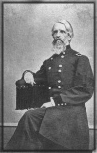
    One name often mentioned in local reminiscences of early Hesperia is James G. Howland. Although not listed among the original incorporators, Howland appears to have been a key leader on the ground during the colony’s formative years. Contemporary reports and later historical sketches suggest that James G. Howland acted in a managerial or executive capacity for the Hesperia Land and Water Company, overseeing daily operations and promotion of the townsite. Some accounts refer to Howland as effectively leading the company’s efforts in Hesperia – for example, directing the sales campaign and perhaps supervising the construction of the infrastructure. Dr. Joseph Widney and the Chaffeys provided the vision and capital, but it was figures like Howland who carried out the practical development work. Howland’s background is less documented in published sources; he may have been an associate of the Chaffeys or an experienced land agent hired to manage the Hesperia project. By local lore, he was the “resident booster” for the town, responsible for guiding tours of the property and extolling the new colony’s potential. Archival information on Howland is sparse, but it’s known that he remained involved at least until the collapse of 1888. After the land bust, Howland fades from the record – it’s unclear whether he stayed on the desert or moved to other ventures. Nonetheless, his early leadership in Hesperia earned him a spot in the town’s historical memory. Modern historical summaries credit Howland as having “led” the Hesperia Land and Water Co.’s promotional push, even if his name did not appear in official founder lists. He is an example of the many 19th-century development promoters whose work was critical to these boomtown schemes, even if later overshadowed by the marquee investors. (Further biographical details on James G. Howland have proven elusive in available archives, suggesting that dedicated research in regional archives or newspapers might be needed to flesh out his story.)

    Reorganization under the Appleton Land, Water and Power Company (1911)

    After two decades of stagnation, Hesperia got a second chance in the early 20th century. In 1911, the assets of the defunct Hesperia Land and Water Co. were purchased and restructured by a new investment group under the name Appleton Land, Water and Power Company. This company was essentially the successor to the original colony enterprise, formed with an authorized capital stock of $300,000 (similar to the original). The Appleton group – reportedly led by P.D. Hatch of Los Angeles – aimed to revive Hesperia’s agricultural potential and make the faltering water system viable. Upon taking over in 1911, Appleton immediately set about rehabilitating and upgrading the infrastructure. They relined the old intake canal from Deep Creek. They replaced the unreliable siphon pipeline with a brand new, larger-capacity steel pipe in a better location under the Mojave River. Specifically, approximately four miles of new 30-inch riveted steel pipe were laid, including a redesigned inverted siphon that crosses the river – a substantial improvement over the old 14-inch line.

    Portions of the original pipeline leading to Hesperia were retained, but much of the system was modernized. A concrete diversion dam (20 feet long) with proper headgates was built on Deep Creek to control and measure the flow into the conduit. Through these efforts, Appleton increased the canal’s capacity to an estimated 40 cubic feet per second and aimed to bring more land under irrigation. To separate utility operations from land sales, the Hesperia Water Company was formed in 1915 as a subsidiary public service entity. With a $40,000 capital investment, the Hesperia Water Co. took over the distribution of water to local users, leasing the water rights and facilities from Appleton, and came under the regulation of the state Railroad Commission as a public utility. This move “divorced” the water service from the colonization business, recognizing that the two required different management. By 1916, however, irrigation under the revived system was still modest – only about 310 acres (90 in orchards and 220 in alfalfa and corn) were being watered. Appleton L. W. & P. Co. controlled roughly 20,000 acres of land (the bulk of the original holdings), with approximately 18,000 acres of that accessible by the new mainline pipe; however, they had not yet succeeded in attracting large numbers of settlers to purchase and farm the land. The new company continued to supply water to the neighboring town of Victorville. Notably, the Victorville water system (serving that community by the river) was owned and operated by Appleton as of the late 1910s. Despite the improvements, Hesperia’s growth continued to be slow. The Appleton company’s strategy eventually shifted more toward long-term land holding and leasing water, rather than immediate large-scale colonization. Nonetheless, the 1911 reorganization preserved Hesperia’s water rights and infrastructure for the future, preventing the project from collapsing entirely.

    Legal Disputes over Deep Creek Water (Arrowhead Reservoir Company Conflict)

    Hesperia’s water rights claims soon faced a serious challenge from outside interests. In the late 1890s and early 1900s, a consortium of Los Angeles and San Bernardino investors formed the Arrowhead Reservoir Company, with the intention of damming Deep Creek (and other headwaters in the San Bernardino Mountains) to divert water southward to the growing cities of the San Bernardino Valley. This plan directly threatened the Mojave Desert communities because it would have siphoned off the source of the Mojave River. Starting around 1902, a prolonged legal and political battle unfolded between Arrowhead Reservoir Co. and virtually all Mojave River water users, prominently including the Hesperia Land and Water Co. and its successors. W.A. Field, who was president of Hesperia Land & Water around this time, led the fight on behalf of the desert interests. Hesperia’s position was that its prior appropriation and use of Deep Creek (dating back to 1886) gave it a superior right that would be harmed if Arrowhead built its dam. In formal filings and court actions, Field and the company argued that the Arrowhead project would “deplete, obstruct or eradicate” the natural flow of water into the Mojave River, thereby violating Hesperia’s vested rights and devastating the farms that depended on that water. The Hesperia company asserted control over some 33,000 acres along the river and marshaled evidence of its water claims: notably a filing for 1,000,000 miner’s inches of flood flow on both forks of the Mojave (an enormous claim made in the early 1900s to preempt Arrowhead). Hesperia pointed out that its claim predated Arrowhead’s by over two years, and furthermore, that for 20 years it had continuously taken about 5,000 miner’s inches from Deep Creek for use on the Hesperia mesa, establishing an “inviolable right” through continued beneficial use. In 1906, while Arrowhead Reservoir Co. began constructing a dam at Little Bear Valley (what would become Lake Arrowhead), Hesperia’s allies (including other ranchers and a group of midwestern investors who had bought up downstream rights) prepared to build a dam of their own in Victor Valley to capture water for local use. A flurry of lawsuits ensued. In 1909, numerous riparian landowners in the Mojave River basin – bolstered by Hesperia’s claims – filed suit to enjoin Arrowhead from diverting the mountain waters out of the basin. These cases dragged on for years. Ultimately, the desert interests prevailed: Arrowhead’s scheme to export Mojave water was halted. By the time Arrowhead’s dam (Lake Arrowhead) was completed in 1922, it was for recreational and local use only; the courts had prohibited the company from sending water south to San Bernardino. The precious Deep Creek flows continued down into the Mojave River, securing the water supply for Hesperia and its neighbors. This protracted legal victory was significant – it protected the Victor Valley’s lifeline and affirmed the priority of Hesperia’s 19th-century water appropriation. Decades later, those same rights would be recognized in comprehensive water adjudications for the Mojave Desert.

    Long-Term Influence on Hesperia and the Victor Valley
    Though the Hesperia Land and Water Company’s original venture did not immediately blossom into the thriving colony its founders envisioned, it left a lasting imprint on the High Desert’s development. The town of Hesperia itself survived in diminished form – a “ghost that refuses to die,” as one historian later put it – thanks largely to the water infrastructure and land surveys put in place in the 1880s. The wide streets laid out by Widney and the Chaffeys became the skeleton of the Hesperia community that would finally grow many decades later. Most importantly, the company’s early establishment of water rights on Deep Creek ensured that Hesperia and surrounding areas had a secured share of water for future use. This proved crucial for the valley’s long-term viability. The successful defense against the Arrowhead Reservoir diversion preserved the Mojave River flows for local agriculture and settlement through the 20th century. Communities like Victorville and Apple Valley thus continued to have access to water, allowing them to expand. In fact, the Hesperia project indirectly spurred development elsewhere in the Victor Valley: for example, in the 1890s some of Hesperia’s unused land was planted in vineyards, producing raisins and wine that briefly gave the Hesperia name a positive reputation. The idea of desert land reclamation persisted – Appleton Land & Water Co.’s efforts in the 1910s to grow apples and alfalfa in Hesperia were an outgrowth of the original dream. While those early orchards never reached large scale, they demonstrated the desert’s agricultural potential under irrigation.

    In the long run, the greatest impact of the Hesperia Land and Water Company was to anchor a settlement at the top of the Cajon Pass that could later be revived. Indeed, after World War II, the Victor Valley experienced a new land boom. In 1954, the remaining 35,000-acre Hesperia ranch (still essentially the same tract the Widneys had assembled) was sold to a development syndicate, the Hesperia Land Development Company. This mid-20th century effort, building on the old townsite and water system, finally succeeded in sparking substantial growth. By the late 1950s, Hesperia was marketing itself as an affordable residential community for Southern Californians, and population began rising. The city of Hesperia incorporated in 1988, a milestone that would have been impossible without the foundations laid by the 1885 company. The influence of that original company is also evident in the region’s infrastructure: the general route of today’s water deliveries in Hesperia traces back to the Deep Creek diversion engineered in the 1880s. The Victor Valley’s agricultural and urban development throughout the 20th century – from ranches to suburbs – was enabled by the water rights and pioneering spirit of those early entrepreneurs. In sum, the Hesperia Land and Water Company’s ambitious attempt to “make the desert bloom” did not prosper on the first try, but it set in motion the land acquisitions, legal rights, and vision of a desert community that eventually became reality. Hesperia and its neighboring High Desert towns owe a considerable debt to that 1880s boom-era venture for establishing their place on the map and securing the water that sustains them to this day.

    Sources: Historical records and analyses were drawn from local history publications, engineering reports, and archival documents, including the State of California Dept. of Engineering Bulletin No. 5 (1918) on Mojave River irrigation, Edmund Jaeger’s “The Ghost that Refuses to Die” (Desert Magazine, Aug. 1954), San Bernardino County historical chronicles, and contemporary accounts and legal filings regarding water rights (e.g. Van Slyke v. Arrowhead Reservoir Co., 1909). Newspaper archives and local museum materials corroborate the roles of key figures like the Widneys, Chaffey brothers, and James G. Howland in Hesperia’s founding. The city of Hesperia’s own historical overview and marker texts were also consulted for confirmation of dates and figures.

  • Mojave River

    The Mojave River is a strange, beautiful thread of water in California’s high desert. Most of the time, you can’t see it. It hides beneath the sand, popping up only in rare places like Afton Canyon or the Narrows near Victorville. But this ghost river has a long and complicated past tied to shifting earth, ancient climates, lost lakes, and generations of people who relied on it.

    It all began millions of years ago when tectonic forces pushed up the San Bernardino and San Gabriel Mountains. These rising peaks blocked older river systems that used to flow toward the Pacific. With nowhere to go, water from the mountains started pooling in the desert. Over time, a new river formed, trapped within these closed desert basins. That was the beginning of the Mojave River.

    During the Ice Age, things looked very different. The Mojave River wasn’t just a trickle or an underground stream—it was a robust river that flowed year-round, fed by rain and snowmelt from the mountains. It carried water from the San Bernardino Mountains to a series of massive lakes out in the desert: Lake Manix near Barstow and Lake Mojave farther east. These were deep, wide bodies of water teeming with life. Around 18,000 years ago, Lake Manix overflowed, carving the dramatic Afton Canyon and sending a flood of water toward Soda and Silver Lakes, which became Lake Mojave. Fossils from this time show mammoths, saber-toothed cats, and even aquatic life like fish and freshwater snails around the river and lakes.

    When the last Ice Age ended, the climate changed. It got warmer and drier, and the big lakes began to dry up. The river still carried water now and then, but only during the wet season, and it often disappeared underground. Over thousands of years, it became the ghost river we know today. Now, it flows mostly beneath the desert floor, surfacing briefly after storms or in spots where rock formations push it upward.

    Despite its dryness, the Mojave River is the lifeblood of the western Mojave Desert. Its rare surface flows and hidden undercurrents recharge underground aquifers, feed oases, and support all kinds of desert life. You’ll find cottonwood trees, willows, and even small fish like the endangered Mojave tui chub in wetter stretches. Birds rely on it too, especially migratory species that need stopover habitat in the middle of a dry land. Some stretches, like Palisades Ranch and Afton Canyon, are rich in wildlife because of the river’s presence.

    People have followed the Mojave River for thousands of years. Indigenous groups, especially the Vanyume (a branch of the Serrano), lived along its banks and used its waters to survive in the desert. It also became part of significant trade and travel routes, notably the Mojave Road. Spanish explorers like Father Garces followed it in 1776, and American mountain men like Jedediah Smith came through in the 1820s. Later, Mexican traders and Mormon pioneers used it to reach California.

    In the 20th century, towns like Victorville, Barstow, and Daggett grew along the river. They pulled water from its aquifer for agriculture and homes. Over time, more groundwater was pumped out—more than was going back in. This led to water shortages and falling water tables. To fix it, water agencies began regulating pumping and importing water from Northern California to recharge the Mojave Basin. Today, the Mojave Water Agency closely monitors the river’s underground flow.

    Climate change is also reshaping the river’s future. Bigger storms could cause major flooding, but longer droughts make the river even more fragile. Meanwhile, conservation groups are working to protect the remaining green places along the river—removing invasive tamarisk, planting native trees, and safeguarding habitat for birds, fish, and other wildlife.

    So while the Mojave River may not look like much at first glance—just a dry wash running through the desert—it’s the thread that ties together this region’s natural and human story. From Ice Age megafauna to modern groundwater battles, the Mojave River has quietly shaped life in the desert for millennia.

    Sources: https://pubs.usgs.gov/of/2004/1007/mojave/index.htm – USGS: Mojave River Geologic Framework and Groundwater Flow https://pubs.er.usgs.gov/publication/wri024280 – USGS Water Resources Investigations: Mojave River Flow System https://mojavedesert.net/mojave-river/ – Digital Desert: Overview and History of the Mojave River https://digital-desert.com/mojave-river/ – Digital Desert: Detailed Description of the Mojave River Course and Features https://digital-desert.com/mojave-river/east-fork/ – Digital Desert: East Fork of the Mojave River https://digital-desert.com/mojave-river/west-fork/ Digital Desert: West Fork of the Mojave River https://digital-desert.com/natural-mojave-river/ – Digital Desert: The Natural Mojave River https://www.blm.gov/visit/afton-canyon – BLM: Afton Canyon Natural Area https://www.mojavewater.org/ – Mojave Water Agency: Groundwater Management and River Info https://westernrivers.org/where-we-work/california/mojave-river – Western Rivers Conservancy: Mojave River Conservation Projects https://www.mdlt.org/ – Mojave Desert Land Trust: Mojave River Habitat Protection https://nrm.dfg.ca.gov/FileHandler.ashx?DocumentID=83982 – CDFW: Camp Cady Wildlife Area Management Plan https://www.fs.usda.gov/Internet/FSE_DOCUMENTS/fseprd493364.pdf – USDA: Mojave River Watershed Assessment https://en.wikipedia.org/wiki/Mojave_River – Wikipedia entry with references on river history, hydrology, and human use

  • Hesperia Ditch

    The Hesperia Ditch was the heart of a bold dream to turn part of the Mojave Desert into a thriving agricultural community. Built in the late 1880s, it was the centerpiece of an irrigation system designed to carry precious water from Deep Creek to the dusty, sun-baked mesa where Hesperia began taking shape.

    The story starts with a group of investors led by Dr. Joseph Widney, a former University of Southern California president. Along with the Hesperia Land and Water Company, Widney believed they could make the desert bloom by diverting water across rough terrain and under the Mojave River to what they hoped would become a green and prosperous settlement.

    In 1886, they began building the ditch. It wasn’t a simple trench—it was an engineering project that included miles of open canal, flumes, and a steel pipeline that dipped under the Mojave River. The water came from Deep Creek, a rocky stream that runs through a canyon just south of modern-day Hesperia. The company built a small concrete dam at the intake point to raise the water level and direct it into a ditch blasted and dug along the canyon wall. That channel clung to the hillsides, sometimes cut into solid rock, and sometimes supported by stone walls or wooden flumes. The route was carefully graded to use gravity to keep the water moving.

    One of the most impressive features of the system was a steel pipeline—about 14 inches in diameter—that crossed under the Mojave River in a kind of inverted siphon. From there, the water continued to a reservoir near present-day Lime Street Park in Hesperia. That earthen reservoir held about 58 acre-feet of water and was a local irrigation hub. Farmers could draw from it to water their fields, orchards, and gardens.

    At its height in the early 1890s, the ditch helped irrigate over a thousand acres of land. Apples, peaches, alfalfa, and other crops were planted, and the new town of Hesperia began to take root with a hotel, train station, and grand ambitions. Optimists thought it would become the next great inland farming colony.

    But dreams can be fragile in the desert. The irrigation system was expensive to build and even more complex to maintain. The 1880s land boom fizzled out, and Hesperia’s growth slowed. Legal disputes over water rights and the unpredictable nature of Deep Creek’s flow added to the difficulties. Floods often damaged the steel pipeline under the river and had to be repaired multiple times. By the early 20th century, much of the system was falling apart, and the amount of water it delivered had dropped significantly.

    In 1911, a new group took over under the name Appleton Land, Water and Power Company. They made some upgrades, including installing a larger 30-inch steel pipeline for part of the route and reinforcing the intake works. Still, only a few hundred acres remained in cultivation. In 1916, just 90 acres of orchard and 220 acres of alfalfa and corn were being irrigated—far less than what had once been envisioned.

    Even so, the ditch left its mark. Parts of the original channel along Deep Creek still exist today. A section of the Pacific Crest Trail follows the old ditch grade—its flat path a silent reminder of the engineers who carved it into the canyon wall over a century ago. The route is visible as a narrow shelf lined with old stonework along the hillside.

    At Lime Street Park, where the reservoir once stood, a historical plaque honors the day in 1886 when “life-giving water” first reached Hesperia. Without the ditch, the town might never have taken hold. Though modern wells and pumps eventually replaced the irrigation system, the ditch was the first to prove that water could be brought to the high desert—and with it, the chance for people to stay, build homes, and try to make the desert bloom.

    Today, the Hesperia Ditch is part of local lore, remembered as both a technical feat and a symbol of frontier determination. While the system didn’t fulfill all the lofty hopes of its founders, it made settlement possible in a place where nature had said no, and that’s no small thing.

  • End of the River

    Sink of the Mojave River, Afton Canyon, Soda Lake

    Rather than growing wider and emptying into the sea the Mojave River becomes smaller and smaller finding its way in the sand between the cobbles and rocks curling into crescent -shaped dark meanders and swales transitioning to dry sand and finally, collections of same sized stones.

    Mojave River https://digital-desert.com/mojave-river/

  • Cottonwoods with Character

    Twisted cottonwood tree growing in Mojave Riverbed, Victorville, Ca.

    Beware of the ‘TREENADO!’
    Mojave River, Victorville, Ca.

  • The Black Bridge

    Railroad bridge Victorville, Mojave River

    “One of Victor’s (Jacob Nash Victor) greatest contributions was supervision of a number of bridges constructed in San Bernardino County. The first and longest of these was the railroad crossing of the Mojave River in the lower narrows. It is not known just how directly involved he or Perris (Fred T. Perris) were with this project, since their correspondence includes a letter regarding recommendation from New England of another engineer-bridge builder anxious for employment just then. Whoever was directly responsible, huge granite blocks were shaped to fit snugly into cemented buttresses, which have not cracked or moved in over 100 years of continuous use and several devastating floods. The iron bridge, described as one of the finest structures of its kind on this coast, was brought in sections by railroad to Barstow and freighted from there to the site. This bridge was replaced early in the 20th century, including a second set of tracks, but the subsequent structures have all continued to utilize the same basic foundation buttresses. This would be the oldest structure in the region (the buttresses were built in 1885).”

    ~ History of the Victor Valley – Lyman
    Published by Mohahve Historical Society

  • Fort Piute

    Piute Hill Fort Best Preserved Mojave Outpost

    By L. BURR BELDEN

    Fortifications along the western extension of the Santa Fe trail, route of the Whipple survey, were built initially because of Indian attacks on covered wagon trains of settlers. The Mojave War followed the massacre of one train by Indians at the Colorado River crossing a few miles above the present Needles.

    Paiute Creek
    Paiute Creek

    The Army was not slow in punishing the Mojave tribes, and entire regiment being collected at Fort Yuma and going upstream. This was in the winter of 1858-59. The initial fort, Ft. Mojave, was established at the time. Supplying of this river outpost was both expensive and difficult.

    Soldiers attacked

    Lt. Col. William Hoffman
    Lt. Col. William Hoffman

    The road over the desert San Bernardino had been given a bad name by Lt. Col. William Hoffman would take in the company of mounted infantry in a small dragoon escort from the Cajon Pass to the river. Hoffman’s command had been attacked by Indians in route. The Col. was under orders to find a site for a desert fort. He saw nothing between Summit Valley in the river he considered a likely site. In fact, Hoffman condemned the entire route as unsuited for travel.

    It is probable the Hoffman report influenced the Army in initially supplying Fort Mojave by steamer from Yuma.  When the river was slow and supplies could not be taken at far upstream the fort garrison was desperate. At this juncture In Winfred Scott Hancock, the same officer who appeared in a recent issue of the series, called on the Banning stage and freight lines to take supplies through. Banning’s experience Teamsters had no trouble They drove again heavy freight wagons, each drawn by eight mule teams to the river in 16 days. The Fort Mojave garrison again had both food and ammunition.

    Cady Old Site

    Hancock at the time an assistant quartermaster, prove that not only the Mojave Valley road was practical. He also reduce the Army’s transport expense to Fort Mojave by two thirds. The hall from drum barracks at Wilmington to the Colorado River via Cajon Pass cost only a third as much per pound as the long water haul around Baja California and transfer shipment to river  steamer.

    Ives Expedition steamboat and crew heading up the Colorado River, 1857.
    Ives Expedition steamboat and crew heading up the Colorado River, 1857.

    The site of Camp Cady  was used as an Indian “fort” even before California became a part of the United States. Indians engaged in stealing horses from the Mexican ranchos built a crude sort of stronghold on the rocky hillsides of the Mojave River near that spot. It was a few miles East of the old Spanish Trail and also guarded the entrance to narrow Afton Canyon which could serve as an escape route if pursuit became too hot.

    Afton Canyon
    Afton Canyon

    There is documentary evidence of the Indian use of their crude stronghold in 1845 point Benjamin Wilson, the Don Benito of Mexican rule, meeting Indians there in battle in 1845 a few days after the historic discovery of Bear Valley.

    California Governor Pio Pico
    Governor Pio Pico

    Wilson’s account of the pursuit of the horse thieves attributed depredations to renegade Indians from Mission San Gabriel but it is probable Sun desert tribes had Braves in the raiding parties. Wilson was alcalde  at Jurupa  and was called upon by Gov. Pico to punish the Indians. The acalde  gathered a large posse including 22 young Californians mounted on fleet horses. The larger party in fact train went up Cajon Pass. Wilson in the young ranchers took the route up to Santa Ana Canyon, enjoyed hunting bear in what Wilson named Bear Valley, and joined the pack train somewhere near Rancho Verde  in the present Apple Valley.

    Wilson, wounded by a poisoned arrow, had his life saved by Lorenzo Trujillo. Trujillo, a New Mexican, was leader in the little colony of Agua Mansa  and its twin town, Trujillo. In the Apple Valley fight the Indians were defeated in three of them killed. Wilson shot the notorious Joaquin, the ex-mission Indian, who was a ringleader among the horse thieves.

    Don Benito Wilson
    Don Benito Wilson

    Several of Wilson’s Horseman pursued the remnant of the Indians down the Mojave  though the wounded Wilson was forced to turn back. Nothing Indians halted in their crude fort near the site of Camp Cady. There, though the entrenched behind rocks, they were again defeated and dispersed.

    In addition to the soldiers at the Mojave Desert forts there were a few civilians quartered at some of the posts. For instance, the returns of Camp Cady for December 1866  indicate an assistant wagon master was stationed there. He was paid $75 a month. Teamsters, their number not specified, received hundred and $75 a month, and herders $35 a month.  Other notations would indicate the herders, at least some of them, were Indians. The Teamsters, whose work was the most skilled, where the aristocrats of the road whether they drove Concord stages and six horses or whipped along multiple freight teams. The Army officers themselves received far less pay.

    There were also, at least at Cady  and Mojave, sutler stores. The Army had no canteen or post exchange in that. And contractors, called settlers,  were granted the privilege of establishing stores on military reservations and also, for that matter, with armies in the field. Suites that supplemented the monotonous menu, tobacco and whiskey as well as such notions as red, writing paper and ink were for sale at the  sutler stores.

    Summit Valley
    He (Hoffman) saw nothing between Summit Valley in the river he considered a likely site. In fact, Hoffman condemned the entire route as unsuited for travel.

    Soldiers receiving $7.50 a month did not have much money to spend but there was no place to go and as a result the software store almost invariably raked in the Army man’s wages. Passing travelers also helps well the sutler income.

    The system was a poor one, and the cause of continuous complaint. The soldier, at times was victimized both by high prices in shoddy material. At one juncture soldier resentment in Camp Cady  passed the usual grumbling stage and the garrison simply looted the store.

    Looting did not satisfy the enraged soldiery. They set fire to the store and literally drove the hated  sutler from the camp. The sutler came to San Bernardino and swore out complaints.  That was in August 1867 after Camp Cady  was manned by regulars.

    First Lieut. Manual Eyre Jr.  in command at Cady, reported the affair to first Lieut. C. H. Shepherd, assistant adjutant general at Fort Mojave. He said:

    “Yesterday the sheriff was here and took with him five of my men for preliminary examination under charges of arson and robbery. The case is stated in my letter addressed to a AAAG  at your headquarters, dated August 8, 1867. I should, I think, be in San Bernardino during the trial of these men, if they are held for trial. I also desire to present before the grand jury’s citizens who have harbored deserters.

    “The posted by you till will be established under superintendence of an officer from Mojave. Could not an officer be spared temporarily to  relieved Lieut. Drum and allow him to relieve me for 10 days or two weeks? If the Rock Springs garrison is withdrawn, I can leave Lieut. Drum here in command until my return?

    “The intention of this man Dead (the sutler)  is evident to me. He will try to obtain money from these men to let them off. If so, I would like to be present to prosecute him for attempting to compound a felony. I am of the opinion that, as much as  I dislike it, I should be in San Bernardino as soon as possible, even if the men are released after preliminary examination when, of course they would be turned loose 100 miles from camp to find their way as they see fit.”

    Both because it served as a headquarters post, and because it was maintained long after the little way stations along the Old Government Road were abandoned, Fort Mojave is far better known than such points as Fort Piute, Rock Springs, Marl Spring, Fort Soda, Bitter Spring, Resting Springs or even Cady.

    Fort Pah-ute ruins
    Fort Pah-ute ruins

    Until recent years Fort Mojave was maintained as an Indian school. When it ceased to be an army post, however, it is records were moved. Some were taken to Whipple barracks in Prescott, others to the Presidio at San Francisco. For Mojave, however had a wealth of old records that escaped attention of the detail entrusted to their moving. Within the past few years the grounds of the old fort were converted to agricultural use. The remains of an old adobe building were bulldozed flat. In the process the bulldozer broke through an old wooden floor long covered with several inches of earth. The accident disclosed a long forgotten cellar. In it were scores of packing boxes containing more records. These were assembled and shipped to Washington. Stacked in a line these rediscovered records stretch 29 feet.

    As yet this latest ” mine”  of Pioneer Army records has not been made available to historical researchers. Presumably in a few years, however, they will have been cleaned, indexed and deposited in the national archives and will furnish a far more detailed commentary on conditions in the Southwest during the pre-railroad decades,, and on Army activities at a dozen or more all but forgotten published such as Las Vegas, Resting Springs, El Dorado Canyon, and numerous early Arizona camps. Frequent transfers of headquarters seem to have  made Fort Mojave a convenient depository  for numerous papers no one wanted to which, under regulations, could not be destroyed. Paperwork in the military was almost as involved in the mid-19th century as it is today. Doubtless the company clerk of the Battalion Sgt. major of 1867 rebelled inwardly at the detail required of his job and doubtless to adjutants were hard put to find storage space for the growing mountains of paper but to their credit it must be noted they observed the rules and did not indulge in the periodic bonfires that mark some of the other branches of the federal service. For instance, research on Colorado River steamers is difficult because the customs offices of registry made it a practice to destroy old records.


  • Riverside Cement – Oro Grande

    Oro Grande Riverside cement plant, Victor Valley, Mojave Desert

    Riverside Cement in Oro Grande, CA started in 1907 as the Golden State Cement Plant. It was shut down during the depression and restarted as Riverside Cement in 1942. The plant was enlarged and completely rebuilt in the late 40s. In late 1997, TXI purchased Riverside Cement.

    More about Oro Grande

  • Newberry Springs?

    For a few months in 1883 when the Southern Pacific Railroad was being built, the Watson post office lived out its short tenure.  Watson was named Watson for Josiah Watson who was the postmaster. When the Watson post office closed the railroad named their station Newberry.  For a few months in 1899, the Newberry post office was reestablished then discontinued.  In 1911 the post office reopened and was named Wagner after Madge Wagner who ran it.  In July of 1919, the name was changed from Wagner to Water, who wasn’t a person but was named for the water that was pumped out of the ground for the Sante Fe Railroad’s use.  Then, years later in 1967, the name was changed from Water to Newberry Springs. No one is quite certain who Newberry was, to begin with, but it could either be for either one or both of two brothers named Newberry who lived near the springs, of which one was killed in a gunfight over water rights to the springs and ended up being buried on top of a hill not far from the springs. Or the name of the springs came from Dr. J.S. Newberry, a physician in the 1857 survey expedition led by Lt. Joseph C. Ives.

    Newberry Springs, California

    Newberry Springs