I found a digital copy of a map drawn in circa 1859 or so. Didn’t look right so I threw some technology at it to see what I could see.
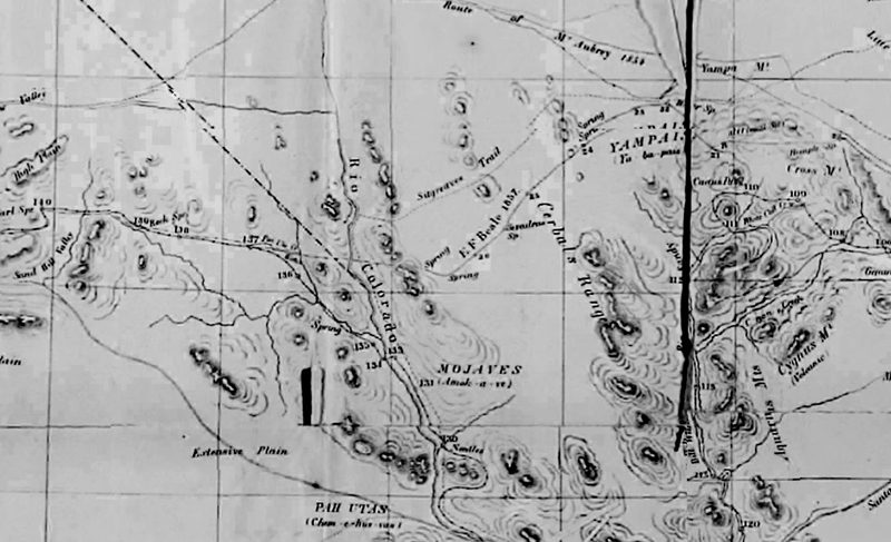
At first I thought it was all detailed and on the money, but studying the map a bit it looked as if Beale’s Wagon Road and Sitgreaves Trail were possibly transposed.
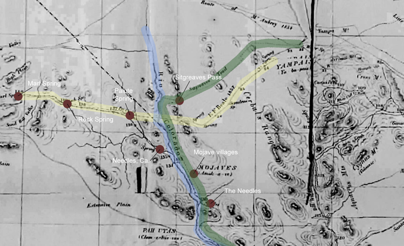
I highlighted the Colorado River in blue and roughly located geographic features and landmarks between about where Kingman would be west to Marl Spring.
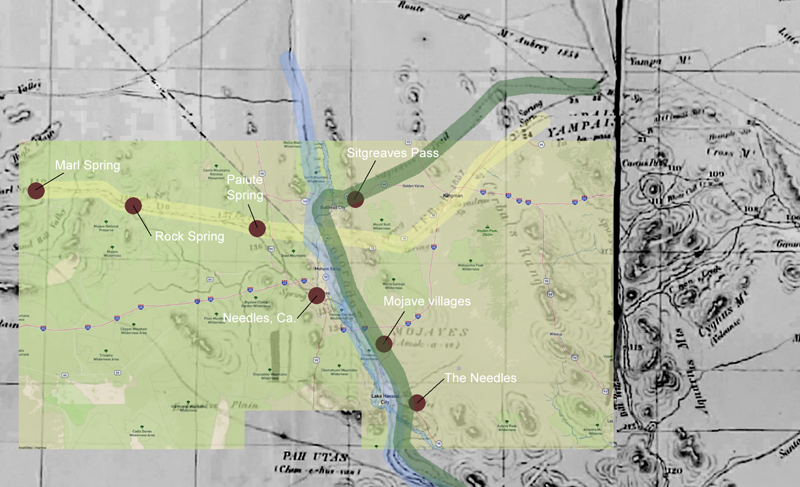
Next, I put in an overlay of a modern map and indeed, Sitgreaves Pass appeared north of where it should be.
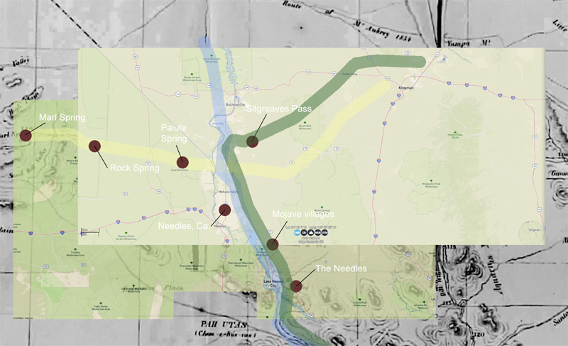
Finally, I put in a solid layer to see how it looked without the historical map.
I am hesitant to say this is this and should be this because whenever I do I am just about always incorrect. I will have to check it out further.