Month: April 2025

  • Modern Mojave History

    The modern history of Mojave Desert communities grew after the mining booms faded and railroads became less of a lifeline. Roughly from the 1940s to now, these places have been redefining themselves—not just surviving the desert but learning how to live with it in new ways.

    Here’s how the modern community story unfolds, level by level:

    1. Military and Aerospace Transformation (1940s–1960s)

    World War II changed everything. The Mojave wasn’t just space—it became a strategic training and testing ground.

    • Camp Iron Mountain and Patton’s Desert Training Center trained soldiers for North Africa.
    • Pilots broke the sound barrier at Edwards Air Force Base, which grew into the heart of desert aviation.
    • China Lake and Fort Irwin brought high-tech military research to places like Ridgecrest and Barstow, drawing families and workers.

    These bases turned small desert outposts into full-blown towns with schools, post offices, and diners.

    2. Route 66 and the Roadside Era (1940s–1970s)

    The desert became part of the great American road trip. Route 66 brought motels, neon signs, gas stations, and diners—places like Victorville, Needles, and Ludlow saw a boom in roadside business.

    Families moved in, schools opened, and churches and drive-ins popped up. This was the golden age of “mom-and-pop” America in the desert.

    3. Suburban Growth and Retirement Towns (1960s–1990s)

    As Southern California’s population exploded, people started looking eastward for cheaper land and quieter lives.

    • Apple Valley, Hesperia, and Pahrump became bedroom communities.
    • Retirees settled in places like Yucca Valley and Desert Hot Springs, drawn by warm weather and low cost of living.
    • Victor Valley Community College, hospitals, and shopping centers brought permanence to areas that once just had a trading post or water tank.

    But growth was a double-edged sword—water use soared, and the Mojave’s quiet shrank.

    4. Conservation and Cultural Identity (1990s–Present)

    As people realized how fragile the desert is, preservation efforts took root.

    • Mojave National Preserve was created in 1994.
    • Groups began restoring historic buildings, like the Kelso Depot and the Apple Valley Inn.
    • Indigenous communities began reclaiming space and stories, renewing ties to sacred sites.

    Meanwhile, desert towns started embracing their unique character—ghost town tourism, art festivals, off-road races, and local museums began drawing visitors. The old pioneer spirit didn’t vanish; it just adapted.

    5. Today: Challenges and Reinvention

    Modern Mojave communities are still small, spread out, and shaped by heat, water, and distance.

    Some focus on eco-tourism or renewable energy. Others wrestle with issues like poverty, declining services, or housing. But there’s pride in being from these places. Pride in the toughness it takes to make a home in the Mojave.

    The modern story isn’t just one of change—it’s about finding a future while holding onto the past.

  • Mirages and Whispers: Sensory Isolation in the Mojave Desert

    Introduction: The Desert of Illusions Dawn breaks over the Mojave Desert with a hushed reverence. The air is cool and clear, and distant mountains seem deceptively close in the sharp light of early morning. Shimmering heat waves appear on the horizon as the sun climbs, hinting at water that is not there. This land of illusions plays tricks on the eyes and ears. A lone traveler here sinks into the silence and wide-open space, and soon, the mind starts picking up signals most folks usually miss. Shadows at the edge of vision start to move. The senses sharpen. Moreover, sometimes, the line between what is real and imagined blurs.

    The Vast Silence and Heightened Senses

    One of the Mojave’s most striking features is its deep silence. Away from towns or traffic, the desert can be nearly soundless. In that stillness, the ears strain to find and often invent input. People in extreme quiet sometimes report hearing phantom sounds: faint music, whispers, or even voices. The Mojave is not a sealed room, but the open expanse and quiet air have a similar effect. Cut off from the usual background noise, a lone traveler here sinks into the silence and wide-open space, and soon; the mind starts picking up signals most folks usually miss. Hearing becomes hypersensitive. One may notice their heartbeat or the scrape of a boot echoing off distant rocks. Some desert wanderers describe hearing whispers on the wind—just enough to make some turn their heads.

    The visual sense sharpens, too. With little to block the view, a person can see for miles. The eye picks up every flicker of movement, and peripheral vision becomes especially active. A lizard’s dart, the shift of a shadow, and even heat ripples can spark a reaction. At night, stargazers in the desert rely on this phenomenon to spot dim stars: looking slightly away from a faint object makes it more visible. However, this same sensitivity can also create illusions. Many travelers have felt watched, only to find a cactus or rock behind them. In the Mojave, the senses amplify every detail; when the brain cannot make sense of something, it fills in the gaps.

    Pareidolia: Faces in the Rocks

    The Mojave is a playground for pareidolia—the tendency to see faces or figures in random patterns. Among the weathered boulders of Joshua Tree or the sculpted cliffs of Red Rock Canyon, it is easy to find rocks that look like skulls, animals, or crouched figures. The mind craves familiarity, and light and shadow give just enough shape to suggest meaning. Visitors often describe seeing people in the rocks or animals in the hills, only to realize it is just how the sun hits the stone. These illusions shift throughout the day. At noon, a rock that’s nothing special might take on a ghostly presence by twilight.

    The Mojave’s heat can create true optical illusions even beyond static shapes. Mirages appear across dry lakebeds and salt flats, fooling the eye with phantom water or hovering images. Early travelers chased these shimmering lakes, only to watch them vanish as they approached. The desert air plays with light, creating a shifting, surreal world where the landscape seems to breathe.

    Whispers on the Wind: Auditory Hallucinations.

    Silence can be just as disorienting as glare. A surreal quiet settles in when the wind is still in the Mojave. People begin to hear things that are not there. The brain, used to constant sound, invents input to fill the void. A whisper might turn out to be wind through Joshua tree branches. Footsteps creeping along could be a kangaroo rat in the brush. The wind can sound like voices when it moves through rock crevices or cactus spines.

    In certain corners of the desert, the land itself finds a voice. At Kelso Dunes, when dry sand slips down the slopes just right, it releases a deep, resonant hum—a low, booming note that can hang in the air for minutes. Stumbling across it by chance might give the impression that the ground is singing. The sound is entirely natural yet out of context; it feels otherworldly. It feeds the notion that the Mojave is not just a place but a presence—alive, alert, and willing to speak to those who listen.

    Desert Lore and Spiritual Thresholds

    Across cultures, deserts are seen as places of vision and revelation. In the Bible, prophets went into the wilderness to confront themselves and hear the divine. Among the Mojave and Chemehuevi people, the desert is not empty but full of spirit. Every mountain and river has a voice. Sitting alone in silence is a way to hear it.

    Modern wanderers sometimes have similar experiences. A desert vision might not come with trumpets or lightning but with subtle signs: a shape in a rock, a whisper of wind that feels like a message, or a sudden connection to something beyond oneself. Artists, mystics, and solo hikers often describe the Mojave as a threshold where imagination and reality touch.

    Startled or Spellbound: Reactions to the Unseen

    These experiences rattle some people. A shadow seen at dusk, a whisper heard at midnight, or a rock that looks too much like a figure can spark real fear. The Mojave has sent many travelers packing, spooked by the sense that something is watching.

    Others embrace it. They return again and again, drawn by the mystery. For them, the strange sights and sounds are not threats but invitations to feel small, listen, and see. In this way, the Mojave becomes not just a place but a mirror. What appears in the silence may reveal more about the observer than the land itself.

    Conclusion: Embracing the Mirage

    In the Mojave, the line between real and imagined begins to blur. The desert does not deceive—it sharpens the senses, asking for attention. A shadow might be only a rock or open a door in the mind. A sound might be wind, or it might be the desert speaking.

    Some leave shaken, others changed. One way or another, the Mojave does not simply reveal itself—it reflects what the traveler carries into the silence.

  • Panamint Legends

    The Road, the Valley, the City, and the Range

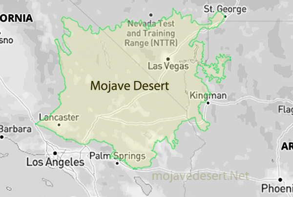
    Tucked between the Inyo Mountains and the Panamint Range in eastern California lies Panamint Valley—a vast, arid stretch of desert where stories cling to the rocks and dust. Part of the northern Mojave Desert, this remote basin has seen centuries of human presence, from Native American trade routes and outlaw hideouts to a silver mining boom and military testing. Surprise Canyon is at the heart of this tale, a rugged cut through the mountains that once served as both a refuge and a gateway to fortune.

    Native Roots and Early Exploration For thousands of years, the Timbisha Shoshone and other Native American groups lived in and around Panamint Valley. They followed game, gathered plants, and knew the subtle signs of water in this harsh landscape. Early explorers and pioneers during the California Gold Rush would later follow their trails. However, few stayed long in the face of the valley heat, dryness, and isolation.

    Outlaws in Surprise Canyon In early 1873, three men hiding from the law—William L. Kennedy, Robert L. Stewart, and Richard C. Jacobs—discovered silver in the steep, narrow depths of Surprise Canyon. Some say they were drawn there by rumors of the Lost Gunsight Mine. Regardless, they struck it rich. Sources differ on the exact date: Nadeau places it in January, Wilson in February, and Chalfant in April. But by June, prospectors had filed 80 claims, and the ore was assaying at thousands of dollars per ton.

    Big Money and Bigger Names Enter E. P. Raines, who secured a bond on some of the most promising claims and began promoting the new district. He drew attention by hauling a half-ton block of silver ore to Los Angeles and displaying it at the Clarendon Hotel. This bold stunt brought together jewelers, bankers, and freighters, who agreed to build a wagon road to the mines. Raines continued north to San Francisco and then Washington, D.C., where he met Senator John P. Jones of Nevada, a former Comstock miner and hero of a deadly fire. Jones loaned him $15,000 and soon partnered with fellow “Silver Senator” William M. Stewart to form the Panamint Mining Company.

    The senators spent over $350,000 acquiring prime claims from known Wells Fargo robbers. Senator Stewart arranged amnesty for these men, with the condition that $12,000 in profits be paid to the express company as restitution. It is believed this arrangement convinced Wells Fargo to avoid opening an office in Panamint.

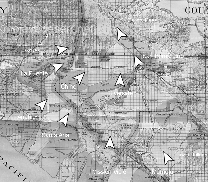
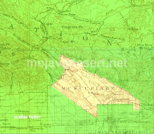
    The Road to the Panamint Mines The silver rush in Surprise Canyon prompted the search for a better supply route. Senator Stewart noticed Meyerstein & Co., a San Bernardino firm, was already sending goods to the region. He encouraged Caesar Meyerstein to establish a stage line. In the fall of 1874, preparations began on a road from Cottonwoods on the Mojave River to the Panamints.

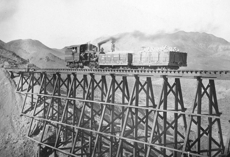
    The Board of Supervisors appointed Aaron Lane as road overseer of the newly formed Mojave District. Lane hired a crew of Chinese laborers under foreman Charley Craw to begin construction. Miners objected to using Chinese labor, but Lane completed the project by mid-November. He advertised the route as an “excellent” road, and the Guardian praised the veteran for his work. Lane submitted a bill for $645.61, but the county approved only $500—a modest sum for 115 miles of desert road.

    This San Bernardino-Panamint Road, sometimes called the Meyerstein Road or Nadeau Cut-Off, shortened the journey to the mines by cutting across from Cajon Pass through Victorville and Hodge (Cottonwoods), connecting with the Stoddard’s Well Road. While freighter Remi Nadeau operated the Los Angeles to Panamint route via Tejon Pass, the San Bernardino route originated separately. Despite the confusion in some sources, the Chinese labor used on the San Bernardino-Panamint Road under Captain Lane should not be mistaken for labor on Nadeau’s route.

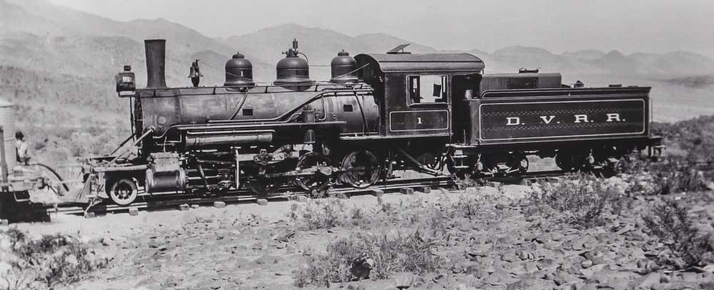
    According to the San Bernardino Weekly Argus, stops along the Meyerstein route included Meyerstein to Martin’s, Fears in Cajon Pass, Huntington’s (Victorville), Cottonwoods (Hodge), Wells, Second Crossing of the Mojave, Black’s Ranch, Granite, Willow Tree Station, and finally Post Office Springs, just before reaching Panamint. These links formed a vital corridor to one of the West’s wildest boomtowns.

    The Rise of Panamint City By March 1874, Panamint had around 125 residents. It had no schoolhouse, church, jail, or hospital—and it never would. To avoid robbery on the lawless route to market, the senators cast silver into 450-pound “cannonballs” that could be hauled unguarded to Los Angeles. On November 28, the Idaho Panamint Silver Mining Company was formed with $5 million in capital, followed by the Maryland of Panamint and several others with an additional $42 million by year’s end. That same month, the Panamint News began publishing—though its editor fled town within days after stealing advertising revenue.

    The town boomed. The winter of 1874-75 was its peak. Two stage lines operated, the Bank of Panamint opened, and 50 buildings lined Surprise Canyon. The Oriental Saloon claimed to be the finest outside San Francisco. Mules and burros were the main form of transport. The lone wagon doubled as a meat hauler and a hearse.

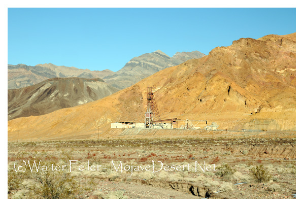
    By January 1875, the population hit 1,500 to 2,000. Businesses thrived. A wire tramway sent ore from the Wyoming and Hemlock mines down to the Surprise Valley Mill and Water Company’s twenty-stamp mill. Wood costs $12 per cord, and miners earn $4 to $5.50 per day. The crumbling smokestack of this mill still stands. Daniel P. Bell, the mill’s builder, later died by suicide in Salt Lake City, reportedly after being diagnosed with cancer.

    Crash and Decline Disaster came quickly. The collapse of the Bank of California in August 1875 shook confidence across the state. Panamint stock crashed, speculation dried up, and the Panamint News ceased publication. By November, the population had largely disappeared, with only a few hopefuls remaining. In July 1876, a cloudburst flooded Surprise Canyon, wiping out large sections of the town.

    Senator Jones, once Panamint’s champion, held on until May 1877. But a market panic forced him to shut down the mill. Despite investing nearly two million dollars, the Silver Senators saw little return.

    Later, Revivals and Post Office Spring Attempts to revive Panamint followed. Richard Decker reopened the post office during 1887 and worked claims into the 1890s. The site saw minor revivals into the 1920s and again in the 1940s. 1947-48, American Silver Corporation leased multiple claims and rebuilt the Surprise Canyon road but filed for bankruptcy in 1948. Interest returned in the 1970s, though the fractured and faulted veins proved challenging to follow.

    Near the city ruins, Post Office Spring played an important role. Besides being a water source, it housed a secret mail drop during Panamint’s outlaw days. A box wired to a mesquite tree held letters marked “John Doe”; a rag on a nearby branch signaled mail had arrived. At night, fugitives collected or left messages in secret.

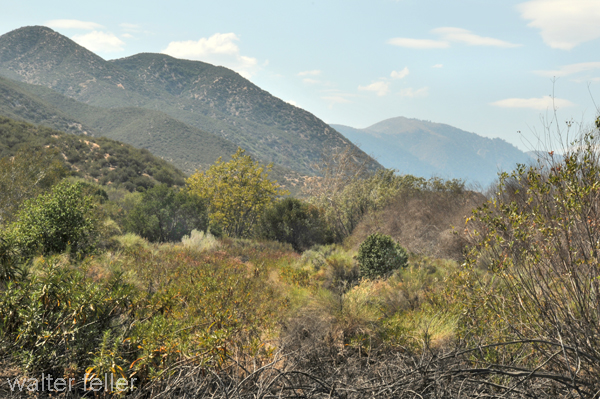
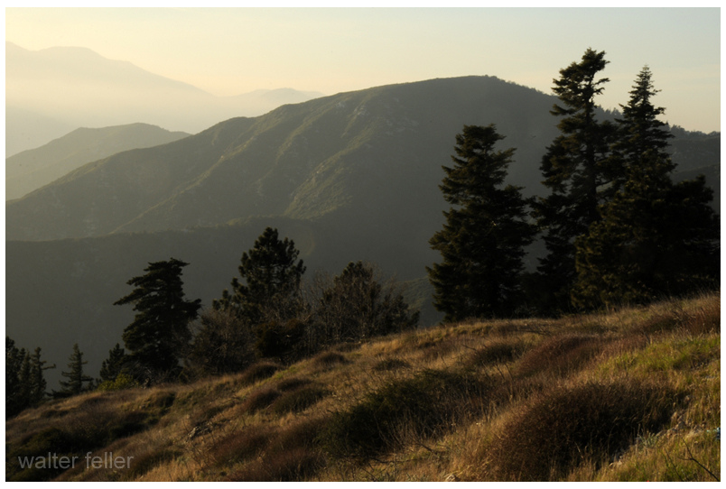
    The Panamint Range: Geology and Life The Panamint Range, separating Panamint Valley from Death Valley, rises from about 1,000 to 11,049 feet at Telescope Peak. It’s part of MLRA 29f and features Precambrian sedimentary and metamorphic bedrock, Paleozoic marine sediments (Cambrian to Carboniferous), Mesozoic granite, and Pliocene basalt. Alluvial fans spread from steep slopes into the valleys. Processes shaping the range include mass wasting, fluvial erosion, deposition, and freeze-thaw cycles.

    Vegetation follows elevation, too, from creosote bush and shadscale at lower levels to pinyon, limber pine, and bristlecone forests higher up. Surface water is scarce; streams run briefly during rains and snowmelt, draining into Panamint and Death Valleys.

    The Road, the Valley, the Legend The road to Panamint, first carved to bring silver to market, is now a rugged path for adventurers. Panamint Valley itself, once crossed by Native trails and mule trains, is now visited by hikers, off-roaders, and desert wanderers: the Panamint Range towers above, its silent peaks guarding the stories of a forgotten boomtown.

    Panamint is more than a ghost town. It mirrors Western ambition—where silver dreams, outlaw grit, and desert extremes shaped one of the wildest chapters in California history.

  • Muscupiabe

    Amuscupiabit

    From across the Mojave and along the Mojave River, springs and other water sources shaped the trail down Cajon Canyon and into the southern California valleys. Trails from all directions met in this canyon and that in itself would possibly indicate that in the overall scheme of things some variety of trade may have taken place here where the trails cross.

    Amuscupiabit – Cajon Canyon

    During the winter months when snow is capping the mountains and the weather is cold the Cajon valley would have generally been warmer. With a good year, there would have been plenty to harvest and forage as well as game to hunt. Drought years may have brought little with it and the camp would have been a starvation camp with little to eat.

    Rancherias

    A rancheria, as the Mexicans called it, would have been a small settlement of Indians living in temporary huts while maintaining seasonal subsistence activities and trade.

    It was among these rancherias … that the missions found the most fertile fields for producing laborers. Whether by trickery or physical force the villagers into the Catholic fold. Being taken to the mission was most likely the fate of the residents of the Serrano rancheria Amuscupiabit in the heart of the Cajon Pass.

    The Old Spanish Trail had become increasingly used as a pack mule trail between New Mexico and California, and with this traffic came the opportunity for those to take advantage of the distant location and desperate nature of the land.

    Crowder (Coyote) Canyon in the Cajon Pass north of San Bernardino
    Hundreds and sometimes even thousands of stolen horses from the ranchos would burst through Coyote Canyon beginning their ‘journey of death’ across the Mojave.

    California horses were beautiful creatures, and the mules were taller and stronger than those in New Mexico and they were easy to steal.  The rolling hills and plains presented clear paths to the  Cajon where numerous hidden canyons and washes were available to slip into and prepare for the furious run across the desert. Horses would be stolen in herds from many different ranchos at once. Hundreds of horses, even thousands could be commandeered and driven by just a few experienced thieves.

    Chief Walkara, ‘Hawk of the Mountains ‘ and the greatest horse thief in all of history along with his band of renegade Chaguanosos, and notables such as Jim Beckwourth and Pegleg Smith would work together in this illegal trade. During one raid they were said to have coordinated the theft of 3,000-5,000 horses, driving them to Fort Bridger to trade for more horses to run to New Mexico to trade again. Horses would fall from exhaustion every mile and the local bands of Paiute would feast on the remains.

    Coyote Canyon

    . . . A few years later Mr. White established a camp in San Bernardino county at the mouth of Lytle creek and again started in the cattle business. Here he was joined by two other white men, who after agreeing to a plan to take up all of the valley lands deserted him before the consummation of the scheme. The Indians learning that he was alone decided that it would be a good time to make a raid and drive away the herds, and under the leadership of Chief Coyote, who was one of the craftiest and most vicious in that section, they accomplished their purpose. The next morning in company with an Indian boy of seventeen years, who was friendly to him, Mr. White started out to find the stock and overtook the thieves at the head of Cajon Pass. Here the Indians had camped and killed a horse, upon which they were feasting when Mr. White discovered them. Cleverly circling the camp he managed to get ahead of them and was endeavoring to stampede the stock when Chief Coyote saw him and started toward him. Waiting until the Indian was within forty or fifty yards of him Mr. White took steady aim and shot him dead, the report of the gun stampeding the cattle. They returned home, Mr. White and the Indian boy following and reaching the valley in safety after having killed a number of other redskins. The boy had been of great assistance to him by loading his extra gun.

    When the governor heard of this affair he sent for Mr. White and ascertaining that he had no land but desired to receive a grant, application was made and surveys taken, and in a few years he received papers conveying to him thirty-two thousand acres of land.

    A HISTORY of CALIFORNIA Extended History of Its Southern Coast Counties – Vol II — J. M. GUINN 1907
    The rich ranchos of southern California.

    In 1843 Michael White was granted one league of land at the mouth of the Cajon Pass called Rancho Muscupiabe. At a point overlooking the trails leading into and away from the canyon he was expected to thwart the raiders and horse thieves that were plaguing the Southern California ranchos. In theory, it was a good plan but in practice, it did not work so well.

    Devore, ca.
    From the piedmont between Devil and Cable canyons, Miguel Blanco could keep an eye out for the horse thieves entering the Cajon.

    He built his home of logs and earth and constructed corrals for his stock. However, the location between Cable and Devil Canyon only served as a closer and more convenient target for the Indian thieves. His family was with him, but after six weeks until it became too dangerous. He left after nine months without any livestock and in debt.

    The Old Spanish Trail went down this slope to behind Miguel Blanco’s rough-hewn homestead. Indians would watch from this forest for Miguel to leave and they would slip down and steal everything that could be stolen.

    Miguel sold his property, however, Miguel had misread the grant, letting the rancho go for much less than it was worth. The land described on the grant was roughly 5 times larger than Miguel thought.  Blanco brought a suit but lost.

    Muscupiabe Rancho, Michael White, Miguel Blanco
    Muscupiabe Rancho

    As the late 1840s and 1850s rolled by wagon roads were being developed in the canyon minimizing the effectiveness of the maze of box canyons being used to cover the escape of desperadoes on horseback. With California becoming a state frontiersmen such as Beckwourth and Peg Leg Smith would not steal from fellow Americans. Horse-thieving under U.S. law had become a crime where before it was just stealing horses from Mexicans. That was only serious if caught in the act. Americans would never extradite them. For the most part, that was the end of the horse-stealing raids.

    • end

  • The Coyote and the Raven: An Uneasy Brotherhood

    Out in the open country—desert, forest, or plain—you’ll sometimes spot a coyote trotting with a black-feathered shadow gliding above or hopping behind. That shadow is usually a raven; believe it or not, those two critters have a working relationship. It’s not friendship or rivalry—more like a loose alliance between two clever survivors who know how to get by in a harsh world.

    The raven is sharp as a tack. One of the most intelligent birds out there, it’s always watching, always thinking. It knows that a coyote’s nose is one of the best tools for sniffing out a meal. So it tags along. The coyote does the dirty work—flushing out prey, unearthing carcasses, chasing rabbits—and the raven swoops in for its share once the chase ends. Sometimes it even helps the coyote out, flying ahead and acting excited when it spots something promising. There’s evidence that coyotes pick up on this behavior and follow the raven’s lead. They’ve learned to pay attention.

    For the coyote, it’s a pretty good deal, too. It might not be able to see as far as a raven can from the air, but it knows that if a raven’s hanging around, something must be going on. Ravens don’t waste energy for nothing. If they’re diving, croaking, and making a scene, there’s usually food nearby. A clever coyote watches that behavior and follows its feathered guide straight to the prize.

    It’s the kind of relationship that’s been going on quietly for generations—no contract, no handshake, just two species reading each other’s cues. It brings to mind those old Native American stories where the coyote and the raven are both tricksters: wily, unpredictable, and always looking for the next angle. In the real world, the desert happens to be their stage.

    But let’s not pretend it’s all rosy. These guys are not buddies. They tolerate each other because it works. And when it stops working—say, if food is scarce or one gets too bold—things can get tense. Coyotes will chase ravens off if they feel annoyed or cheated. And on the flip side, ravens are scavengers at heart. If a young coyote meets an unfortunate end, a raven won’t hesitate to peck at the remains. Nature isn’t sentimental.

    Furthermore, if a coyote stumbles upon a dead raven, you can bet it’ll at least give it a sniff. Coyotes aren’t picky. They’ll chew on roadkill, fruit, old hamburger wrappers, and yes—if legend (and plenty of firsthand accounts) holds—even an old boot. So a raven carcass? That’s fair game. They might not go out of their way to chase down a healthy raven, but if one’s lying sick, twitching, and eyes rolled back, a coyote will pick through the clump a bit.

    Ultimately, the relationship between the coyote and the raven is a perfect example of how survival shapes behavior. These two animals don’t need to like each other—they need to pay attention. It’s all about reading the land, knowing your neighbors, and taking chances when they come. They may come from different worlds—one with wings, the other with paws—but they’ve carved out a quiet understanding. And in the wild, that can mean the difference between a good day and an empty belly.

  • Owens Valley Chronology

    Pre-Contact Era (Before 1800s)

    • The Nüümü (Paiute people) live in the Owens Valley, using sophisticated irrigation systems to grow native plants. They also engage in seasonal hunting and gathering throughout the region.

    Owens Valley Paiute

    1834 – Joseph R. Walker Enters Owens Valley

    • Joseph R. Walker, a scout and explorer leading a detachment of Bonneville’s Expedition, is credited as the first known non-Native American to travel through Owens Valley.
    • His route takes him along the eastern slope of the Sierra Nevada, likely crossing the valley while seeking a pass into California.
    • Walker’s expedition opened early paths for later settlers and explorers.

    Joseph R. Walker, Owens Valley

    1845 – Naming of Owens River and Lake

    • During a U.S. military survey expedition, John C. Fremont named the Owens River and Lake after his topographer, Richard Owens.

    Owens Lake

    1861 – Samuel A. Bishop Arrives

    • Bishop drives 500 cattle and 50 horses into the valley and establishes San Francis Ranch.
    • His actions disrupt Paiute lands and irrigation, leading to armed resistance and the Battle of San Francis Ranch in early 1862.

    1861–1863 – Owens Valley Indian War

    • Conflict between settlers and Paiute bands escalates.
    • The U.S. Army was called to support settlers and forced many Paiutes to Fort Tejon in 1863.

    Paiute Indian War, Fort Tejon

    1862 – Camp Independence Established

    • July 4: U.S. Army establishes Camp Independence near Oak Creek to protect settlers and assert military control during the war.
    • The site later becomes part of the Fort Independence Indian Community.

    Camp Independence

    1860s–1880s – Expansion of Settlement

    • Settlers build farms, ranches, and towns like Lone Pine and Independence.
    • Mining in nearby Cerro Gordo spurs economic growth.

    Lone Pine, Independence, Cerro Gordo

    1872 – Lone Pine Earthquake

    • A devastating quake destroys much of Lone Pine, kills about 27 people, and leaves a visible fault scarp.

    1883 – Carson & Colorado Railroad reaches Laws

    • A narrow-gauge rail line connects the valley to northern mining districts, bringing passengers, freight, and new economic lifelines.

    Carson & Colorado RR

    1900s–1910s – Southern Pacific & Standard-Gauge Rail

    • Southern Pacific Railroad acquires the Carson & Colorado.
    • A standard-gauge line is built from Mojave to Owenyo.

    Southern Pacific RR, Mojave

    1905–1913 – Los Angeles Aqueduct

    • LA secures land and water rights.
    • 1913: The aqueduct is completed, diverting the Owens River to Southern California.

    1924 – Aqueduct Sabotage

    • Local farmers and ranchers retaliate with dynamite attacks on aqueduct facilities, protesting water loss.

    1927 – Owens Lake Dries Up

    • Once a large inland sea, Owens Lake becomes a dry lakebed as diversions continue.

    1960 – End of Narrow-Gauge Rail Service

    • Final train reaches Laws, marking the end of narrow-gauge railroad operations in the valley.
    • The depot is preserved as part of the Laws Railroad Museum.

    1970s–1990s – Environmental Action

    • Residents and conservationists challenge LA’s dust and water practices.
    • 1991: LA is legally required to control dust on Owens Lake.

    2000s–Present – Restoration and Advocacy

    • Efforts continue to restore natural flow, clean up air quality, and address the historical displacement of Native communities.

  • Owens Valley History

    Early Inhabitants and Settlement

    The valley was originally home to the Paiute people, who practiced irrigation to cultivate crops along the riverbanks. In the 19th century, American and English fur trappers and mountain men were among the first non-indigenous individuals to explore the area. The discovery of silver and lead deposits in the nearby Cerro Gordo Mines during the late 1800s led to a mining boom, attracting settlers and leading to the establishment of communities like Keeler.

    Owens Valley Indian War

    Tensions between settlers and the indigenous Paiute people escalated into the Owens Valley Indian War in the early 1860s. Conflicts over land and resources resulted in violent confrontations, leading to significant casualties on both sides. In March 1862, settlers attacked a Paiute camp in the Alabama Hills, resulting in the deaths of eleven Paiutes and the destruction of their food supplies. Subsequent engagements saw the involvement of military forces and further loss of life.

    Water Diversion and the Owens Valley Water Wars

    In the early 20th century, Los Angeles sought to secure water resources to support its growing population. The city constructed the Los Angeles Aqueduct, completed in 1913, to divert water from the Owens River to Los Angeles. This diversion had devastating effects on Owens Valley’s agriculture and led to the drying up of Owens Lake. Local farmers and residents opposed the project, leading to acts of sabotage and legal battles known as the Owens Valley Water Wars. Despite their efforts, Los Angeles maintained control over the water resources, leading to long-term economic and environmental consequences for the valley.

    Manzanar Internment Camp

    During World War II, the U.S. government established the Manzanar War Relocation Center in Owens Valley. From 1942 to 1945, over 10,000 Japanese Americans were forcibly relocated and incarcerated at Manzanar as part of the internment program. The harsh conditions and unjust treatment of these individuals remain a poignant chapter in American history.

    Saline Valley Salt Tram

    An engineering feat of the early 20th century, the Saline Valley Salt Tram was constructed between 1911 and 1913 to transport salt from the Saline Valley over the Inyo Mountains into Owens Valley. Covering a distance of 13.4 miles with steep inclines, it operated intermittently until 1935 and stands as a testament to the industrial endeavors of the era.

    The history of Owens Valley reflects a tapestry of cultural heritage, resource conflicts, and resilience, offering valuable insights into the complexities of development and conservation in the American West.

  • Why is the Mojave Famous?

    Here is a look at what the Mojave is famous for, with pioneer trails and human history front and center:

    1. Native Peoples
      Long before wagon wheels, the Mojave was home to Native tribes like the Mojave, Chemehuevi, Southern Paiute, and Serrano. These communities knew the springs, passes, and seasonal rhythms like the back of their hand, and they left trails, trade routes, rock art, and village sites throughout the region. Their knowledge of water and survival shaped later explorers’ routes.
    2. Pioneer Trails
      • Old Spanish Trail: This historic trade route linked New Mexico to California, winding through the Mojave. Traders, herders, and explorers used it to move livestock and goods—often braving vast dry stretches and rugged terrain.
      • Mojave Road (aka Government Road): Originally a Native footpath, it became a vital wagon route in the 1800s, linking the Colorado River to Southern California. Army outposts like Fort Mojave and Camp Cady were built along it to protect travelers.
      • Salt Lake Wagon Road and Bradshaw Trail: These overland trails helped connect remote mining districts and settlements, pushing westward expansion through incredibly harsh country.
      • Butterfield Overland Mail Route: This short-lived but famous stagecoach line cut through the edge of the Mojave to deliver mail between St. Louis and San Francisco.
    3. Homesteaders, Miners, and Ranchers
      Once the trails were blazed, the floodgates opened to prospectors, settlers, and ranchers. Boomtowns sprang up around gold, silver, and borax. Think Calico, Tecopa, Kelso, and Ballarat—all born of dreams and dust. Cattlemen like Albert Swarthout carved out rough but sustainable ranches, running cattle from the low desert to summer pastures in the San Bernardino Mountains.
    4. Railroads and Route 66
      The Santa Fe, Southern Pacific, and Atlantic & Pacific Railroads stitched the desert into the country’s growing infrastructure. Later, Route 66 brought travelers through towns like Barstow, Needles, and Amboy, adding roadside Americana to the desert’s legacy.
    5. Modern Tribes of the Desert
      Today, the Mojave is home to desert dwellers of all stripes—scientists, artists, loners, and communities like the Mojave Indian Tribe, who still live near the Colorado River. It also draws off-grid homesteaders and folks seeking freedom in wide open country.
    6. Endurance and Ingenuity
      Whether you’re talking about ancient foot trails, covered wagons crossing dry washes, or early aviators launching into the unknown, the Mojave has always demanded toughness and adaptability. It’s a place that doesn’t hand out easy victories—but the stories it holds are worth every blister and rattlesnake dodge.