Author Archives: Walter

One Fine Day

A beautifully alive day in the Mojave Desert.

If you want to see the desert pick a fine day and go to the desert. It will be cloudless, hot, and asleep and pretty much as you expect it.

If you want to be in the desert while it is awake and alive and changing its own character–go when there is drama in the skies and in the wind. Go when its army of clouds cast unshaped shadows of camouflage on its colored hills. Go when rain is pouring down from the heavens in patches and flooding the landscapes and carving the canyons and washes. Go when the wind is blowing sand that scars its cliffs and uprooting the Joshua trees that have become old and weak. Go while the desert is growing, reshaping, and in a dubious struggle with itself. Go then.

Red Rock Canyon

Lenticular Clouds

Known as Altocumulus Standing Lenticular (ACSL) or Altocumulus Standing Lenticularis clouds, they are associated with waves in the atmosphere that develop when relatively stable, fast moving air is forced up and over a topographic barrier that is oriented more or less perpendicular to the direction from which the upper-level wind is blowing. This deflection creates a gravity wave downwind of the topographic barrier not unlike a wave you might generate by throwing a pebble into a pond. When sufficient moisture is present above mountain-top level, ACSL clouds develop within the crest of these mountain waves where the air is rising. ACSL clouds are continually developing and dissipating in the vicinity of the wave’s crest and immediately downwind of the crest, respectively. That is why they appear to remain stationary (hence the name) even though winds are swiftly (sometimes very swiftly) moving through the entire cloud

  • https://www.weather.gov/abq/features_acsl
Standing lenticular cloud over the unseen Fremont Peak in the Mojave Desert – from Black Canyon

A Striking Image

A survivor yucca grows out of a cleft appearing to be damaged from a high-speed contact. Taken during the last sliver of direct sunlight of the day. I thought the little shrub exquisite and beautiful. The granite, reddish and perfect–the light was a shear veil laid like a blessing. All the way from my birth and experiences and all the way from the time before time began when the stone was born and born again and again under oceans and earth and heat and wear. All the way from then through the life of the thing, growing its spikes like crazily splashed slashes of bold green paint contrasted on a red canvas, its sacred moment, its peak of existence. Pause, then slowly, deeply, exhale.

Rainbow Basin

It took me a bit before I realized I had not been breathing. . .

Rainbow Basin
https://digital-desert.com/rainbow-basin/

“There is sparse plant life here in the ancient soils. The land has been dropped and twisted and filled with sediments layered by lakes long ago. Several small faults run through the area yanking and grinding the basin into its current mismanaged buttonhole configuration.”

~ BLM

Cajon Pass Wagon Road Divide

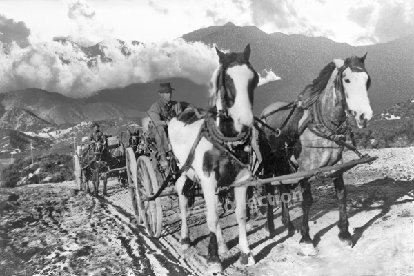
Road traces just below the Cajon Summit

Just east of the Cajon Summit is where the historic traffic corridor in and out of the Mojave Desert narrows and the various alignments come within hollering distance of each other as they cross over the divide between the high desert and Cajon Canyon.

Traces and fragments of footpaths, trails, wagon roads and early highways can be found next to our modern freeway and here they become interwoven, laced and worn or grown over. None of all of this, by any means, obscures the vision of countless travelers of past ages passing this point.

https://digital-desert.com/cajon-pass/

West Fork – Mojave River

Just Sayin’

I suppose, if there is any hard and clear boundary to the Mojave Desert that this is where it is. Over time, the Mojave River has cut away the bluff in Summit Valley, east of the Cajon Pass, as the Mojave Desert moves with the rest of the Mojave Block as it separates from the San Bernardino mountain range.

https://digital-desert.com/mojave-river/

Macadam

In 1873 Scottish inventor John Loudon McAdam created an inexpensive type of paving that used rocks and gravel, was put down while it was soft and cured as it was driven on.

Stretch of macadam pavement on old road to and from the summit

John Loudon McAdam and Macadam

Merriam-Webster: In 1783, inventor John Loudon McAdam returned to his native Scotland after amassing a fortune in New York City. He became the road trustee for his district and quickly set his inventiveness to remedying the terrible condition of local roads. After numerous experiments, he created a new road surfacing material made of bits of stone that became compressed into a solid mass as traffic passed over them. His invention revolutionized road construction and transportation, and engineers and the public alike honored him by using his name (respelled macadam) as a generic term for the material or pavement made from it. He is further immortalized in the verb macadamize, which names the process of installing macadam on a road.

https://www.merriam-webster.com/dictionary/macadam

Egg Business

This image has an empty alt attribute; its file name is eggs-2.jpg

Bill owned a chicken ranch out in the great wide-open desert. He was called to go to the big city to do some business and would be gone for several weeks. He asked his friend, Buck, to watch his chicken ranch while he was gone. Buck accepted and each and every day he fed and watered the chickens and gathered the eggs.

One day a rainy deluge swept across the desert causing flash flooding, panic, and havoc. The runoff from the rain destroyed all the chicken feed on Bill’s ranch. Since it would be a while before Bill returned, Buck was in a bit of a fix over the chicken feed. Buck went into the little town nearby to buy some more. He needed two sacks of feed but could only afford one. Buck, being the resourceful individual that he was, went next door to the lumber mill and bought a sack of sawdust. By mixing the sawdust with the chicken feed he would have enough to feed the chickens and keep them from starving.

Buck’s plan appeared to work, but soon one of the chickens laid a wooden egg–and then another hen laid one, and there was another, and another, and another.

I’m telling you . . .

When Bill returned from the big city all of his chickens were laying wooden eggs.

Now, everybody pretty much knows that wooden eggs are useless and it didn’t take but a minute or so for Bill to realize the predicament he was in.

Bill solved his problem by getting out of the egg business.

The end.

The Las Vegas Mormon Fort

A Midpoint Waystation on the Mormon Road

In April 1855, Brigham young, President of the church of Jesus Christ of Latter-Day Saints, called 30 men to leave their families and possessions in the recently settled towns of Utah to serve a mission at the Las Vegas Springs. The verdant meadows watered by the springs had been seasonally inhabited by the Paiute Indians for centuries. The water and meadows made Las Vegas an important stop on the Spanish Trail (called the Mormon Road after 1848).

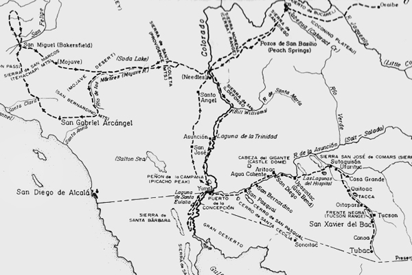
Map of the Old Spanish Trail (Mormon Road) from Mountain Meadows, UT. to San Bernardino, CA.

Map of the Old Spanish Trail (Mormon Road) from Mountain Meadows, UT. to Los Angeles, CA.

President Young directed this group of newly called missionaries to become self-sufficient, to provide a place of rest insecurity for travelers between California and Salt Lake City, and to teach the Indians the gospel of Jesus Christ. In the heat of the summer, in June 1855, the missionaries arrived at this site. The mission, intended to be permanent, was first Anglo-American settlement in Las Vegas Valley.

Mormon Fort - Las Vegas, NV.

Mormon Fort – Las Vegas, Nv.

By summer’s end there irrigating gardens were producing fresh vegetables and grains. A new fort was under construction, and a spirit of cooperation and mutual learning was being established with the native inhabitants. They also discovered a deposit of lead or in the nearby mountains. More missionaries were sent to smelt the complex ore in large quantities, but the attempt was unsuccessful.

On 23 February 1857 church leaders sent word to the settlement that the mission was to be disbanded. These early pioneers returned to Utah the left a legacy of faith, devotion, and service shown by their willingness to settle in this hostile environment.

Source: Old Mormon Fort Historical Dedication

Sad Fate of an Inventor

Editor; Dan De Quille –  Virginia City Territorial Enterprise –  1874

 A gentleman who has just arrived from the borax fields of the desert regions surrounding the town of Columbus, in the eastern part of the state,  gives us the following account of the sad fate of Mr. Jonathan Newhouse, a man of considerable inventive genius. Mr. Newhouse had constructed what he called a “solar armor,”   and apparatus intended to protect the wearer from the fierce heat of the sun in crossing deserts and burning alkali plains.

The armor consisted of a long, close-fitting material; being about an inch in thickness. Before starting across a desert this armor was to be saturated with water. Under the right arm was suspended an Indian rubber sack filled with water and a small gutta-percha tube leading to the top of the hood. In order to keep the armor moist, all that was necessary to be done by the traveler, as he progressed over the burning sands, was to press the sack occasionally, when a small quantity of water would be forced up and thoroughly saturate the hood and the jacket below it. Thus, by the evaporation of the moisture in the armor, it was calculated might be produced almost any degree of cold.

Mr. Newhouse went down to Death Valley, determined to try the experiment of crossing that terrible place in this armor.  He started out into the valley one morning from the camp nearest its borders, telling the man at the camp, as he laced his armor on his back, that he would return in two days.

The next day in Indian who could speak but a few words of English came up to the camp in a great state of excitement. He made the men understand that he wanted them to follow him. At the distance of about 20 miles out into the desert the Indian pointed to a human figure seated against a rock. Approaching they found it to be Newhouse still in his armor. He was dead and frozen stiff.

His beard was covered with frost and– though the noon day sun poured down its fiercest rays– and icicle over a foot in length home from his nose. There he had perished miserably, because his armor had worked but too well, and because it was laced up behind where he could not reach the fastenings.”

Devil's golf course, Death Valley
Devil’s Golf Course

 This was Death Valley’s most widely publicized death. It was reported almost halfway around the world, and this terrible death, well, it never happened–it was simply a yarn as used as filler on a dull day in that summer of 1874.

Jim Beckwourth – Stealing Horses

Notes:
Mountain man Jim Beckwourth flees California during the Bear Flag Revolt Stealing Horses Along the Way

James Beckwourth

I had but little time to deliberate. My people was at war with the country I was living in; I had become security to the authorities for the good behavior of several of my fellow-countrymen, and I was under recognizances for my own conduct. The least misadventure would compromise me, and I was impatient to get away. My only retreat was eastward; so, considering all things fair in time of war, I, together with five trusty Americans, collected eighteen hundred stray horses we found roaming on the Californian ranchos, and started with our utmost speed from Pueblo de Angeles. This was a fair capture, and our morals justified it, for it was war-time. We knew we should be pursued, and we lost no time in making our way toward home. We kept our herd jogging for five days and nights, only resting once a day to eat, and afford the animals time to crop a mouthful of grass. We killed a fat colt occasionally, which supplied us with meat, and very delicious meat too rather costly, but the cheapest and handiest we could obtain. After five days’ chase our pursuers relaxed their speed, and we ourselves drove more leisurely. We again found the advantage that I have often spoken of before of having a drove of horses before us, for, as the animals we bestrode gave out, we could shift to a fresh one, while our pursuers were confined to one steed.

When we arrived at my fort on the Arkansas, we had over one thousand head of horses, all in good condition. There was a general rejoicing among the little community at my safe arrival, the Indians also coming in to bid me welcome. I found my wife married again, having been deceived by a false communication. Her present husband had brought her a missive, purporting to be of my inditing, wherein I expressed indifference toward her person, disinclination to return home, and tendering her a discharge from all connubial obligation. She accepted the document as authentic, and solaced her abandonment by espousing her husband’s messenger. My return acquainted her with the truth of the matter. She manifested extreme regret at having suffered herself to be imposed upon so readily, and, as a remedy for the evil, offered herself back again; but I declined, preferring to enjoy once more the sweets of single blessedness.

I left the fort on a visit to San Fernandez. I found business very dull there on account of the war, and great apprehensions were felt by my friends in regard to the result. Perceiving that was no very desirable place to remove to, I returned to my community. General Kearney was just then on his march to Santa Fe. I took a drove of my horses, and proceeded down the Arkansas to meet him on his route; for it was probable there might be an opportunity of effecting some advantageous exchanges. The general came up, and found me in waiting with my stock; we had been acquainted for several years, and he gave me a very cordial reception.

“Beckwourth,” said the general, you have a splendid lot of horses, really; they must have cost you a great sum of money.”

“No, general,” I replied, “but they cost me a great many miles of hard riding.”

“How so?” he inquired.

“Why, I was in California at the time the war broke out, and, not having men enough at my command to take part in the fighting, I thought I could assist my country a little by starting off a small drove of the enemy’s horses, in order to prevent their being used against us.”

“Ah, Beckwourth, you are truly a wonderful man to possess so much forethought,” and he laughed heartily. “However,” added he, ” trade them off as quickly as possible, for I want you to accompany me. You like war, and I have good use for you now.”  …

from: The Life and Adventures of James P. Beckwourth
Mountaineer, Scout, and Pioneer and Chief of the Crow Nation of Indians


Aphid Loaf

Reeds along Big Bear Lake
I have heard the Indians would go to the reeds in the riparian areas where aphids fed in large numbers, brush away the tiny bugs and scrape their shiny-sticky waste from the blades. En masse the material would be shaped into a large, heavy loaf with a hardness and sweetness similar to rock candy. In Jedediah Smith’s first expedition across the Mojave his guides recovered a cache of the sweet bread to supplement their then meatless diet.

“But men accustomed to living on meat and at the same time travelling hard will Eat a surprising quantity of corn and Beans which at this time constituted our principal subsistence.”
~ J.Smith, 1826

Hesperia Lake

This compound is across the dirt road east of the lake. I’ve heard different things about what this complex is, was, was supposed to be and ended up being as well as a couple different things along the way. Mostly, at this point in time, it has been under construction.  It looks cool though and is one of the 7 wonders of Hesperia. I think it probably shrinks anyone who goes inside to about 3/4 scale. I have never seen anyone come out

Round buildings and igloos at Hesperia Lake

Round buildings and igloos at Hesperia Lake

Hesperia Lake:
http://digital-desert.com/a/hesperialake/

Differences

Sometimes the scenery appears to be the same– It looks like that here and there and over there.  Look closer–this sameness is the differences. There are no gradual changes or blending. Everything is this or that.  Hard contrast.  Then, instead of becoming this faceless hole in our memory, we can become aware of our attachment to common reality.

Cajon Pass
Mormon Rocks

Erosion at Mormon Rocks

The sameness of the differences at Mormon Rocks in the Cajon Pass

Dolomite Ghost Town

Dolomite ghost town, Owens Valley

Downtown Dolomite

I suppose the good news is, is that I got this photo of a shack in the little ghost town of Dolomite. I suppose the bad news is that I shot it in 2001 with a low resolution camera. Then again, some good news is that I doubled the size of it and cleaned up a few rough spots on it with my fancy software. And I suppose the bad news is, is that for all my efforts, Dolomite isn’t an authentic ghost town. I’m finding out that it was built for a movie set. It is a bit of good news that the movie was Nevada Smith starring Steve McQueen, one of my favorite movies. The bad news is that I won’t e able to reshoot it because of circumstances beyond my control at the moment. That’s good because it was on private property. It could have been worse when I was caught trespassing the first time. The owner chased me down and started giving me hell for being on his property. So it was a good thing I told him I came in a few miles over and followed the base of the mountain shooting some other ruins while I went along. It was another good thing when he laughed at my little truck and said, “I wouldn’t think you could make it through there in that.” I told him I was just taking some pictures. He told me to “Have at it.”

At least I didn’t get shot.

Dolomite ghost town photos


Better Holes & Middens

Desert Woodrat
Neotoma lepida

Desert pack rat nests can be used by the same pack rat families for generations and generations.

Packrat nest
Wood rat midden


This rodent is commonly known as the “pack rat” or “trade rat” named for collecting any shiny or metallic object it fancies. Its burrow is easily recognized by the rubbish littered about the entrance.

More about the wood rat:
https://digital-desert.com/wildlife/rodents/desert-woodrat.html

Local History — A 30 Second Story — Silverwood

Silverwood LakeThis is Silverwood Lake. It is named after some guy named Silverwood rather than the silver wood that grows around the lake and Summit Valley. Before they could have the lake there had to be the dam. The dam in this picture is Cedar Springs Dam. Before the dam there was Cedar Springs. It was a small town. It was flooded to make the lake. Everyone moved out first. Some other stuff happened here before that.

The end.

Playas …

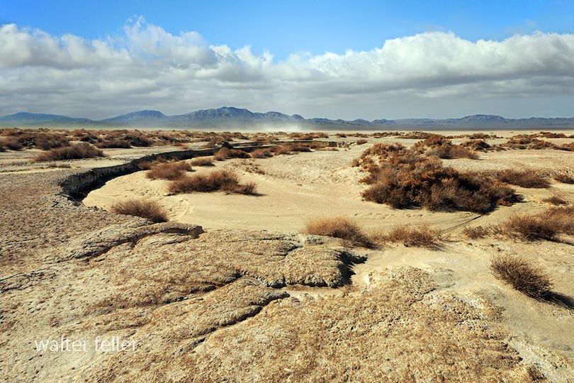
Playas, dry lakes, they hypnotize me. Flat and dry and scarred but still pure. Hardened earth and soft skies. An elegant monotony that locks in on whatever lobe in my brain it is that controls my fascination for seeking a niche, an edge, a flaw as my eye draws up to, in this specific case, a dark and slivered horizon. Few words. Clear and open thought. Appreciation. I clap my hands. The sound dissipates and the ever so slight vibrations go on endlessly.

Playa, Superior dry lake, Barstow, CA.

Playa, Superior dry lake


http://digital-desert.com/dry-lakes/

Be Soft …

Joshua Tree National ParkBe soft. Do not let the world make you hard.
Do not let pain make you hate.
Do not let the bitterness steal your sweetness.
Take pride that even though the rest of the world may disagree, you still believe it to be a beautiful place.

— Kurt Vonnegut

Flying Ford

Abandoned 49 Ford sitting in Death Valley National Park

The ol’ 49er

So the way it went is that the guys that were shooting at me fell over when I drove through just like I bowled a strike (and that’s why all the bullet holes are there). Some other guys started chasing me and I was going so fast that people said they could see my dust blowing in the wind for 32 miles. I come barreling down the road and the road turned and I didn’t so I went airborne over that there hill and landed in a dead stop right there where you see it. The old flathead engine was running so hard and fast still and afraid to do anything but go full throttle and it come bursting right out of the hole in the front you see and hurtled into space. About every 80 days the motor still flies by just a humming, spinning, and gleaming in the sun. I swear–true story.
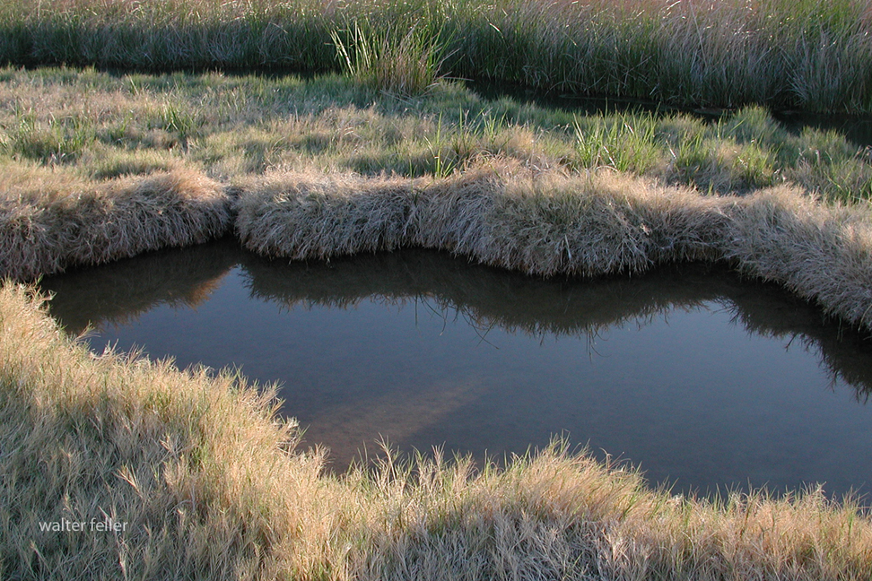
~ Walter

Human Impact on the Mojave Desert

by Laurie J. Schmidt – EROS Data Center DDAC

What do you do when a fragile desert ecosystem turns into a recreational playground? Leonard Gaydos, Coordinator for the U.S. Geological Survey’s (USGS) Recoverability and Vulnerability of Desert Ecosystems project, and colleagues are using satellite data to develop tools that will help Mojave Desert land managers decide what recreational activities to allow and where to allow them. Specifically, the research team is studying vulnerability and recoverability of desert lands.

“Our goal is to create predictive models of the desert that land managers can use to forecast what is likely to happen to a specific piece of land, given its exposure to various types of disturbances,” said Gaydos.

The Mojave Desert encompasses 125,000 square kilometers in southern Nevada, western Arizona, southwestern Utah, and a quarter of California. Situated between the burgeoning cities of Los Angeles and Las Vegas, it is within a day’s drive of 40 million people.

“The Mojave Desert is increasingly viewed as a playground,” said Gaydos. “It now contains four national parks, with millions of people around the edges.” That wasn’t always the case, he said.

“The Mojave Desert was a place you went to get away from civilization. You didn’t have to worry about disturbing anyone or causing any harm,” Gaydos said. In fact, it was largely for this reason that the U.S. military established most of its training facilities there. “It was the last piece of open space in the continental United States where the military could conduct training and not disturb anyone,” Gaydos said.

But, the Mojave’s growing pains make an ideal case study for researching long-term effects of disturbances to desert ecosystems. Land managers are now faced with the daunting task of dealing with competing demands on the land, including impacts from all-terrain vehicles, motorcycles, military activities, and grazing livestock.

“It is incumbent upon the U.S. military, the Bureau of Land Management, the National Park Service, and other land managers to understand the effects of these disturbances on the land,” said Gaydos. “All compact the soil and disturb resources at the land’s surface.”

The project requires a combination of expertise, involving researchers who have worked extensively in adjacent arid land regions, such as southern Arizona, the Grand Canyon, and southeast Utah’s Canyonlands. “The project’s multidisciplinary nature means that scientists on the project team are learning from each other,” said Gaydos. “We have geologists out in the field looking for soil crusts and counting tortoise burrows — not traditional tasks for a geologist.”Map of Desert Southwest

Shaded-relief model of the Desert Southwest (Image courtesy of the USGS Recoverability and Vulnerability of Desert Ecosystems project.

Remote sensing is one of the most valuable tools the team is using. “Satellite imagery enables us to look at the age and characteristics of a site’s surface geology, which is essential to understanding the rate at which that site will recover from disturbances,” said Gaydos.

The scientists use geologic maps created from Landsat 5 data, supplied by the EROS Data Center Distributed Active Archive Center (EDC DAAC) in Sioux Falls, SD. In addition, Landsat data have proved invaluable for identifying study unit boundaries when the team is working in the Mojave. The team also plans to use satellite data to examine dust movement in the desert, an important symptom of disturbance.

The researchers work with high-tech tools such as digital ortho-photos created by the USGS, and imagery from the Advanced Visible and Infrared Imaging System (AVIRIS). Digital ortho-photos are produced by applying corrections to aerial photos using an elevation model. “This process enables us to remove distortions from aerial photos so that they scale correctly, which helps us interpret what we’re seeing,” said Gaydos.

The multi-band capability of the AVIRIS sensor enables computer enhancement of land features, a vital part of the geologic mapping process. “This application of AVIRIS data is still experimental, but it shows lots of promise in mapping the surface geology of the Mojave Desert,” said Gaydos.

These tools have greatly contributed to some of the project’s key findings. First, the research team found that under most circumstances, land seems to recover faster in the years immediately following the disturbance than in later years. In addition, not all areas recover at the same rate.

“The good news is that the desert seems to recover faster than earlier models predicted. The bad news is that it still takes the land a long time to return to its original state, and, in some cases, it may never be exactly what it was before the disturbance occurred,” said Gaydos.

As an example, Gaydos described one of the project’s test sites that lies near an old railroad line built in the early 1900s. For the past 50 years or so since the railroad was abandoned, a berm has acted as an artificial dam for surface processes, such as erosion and runoff. By digging trenches on the slope side of the railroad line, team members measured nearly a dozen flood events. Successive flash-floods rinsed sediment down and built up the surface nearly a meter. “This tells us that we’re dealing with a very dynamic system in the Mojave,” said Gaydos. “At various intervals, flood events wash the sediment down, the plants adapt, and the desert renews itself.”

Land management ranks are also subject to renewal. To keep changing land management and restoration staffs apprised of current findings, Gaydos and his team must maintain regular communications with those in the field.

Sustaining investment is critical, according to Gaydos, because the project still has a way to go. “In the past, the Mojave Desert has been benignly neglected,” he said. “People haven’t worried about it much — it’s not Yellowstone or the Everglades, or any of the places that tend to come to mind when people think of protecting the environment.”

Fortunately, those values seem to be changing, and the desert “playground” is now deemed a valuable resource.

The Thousand Year Ballet

Migration- plants migrate. Plants are always looking for ideal conditions, conditions that help them live longer and better. This is a condition of life. Everything living does this. Inch by inch, foot by foot, generation after generation–plant populations move, march on toward better lives in more conducive environments. They adapt. They evolve. They move in the gradual changes of long-term weather patterns. We may not see it in our lifetimes, but we can in the histories find evidence of, and compile; this used to be here, that used to be there, relict populations remain if any. A seed grows here but not there, and a seed will sprout on this side and not that side. A slow dance extending much longer than we can personally experience, but a dance indeed.

Mojave yucca
Yucca schidigeraMojave National Preserve

Tips for Stagecoach Travelers

from the Omaha Herald, 1877

The best seat inside a stage is the one next to the driver. Even if you have a tendency to seasickness when riding backwards — you’ll get over it and will get less jolts and jostling. Don’t let “sly elph” trade you his mid-seat.

Southern Hotel - San Bernardino (L.A. Co. Museum)

Southern Hotel – San Bernardino
(L.A. Co. Museum)

In cold weather, don’t ride with tight-fitting shoes, or gloves. When the driver asks you to get off and walk, do so without grumbling, he won’t request it unless absolutely necessary. If the team runs away — sit still and take your chances. If you jump, nine out of ten times you will get hurt.
In very cold weather, abstain entirely from liquor when on the road, because you will freeze twice as quickly when under its influence.

Don’t growl at the food received at the station — stage companies generally provide the best they can get.

Don’t keep the stage waiting. Don’t smoke a strong pipe inside the coach. Spit on the leeward side. If you have anything to drink in a bottle, pass it around. Procure your stimulants before starting, as “ranch” (stage depot) whisky is not “nectar.”

Don’t lean or lop over neighbors when sleeping. Take small change to pay expenses. Never shoot on the road, as the noise might frighten the horses. Don’t discuss politics or religion.

Don’t point out where murders have been committed, especially if there are women passengers.

Don’t lag at the wash basin. Don’t grease your hair, because travel is dusty. Don’t imagine for a moment that you are going on a picnic. Expect annoyances, discomfort, and some hardships.
A Photo Tip

Power lines, not being all that aesthetic, can really mess up a pretty, scenic shot. Not much can be done about them, but if you are under them, they more or less cease to be an issue, and the maintenance roads in the right-of-way can lead to many other opportunities.

599-j2384

Quick Study

I shot these three photos as a study in light on the same subject during different times of day.

Morning

Morning

Noon

Noon

Late afternoon

Late afternoon