April 2016 Updates and New Pages: MojaveDesert.Net

New – Romantic Heritage of the Mojave River Valley
http://mojavedesert.net/books/mojave-river-valley/

New – Romantic Heritage of the Upper Mojave Desert
http://mojavedesert.net/books/upper-mojave/

Update – Ridgecrest, Ca.
http://digital-desert.com/ridgecrest-ca/

Update – Mormon Rocks (Cajon Pass)
http://digital-desert.com/mormon-rocks/

Update – Barstow, Ca.
http://digital-desert.com/barstow-ca/

July 2013, Updates

Indian Basketry:

“It has always amazed me…the first person that walked into the forest, and come out with a basket.”
~Vivien Hailstone (Yurok/Karuk/Hoopa Valley tribe)

Lost City:

Burrowing into the sandhills of Southern Nevada, archeologists have uncovered the homes and utensils of a thriving Indian civilization which existed 300 or 400 years before Columbus discovered America. Now the rising waters of Lake Mead are about to submerge the Lost City and remove it permanently from the field of research. But in the meantime the men of science have uncovered a wealth of interesting facts about these ancient tribesmen. The highlights of their discoveries are presented in this story by Johns Harrington, son of the archeologist in charge of the excavations. (reprint from Dec 1937, Desert Magazine)

The Captivity of the Oatman Girls:

This story has fascinated me since I first heard of it. The Mohave Indians impressed me as a people different from other desert Peoples in that I feel they were not only in control of the Mojave, but were a flawed people, wild in every way, and affected by the relatively sudden influx of pioneers and traders traveling through the area. The Mohave culture was brutal and raw, however, some of this story seems like it may have been enhanced for dramatic affect. For me it is interesting and historical in the way that there is no other like it.

New Pages

Both pages in this update are out of the Mojave, but were essential to the Mojave as destinations and bases of operation.

Mission San Gabriel

Image of Mission San Gabriel
San Gabriel Mission

The mission was the destination for early explorers, trappers, and traders to southern California.

San Bernardino, California

San Bernardino and San Bernardino valley
San Bernardino, California as seen from the San Bernardino mountain range

Initially starting as an “Astencia” or outpost to the San Gabriel mission, Mormons purchased the land from The Lugo brothers and turned it into a stronghold and ultimately into the gateway to southern California.


American Avocet

Quite a pretty bird, one I had probably seen before, but never really paid attention to.  These were in the Saline Valley, one of the most remote and difficult-to-access locations in Death Valley National Park. These birds stand out to me now because someone I talked to said that these birds wandered in during a wet spring and never left;  that it was too far to the next body of water that was livable for them, and ultimately, they just began to live here throughout the year.  I know better now, however, there is no sense in throwing a good story like that away.

American Avocet

American Avocet in the Saline Valley

Red Racer

 http://digital-desert.com/wildlife/red-racer.html  

Incorrect Latin name^^^

The snake listed on the page above is actually a red color phase of 
the western coachwhip. Sometimes called "red racer". However, it is a 
coachwhip, (Masticophis flagellum) not truly a racer. You have listed 
the Latin name incorrectly as "coluber constrictor" which is a 
different, unrelated snake and is a true racer.

Old photo – wrong snake

Apparently I had a picture of a coachwhip snake on the red racer page.  This has been corrected by replacing the photo.

Red racer snake

Red racer (coluber constrictor)

I remember some confusion when I put the page up initially. Hopefully this clears that up, plus it makes a nicer-looking page with the larger photo.


What I Heard about the Desert Queen Mine

I’ve heard that Jim McHaney got Charlie Martin to get a man named James to sign over the Desert Queen Mine before Charlie shot and killed him.  Charlie went on trial for the murder, but got off on self-defense. Charlie also was pals with the San Bernardino County Sheriff so that may have helped, and it may have helped Charlie Martin become the Chief of Police in San Bernardino once Charlie decided to settle down.  However, that had nothing to do with Jim McHaney and his band of rustlers, thieves and killers running the Desert Queen into the ground after spending the investors’ money.  McHaney ended up using the gold from the mine to counterfeit twenty dollar gold pieces, which after he got caught and sent to prison where he either died there or ended up sweeping streets in Riverside until he did die. Whoever did own the mine after McHaney lost it didn’t pay Bill Keys for working it, and Keys took over the claim for back wages.  There was about four million of  today’s dollars total in gold that came out of the mine over the 60-70 years that it was in operation.  At least that’s what I heard.

The Desert Queen Mine

Mt Baden-Powell and the Pacific Crest Trail

Many, many updates bringing the Pacific Crest Trail and Mt. Baden Powell up to date. Some tours haven’t had much done since they were first put online in 1997. Not that they are all that snazzy now, but they match the format of the rest of the site.  Still much to be done, but I need to work on something else for awhile.

Mt Baden-Powell

Pacific Crest Trail

Hopefully, I’ll be getting some fresh shots of the PCT this next spring.  The last few years have been devastating to the project but things are turning about.


More Birds

Somehow I got off track from the food web and started working on my bird section. It was in need of updating for sure, so I spent sometime bringing that up to speed.  While I was there I decided to work on some of my favorites and see what I could do to improve the pages- Mostly just make the pictures larger.

Western Tanager

Summer Tanager

Vermilion Flycatcher

Canada Geese

When I first moved to the Mojave Desert I found it funny to see these at the local lakes. I thought they had been shipped in to add ambiance to the park atmosphere. I was right–They do make it nice in the parks. But they came on their own.

Bird of the Day – Canada goose

As mentioned, I’ve seen these at the local park fishing lake.  They certainly aren’t as obnoxious as the domestic white geese there.  They will chase you though–and chase you and chase you and chase you.  At least that’s what I seen happen to a little boy trying to bully one. I’ll bet that kid doesn’t do it again.

These geese, there were a Momma, Papa, and five or six little goslings on a tiny island made of rocks in the Colorado River. There was a nice backwater flow and I went around the island several times taking pictures.  Mom and Dad were concerned but not aggressive . I kept my distance and admired the little family.

I think the strangest place I’ve ever seen geese was at Saratoga Springs at the extreme southern end of Death Valley.  I certainly wasn’t expecting that.  Now that I know more about these beautiful creatures it doesn’t seem so odd.  They were probably just taking a break on their way south.


Glossary & the Food Chain

I finally found a graphic I could use for a page on a food pyramid.  I probably could have made one faster, but it was a good excuse for it putting off for a few years.  The food web is a little trickier.  I’ll definitely be making my own illustration for that.  I seen one where someone used one of my images and did a sloppy job of it. It is a same when someone steals your work and uses it as part of something that isn’t worth stealing back.  I can do better. So I will.  That will come in time though.

Links:

Food Chain

Food Pyramid

I’m certain that these updates do not appear to be all that complex.  What is interesting is the updates that spring off of these. For instance, associated words such as:

There may be a couple more- but I know for sure that there are a couple that still need to be updated.

Going through these and adding photos has been a trip.  The shots come from various times and places.  In these updates I used all my own photos, and even though some sots were taken of caged animals, they are geographically accurate.  That means I didn’t go to a zoo out of the area to get these photos.  The cougars and sometimes coyotes may look fat and spoiled, and they may well be, however, the park or zoo is geographically located in the same general environment.  There are some exceptions further into the site I can think of, but not now.

I should get back to work on the food web page. It needs a graphic and some relevant information.


Updates: Generally Speaking

I’ve been going through updating sections like popular pages in the glossary. I am hoping to get things uniform and reasonable to navigate.

The important thing with this update is that I’ll be blogging future updates here instead of continually editing and uploading a static page.  Over the years it has become cumbersome and I tend to just let journal updates go. For now I’ve put a notice on the “Features” page redirecting to the “Updates” category  here on the Desert Gazette.

Llano Del Rio

The problem with the Socialist colony at Llano Del Rio was that it wasn’t by a Rio (river). It was during a wet year that the land was purchased and the wash coming out of Big Rock Creek was flowing with water. It didn’t take but a few years for them to realize that the dried-up desert plain they were living on wasn’t more than what it looked like, a dried-up desert plain. Certainly, there were other reasons the colony failed. Probably politics–individual, internal, external or otherwise. Ain’t it always like that though?

I was driving through the area yesterday in the morning. I had to go westward toward Palmdale for an appointment that was sure to take most of the day. There were road crews widening Highway 138 at the site of the ruins. This and that was barricaded and fenced off and dust and paving and whatnot. I had updated the web page I keep on the place a few days before and noticed I only had low-resolution photos I took in probably 1999. I thought it would be a good idea to stop on my way back and get some shots for a photo update.

My meeting went on about an hour longer than I anticipated and I was running late. The sunset light was great, golden, and a little harsh. I could have got some nice shots if I could avoid getting myself into the long shadows. I must admit, in some spots I drove a little fast, but I’d catch myself and mostly I drove safe. I like to think I’d rather get to where I’m going late, but alive rather than early and dead. Now I know the second half of that makes no sense, but when I think of it the word ‘dead’ is a keyword to me and I slow it down.

The sun had just slipped behind the mountain when I arrived. I grabbed the camera and tripod and hiked a hundred yards or so to the site of the ruins. There was some great ambient light going and I had probably about half an hour of shooting. When the sun slips behind the mountains as it does at this time of year it gives a false sunset. It stays light, but the shadows disappear. For me, the light was perfect. I couldn’t have timed it better.

Owens Valley

Features and points of interest in the Owens Valley area

I’ve been trying to eliminate my inconsistencies as a mapmaker and standardize various levels of my maps.  One of the problems over the years has been finding uniform base maps that are okey-dokey to use.  I think I’ve finally come up with something, at least for California, that I can work with.  The less symbols the easier.  I’ve decided to try working with the Owens Valley as one of my first vicinity map areas.  So far I am pleased with the result.

Interactive Owens Valley Map

Wilderness Areas Update: the Day Bob Hope Died and My Boat Motor

I believe the title may not make sense. Good.

A few of these shots in this update were taken on the way to Pahrump, Nevada, the first time Bob Hope was reported as having passed away–and I believe (if my camera was correct) that was June 28, 2003.  But Bob wasn’t dead. At least that’s what he said. It seems some over-exuberant television reporter may have put the information out without checking facts.

The wilderness areas section is being brought up to speed on the pages with photos- The major change, however, is the base map, which was fairly crude.  Now it is all kind of snazzy.  😉  Also, both the alphabetical and numerical index pages have this new interactive map embedded.  The individual wilderness area updates are mostly just enlarging the photos and doing a little clean up. A list of the updated pages follows:

Wilderness Map (alphabetical index)

Wilderness Map (numerical index)

Individual wilderness areas

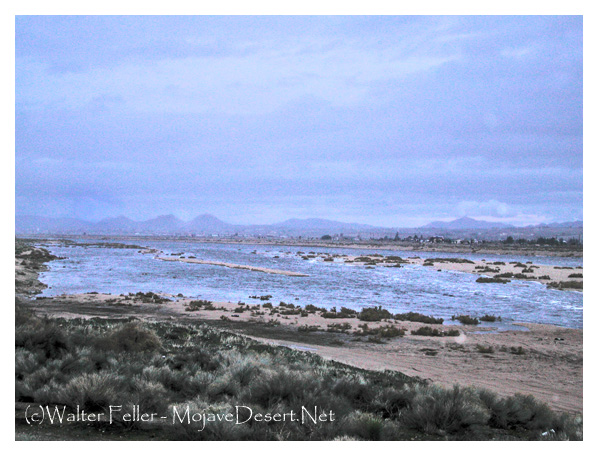
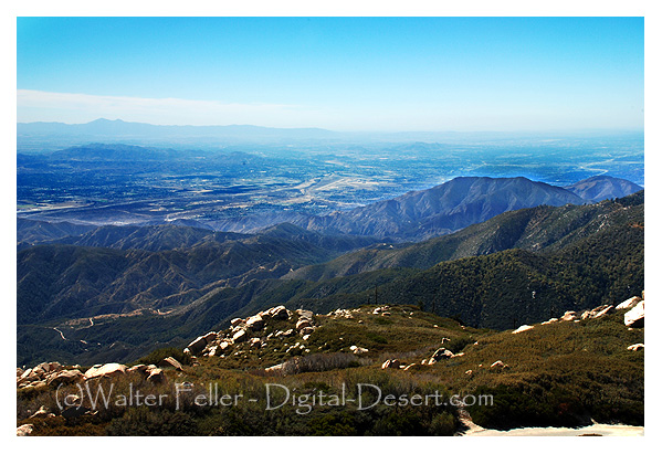
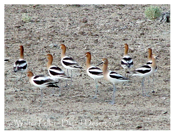
A couple of years later, in 2005, I had bought a 13 foot, leaking, aluminum fishing boat. My friend Cliff, who owned a canoe and kayak rental at the Topock marina, was going to sell me his Grandfather’s 5 horsepower outboard motor.  So what I did was photograph a few of the wilderness areas along the I-40 freeway on my way out to pick it up.

I’ve heard it said that the two most memorable days in a boat owner’s mind are the day you buy your boat, and the day you sell it. Certainly, I remember the day I sold it–but I can’t recall the day I bought it. Wait … Now I can.  Anyway, I remember the day I bought that motor. That was a lot of fun.  I’ll tell you about the day I got the boat in some other update.

New Dale

New Dale – New Dale wasn’t called New Dale back then, it was just called Dale even  though it was new, at least newer than Old Dale, which wasn’t called Old Dale then either, just Dale. But you see the problem with them both being called Dale then don’t you? To further complicate matters neither Old Dale or New Dale was too much worth looking at. In fact if you click on the link you’ll probably be a might disappointed because if there weren’t a title on the page you wouldn’t be able to tell if you were in New Dale or Old Dale, because New Dale doesn’t look any newer than Old Dale and Old Dale doesn’t either. BTW, nobody knows who Dale was in the first place. He moved out of Old Dale while it was still new.

New Dale Ghost Town

New Dale Ghost Town – Twentynine Palms, California Area