It was the morning of the hottest day
the thick, warm, air began to weigh
heavy on God’s creatures one and all . . .
. . . so they hugged the shadows however small
and found a hole to scurry in
before the hottest day would begin.
This, that, and the other.
It was the morning of the hottest day
the thick, warm, air began to weigh
heavy on God’s creatures one and all . . .
. . . so they hugged the shadows however small
and found a hole to scurry in
before the hottest day would begin.
The March 1915 issue of Motor magazine contained an article by A. L. Westgard on “Motor Routes to the California Expositions.” The following is an excerpt from that article:
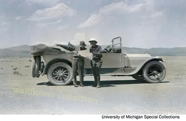
Owing to the recent improvement of the transcontinental routes, it is no longer necessary to load one’s car down with all sorts of paraphernalia to combat the many difficulties which formerly were strewed along the path, nor is it, in this day of dependable motor cars, necessary to carry a multiplicity of parts. Still, it is well to outfit with reasonably limited equipment to provide against mud, possible breakdowns, and climatic changes.
To begin with, limit your personal outfit to a minimum, allowing only a suitcase to each person, and ship your trunk. Use khaki or old loose clothing. Some wraps and a tarpaulin to protect you against cool nights and provide cover in the case of being compelled to sleep outdoors are essential. Amber glasses, not too dark, will protect your eyes against the glare of the desert. You will, of course, want a camera, but remember that the high lights of the far west will require a smaller shutter opening and shorter exposure than the eastern atmosphere.
Carry sixty feet of 5/8-inch Manila rope, a pointed spade, a small ax with the blade protected by a leather sheet, a camp lantern, a collapsible canvas bucket with spout, and a duffle bag for the extra clothing and wraps. Start out with new tires all around, of the same size if possible, and two extra tires also, with four extra inner tubes. Select a tire with tough fabric; this is economical and will save annoyance. Use only the best grade of lubricating oil and carry a couple of one-gallon cans on running-board as extra supply, because you may not always be able to get the good oil you ought to use.
And, mark this well, carry two three-gallon canvas desert water bags, then see that they are filled each morning. Give your car a careful inspection each day for loose bolts or nuts and watch grease cups and oil cups. Carry two sets of chains and two jacks, and add to your usual tool equipment a coil of soft iron wire, a spool of copper wire, and some extra spark plugs.
West of the Missouri carry a small commissary of provisions, consisting of canned meat, sardines, crackers, fresh fruit or canned pineapples, and some milk chocolate for lunches. The lack of humidity in the desert sections, combined with the prevalence of hard water west of the Missouri River is liable to cause the hair to become dry and to cause chaps and blisters on the face and hands as well as cause the fingernails to become brittle and easily broken. To prevent this, carry a jar of outing cream and a good hair cleanser. Use them every night.
-.-
There are those memories of the autumnal winds when seasons turn upside down and the icy drama of the silver winter threads through the hollows between trees stirring last year’s brown leaves into a low ruckus and crackle. Thin and bare sycamore branches, delicate and bony, trace low and lonely moans in their dark choir. Pink sand from the nearby riverbed salted everywhere and anywhere; grit flecked in your hair, in your shoes, in your eyes. These are the days. These were the days. These are the heartfelt and kind memories of these days.
The Southern Pacific had a monopoly on Southern California’s Transcontinental Railroads. Nothing came in or went out on any other rails than Southern Pacific rails.
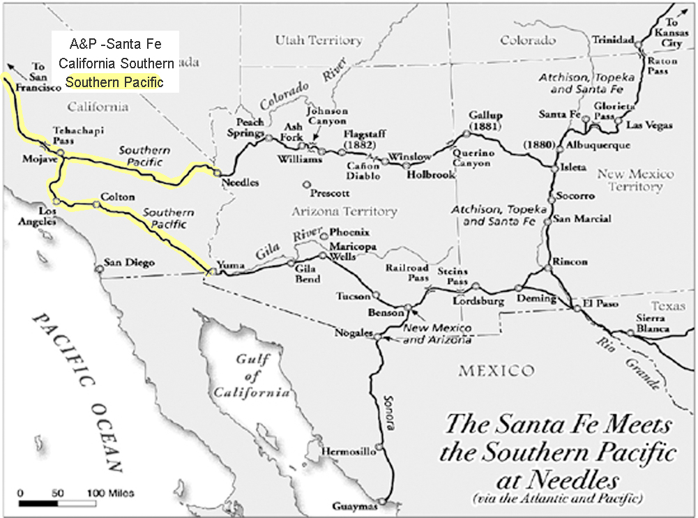
However, the Southern Pacific at Needles needed to connect with the bridge at the Colorado River to the Atlantic and Pacific. In order to do this, they worked out an agreement wherein the Atlantic & Pacific could use their rails to ship to and from San Francisco. Southern California still remained in a monopoly.
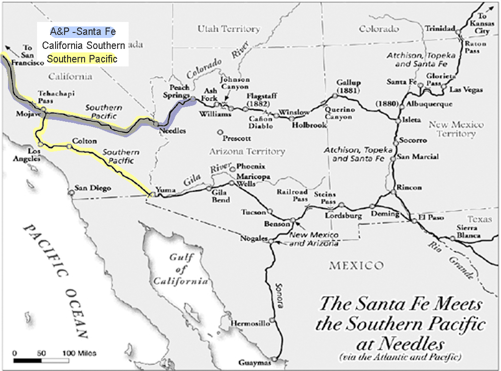
San Diego wanted a share in the rapid growth of the state. With the high cost of getting there, most tourists simply stopped in Los Angeles.
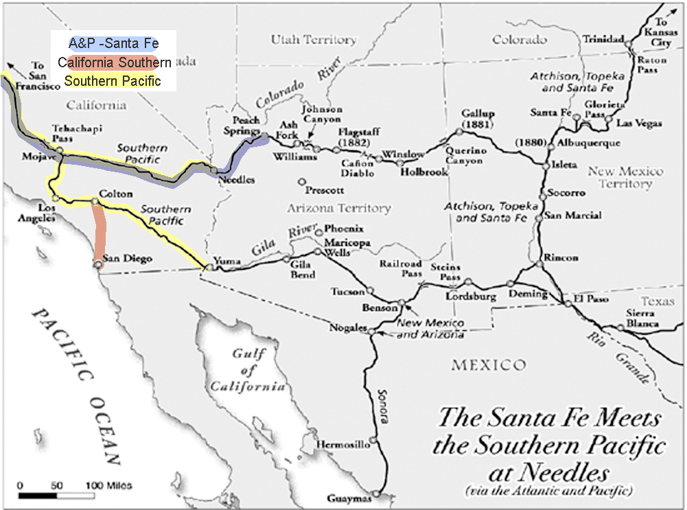
The California Southern, backed by investors from Boston, built from San Diego to Colton, but the Southern Pacific delayed their progress further north for over a year in what became known as the ‘Frog War.’ ‘Frog’ is the term for a rail crossing rail assembly so that either track can cross the other.
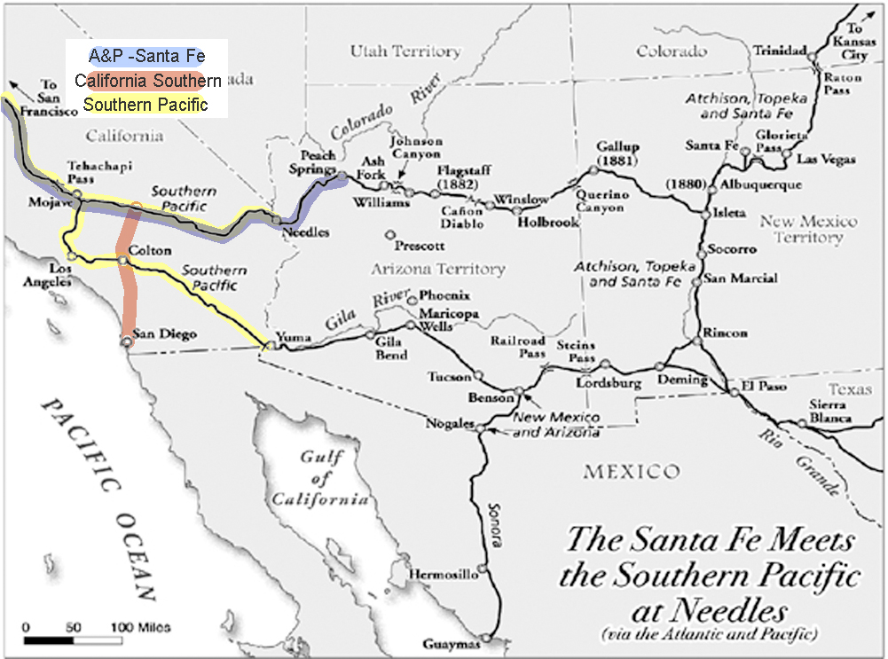
Formidable, but not impossible, building through the Cajon Pass to the Mojave River, through the upper and lower narrows, and then along in the same direction to Waterman, now known as Barstow. San Diego now had the benefit of a link to a transcontinental railroad and Southern California had a competitive transportation network.
W.feller.
MAPS AND SURVEY – 1913
BY ARTHUR R. HINKS, M.A., F.R.S.
CHAPTER III
route traversing
The Explorer’s Route Map
The first care of a traveler who passes through an unknown, or partially explored country, is to make a record of where he has been, and of the main features of the country along the route by which he has traveled. Often singlehanded, encumbered by transport, compelled to keep to the track, and unable to leave his party, he cannot hope to make anything in the nature of a map, in the ordinary sense of the term. But for his own guidance, to avoid getting lost, he is compelled to determine his position day by day in much the same way that the position of a ship is determined at sea, by observation of the Sun and the stars, so that he is able to say roughly in what latitude, and perhaps in what longitude his halting places were. Moreover, as he goes along he is able to make such observations of the shape and course of his path as to enable another man coming after him not only to arrive more or less at the same place but to follow the same route. And finally, he can keep a sort of running record of the things that lie immediately to the side of his path. All this is done by the construction of a “route traverse” or “route map.”
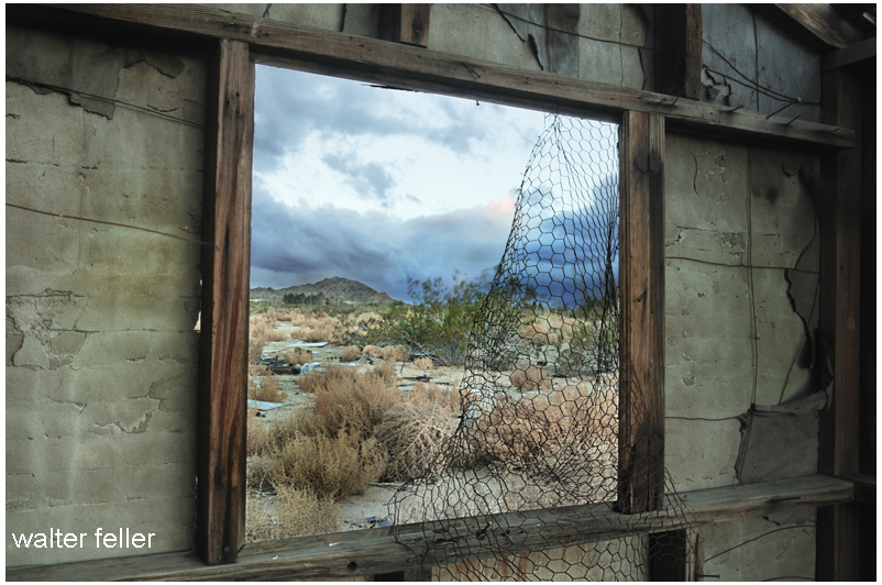
Through the thin window, I watch the torn-away sky
clouds shredded and stolen as sharpened winds howl by
Spinning wildflowers and tumbling weeds
frantically, frantically spreading their seeds
Two birds in a bush warbling in trills and quavers
it is the lopsided melody the garbled song favors
Trade rats somersaulting across the bare ground
cartwheeling badgers angrily claw as they wheel round and round
Stiff-legged coyotes hobnobbing in play
catching jackrabbits and cottontails that can only jump up, not away
and dust swirls into dust devils then dispersed above
All of this, all of this, lonely, barren, wind-scarred, and loved.
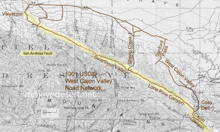
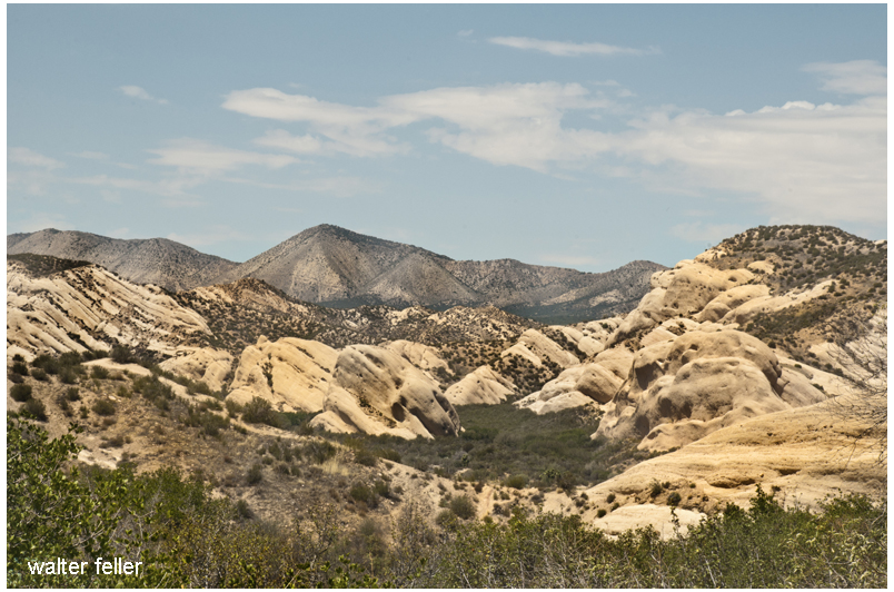
It seems that people have made use of the San Andreas Fault long before automobile or even wagon roads were developed along its seam. Shown is a 1901 U.S.G.S. map where I have traced the route leading from near Blue Cut in the Cajon Pass, just about straight northwest to Valyermo. The dotted line portion shown at the Big Pines saddle may have been either a mule trail or a road possibly impassible or without increased effort by wagon or auto. Indians likely used the features of the fault as a footpath to do as we all do; go from here to there.
The impending doom of Mr. Bubble
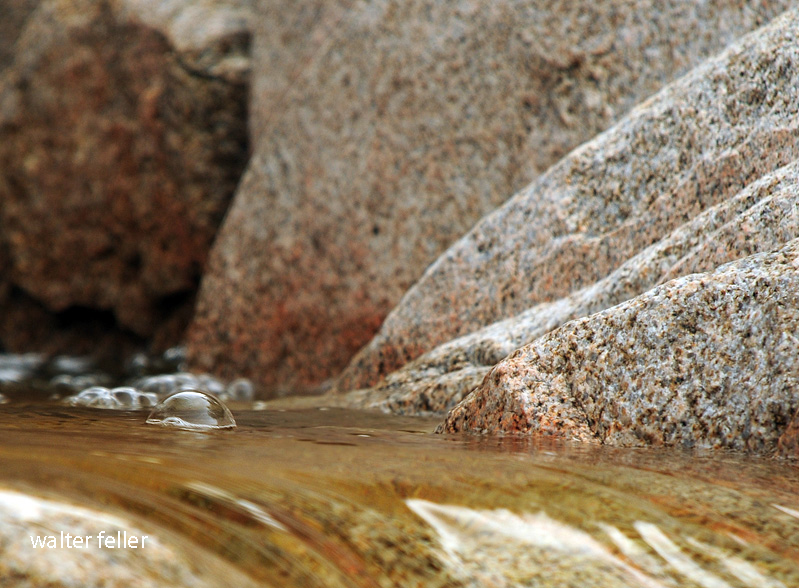
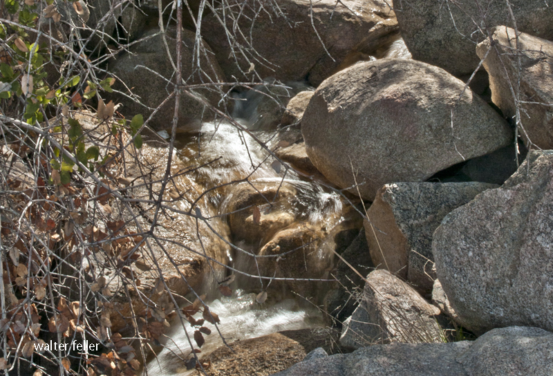
They were brothers, airborne, spiraling to earth together. Brothers as brothers can be, they remained brothers until they fell on the divide together; one splashed toward the ocean, and the larger of the two trickled toward the desert. That large raindrop would do fine; however, the small one would have to find its own invent an ocean. Until then, the little raindrop did what most other raindrops do, and that is to fall.
At this point, many raindrops would soak into the earth joining the stormwater underground. These rainshadow renegades would travel to the aquifers deep into the earth below to ancient, private, and murky waters.
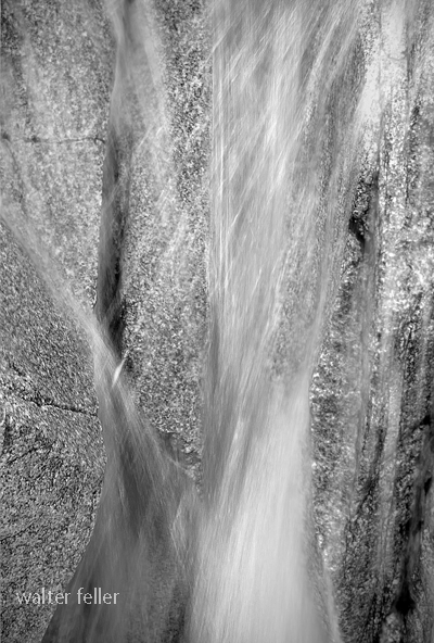
From sticks and dead leaves and rocks and out of crevices other little raindrops dripped to trickle together in intricate alpine streams hastily making way through a myriad of delicate and fragile waterfalls, into pools, then resting a few moments before being pushed out by the increasing deluge behind them.
From these streams to creeks the raindrops gathered rushing rather blindly through boulders and fallen trees in the narrow canyon joined by other smaller canyons and joining itself to larger creeks coming from larger canyons until swirling and twisting, colored with mud and dirty foam, all of a sudden coming together to become a river.
“Rejoice, rejoice, rejoice,” thought the little raindrop. It had found its way–to a river that should by all accounts transport it to the sea.
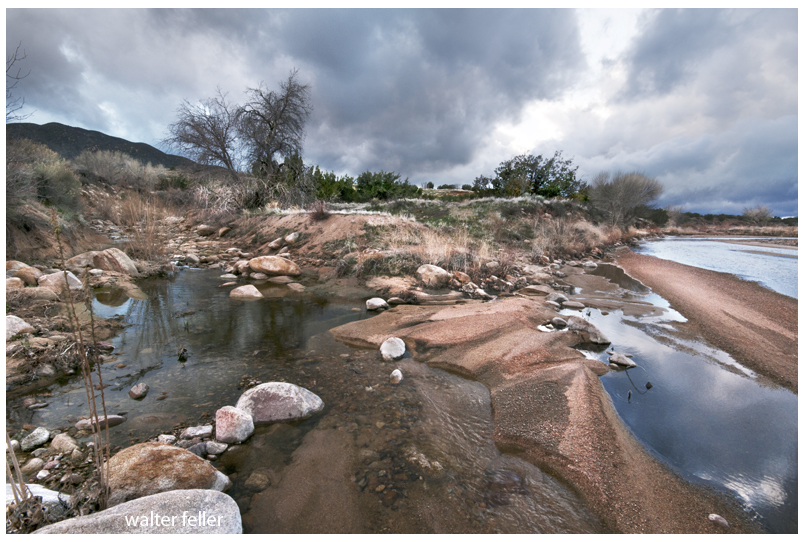
That didn’t happen, though. The river fell into the quicksands and disappeared into an eerie underworld layered below the clouded skies, under the sands of the empty river, and above the dark and mysterious aquifer.
Later, there was the bright and sunny sky overhead when the raindrop, risking evaporation, surfaced for a breath then soaked back into the safety of the shallows.
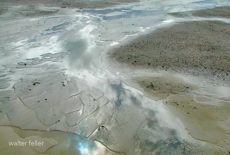
Again and one more time again this happened. Finally, there is no finally. The little raindrop simply never came back. After all, it was just a raindrop, and this river in the desert never reaches the sea.
The end.
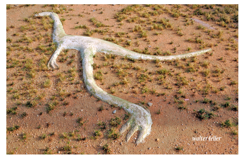
Finding my first fossil was a much bigger deal than I thought it would have been. There was a lot of excitement and yelling. Running around, too–don’t know why, I mean, it wasn’t going anywhere. There were people from the museums, also. They were standing over in the shade grumbling in muffled mumbles. They coveted the find. However, smiling broadly with all rows of their sharpened teeth showing, they stood next to it for pictures.
In a little more than a whisper from their dark huddle, one could hear, “It should have been us. We are worthy.”
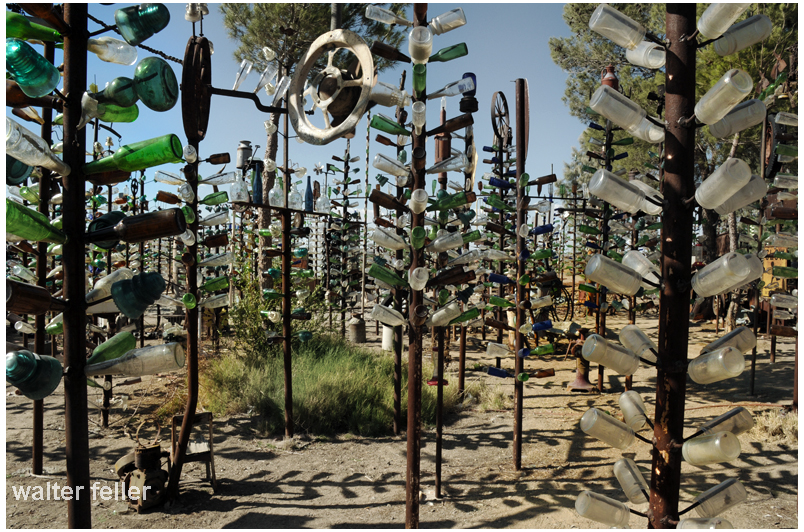
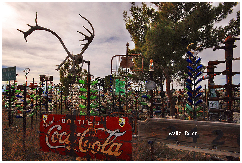
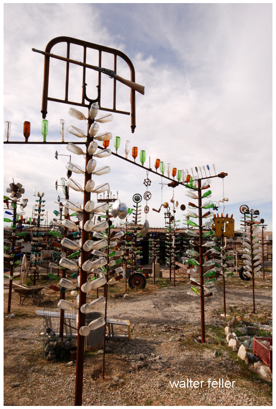
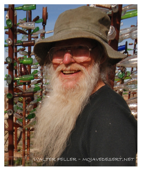
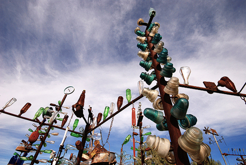
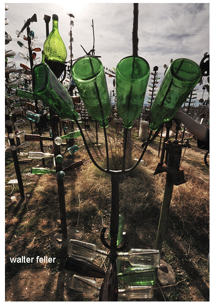
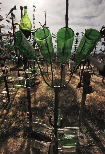
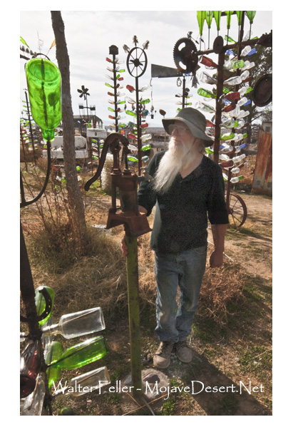
Elmer Long’s place — Historic Route 66 – Helendale, Ca.


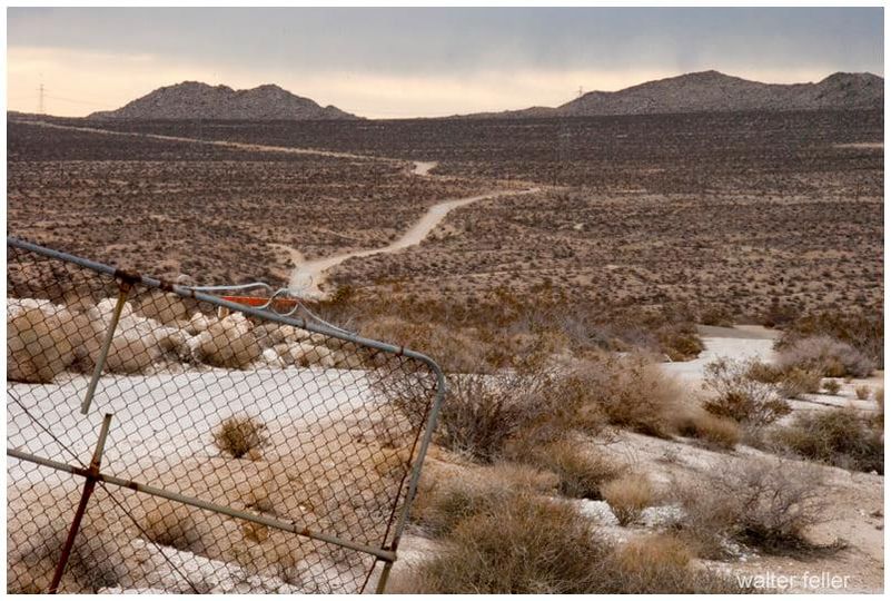
The scribbled road escapes through a broken gate tearing across the rumpled and scratchy desert.
Zig-zagging hastily along the narrow and dusty trail.
Traversing the rise, and disappearing, then a cloud of dust and disappearing again into the far horizon.
Under the dull gray-white skies of this heartless Mojave valley
Nothing moves and stands fast until dark.
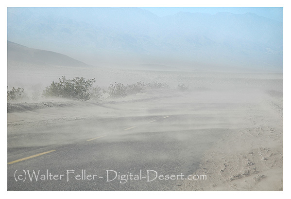
Then there were the “Northers,” which the heavy winds that swept down the Cajon Pass from the Mohave desert were called. They were much more severe then and sometimes very cold, blowing for about three days at a time. Many people treated them as they would rainy weather, and by way of derision, they were sometimes called “Mormon rains,” coming as they did by way of San Bernardino. They often came before the rains and when sheep had been pastured in the early summer the surface of the ground was cut into fine dust and we would have a dust storm which would cover the inside of the houses with dust. Since the land was planted and roads oiled, the “Northers” have lost most of their disagreeable features. Being dry they clear the atmosphere and are one of the beneficial features in our healthy climate.
History of San Bernardino County – John Brown Jr., 1922
“It is often said that America has no real deserts. This is true in the sense that there are no regions such as are found in Asia and Africa where one can travel a hundred miles at a stretch and scarcely see a sign of vegetation—nothing but barren gravel, graceful, wavy sand dunes, hard, wind-swept clay, or still harder rock salt broken into rough blocks with upturned edges. In the broader sense of the term, however, America has an abundance of deserts—regions which bear a thin cover of bushy vegetation but are too dry for agriculture without irrigation…. In the United States the deserts lie almost wholly between the Sierra Nevada and the Rocky Mountain ranges, which keep out any moisture that might come from either the west or the east. Beginning on the north with the sagebrush plateau of southern Washington, the desert expands to a width of seven hundred miles in the gray, sage-covered basins of Nevada and Utah. In southern California and Arizona the sagebrush gives place to smaller forms like the salt-bush, and the desert assumes a sterner aspect. Next comes the cactus desert extending from Arizona far south into Mexico. One of the notable features of the desert is the extreme heat of certain portions. Close to the Nevada border in southern California, Death Valley, 250 feet below sea-level, is the hottest place in America. There alone among the American regions familiar to the writer does one have the feeling of intense, overpowering aridity which prevails so often in the deserts of Arabia and Central Asia. Some years ago a Weather Bureau thermometer was installed in Death Valley at Furnace Creek, where the only flowing water in more than a hundred miles supports a depressing little ranch. There one or two white men, helped by a few Indians, raise alfalfa, which they sell at exorbitant prices to deluded prospectors searching for riches which they never find. Though the terrible heat ruins the health of the white men in a year or two, so that they have to move away, they have succeeded in keeping a thermometer record for some years. No other properly exposed out-of-door thermometer in the United States, or perhaps in the world, is so familiar with a temperature of 100° F. or more. During the period of not quite fifteen hundred days from the spring of 1911 to May, 1915, a maximum temperature of 100° F. or more was reached in five hundred and forty-eight days, or more than one-third of the time. On July 10, 1913, the mercury rose to 134° F. and touched the top of the tube. How much higher it might have gone no one can tell. That day marks the limit of temperature yet reached in this country according to official records. In the summer of 1914 there was one night when the thermometer dropped only to 114° F., having been 128° F. at noon. The branches of a pepper-tree whose roots had been freshly watered wilted as a flower wilts when broken from the stalk.”
—The Chronicles of America.—Volume I. “The Red Man’s Continent,” by Ellsworth Huntington.
Birdhouse, Mule Canyon, Calico Mountains, Mojave Desert, California, United States of America, Planet Earth, Sol, so on, so forth. . .
This is Lake Tuendae (to be beheld) at the Desert Studies Center, Zzyzx. In the center of the lake is an island with a fountain. The name of the island in Enrico Caruso Island.
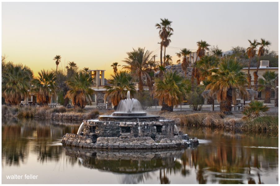
Enrico Caruso Island is named Enrico Caruso Island in honor of Enrico Caruso but not Enrico Caruso the famous singer but the Enrico Caruso who built Enrico Caruso Island was named for the legendary Enrico Caruso and named it Enrico Caruso Island for himself.
Enrico Caruso
Very early one morning in Joshua Tree National Park . . .
It was, of course, quiet. It was, of course, dark. It was also a little bit chilly, and after a moment it was a moment before dawn.
Midnight blue to dark blue to blue and sky blue.
Clouds in waves of deep red, red, orange, yellow, and ultimately white.
Everything collected the light, saving it, glowing with it. Warming.
The night was over. The day had begun.
What histories of tragic struggle with fortune and of defeat there are written in California! How many young men, for whom still fond hearts of sisters or mothers beat lovingly in vain, have fought the battle of life here unsuccesfully, and have died, as men know how to die, in solitude without a murmur or a groan.
— Charles Loring Brace
The New West, 1869
For a few months in 1883 when the Southern Pacific Railroad was being built, the Watson post office lived out its short tenure. Watson was named Watson for Josiah Watson who was the postmaster. When the Watson post office closed the railroad named their station Newberry. For a few months in 1899, the Newberry post office was reestablished then discontinued. In 1911 the post office reopened and was named Wagner after Madge Wagner who ran it. In July of 1919, the name was changed from Wagner to Water, who wasn’t a person but was named for the water that was pumped out of the ground for the Sante Fe Railroad’s use. Then, years later in 1967, the name was changed from Water to Newberry Springs. No one is quite certain who Newberry was, to begin with, but it could either be for either one or both of two brothers named Newberry who lived near the springs, of which one was killed in a gunfight over water rights to the springs and ended up being buried on top of a hill not far from the springs. Or the name of the springs came from Dr. J.S. Newberry, a physician in the 1857 survey expedition led by Lt. Joseph C. Ives.

There are many different varieties of barrel cactus, but a couple of things pretty much hold true with all of them. First, the taller ones tend to point toward the south. This is due to the fact that for most of the year the sun is more toward the south. Second, it is not a good idea to drink the juice from the cactus when out of water. A couple of reasons for that; one, these cacti are tough, and the perspiration expended to open one of these up would exceed the available water within. Secondly, the liquid will most likely cause a horrible case of diarrhea, further depleting the body of water and accelerating dehydration.