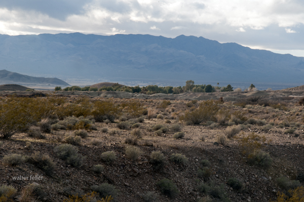
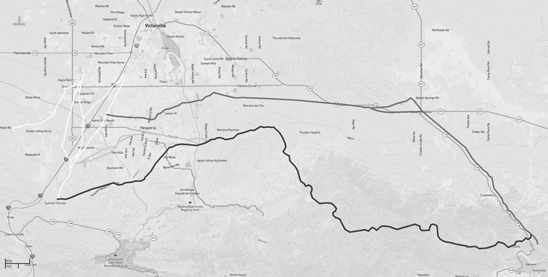
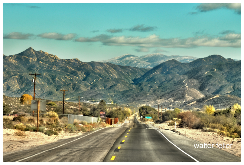
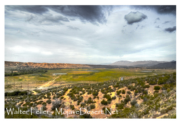
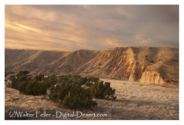
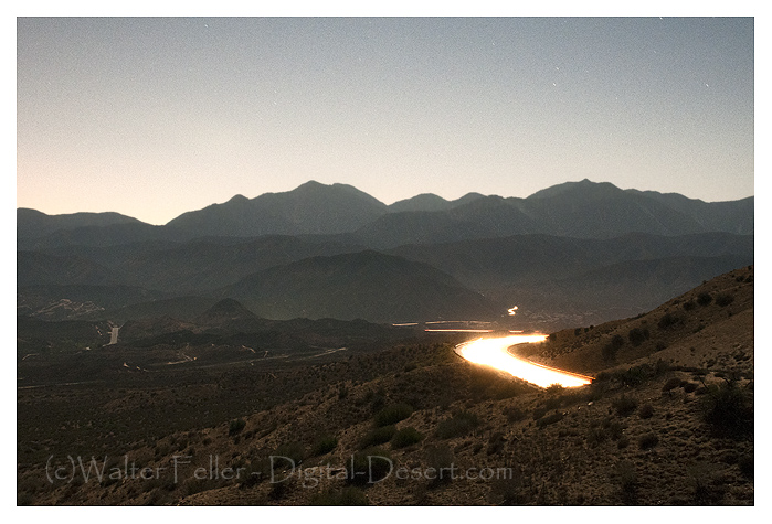
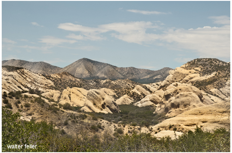
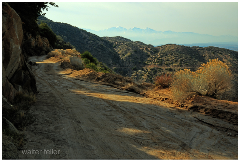
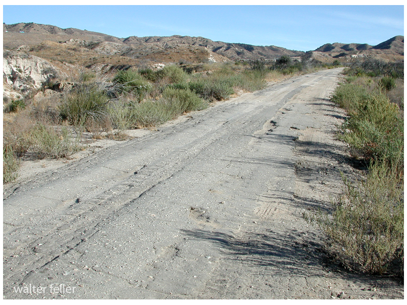
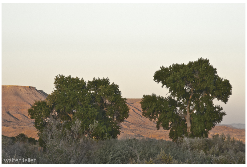
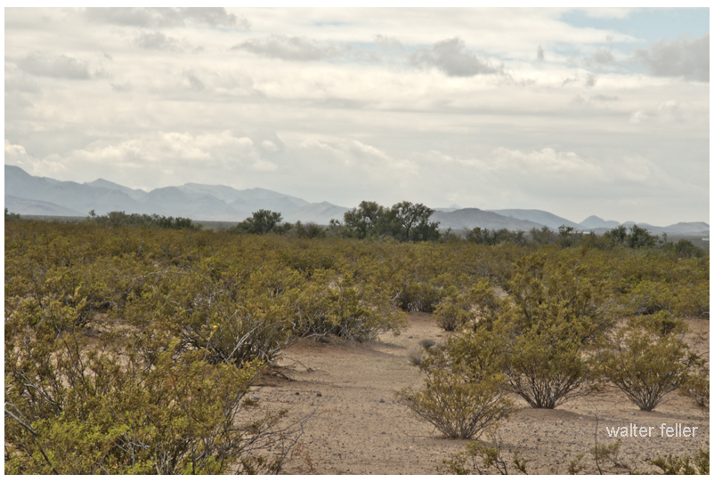
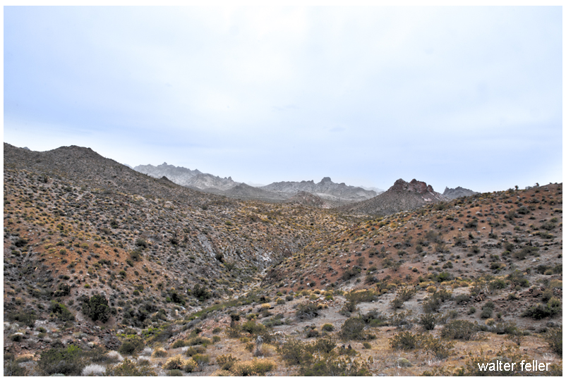
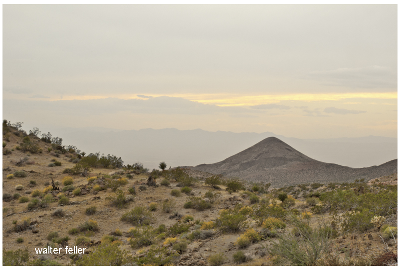
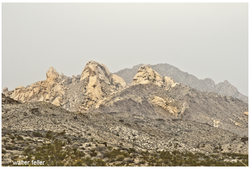
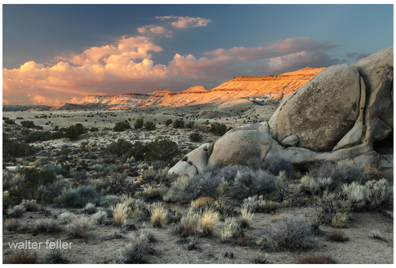
The Cushenbury Grade is a steep and winding stretch of mountain road that climbs from the high desert of Lucerne Valley up to the pine-covered town of Big Bear Lake. Today, it’s part of California State Route 18, but long before pavement and guardrails, this canyon trail served miners, ranchers, and Native travelers through the San Bernardino Mountains.
Before roads were built, the Serrano people used footpaths through Cushenbury Canyon to move between desert and mountain environments. These routes followed natural contours through the rugged terrain and were later adopted by settlers.
By the 1860s and 70s, prospectors, cattlemen, and freighters were dragging wagons up and down this slope. During the gold boom in nearby Holcomb Valley, Cushenbury became one of the main north-side routes into Big Bear. It was grueling work—steep grades, loose rock, and no guarantee your wagon would make it to the top in one piece.
The canyon and grade took their names from the Cushenbury family, early settlers and cattle ranchers in the Lucerne Valley area. Their name stuck, and by the early 20th century, the area gained new attention, not for gold but for limestone.
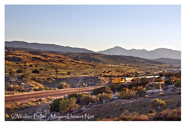
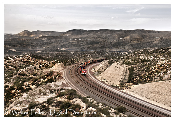
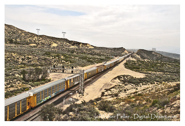
In 1918, rich limestone and marble deposits were discovered along the grade. This sparked industrial interest, and by the 1950s, Kaiser Cement had developed a massive limestone quarry near the top. A narrow-gauge rail system carried raw material down the grade to a processing plant: even today, trucks loaded with cement rumble up and down the slope.
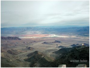
During the 1960s, the state upgraded the road and officially folded it into California State Route 18. This brought pavement, safety improvements, and better access to Big Bear from the desert side. Though safer now, the grade still features tight switchbacks and dramatic elevation changes, rising from about 3,000 feet in Lucerne Valley to over 6,700 feet at the top.
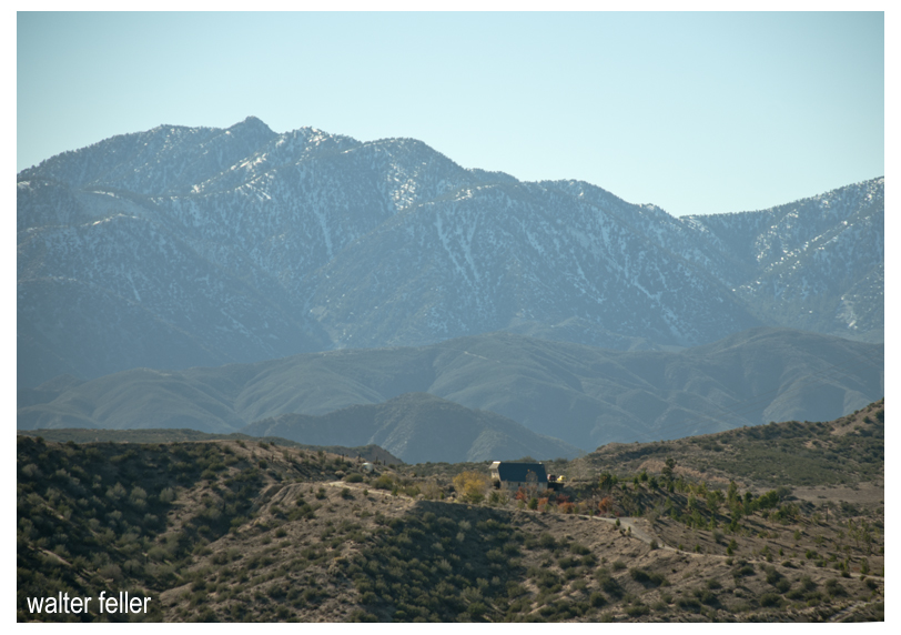
Today, the Cushenbury Grade remains a key route for both commerce and recreation. It offers expansive views of the Mojave Desert below and a sense of just how much effort it once took to reach the mountains. Whether hauling limestone or heading up for a weekend getaway, this road directly links two very different worlds—desert and alpine.
Timeline
Cushenbury Grade Historical Timeline
Pre-1800s: Indigenous Serrano people use Cushenbury Canyon as a seasonal travel route between the Mojave Desert and mountain forests.
1860s–1870s: Miners and ranchers began traveling through the canyon using rough trails to access Holcomb Valley and Big Bear. The steep terrain made it tough for freight wagons and livestock.
1880s: A more defined wagon road is carved into the canyon wall. It’s still rough going—narrow, rocky, and dangerous—but it’s one of the few ways into Big Bear from the desert.
Early 1900s: The Cushenbury family settles in the Lucerne Valley area, giving their name to the canyon and grade.
1918: Limestone and marble are discovered along the canyon. As mining gains momentum, the area shifts from wagon trail to industrial corridor.
1950s: Kaiser Cement develops a large limestone quarry near the top of the grade. A private rail system is built to haul material to the desert floor. This leads to improvements along the road.
1960s: The state paves and upgrades the road, officially making it part of California State Route 18. It becomes a year-round access route to Big Bear Lake from the high desert.
1990s–present: The Cushenbury Grade is heavily used by cement trucks and tourists. The steep climb and sharp turns remain challenging, especially in winter, but it’s a vital link between two different environments.
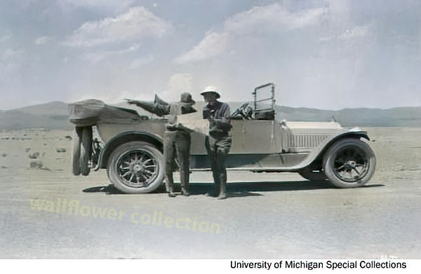
The March 1915 issue of Motor magazine contained an article by A. L. Westgard on “Motor Routes to the California Expositions.” The following is an excerpt from that article:
Owing to the recent improvement of the transcontinental routes, it is no longer necessary to load one’s car down with all sorts of paraphernalia to combat the many difficulties which formerly were strewed along the path, nor is it, in this day of dependable motor cars, necessary to carry a multiplicity of parts. Still, it is well to outfit with reasonably limited equipment to provide against mud, possible breakdowns, and climatic changes.
To begin with, limit your personal outfit to a minimum, allowing only a suitcase to each person, and ship your trunk. Use khaki or old loose clothing. Some wraps and a tarpaulin to protect you against cool nights and provide cover in the case of being compelled to sleep outdoors are essential. Amber glasses, not too dark, will protect your eyes against the glare of the desert. You will, of course, want a camera, but remember that the high lights of the far west will require a smaller shutter opening and shorter exposure than the eastern atmosphere.
Carry sixty feet of 5/8-inch Manila rope, a pointed spade, a small ax with the blade protected by a leather sheet, a camp lantern, a collapsible canvas bucket with spout, and a duffle bag for the extra clothing and wraps. Start out with new tires all around, of the same size if possible, and two extra tires also, with four extra inner tubes. Select a tire with tough fabric; this is economical and will save annoyance. Use only the best grade of lubricating oil and carry a couple of one-gallon cans on running-board as extra supply, because you may not always be able to get the good oil you ought to use.
And, mark this well, carry two three-gallon canvas desert water bags, then see that they are filled each morning. Give your car a careful inspection each day for loose bolts or nuts and watch grease cups and oil cups. Carry two sets of chains and two jacks, and add to your usual tool equipment a coil of soft iron wire, a spool of copper wire, and some extra spark plugs.
West of the Missouri carry a small commissary of provisions, consisting of canned meat, sardines, crackers, fresh fruit or canned pineapples, and some milk chocolate for lunches. The lack of humidity in the desert sections, combined with the prevalence of hard water west of the Missouri River is liable to cause the hair to become dry and to cause chaps and blisters on the face and hands as well as cause the fingernails to become brittle and easily broken. To prevent this, carry a jar of outing cream and a good hair cleanser. Use them every night.
MAPS AND SURVEY – 1913 BY ARTHUR R. HINKS, M.A., F.R.S.
CHAPTER III route traversing The Explorer’s Route Map
The first care of a traveler who passes through an unknown, or partially explored country, is to make a record of where he has been, and of the main features of the country along the route by which he has traveled. Often singlehanded, encumbered by transport, compelled to keep to the track, and unable to leave his party, he cannot hope to make anything in the nature of a map, in the ordinary sense of the term. But for his own guidance, to avoid getting lost, he is compelled to determine his position day by day in much the same way that the position of a ship is determined at sea, by observation of the Sun and the stars, so that he is able to say roughly in what latitude, and perhaps in what longitude his halting places were. Moreover, as he goes along he is able to make such observations of the shape and course of his path as to enable another man coming after him not only to arrive more or less at the same place but to follow the same route. And finally, he can keep a sort of running record of the things that lie immediately to the side of his path. All this is done by the construction of a “route traverse” or “route map.”
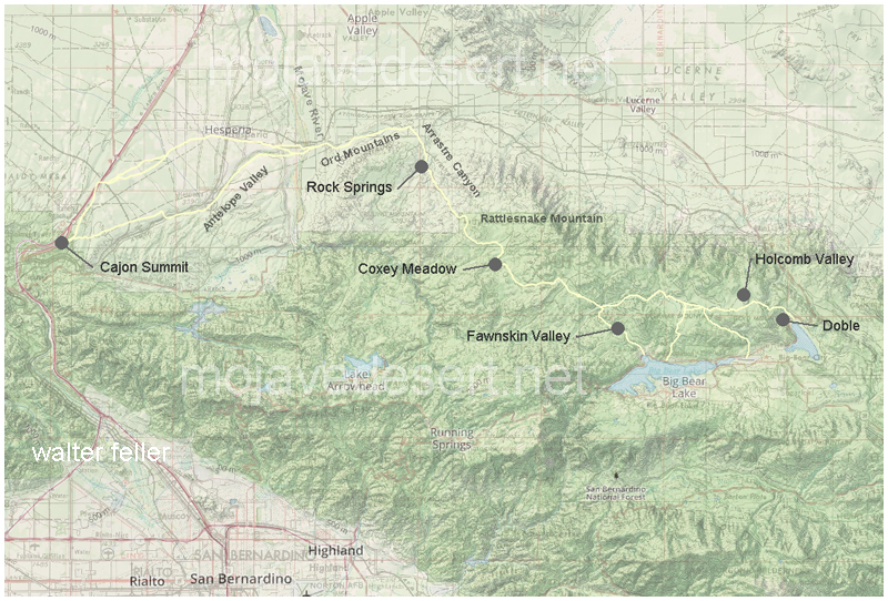
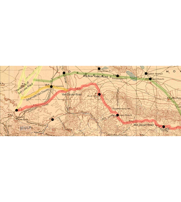
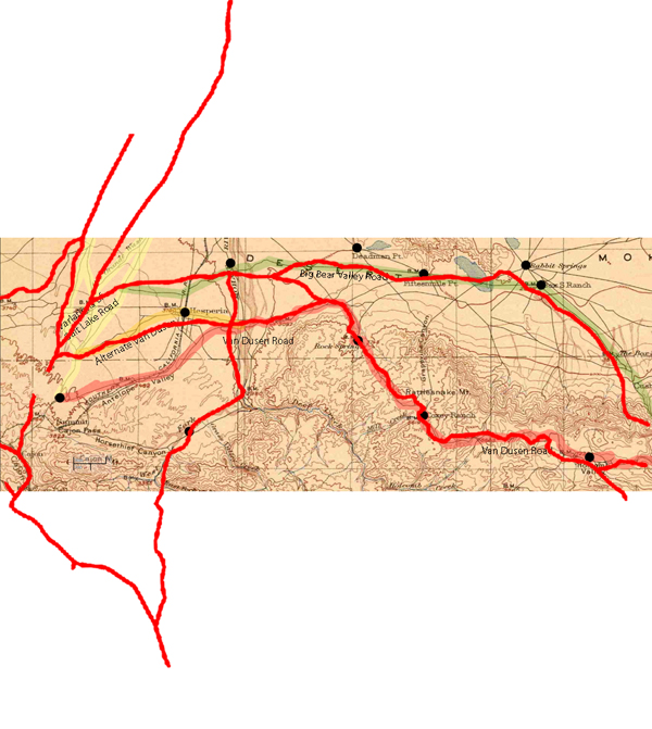
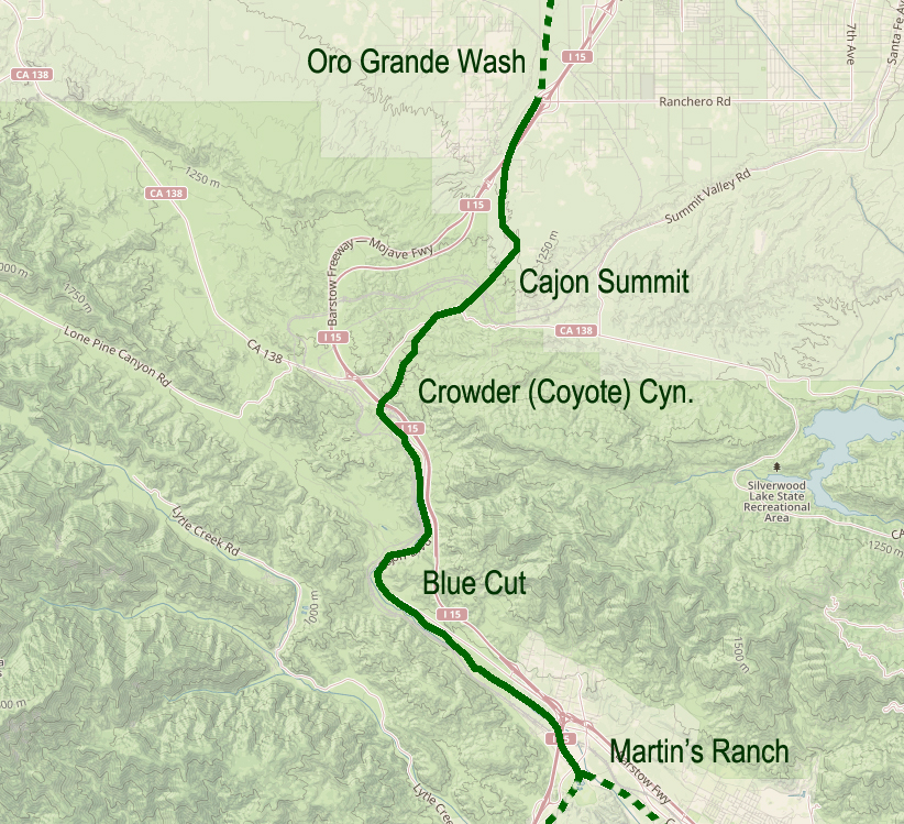
Van Dusen Road/ Coxey Truck Trail from Cajon Summit to Holcomb Valley
He (Hoffman) saw nothing between Summit Valley in the river he considered a likely site. In fact, Hoffman condemned the entire route as unsuited for travel.
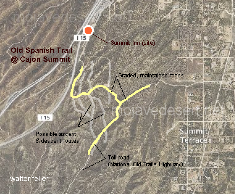
Traces of old trails and graded roads near the Cajon summit.
The direct route over the summit and down the pass eliminates the steep climb and descent over the San Bernardino Mountains.
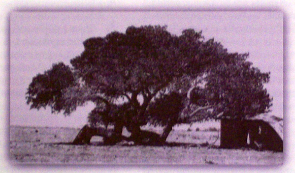
Cottonwood tree at the massacre site in Summit Valley
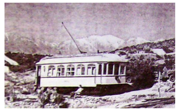
Chard Walker watching trains pass from the terrace beside the Decanso in 1954. From his book, “Railroading in the Pass”
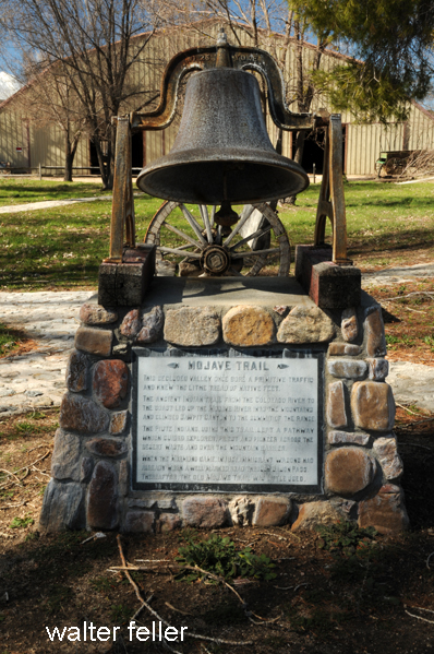
This secluded valley once bore primitive traffic and knew the lithe tread of native feet. The ancient Indian trail from the Colorado River to the coast led up the Mojave River into the mountains and climbed Sawpit Canyon to the summit of the range. The Piute Indians, using this trail, leaving a pathway that guided a Spanish priest, explorers, and pioneers across the desert waste and over the mountain barrier. When the Mormons came, in 1851, immigrant wagons wore a well-marked road through Cajon Pass. Thereafter, the old Mojave Trail through Summit Valley was little used.
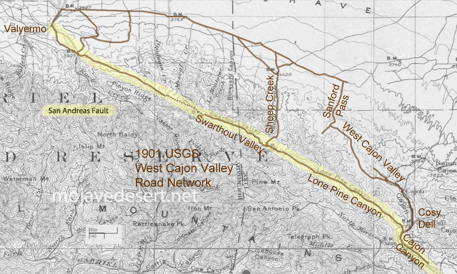
It seems that people have made use of the San Andreas Fault long before automobile or even wagon roads were developed along its seam. Shown is a 1901 U.S.G.S. map where I have traced the route leading from near Blue Cut in the Cajon Pass, just about straight northwest to Valyermo. The dotted line portion shown at the Big Pines saddle may have been either a mule trail or a road possibly impassible or without increased effort by wagon or auto. Indians likely used the features of the fault as a footpath to do as we all do; go from here to there.
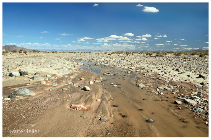
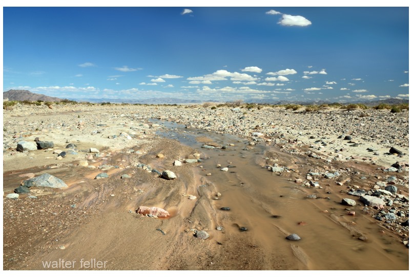
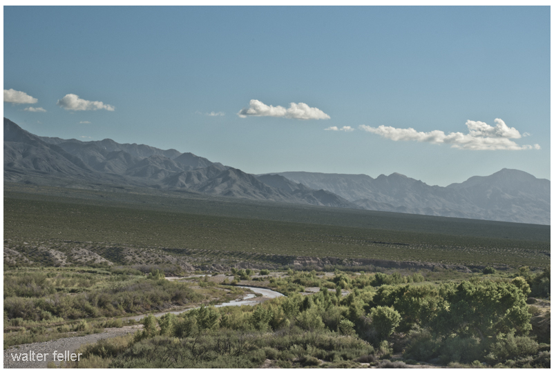
It is the strangest thing; the river; I follow it downstream and it becomes smaller and smaller and smaller. With every step, it becomes less and less and less. The water diminishes and depletes until it is just a trickle, until a glisten, until just a wet spot surrounded by damp sand, and then nothing. That is how this river ends–not mightily at an ocean, but quietly, subdued in the sand and rubble and stone becoming as if it never were.
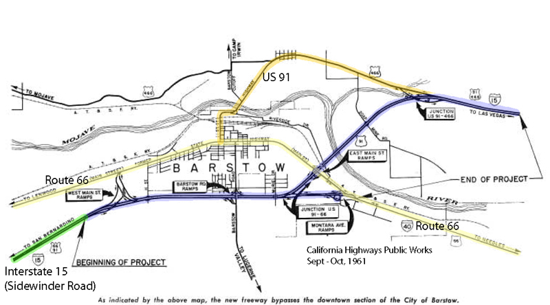
Bits from an interesting 1961 article about by-passing downtown Barstow and modernizing transportation infrastructure at the geographical descendant of ‘Forks-in-the-Road‘ of pioneering times. Speaks to the morphology of the transportation corridor from the classic Route 66 to the modern Interstate 15 Freeway. Also, see Sidewinder Road for maps between Victorville and Barstow.
On July 5, nine miles of the Barstow Freeway, known locally as the “Barstow By-Pass”, were opened to traffic by construction contractors Gordon H. Ball and Ball & Simpson.
The project is an extension of the 24-mile freeway from Victorville to Barstow which was opened in January 1959. It makes available the improvement to full freeway standards of an important link of Federal Interstate Route 1 S (U.S. 91) and the first step of freeway improvement of Interstate Route 40 (U.S. 66) toward Needles.
California Highways, Sep/Oct 1961.
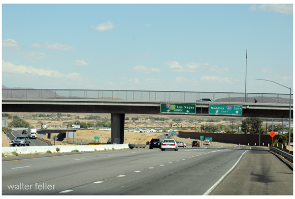
Modern ‘Forks-in-the-Road’ junction at Interstate 15 & 40 FreewaysForks-of-the-Road – Where the Salt Lake Road and Mojave Road come together and become the Mojave River Trail
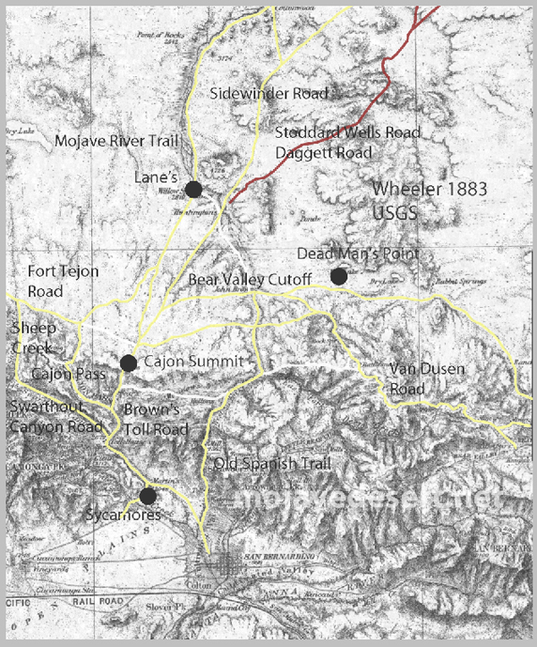
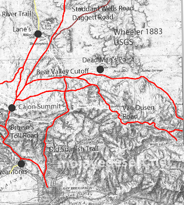
Not all-inclusive, this 1901 map shows basic transportation routes between the Cajon Summit on the west and east from there through either the San Bernardino Mountains or Lucerne Valley to where the two roads meet in the Big Bear Valley.
This map below was made in 1883 and shows an earlier and geographically expanded version of the routes.
1883 map of route network in the upper Mojave River region (note; no railroad)
The 1883 map is more inclusive and contains a couple of items I want to keep track of. There are differences but the road segments look about the same.
I made a copy of the 1883 roads layer and made it red to stand out better.
There are some nuances between the two maps, and right now the Oro Grande Wash area seems considerably off, fiddling with it some I can get a better fit–but not at these rates. The 1901 would be the more accurate depiction of what went on out there even if it were 35 years or so after the fact.
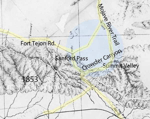
Williams USGS survey map 1853
Note that in the above map the variations of trails from across the valley leading to the Cajon Summit seem not to have been developed at this time and instead the trail along the Mojave River is shown.
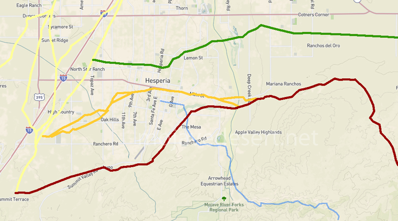
1901 trail routes transposed over modern street map through Hesperia
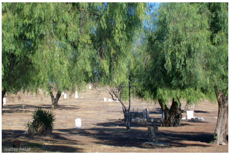
Traders in the caravans coming to California did not just trade with those at the missions, but with any group or community they came across. The little settlement of Agua Mansa enjoyed the benefit of being the first village of any size once the mule trains dropped in from the mountains after crossing the deserts.
Agua Mansa cemetery
It was called Aqua Mansa, meaning Gentle Water, and was composed entirely of immigrants from New Mexico, numbering some 200 souls–simple, good souls they were, too, primitive in their style of living, kind and hospitable to strangers, rich in all that went to make people happy and content, never having been, up to that time, vexed by the unceremonious calls of the tax collector, owing allegiance to none save the simple, kindhearted old priest who looked after their spiritual welfare. With peace and plenty surrounding them, the good people of Aqua Mansa went to make as contented and happy of people as could be found in the universe.
Originally, possibly a footpath for trade and society. There is no written record of that. After explorers, and then trade caravans wore in mule trails and braided paths as travelers do, to find the path of least resistance. Following the Mojave River, and to get to the hills and valleys of southern California this route was the most direct way, and indeed it was the only way for miles and miles in either direction where wagons could pass through the mountains.
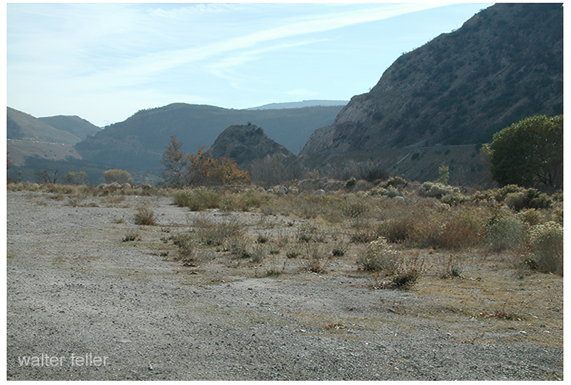
Road over the divide at the summit.
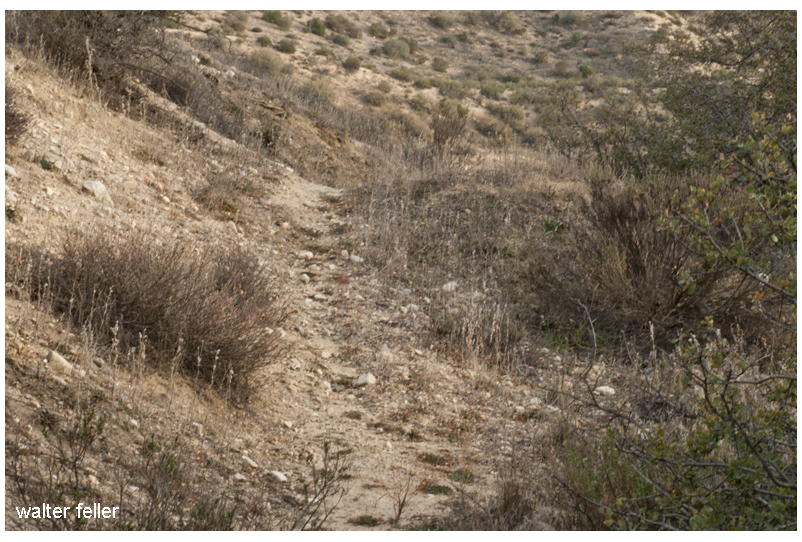
All the frayed trails come together at essentially one point. Within a few yards either way, most all travelers would pass through this trail bottleneck. If there were remnants or traces of old wagon roads where pioneers and freighters passed through and they could still be seen, it would be here where this faint suggestion of an old trail can be observed.
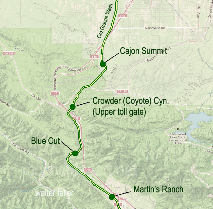
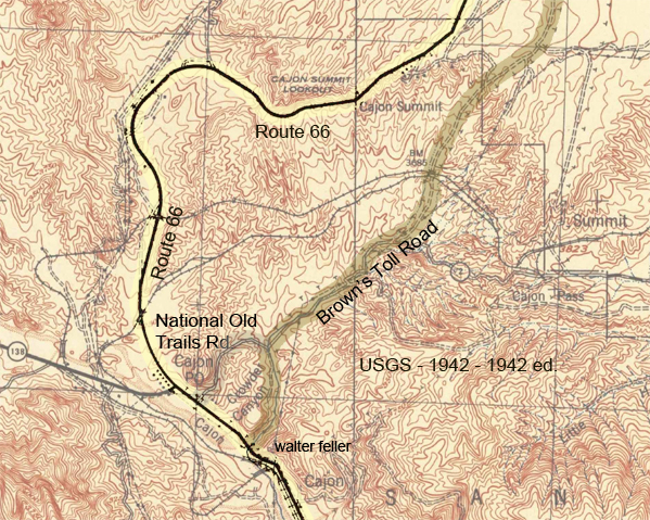
Another cut into the hillside.Cut in road near the summitAt the southern end of the toll road was Martin’s Ranch. The northern end was just beyond the Cajon Summit.Footpaths are as wide as a man’s gait. Mule trails are wider with their broad stance and cargo.
I have heard that Captain Jefferson Hunt brought the first wagon through the pass. Since he succeeded at that, Captain Hunt became instrumental in bringing the early pioneer wagon trains across the Mojave Desert.
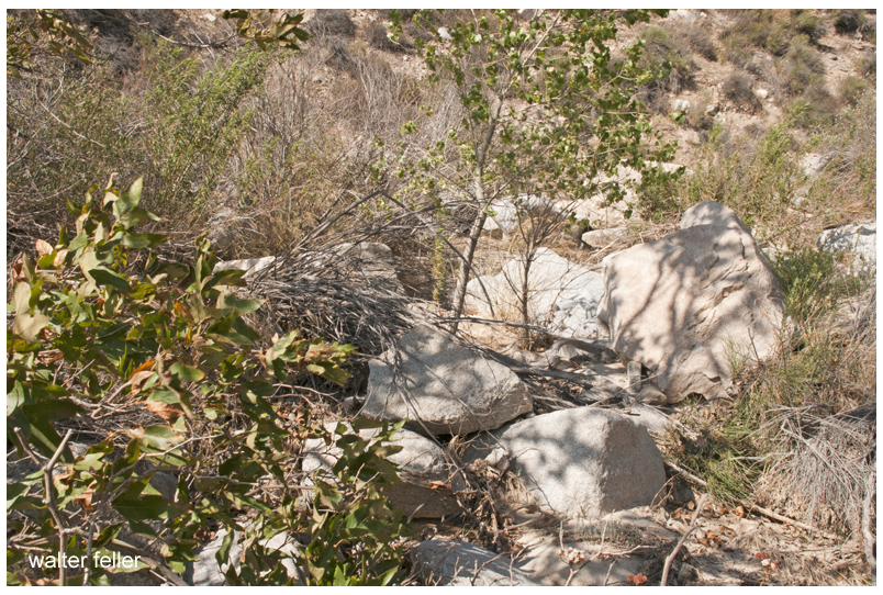
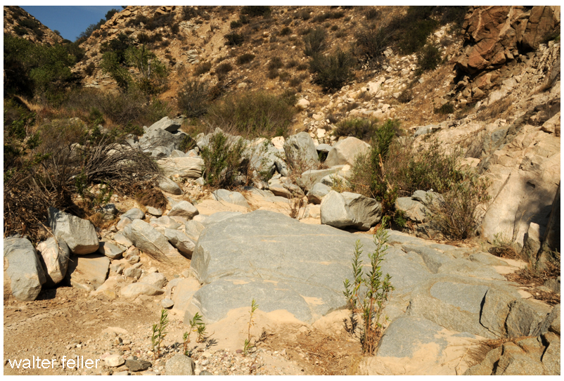
The bottom of the canyon, about the last half mile, was strewn with boulders and impassible by any wheeled vehicle.
Steep at the top and rocky at the bottom, the solution was to disassemble wagons at the bottom and use mules to pack everything through the rocks on the mule trail, then put it all back together.
This map, dated 1859, shows the beginnings of the Cajon road network.There were two ways of coming down or going up the stretch of canyon at the summit; either the low spots between the hills or the one of the long ridges, which ever provided a less steep grade to work with.The best thing about coming up or going down the 2500 ft between the summit and foot of the pass is that it isn’t done all at once. I suppose it is like one would eat an elephant; one bite at a time.
Floods were common and so was the erosion which would cause damage to the already rugged trails. One time this way would be good, the next time another.
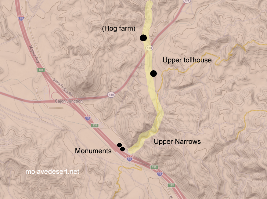
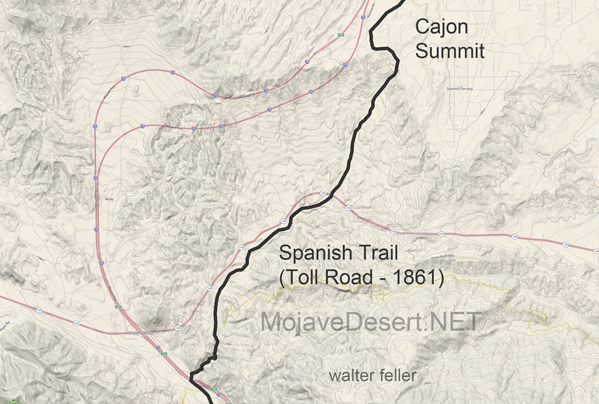
An earthquake in 1899 caused serious damage to the roadway. A bypass was graded in order to avoid the narrows entirely.A generalized map of the upper narrows and toll road through Coyote Canyon in the Cajon Pass.
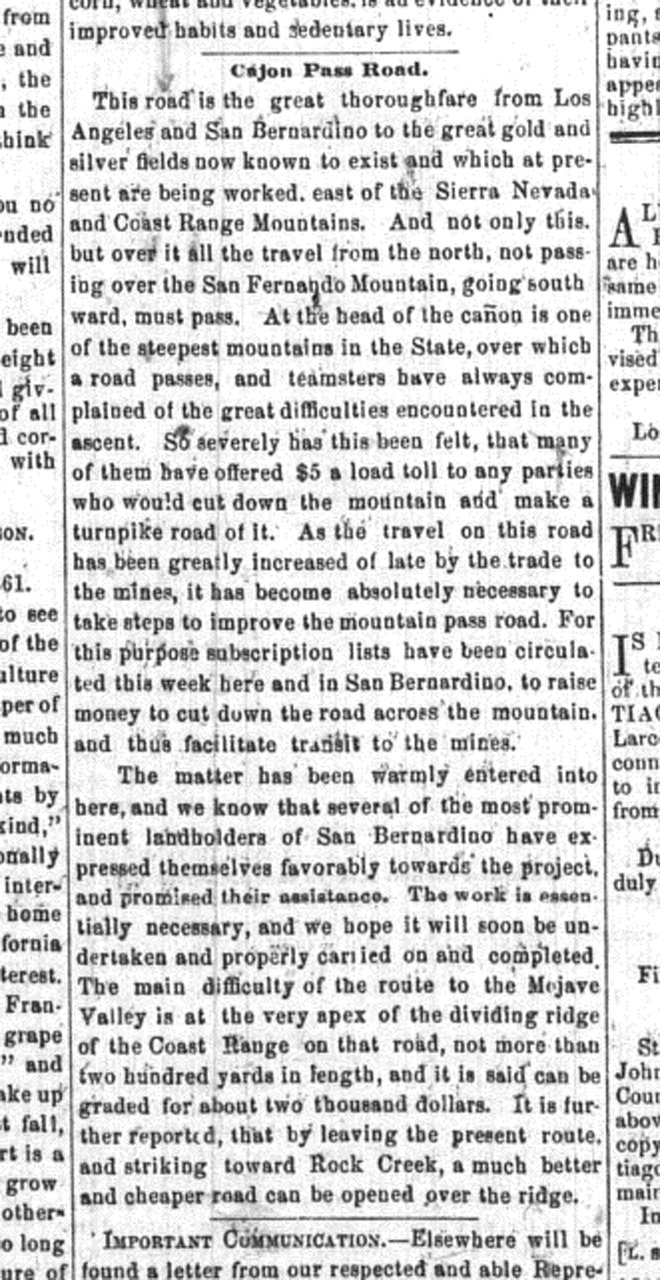
This road is the great thoroughfare from Los Angeles and San Bernardino to the great gold and silver fields now known to exist and which at present are being worked, east of the Sierra Nevada and Coast Range Mountains. And not only this but over it, all the travel from the north, not passing over the San Fernando Mountain, going southward, must pass. At the head of the cañon is one of the steepest mountains in the State, over which a road passes, and teamsters have always complained of the great difficulties encountered in the ascent. So severely has this been felt, that many of them have offered $5 a load toll to any parties who would cut down the mountain and make a turnpike road of it. As the travel on this road has been greatly increased of late by the trade to the mines, it has become absolutely necessary to take steps to improve the mountain pass road. For this purpose subscription lists have been circulated this week here and in San Bernardino, to raise money to cut down the road across the mountain, and thus facilitate transit to the mines. – Los Angeles Star – April 6, 1861
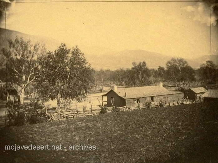
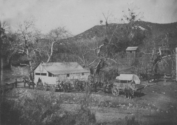
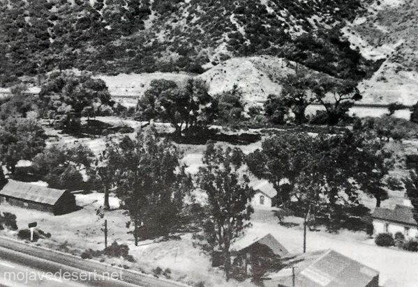
Martin’s Ranch — The southern and of the toll road.Brown significantly improved the old pack trail through the upper narrows.Upper toll gate
The road which I followed in 1865 crosses from left to right bank of the river a few miles above the Grapevine place said, continues past Cottonwood to Point of Rocks, 22 miles from Grapevine, on a southwest course; at Point of Rocks it turns due south to what was called Lane’s, or the Upper crossing, and there leaves the river entirely to strike straight south by west for Cajon pass in the mountains, reached in 19 miles from Lane’s. This is the way I went, as my itinerary shows: ” Nov. 9. To Martin’s ranch, 29 miles S. from Lane’s crossing; more than half the distance in open country, and then we entered the Cajon pass in the mountains, where there is a tollgate. The pass is a narrow, deep, and tortuous canon, the roughest I have ever traversed on wheels; there was 10 miles of this from the tollgate to Martin’s ranch.” Now Garces has been sent through Cajon pass, with a query, as by Bancroft, Hist. Cala., i, p. 275; but I do not think he went that way. Taking his courses on their face, he continued up the Mojave.
In 1882 John Brown wanted out of the toll road business–the day of the sale the Bear Flat Ranch became Cozy Dell.Bear Flat Ranch – Cozy Dell – Lower toll gate
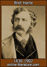
Francis Brett Hart, known as Bret Harte (August 25, 1836 – May 5, 1902), was an American short story writer and poet, best remembered for his short fiction featuring miners, gamblers, and other romantic figures of the California Gold Rush.
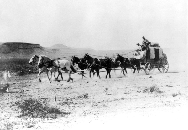
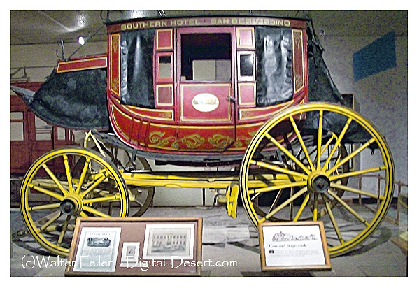
I stood with my shawl and carpetbag in hand, gazing doubtingly on the vehicle. Even in the darkness the red dust of Wingdam was visible on its roof and sides, and the red slime of Slumgullion clung tenaciously to its wheels. I opened the door; the stage creaked easily, and in the gloomy abyss the swaying straps beckoned me, like ghostly hands, to come in now and have my sufferings out at once.
I must not omit to mention the occurrence of a circumstance which struck me as appalling and mysterious. A lounger on the steps of the hotel, who I had reason to suppose was not in any way connected with the stage company, gravely descended, and walking toward the conveyance, tried the handle of the door, opened it, expectorated in the carriage, and returned to the hotel with a serious demeanor. Hardly had he resumed his position when another individual, equally disinterested, impassively walked down the steps, proceeded to the back of the stage, lifted it, expectorated carefully on the axle, and returned slowly and pensively to the hotel. A third spectator wearily disengaged himself from one of the Ionic columns of the portico and walked to the box, remained for a moment in serious and expectorative contemplation of the boot, and then returned to his column. There was something so weird in this baptism that I grew quite nervous.
Perhaps I was out of spirits. A number of infinitesimal annoyances, winding up with the resolute persistency of the clerk at the stage office to enter my name misspelt on the waybill, had not predisposed me to cheerfulness. The inmates of the Eureka House, from a social viewpoint, were not attractive. There was the prevailing opinion–so common to many honest people–that a serious style of deportment and conduct toward a stranger indicates high gentility and elevated station. Obeying this principle, all hilarity ceased on my entrance to supper, and general remark merged into the safer and uncompromising chronicle of several bad cases of diphtheria, then epidemic at Wingdam. When I left the dining-room, with an odd feeling that I had been supping exclusively on mustard and tea leaves, I stopped a moment at the parlor door. A piano, harmoniously related to the dinner bell, tinkled responsive to a diffident and uncertain touch. On the white wall the shadow of an old and sharp profile was bending over several symmetrical and shadowy curls. “I sez to Mariar, Mariar, sez I, ‘Praise to the face is open disgrace.’” I heard no more. Dreading some susceptibility to sincere expression on the subject of female loveliness, I walked away, checking the compliment that otherwise might have risen unbidden to my lips, and have brought shame and sorrow to the household.
It was with the memory of these experiences resting heavily upon me that I stood hesitatingly before the stage door. The driver, about to mount, was for a moment illuminated by the open door of the hotel. He had the wearied look which was the distinguishing expression of Wingdam. Satisfied that I was properly waybilled and receipted for, he took no further notice of me. I looked longingly at the box seat, but he did not respond to the appeal. I flung my carpetbag into the chasm, dived recklessly after it, and–before I was fairly seated–with a great sigh, a creaking of unwilling springs, complaining bolts, and harshly expostulating axle, we moved away. Rather the hotel door slipped behind, the sound of the piano sank to rest, and the night and its shadows moved solemnly upon us.
To say it was dark expressed but faintly the pitchy obscurity that encompassed the vehicle. The roadside trees were scarcely distinguishable as deeper masses of shadow; I knew them only by the peculiar sodden odor that from time to time sluggishly flowed in at the open window as we rolled by. We proceeded slowly; so leisurely that, leaning from the carriage, I more than once detected the fragrant sigh of some astonished cow, whose ruminating repose upon the highway we had ruthlessly disturbed. But in the darkness our progress, more the guidance of some mysterious instinct than any apparent volition of our own, gave an indefinable charm of security to our journey that a moment’s hesitation or indecision on the part of the driver would have destroyed.
I had indulged a hope that in the empty vehicle I might obtain that rest so often denied me in its crowded condition. It was a weak delusion. When I stretched out my limbs it was only to find that the ordinary conveniences for making several people distinctly uncomfortable were distributed throughout my individual frame. At last, resting my arms on the straps, by dint of much gymnastic effort I became sufficiently composed to be aware of a more refined species of torture. The springs of the stage, rising and falling regularly, produced a rhythmical beat which began to absorb my attention painfully. Slowly this thumping merged into a senseless echo of the mysterious female of the hotel parlor, and shaped itself into this awful and benumbing axiom–“Praise-to-the-face-is- open-disgrace. Praise-to-the-face-is-open-disgrace.” Inequalities of the road only quickened its utterance or drawled it to an exasperating length.
It was of no use to consider the statement seriously. It was of no use to except to it indignantly. It was of no use to recall the many instances where praise to the face had redounded to the everlasting honor of praiser and bepraised; of no use to dwell sentimentally on modest genius and courage lifted up and strengthened by open commendation; of no use to except to the mysterious female, to picture her as rearing a thin-blooded generation on selfish and mechanically repeated axioms–all this failed to counteract the monotonous repetition of this sentence. There was nothing to do but to give in–and I was about to accept it weakly, as we too often treat other illusions of darkness and necessity, for the time being, when I became aware of some other annoyance that had been forcing itself upon me for the last few moments. How quiet the driver was!
Was there any driver? Had I any reason to suppose that he was not lying gagged and bound on the roadside, and the highwayman with blackened face who did the thing so quietly driving me–whither? The thing is perfectly feasible. And what is this fancy now being jolted out of me? A story? It’s of no use to keep it back– particularly in this abysmal vehicle, and here it comes: I am a Marquis–a French Marquis; French, because the peerage is not so well known, and the country is better adapted to romantic incident– a Marquis, because the democratic reader delights in the nobility. My name is something LIGNY. I am coming from Paris to my country seat at St. Germain. It is a dark night, and I fall asleep and tell my honest coachman, Andre, not to disturb me, and dream of an angel. The carriage at last stops at the chateau. It is so dark that when I alight I do not recognize the face of the footman who holds the carriage door. But what of that?–PESTE! I am heavy with sleep. The same obscurity also hides the old familiar indecencies of the statues on the terrace; but there is a door, and it opens and shuts behind me smartly. Then I find myself in a trap, in the presence of the brigand who has quietly gagged poor Andre and conducted the carriage thither. There is nothing for me to do, as a gallant French Marquis, but to say, “PARBLEU!” draw my rapier, and die valorously! I am found a week or two after outside a deserted cabaret near the barrier, with a hole through my ruffled linen and my pockets stripped. No; on second thoughts, I am rescued–rescued by the angel I have been dreaming of, who is the assumed daughter of the brigand but the real daughter of an intimate friend.
Looking from the window again, in the vain hope of distinguishing the driver, I found my eyes were growing accustomed to the darkness. I could see the distant horizon, defined by India-inky woods, relieving a lighter sky. A few stars widely spaced in this picture glimmered sadly. I noticed again the infinite depth of patient sorrow in their serene faces; and I hope that the vandal who first applied the flippant “twinkle” to them may not be driven melancholy-mad by their reproachful eyes. I noticed again the mystic charm of space that imparts a sense of individual solitude to each integer of the densest constellation, involving the smallest star with immeasurable loneliness. Something of this calm and solitude crept over me, and I dozed in my gloomy cavern. When I awoke the full moon was rising. Seen from my window, it had an indescribably unreal and theatrical effect. It was the full moon of NORMA–that remarkable celestial phenomenon which rises so palpably to a hushed audience and a sublime andante chorus, until the CASTA DIVA is sung–the “inconstant moon” that then and thereafter remains fixed in the heavens as though it were a part of the solar system inaugurated by Joshua. Again the white-robed Druids filed past me, again I saw that improbable mistletoe cut from that impossible oak, and again cold chills ran down my back with the first strain of the recitative. The thumping springs essayed to beat time, and the private-box-like obscurity of the vehicle lent a cheap enchantment to the view. But it was a vast improvement upon my past experience, and I hugged the fond delusion.
My fears for the driver were dissipated with the rising moon. A familiar sound had assured me of his presence in the full possession of at least one of his most important functions. Frequent and full expectoration convinced me that his lips were as yet not sealed by the gag of highwaymen, and soothed my anxious ear. With this load lifted from my mind, and assisted by the mild presence of Diana, who left, as when she visited Endymion, much of her splendor outside my cavern–I looked around the empty vehicle. On the forward seat lay a woman’s hairpin. I picked it up with an interest that, however, soon abated. There was no scent of the roses to cling to it still, not even of hair oil. No bend or twist in its rigid angles betrayed any trait of its wearer’s character. I tried to think that it might have been “Mariar’s.” I tried to imagine that, confining the symmetrical curls of that girl, it might have heard the soft compliments whispered in her ears which provoked the wrath of the aged female. But in vain. It was reticent and unswerving in its upright fidelity, and at last slipped listlessly through my fingers.
I had dozed repeatedly–waked on the threshold of oblivion by contact with some of the angles of the coach, and feeling that I was unconsciously assuming, in imitation of a humble insect of my childish recollection, that spherical shape which could best resist those impressions, when I perceived that the moon, riding high in the heavens, had begun to separate the formless masses of the shadowy landscape. Trees isolated, in clumps and assemblages, changed places before my window. The sharp outlines of the distant hills came back, as in daylight, but little softened in the dry, cold, dewless air of a California summer night. I was wondering how late it was, and thinking that if the horses of the night traveled as slowly as the team before us, Faustus might have been spared his agonizing prayer, when a sudden spasm of activity attacked my driver. A succession of whip-snappings, like a pack of Chinese crackers, broke from the box before me. The stage leaped forward, and when I could pick myself from under the seat, a long white building had in some mysterious way rolled before my window. It must be Slumgullion! As I descended from the stage I addressed the driver:
“I thought you changed horses on the road?”
“So we did. Two hours ago.”
“That’s odd. I didn’t notice it.”
“Must have been asleep, sir. Hope you had a pleasant nap. Bully place for a nice quiet snooze–empty stage, sir!”
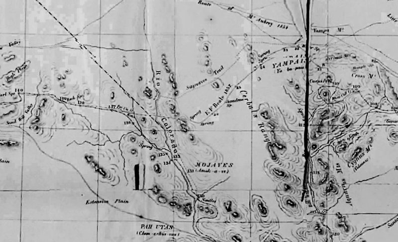
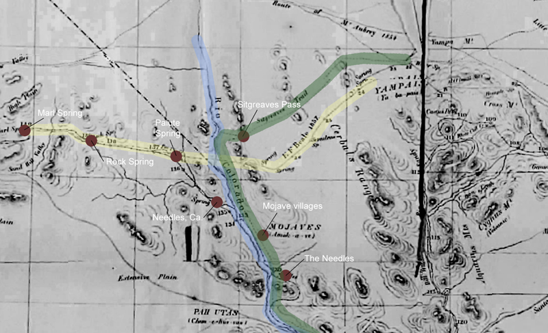
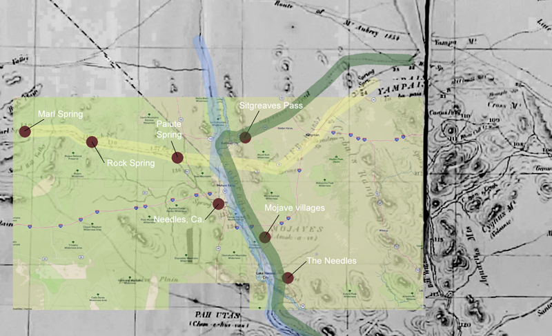
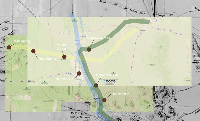
I found a digital copy of a map drawn in circa 1859 or so. Didn’t look right so I threw some technology at it to see what I could see.
At first I thought it was all detailed and on the money, but studying the map a bit it looked as if Beale’s Wagon Road and Sitgreaves Trail were possibly transposed.
I highlighted the Colorado River in blue and roughly located geographic features and landmarks between about where Kingman would be west to Marl Spring.
Next, I put in an overlay of a modern map and indeed, Sitgreaves Pass appeared north of where it should be.
Finally, I put in a solid layer to see how it looked without the historical map.
I am hesitant to say this is this and should be this because whenever I do I am just about always incorrect. I will have to check it out further.
A gentleman named Bill had a hankering to wander about the desert. He had been told the way to really see the desert was to walk through it. He liked the idea and drove as far as Death Valley to start a good distance from all humanity and all things civilized. Here he met a Shoshone Indian Chief who traded him a fine burro for a fine, fairly new car. Off he went for a wonderful, if not occasionally harrowing adventure. Through Nevada into a corner of Utah back into Arizona and down the north rim of the Grand Canyon and back up the south rim to the village and then back to the desert in California. Well over a year had passed when he returned to his wife who was waiting for him in the little town of Baker in the middle of the Mojave. All was well upon his return and his adventures were becoming known far and wide. Bill had become known as ‘Burro’ Bill. One evening there was a knock at the door. Bill was surprised to see his friend, the Shoshone chief. The chief wanted his burro back. ‘Burro’ Bill said the burro was his now. They had been through so much together and he could not bear to part with the beast. The chief explained that a day or two after Bill and the burro departed the car had a flat tire and broke a wheel therefore was not drivable, therefore the deal was no good. The burro was still operable while the car that sat in Death Valley was not.
ref: review Burro Bill and Me, Ramblings in the American Desert Author: Edna Calkins Price
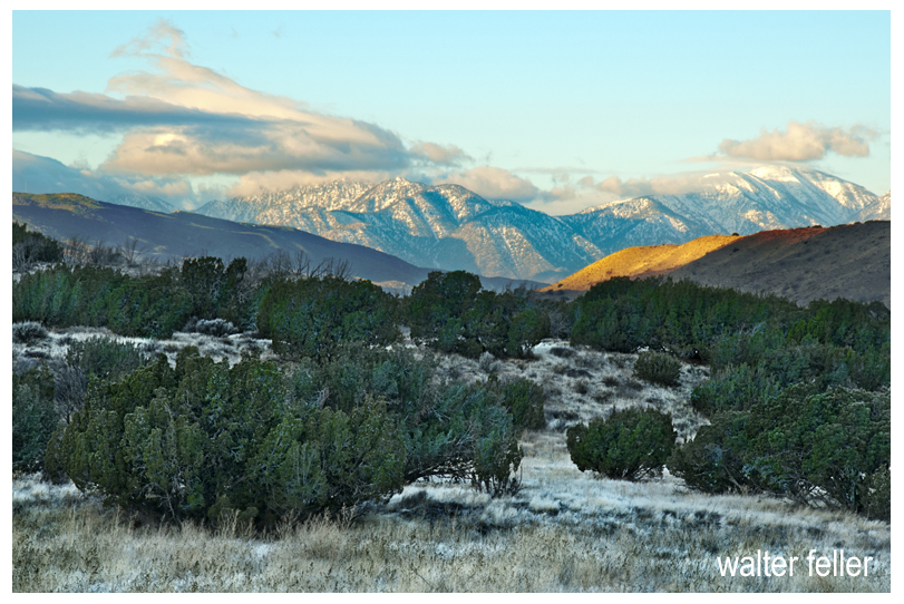
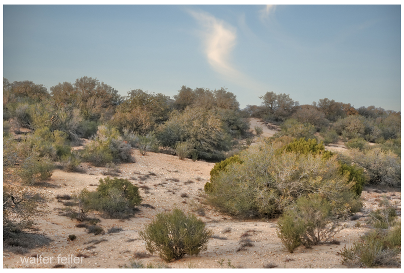
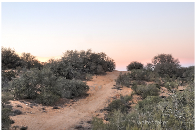
When the air has a bit of a chill and the days are short it feels good to spend time idling down a back road in that golden light with no intended time of arrival, anywhere.
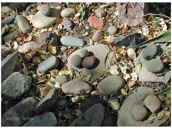
Rather than growing wider and emptying into the sea the Mojave River becomes smaller and smaller finding its way in the sand between the cobbles and rocks curling into crescent -shaped dark meanders and swales transitioning to dry sand and finally, collections of same sized stones.
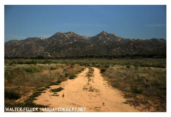
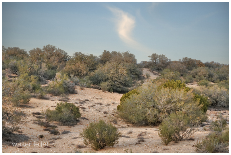
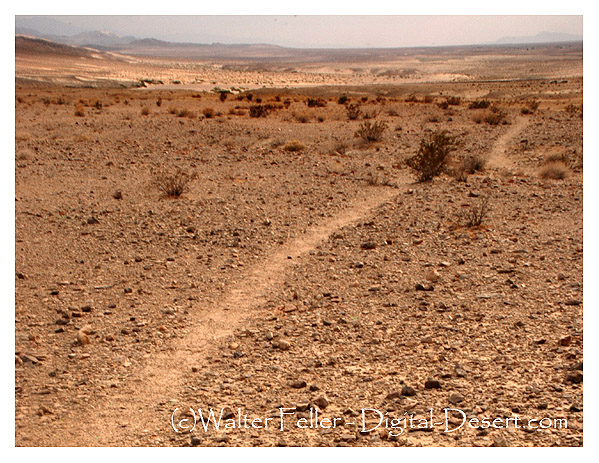
Just east of the Cajon Summit is where the historic traffic corridor in and out of the Mojave Desert narrows and the various alignments come within hollering distance of each other as they cross over the divide between the high desert and Cajon Canyon.
Traces and fragments of footpaths, trails, wagon roads and early highways can be found next to our modern freeway and here they become interwoven, laced and worn or grown over. None of all of this, by any means, obscures the vision of countless travelers of past ages passing this point.
In 1873 Scottish inventor John Loudon McAdam created an inexpensive type of paving that used rocks and gravel, was put down while it was soft and cured as it was driven on.
Stretch of macadam pavement on old road to and from the summit
John Loudon McAdam and Macadam
Merriam-Webster: In 1783, inventor John Loudon McAdam returned to his native Scotland after amassing a fortune in New York City. He became the road trustee for his district and quickly set his inventiveness to remedying the terrible condition of local roads. After numerous experiments, he created a new road surfacing material made of bits of stone that became compressed into a solid mass as traffic passed over them. His invention revolutionized road construction and transportation, and engineers and the public alike honored him by using his name (respelled macadam) as a generic term for the material or pavement made from it. He is further immortalized in the verb macadamize, which names the process of installing macadam on a road.
The water of Little Salt Lake is as briny, we were told, like that of Great Salt Lake, and we noticed that its shores were covered with saline incrustations for a mile or more from the water’s edge; but the Mormons stated that the salt was of little value, being impregnated with saleratus and other alkaline matter, which rendered it unfit for use. They obtain their supplies of this article from mines of rock salt in the mountains. The excitement occasioned by the threats of Walkah, the Utah chief, continued to increase during the day we spent at Parowan. Families flocked in from Paragoona, and other small settlements and farms, bringing with them their movables, and their flocks and herds. Parties of mounted men, well-armed, patrolled the country; expresses came in from different quarters, bringing accounts of attacks by the Indians, on small parties and unprotected farms and houses. During our stay, Walkah sent in a polite message to Colonel G. A. Smith, who had military command of the district, and governed it by martial law, telling him that, “The Mormons were d—d fools for abandoning their houses and towns, for he did not intend to molest them there, as it was his intention to confine his depredations to their cattle, and that he advised them to return and mind their crops, for, if they neglected them, they would starve, and be obliged to leave the country, which was not what he desired, for then there would be no cattle for him to take.” He ended by declaring war for four years. This message did not tend to allay the fears of the Mormons, who, in this district, were mostly foreigners, and stood in great awe of Indians.
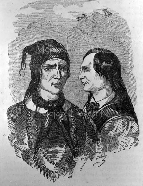
The Utah chieftain who occasioned all this panic and excitement is a man of great subtlety and indomitable energy. He is not a Utah by birth but has acquired such an extraordinary ascendency over that tribe by his daring exploits, that all the restless spirits and ambitious young warriors in it have joined his standard. Having an unlimited supply of fine horses, and being inured to every fatigue and privation, he keeps the territories of New Mexico and Utah, the provinces of Chihuahua and Sonora, and the southern portion of California in constant alarm. His movements are so rapid, and his plans so skillfully and so secretly laid, that he has never once failed in any enterprise and has scarcely disappeared from one district before he is heard of in another. He frequently divides his men into two or more bands, which making their appearance at different points at the same time, each headed, it is given out, by the dreaded Walkah in person, has given him, with the ignorant Mexicans, the attribute of ubiquity. The principal object of his forays is to drive off horses and cattle, but more particularly the first, and among the Utahs we noticed horses with brands familiar to us in New Mexico and California.
This chief had a brother as valiant and crafty as himself to whom he was greatly attached. Both speaking Spanish and broken English they were enabled to maintain intercourse with the whites without the aid of an interpreter. This brother the Mormons thought they had killed, for, having repelled a night attack on a mill, which was led by him, on the next morning they found a rifle and a hatchet which they recognized as his, and also traces of blood and tracks of men apparently carrying a heavy body. Although rejoicing at the death of one of their most implacable enemies, the Mormons dreaded the wrath of the great chieftain, which they felt would not be appeased until he had avenged his brother’s blood in their own. The Mormons were surprised at our having passed in safety through Walkah’s territory, and they did not know to what they were to attribute their escape from destruction. They told us that the cattle tracks which we had seen a few days previously were those of a portion of a large drove lifted by Walkah, and that the mounted men we had noticed in the mountains in the evening of August 1st were scouts sent out by him to watch our movements. They endeavored to dissuade us from prosecuting our journey, for they stated that it was unsafe to travel even between their towns without an escort of from twenty-five to thirty men.
He has adopted the name of Walker (corrupted to Walkah) on account of the close intimacy and friendship which in former days united him to Joe Walker, an old mountaineer, and the same who discovered Walker’s Pass in the Sierra Nevada.
The Mormons had published a reward of fifteen thousand dollars for Walkah’s head, but it was a serious question among them who should “bell the cat.”
Campsite near confluence of Muddy and Virgin rivers.
“These Indians are Pa utch but not as wild as those above the Mt. their women and children did not run off. I saw at their Lodges a large cake of rock salt weighting 12 or 15 lbs and on enquiry found that they procured it a cave not far distant.”
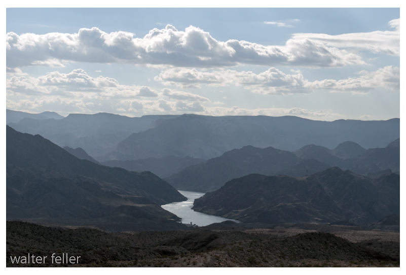
Lake Mead near St. Thomas
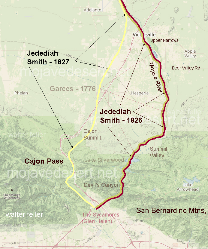
Journal of Jedediah Smith – 1826
http://mojavedesert.net/jedediahsmith/journal-1-02.html
“I turned off to the right across a level piece of ground about 1/2 mile to the foot of a hill which appears to be two or three mile long and 100 or 150 feet high its course being about parallel with the River which is here running S E or E S E.”
“One of my men found a singular substance Some hard and transparent pieces of stone about twice as large as a large pea were firmly fixed in the side of a flat stone. Appearance of an abundance of Iron ore are seen here. and most certainly if a country produces minerals in proportion to its barrenness this must be rich in mineral productions.”
“The River entering a low but rugged mountain below I found it would be necessary to turn off from it to the left and as my guides informed me that it was more than a days travel to the next accessible point on the river between which place and this no water could be found”
I have heard that the Paiute Indians have a legend–a story they would tell about a giant who crossed the desert with an olla full of water in each arm. With each step he would leave his footprint in the ground, and water would spill from the olla into the hole as he walked on. The giant was so large that these waterholes were one day’s walk between each for a normal-sized man. The Indian learned this and used these waterholes to travel great distances and trade with other Peoples beyond the desert. As time went on and things went the way things do, one such trail became the Mojave Road. — Editor
Mataviam described travel in general to Kelly (1933: 23:7) in the following way:
Travelers packed everything on their backs, and wore any kind of foot gear. Children always wore shoes; if the children were too small to walk, their parents took turns carrying them. They also took turns packing the water jar, which was carried in a burden basket (ais) or a net. Blankets, etc., were taken. Women took cooking utensils, including manos, but not metates. Men took weapons and walked ahead. Dogs accompanied the party. Children were given something to carry; perhaps a small skin sack, but not a burden basket or net. Travel along certain routes had to be timed so that people could be sure that there would be water available in drier sections. Timing was particularly important if some of these sources were tanks and sandstone potholes.
Manos atop metates
from: Southern Paiute – Chemehuevi Trails Across the Mojave Desert: Isabel Kelly=s Data, 1932-33 (Darling/Sneed Symposium, AAA 2004) Catherine S. Fowler University of Nevada, Reno
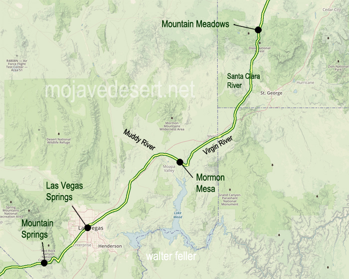
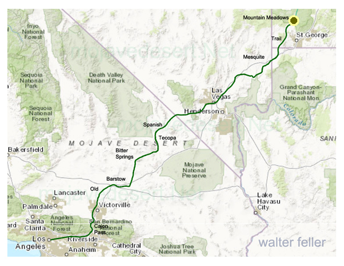
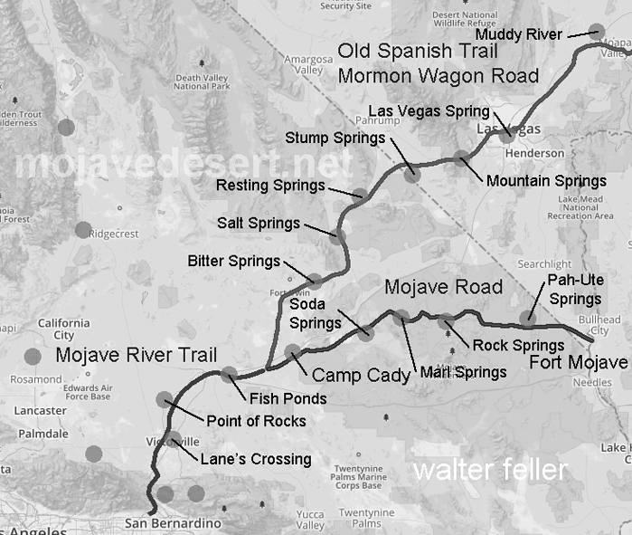
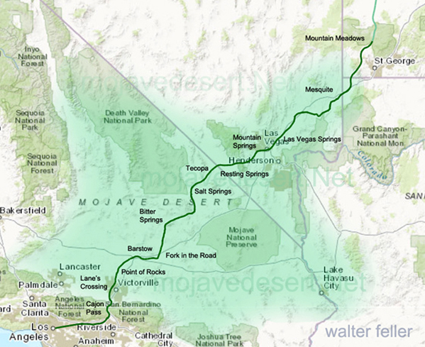
In April 1855, Brigham young, President of the church of Jesus Christ of Latter-Day Saints, called 30 men to leave their families and possessions in the recently settled towns of Utah to serve a mission at the Las Vegas Springs. The verdant meadows watered by the springs had been seasonally inhabited by the Paiute Indians for centuries. The water and meadows made Las Vegas an important stop on the Spanish Trail (called the Mormon Road after 1848).
Map of the Old Spanish Trail (Mormon Road) from Mountain Meadows, UT. to Los Angeles, CA.
President Young directed this group of newly called missionaries to become self-sufficient, to provide a place of rest insecurity for travelers between California and Salt Lake City, and to teach the Indians the gospel of Jesus Christ. In the heat of the summer, in June 1855, the missionaries arrived at this site. The mission, intended to be permanent, was first Anglo-American settlement in Las Vegas Valley.
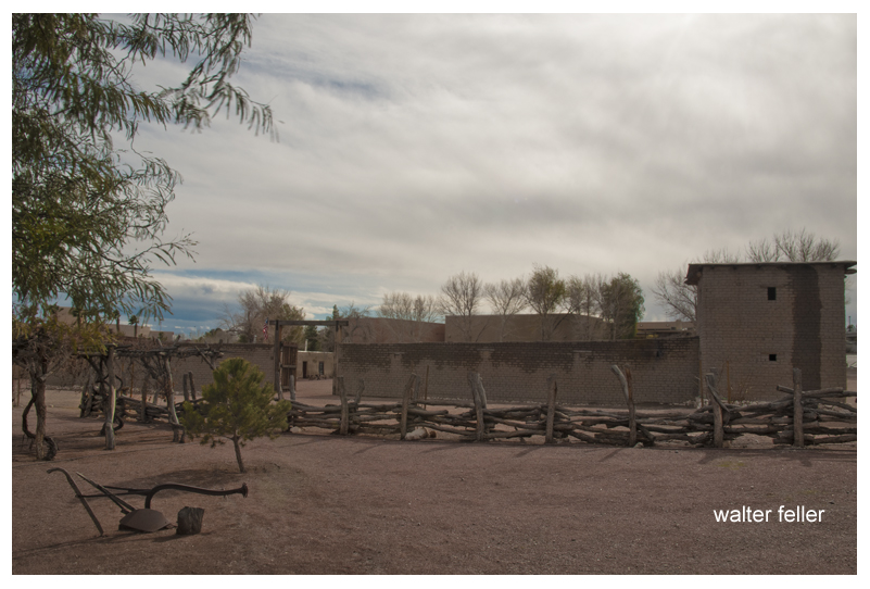
Mormon Fort – Las Vegas, Nv.
By summer’s end there irrigating gardens were producing fresh vegetables and grains. A new fort was under construction, and a spirit of cooperation and mutual learning was being established with the native inhabitants. They also discovered a deposit of lead or in the nearby mountains. More missionaries were sent to smelt the complex ore in large quantities, but the attempt was unsuccessful.
On 23 February 1857 church leaders sent word to the settlement that the mission was to be disbanded. These early pioneers returned to Utah the left a legacy of faith, devotion, and service shown by their willingness to settle in this hostile environment.
Of all the brother acts operating in and around San Bernardino County during the Mormon period, Few accomplished more for the ultimate benefit of the area than the Stoddard boys, Arvin and Sheldon.
Neither cut an imposing figure. Arvin, the quiet one, was only 5’5″ tall and weighed 135 pounds soaking wet, while Sheldon wasn’t much larger. But what they lacked in height they more than made up in spirit.
Arvin, however, had an imposing ally in his wife Caroline. She was 6 feet tall and weighed well over 200 pounds — a formidable Amazon and an extremely vocal one too. One is tempted to ask if she carried him across the threshold on their wedding night.
She became Arvin’s mouthpiece and did not hesitate to make her opinions known, particularly when the chips were down. As their grandson, R. Jackson Stoddard wrote in the March 1970 issue of the LA Westerners Branding Iron, “For although she followed the will of her husband, in many cases the will of her husband was truly only a reflection of her own wants and desires.”
Stoddard Mountain
Today, a stretch of the Mojave Desert between Victorville and Daggett is blanketed with sites bearing the Stoddard’s names. They include the Stoddard Mountains, Stoddard Hills, Stoddard gulch, Stoddard Valley, Stoddard Well and Stoddard Wells Road — all directly attributable to Arvin’s work in the area during the 1850s and 60s.
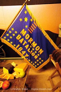
Flag of the Mormon Battailion (note spelling)
There were four Stoddard Brothers at the beginning; Rufus, Albert, Arvin and Sheldon, who were all born in Canada. When their father died in 1838, mother Jane gathered them all up and crossed the United States border, first to Ohio in then to Warsaw, Illinois, where she became hooked on the Mormon religion. When the church made it’s great trek to Salt Lake City in 1847, she and her boys were in the initial contingent.
Rufus was the first of the boys to reach California, arriving in San Diego as a member of the MormonBattalion. After his group was disbanded in Los Angeles, he remained in the area for almost a year before he rejoining his family at Salt Lake City in 1849.
Sheldon was the next to go. Leaving Salt Lake in 1848, along with 30 other men found for the placer diggings near hang town, they traveled as far as Mountain Meadows with a larger company who hired Capt. Jefferson Hunt to guide them to Los Angeles over the Old Spanish Trail.
At the Meadows they left Hunt’s party and turned west to take what they thought was a shortcut to the gold fields and for the next 17 days blindly followed a false trail without a guide, compass or map to go by.
On the 18th day, hopelessly lost in facing death without water their lives were spared when a sudden rain squall drenched the area. As Sheldon later wrote, “We caught the water by spreading out our rubber blankets on the ground and drank it with a spoon.”
They then turned east on the Muddy River, followed at South until they fortunately encountered Capt. Hunt’s company again and accompanied it up the Mojave River, through Cajon Pass and down to the Chino Ranch.
Crowder Canyon – Old Spanish Trail
Tragically enough, on the same trip another group of would-be minors left Hunt’s command at Provo, Utah, insisting they also knew a shorter route to the gold fields, only to blunder into Death Valley, where five died before the survivors made it to Los Angeles.
Death Valley
From Chino the party went on to Mariposa, where they broke up to mine, while Stoddard ran a trading post in nearby Carson Valley for a few months before returning to Salt Lake with a herd of horses and mules.
in March 1851 Sheldon married Jane Hunt, daughter of Capt. Hunt, and the following month they accompanied the first group of Mormon colonizers to the San Bernardino Valley, making temporary camp at Sycamore Grove.
After the Mormons purchased the San Bernardino Rancho that September, and moved down into the valley, Sheldon built the first log cabin in the settlement on First Street,, west of I Street. His cabin was later moved to and made part of the Westside of this stockade constructed on the present courthouse site as protection against hostile Indians.
For the next 14 years Sheldon Stoddardwas engaged in freighting and carrying mail between San Bernardino and Salt Lake City, crossing the Mojave 24 times in all. In 1865 he made one trip to Nevada in Montana with a mule team which covered over 1300 miles, and took six months to complete.
Arvin Stoddard and his wife also came to San Bernardino with the first Mormon train and lived in the stockade for three years before receiving an urgent message from Mormon leader Brigham Young, authorizing him to investigate a gold strike in the Calico Hills to see if he could ” obtain as much gold as possible to help finance the founding and furtherance of the faith,” keeping only enough to live on during the venture.
Calico Hills
Arvin and Caroline, ardent church devotees, packed their wagon and with their poor young children in tow, headed for the hills without hesitation.
Mojave River at Afton Canyon
But before looking for gold, Arvin searched for water to raise crops to feed his family and stock and to flush through sluice boxes used to separate flakes of gold from the desert sand.
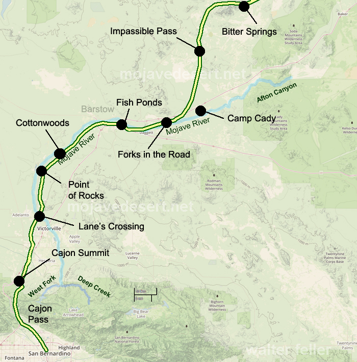
One of his more successful wells, known as Stoddard Well, is still flowing today and besides furnishing the family with ample water, also provided an impetus for others to break out a new road on almost a straight line from Lane’s Crossing, near today’s Oro Grande, to Fish Ponds Station between present-day Barstow and Daggett, thereby saving many miles compared with the old route, which followed the westward band of the Mojave River.
Although it took him almost 8 years of prospecting, Arvin finally struck a rich claim and extracted a sum that Caroline estimated at $60,000 before calling it quits and lighting out for Salt Lake City to hand to Brigham Young.
But before they reach the Mormon Temple, they were held up by Indians and robbed of all their hard-earned loot, except for a few thousand dollars hidden in Caroline’s underwear.
As her grandson related, “The Indians were neither red nor brown. they were more white than any Indian she (Caroline) had ever seen.” Caroline deduced they were renegade Mormons, acting on behalf of the church, and although her suspicions were never resolved, her once benevolent attitude toward the Mormon hierarchy changed overnight and led to her eventual break with the church.
In 1869 the Arvin Stoddards move to Milford, Utah, where they build a hotel called, naturally, “The Stoddard House,” where they lived until Caroline died in 1904.
Sheldon Stoddard remained in San Bernardino for the rest of his life, Rev. and honored by all who knew him for his contributions to the county and state.
Blue Cut – Cajon Pass
After serving as president of the pioneer society, he spent his final years surrounded by old friends like John Brown and Billy Holcomb. They camped and fished together in their mountain retreats and dedicated monuments to the pioneers in Cajon Pass. he was active up to the day of his death in 1919 at the age of 89.
From:
Heritage Tales 1988 by Fred Holladay published by the City of San Bernardino Historical and Pioneer Society
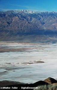
In 1849 in the rush to the goldfields of California the Bennett-Arcane party of the Mojave-San Joaquin wagon train decided to try an unknown shortcut and became stranded in what is now known as Death Valley. Two young men, William L. Manly and John Rogers walked out, across the desert and into the canyons north of Los Angeles. At a rancho in San Francisquito canyon they managed to get a white horse and a one-eyed mule as well as supplies then they walked back to those who were remaining at the camp. Once they returned they led the lost party to safety. Following are their observations of the topography of the Mojave and how Manly claimed Death Valley got its name.
While waiting for the women Bennett and Arcane wanted to go out and get a good view of the great snowy mountain I had told them so much about. The best point of view was near our camp, perhaps three or four hundred yards away, and I went with them. This place where we now stood was lower than the mountains either north or south, but were difficult to climb, and gave a good view in almost every direction, and there, on the back bone of the ridge we had a grand outlook, but some parts of it brought back doleful recollections. They said they had traveled in sight of that mountain for months and seen many strange formations, but never one like this, as developed from this point. It looked to be seventy-five miles to its base, and to the north and west there was a succession of snowy peaks that seemed to have no end. Bennett and Arcane said they never before supposed America contained mountains so grand with peaks that so nearly seemed to pierce the sky. Nothing except a bird could ever cross such steep ranges as that one.
West and south it seemed level, and low, dark and barren buttes rose from the plain, but never high enough to carry snow, even at this season of the year. I pointed out to them the route we were to follow, noting the prominent points, and it could be traced for fully one hundred and twenty-five miles from the point on which we stood. This plain, with its barren ranges and buttes is now known as the Mojave Desert. This part of the view they seemed to study over, as if to fix every point and water hole upon their memory. We turned to go to camp, but no one looked back on the country we had come over since we first made out the distant snow peak, now so near us, on November 4th 1849. The only butte in this direction that carried snow was the one where we captured the Indian and where the squashes were found.
The range next east of us across the low valley was barren to look upon as a naked, single rock. There were peaks of various heights and colors, yellow, blue fiery red and nearly black. It looked as if it might sometime have been the center of a mammoth furnace. I believe this range is known as the Coffin’s Mountains. It would be difficult to find earth enough in the whole of it to cover a coffin.
Just as we were ready to leave and return to camp we took off our hats, and then overlooking the scene of so much trial, suffering and death spoke the thought uppermost saying:–“_Good bye Death Valley!”_ then faced away and made our steps toward camp. Even after this in speaking of this long and narrow valley over which we had crossed into its nearly central part, and on the edge of which the lone camp was made, for so many days, it was called Death Valley.
Many accounts have been given to the world as to the origin of the name and by whom it was thus designated but ours were the first visible footsteps, and we the party which named it the saddest and most dreadful name that came to us first from its memories.
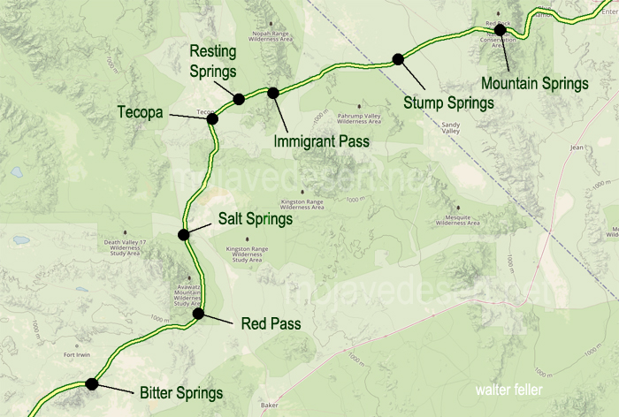
From: Shoshone Country; Resting Springs – Loafing Along Death Valley Trails by W. Caruthers
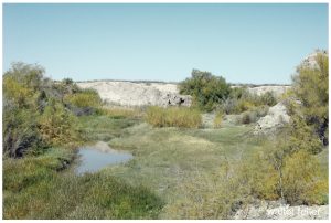
Resting Springs
Early in 1843, John C. Fremont led a party of 39 men from Salt Lake City northward to Fort Vancouver and in November of that year, started on the return trip to the East.
Fremont 1844 – annotated
This trip was interrupted when he found his party threatened by cold and starvation and he faced about; crossed the Sierra Nevada and went to Sutter’s Fort. After resting and outfitting, he set out for the East by the southerly route over the old Spanish trail, which leads through the Shoshone region.
Bitter Springs
At a spring somewhere north of the Mojave River he made camp. The water nauseated some of his men and he moved to another. Identification of these springs has been a matter of dispute and though historians have honestly tried to identify them, the fact remains that none can say “I was there.”
In the vicinity were several springs any of which may have been the one referred to by Fremont in his account of the journey. Among these were two water holes indicated on early maps as Agua de Tio Mesa, and another as Agua de Tomaso.
Red Pass on the Old Spanish Trail between Bitter Springs and Salt Spring
There are several springs of nauseating water in the area and some of the old timers academically inclined, insisted that Fremont probably camped at Saratoga Springs, which afforded a sight of Telescope Peak or at Salt Spring, nine miles east on the present Baker-Shoshone Highway at Rocky Point.
Salt Spring
Kit Carson was Fremont’s guide. Fremont records that two Mexicans rode into his camp on April 27, 1844, and asked him to recover some horses which they declared had been stolen from them by Indians at the Archilette Spring, 13 miles east of Shoshone.
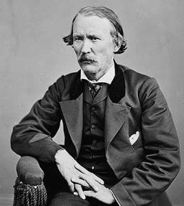
Christopher “Kit” Carson
One of the Mexicans was Andreas Fuentes, the other a boy of 11 years—Pablo Hernandez. While the Indians were making the raid, the boy and Fuentes had managed to get away with 30 of the horses and these they had left for safety at a water hole known to them as Agua de Tomaso. They reported that they had left Pablo’s father and mother and a man named Santiago Giacome and his wife at Archilette Spring.
With Fremont, besides Kit Carson, was another famed scout, Alexander Godey, a St. Louis Frenchman—a gay, good looking dare devil who later married Maria Antonia Coronel, daughter of a rich Spanish don and became prominent in California.
In answer to the Mexicans’ plea for help, Fremont turned to his men and asked if any of them wished to aid the victims of the Piute raid. He told them he would furnish horses for such a purpose if anyone cared to volunteer. Of the incident Kit Carson, who learned to write after he was grown, says in his dictated autobiography: “Godey and myself volunteered with the expectation that some men of our party would join us. They did not. We two and the Mexicans … commenced the pursuit.”
Fuentes’ horse gave out and he returned to Fremont’s camp that night, but Godey, Carson, and the boy went on. They had good moonlight at first but upon entering a deep and narrow canyon, utter blackness came, even shutting out starlight, and Carson says they had to “feel for the trail.”
Amargosa River, Tecopa
One may with reason surmise that Godey and Carson proceeded through the gorge that leads to the China Ranch and now known as Rainbow Canyon. When they could go no farther they slept an hour, resumed the hunt and shortly after sunrise, saw the Indians feasting on the carcass of one of the stolen horses. They had slain five others and these were being boiled. Carson’s and Godey’s horses were too tired to go farther and were hitched out of sight among the rocks. The hunters took the trail afoot and made their way into the herd of stolen horses.
Rainbow Canyon/China Ranch
Says Carson: “A young one got frightened. That frightened the rest. The Indians noticed the commotion … sprang to their arms. We now considered it time to charge on the Indians. They were about 30 in number. We charged. I fired, killing one. Godey fired, missed but reloaded and fired, killing another. There were only three shots fired and two were killed. The remainder ran. I … ascended a hill to keep guard while Godey scalped the dead Indians. He scalped the one he shot and was proceeding toward the one I shot. He was not yet dead and was behind some rocks. As Godey approached he raised, let fly an arrow. It passed through Godey’s shirt collar. He again fell and Godey finished him.”
Tecopa
Subsequently it was discovered that Godey hadn’t missed, but that both men had fired at the same Indian as proven by two bullets found in one of the dead Indians. Godey called these Indians “Diggars.” The one with the two bullets was the one who sent the arrow through Godey’s collar and when Godey was scalping him, “he sprang to his feet, the blood streaming from his skinned head and uttered a hideous yowl.” Godey promptly put him out of his pain.
They returned to camp. Writes Fremont: “A war whoop was heard such as Indians make when returning from a victorious enterprise and soon Carson and Godey appeared, driving before them a band of horses recognized by Fuentes to be part of those they had lost. Two bloody scalps dangling from the end of Godey’s gun….”
John Charles Fremont
Fremont wrote of it later: “The place, object and numbers considered, this expedition of Carson and Godey may be considered among the boldest and most disinterested which the annals of Western adventure so full of daring deeds can present.” It was indeed a gallant response to the plea of unfortunates whom they’d never seen before and would never see again.
When Fremont and his party reached the camp of the Mexicans they found the horribly butchered bodies of Hernandez, Pablo’s father, and Giacome. The naked bodies of the wives were found somewhat removed and shackled to stakes.
Fremont changed the name of the spring from Archilette to Agua de Hernandez and as such it was known for several years. He took the Mexican boy, Pablo Hernandez, with him to Missouri where he was placed with the family of Fremont’s father-in-law, U. S. Senator Thomas H. Benton. The young Mexican didn’t care for civilization and the American way of life and in the spring of 1847 begged to be returned to Mexico. Senator Benton secured transportation for him on the schooner Flirt by order of the Navy, and he was landed at Vera Cruz—a record of which is preserved in the archives of the 30th Congress, 1848.
Three years later a rumor was circulated that the famed bandit, Joaquin Murietta was no other than Pablo Hernandez (This was indeed, just a rumor as the dates were mismatched by at least ten years -ed.)
Lieutenant, afterward Colonel, Brewerton was at Resting Springs in 1848 with Kit Carson who then was carrying important messages for the government to New Mexico. He found the ground white with the bleached bones of other victims of the desert Indians. Brewerton calls them Pau Eutaws.
by Van P. Wilkinson – Desert Magazine – July, 1971
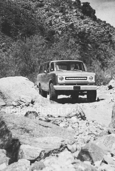
Relics lure as many folks into California’s wilderness today as did the precious ores of the 1800s. To get a piece of the action then, the needs were demanding and basic: a weatherproof disposition, an impenetrable faith against stark wilderness, and an inventive craftiness to second-guess nature. Today, it’s a mite simpler: a topographical map, an off-road vehicle, and a slight case of frenzied persistence.
Rattlesnake Canyon
Rattlesnake Canyon is a handy one-day hunting ground for the slightly-more than-motivated. Here, you’ll find noteworthy mining remains, a scattering of solder-top-age cans and purple glass, and many short 4WD excursions to seldom visited wild areas.
Historically, the San Bernardino Mountains were prospected and mined over a hundred years before the gold migration to the Mother Lode in 1849.
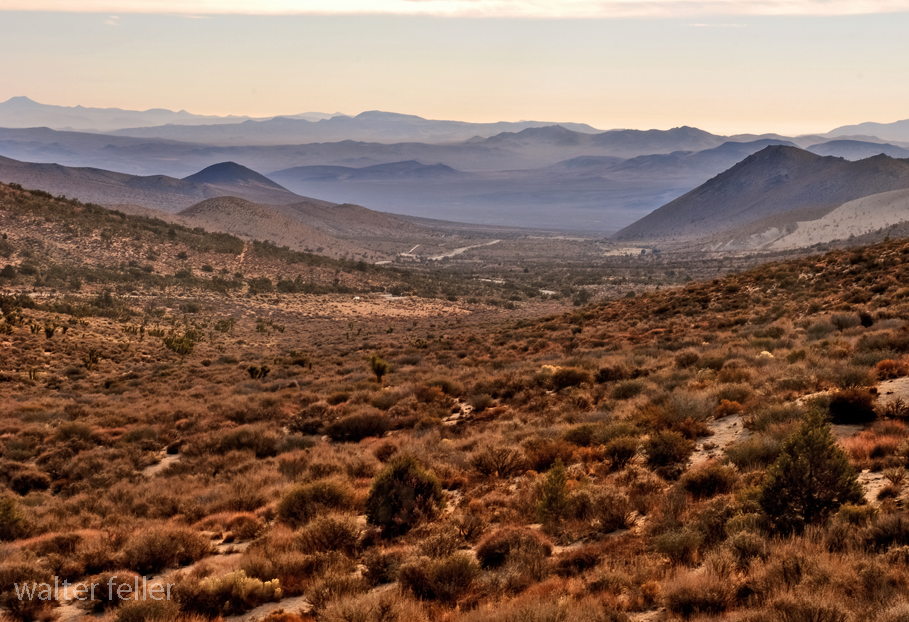
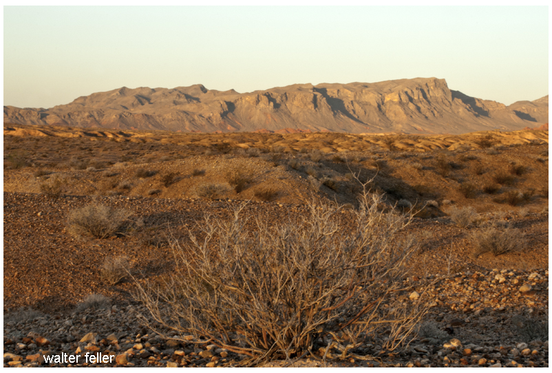
Indians and Spanish found in the San Bernardinos not only beauty and shelter, but trading commodities such as furs and minerals. Holcomb Valley gold, discovered in the early 1860s, created some new geographical problems peculiar to this northeasterly mountain location. The great Mojave Desert trough of Victor, Apple, Lucerne and Johnson valleys was closer than the southwesterly mountain slopes into the “civilized” basins of San Bernardino, Redlands and Riverside.
While selecting appropriate shipping routes from the Big Bear Lake vicinity, trailblazers and last-chance prospectors joined forces in the 1860s and began serious exploring and mapping of the canyons east and north down to the desert flatlands.
Like all venturers, these men named areas as often by whim as by rationale. Rattlesnakes are common in high desert canyons leading into the mountains, and there are no less than three canyons and three springs in this region which still bear that viperous name. The Rose Mine is located in another Rattlesnake Canyon (Burns Canyon to Pioneertown); the Balanced Rock Mine east of the Old Mormon Trail is located near another Rattlesnake Spring (between Apple Valley and Fawnskin).
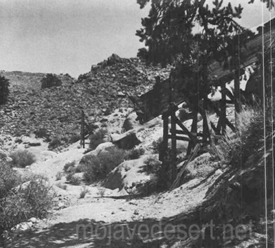
Once used to haul ore from the wooden chute the old wagon road is now covered with weeds and shouts of the wagon masters are no longer heard.
By 1870, the Black Hawk and Silver Reef Mining Districts had been established just a few miles west ofOld Woman Springs. It is safe to assume that the initial digs in our Rattlesnake Canyon were made between I860 and 1880. Generous samples of pre-automation cans and shallow tunnels marked with hand-hewn primitiveness hint at this.
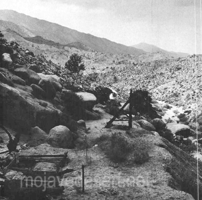
Looking west toward the Bighorn Mountains (below) are seen the shaft, headframe and tailings of the mining operation. Photos by Van P. Wilkinson
Getting into Rattlesnake Canyon today is not altogether simple. The westerly entrance, via Old Woman Springs, is through private property and prohibited. On Old Woman Springs Road toward Yucca Valley, a set of telephone poles flanks the road on the north side. At one point about three miles east of Old Woman Springs there is a support pole on the south side of the road, where the asphalt curves. At this bend, where a taut cable crosses over the road, is the dirt road leading southwesterly into the Bighorn Mountains.
Gentle, dipping and dusty, this road covers some four miles across the alluvial fan toward the mouth of Rattlesnake Canyon. The trail narrows and winds near two private corrals at Two Hole Spring. Then, abruptly, the road dives into the rocky, sandy wash of the canyon. From here to the major mining area (some five miles), it’s either high-clearance 2WD with non-slip differential or 4WD. Why? Because the tracks follow the granular riverbed and at times over breadbasket-sized boulders.
You’ll know you’re on the right path when you reach a cattle gate at the canyon mouth. A sign reads, “Close Gate.” Please do so—stray cattle yield lost revenue and irate ranchers.
Not more than 200 yards on up the southwesterly side of the canyon is Rattlesnake Spring, surrounded by a cattle shed and feed supplies. It was in this area that a couple of glaring bulls blocked the path of our truck while protecting a wary herd-Be careful.
The road dodges and cuts along the wide canyon floor for about two miles, narrow and sandy enough in many places to prohibit campers. Great banks of quartz sediment and loose conglomerate choke the canyon’s south side in a few places as the Bighorn Mountain slopes begin to near the road. The northerly canyon banks show random mineral prospects and dune-buggy scars.
Mica, quartz-veined granite and schist are common ingredients along Rattlesnake Canyon’s steep sides. Multi-colored quartz specimens lay eroded in various sizes, good for rock gardens or the rock tumbler.
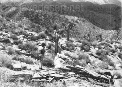
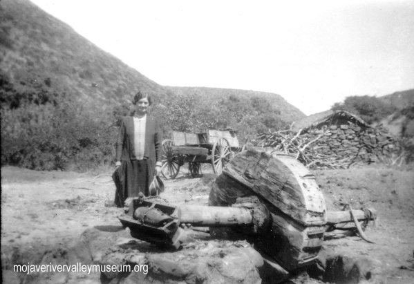
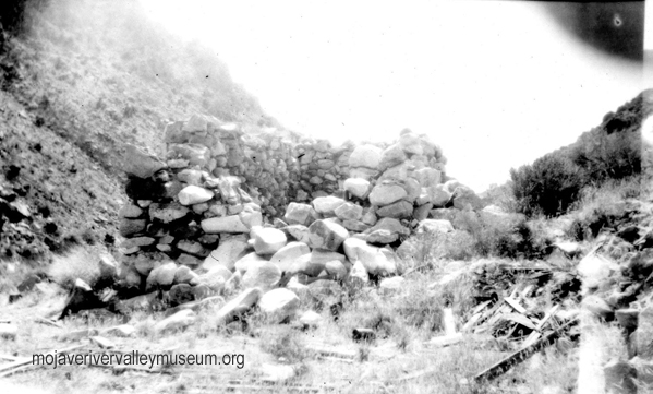
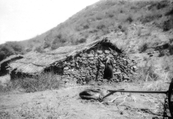
Ruins of a miner’s shack
Some three miles from the gate, the canyon walls move in and the road worsens. The tracks bend in several S’s; in this spot, rainfall or flooding would erase the path and trap a vehicle.
Then, the canyon widens at a gentle cluster of desert willows. Up the northeast canyon bank is a narrow 4WD trail leading to several shafts tunnels and collapsed out-buildings of the central mining activity. One quarter of a mile further up the canyon, another, almost identical trail (but wider) leads in the same direction to a flattened prospector’s shack.
About one-quarter of a mile along the canyon the road ends for all but the bravest with a very narrow 4WD vehicle; it is past this “road’s end” about 200 yards that a tunnel strikes west into the canyon wall. Here, in the tailings, is a collector’s “relic’in reward.”
The tailings of the 80-foot tunnel are small, but the abundance of undisturbed cans amidst the debris is amazing. Evidently, those who made it this far in the past were not after relics, just cattle or adventure.
However, the dumps and discards at the area of major activity have been partially investigated. The shafts were probably started in this region before 1900, but have been worked on and off since then—deepened and reinforced. The tunnels at this site are relatively new, and a nearby claim indicates that someone was still investing money in Rattlesnake Canyon as late as 1967.
A steep trail leads south from the flattened prospector’s shack, presumably paralleling the canyon trail to Mound Spring and the Rose Mine region. This is the direction from which explorers came in the 1860s. Another trail, marked on the map, heads southwesterly from Rattlesnake Canyon up a subsidiary wash toward Granite Peak. Neither of these is for amateurs.
Whether you find in the Bighorn Mountains a chance to test your off-road navigation, or whether you find a relic to add to your collection, there’s one certainty: you’ll be bitten by the lure of Rattlesnake Canyon.
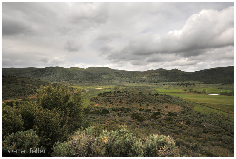
Mountain Meadows–the dark valley where in late 1857 the murder of 135 men, women and children took place. They were rendered defenseless and surrendered after several days of siege on their defensive circle of wagons losing 10 men in the battle. The unsuspecting victims, expecting to be led to a local town were marched up a hill and the slaughter began in earnest.
The Old Spanish Trail enters the Mojave from the northeast south of Mountain Meadows in Utah.
In 1864 Sarah Rousseau came through the site on her way to California with the Earp family noting the following comments in her diary;
“They arrived here in September, ’57, where they were murdered in cold blood by the Mormons. There was a monument raised to their memory once before, but the Mormons tore it down. This spring sometime in May, some soldiers came through California and erected this monument and dared any of the Mormons to touch it.
Mountain Meadows
There were survivors. She continued;
“There were 150 cruelly butchered men women and children, only six small children, too young to tell the tale, were suffered to live. They are at Salt Lake City. I cannot for a moment suppose that such barbarism will be buried in oblivion. “Oh, it cannot be.” It will be brought to light and the aggressors punished.
Mountain Meadows
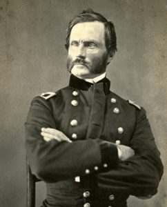
Brevet Major Henry Carleton led his troops into the area discovering the hastily buried bodies at the massacre site.
Maj. J. H. Carleton
In his special report of 1859 the Major did not hold back his distaste for Mormons and these events;
“In pursuing the bloody thread which runs throughout this picture of sad realities, the question how this crime, that for hellish atrocity has no parallel in our history, can be adequately punished often comes up and seeks in vain for an answer. Judge Cradlebaugh says that with Mormon juries the attempt to administer justice in their Territory is simply a ridiculous farce. He believes the Territory ought at once to be put under martial law. This may be the only practical way in which even a partial punishment can be meted out to these Latter-Day devils.
“But how inadequate would be the punishment of a few, even by death, for this crime for which nearly the whole Mormon population, from Brigham Young down, were more or less instrumental in perpetrating.
In his book, Roughing It, Mark Twain described the reaction of the pubic upon hearing of the mass murder: “The whole United States rang with its horrors.”
Hindered by the Civil War and other events indictments were issued but the only one convicted was a Mr. John D. Lee who was executed by firing squad in 1877, 20 years after the fact.


 In 1849 in the rush to the goldfields of California the Bennett-Arcane party of the Mojave-San Joaquin wagon train decided to try an unknown shortcut and became stranded in what is now known as Death Valley. Two young men, William L. Manly and John Rogers walked out, across the desert and into the canyons north of Los Angeles. At a rancho in San Francisquito canyon they managed to get a white horse and a one-eyed mule as well as supplies then they walked back to those who were remaining at the camp. Once they returned they led the lost party to safety. Following are their observations of the topography of the Mojave and how Manly claimed Death Valley got its name.