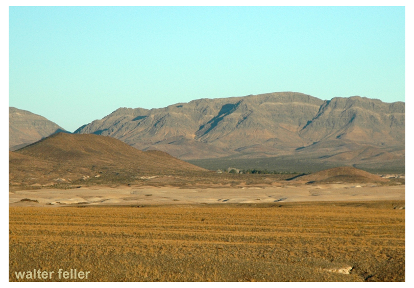
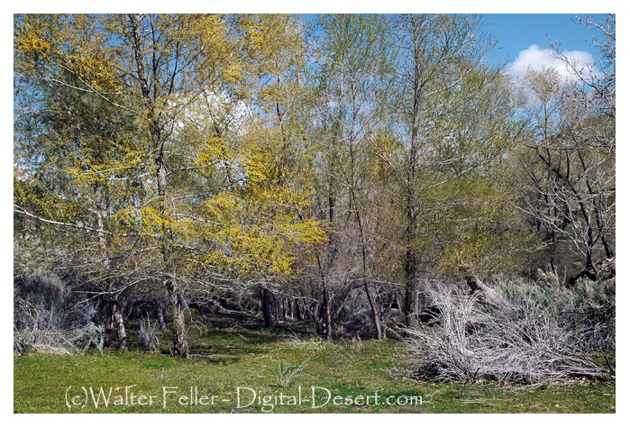
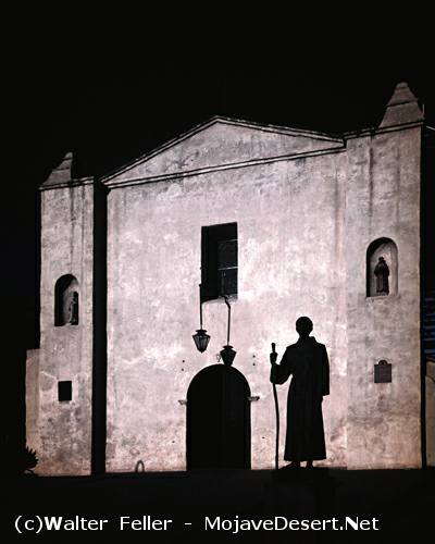
Mrs. Kemper Campbell, with her husband and their law partner, Mr. Sorenson, acquired the Verde Ranch in 1924. Mrs. Campbell, now 76 years of age, recalls that the original Verde ranch was approximately 4000 acres. The Campbells retained the north portion of 1900 acres, while Mr. Sorenson retained the south portion. Part of the Kalin ranch, from the south portion along Bear Valley Road, is now being developed for the new Victor Valley College.
Verde/Kemper Campbell Ranch
Mrs. Campbell describes the red House is consisting of nine rooms and in good repair. The “red house” was built in 1870 by John Brown Sr. and was used by the Mormons as a hotel and stopover. It was a meeting place of the pioneers on their journeys south to the San Bernardino Valley. In 1867, John Brown homesteaded the Verde Rancho, which became the first major ranch of the Mojave River Valley. Horse and cattle raising and production of alfalfa have been the major uses of the ranch by a succession of owners: the Coles, Sterlings and Greers before the Campbells and Mr. Sorenson became owners. The Campbells operated their portion as a working ranch. In the 1930s they added attractions for guests, and for many years it was well known as the “North Verde.” after the death of their oldest son during World War II the name was changed to “Kemper Campbell Jr. Ranch” in his memory.
Adapted from Mohahve I – Scrapbooks of History, page 93 – Mohahve Historical Society
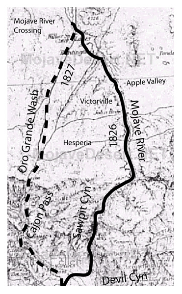
Map showing Smith’s routes across the Victor Valley in 1826 and 1827
The next day W S W 8 or 10 miles across a plain and entered the dry Bed of a River on each side high hills. Pursuing my course along the valley of this river 8 or 9 miles I encamped. In the channel of the river I occasionally found water. It runs from west to east alternately running on the surface and disappearing entirely in the sands of its bed leaving them for miles entirely dry. Near the place where I entered its Bed it seemed to finally lose itself in the plain.* (* It is perhaps reasonable to suppose that the Salt Plain has been formed by the waters of this river overflowing the level country in its freshets and in the dry season sinking in the sand and Leaving a deposit of salt on the surface. The waters of the River at this place are sufficiently salt to justify this conclusion.) At this time my provision was nearly exhausted although I thought I had provided enough to last me 10 or 12 days. But men accustomed to living on meat and at the same time traveling hard will eat a surprising quantity of corn and beans which at this time constituted our principal subsistence. One of my guides said he knew where his people had a cache of some provision and the next day as I traveled on he went with one of the men to procure some at night they returned bringing something that resembled in appearance loaves of bread weighing each 8 or 10 pounds. It was so hard that an ax was required to break it and in taste resembled sugar candy. It was no doubt sugar but in that imperfect form in which it is found among nations to which the art of granulation is unknown. On inquiry I found it was made from the cane grass which I have before spoken of on Adams River and the same of which the Amuchabas make their arrows. For three days nothing material occurred Our course was up the river which sometimes run in sight and then for miles disappeared in the sands. In places I found grass and the sugar cane and in some places small cottonwood. I also saw the tracks of horses that had been here during the summer. My guides Belonged to a tribe of Indians residing in the vicinity called the Wanyumas. Not numerous for this barren country could not support them. At this place was some sign of antelope and mountain sheep Mr. Rogers killed an antelope which tasted quite strong of wormwood. On the 4th night from the salt plain an Amuchaba Indian that had come this far with me disappeared. I suppose he had become tired of the journey and returned. My guides had expected to find their families here but were disappointed. The next day still following the course of the River which had a strong current in places 20 yds in width and in others entirely disappeared in the sands. After a long days travel I arrived late at a Wanyuma lodge. Close by were 2 or three families of the same tribe. Here I remained the following day and in the mean time was well treated by these Indians. They gave us such food as they had consisting of a kind of mush made of acorns and pine nut bread made of a small berry. This bread in appearance was like corn bread but in taste much sweeter. As there were in the neighborhood a plenty of hares the Indians said they must give us a feast. Several went out for this purpose with a net 80 or 100 yards long. Arriving at a place where they knew them to be plenty the net was extended among the wormwood. then divided on each wing they moved in such direction as to force the frightened game to the net where they were taken while entangled in its meshes. Being out but a short time they brought in 2 or three dozen a part of which they gave me. Seeing some tracks of antelope Mr. Rogers and myself went out and killed two. In this vicinity there are some groves of cottonwood and in places sugar cane and grass. On the following day after making the Indians some presents I moved on keeping a right hand fork my course nearly S W passing out at the head of this creek and over a ridge I entered a ravine running S W I proceeded down it nearly to where it entered some high hills which were apparently covered with pine. At this place I encamped. In the course of the days I passed hills covered with a scattering growth of bastard cedar and bushy oak. Some antelopes were seen in the course of the day and the tracks of bear and black-tailed deer.
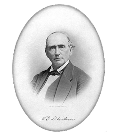
in the summer of 1845, Benjamin D Wilson, own part of the interest in the Jurupa Rancho, site of the present city of Riverside, led a troop of Calvary in search of cattle rustlers.
Setting out from San Bernardino Valley, he divided his command. Most of the men he sent through Cajon Pass, keeping only 22 Mexican troopers with him to follow a trail across the mountains. Two days later, Wilson and his men reached the lake where they sighted scores of grizzly bears.
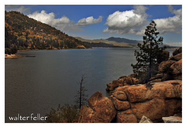
Big Bear Lake
Most of the soldiers had been vaqueros. They formed in pairs and drew reatas, each pair attacking a bear. One looped a rope around bear’s neck; his companion roped same bear by a hind foot. Then the men drew apart to stretch the rope taut and hold the bear a prisoner. They bagged and skinned eleven bears, stretched their hides and continued across the mountains to join the rest of the command on the desert at Rancho Las Flores, on the Mojave River.
Here the reunited party engaged Indians in a fight, after which Wilson and his 22 vaquero-troopers returned home by the way of the lake. They again found the place overrun with bears, and the same 22 soldiers brought in eleven more bears– enough to give them a bear rug apiece as a trophy. It was then that Wilson gave the name of Bear Lake to the little body of water.
Years later the name was changed to Baldwin Lake. The name survives, however, in Big Bear Lake which was created in the site of the Talmadge Ranch in 1884 when a dam was built to provide a constant water supply for the Redlands District.
–
adapted from ~ Pioneer Tales of San Bernardino County – WPA – 1940.
Johnny Lang set out one day in 1894 to search for a lost horse. He ran smack into a band of rustlers and found a fortune in gold.
Johnny was plodding over the little San Bernardino Mountains, in that area known today as Joshua Tree National Monument, Where masses of rock form fort-like walls around hidden valleys and grass meadows. Here it was that the rustlers pastured their stolen stock. They ran choice cattle and horses ranches in Arizona, into the little San Bernardino’s ( by easy stages), and from there they spread through Southern California, selling their contraband herds.
The first thing Johnny knew one of the rustlers lookouts who drew a gun and threatened him. ” You ain’t lost no horse,” the gunman said. “Git going!”
Johnny made his way back down the mountain and return to the camp. There he met another prospector, a stranger, who pointed out a nearby hill as a likely spot to dig for gold. Johnny took his advice. He found a rich outcropping of ore and staked out a claim which he called the Lost Horse Mine.
Bill & Willis Keys burying Johnny Lang
News of the strike brought on a gold rush– and that was the end of the last great band of organized rustlers entrenched in California. The minor sworn to the hills and valleys and drove the rustlers from their hideouts. Johnny Lang made fortunes during his lifetime and never saved up any. One day in 1928 he was found dead. He died with his boots on, still searching for gold in the wilderness of rock.
adapted from ~ Pioneer Tales of San Bernardino County – WPA – 1940.
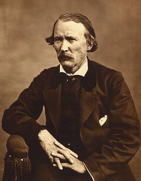
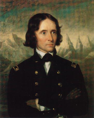
The characteristic account of the hazards of traveling through the Mojave during pioneer days appears in the journal of General John Charles Fremont. Leading a party of topographical engineers, with the famous Kit Carson and Alex Godey as scouts, Fremont was on the last leg of an exploration trip through Oregon and California, and was headed for Salt Lake City when he called camp at the lagoons 8 miles below Yermo for the purpose of killing and jerking enough beef for the long “jornada” to the next waterhole.
Here, on the afternoon of April 24, 1844, Fremont was surprised by the sudden appearance of two Mexicans, one a man, Andreas Fuentes, the other an 11-year-old boy named Pablo Hernandez. They were members of an advance party of six men and women who had left Los Angeles well ahead of a large caravan, in order that they might travel leisurely with their head of 30 horses. They had reached Agua Archilette (now Resting Springs) , where they decided to remain until the caravan overtook them. While camped here, they were visited by several seemingly friendly Indians. A few days after this they were surprised to see approaching them a large number of Indians, estimated to be about 100.
Agua de Archilette (Resting Springs)
The commander of the Mexican party shouted to Fuentes and Pablo, who were on guard duty, to drive the horses to their former water hole. The guards were mounted according to custom and managed to stampede the horses through the Indian lines despite a volley of arrows. Knowing they would be pursued, the man and boy drove the horses about 60 miles, halting only to change mounts. When they reached Agua de Tomaso (now Bitter Springs) they left the horses there and pressed on, hoping to meet the oncoming caravan. Exhausted, the two were overjoyed to find the Fremont party.
Agua de Tomosa (Bitter Springs)
The Fremont cavalcade broke camp immediately, left the river and, turning north, followed the old Spanish trail 25 miles to Agua de Tomaso. Here they found traces of recent origin that showed the Indians had captured the horses and run off with them. Carson and Godey, accompanied by Fuentes, decided to follow the marauders. That evening, Fuentes returned alone, his horse having given out.
The scouts had been taken about 30 hours. They estimated their trip had taken them about 100 miles. At nightfall of the first day they had entered the mountains. Bright moonlight made the pursuit easy for a time, but when they entered a defile, it became necessary to dismount and feel for the trail with their hands. At midnight they lay down to sleep.
Cold as it was, they dared not to make a fire and till morning when in a little ravine, they kindled a tiny blaze to warm themselves before starting on.
Christopher “Kit” Carson
At daylight they continued their pursuit and about sunrise ran across a few of the missing horses. Concealing their exhausted mounts behind a pile of rocks, they crept toward the crest of a nearby hill, from which they could look down on four lodges and about 30 Indians were gorging themselves on horse meat.
The cautious movements of the scouts disturbed a horse grazing nearby, which snorted, giving warning of their presence to the feasting Indians. The scouts charged, shouting as they went. Carson downed in the Indian with his first shot. Godey shot twice and hit another. Godey received an arrow through his shirt collar. The rest of the Indians fled, no doubt believing the two men were the advance of a large party.
Carson stood guard while Godey dashed down to scalp the two prostrate figures. As he stripped the scalp from one of them, the Indian regained consciousness and screamed. An old squaw, ascending a nearby hill, turned, hurled a handful of gravel down on Godey, and screeched maledictions. Godey mercifully killed the man. Then the scouts returned to the herd and drove it off without interference.
John C. Fremont
The scouts’ story told, Fremont ordered camp broken. The party proceeded north across the open plain. Two days later, Fremont came across the bodies of two men, Hernandez, father of Pablo, and another member of the Mexican advance party. Both had been mutilated. Later the bodies of the two women who completed the advance party were discovered, also murdered and mutilated.
adapted from ~ Pioneer Tales of San Bernardino County – WPA – 1940.
In 1840, raiders under Peg-leg Smithand Wakara, an Indian renegade, made a simultaneous attack against a number of ranches in Southern California and drove off hundreds of horses. Some of these horses came from as far north as San Luis Obispo, but all were run south and into the Mojave Desert through the Cajon Pass.
Horse Thief Springs – Kingston Range
When Peg-leg was asked how many horses had been stolen, he replied, “Only about 3,000. The Spaniards followed us and got half of what we started away with, damn them.” During that wholesale raid, Wakara, alone, is believed to have led about 1,000 tame horses from the mission corral at San Luis Obispo.
In 1843, Michael White obtained a grant to the El Cajon de Muscupiabe Rancho in Cajon Canyon, for the purpose of guarding the pass against the Indian raiders. It was the practice of the marauders to slip through the pass in the San Bernardino Mountains, and, under cover of darkness, to rob and pillage. Their constant raiding depleted the Californian’s herds.
In the early fall of 1845, Governor Pio Pico sent against the plundering Indians a force of 80 well-armed men under the command of Benjamin D Wilson. Wilson was a native of Tennessee and had been a trapper in New Mexico when he joined the Workman party which entered San Bernardino County in 1841. In 1843 he purchased one-half interest in the Jurupa Grant with Juan Bandini.
Following the instructions of the governor, Wilson planned and outfitted its expeditionary force. A pack train and 58 soldiers passed through the Cajon, and Wilson, with 28 Californians, crossed the mountains. From Bear Valley, the Wilson party followed the East Fork of the Mojave River down to the Mojave desert floor. There they joined the other division. For several days the expedition marched northward along the Mojave River. Wilson, riding a mule, was usually two or 3 miles in advance, looking for Indian signs.
On the fourth or fifth day, Wilson saw four Indians coming toward him along the trail. Certain they had not seen him, he turned his mule into the river bed and kept under cover until he judged he was opposite them. When he climbed the bank he called in the savages responded in a friendly manner.
It had been Wilson’s intention to take the Indians prisoner in order to obtain some much-needed information, but one of the four was a renegade Indian for all Southern California had been looking– at the notorious Joaquin. Joaquin had been trained as a page by the Catholic Church at the San Gabriel Mission, but a career of crime brought him the customary reward: a branded lip and a cropped ear.
Mission San Gabriel
Wilson commenced a conversation in Spanish, and the Indians to them to be nothing more than a traveler until his force came into view. Joaquin, realizing that Wilson was the vanguard of this group, jerked an arrow from his quiver and strung his bow. Wilson fired from the hip at the same time Joaquin loosed his arrow. The Indian shaft struck Wilson in the right shoulder; the white man’s bullet pierced Joaquin’s breast area the force of the arrow caused Wilson to drop his gun, but the shot had brought Joaquin to the ground where he lay cursing the white race.
The other three Indians made off across the desert. Wilson ordered his soldiers to take their life. The Indians resisted and were killed. Joaquin watching the slaying of his kinsman continued to pour profanity on Wilson and his kind until a soldier put him to death.
Don Benito Wilson – 1870
Upon examination of his wound, Wilson found that he had been struck by an arrow made poisonous by putrid meat blood. The Comanche Indian, Lorenzo Trujillo, who had accompanied Wilson from New Mexico suck the blood from the extremely painful wound. Although the swelling began to reduce, Wilson was unable to travel, so he kept five men with him and sent the remainder down the river to find the Indian camp.
After several days, his command returned to report that they had struck a fresh Indian trail about 10 leagues below Wilson’s camp. Following the trail up a rocky mountain, they discovered Indians hidden among the rocks. The Californians made an attack but were obliged to retreat with several badly wounded men, leaving the Indians in command of their natural fortress. Wilson’s wound now healed, this first major battle between San Bernardino settlers and Mojave marauders pronounced a draw, and the punitive expedition withdrew to return the wounded man home.
adapted from ~ Pioneer Tales of San Bernardino County – WPA – 1940.
Holcomb Valley, north of Big Bear Lake, was the scene in the biggest gold rush in Southern California history. Actually there were at least three different boom periods in the valley-the early 1860s, the mid-1870s and the 1890s. There has also been considerable mining activity here in the 20th century–including a large mine still operating.
Although the area is named for the leading publicist, William F Holcomb, who found a gold vein in 1861, Mormon miners from San Bernardino worked claims in the area at least six years before that. Their activities were well reported in the Los Angeles Star of the 1850s. They did not want a large rush of people to the area, and they got their way, until Holcomb’s loud announcements of his discovery.
The main route to the valley was by way of Cajon Pass and across future Victor Valley on what was known as the Van Dusen Road. Thus there was a close tie of the mining area to the Mojave River community. Several early Victor area settlers, including Samuel Rogers and John J Atkinson, were deeply involved in Holcomb Valley before and during their time in the high desert.
Another tie of the Victor Valley to the Holcomb Valley is that the Hitchcock range summer range was at an extensive mountain meadow ranch in Holcomb Valley and the winter range, in Apple Valley. The mountain ranch is still intact in the Boy Scout camp-reservation. They would be open to historical Society assistance preserving the facility. Holcomb Valley is one of the best artifacts in place of the regions mining history. Those who visit the area never forget it
~ Leo Lyman
The Mohahve Muse – Volume 3, Issue 7 – September 2000
Mohahve Historical Society
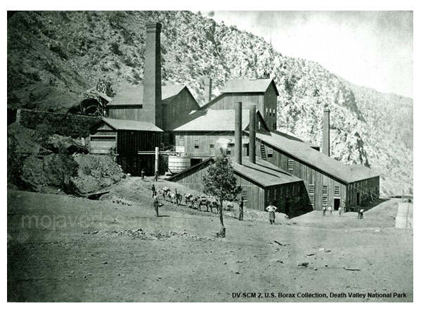
Mining History of Cushenbury Canyon
& its Impact on the Victor Valley
Mitsubishi Cement Corp.
The gold discovery in Holcomb Valley in 1860 brought a rush of fortune seekers to the Victor Valley including some foreign interests. The English family of Del Mar’s had a significant impact on Cushenbury Canyon. Holcomb Valley miners affected California history by participating in their own Civil War actions and may have left treasure in their wake.
World War II ended the golden era and Cushenbury Canyon but initiated another mineral rush. The postwar California population boom brought about the industrial minerals revolution fueled by the construction industry.
Kaiser Cement built a cement plant and Cushenbury Canyon as an indirect result of the decision by an American General during World War II. The facility was modernized in 1982 and Mitsubishi Cement Corp. purchased the plant 1988. Today Mitsubishi Cement Corporation Cushenbury Plant is one of the leading industries in the Victor Valley.
The industrial minerals boom has a direct impact on everyone’s lives here in the US. The industrial minerals mined in the Victor Valley fuel the economy in California. San Bernardino County provides largest source mineral commodities in the US. ” If it can’t be grown, it has to be mined!” the mining industry provides the “stuff” to make the “things” we need to continue our lifestyle.
The Mohahve Muse – Volume 4, Issue 3 – March 2001 – Mohahve Historical Society
Leo Lyman – President
Blond-haired, whiskered veteran prospector Richard C. Jacobs and partner Bob Stewart were grubstaked by W. L. Kennedy, a Kernville merchant. Most grubstakes failed, but these two men wandered over to Panamint Valley, then up the steep 6,000-foot climb of Surprise Canyon and found several types of silver ore exposed by erosion. They made four claims, formed Panamint Mining District, and elected Bob Stewart as recorder. Samples shown to Kennedy assayed from $125 to $3,000 per ton. By April 1873, there were 80 to 90 claims. The Panamint mining started fairly normally until the search for investors brought in wealthy and influential men: two Nevada U. S. Senators, John P. Jones and William M. Stewart, and ex-49er Trenor W. Park, a New York Wall Street investor, formerly a San Francisco lawyer and current director of Pacific Mail Steamship Company and president of the Panama Railroad that linked the two oceans. Experienced in mining and investing, these successful men encouraged others to rush for quick potential riches.
Panamint Fever had started.
Miners from 29 Palms, Ivanpah, Arizona, Nevada, and northern California came to Panamint Valley and made the horrid trip up Surprise Canyon to the Panamint Mountains on a road that is still more of a dry waterfall than a road. Miners found a small booming city with sounds of hammering, dragging, and building all over, and sounds on higher hills of dynamite exploding. Anybody who wanted to work had a job at $4 per day, board $7 per week—not bad wages for those days. In March 1874 there were over 700 men who already staked about 150 claims and were still prospecting to find that great silver lode like at Virginia City. Men rented a room or a space on the ground at “Hotel de Bum,” a huge tent. Most slept outside in blankets looking at the stars.
Wagons unloaded supplies at the bottom of Surprise Canyon and pack mules made it up the waterfall road, unloading their gear to tent stores, potential wooden and rock buildings, or to mines further up the hill. Jacobs hired Chinese laborers to cut down the steep grade over the Slate Range so his 10-stamp mill could be brought easily to Surprise Canyon. Owens Valley businessman Bart McGee sculptured a road up Surprise Canyon, thereby enabling wagons to use the waterfall road (where the grade was 500 feet to the mile). Seven stages a week arrived at the new city by the end of 1874.
Panamint City developed almost a mile of businesses for city amenities. According to mining historian Remi Nadeau, the city had a dozen saloons, a water company, six general stores, three bakeries and restaurants, a livery stable, boot shop, meat market, three barbershops, a newspaper called Panamint News, the Bank of Panamint, and another important town amenity: a log cabin brewery. When Martha Camp, a buxom lady from Nevada, brought her ladies to town, the night life in Panamint became livelier—it became a real city!
As usual, gamblers, criminals, gun fighters, and assuredly con-artists, climbed the hill to Panamint. The town soon needed a jail. As a result of a gambling dispute, a shootout in a saloon in which Kirby, a man from Pioche, shot Bill Norton in the leg and ran away when Norton fired back. The only official in town was town recorder W. C. Smith who discovered Kirby planned to waylay Norton. Smith got the drop on Kirby and suggested he leave town right away. The town later elected Smith Justice of the Peace. Jim Bruce and Edward Barstow, a night watchman of the town, had an argument in Camp’s house. Barstow, drinking too much, left the business but returned later after he sobered a bit and found Bruce in Martha’s bed and shot it out with Bruce. Barstow died. The town needed a cemetery.
A few years later the boom and fever ended. But the effects on the Mojave Desert was great. San Bernardino County appointed Oro Grande’s Aaron Lane as Superintendent of desert roads, namely the Road to Panamint from the Mojave River to the Inyo County line. Desert “Stations”—ranches like gas stations and motels today—were built and profited, especially with freight from San Bernardino over the Cajon Pass. For example, lumber mills in the San Bernardino Mountains supplied much of Panamint’s lumber. Berdoo merchants out- hustled L.A. businessmen. Despite Panamint’s decline in the late ’70s, mining increased in the Mojave Desert, especially with Barstow’s Waterman Mine and the wonderful Calico Hills discoveries. The Mojave Desert became settled by the end of the 1880s.
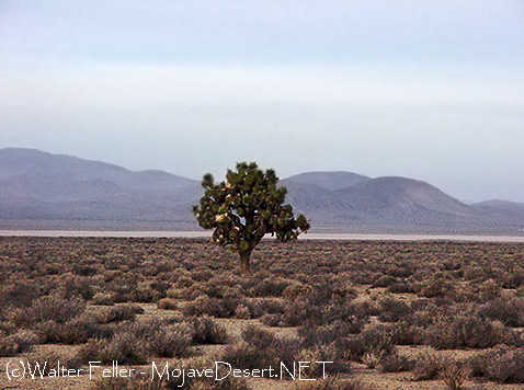
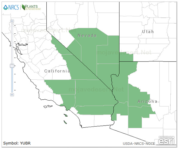
Mojave Desert Plants: Trees Joshua Tree
BOTANICAL AND ECOLOGICAL CHARACTERISTICS
SPECIES: Yucca Brevifolia (Joshua Tree)
GENERAL DISTRIBUTION
Joshua tree is one of the most characteristic plants of the Mojave Desert and extends southward to the Mojave-Sonoran Desert ecotone. This species grows from southern California, Mexico, and western Arizona eastward into southern Nevada and southwestern Utah.Var. brevifolia reaches its greatest abundance in the vicinity of Joshua Tree National Park; California. var. jaegeriana grows primarily in the eastern portion of the Mojave; var. herbertii is restricted to parts of the western Mojave Desert in California.The Joshua tree was named after the biblical leader, Joshua, as it reminded the Mormon pioneers of the hero raising out-stretched arms toward the heavens.William Lewis Manly referred to them as “cabbage trees” in his book (Death Valley in ’49), about the rescue of the Bennett and Arcane families from Death Valley.Pedro Fages, in his expedition along the edge of the Mojave searching for deserters from the Spanish Army, called the ungainly trees “palm” trees.

