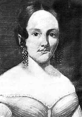
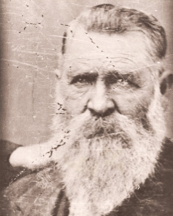
An 1866 massacre witness describes historic massacre
From a letter supplied by Harry L. Anderson to the Hesperia Gazette, as printed in the Victor Press, January 12, 1956:
San Bernardino, California March 31, 1866
Mrs. H. E. Parrish
Respected Madam:
According to your request, I will try to state on paper the circumstances of the death of your lamented husband. On the 22nd he came over to Mr. Dunlop’s ranch on the Mojave, 18 miles from this town across the mountains and joining reserve all went to gathering up cattle.
The foreman of Sunday the 25th myself and a Californian saw about 2 1/2 miles from the Rancho, the fresh trail of a party of the Indians – precise number then unknown.
Arriving at the house, while snatching about 2 o’clock a hasty meal, I made our discovery known, but no danger was apprehended by any of myself, and that was only to a slight extent.
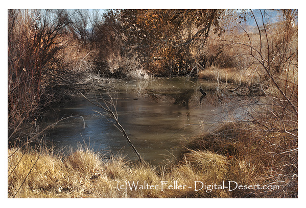
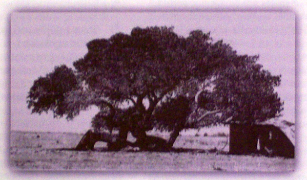
Cottonwood tree at the massacre site in Summit Valley
After dinner, Mr. Parrish, Nephi Bemis, and myself started afresh after stock, but as the mule I was riding was worn down, I was dispatched to take the place of Mr. Pratt Whiteside at the herd and to tell him to go with Mr. Parrish in my stead. That was the last I saw of those poor men until we found them cold in death, the victims of savage cruelty. While guarding the herd of cattle already collected being nearest the hills, the Californian already mentioned and on whose mind the Indian sign (steering as it was for the Valley we were in) had made an impression, came from the other side of the herd around to me and said he had heard eight loud rapid reports in the foothills at a point nearer to me than him, but the high winds that prevailed blue directly towards him but past the rest of us. the shots were considered by some of the men below me to have been shots fired at a vicious cow in the chemisal, which Mr. Parrish said that day he would shoot if bothered anymore.
After bloody moments talk, I returned to my post near the ill and immediately saw the horses of Mr. Parrish and Mr. Bemis running riderless from the hills. Sparing after them, the attention of the rest was attracted and we soon got Mr. Parrish’s horse with blood on his shoulder and on the saddle. No More was needed to tell the sad tale and I immediately hurried to acquaint Mr. Dunlop, was lying sick of the house, with the facts, and to get more arms and men to finish the red fiend’s if we met them in search of our friends.
Many causes, chiefly the brushy character of the place and its extent, combined to baffle our search and it was not until sundown that we found poor Bemis–lifeless– all circumstances around, indubitably proof of the work of the Chimchueva Indians, some 30 or 40 of whom by mistake and charity, almost criminal, had been allowed to stay around this town during the past winter and prepare for such hellish deeds as this.
… on the Sabbath look to the Mountain Peaks …
Further search that evening for the other missing men proved unavailing and though much fatigued, who can sleep? Two men to whom we all felt attached, shrouded in all uncertain fate, the veil of which morning could lift and reveal.
Possibly only wounded, yet helpless, leading, alas dying instant death preferable to the anguish of a night of such a state.
Quietly as possible the next morning we marched again on our mournful errand. After about a two-hour search we found poor Whiteside, surrounded by evidence of having fought and fully, as the ground around in the uncommon number of wounded (some 23 in all) knew sad evidence of a bravery that was all in vain.
Soon we found poor Edwin– hid in a clump of young oak, and covered in rubbish, except one foot, a portion of which uncovered, by its white appearance, drew our attention. He too had died fearlessly as was shown by this stone in his right hand, which as he had no pistol or other weapon with him, he had used for want of a better.
Mr. Bemis receiving a mortal wound by the passage of a large ball, cutting the jugular vein down through the lung died instantly, or nearly so. Mr. Parrish, I think and hope suffered not long.
The Indians carried off all of Whiteside’s riding rig, also the clothes of all three of their victims and Whiteside’s pistol. His horse they ate in the vicinity that night.
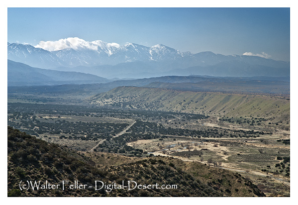
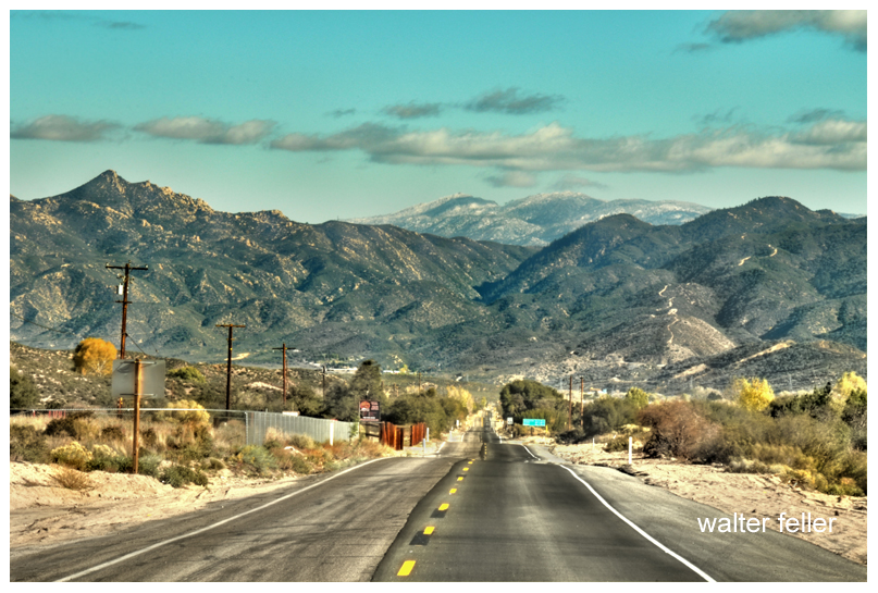
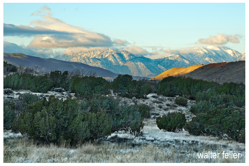
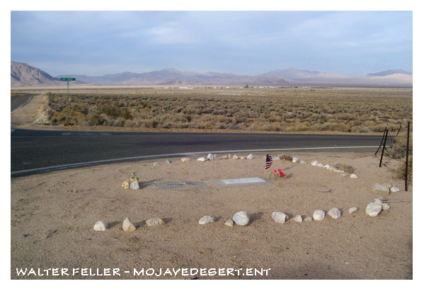
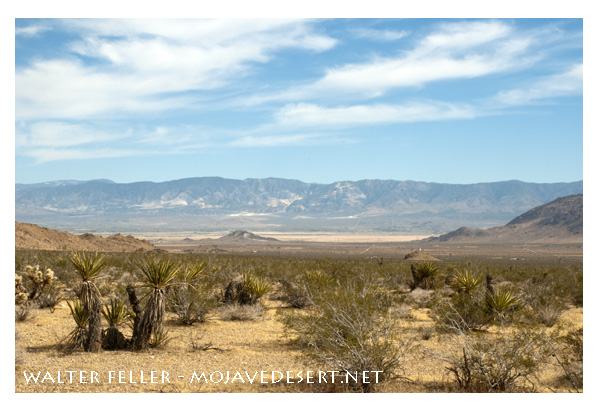
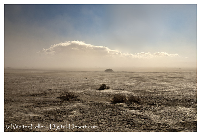
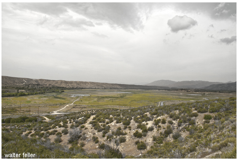
Summit Valley from Highway 173 Viewpoint
But I have already become tedious in this mournful story. As its object, however, is intended to spare you the frequent recital of your husband’s sad fate, a full relation of particular’s will enable you to escape the laceration of the feeling of a widowed wife and mother by the many who do not realize your affliction.
When I came over here three months ago, I brought four copies of Desert with me. Needless to say they have become rather dogeared as I have read them from cover to cover several times, and passed them around to my friends who have enjoyed them immensely.
Desert Magazine, Oct. 1942
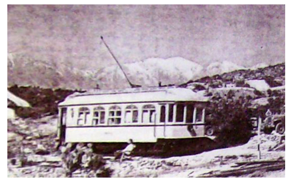
The last day I was in sunny Southern California (it rained all the time I was in Frisco waiting to embark), I made one last sojourn to our desert retreat—the summit of Cajon Pass. Few people know of this unique retreat, except those who pass by on the trains, and then all they see is a street-car tucked away on the side of a hill, 200 yards from the tracks.
The street-car is the former Los Angeles railway’s funeral car Descanso. A group of railfans, known as Railroad Boosters, became interested when it was known the car was to be scrapped, and decided something should be done about it. So far as we were able to tell the Descanso was the only funeral car in existence, and to delegate such an ornate car to the junk heap was not a very fitting end. The L. A. railway then told us that if we could find a place to put it we could have it as a sort of museum piece. After several months of scouting around, we decided on summit. On July 4, 1940, the Descanso was hauled up to summit by flatcar on the Santa Fe. Eight of us spent a very strenuous day unloading the car. It weighed 18 tons.
Chard Walker watching trains pass from the terrace beside the Decanso in 1954. From his book, “Railroading in the Pass”
Three weekends were spent in getting the car to its present position, by the tedious process of laying a section of track in front, pulling the car up with a truck by means of block and tackle, then picking up the section in the rear, placing it up front again, etc. Then began the process of scraping off the old paint, removing the seats, and taking out a few of the unnecessary controllers, etc.
Route 66, Cajon Pass
In the two years that have passed since its arrival at summit, the Descanso has gradually transformed from a dirty looking old streetcar, to that of a newly painted, well furnished cabin. From the exterior it still has the same general appearance of a streetcar as it still is on wheels on a section of rail, the trolley is still up, and still has the stained glass in the upper halves of the windows.
Quite a change has taken place on the interior though. Only two of the original seats are left in place with a folding table in between. A pot bellied stove, and a wheesy old phonograph well stocked with records, dominate the center of the car, while an icebox, a few chairs and another table and a small but complete kitchen take up the rest of the available space. Eventually we may put some folding bunks in one end, but due to material shortage, we content ourselves with sleeping on the floor in our sleeping bags.
We find it an ideal spot to go on a weekend, either as a home camp for a small hunting expedition, or for hiking up and down the railroad, the mountains, or just to lie around in the sun and watch the trains go by.
For anyone wishing to visit Summit, just go up Cajon Pass on U. S. 66 to Camp Cajon, and turn east (right if leaving from San Bernardino). This road is known as the back road to Arrowhead. It’s about five miles from 66 to Summit which can’t be missed as the road leaves the twisting mountain road onto the level Summit valley road. Off to the left about a quarter of a mile is the railroad station of Summit with its scattering of section houses and the post office. The Descanso is directly behind the station.
Summit
In closing I wish to extend a cordial welcome to anyone visiting Summit, and wish I could be there and meet them personally. Until the war ends I’ve got to be content to visit the desert via Desert Magazine.
From a handwritten copy on file at the Victor Valley College Library – Author Unknown
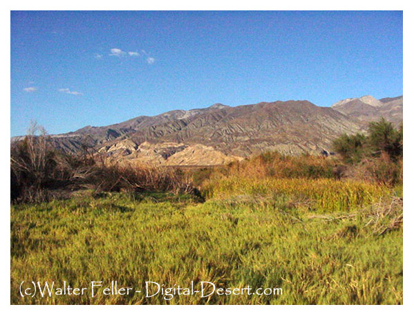
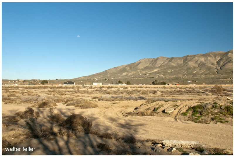
More than 30 years ago the green grass and running water of Summit Valley attracted the white people who later became the first settlers here. Mr. Houghton took up a Government claim, the plan now included in the Las Flores Ranch. Cattle were driven in from Arizona to be fattened and then driven to market San Bernardino. This entire valley was given over as a cattle range. The grassy slopes afforded splendid pasture lands and Mr. Houghton was well pleased.
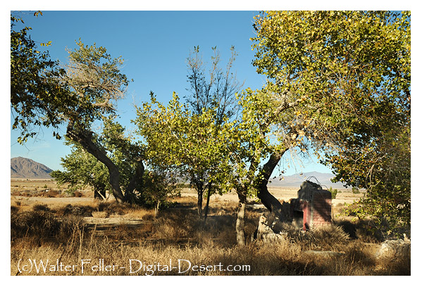
Las Flores Ranch
Still there were some hardships to be endured in this new country. Many wild animals roam the hills, mountain lions stole the young cattle in the small brown bears came in droves to find what they could to eat. At times Mrs. Houghton and the children were obliged to climb into the attic of their house to be safe from the bears. After robbing the hives of honey, these bears would go back into the nearby hills and mountains, disturbing nothing more.
The Indian inhabitants of the valley were unfriendly and while Mr. Houghton owned the ranch three men were killed by the Indians in ambush.
About 30 years later Mr. Bircham bought the ranch and continued to run it as a cattle ranch. Each year more cattle were put on the range. A great many horses were brought into the valley too. These proved to be a temptation for horse thieves, who made a regular practice of stealing horses and selling them in other places. Finally, the two neighboring canyons received the names of Big and Little Horse Thief Canyon. At length, the horse thieves were driven out, but the smaller of the two canyons still retains the name of Horse Thief Canyon, the larger known as Summit Valley.
Little Horse Thief Canyon
All traveling was done with horses until a railroad called the Southern California was built. This road went through in the year 1883 and 1884 and followed the old Santa Fe Railway Company. The highest point along the road was called Summit and a station was established there at once. It was located about 6 miles west of the Bircham Ranch and became their shipping point for supplies.
At the time when it was believed that oil was hidden in the land all through Southern California, the Summit Valley was located for oil, but the government authority on oil found that it was not present in this land.
The Arrowhead Reservoir and Power Company wish to buy up lands in the mountains in order to gain the water rights attached. Mr. Bircham’s holdings of 1200 acres were bought and various other lands nearby.
The ranch was now owned by a company, it was no longer the Bircham Ranch or the Houghton Ranch, so another name was to be found. The name decided upon was “Las Flores,” meaning The Flowers, and a very fitting name it was as one looks towards Mount Baldy and its companions, the fields in the summertime seem yellow with flowers.
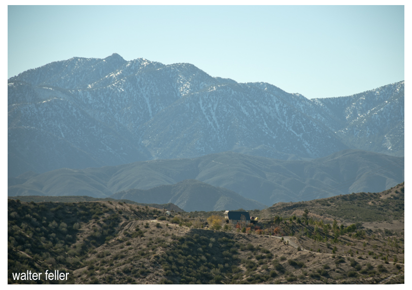
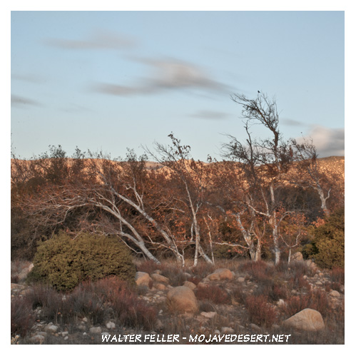
Summit Valley with San Gabriel Mountains
The ranch was still conducted as a cattle ranch but it was not long before the range, on which the cattle had roamed, was disputed by new settlers. In 1912, Mr. Searle and his family filed on government land for a home. Later in the same year, Mr. Blumberg’s family moved in, then Mr. Watson, and so it has been ever since that time.
There were enough children in 1913 to form a new school district and open the school. Within the next year, a post office and store were opened. Fertile land with quantities of water upon it brought about these changes in Summit Valley.
At the present time, an option is held on the holdings of the Arrowhead Reservoir and Power Company, to be closed within the next eight months. This land is to be sold with the water rights, for the purpose of irrigating 100,000 acres of land in the Victor Valley changing it into a great garden.
San Bernardino looks upon this great undertaking with interest. It will mean much to that city since this section in San Bernardino is connected by an automobile and railroad.
Scrapbook of Memories of Summit Valley & Cedar Springs from before the Tin Lizzy until after Silverwood Lake – collected by Isabelle Rue Rentfro
From the diary of Sarah J. Rousseau , 1864:
Regarding traveling with Indians across the Mojave
Sunday, November 6 … The lava that has been thrown out looks like cinders. The mountains, some of them have a grand appearance, some a red color while others have a white appearance. Some of them I think must be 400 feet high. This canyon is called Diamond. at the mouth it takes us into Santa Clara Valley which we traveled through and down a pretty dangerous hill to Santa Clara Creek where we got food and shelter for horses. Here came a number of Paiute Indians. they are a tribe that is very fond of horse flesh to eat, and will steal anything they can lay their hands on. We have came today 20 miles.
Santa Clara/Virgin River divide
Monday, November 7. Started from camp late this morning. It is a cold, windy time. The Dr. had to prescribe and deal out medicine for a little child that belonged to a Mormon Bishop. About breakfast time a number of Indians came to the camp and we gave some their breakfast. When we started four of them started with us, three of them on foot and one on horseback. They are miserable looking creatures. Some of them almost entirely destitute of clothing. I believe it is their intention to go to the Muddy with us. as for me I would rather have their room than their company. I am afraid of them. We have crossed the Santa Clara 15 times this morning, and have now camped. It is cold and windy, a real disagreeable time.
Sarah Jane Rousseau
Tuesday, November 8. A cold blustering morning, the wind blowing hard all night. Started from our camp rather late with an escort of from 10 to 15 Paiute Indians. Last night two of them stayed with us as prisoners. Our guide, Mr. Hatten, said it would not do to let them leave camp after dark, as they might get some other Indians, come back and do us some mischief. We started from camp with five, which increased to 15 of them. We crossed the Santa Clara this morning 14 times in after going 12 miles made a dry camp at Camp Springs, having filled our kegs the last crossing place. the Indian chief told the guide we must all give them something for traveling through their country, to renumerate them for using water and grass. We all gave them some flour. We intend to let them have the care of our horses tonight, they are going to take the cattle as well. The Chief with four others we kept as prisoners till morning when they bring back the stock. Then they will be free.
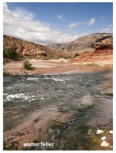
Virgin River
Wednesday, November 9. A pretty warm morning. Started from camp about sunup. The Indians brought back the stock safely back. Left camp with our escort, traveled over some rough roads till noon. This afternoon the road’s much better. Passed over the summit between the Clara and Virgin, went 5 miles in the canyon and camped. Some grass for the stock but no water.
Wagon Master Nicholas Earp
Thursday, November 10. A cool but pleasant morning. Last night the Indians were prisoners again. They left the stock go on to the mountains to feed. We fed five among us. All are willing to do so but Mr. Earp. He swears and cuts up about it, although he derives the same benefit as the rest of us. I fear he may cause us some trouble when we get to the Muddy. … “
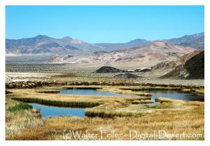
In the early days, natural springs in what now is Lucerne Valley provided good camping grounds for Indians on their way into the San Bernardino Mountains together pinon nuts. The Indians resented white pioneers settling in the territory and committed some violent acts against them. Instead of discouraging the settlers, caused them to marshal forces and attack the Indians who were of the Paiute, Chemehuevi and Serrano tribes. in February 1867 a decisive battle at chimney rock caused the Indians to retreat and leave the territory to the white pioneers. (Chimney Rock is at the north edge of Rabbit Dry Lake. A quite complete story of the Chimney Rock Massacre is available at the Lucerne Valley branch of the county library.)
Rabbit Springs
In July, 1873 five men, L. D. Wilson, John E. McFee, W. S. Manning, W. P. Morrison and (?) Holmes located the springs known as Rabbit Springs. They laid claim to the Springs and 100 surrounding acres 20 acres each according to a recorded document.
In 1884 Peter Davidson operated a way station at Rabbit Springs. Travelers could get fresh water, exchange news, rest and sleep over. “Uncle Pete” died in 1906. His grave is at the corner of Kendall Road and Rabbit Springs Road.
Pete Davidson’s grave
In 1886, W. W. Brown brought his family to this valley, which was without a name at the time. Brown had the water rights at the Box S. (The Box S ranch is where the drainage ditch now crosses Highway 18.) The family stayed at “Uncle Pete’s” until an abandoned house could be moved on to the Box S property.
Box S Ranch, Lucerne Valley, CA.
In 1896 Al Swarthout acquired the Box S, intending to raise cattle. There was plenty of water but not much forage. Swarthout and a friend found a place about 15 miles to the east, that had even more water and lots of forage. after one year he gave up on the Box S and moved to Old Woman Springs Ranch. (It is said the Indians used to leave their old people camped here while the young ones went into the mountains to forage for pinon nuts.)
In 1897 James Goulding came to the Box S with his wife Anna and two small children, Mamie and George. Three more children, Minnie, Jim, and Nelly were born in Lucerne Valley. “Dad” Goulding proved the fertility of our soil with his apple orchard, vegetable garden and alfalfa fields. He also raised cows, horses and other animals. He dug a well which proved to be artesian.
Alfalfa field in Lucerne Valley
In 1905 a friend suggested to Goulding that this valley should have a name. Because of his success in growing alfalfa (also known as lucerne) he christened this place Lucerne Valley.
Dad Goulding is generally acknowledged as the founder of Lucerne Valley. In 1907 Goulding legally established Lucerne Valley School District. Hanna Brown, a cousin whose family lived in near by Oro Grande, came to live with the Gouldings so the requirement of six students could be met. The school building was a former cook shack on wheels, 8′ x 18′. With wheels removed and one end of the inside painted black for a blackboard, the school opened on September 9, 1907 on the Box S Ranch.
In the meantime, more families were settling all over Lucerne Valley, and Goulding donated property in 1910 for a new school where the Baptist Church now stands.
In 1912, people in the east end of the valley thought the school should be closer to them, so they formed a new school district to be known as Midway. Still another school district, Rodman, was formed in North Valley, in 1915.
View of Lucerne Valley from North Valley
Then, in 1916, windstorms and fire destroyed both Lucerne Valley and Midway schools. all the students attended Rodman school until the other two were rebuilt, which took a couple of years because of wartime problems. In 1920 Rodman School District lapsed and joined with Midway, which by then was in its present form.
In 1941 was certain school was condemned as unsafe and all students went to Midway. The building and grounds were purchased by the Community Church ( not the present Community Church) and used until 1952. It was then that the building burned to the ground during a terrific windstorm at night. Construction was begun in 1952 on the new Lucerne Valley School at its present site.
Lucerne Valley’s library began in 1912 with 140 books in the front room of the Box S ranch house. Most of them were for school use, but some could be borrowed by local residents. In 1915 the library was at Midway school. In 1916 storm damage some of the books in the library was moved to the Boom Ranch on Wilshire, northeast of Midway. After being closed during World War I, both Midway school and the library reopened in September 1918. The library continued as a combination school-public library until March 1928, when it became a community branch of the county library system.
The Lucerne school building was condemned for school use, so the library moved in. When the church bought the building, the library was moved into a smaller room there. Later it was moved into a small, narrow trailer behind the present China House. Ethel Windschanz Clapton, the librarian, said that looking out the little, porthole shaped windows during a strong wind made her feel like she was on a sinking ship.
The library moved begin to the building which was occupied by the Sheriff’s office. Mrs. Vera Russell was one of the librarians at that location. The library then moved into the building generously provided by John Russell (Vera’s son) at very low rent. From there moved into its beautiful new permanent home for which ground was broken March 17, 1988.
Lucerne Valley post office was established in 1912 at the ranch of John and Rosa Koehly, who came here in 1909. It was on the southeast corner of Rabbit Springs Road and Post Office road. (Have you wondered about the road name?) Rosa Koehly was postmistress. Some days only eight cents worth of stamps were canceled, so that was the postmistress’s salary.
In 1935, the post office moved to a one-room building on the highway, west of the Box S Ranch, with Ed Smith as postmaster. (Ed Smith was also a licensed electrician and Scoutmaster of Troop 71, Lucerne Valley’s first Boy Scout troop, from 1928 to 1933. Some of those scouts are still living here, among them Harold Reed and Dick Owen.)
Downtown Lucerne Valley, CA.
Later the post office moved again, to shared the Clark building with John Hutson’s and Irving Seeberg’s hardware store. ( The Clark building is now occupied by the China House.) Flora and Clark was postmistress. The post office moved again to “the triangle” on Verdugo Road at Oracle Road ( now renamed Oracel by the county street sign makers.) Early postmasters there were Vern Ely and Ray Bonin. The post office is now in its permanent location on Highland Avenue south of Highway 18.
A volunteer fire department was first organized during World War II, along with fire watchers, skywatchers, plane watchers, civil defense, etc. In the early 50s a fire house was built with donated material (cinderblock) and volunteer labor. it was located about where Shell gas station/ Halleck’s Market is now. They had a unique system. People would phone Dick’s Center Store to report fires. Dick Grobaty would then press a button on his wall, which was wired to the siren on top of the firehouse. That was how the volunteer firemen were summoned. The building was torn down after a short period and the present County fire district was formed in 1962-63. At that time it still operated with volunteer firemen and one paid chief.
Lucerne dry lake
Some of the descendants of the early settlers still live here. John Russell’s father, William Russell in 1911 had filed on land called Lucerne Springs which brought son John here to live in 1949. He has been building houses and commercial buildings ever since. Also in 1911, Theodore P. Owen filed on 640 acres to miles north of Midway school his son, Dick, has come and gone but has lived here steadily since 1950.
View from shack at Gobar Ranch
Athene Siewerda was another very early settler. She was the first to have pistachio trees here. Her son, Joe Sherman, lives here now Orlando (Jake) and Mildred Jacobs came here in 1928. There were about 250 people in Lucerne Valley then. At the Jacobs home in North Valley, Jake bake 60 or 70 loaves of bread, sweet rolls, cakes and pies on Saturdays and sold them through Max Lewis’s grocery store. Later he rented from Goulding the building now housing the Rosebud Gift Shop and established Homestead Bakery and Grocery. At that same time Mildred ran the Jackrabbit Café, located on land now occupied by Halleck’s Market. In 1936 Jake in Mildred moved their house onto land they bought from the Southern Pacific Railroad, the southeast corner of Barstow Road and old woman Springs Road. The Jacobs donated 10 acres of their land which is now Pioneer Park. As Jake’s health failed, Mildred gave up the café and ran the Homestead Bakery. She, along with other citizens, still found time to clear implant for the park, along with other citizens. The Jacobs had two daughters, Shirley Ann and Millie Lou. Millie Lou lives in Maryland and Shirley Ann (Mrs. Bob Fuller) lives in Apple Valley.
Ethel Owen came in 1946 as Ethel Johnston and built Lucerne Valley’s first beauty shop. Ethel and Dick Owen were married in 1950 in the old community church and their daughter, Lilli Ann, born in 1952, was dedicated there shortly before it burned down.
The foregoing was prepared by Ethel Owen on March 25, 1988 from material obtained from Lucerne Valley library and from her own memory. She apologizes for any inaccuracy of dates of facts and/or omissions. There is much to be added that could not be contained in these pages.
From: History of Lucerne Valley by Ethel V. Owen
Mohahve V – Scrapbooks of History – 1991, 2016
Mojave Historical Society
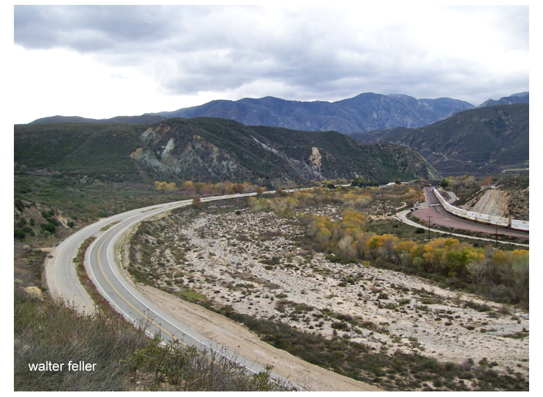
Long years ago, Cajon Pass became the gateway into the desert interior of California. The word “cajon” means box in Spanish and was fittingly applied to the area that has served as a pass through the rugged country between the desert and the valley lands west.
San Gabriel Mountains
Cajon is not a pass through a mountain. It is a pass between two mountain ranges — San Bernardino and San Gabriel Mountains which overlap. It was through or around this pass that the early settlers had to travel. Either way, it was a difficult trek of uncharted roads and highways. for that time and era, it would seem that settlers might want to stay on the eastern side of the ranges and settle down rather than try to get horses and wagons over the steep and hazardous mountains.
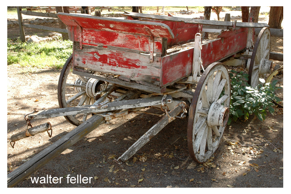
Horse-drawn wagon
Many years in the past the Pass became the “gateway into the wilds of the interior.” What an interior it is! coming or going from the coastal area of Southern California that great mass of mountain peaks and sheer drops from the high precipices are startling and they culminate into the one of the most rugged as well as one of the most beautiful in the West.
The fact that this pass was at the western end of the Old Spanish Trail made it an important spot in the emigrant days.
Old road over the divide near the summit of the Cajon.
Camp Cajon, 3 miles above the Blue Cut was once an Indian village. Here the pass becomes wider, a fan-shaped site bounded by the divide on the upper edge. the divide is the desert rim. Eroding water cause the formation of the two major divisions which are known as East and West Cajon.
The divide at the top of the pass
Long before the Cajon Pass was an accepted one and used freely, the wilderness of the Cajon region was a hideout for renegade Indians and white men. Cattle and horse stealing became so common that the people of the lower valleys had to take to battle. Once in the interior of the vast mountain area beyond Cajon it was almost impossible to recover the animals.
Brown’s toll road through the Pass.
One of the historic roads that benefited the desert for many years was built by John Brown Sr. , an early desert settler. This was the toll road that he built to connect the desert territory with the outside areas. The toll road served the public for 20 years. It was built from the Cajon Pass to the old Verde Ranch adjacent to Victorville.
from: The Cajon Pass — Yesterday by Myra McGinnis 1968 Mohahve IV – Scrapbooks of History Mohahve Historical Society
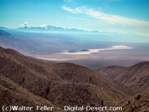
An exceedingly interesting region of California is known as the Mojave Desert. The region is traversed for a distance of 100 miles by the Mojave River, from which it gets its name. The area includes Inyo and San Bernardino counties, and eastern Kern, northeastern Los Angeles, and northern and eastern Riverside counties. Death Valley lies to the north. There is no definite line of demarcation separating the desert to the south from the similarly desert region lying to the east of Owens Lake, and including Death Valley and the Amargosa Desert.
Location and Extent
49 Palms Oasis
Mojave Desert is separated from the Colorado Desert, which lies to the south, by a series of southeasterly trending mountain ranges. The San Bernardino Range extends southeast from Cajon Pass more than 100 miles, and the Cottonwood, Chuckawalla, and Chocolate ranges extend to the Colorado River. The San Gabriel Range separates the desert from the Los Angeles basin on the south. The Desert is bounded on the west by the southern Sierra Nevada Range and the Tehachapi Mountains. It extends north to the latitude of Mount Whitney, and east to the State line and into Nevada. On the south and east it extends to the Colorado River, which forms the boundary of the State of Arizona. It is a part of the Great Basin region of North America. This vast desert region embraces more than 30,000 square miles, an area almost as large as that of the State of Maine. It is a vast arid region destitute of any drainage streams that reach the ocean. The water supply, such as there is, is obtained from springs and wells. The region is much broken by mountains and hills, often rough and rocky.
San Bernardino Mountain Range
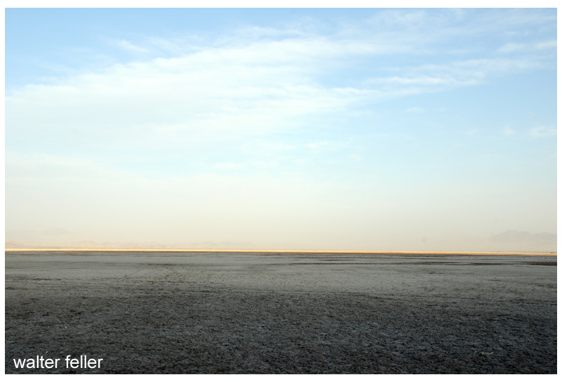
Soda Lake
The topography is typical of the western deserts, consisting of bare mountain ranges and isolated knobs separated by nearly flat arid belts of varying width. The mountains rise abruptly from the desert, in places almost precipitously. The appearance of the mountains suggests that they are the summits of more massive ranges whose lower slopes are submerged beneath unconsolidated desert deposits. It is thought the irregularly distributed ranges and peaks of the southeastern Mojave Desert are ridges and peaks of a former vast mountain system comparable to the Sierra Nevada, which has been lowered by subsidence of the region, and by erosion, which has resulted in tremendous valley-filling. Alluvial fans occur at the mouths of gullies, and these unite into broad aprons which slope gently toward the centers of the basins. In the center is generally a flat nearly level area known as a playa, dry lake, or alkali flat. Such flats may be covered with water during parts of the year, and they are commonly covered with a white crust of alkali or salt. Toward the west the surface of the desert is generally level. Toward the east it is marked by isolated knobs and short ranges of mountains having no system of arrangement, and separated by broad stretches of alluvial deposits in the form of fans and playas. To the north, in Inyo County, mountain ranges are prominent and are arranged in a somewhat definite north-south system.
A striking feature of the landscape in many parts of the desert is the presence of flat areas ranging in extent from a few acres to many square miles, which are entirely devoid of vegetation. This intensely arid region, lying between the Sierra Nevada Range and the Colorado River, is in extreme contrast with the region lying west and south of the San Gabriel Range, in Los Angeles and Orange counties. However, wherever sufficient water can be obtained in the desert ranches have been developed, and their bright green is a welcome sight to the traveler weary of the interminable desert waste and the dark, forbidding mountains. Many of the valleys or basins that separate the mountain ranges are absolutely desert, totally destitute of water, and treeless for distances representing many days’ journey, gray sage brush alone giving life to the landscape. In the larger basins the land slopes toward a central depression into which an intermittent stream may convey water during rainy seasons, forming playas or mud plains. Some larger valleys have permanent lakes, and these are saline or alkaline. The shores of such lakes are devoid of all forms of life except salt-loving plants.
Arid Conditions Due to Mountains
The great Sierra Nevada mountain system is the factor which determines the climate of the desert region. The moisture-laden winds from the Pacific Ocean shed their moisture upon the high mountains, and the lands to the east are left literally “high and dry.”
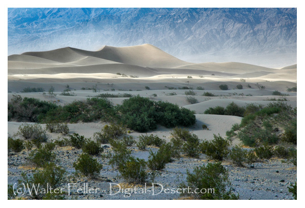
Death Valley Region
Mesquite Flats Sand Dunes
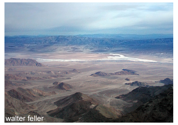
Saratoga Springs, Death Valley
An outstanding feature of this great desert region is Death Valley. This remarkable sink of the earth’s crust is located about 50 miles east of the Sierra Nevada Range, 6 to 35 miles west of the Nevada State line. This depression of the earth’s crust has a length of more than 80 miles, and in width ranges from two to eight miles. It is 60 to 70 miles east of Mount Whitney, the highest point in the United States. The lowest point in Death Valley, according to the U. S. Geological Survey, is 296 feet below sea level. This point is three miles east of Bennett’s well, about 30 miles in a direct line west from Death Valley Junction on the Tonopah & Tidewater railroad, and about the same distance northwest from Saratoga Springs, following the road down the valley. The rainfall does not exceed two to three inches annually, with no precipitation at all some years. Mountain ranges on either side of the Valley rise nearly to the line of perpetual snow. Funeral Mountains and Black Mountains, of the Amargosa Range, rise on the eastern side of the Valley to altitudes of 5,000 to 7,000 feet, while on the west the Panamint Range reaches a height of more than 10,000 feet.
High Temperature and Low Humidity
The most marked feature of the desert climate is the unusually high summer temperature and the low relative humidity. Temperatures in this arid region rise to 125 to 130 during the
summer months, and seldom during these months fall below 70. The humidity is low so that conditions are more endurable than would be the case under such conditions of heat in regions
of higher humidity. The highest officially recorded temperature of any place in the world is that of 134 at Greenland ranch in Death Valley. This is said to be the dryest and hottest place in the United States. A low temperature of 15 F. has been recorded at Greenland ranch. The difference between the highest and lowest recorded temperatures however is not as great in this desert region as in some parts of the United States. In the Dakotas and Montana differences of 150 have been recorded. In the desert region sunstroke is almost unknown, due to the low humidity. Because of the dryness of the air the moisture given off by the body quickly evaporates producing a cooling effect. Travelers in the desert should be provided with a sufficient water supply. One should never go far from a source of water, in winter or summer, without enough water to last until another supply can be reached. Travelers should carry at least two to four gallons of water per person for each 24 hours.
Three Rivers that Do Not Reach the Sea
Three rivers enter upon the vast domain of the Mojave Desert from high mountain ranges, but none delivers any water to the ocean. These are the Mojave, the Owens, and the Amargosa rivers. The rivers originate on high mountain ranges, fed by melting snows that gather upon the high ranges and peaks, and by rains that are condensed from the wind-borne clouds at high altitudes. These all start as rapidly flowing turbulent torrents. They continue for many miles as intermittent streams, but ultimately disappear by evaporation after passing into the porous soils and sands, detritus from the erosion of the mountain slopes. Other streams that flow as mountain torrents to the great desert plain sink at once into the sands and are “lost” as streams.
West Fork – Mojave River
The Mojave is a typical desert river. It rises in the high San Bernardino Mountains, in southwestern San Bernardino County. The waters gather in the mountains and form a perennial stream. Within a short distance it emerges upon the desert plain, and much of the water sinks into the porous alluvium. The course of the stream is in a northerly direction to Barstow, where it turns to the northeast. In times of flood the water may be carried 40 miles east of Daggett to Soda Lake. Water sometimes flows into Silver Lake, another playa a mile or two to the north of Soda Lake. During many years no water from the river reaches the playas, but in years of extreme flood the water may be several feet deep in the playas and remain for
several months. The water that reaches the playas disappears by evaporation. The river ends in these depressions. The region of these playas has been called “the Sink of the Mojave.”
Aguereberry Point
Owens River is the principal stream occupying Owens Valley. Owens Valley is a long narrow depression lying between the Inyo Range on the east and the Sierra Nevada Range on the
west. Between these two ranges Owens River flows south to its end in the saline sea called Owens Lake. The valley is thought to have originated as an enclosed and undrained basin
through profound faulting of the crust of the earth. The origin of the valley is thought to be similar to that of Death Valley and most of the enclosed undrained areas of the Great Basin. This great structural valley extends from the great bend of Owens River north of Bishop southeast to the southern end of Owens Lake, a distance of 100 miles. It is wholly in Inyo County.
Owens River rises in the Sierra Nevada Mountains near San Joaquin Pass and descends the rugged eastern slopes as a turbulent stream. The river emerges from a deep canyon cut in a
table-land of volcanic lava north of Bishop and enters upon the level floor of Owens Valley, whence it pursues a meandering course southeastward to Owens Lake. It is one of the few
perennial streams of the Great Basin. Owens Lake, into which the river empties, lies in an undrained depression at the south end of the valley, from which the water disappears by evaporation. The waters of the lake constitute a dense brine containing common salt, sodium carbonate, potassium sulphate, borax, and other salts. The recovery of sodium carbonate is an important chemical industry established near Keeler. About 40 miles above the point where the river enters Owens Lake, near Big Pine, the pure mountain water is diverted through the Los
Angeles Aqueduct and conveyed to that city.
Fresh Water of Owens River forms Saline Lake
The waters that gather from the mountains to form Owens River are “pure” as surface waters go. Even the pure clear sparkling waters of mountain streams contain some mineral matter dissolved from the rocks. By long continued evaporation from Owens Lake the contained mineral matter becomes concentrated so that the waters of Owens Lake are strongly saline. The river waters diverted by the Los Angeles Aqueduct are essentially pure. The salts now contained in solution in Owens Lake were undoubtedly derived by the slow accumulation and concentration of the river waters entering the basin.
In the geologic past Owens Lake overflowed and supplied water to a series of lakes in Indian Wells, Searles, and Panamint valleys. On the bottoms of these lakes deposits occurred consisting principally of clay, with minor amounts of sand and almost no gravel. In most places they include some chemically deposited salts. In a few places these salts are of economic value.
Amargosa River rises in a group of springs about 17 miles northeast of Bullfrog, Nevada. It is dry the greater part of the time throughout much of its course. It is about 140 miles long. Its course is east of south through Franklin Dry Lake, thence south through a canyon about 10 miles long to the southern end of Death Valley. Here it turns westward to Saratoga Springs, where it flows northwestward to the sink of Death Valley. The northern end of Death Valley lies nearly due west of the head of the river, so that the depression which is occupied by the Amargosa River as a whole is in the form of a long and narrow U. Ordinarily there is water at only a few places along the course of the channel, but when a cloud-burst occurs it may become a raging torrent for a few hours. For many years the river has not been known to carry enough water to flow on
the surface as far as the lowest depression of Death Valley. The waters of the Amargosa are briny along its lower course. Where it spreads out into the large playa at Resting Springs
Dry Lake it leaves fields of salt as well as of borax and niter. Hot springs discharge into it at a number of places.
Coyote Dry Lake
Playas or “dry lakes” are widely distributed throughout the desert region. It is somewhat paradoxical to speak of a “dry” lake. Often flat dry surfaces of saline mud are ripple-marked
from the wind before the water disappeared. Seen from a distance such “dry lakes” may deceive the traveler, the dry flat bottom having the appearance of a water surface. The term
“dry lake” seems therefore not entirely inappropriate. In the desert region the rainfall is very light, but sporadic. Mountain torrents tear down the slopes with great erosional force after
sudden rains. Broad basins between mountain ranges are generally filled, often to depths of hundreds of feet, with alluvial wash from the surrounding mountains. In the lowest parts of such basins water may gather after storms, and large areas may be covered by shallow sheets of water for a time. Soon, however, the waters disappear by evaporation, and the lowest part of the basin becomes a salt-encrusted flat pan, or dry lake.
Soda Lake
Salt Deposits Accumulate on Lake Bottoms
Scores of dry lakes or playas range in size from a few acres to lake beds several miles across. One of the largest and most important playas is Searles Lake, which has an area of about 60
square miles. This playa is important because of the extensive deposit of crystalline salt in the central part of the broad basin. Solid salt beds embrace an area of 11 or 12 square miles, and
extend to depths of 60 to 100 feet. It is unique in that the salt is nearly pure crystalline mineral (sodium chloride), and not interbedded or mixed with dust or clay, as is the case in many playas where saline deposits occur. This deposit of salt is free from earth sediments, it is thought, because of settling basins in Indian Wells and Salt valleys through which waters passed from Owens Lake during Quaternary (Pleistocene) time when waters from Owens Valley evaporated here. Death Valley contains an immense salt field. It extends fully 30 miles south from the old borax works. It varies in width from two to four miles. Borax was once manufactured two or three miles north of the point where Furnace Creek emerges from the hills of the west slope of Black Mountains (Amargosa Range) .
World’s tallest thermometer (134′), Baker, CA.
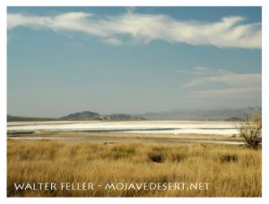
Soda Lake, southwest of Baker, is one of the largest playas in the desert, having an area of approximately 60 square miles.It is here that Mojave River ceases as a stream. To the north, and separated by a low divide, is the playa of Silver Lake. The great structural trough in which these playas lie is continuous with the trough of Death Valley, and it is thought that waters from the Mojave Valley in Pleistocene time moved northward and joined the Amargosa, and then flowed into Death Valley. Strand lines or beaches high above the valley bottom show that a large body of water once filled Death Valley.
Poppy Reserve – Antelope Valley
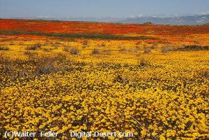
Antelope Valley, lying north and east of the San Gabriel Mountains and south and east of the Tehachapi Mountains, is a closed basin, having no outlet for its surface waters. The rainfall is so slight and the evaporation is so great that not enough water reaches the bottom of the valley to form a lake. Several playas occur, the largest of which are Rosamond, Rogers, and Buckhorn. It is thought that at one time (Pleistocene) all three formed a single large playa. The rainfall in Antelope Valley ranges from 3 or 4 inches to 1 inches annually, varying widely different years. The greater part of the annual precipitation occurs during the winter months of January, February, and March. The summer rainfall is so slight and so irregular that it is not of much value to agriculture. Irrigation is therefore important. The greatest development of agriculture in the Mojave Desert region has been in the Antelope Valley, where it is claimed 10,000 to 1 5,000 acres are under cultivation. Water for irrigation is obtained from mountain streams.
Geology of the Region Very Complex
Panamint Valley
The geology of Mojave Desert and the Death Valley region is very complicated. The region embraces the southwestern portion of the Great Basin plateau. In the north, in the Death
Valley region, mountain ranges trend in somewhat parallel lines in a generally north-northwest and south-southeast direction. Faults in many cases mark the boundaries of the ranges and valleys. Death Valley, lying west of the Amargosa Range (Funeral and Black mountains) , is a sunken basin in which the floor dips to the east and north toward the great fault scarp which marks the mountain side. The structure of Panamint Valley, lying west of the Panamint Range, suggests that it is a down-faulted block with the greatest depression on the east side of the valley. What is thought to be a fault-plane appears in the abrupt wall of the mountain range on the east. Hot springs at the north end of the valley, and the springs near Ballarat, indicate a zone of faulting along this edge of the valley. The parallel arrangement of the mountains and valleys is generally believed to be due to a series of parallel faults, the valleys representing large blocks that have been lowered relatively with respect to the blocks that have been elevated or tilted to form the mountains.
Post Office Spring (Ballarat)
1.7 billion year old Crystalline Basement Rock
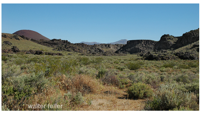
Very ancient rocks, granites probably of Archaean age, occur in some of the mountains. Whatever rocks may have been deposited over them have been removed by erosion. During the early part of the Paleozoic era (Cambrian period) some parts of the region were submerged beneath the sea. This is shown by beds of limestone and other sea sediments in which fossils have been found. If the sea covered the entire region during Cambrian time the formations that were laid down have been removed by erosion from most of the region. During the long Ordovician, Silurian, and Devonian periods it is thought that the region was land, as no fossils of these ages have been found. Small patches of rocks containing fossils of Carboniferous age have been found, showing that the sea covered parts of the region at least during Cambrian time. Throughout the Mesozoic era the region is thought to have been land, and was greatly eroded. In the early part of the Tertiary period volcanic outbursts occurred and great lava flows spread over large areas. Throughout the long time of the Tertiary and Quaternary periods erosion was actively going on. A large part of the Tertiary lava flows and other rocks were worn away until now only remnants of once continuous formations are left. Disturbance of the rocks by faulting completed the work of deformation and resulted in the present relief. Geological conditions have resulted in the accumulation of mineral deposits. These constitute the greatest resource of the region, and have been the incentive for the early exploration and much of the later industrial development. Of metallic ores those of gold, silver, copper, and iron have been principally mined, but lead, zinc, quicksilver, and many rarer metals also have been found. Non-metallic minerals, as salt, potash, niter, borax, and gypsum occur in many places, some in commercially important quantities. Much literature relating to the minerals and geologic features of the region is available. (See Appendix.)
Lava flow at Fossil Falls
From: ADVENTURES IN SCENERY A Popular Reader of California Geology BY DANIEL E. WILLARD, A.M. Fellow American Geographic Society, Fellow A.A.A.S.
John W Searles‘ bottle full of his own teeth was a reminder of one of the most remarkable encounters with the grizzly bear ever related in San Bernardino County.
While hunting deer in March, 1870, Searles, a miner and hunter, came to the brink of a precipice, and saw in the valley that spread out before him two fully grown bears and a cub. Although he had only for good cartridges, he had contrived to make a few extra makeshift loads for his gun from a misfit box of ammunition which had been sent to him by mistake.
Searles entered the valley and road for hours over rough, snow-covered country, looking for the bears, before he finally came upon one sleeping under a clump of brush. He fired a shot and the bear rolled over from the impact of the bullet. two more shots finished them. Then, nearby, Searles heard the sound of another bear.
NPS photo
Wet with snow, Searles worked his way cautiously through the brush, only to be surprised when a second massive bear reared up before him, its nose scarcely 10 feet away. the thick brush made it impossible to step back and aim. Searles jammed another bullet in his rifle and pulled the trigger, but there was no report. It was one of the off size cartridges.
Before he could try a third time, the grizzly charged, mouth agape. Searles tried to jam his rifle down the bear’s throat. The animal flung the weapon aside and threw Searles to the ground. With one foot on the hunter’s breast, the grizzly bit off a large section of Searles’ lower jaw, then gashed his throat and laid bare his shoulder bone. Searles managed to roll over, his coat doubled up on his back in a hump. The bear bit the coat once and left.
Despite his mangled condition, Searles recovered his horse and, with the freezing cold sealing his ruptured veins, road 4 miles to a camp, where he received first aid before proceeding on a three-day trip to a Los Angeles hospital. Doctors gave him no chance to live, but three weeks after they had patched, sewed and pieced him together, the hunter was up and able to get around.
For years afterward, Searles kept in his desk a 2 ounce bottle containing 21 pieces of broken bone and teeth, torn from his lower jaw by the grizzly. And, in the corner of his office, his old Spencer rifle stood, its lock showing clearly the dents of the grizzly’s vicious teeth.
from : Pioneer tales of San Bernardino County
WPA Writers Program – 1940
Point of Van Dusen Road crossing Mojave River, Hesperia, CA. Looking toward Apple Valley and Marianas Mountains
The Van Dusen Road branched off from John Brown’s toll road heading east along the ridge after reaching the Cajon Summit. The road found its way down the Antelope Valley Wash to the Mojave River. At this point the trail crossed through the soft sand and ascended through a small canyon at the base of the mountains, finding its way east then southeast to Rock Springs. From the springs the road then branched to the left heading east to Holcomb Valley becoming what is now known as the Coxey Truck Trail.
Looking west up Antelope Valley Wash from the Mojave River toward Cajon Summit
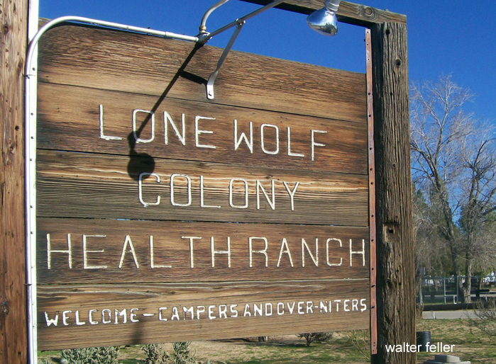
I enjoy hearing the stories about places from people that have absolutely no idea about what the story of that place is. For example; West of Dead Man’s Point a mile or so, on Bear Valley Road, there is a quiet little place with the sign out front that says “Lone Wolf Health Colony.” years and years I would ask folks about the place and for years and years I was told it was a “nudist camp.” It is not. I am a little bit disappointed. …
Not a nudist camp!
Following his a brief history of the Lone Wolf Colony originally written in 1966 by Paul and Sylvia Hopping.
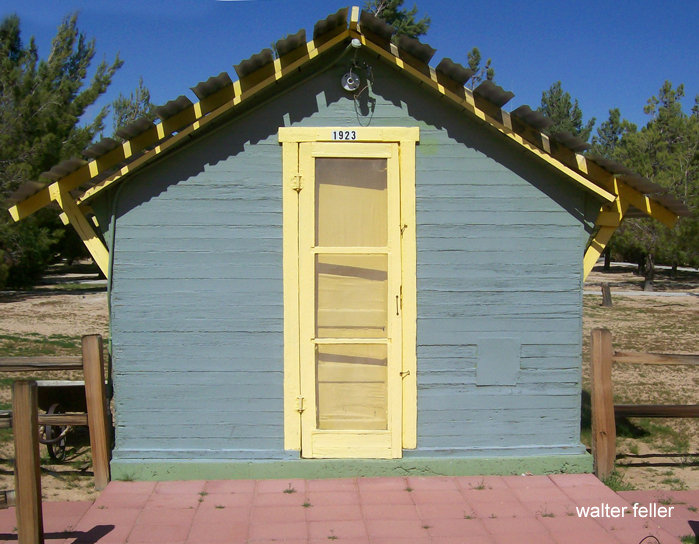
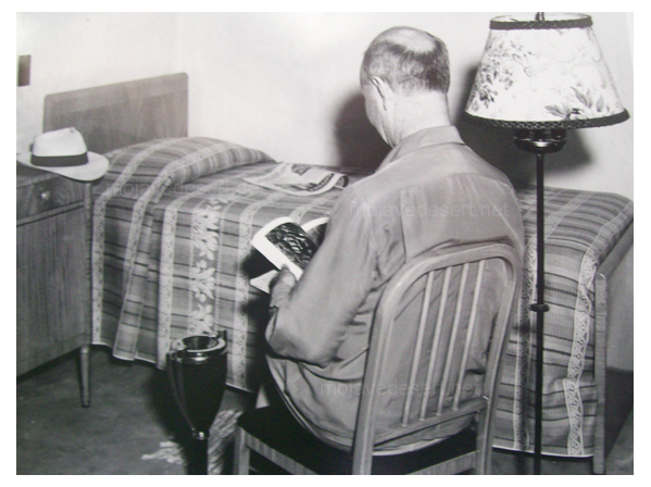
Many years ago, in June 1922, a Mr. Sam Caldwell and a few other employees of the old Home Telephone Company, including Eddy Schock and a Mr. Crowfoot, realizing the beneficial health factors of the desert, started a movement to help World War I male employee veterans who were suffering from poison gas and the veterans who were unable to obtain the hospitalization and other care they required. Mr. Caldwell at that time owned 160 acres of land at Dry Lake flats, in back of Mt. Baldy. He donated this land for a health resort on condition that he should be one of the patients. It was Mr. Caldwell who gave the health resort its name of Lone Wolf Colony. He passed away in 1934.
Original first cabin built in 1923
The first small building was begun in March, 1923. Carpenters donated their time to assemble the materials which are brought to the desert in April. The health resort operated only 30 days on Mr. Caldwell’s property when it was found that the water supply was inadequate. The colony then move to a spot 5 miles west of Victorville. The colony at that time had two cottages and five tent houses. A water shortage again developed and at the end of the third year the colony moved to a site on Bear Valley Road near the railroad. It was there only a short time when it moved to its present 20 acre site on February 22, 1926.
A well drilled on this property and abundant water was found. The telephone company provided trucks and equipment and 250 employees donated their time. And one day the buildings, cabins, fences, pump for reservoir, pole line for electricity and telephone were installed, which was considered a very fine undertaking.
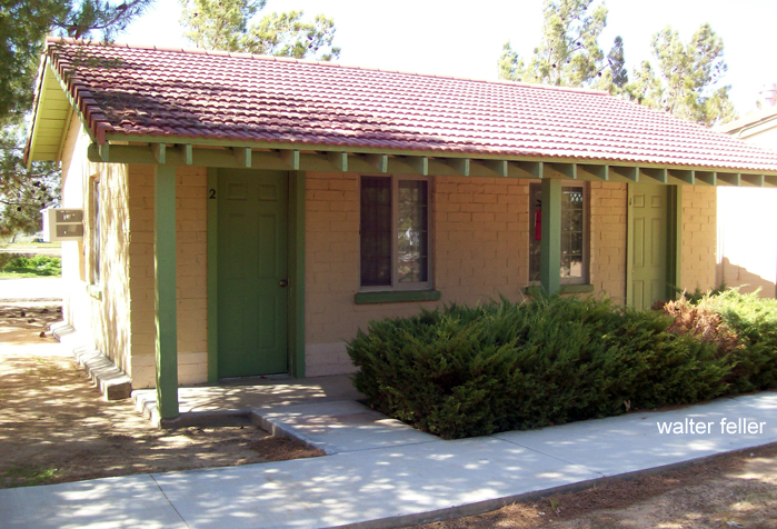
Duplex buildings built in 1950
Funds to build the health ranch, which was incorporated February 7, 1924, were raised through various channels and company support. At the end of the 18th year the colony had in use and administration building and 10 small cabins. In 1950 there were five modern duplex concrete cabins. In 1958 a very large, fine, modern administration building, including a large lounge, dining room, stainless steel equipped kitchen and caretakers living quarters was completed in the colony had its first Thanksgiving dinner in the new building of that year.
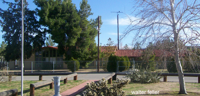
Administration building built in 1958
Chickens and cattle are raised on the grounds that the Colony which provide meat for the guests. With abundant water, alfalfa is also raised which feeds the cattle and helps to hold down the dust and provide a green ground cover. The Ranch contains all types of farm equipment and tools. Water is piped to all corners of the property and there are restrooms and bathhouses at the camping area. Work parties are organized to help with the work around the Colony.
Boy Scout troops are welcome to use the south end of the property for camp outs but the colony superintendent must be contacted to set the date and time for such event. At least one scoutmaster of each troop must be a telephone man.
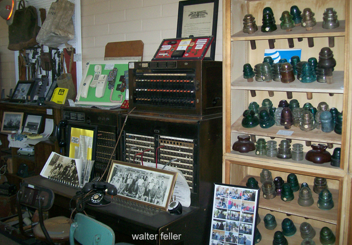
Telephone museum
The present colony is located on a 20 acre site about halfway between Central Road and Dead Man’s point on Bear Valley Road, in section 2 in Apple Valley. It is owned by the male employees of the Pacific Telephone and Telegraph Company.
The facility is open to male employees both presently employed and retired. There is no charge to employees of Pacific Telephone Company and Western Electric Company, Southern Area (West Coast Division), as the Colony is operated on contributions. All applicants, both active or retired, must make application and have a doctor’s recommendation before they can be admitted to the Colony. They are allowed to stay as long as the doctors think the desert climate is aiding their health. At this time there are average of six employees per day recuperating under the care of the genial host and hostess, Virgil and Goldie Long.
In 1963, air-conditioning and wall-to-wall carpeting were put in all the cabinets. At present plans are being worked on for a recreation hall, heated pool for therapy and an enclosed solarium.
Enjoying an evening of sitting in a chair.
Many of the old-timers are no longer here today the sum of the early founders were Eddy Schock, who helped Mr. Caldwell with the building of the original colony, Charles Rogers, who helped move the buildings and cottages from the first place and Mr. Crowfoot, now in his 90s, who is now living in Lancaster with his daughter. Mr. Schock is an active member of the Board of Directors of Lone Wolf Colony. Truly the desert is helpful and beneficial as is quoted from the Lone Wolf Colony bylaws as follows: “Where the curative power of the sun’s rays and the climatic condition are unsurpassed for the improvement of general health.”
The end.
The Mojave Historical Society expresses appreciation to Mr. Eddy Schock, the Board of Directors of Lone Wolf Colony and to Mr. and Mrs. Virgil Long further help in obtaining this history of Lone Wolf Colony.
from: The History of Lone Wolf Colony – by Paul and Sylvia Hopping Mohahve III – Scrapbooks of History (c)1966, 2016 Mohahve Historical Society
As you whiz down the freeway in a well protected automobile, have you ever wondered what life was like in the good old days as the hardy pioneer planned the trip 50 miles into the desert with wagon and a team of horses?
Excerpts from ‘Water Supply Paper Number 224’ published in 1909 by the US Department of Interior states, “A party leaving a supply station to go 100 miles or more into an uninhabited part of the desert must take along everything needed, even to the most minute detail.”
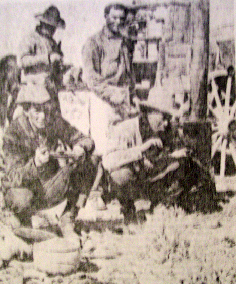
Cowpokes eating a hearty breakfast on the trail.
” This means if the trip is to last for two weeks enough hay and grain for each animal and enough provisions to last each man that length of time must be taken.
” For four horses, drawing a wagon that carries for persons and their bedding, provisions, and tools, another team of four horses must also be taken to all sufficient hay and grain to feed the eight horses for two weeks.
” There are but few places in the desert, away from the railroads, where grain or hay of any kind can be procured. As the teams are rarely able to travel faster than a walk, heavy horses that are good walkers should be selected. The tires should be as wide as can be procured. Desirable widths of tires for freight wagons are 6 to 9 inches; for light wagons 3 inches.”
The average Victor Valley pioneer took a week every six months to travel by horse and wagon to San Bernardino, to do his shopping and come back home. Leaving the desert and spending the first night in Cajon Pass at one of the campsites close to the junction of State Highway 138 or Interstate Highway 15 further on down at Cozy Dell Campgrounds. it was another day’s journey to San Bernardino, and after doing shopping and visiting for a couple of days, it was a two-day journey back to the desert Homestead. Now with our sleek automobiles, we whisk down to San Bernardino and 45 minutes, sometimes grumbling because it takes so long.
Cozy Dell, Cajon Pass – 1938
Drinking java from an old tin can was a way of life and not a song in the past century. Living in the open and eating cowboy beans were part of traveling through the desert before the advent of the auto. The trails of yesterday became our freeways of today. Our present freeway route from Victorville to Barstow parallels the one the freighters to quit their mule trains to sell supplies to the minors and Calico in the 1880s. Instead of having a well-built bridge to span the Mojave as we do today, they forded the river even when it was high.
from: Mohahve IV – Scrapbooks of History (c)1984, 2016
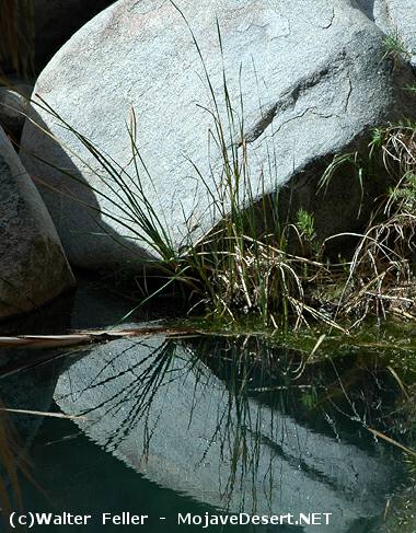
The day was hot. There were only five of us who showed up for the trip. We met at Carl Cambridge’s Museum on Bear Valley Road in Apple Valley in about 9:30 AM and left via Deep Creek Road to Rock Springs Road and across the river to Lake Arrowhead Road and then via Summit Valley Road to Miller Canyon and Lake Gregory Road to Cedar Springs.
Because of the heat, this was to be more of the picnic been a field trip. We had chosen Cedar Springs because of its location in the big binds and the stream which ran nearby the campground. The site is located on the East Fork of the West Fork of the Mojave River in T2N, R3W, Sec. 6, San Bernardino County.
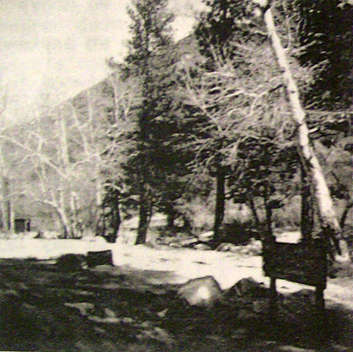
Cedar Springs Campground
When we arrived, we found the stream bed entirely dry, and the picnic table which we chose was sitting in the middle of the dry wash. while we enjoyed our picnic lunch, the Martins talk to the early days when they brought their children and grandchildren and camp by this dream which was at that time a swift moving and cool, sparkling little creek. We then tried to imagine what it would be like in a few years when the entire area will be underwater. Already, many of the homes had been removed in preparation for the time when the dam will be billed at the forks of the river, to hold back the waters of the Feather River when they are delivered to the Southland to water the thirsty reservoirs at the Mojave River Valley and the great metropolitan area.
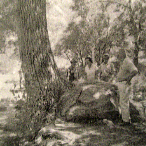
The tree that grew into a rock. 1964.
As we sat and talked, we began to look around, and we realize that the well-known landmarks would soon disappear. Nearby, was a huge old pine tree with roots in twined around a very large boulder which had once been at the stream’s edge. Close by was a beautiful old sycamore with a satellite branch, just right for small and not so small boys to climb. downstream was a grand old tree that guarded the dry stream bed and looked as if it had been watching over the course of the stream for many years. We took some pictures and left.
Our road led us through Summit Valley to a road which took us up to Cleghorn Canyon in search of a way to reach a monument which was said to be located at a point where Fr. Francisco Garces (1776) and Jedediah Smith (1826) had crossed over from the desert to the San Bernardino Valley.
We failed to locate a way to reach the monument, but we did find a vast area that had been almost denuded by a destructive forest fire which had swept the area only a few weeks earlier. in the midst of this, we also observed a “guzzler” which still contained water, and the ground around was covered with thousands of little tracks which was evidence of the birds and small animals that had somehow survived the ravages of the flames. Joel Martin mentioned that he had, at one time, worked on a project to help install these guzzlers which were designed to help preserve the wildlife of the county and state.
As we return down the canyon to the Summit Valley Rd., Carl Cambridge suddenly called a stop, and there beside the road, where the road had crossed a dry wash, lay a large metate. There was also the ruins of an old cabin and signs of placer mining, which told a silent story of a culture and a generation earlier than ours.
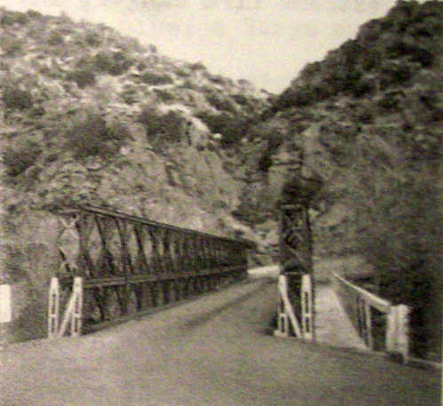
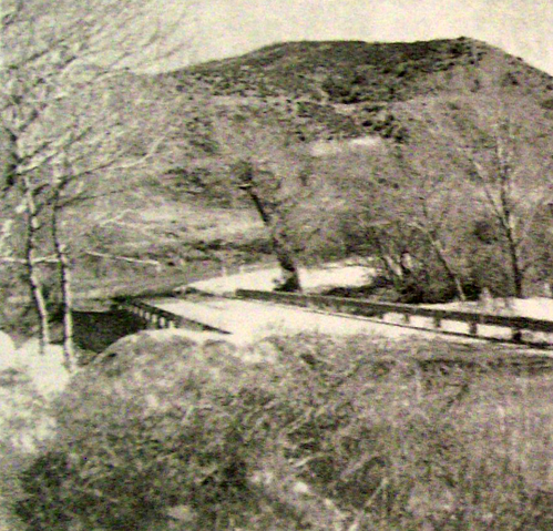
Bridge at fork to Cedar Springs
We retraced our road to where the Summit Valley Road and the road to Cedar Springs meet, to make a survey of his site of an old Indian camp which Carl had told us had been discovered there several years ago, but all that we found were a few fire stones and the dark and soil, evidence that the Indians had once been there.
Although no great historical facts were uncovered, the day proved to be very interesting, and in time it may be looked back upon as being of historic interest because of what was but is no longer.
As we thought about the things that were taking place in the area, we realize that, just as the last remnants of other eras were disappearing, the day would soon come when the landmarks that are so familiar in the area today will soon be gone. So we took more pictures for remembrance.
from: A Field Trip Report by Gladys Steorts Mohahve III – Scrapbooks of History (c)1966 Mohahve Historical Society
 Soon we found poor Edwin– hid in a clump of young oak, and covered in rubbish, except one foot, a portion of which uncovered, by its white appearance, drew our attention. He too had died fearlessly as was shown by this stone in his right hand, which as he had no pistol or other weapon with him, he had used for want of a better.