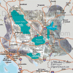
An exceedingly interesting region of California is known as the Mojave Desert. The region is traversed for a distance of 100 miles by the Mojave River, from which it gets its name. The area includes Inyo and San Bernardino counties, and eastern Kern, northeastern Los Angeles, and northern and eastern Riverside counties. Death Valley lies to the north. There is no definite line of demarcation separating the desert to the south from the similarly desert region lying to the east of Owens Lake, and including Death Valley and the Amargosa Desert.
Location and Extent
Mojave Desert is separated from the Colorado Desert, which lies to the south, by a series of southeasterly trending mountain ranges. The San Bernardino Range extends southeast from Cajon Pass more than 100 miles, and the Cottonwood, Chuckawalla, and Chocolate ranges extend to the Colorado River. The San Gabriel Range separates the desert from the Los Angeles basin on the south. The Desert is bounded on the west by the southern Sierra Nevada Range and the Tehachapi Mountains. It extends north to the latitude of Mount Whitney, and east to the State line and into Nevada. On the south and east it extends to the Colorado River, which forms the boundary of the State of Arizona. It is a part of the Great Basin region of North America. This vast desert region embraces more than 30,000 square miles, an area almost as large as that of the State of Maine. It is a vast arid region destitute of any drainage streams that reach the ocean. The water supply, such as there is, is obtained from springs and wells. The region is much broken by mountains and hills, often rough and rocky.
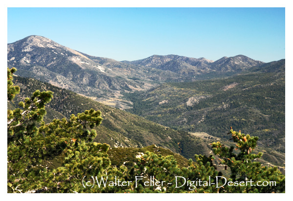
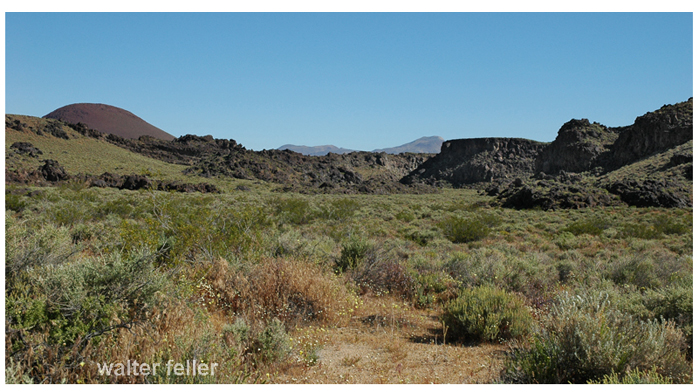
The topography is typical of the western deserts, consisting of bare mountain ranges and isolated knobs separated by nearly flat arid belts of varying width. The mountains rise abruptly from the desert, in places almost precipitously. The appearance of the mountains suggests that they are the summits of more massive ranges whose lower slopes are submerged beneath unconsolidated desert deposits. It is thought the irregularly distributed ranges and peaks of the southeastern Mojave Desert are ridges and peaks of a former vast mountain system comparable to the Sierra Nevada, which has been lowered by subsidence of the region, and by erosion, which has resulted in tremendous valley-filling. Alluvial fans occur at the mouths of gullies, and these unite into broad aprons which slope gently toward the centers of the basins. In the center is generally a flat nearly level area known as a playa, dry lake, or alkali flat. Such flats may be covered with water during parts of the year, and they are commonly covered with a white crust of alkali or salt. Toward the west the surface of the desert is generally level. Toward the east it is marked by isolated knobs and short ranges of mountains having no system of arrangement, and separated by broad stretches of alluvial deposits in the form of fans and playas. To the north, in Inyo County, mountain ranges are prominent and are arranged in a somewhat definite north-south system.
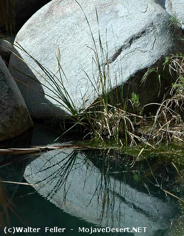
A striking feature of the landscape in many parts of the desert is the presence of flat areas ranging in extent from a few acres to many square miles, which are entirely devoid of vegetation. This intensely arid region, lying between the Sierra Nevada Range and the Colorado River, is in extreme contrast with the region lying west and south of the San Gabriel Range, in Los Angeles and Orange counties. However, wherever sufficient water can be obtained in the desert ranches have been developed, and their bright green is a welcome sight to the traveler weary of the interminable desert waste and the dark, forbidding mountains. Many of the valleys or basins that separate the mountain ranges are absolutely desert, totally destitute of water, and treeless for distances representing many days’ journey, gray sage brush alone giving life to the landscape. In the larger basins the land slopes toward a central depression into which an intermittent stream may convey water during rainy seasons, forming playas or mud plains. Some larger valleys have permanent lakes, and these are saline or alkaline. The shores of such lakes are devoid of all forms of life except salt-loving plants.
Arid Conditions Due to Mountains
The great Sierra Nevada mountain system is the factor which determines the climate of the desert region. The moisture-laden winds from the Pacific Ocean shed their moisture upon the high mountains, and the lands to the east are left literally “high and dry.”
Death Valley Region
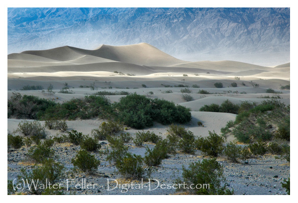
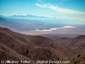
An outstanding feature of this great desert region is Death Valley. This remarkable sink of the earth’s crust is located about 50 miles east of the Sierra Nevada Range, 6 to 35 miles west of the Nevada State line. This depression of the earth’s crust has a length of more than 80 miles, and in width ranges from two to eight miles. It is 60 to 70 miles east of Mount Whitney, the highest point in the United States. The lowest point in Death Valley, according to the U. S. Geological Survey, is 296 feet below sea level. This point is three miles east of Bennett’s well, about 30 miles in a direct line west from Death Valley Junction on the Tonopah & Tidewater railroad, and about the same distance northwest from Saratoga Springs, following the road down the valley. The rainfall does not exceed two to three inches annually, with no precipitation at all some years. Mountain ranges on either side of the Valley rise nearly to the line of perpetual snow. Funeral Mountains and Black Mountains, of the Amargosa Range, rise on the eastern side of the Valley to altitudes of 5,000 to 7,000 feet, while on the west the Panamint Range reaches a height of more than 10,000 feet.
High Temperature and Low Humidity
The most marked feature of the desert climate is the unusually high summer temperature and the low relative humidity. Temperatures in this arid region rise to 125 to 130 during the
summer months, and seldom during these months fall below 70. The humidity is low so that conditions are more endurable than would be the case under such conditions of heat in regions
of higher humidity. The highest officially recorded temperature of any place in the world is that of 134 at Greenland ranch in Death Valley. This is said to be the dryest and hottest place in the United States. A low temperature of 15 F. has been recorded at Greenland ranch. The difference between the highest and lowest recorded temperatures however is not as great in this desert region as in some parts of the United States. In the Dakotas and Montana differences of 150 have been recorded. In the desert region sunstroke is almost unknown, due to the low humidity. Because of the dryness of the air the moisture given off by the body quickly evaporates producing a cooling effect. Travelers in the desert should be provided with a sufficient water supply. One should never go far from a source of water, in winter or summer, without enough water to last until another supply can be reached. Travelers should carry at least two to four gallons of water per person for each 24 hours.
Three Rivers that Do Not Reach the Sea
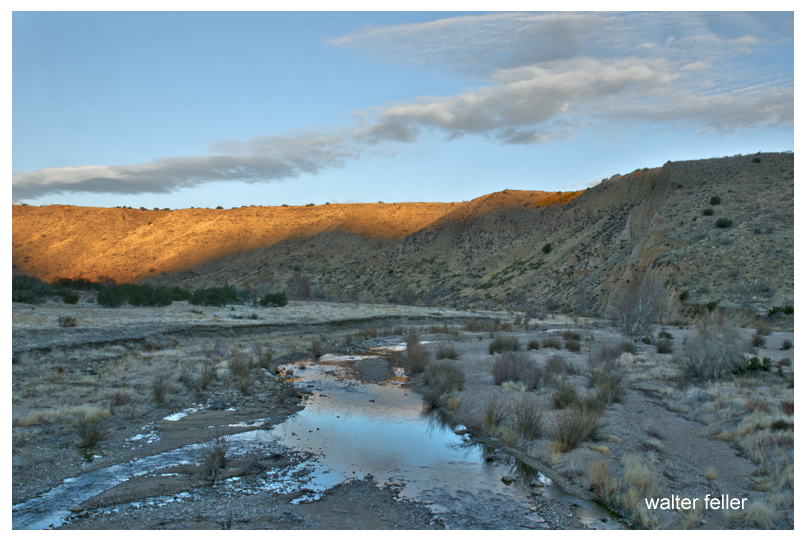
Three rivers enter upon the vast domain of the Mojave Desert from high mountain ranges, but none delivers any water to the ocean. These are the Mojave, the Owens, and the Amargosa rivers. The rivers originate on high mountain ranges, fed by melting snows that gather upon the high ranges and peaks, and by rains that are condensed from the wind-borne clouds at high altitudes. These all start as rapidly flowing turbulent torrents. They continue for many miles as intermittent streams, but ultimately disappear by evaporation after passing into the porous soils and sands, detritus from the erosion of the mountain slopes. Other streams that flow as mountain torrents to the great desert plain sink at once into the sands and are “lost” as streams.
The Mojave is a typical desert river. It rises in the high San Bernardino Mountains, in southwestern San Bernardino County. The waters gather in the mountains and form a perennial stream. Within a short distance it emerges upon the desert plain, and much of the water sinks into the porous alluvium. The course of the stream is in a northerly direction to Barstow, where it turns to the northeast. In times of flood the water may be carried 40 miles east of Daggett to Soda Lake. Water sometimes flows into Silver Lake, another playa a mile or two to the north of Soda Lake. During many years no water from the river reaches the playas, but in years of extreme flood the water may be several feet deep in the playas and remain for
several months. The water that reaches the playas disappears by evaporation. The river ends in these depressions. The region of these playas has been called “the Sink of the Mojave.”
Owens River is the principal stream occupying Owens Valley. Owens Valley is a long narrow depression lying between the Inyo Range on the east and the Sierra Nevada Range on the
west. Between these two ranges Owens River flows south to its end in the saline sea called Owens Lake. The valley is thought to have originated as an enclosed and undrained basin
through profound faulting of the crust of the earth. The origin of the valley is thought to be similar to that of Death Valley and most of the enclosed undrained areas of the Great Basin. This great structural valley extends from the great bend of Owens River north of Bishop southeast to the southern end of Owens Lake, a distance of 100 miles. It is wholly in Inyo County.
Owens River rises in the Sierra Nevada Mountains near San Joaquin Pass and descends the rugged eastern slopes as a turbulent stream. The river emerges from a deep canyon cut in a
table-land of volcanic lava north of Bishop and enters upon the level floor of Owens Valley, whence it pursues a meandering course southeastward to Owens Lake. It is one of the few
perennial streams of the Great Basin. Owens Lake, into which the river empties, lies in an undrained depression at the south end of the valley, from which the water disappears by evaporation. The waters of the lake constitute a dense brine containing common salt, sodium carbonate, potassium sulphate, borax, and other salts. The recovery of sodium carbonate is an important chemical industry established near Keeler. About 40 miles above the point where the river enters Owens Lake, near Big Pine, the pure mountain water is diverted through the Los
Angeles Aqueduct and conveyed to that city.
Fresh Water of Owens River forms Saline Lake
The waters that gather from the mountains to form Owens River are “pure” as surface waters go. Even the pure clear sparkling waters of mountain streams contain some mineral matter dissolved from the rocks. By long continued evaporation from Owens Lake the contained mineral matter becomes concentrated so that the waters of Owens Lake are strongly saline. The river waters diverted by the Los Angeles Aqueduct are essentially pure. The salts now contained in solution in Owens Lake were undoubtedly derived by the slow accumulation and concentration of the river waters entering the basin.
In the geologic past Owens Lake overflowed and supplied water to a series of lakes in Indian Wells, Searles, and Panamint valleys. On the bottoms of these lakes deposits occurred consisting principally of clay, with minor amounts of sand and almost no gravel. In most places they include some chemically deposited salts. In a few places these salts are of economic value.
Amargosa River rises in a group of springs about 17 miles northeast of Bullfrog, Nevada. It is dry the greater part of the time throughout much of its course. It is about 140 miles long. Its course is east of south through Franklin Dry Lake, thence south through a canyon about 10 miles long to the southern end of Death Valley. Here it turns westward to Saratoga Springs, where it flows northwestward to the sink of Death Valley. The northern end of Death Valley lies nearly due west of the head of the river, so that the depression which is occupied by the Amargosa River as a whole is in the form of a long and narrow U. Ordinarily there is water at only a few places along the course of the channel, but when a cloud-burst occurs it may become a raging torrent for a few hours. For many years the river has not been known to carry enough water to flow on
the surface as far as the lowest depression of Death Valley. The waters of the Amargosa are briny along its lower course. Where it spreads out into the large playa at Resting Springs
Dry Lake it leaves fields of salt as well as of borax and niter. Hot springs discharge into it at a number of places.
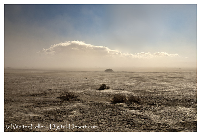
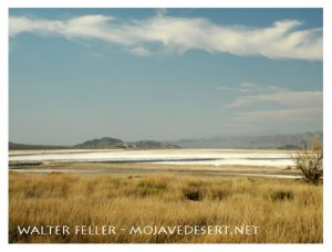
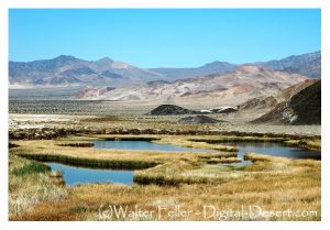
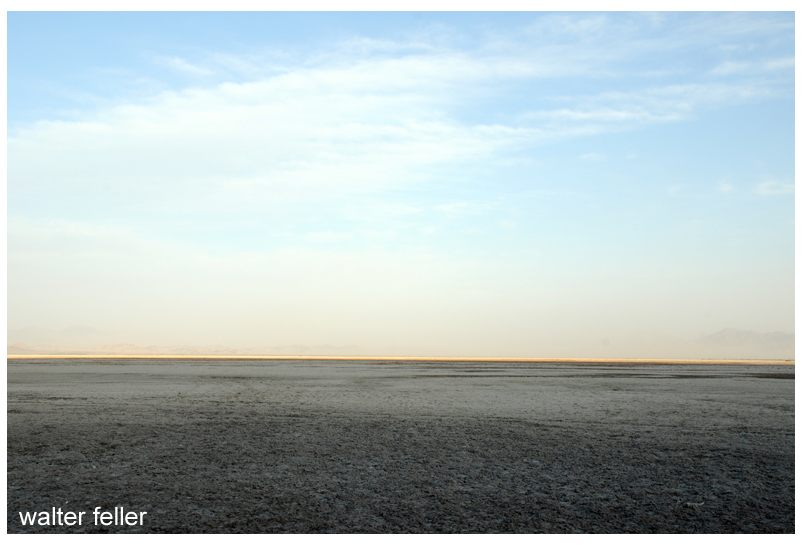
Playas or “dry lakes” are widely distributed throughout the desert region. It is somewhat paradoxical to speak of a “dry” lake. Often flat dry surfaces of saline mud are ripple-marked
from the wind before the water disappeared. Seen from a distance such “dry lakes” may deceive the traveler, the dry flat bottom having the appearance of a water surface. The term
“dry lake” seems therefore not entirely inappropriate. In the desert region the rainfall is very light, but sporadic. Mountain torrents tear down the slopes with great erosional force after
sudden rains. Broad basins between mountain ranges are generally filled, often to depths of hundreds of feet, with alluvial wash from the surrounding mountains. In the lowest parts of such basins water may gather after storms, and large areas may be covered by shallow sheets of water for a time. Soon, however, the waters disappear by evaporation, and the lowest part of the basin becomes a salt-encrusted flat pan, or dry lake.
Salt Deposits Accumulate on Lake Bottoms
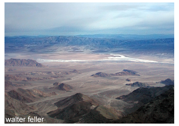
Scores of dry lakes or playas range in size from a few acres to lake beds several miles across. One of the largest and most important playas is Searles Lake, which has an area of about 60
square miles. This playa is important because of the extensive deposit of crystalline salt in the central part of the broad basin. Solid salt beds embrace an area of 11 or 12 square miles, and
extend to depths of 60 to 100 feet. It is unique in that the salt is nearly pure crystalline mineral (sodium chloride), and not interbedded or mixed with dust or clay, as is the case in many playas where saline deposits occur. This deposit of salt is free from earth sediments, it is thought, because of settling basins in Indian Wells and Salt valleys through which waters passed from Owens Lake during Quaternary (Pleistocene) time when waters from Owens Valley evaporated here. Death Valley contains an immense salt field. It extends fully 30 miles south from the old borax works. It varies in width from two to four miles. Borax was once manufactured two or three miles north of the point where Furnace Creek emerges from the hills of the west slope of Black Mountains (Amargosa Range) .
Soda Lake, southwest of Baker, is one of the largest playas in the desert, having an area of approximately 60 square miles.It is here that Mojave River ceases as a stream. To the north, and separated by a low divide, is the playa of Silver Lake. The great structural trough in which these playas lie is continuous with the trough of Death Valley, and it is thought that waters from the Mojave Valley in Pleistocene time moved northward and joined the Amargosa, and then flowed into Death Valley. Strand lines or beaches high above the valley bottom show that a large body of water once filled Death Valley.
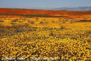
Antelope Valley, lying north and east of the San Gabriel Mountains and south and east of the Tehachapi Mountains, is a closed basin, having no outlet for its surface waters. The rainfall is so slight and the evaporation is so great that not enough water reaches the bottom of the valley to form a lake. Several playas occur, the largest of which are Rosamond, Rogers, and Buckhorn. It is thought that at one time (Pleistocene) all three formed a single large playa. The rainfall in Antelope Valley ranges from 3 or 4 inches to 1 inches annually, varying widely different years. The greater part of the annual precipitation occurs during the winter months of January, February, and March. The summer rainfall is so slight and so irregular that it is not of much value to agriculture. Irrigation is therefore important. The greatest development of agriculture in the Mojave Desert region has been in the Antelope Valley, where it is claimed 10,000 to 1 5,000 acres are under cultivation. Water for irrigation is obtained from mountain streams.
Geology of the Region Very Complex
The geology of Mojave Desert and the Death Valley region is very complicated. The region embraces the southwestern portion of the Great Basin plateau. In the north, in the Death
Valley region, mountain ranges trend in somewhat parallel lines in a generally north-northwest and south-southeast direction. Faults in many cases mark the boundaries of the ranges and valleys. Death Valley, lying west of the Amargosa Range (Funeral and Black mountains) , is a sunken basin in which the floor dips to the east and north toward the great fault scarp which marks the mountain side. The structure of Panamint Valley, lying west of the Panamint Range, suggests that it is a down-faulted block with the greatest depression on the east side of the valley. What is thought to be a fault-plane appears in the abrupt wall of the mountain range on the east. Hot springs at the north end of the valley, and the springs near Ballarat, indicate a zone of faulting along this edge of the valley. The parallel arrangement of the mountains and valleys is generally believed to be due to a series of parallel faults, the valleys representing large blocks that have been lowered relatively with respect to the blocks that have been elevated or tilted to form the mountains.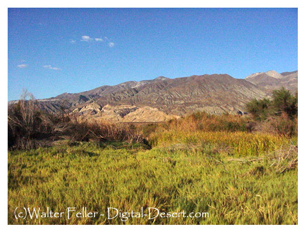
Post Office Spring (Ballarat)
Very ancient rocks, granites probably of Archaean age, occur in some of the mountains. Whatever rocks may have been deposited over them have been removed by erosion. During the early part of the Paleozoic era (Cambrian period) some parts of the region were submerged beneath the sea. This is shown by beds of limestone and other sea sediments in which fossils have been found. If the sea covered the entire region during Cambrian time the formations that were laid down have been removed by erosion from most of the region. During the long Ordovician, Silurian, and Devonian periods it is thought that the region was land, as no fossils of these ages have been found. Small patches of rocks containing fossils of Carboniferous age have been found, showing that the sea covered parts of the region at least during Cambrian time. Throughout the Mesozoic era the region is thought to have been land, and was greatly eroded. In the early part of the Tertiary period volcanic outbursts occurred and great lava flows spread over large areas. Throughout the long time of the Tertiary and Quaternary periods erosion was actively going on. A large part of the Tertiary lava flows and other rocks were worn away until now only remnants of once continuous formations are left. Disturbance of the rocks by faulting completed the work of deformation and resulted in the present relief. Geological conditions have resulted in the accumulation of mineral deposits. These constitute the greatest resource of the region, and have been the incentive for the early exploration and much of the later industrial development. Of metallic ores those of gold, silver, copper, and iron have been principally mined, but lead, zinc, quicksilver, and many rarer metals also have been found. Non-metallic minerals, as salt, potash, niter, borax, and gypsum occur in many places, some in commercially important quantities. Much literature relating to the minerals and geologic features of the region is available. (See Appendix.)
From: ADVENTURES IN SCENERY
A Popular Reader of California Geology
BY DANIEL E. WILLARD, A.M.
Fellow American Geographic Society, Fellow A.A.A.S.