Tag: Garlock Fault

  • Defining the Garlock Fault

    Step 1: Locate Garlock fault alignment

    Garlock fault located and highlighted on geology map
    Garlock fault located and highlighted on geology map

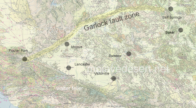
    Step 2: Review alignment transfered to overlays

    Garlock fault overlay on satellite image
    Garlock fault overlay on satellite image
    Garlock fault overlay on terrain map
    Garlock fault overlay on terrain map
    Garlock fault overlay on USGS topographic map

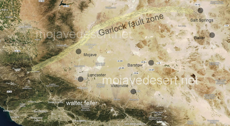
    Step 3: Locate eastern end of fault.

    By word of mouth and small scale maps the eastern end of the fault appears to be located just west of Salt Springs, which is on state highway 127 between Baker and Shoshone, California near Dumont Dunes.

    (still working on it)

    [huge_it_gallery id=”16″]