Historical Timeline
Pre-1800s – Native American tribes, primarily the Kitanemuk and Serrano, lived in the area for generations. They followed seasonal rhythms, gathering plants, hunting game, and using the natural springs and creeks that flowed down the San Gabriel Mountains.
Mid-1800s – European-American settlers began to arrive. The region’s open land, steady sunshine, and access to water from nearby canyons made it attractive for small farms and ranches. Homesteads began to dot the valley.
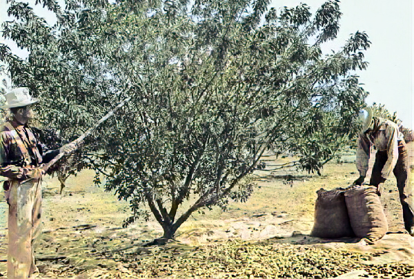
In the late 1800s, Fruit trees—especially pear trees—were planted, and in springtime, the landscape filled with white blossoms. That image gave the town its name: Pearblossom. The community slowly took shape around small farms and trading posts.
Early 1900s – Pearblossom remained a quiet agricultural community. Residents grew pears, apples, and other crops suited to the Antelope Valley climate. Life moved at a slower pace, and neighbors relied on one another.
1930s–1950s – While nearby towns like Palmdale and Lancaster grew thanks to the aerospace industry, Pearblossom kept its small-town feel. Families continued to work the land, and the community stayed tight-knit.
1960s – Pearblossom Highway (State Route 138) became a main route connecting travelers from the Los Angeles Basin to the High Desert and beyond. Pearblossom became a known stop along the way, though traffic brought both opportunity and concern.
1980s – British artist David Hockney photographed the area and created a famous photo collage titled Pearblossom Highway. His work captured the dry beauty and roadside oddities of the region, giving the town an unexpected spot in modern art.
Today – Pearblossom still holds onto its rural charm. The orchards may be fewer, but the name and spirit remain. Locals enjoy the peace, and visitors pass through on their way to places like the Devil’s Punchbowl—a nearby natural area filled with jagged rock formations and hiking trails.