Tag: Native American trails

  • The Cushenbury Grade

    The Cushenbury Grade is a steep and winding stretch of mountain road that climbs from the high desert of Lucerne Valley up to the pine-covered town of Big Bear Lake. Today, it’s part of California State Route 18, but long before pavement and guardrails, this canyon trail served miners, ranchers, and Native travelers through the San Bernardino Mountains.

    Before roads were built, the Serrano people used footpaths through Cushenbury Canyon to move between desert and mountain environments. These routes followed natural contours through the rugged terrain and were later adopted by settlers.

    By the 1860s and 70s, prospectors, cattlemen, and freighters were dragging wagons up and down this slope. During the gold boom in nearby Holcomb Valley, Cushenbury became one of the main north-side routes into Big Bear. It was grueling work—steep grades, loose rock, and no guarantee your wagon would make it to the top in one piece.

    The canyon and grade took their names from the Cushenbury family, early settlers and cattle ranchers in the Lucerne Valley area. Their name stuck, and by the early 20th century, the area gained new attention, not for gold but for limestone.

    In 1918, rich limestone and marble deposits were discovered along the grade. This sparked industrial interest, and by the 1950s, Kaiser Cement had developed a massive limestone quarry near the top. A narrow-gauge rail system carried raw material down the grade to a processing plant: even today, trucks loaded with cement rumble up and down the slope.

    During the 1960s, the state upgraded the road and officially folded it into California State Route 18. This brought pavement, safety improvements, and better access to Big Bear from the desert side. Though safer now, the grade still features tight switchbacks and dramatic elevation changes, rising from about 3,000 feet in Lucerne Valley to over 6,700 feet at the top.

    Today, the Cushenbury Grade remains a key route for both commerce and recreation. It offers expansive views of the Mojave Desert below and a sense of just how much effort it once took to reach the mountains. Whether hauling limestone or heading up for a weekend getaway, this road directly links two very different worlds—desert and alpine.

    Timeline

    Cushenbury Grade Historical Timeline

    Pre-1800s:
    Indigenous Serrano people use Cushenbury Canyon as a seasonal travel route between the Mojave Desert and mountain forests.

    1860s–1870s:
    Miners and ranchers began traveling through the canyon using rough trails to access Holcomb Valley and Big Bear. The steep terrain made it tough for freight wagons and livestock.

    1880s:
    A more defined wagon road is carved into the canyon wall. It’s still rough going—narrow, rocky, and dangerous—but it’s one of the few ways into Big Bear from the desert.

    Early 1900s:
    The Cushenbury family settles in the Lucerne Valley area, giving their name to the canyon and grade.

    1918:
    Limestone and marble are discovered along the canyon. As mining gains momentum, the area shifts from wagon trail to industrial corridor.

    1950s:
    Kaiser Cement develops a large limestone quarry near the top of the grade. A private rail system is built to haul material to the desert floor. This leads to improvements along the road.

    1960s:
    The state paves and upgrades the road, officially making it part of California State Route 18. It becomes a year-round access route to Big Bear Lake from the high desert.

    1990s–present:
    The Cushenbury Grade is heavily used by cement trucks and tourists. The steep climb and sharp turns remain challenging, especially in winter, but it’s a vital link between two different environments.
  • The Story of Garces Rock

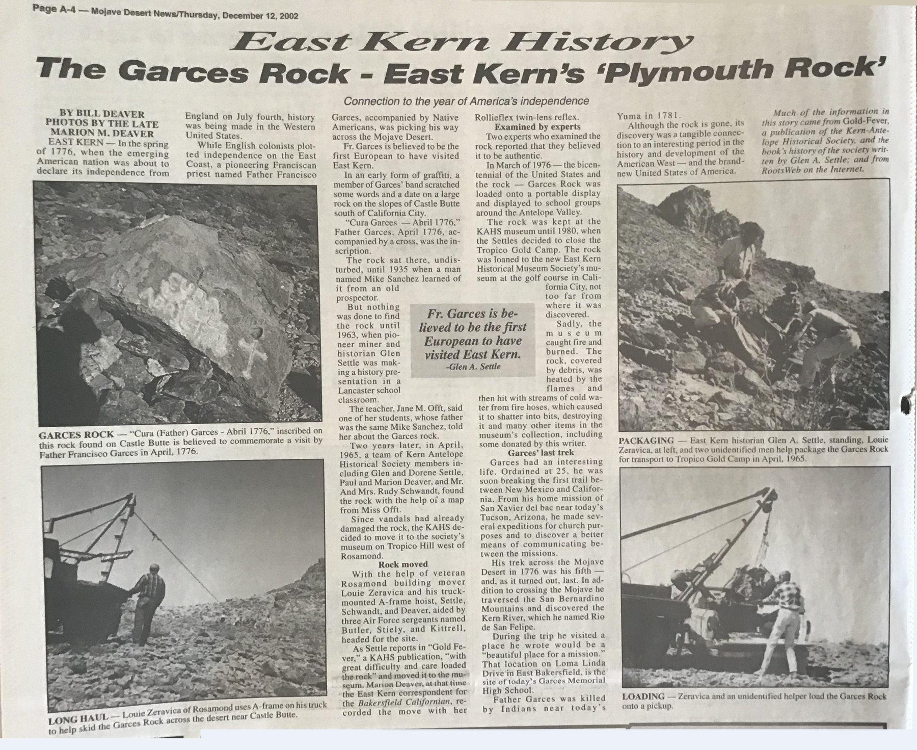
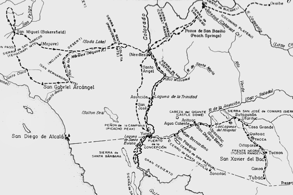
    In the spring of 1776, while revolution stirred on the East Coast, something quieter, though no less meaningful, was happening far in the West. A Spanish Franciscan missionary, Father Francisco Garces, was on his fifth and final journey into the heart of what is now California.

    Guided by Native people and traveling by foot and mule, Father Garces came up through the Antelope Valley, tracing ancient indigenous trails through uncharted territory to Europeans. From there, he pressed on into the San Joaquin Valley, turned east and crossed the rugged mountains near Tehachapi, and continued into the dry interior, heading toward the Mojave River.

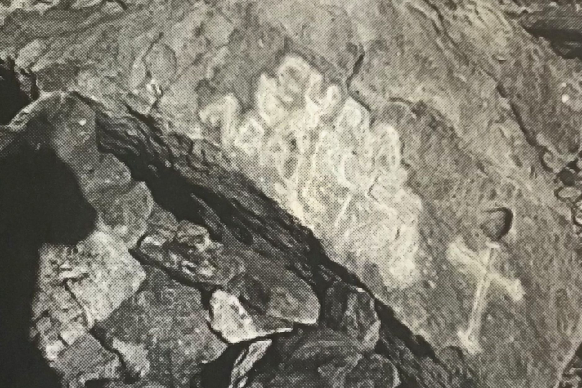
    During this leg of the journey, near the base of Castle Butte, east of present-day California City, someone in his party left behind a quiet message. Carved into a large boulder was a simple inscription:
    “Cura Garces – Abril 1776.”
    A trace is left in stone to mark their passage through the high desert.

    That rock sat in silence for more than 150 years. Then, around 1935, an old prospector pointed it out to a man named Mike Sanchez, but the story of the stone didn’t go far. Sanchez wasn’t much of a talker, and the tale faded.

    Later, in 1963, local historian Glen Settle gave a talk at an elementary school in Lancaster. A teacher there told him about the rock. One of her students—Mike Sanchez’s son—had shared the story, and he even had a hand-drawn map.

    Two years later, in 1965, Settle and several other members of the Kern Antelope Historical Society followed that map and found the rock. It had already suffered some vandalism, so the group relocated it to a safe location. They called in a local man with a truck and a sturdy A-frame hoist. With help from a few Air Force sergeants, they carefully transported the rock to the Tropico Gold Camp Museum in Rosamond.

    They brought in experts to study it. One priest, an authority on early Spanish California, confirmed that the words and cross were consistent with 18th-century Franciscan markings. The weathering on the carving was old, possibly as old as Garces’ journey.

    During the 1976 U.S. Bicentennial, organizers mounted the rock on a traveling display. They showed it at schools and events throughout the Antelope Valley. It was a rare, tangible link between the Mojave Desert and the very year the United States was born.

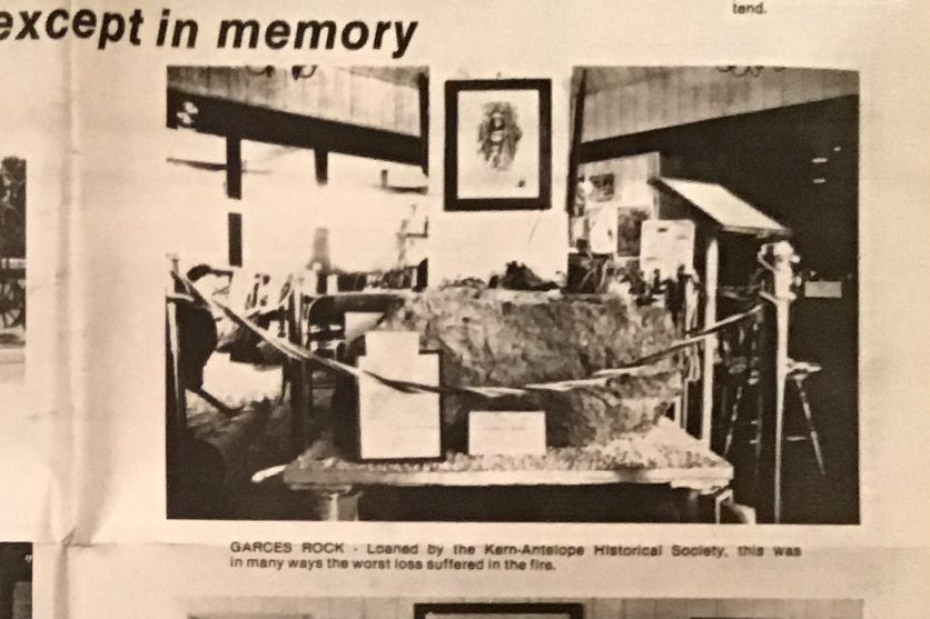
    In 1979, the rock was loaned to the new East Kern Historical Museum in California City, close to where it had first rested centuries earlier.

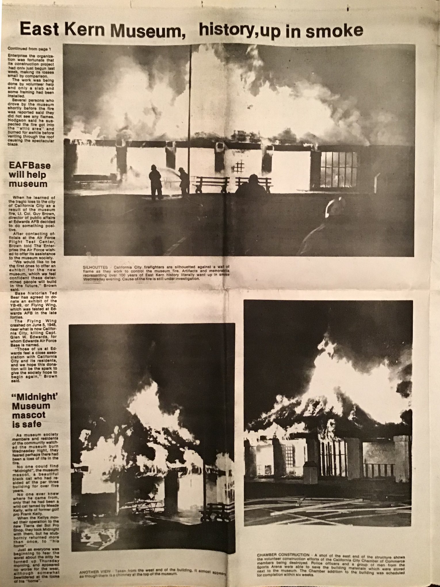
    Then, tragedy struck in the dark hours of February 4, 1981. The museum caught fire. Local fire crews responded quickly, but upon arrival, the wooden structure was already fully engulfed in flames.

    At first glance, the Garces Rock seemed to have survived the blaze. But it crumbled into fragments when someone gently touched it the next morning. The heat from the fire, followed by cold water from the hoses, had cracked and fractured the boulder beyond saving—even the carved inscription dissolved into dust.

    Firefighters did everything they could. There was nothing left.

    What was lost that night wasn’t just a rock. It was a rare and quiet witness to a moment of deep historical significance—when a European missionary followed Native guidance across the mountains, valleys, and deserts of early California.

    Father Garces didn’t live long after his desert crossing. He was killed near the Colorado River in 1781, near what is now Yuma, Arizona. But his name still lives on in places like Garces Memorial High School in Bakersfield—built near the spot he once called a “beautiful place for a mission.”

    Though the rock is gone, the story remains. It’s kept alive by teachers, old-timers, maps passed down, and folks who care enough to remember. It’s proof that sometimes the desert whispers back—and if you listen closely, you can still hear the footsteps of history echoing through the sand.