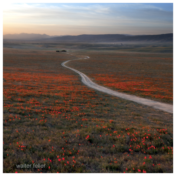
Beautiful memories of beautiful moments — I was there the day the valley floor was being painted. Each brushstroke was evenly pulled across the plain as the sun rose and the day grew warm. The colors covered everything with life. There were bugs and brightly detailed butterflies and the creatures that eat them. There were the diminutive blue and pink fairies that made it all worth living for and meek mice, humble hares (although no one seems to remember one in particular), rats underground and birds that flew higher than could be seen, and then there were the birds that flew in between.
Rats. Rats were everywhere–typically.
Ver (Latin)- very, new, truth, life, forward . . . ‘verdant’ meaning green and growing and ‘veritas’ or truth.
24 Consider the ravens: They do not sow or reap, they have no storeroom or barn, yet God feeds them. And how much more valuable you are than birds! 25 Who of you by worrying can add a single hour to your life? 26 Since you cannot do this very little thing, why do you worry about the rest? — luke 12:24-26
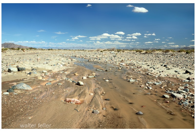
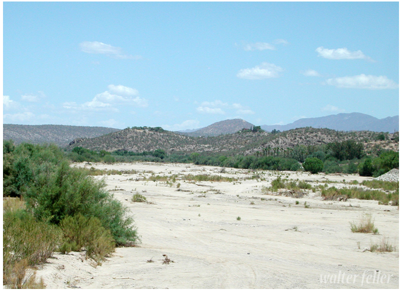
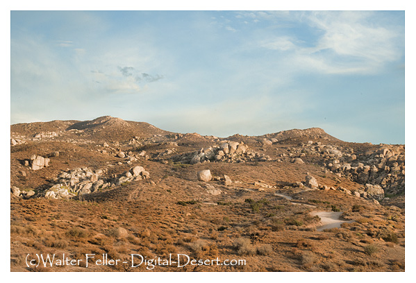
Rather than growing wider and emptying into the sea the Mojave River becomes smaller and smaller finding its way in the sand between the cobbles and rocks curling into crescent -shaped dark meanders and swales transitioning to dry sand and finally, collections of same sized stones.
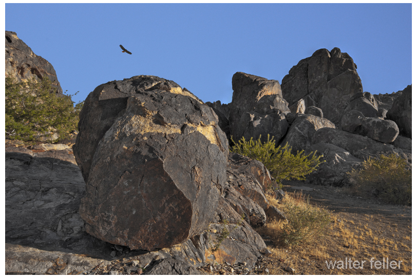
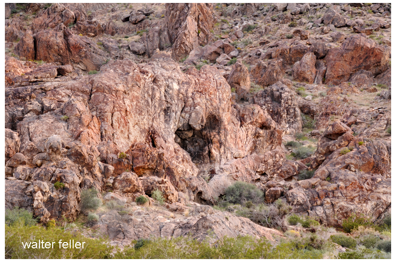
A survivor yucca grows out of a cleft appearing to be damaged from a high-speed contact. Taken during the last sliver of direct sunlight of the day. I thought the little shrub exquisite and beautiful. The granite, reddish and perfect–the light was a shear veil laid like a blessing. All the way from my birth and experiences and all the way from the time before time began when the stone was born and born again and again under oceans and earth and heat and wear. All the way from then through the life of the thing, growing its spikes like crazily splashed slashes of bold green paint contrasted on a red canvas, its sacred moment, its peak of existence. Pause, then slowly, deeply, exhale.
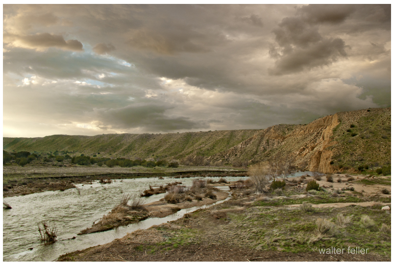
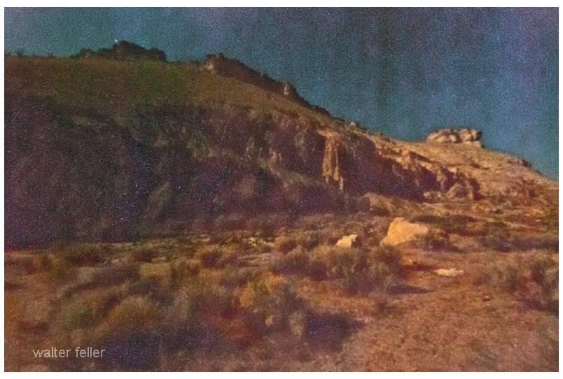
I suppose, if there is any hard and clear boundary to the Mojave Desert that this is where it is. Over time, the Mojave River has cut away the bluff in Summit Valley, east of the Cajon Pass, as the Mojave Desert moves with the rest of the Mojave Block as it separates from the San Bernardino mountain range.
Bill owned a chicken ranch out in the great wide-open desert. He was called to go to the big city to do some business and would be gone for several weeks. He asked his friend, Buck, to watch his chicken ranch while he was gone. Buck accepted and each and every day he fed and watered the chickens and gathered the eggs.
One day a rainy deluge swept across the desert causing flash flooding, panic, and havoc. The runoff from the rain destroyed all the chicken feed on Bill’s ranch. Since it would be a while before Bill returned, Buck was in a bit of a fix over the chicken feed. Buck went into the little town nearby to buy some more. He needed two sacks of feed but could only afford one. Buck, being the resourceful individual that he was, went next door to the lumber mill and bought a sack of sawdust. By mixing the sawdust with the chicken feed he would have enough to feed the chickens and keep them from starving.
Buck’s plan appeared to work, but soon one of the chickens laid a wooden egg–and then another hen laid one, and there was another, and another, and another.
I’m telling you . . .
When Bill returned from the big city all of his chickens were laying wooden eggs.
Now, everybody pretty much knows that wooden eggs are useless and it didn’t take but a minute or so for Bill to realize the predicament he was in.
Bill solved his problem by getting out of the egg business.
After a down pouring rain water had collected in a small natural basin the sticks and stems and twigs and dried up flowers had fermented into an intoxicating brew that the local desert fauna seemed to enjoy drinking. There was what turned into a drunken festival in which the hare, sloppily and completely boozed up challenged a tee-totaling tortoise to a race. The tortoise, who was not too bright, accepted the contest mainly because the rabbit was staggering about insulting the clutch of eggs the sober tortoise hatched from and complaining that the whole tortoise famn-damily was slow and stupid.
Bobcats and rats and mice and snakes and lizards and coyotes put aside their differences to watch the tiny marathon and gathered together at the starting line. The judge, a badger, got a gun from somewhere and wildly fired it toward the sky and a batch of drunken Canada geese that happened to be flying by, winging one but not quite killing it, only making it wish it were dead from the pain. And that was the start of the race.
It may have been just the way it is, but the jackrabbit felt he had the contest in the bag …
The hare bolted and leaped sideways rather uncontrollably
as if one hind leg were much shorter than the other–he rocketed into a
patch of California Buckwheat (eriogonum fasciculatum) and fell over.
The tortoise, who calculated the rabbit was too stoned to follow the
course, felt that if he were slow and steady and persistent, that he
could beat the rabbit.
A bit later, the rabbit passed the
tortoise faster than the tortoise had ever seen a rabbit move. However,
the tortoise continued to believe that if he were slow and steady and
persistent, that he could beat the rabbit and sure enough, the tortoise
plugged along and quietly passed the rabbit taking a nap under a desert
willow (chilopsis linearis). The tortoise smugly snickered as he passed
the hungover hare.
The tortoise kept its pace and crossed the finish line proudly proclaiming that he had won the race. Judge Badger, with his gun in claw, fired it into the air hitting another flying goose then walked right up to the tortoise and said, “didn’t you see the rabbit? He went back to tell you you lost.” The embarrassed tortoise crawled back to his burrow, entered and slept the rest of the summer and everything else in the animal world went back to normal including the two coyotes that tracked the course back to the still passed out rabbit and ate him.
If you drove north on Central Avenue in Apple Valley, about 3 miles from Highway 18,
a strange sight might give you a moment surprise: a group of dinosaurs
would appear on the horizon. This meant figures represent the work of
Lonnie Coffman, a soft-spoken, wiry, energetic man, who, in the 1960s,
began the building of his childhood fantasy a dinosaur park.
With his Midwestern family to board to provide recreational trips and
entertainment, Coffman spent much of his childhood in the public
library reading about prehistoric animals and dreaming of the park he
would someday build for other children to enjoy. According to a former
neighbor, Rose McHenry, he worked from dawn until dark every day on his
hobby. He never charged the busloads of schoolchildren that visited the
park, climbing over this meant replicas, and listening to the man,
usually of few words, expound on the life of the dinosaur.
He had written to Washington to get the exact measurements of Noah’s
Ark to add to his collection, when, after 12 years of personal funding,
his savings ran out. Coffman appealed to the county for help to continue
building his 17 1/2 acre park, but was turned down. He had no other
recourse but to give up his dream. According to Mrs. McHenry, Lonnie
Coffman left the area about 1982 a heartbroken man, leaving his concrete
dinosaurs to the winds and sands of the desert.
Adapted from Mojave V – Mohahve Historical Society
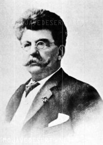
“I was down in San Berdo the other day, and a man got me into one of them women’s afternoon fandangos; you know, one of them afternoon affairs where they all talk and don’t say nothing. And a “fly-up-the-creek” woman came up, all “a side-winding,” and said: ‘Now Mr. Scott, I’m sure in your desert travels you must have lots of opportunities to do kind deeds. What you tell the ladies the kindest deeds you ever did?”
Death Valley Scotty
“Well, lady,” I says, ” let me think a minute. One time several years ago I been traveling all day on a horse, and I came in on a dry camp way up in one of the canyons. There was an old road leading up to it; hadn’t been used for years; but I noticed fresh tracks on it. When I got to the camp, there sat an old man and an old woman. They must have been 70 years old apiece. When they saw me they both began to cry, and I said: ‘ my goodness, how in the hell did you two ever get up here?’ Well, they said, they were driving through the valley, and it was so hot they thought they were going to die, and they come up to this road and they thought it led to a higher place where it would be so hot, so they took it and got up there, and it was night, so they camped there all night in the morning they found their horse had wandered off. They had looked for him but he was gone, and they’d been there most a week and had no food. Well, I open my packet built a fire and made them a cup of coffee and fried some bacon and stirred up some saddle blankets (hot cakes) for them, and say, you ought to see them two old folks eat! It cheered them up considerable.
We sat around the fire all the evening and powwowed, and they was a nice old couple. We all slept that night on the ground. They was pretty cold, so I gave them a blanket I had. The next morning I made them some more coffee and gave them some breakfast. I had to be going, so I packed up and got astride my horse. I sort of hated to leave the old couple; they seemed kind enough sort of people; but there was nothing else to do; so I said goodbye, and they both was crying; said they’d sure die; no way for them to get out. They couldn’t walk. It was 100 miles from help, and there was no automobiles in those days. But I got on my horse and started off, and then I looked around and saw them two old people a-standing there crying, and, you know, I just couldn’t stand it to leave them old people there alone to die, so I’d just took out my rifle and shot them both. Lady, that was the kindest deed I ever did.”
“Oh, Scotty,” I said, “Why did you tell those women such a tale as that?”
“Well, you know all them bandits you meet when you go out; you got to tell them something, ain’t you?”
“I suppose so, but it seems to me you might think up something better than that to tell at a ladies club meeting.”
“Well, that’s what I told that bunch, anyway. You’ve got to send up some kind of a howl if you’re going to be heard. There are so many free schools and so much ignorance.”
And Scotty lighted another fifteen cent cigar (he always smoked the best), …
from Death Valley Scotty by Mabel – Bessie M. Johnson – Death Valley Natural History Association
— Wyatt had bought a brand new auto and was taking Josie out to visit a friend in Arizona. Somewhere south of Needles, a large bull leapt out from behind a creosote bush. The bull huffed and puffed and stomped and scrapped his hooves, lowered his head and charged the brand-new shiny-clean car. The bull came at the door on Josie’s side. She screamed. She was afraid the bull would kill her. However, she had no reason to fear death as Wyatt, drew his gun and put 3 shots into his thick skull right between its wide-set eyes. This killed the bull instantly. The bull had messed up the door pretty bad. Then all of a sudden some guy jumped out of the creosote yelling and screaming about the “prize bull” Wyatt just killed. An argument ensued. It seemed that Wyatt knew this guy’s boss and was the friend he was taking Josie to visit. It was pretty funny. Sort of. I don’t know who, if anyone, paid to get Wyatt’s door fixed. I imagine they ate the bull.
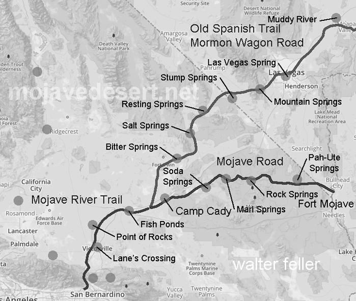
I have heard that the Paiute Indians have a legend–a story they would tell about a giant who crossed the desert with an olla full of water in each arm. With each step he would leave his footprint in the ground, and water would spill from the olla into the hole as he walked on. The giant was so large that these waterholes were one day’s walk between each for a normal-sized man. The Indian learned this and used these waterholes to travel great distances and trade with other Peoples beyond the desert. As time went on and things went the way things do, one such trail became the Mojave Road. — Editor
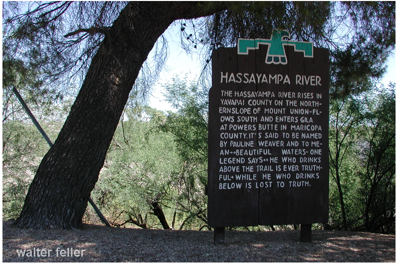
The legend of the Hassayampa River as it runs through Wickenburg, Arizona, has it that if you drink from the river’s waters you will never tell the truth again. There, of course, are some caveats and loopholes some weak-kneed people may use to claim the curse will not affect them, but it does–they may be lying, however.
Hassayampa River, Wickenburg, Az.
At any rate, it was not people who went into the desert merely to write it up who invented the fabled Hassayampa, of whose waters, if any drink, they can no more see fact as naked fact, but all radiant with the color of romance. I, who must have drunk of it in my twice seven years’ wanderings, am assured that it is worthwhile.
The legend of the Hassayampa River — The Hassayampa rises in Yavapai county on the northern slope of Mount Union- flows south and enters Gila River at Powers Butte in Maricopa county. It is said to be named by Pauline Weaver and to mean–beautiful waters. One legend says–He who drinks above the trail is ever truthful – While he who drinks below is lost to the truth.
The Hassayampa Legend -Andrew Downing
There’s a legend centuries old By the early Spaniards told Of a sparkling stream that “lies” Under the Arizona skies Hassayampa is its name And the title of its fame Is a wondrous quality Known today from sea to sea Those who drink it’s waters bright Red man, white man, boor or Knight Girls, or women, boys or men Never tell the truth again!
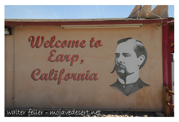
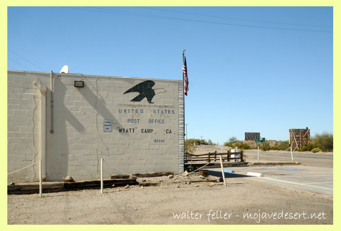
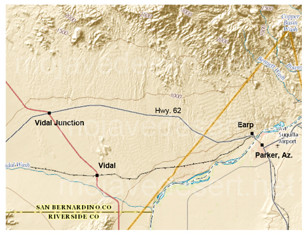
Earp, California is an unincorporated community in San Bernardino County in the Sonoran/Mojave Desert transition next to the Colorado River at the California/Arizona state line in Parker Valley.
Welcome to Earp, California
Earp post office at the eastern end of Highway 62, ZIP 92242.
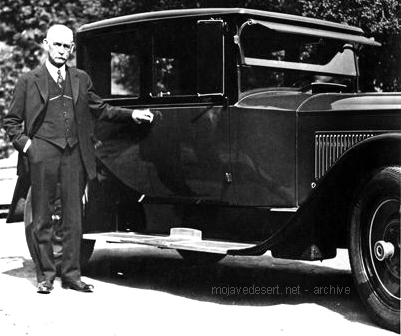
In 1910 the little town was named Drennan. In 1929 Drennan was renamed Earp in 1929 in honor of the nefarious Old West lawman and entrepreneur Wyatt Earp. Wyatt and Josephine Sarah Marcus, his common-law wife, lived in the area seasonally from about 1906 staking more than 100 claims near the base of the Whipple Mountains.
Downtown Vidal, California
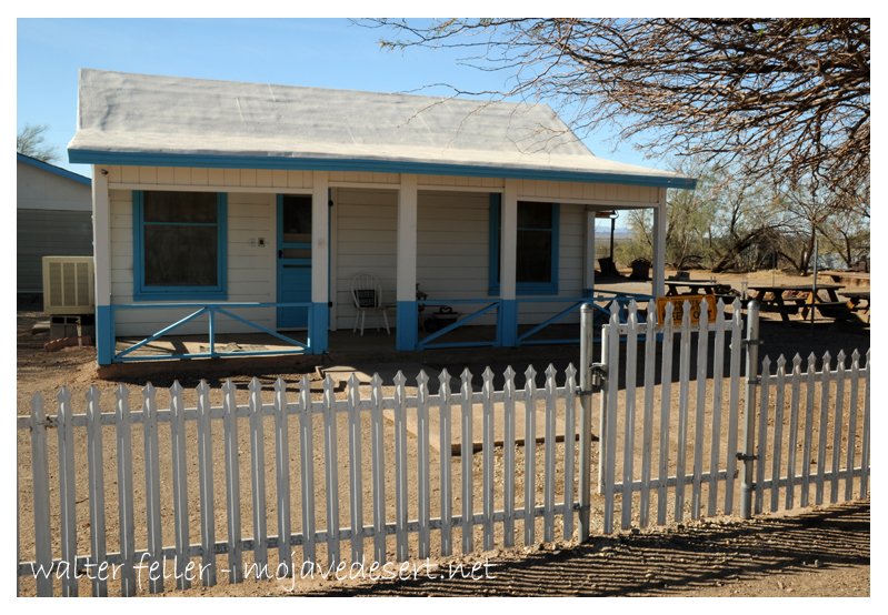
Wyatt Earp, the legendary law man, gunfighter, gambler, businessman and miner along with his wife, Josephine, inhabited this “dream-come-true” cottage from 1925 through 1928, winter and spring months, while he worked his “Happy Days” mines in the Whipple Mountains a few miles north of this site. This is the only permanent residence they owned in their long lives.
They bought a small cottage in nearby Vidal and lived there during the fall, winter and spring months of 1925 – 1928, while he worked his “Happy Days” mines in the Whipple Mountains a few miles north. It was the only place they owned the entire time they were married. They spent the winters of his last years working the claims but lived in Los Angeles during the summers, where Wyatt died on January 13, 1929.
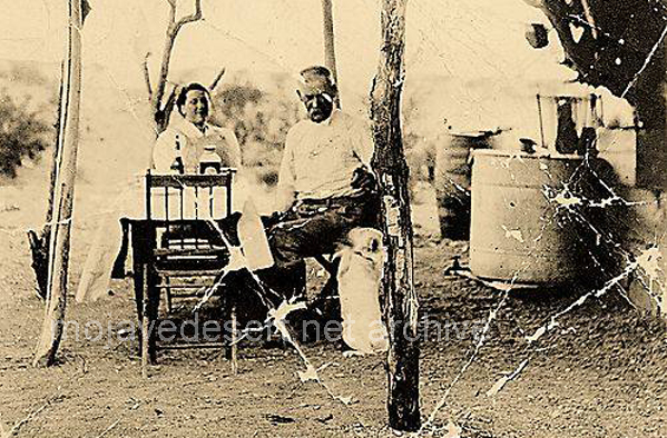
Josie & Wyatt and dog at Happy Days mine west of Parker, Az.
When from the lips of Truth one mighty breath Shall, like a whirlwind, scatter in its breeze The whole dark pile of human miseries, Then shall the reign of mind commence on earth And, starting forth as from a second birth, Man, in the sunrise of the world’s new spring, Shall walk transparent like some holy thing.
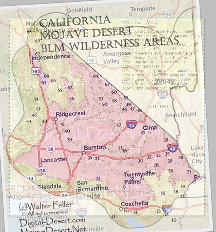
WEST CENTRAL MOJAVE DESERT, SAN BERNARDINO COUNTY CALIFORNIA (Abstract)
Stoddard Ridge is a prominent landmark south of Barstow California in the west central Mojave Desert area.
The 35 square mile area was mapped in detail at a scale of 1:12,000. The geology is far more complex than depicted on all older published maps. The new mapping adds significant new data regarding the variety of rocks present, and adds new details on the geologic structure and complex geologic history of the area.
Several packages of rocks are exposed. At the east end of the ridge the oldest rocks are exposed and include PreCambrian basement gneiss complex, metamorphosed intrusive rocks, and possible Late Proterozoic metasedimentary rocks (schist units). The central part of the ridge exposes several sequences of steeply dipping Mid Jurassic Lower Sidewinder volcanic (JLSV) rocks, and younger (JLSV) rhyolite dome complex that includes extrusive, flow banded and massive hypabyssal intrusives. The western portion of Stoddard Ridge is largely heterogeneous Mid Jurassic plutonic rocks (post JLSV) which form a steeply dipping sheeted intrusive complex, that includes diorite, granodiorite, quartz monzonite and felsite. Plutonic and to a lesser degree volcanic rocks are cut by numerous younger mafic and felsic dikes correlated with the Independence dike swarm of Late Jurassic age. The eastern part of the ridge has been intruded by homogeneous Mid Jurassic plutonic rocks, and Cretaceous granitic intrusive rocks are exposed along the southwestern base of Stoddard Ridge. Several ages of Late Cenozoic alluvial units were also differentiated in mapping.
Geologic structure is complex, the result of several deformational events including shearing, folding, faulting, intrusion and metamorphism of pre Mid Jurassic age, followed by multiple Mid Jurassic age volcanic, intrusive and deformation (folding and faulting) events, and younger Cenozoic age faulting. Most bedrock units have a northwest trending structural grain which likely formed in Jurassic time. Suspected concealed faults are present under alluvium. Several prominant young northwest trending high angle faults are present on the south side of the ridge and can be seen to cut alluvium.
BROWN, Howard J. Cordilleran Section – 109th Annual Meeting (20-22 May 2013)
Lucerne Valley post office – Photo courtesy Charles Rader
In 1930, Lucerne Valley boasted having this post office building on the Box “S” Ranch in this widely homesteaded area. Famed for its pure Mojave dry air, World War I veterans who suffer being gassed in France found breathing here are easy. One section of the valley is called “Little Inglewood.” This stems from many homesteaders, originally from Inglewood, California, moving there in the 1920s and 1930s.
from – Images of America – Mojave Desert by John Swisher
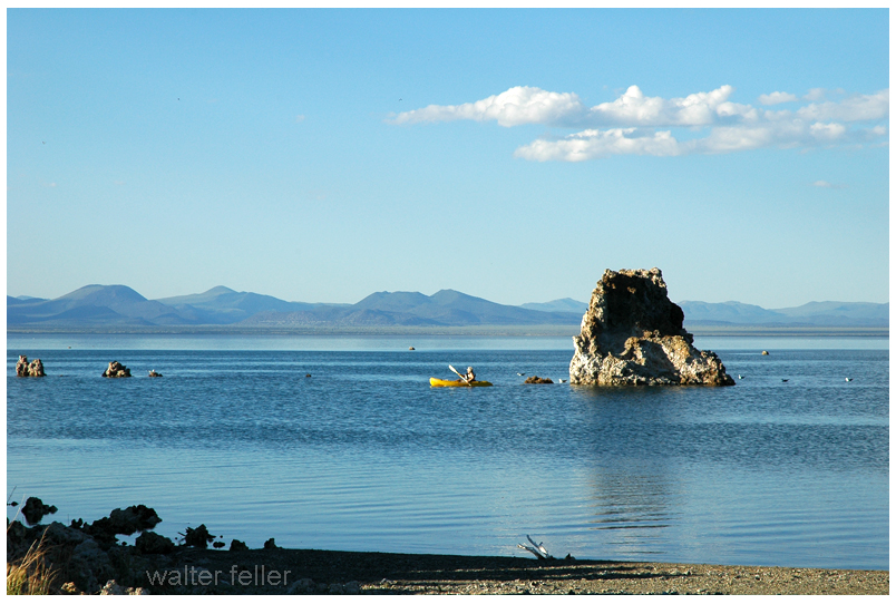
Mono Lake lies in a lifeless, treeless, hideous desert, eight thousand feet above the level of the sea, and is guarded by mountains two thousand feet higher, whose summits are always clothed in clouds. This solemn, silent, sail-less sea—this lonely tenant of the loneliest spot on earth—is little graced with the picturesque. It is an unpretending expanse of grayish water, about a hundred miles in circumference, with two islands in its centre, mere upheavals of rent and scorched and blistered lava, snowed over with gray banks and drifts of pumice-stone and ashes, the winding sheet of the dead volcano, whose vast crater the lake has seized upon and occupied.
Mono Lake
The lake is two hundred feet deep, and its sluggish waters are so strong with alkali that if you only dip the most hopelessly soiled garment into them once or twice, and wring it out, it will be found as clean as if it had been through the ablest of washerwomen’s hands. While we camped there our laundry work was easy. We tied the week’s washing astern of our boat, and sailed a quarter of a mile, and the job was complete, all to the wringing out. If we threw the water on our heads and gave them a rub or so, the white lather would pile up three inches high. This water is not good for bruised places and abrasions of the skin. We had a valuable dog. He had raw places on him. He had more raw places on him than sound ones. He was the rawest dog I almost ever saw. He jumped overboard one day to get away from the flies. But it was bad judgment. In his condition, it would have been just as comfortable to jump into the fire.
The alkali water nipped him in all the raw places simultaneously, and he struck out for the shore with considerable interest. He yelped and barked and howled as he went—and by the time he got to the shore there was no bark to him—for he had barked the bark all out of his inside, and the alkali water had cleaned the bark all off his outside, and he probably wished he had never embarked in any such enterprise. He ran round and round in a circle, and pawed the earth and clawed the air, and threw double somersaults, sometimes backward and sometimes forward, in the most extraordinary manner. He was not a demonstrative dog, as a general thing, but rather of a grave and serious turn of mind, and I never saw him take so much interest in anything before. He finally struck out over the mountains, at a gait which we estimated at about two hundred and fifty miles an hour, and he is going yet. This was about nine years ago. We look for what is left of him along here every day. …
Pictorialism, an approach to photography that emphasizes beauty of subject matter, tonality, and composition rather than the documentation of reality.
The Pictorialist perspective was born in the late 1860s and held sway through the first decade of the 20th century. It approached the camera as a tool that, like the paintbrush and chisel, could be used to make an artistic statement. Thus photographs could have aesthetic value and be linked to the world of art expression.
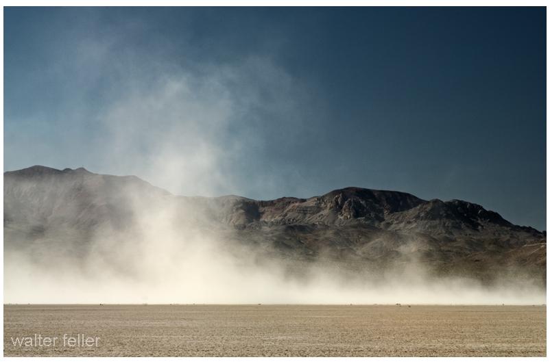
Death Valley was having one of its periodic wind storms when the tourists drove up in front of Inferno store to have their gas tank filled.
Hard Rock Shorty was seated on the bench under the lean-to porch with his hat pulled down to his ears to keep it from blowing away.
Desert wind storm
“Have many of these wind storms?” one of the dudes asked.
“Shucks, man, this ain’t no wind storm. Jest a little breeze like we have nearly every day. You have to go up in Windy Pass in the Panamints to find out what a real wind is like.
“Three-four years ago I wuz up there doin’ some prospectin’. Got together a little pile o’ wood an’ finally got the coffee to boilin’. Then I set it on a rock to cool while I fried the eggs.
“About that time one of them blasts o’ wind come along and blowed the fire right out from under the fryin’ pan. Blowed ‘er away all in one heap so I kept after it tryin’ to keep that fryin’ pan over the fire to git my supper cooked.
“I usually like my eggs over easy, but by the time 1 got one side done I wuz all tired out so I let ‘er go at that. Had to walk four miles back to the coffee pot.”
Once I asked Shorty Harris how he obtained his grubstakes. “Grubstakes,” he answered, “like gold, are where you find them. Once I was broke in Pioche, Nev., and couldn’t find a grubstake anywhere. Somebody told me that a woman on a ranch a few miles out wanted a man for a few days’ work. I hoofed it out under a broiling sun, but when I got there, the lady said she had no job. I reckon she saw my disappointment and when her cat came up and began to mew, she told me the cat had an even dozen kittens and she would give me a dollar if I would take ’em down the road and kill ’em.
“‘It’s a deal,’ I said. She got ’em in a sack and I started back to town. I intended to lug ’em a few miles away and turn ’em loose because I haven’t got the heart to kill anything.
“A dozen kittens makes quite a load and I had to sit down pretty often to rest. A fellow in a two-horse wagon came along and offered me a ride. I picked up the sack and climbed in.
“‘Cats, eh?’ the fellow said. ‘They ought to bring a good price. I was in Colorado once. Rats and mice were taking the town. I had a cat. She would have a litter every three months. I had no trouble selling them cats for ten dollars apiece. Beat a gold mine.’
Prospector with grubstake essentials
“There were plenty rats in Pioche and that sack of kittens went like hotcakes. One fellow didn’t have any money and offered me a goat. I knew a fellow who wanted a goat. He lived on the same lot as I did. His name was Pete Swain.
“Pete was all lit up when I offered him the goat for fifty dollars. He peeled the money off his roll and took the goat into his shack. A few days later Pete came to his door and called me over and shoved a fifty-dollar note into my hands. ‘I just wanted you to see what that goat’s doing,’ he said.
“I looked inside. The goat was pulling the cork out of a bottle of liquor with his teeth.
“‘That goat’s drunk as a boiled owl,’ Pete said. ‘If I ever needed any proof that there’s something in this idea of the transmigration of souls, that goat gives it. He’s Jimmy, my old sidekick, who, I figgered was dead and buried.’
“‘Now listen,’ I said. ‘Do you mean to tell me you actually believe that goat is your old pal, whom you drank with and played with and saw buried with your own eyes, right up there on the hill?’
“‘Exactly,’ Pete shouted, and he peeled off another fifty and gave it to me. So, you see, a grubstake, like gold, is where you find it.”
from: Loafing Along Death Valley Trails A Personal Narrative of People and Places Author: William Caruthers
L. Burr Belden San Bernardino Sun-Telegram September 6, 1959
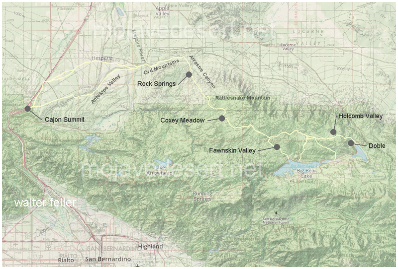
In 1861 the county of San Bernardino contracted with John Brown to build a toll road through the Cajon Pass from Devore to Cajon Summit. That would do fine to get wagons and freight between San Bernardino and the Mojave Desert. At the same time the county also approved a subscription road to be built by Jed Van Dusen from near the summit through the mountains so equipment and supplies could be freighted to the mines in Holcomb Valley.
History in the Making
Mountain Road Cost Miners $2,000 in Gold
Brown’s Toll Road
Back in the early 1860s the gold rich but food poor miners of Holcomb Valley decided the number one need for their mountain metropolis was a road. in typical pioneer fashion instead of looking to San Bernardino, Sacramento or Washington these miners resolved to build the road.
At the time supplies for Holcomb Valley were brought up by way of a packed train trail up Santa Ana Canyon from the San Bernardino Valley and thence to Holcomb Valley by trails threading either Polique or Van Dusen Canyons. these trails served for burros, mules or horses but the only way to get a wagon to the gold mines was to take it apart and load its pieces on pack animals.
Toll Road up Cajon
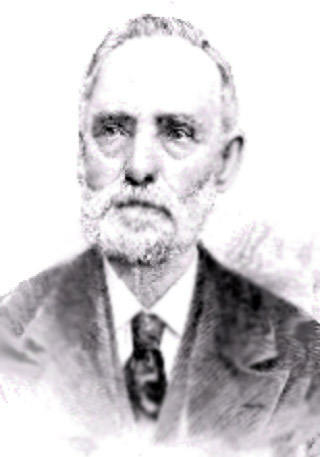
John Brown Sr.
The Holcomb Valley mines were reputedly among the richest in California. Free gold, as the placers were known, was becoming hard to obtain in quantities up in the worked over streams of the Mother Lode and accordingly thousands of footloose miners poured into Holcomb Valley making an increasingly heavy strain on the thin supply line.
Down in San Bernardino John Brown Sr. a resourceful Rocky Mountain man, who was one of the leaders in the settlement both during and subsequent to the Mormon regime, had an experienced eye for trade routes. Brown was probably one of the first to vision San Bernardino as a trade center due to its central location and proximity of favorable mountain gateways.
Brown saw that San Bernardino could obtain an even better share of overland travel with better roads. Accordingly he planned to make the Cajon Pass gateway the preferable way east. He applied to the Board of Supervisors and was granted a toll road franchise. His road utilized the East Cajon route which he improved so it could accommodate wagons. Then Brown went farther and started a ferry over the Colorado River at Fort Mohave.
Builder Paid $2,000
Van Dusen Road/ Coxey Truck Trail from Cajon Summit to Holcomb Valley
The Brown Road diverted Holcomb Valley traffic away from the Santa Ana trail. A new trail was blazed down Holcomb Creek, Willow Creek and Arrastre Creek to reach the Mojave Desert floor in the vicinity of Deadman Point. From Deadman Point it was an easy open path to Brown’s road.
Van Dusen Road at east bank Mojave River
Miners and supply men who used the new trail saw that it could be widened to accommodate wagons. The usual method of making a road would have been for the Holcomb Valley miners to turn out with their picks and shovels, but that meant leaving their claims just when water was high enough for gold washing. Accordingly a person of $2,000 in gold dust was raised and Jed Van Dusen, the camp blacksmith, was hired to build the road. He did just that. Van Dusen was a resourceful fellow. He had assembled a wagon from parts brought up to Holcomb Valley by pack train. In between running his smithy he had some good claims he worked in the canyon that has been given his name. Van Dusen’s chief claim to fame, however, was neither his skill as a road builder, blacksmith or miner. it rested on the fact he was father of a very pretty little girl named Belle.
Dead Man’s Point
Daughter Honored
When the miners cast about for a name for their town in Holcomb Valley they found W. F. (Billy) Holcomb reluctant to have it named for him. Then someone had an idea. Why not name the camp for Jed Van Dusen’s little girl? So Belleville became the name of the big roaring mining camp that had almost as many residents as the rest of the county.
Lucky Baldwin’s Gold Mountain
For a dozen years or so the Van Dusen built road carried the heaviest traffic in the county. The travel to the mines, of course, was a great help to the Brown tollway. Heavy machinery needed for quartz mining was hauled over the road as gold veined ledges were discovered. The latter included two of the most famous gold mines San Bernardino County history, E. J. (Lucky) Baldwin’s Gold Hill property and Richard Garvey’s Greenlead.
During Civil War days the Van Dusen – built road carried a strange assortment of passengers and cargo. Liquors for Greek George’s notorious saloons and dance halls, staple goods, the inevitable blasting powder and large bullion shipments. Strangest of all travelers, however, was a ragged troop of filibusters recruited in Visalia who called themselves Confederate calvarymen and commanded by Mariposa County’s stormy Assemblyman Dan Showalter. Showalter and his motley horsemen were trying to reach southern lines in Texas but a few weeks later ran into California volunteers near Warner’s Ranch and were taken prisoner.
This was the same Showalter who had recently slain San Bernardino County’s Assemblyman Charles Piercy in a duel at San Rafael. The duel was fought with rifles at 40 paces. First shots of both antagonists went wild and Showalter allegedly jumped the gun and shot the second time at the count of two, killing Piercy. Showalter was a fugitive when he was in Holcomb Valley but secessionist sentiment plus that of roughs who wanted no government at all served to protect the fact it was San Bernardino County’s legislator he had slain.
The roughs around Belleville ran things with a high hand, at least until Greek George fell mortally wounded from the knife of ” Charlie the Chink” in the drunken aftermath of a Fourth of July celebration. In a reminiscent account written 35 years later Billy Holcomb told of that fatal July 4 and of George’s killing three men before his fatal combat with the celestial.
Van Dusen Road
It was members of George’s gang, left more or less leaderless, who held up an outgoing stagecoach and relieved the Wells Fargo messenger of $60,000. It was the disgusted miners, anxious to drive out the roughs, who pursued the highway men and killed them all. The last bandit was slain a bit too quick for he died while trying to tell where the $60,000 was hidden. As far as is known it has never been found, a sizable cache of gold bars that has lured treasure seekers unsuccessfully for something like 90 years.
Baldwin Garvey Feud
The Van Dusen Road carried the ballot boxes in the weird election when Belleville tried to become county seat, and probably succeeded in polling a countrywide majority but lost on the official count by the “accident” of a Belleville precinct’s box being lost in a bonfire down in San Bernardino.
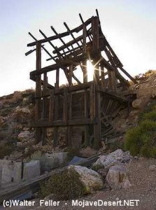
After the richer placer deposits had been worked Belleville and upstream Beardstown dwindled in size. The emphasis’s one to hard rock mining which required less men more capital and tools. In the hard rock field the giant was Baldwin, who at one time was running a 40- stamp mill at Gold Hill and the operation was supporting a good-sized town, the town of Doble.
Elias Jackson “Lucky” Baldwin
Next in size to Baldwin’s operation were those of Garvey. Garvey had owned Gold Hill at one time and reportedly sold it to Baldwin for $200,000. The Garvey family always contended that Baldwin took a bill of sale for the mine but neglected to pay the Irish-born Garvey all the promised money. Garvey trusted his supposed friend.
Garvey held onto the Greenlead, which is almost at the side of the Van Dusen Road in lower Holcomb Valley. When hard times depressed Los Angeles real estate Garvey found he owed $300,000 on the land no longer worth the amount of the mortgages. Three shifts worked the Greenlead and Garvey paid all but $90,000 of the $300,000 debt. The family held onto the Greenlead. It had been leased, sold and worked from time to time. The new owner from Sherman Oaks was on the property a year ago with plans for reopening the long tunnels where there is still said to be quantities of ore rich enough to pay for mining even under current costs.
Long Cattle Drives
In the wake of the minors cattlemen moved into the San Bernardino Mountains. The old road to Holcomb Valley saw huge drives in both spring and fall as cattle were moved from desert ranges to the mountains and back again.
When the first dam was built at Bear Valley in the 1880s A. E. Taylor hauled supplies over the old road, then completed and used the road up Cushenbury direct to Bear Valley. Advent of the Cushenbury gateway, now Highway 18, and the later Mill Creek and crest routes serve to diminish the importance of the old route but it was not closed.
Coxey Meadows
Halfway down to the desert, at the well-known landmark of Coxey’s Ranch, the Forest Service had one of its early ranger stations. It was one of the picturesque log cabin structures typical of such stations 40 years ago. A search for the station earlier this summer disclosed that he had reverted to the status of a guard station and that two or three years ago it was burned when a gasoline lantern or stove exploded. The old corral remains Coxey’s. Today’s guards camp out and have telephone service.
The old road is a popular one with Forest visitors who like to get away from the pavement and camp out. There are public grounds at Horse Springs, Big Pine Flats, and that Hannah Flats. Numerous Springs make the route a well watered one that it is no place for a pavement driver with a low center car.
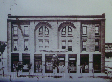
The Walters family is an important part of Hesperia history. Starting with George Francis Walters, who moved his family from Illinois to California because his wife, Harriet C Finigan Walters had asthma.
Hesperia Hotel
The family first settled in the Riverside area where he went to work for the Santa Fe Railroad. According to Bolton Minister, son of George O Walters Minister, George was offered a transfer to Hesperia to manage the Hesperia Hotel.
The Walters family consisted of George and his wife Harriet, and their children, in birth order, Georgia Henry had to Walters Minister-Henry, Verial W. Walters Ormond and Roy Edward Walters.
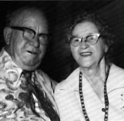
According to Mr. Minister, both the daughters went to work in the hotel. They were later joined by Laura McClanahan who in 1921 transferred from the Goodsprings Hotel, in Goodsprings, Nevada.
Roy & Laura Walters
Verial was postmistress, until she moved away when she got married, and then her position was given to her brother Roy.
Roy ended up marrying Laura McClanahan and having a daughter, Geraldine Henrietta Walters. Geraldine married first, Yeager and second Schwartz.
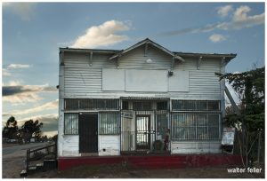
According to Mr. Minister, George Francis Walters built the Walters house in the Walters general store according to Geraldine, her grandmother Harriet was the midwife in the delivery of 32 Hesperia babies.
When George passed away the store was handled over to Roy, who operated it for many years.
I do not know where George and area Walters or Barry. However, I do know that Roy and Laura are buried at the cemetery in Victorville.
With the passing of time, their store had deteriorated and will eventually disappear from Hesperia. As eventually, the Walters name will.
The most famous lost mine in the Death Valley area is the Lost Breyfogle. There are many versions of the legend, but all agree that somewhere in the bowels of those rugged mountains is a colossal mass of gold, which Jacob Breyfogle found and lost.
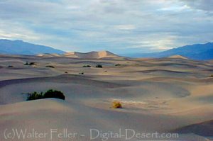
Mesquite Flats Sand Dunes – Death Valley
Jacob Breyfogle was a prospector who roamed the country around Pioche and Austin, Nevada, with infrequent excursions into theDeath Valleyarea. He traveled alone.
Indian George, Hungry Bill, and Panamint Tom saw Breyfogle several times in the country around Stovepipe Wells, but they could never trace him to his claim. When followed, George said, Breyfogle would step off the trail and completely disappear. Once George told me about trailing him into the Funeral Range. He pointed to the bare mountain. “Him there, me see. Pretty quick—” He paused, puckered his lips. “Whoop—no see.”
Breyfogle left a crude map of his course. All lost mines must have a map. Conspicuous on this map are the Death Valley Buttes which are landmarks. Because he was seen so much here, it was assumed that his operations were in the low foothills. I have seen a rough copy of this map made from the original in possession of “Wildrose” Frank Kennedy’s squaw, Lizzie.
Breyfogle presumably coming from his mine, was accosted near Stovepipe Wells by Panamint Tom, Hungry Bill, and a young buck related to them, known as Johnny. Hungry Bill, from habit, begged for food. Breyfogle refused, explaining that he had but a morsel and several hard days’ journey before him. On his burro he had a small sack of ore. When Breyfogle left, Hungry Bill said, “Him no good.”
Incited by Hungry Bill and possible loot, the Indians followed Breyfogle for three or four days across the range. Hungry Bill stopped en route, sent the younger Indians ahead. At Stump Springs east ofShoshone, Breyfogle was eating his dinner when the Indians sneaked out of the brush and scalped him, took what they wished of his possessions and left him for dead.
Ash Meadows Charlie, a chief of the Indians in that area confided to Herman Jones that he had witnessed this assault. This happened on the Yundt Ranch, or as it is better known, the Manse Ranch. Yundt and Aaron Winters accidentally came upon Breyfogle unconscious on the ground. The scalp wound was fly-blown. They had a mule team and light wagon and hurried to San Bernardinowith the wounded man. The ore, a chocolate quartz, was thrown into the wagon.
Resting Springs
“I saw some of it at Phi Lee’s home, theResting Spring Ranch,” Shorty Harris said. “It was the richest ore I ever saw. Fifty pounds yielded nearly $6000.”
Breyfogle recovered, but thereafter was regarded as slightly “off.” He returned to Austin, Nevada, and the story followed.
Wildrose (Frank) Kennedy, an experienced mining man obtained a copy of Breyfogle’s map and combed the country around the buttes in an effort to locate the mine. Kennedy had the aid of the Indians and was able to obtain, through his squaw Lizzie, such information as Indians had about the going and coming of the elusive Breyfogle.
“Some believe the ore came from around Daylight Springs,” Shorty said, “but old Lizzie’s map had no mark to indicate Daylight Springs. But it does show the buttes and the only buttes in Death Valley are those above Stovepipe Wells.
“Kennedy interested Henry E. Findley, an old time Colorado sheriff and Clarence Nyman, for years a prospector for Coleman andSmith(thePacific Borax Company). They induced Mat Cullen, a rich Salt Lake mining man, to leave his business and come out. They made three trips into the valley, looking for that gold. It’s there somewhere.”
Francis Marion “Borax” Smith
At Austin, Breyfogle was outfitted several times to relocate the property, but when he reached the lower elevation of the valley, he seemed to suffer some aberration which would end the trip. His last grubstaker was not so considerate. He told Breyfogle that if he didn’t find the mine promptly he’d make a sieve of him and was about to do it when a companion named Atchison intervened and saved his life. Shortly afterward, Breyfogle died from the old wound.
Indian George, repeating a story told him by Panamint Tom, once told me that Tom had traced Breyfogle to the mine and after Breyfogle’s death went back and secured some of the ore. Tom guarded his secret. He covered the opening with stone and leaving, walked backwards, obliterating his tracks with a greasewood brush. Later when Tom returned prepared to get the gold he found that a cloudburst had filled the canyon with boulders, gravel and silt, removing every landmark and Breyfogle’s mine was lost again.
“Some day maybe,” George said, “big rain come and wash um out.”
Among the freighters of the early days was John Delameter who believed the Breyfogle was in the lower Panamint. Delameter operated a 20 mule team freighting service between Daggett and points in both Death Valley and Panamint Valley. He told me that he found Breyfogle down in the road about twenty-eight miles south of Ballarat with a wound in his leg. Breyfogle had come into the Panamint from Pioche, Nevada, and said he had been attacked by Indians, his horses stolen, while working on his claim which he located merely with a gesture toward the mountains.
Subsequently Delameter made several vain efforts to locate the property, but like most lost mines it continues to be lost. But for years it was good bait for a grubstake and served both the convincing liar and the honest prospector.
Nearly all old timers had a version of the Lost Breyfogle differing in details but all agreeing on the chocolate quartz and its richness.
That Breyfogle really lost a valuable mine there can be little doubt, but since he is authentically traced from the northern end of Death Valley to the southern, and since the chocolate quartz is found in many places of that area, one who cares to look for it must cover a large territory.
From: Chapter XXII Lost Mines. The Breyfogle and Others Loafing Along Death Valley Trails by William Caruthers
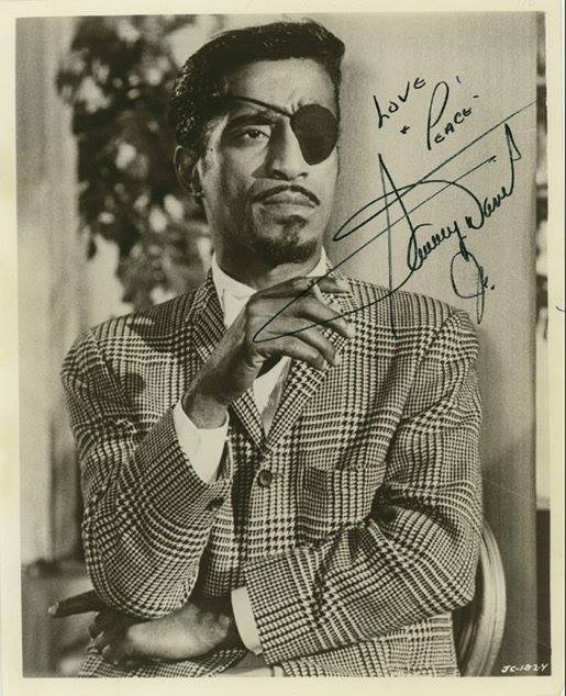
I was standing here one day taking some train shots and some guy told me this was where Say Davis Jr. had the accident where he lost his eye. I asked him if he knew if or not that it had been found? He told me it hadn’t and I told him I would look around before I left.
Strange, but not true … (or, All in favor, say “Eye.”) Oro Grande, Ca.
I knew better. I didn’t know the story or location in detail, so I looked it up on the ‘Google.’ Google has ‘everything’ (Dad was right).
This is not where Sammy Davis Jr. was in an auto accident and lost his eye–it would have been found by now if it were!
A MYSTERY FROM THE MYSTERIES OF THE MYSTERIOUS MOJAVE
Where did Sammy Davis Jr. Lose His Eyeball?
Bullet-shaped horn button on ’55 Caddy
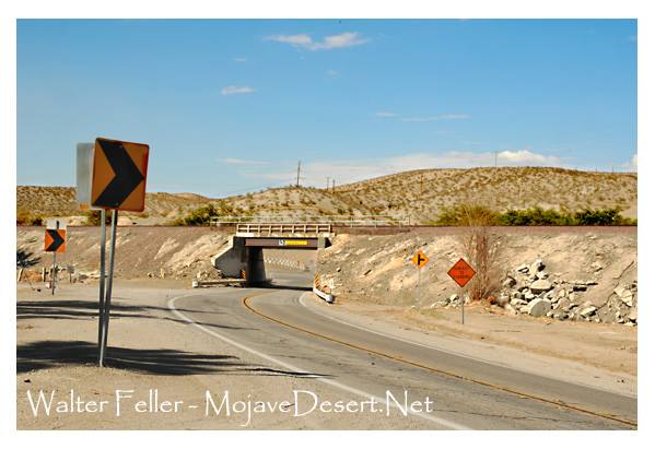
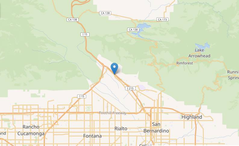
As he was making a return trip home to Los Angeles from Las Vegas, Davis lost his left eye to the bullet-shaped horn button (a standard feature in 1954 and 1955 Cadillacs) in an automobile accident on November 19, 1954, in San Bernardino, California. The accident occurred at a fork in U.S. Route 66 at Cajon Boulevard and Kendall Drive (34.2072°N 117.3855°W).
Kendall Rd. & Cajon Blvd.
BTW; His eyeball is not there either–I looked. If the ‘Google’ says that’s it, that’s it!
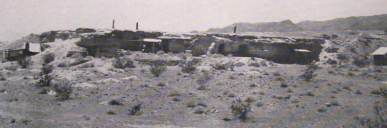
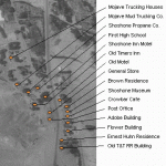
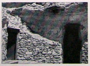
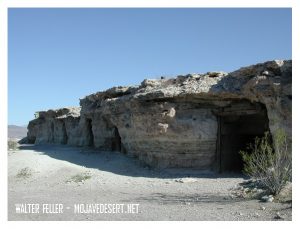
They belong to the occupants while they live there, and the first man to move-in is the next owner. It is not a written law, but is a habit and custom of the country and is respected by rich and poor alike.
It started with Dobe Charley when he needed a home. A tent was too hot in summer and too cold in winter. he pondered the problem through one cold windy winter and one hot desert summer.
When “camping out” became too unbearable he took refuge in an old deserted mine tunnel a few miles from Shoshone, and was comfortable. He was protected from all weather hazards, but it was too isolated to suit his tastes.
Shoshone, Ca.
” Why not make a tunnel in a hill closer to town?” the idea grew, and he looked all over the hills close around. Finally he picked out what he considered an ideal place.
It was a cliff of hard adobe mud, within easy walking distance of the general store and post office. Not that he intended to walk, that is, that while his motorcycle would run.
He dug out a whole as big as a medium sized room and put a door on it. When it was finished to his satisfaction, he moved in and became the envy of all the loafers in the little desert oasis on the fringe of Death Valley.
Joe Volmer, a retiring, middle-aged man, got himself a dwelling nearby. His consisted of several rooms connected by tunnels. To enter one of the rooms one must pull aside a cupboard and go a short distance down a ladder through a narrow passageway.
Ashford Brothers
The Ashford brothers, Harold and Rudy, decided to follow suit. They were dapper little fellows, very English and very neat and clean. Their cliff dwelling reflected them, neat and across the gulch from the others. like its occupants, it stood a little apart from its companions.
Bill, big and lazy, liked Doublin Gulch, but hadn’t the ambition to dig a dwelling. He built his one-room shack on a level place against the cliff.
Crowly, aggressive and authoritative, look it over and chose the point of the hill, a position dominating all the other cliff houses. An imposing location, but like its builder, it was untidy.
Crowly appointed himself a sort of Mayor of Doublin Gulch. If the others resented it they gave no indications. Mostly they did not mind as long as no one interfered with their way of life.
Cool in the summer–and a great view!
Other men settled along the cliff. Thrown together by circumstances, these men were a variable lot. For the most part their past was a closed book. Some, no doubt, came to escape this or that, but on the whole they lived as they pleased, working at the nearby mines until they had saved a stake, returning to their cliff dwelling to live the leisurely until it was gone.
When one has finished with this life and needs his home no longer, another drifter, perhaps fleeing from his past or maybe just tired of the sorrows and troubles of the outside world and finding solace in the desert, moves in.
Thus these cliff dwellings of Doublin Gulch have passed from one occupant to another.
Who can tell what secrets they have hidden or what sorrows have been soothed by the quiet and solitude of these rugged refuges thrusting their doors from the face of the cliff like turtle’s heads from under their shells.
Ghost Town News Knott’s Berry Place Buena Park, Calif. December 1944
“Warm in the winter, cool in the summer, the caves carved into the soft material of the banks of this wash were home, at one time or another, to people … ”
Sandy Walker, Desert Rat, says that in the desert a Ford lives 3 years – a dog 3 times the age of the Ford – 9, a horse 3 times the age of a dog – 27, and a man 3 times the age of the horse – 81, and some say a burro 3 times the age of a man – 243, at least this is 4/5ths true.
Sandy Walker says you can’t find gold with Fords – have to have burros. Says he’s been out here in the desert 26 years, 6 years hunting gold and 20 years hunting burros. He didn’t find his mine while hunting gold. He found it while hunting his dadburned runaway burros.
Many prospectors will tell you that no one has ever seen a dead burro.
Uncommon to locally common in deserts of California. Range extends into eastern Lassen Co., and from extreme southern Mono Co. south to the Mexican border. Most are found in Inyo Co., northeastern San Bernardino Co., and in the vicinity of the Colorado River.


 Death Valley was having one of its periodic wind storms when the tourists drove up in front of Inferno store to have their gas tank filled.
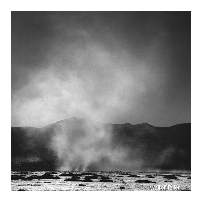


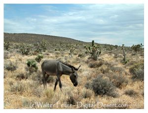
 Sandy Walker says you can’t find gold with Fords – have to have burros. Says he’s been out here in the desert 26 years, 6 years hunting gold and 20 years hunting burros. He didn’t find his mine while hunting gold. He found it while hunting his dadburned runaway burros.