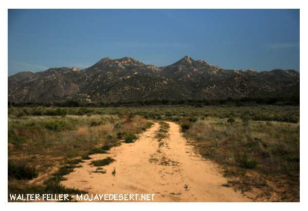
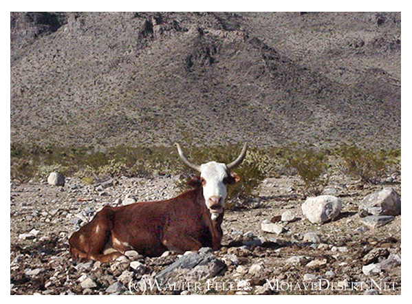
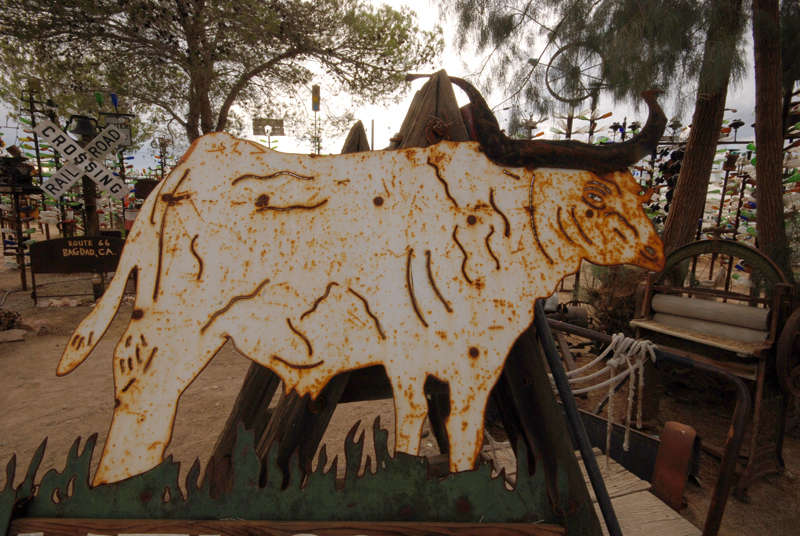
The cow is the clear focal point, positioned almost dead-center, which gives the image a straightforward, documentary feel. While this works for identification, shifting the cow slightly off-center would add visual interest.
The background is flat but expansive, conveying a sense of isolation and vastness—typical of open-range desert scenes.
Lighting & Color
Harsh daylight casts minimal shadow, resulting in a flat overall tone. Morning or evening light could create more contrast and mood.
Color is natural and subdued—browns and tans dominate, blending the cow into its surroundings a bit too much. A stronger separation between subject and background would help.
Narrative & Tone
The cow’s stance and the empty landscape suggest solitude and endurance, though the image stops short of telling a full story. Including another cow or a sign of human activity (like a trough or fence line) might deepen the narrative.
The image leans more toward utilitarian than artistic—this could be intentional, especially for documentary or archival use.
Technical Observations
Focus is good; the cow is sharp, and background elements are nicely blurred.
The horizon is level, which is essential in landscape shots.
There’s some dead space above and beside the cow, which could be tightened or reframed to emphasize the subject.
Summary: This image works well as a straightforward record of a lone cow in a desert setting. It’s honest and functional. For stronger visual impact or storytelling, a few changes in light, framing, and background elements would elevate it from reference to expressive photograph.
6 out of 10.
Why 6?
+2 for clear subject and sharp focus
+2 for honest, documentary value
+1 for capturing natural environment and mood
+1 for decent composition and exposure
-1 for flat lighting and lack of visual depth
-1 for minimal storytelling or emotional engagement
-1 for slightly awkward centering and framing
With some adjustments—especially in light, timing, and narrative context—it could easily reach an 8 or 9.
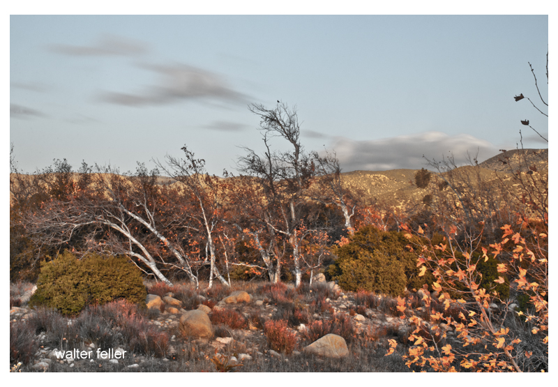
There are those memories of the autumnal winds when seasons turn upside down and the icy drama of the silver winter threads through the hollows between trees stirring last year’s brown leaves into a low ruckus and crackle. Thin and bare sycamore branches, delicate and bony, trace low and lonely moans in their dark choir. Pink sand from the nearby riverbed salted everywhere and anywhere; grit flecked in your hair, in your shoes, in your eyes. These are the days. These were the days. These are the heartfelt and kind memories of these days.
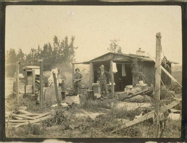
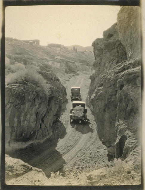
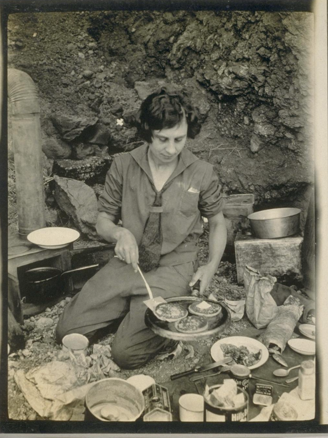
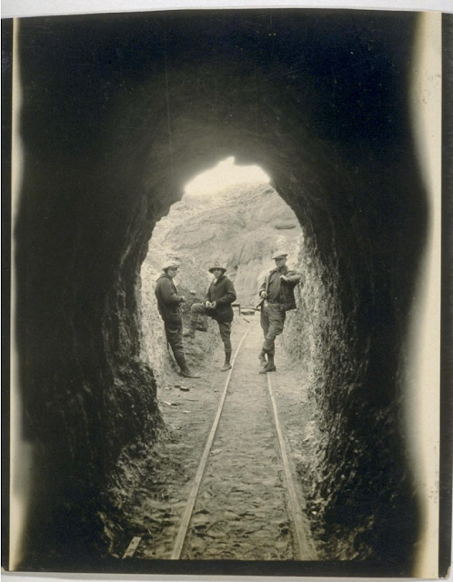
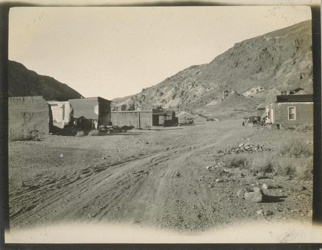
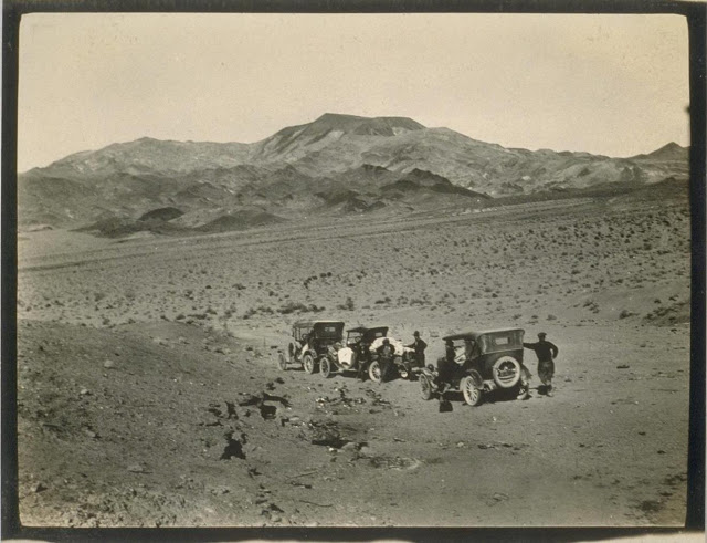
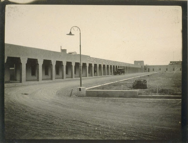
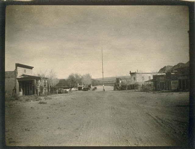
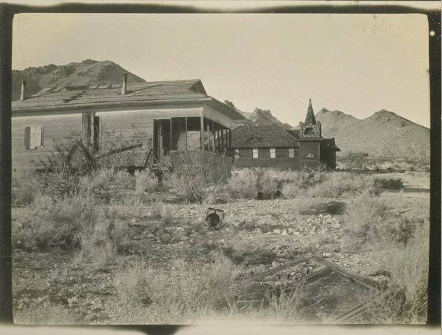
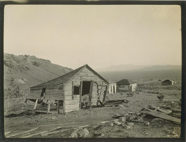
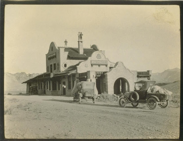
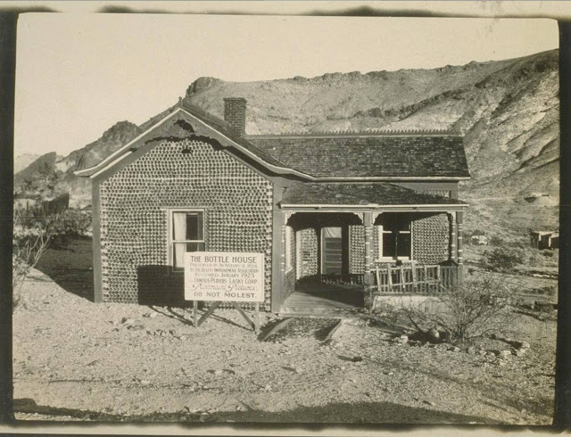
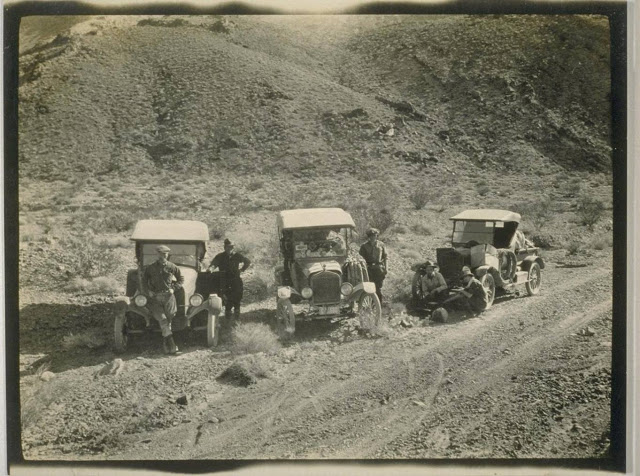
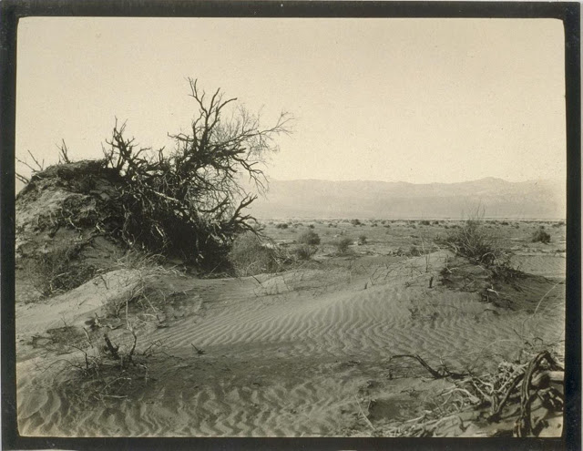
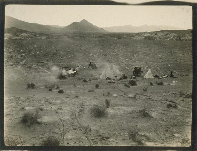
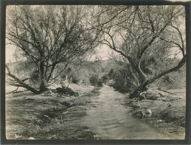
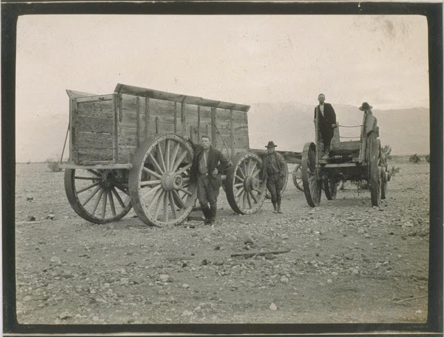
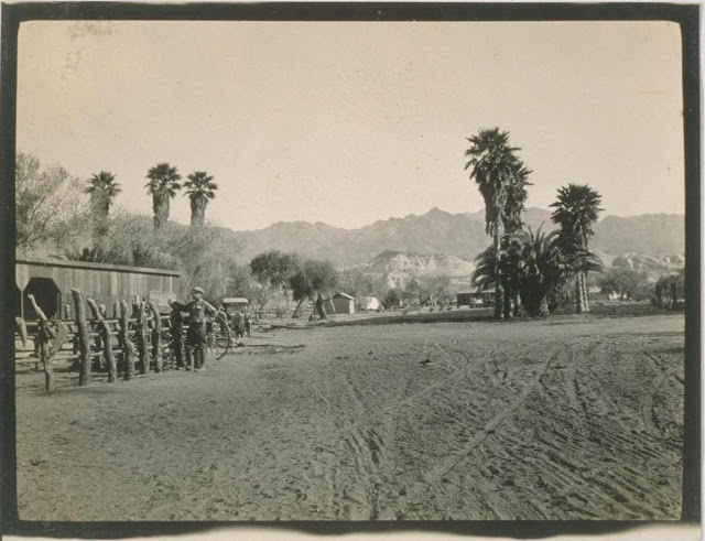
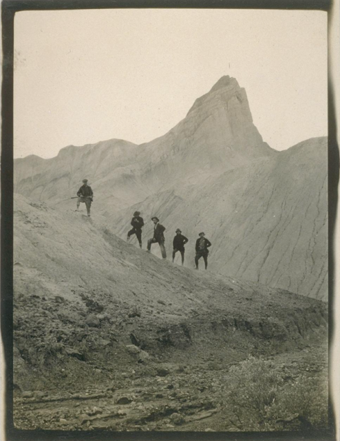
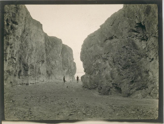
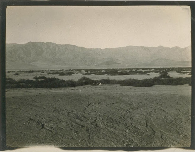
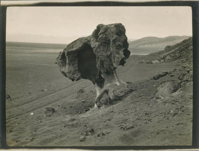
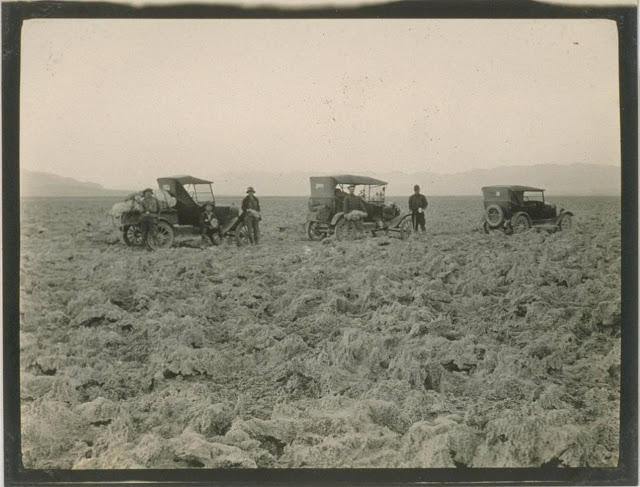
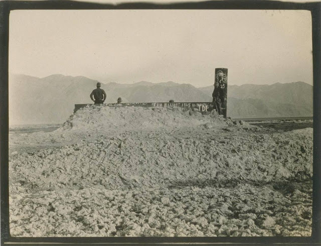
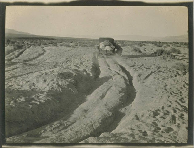
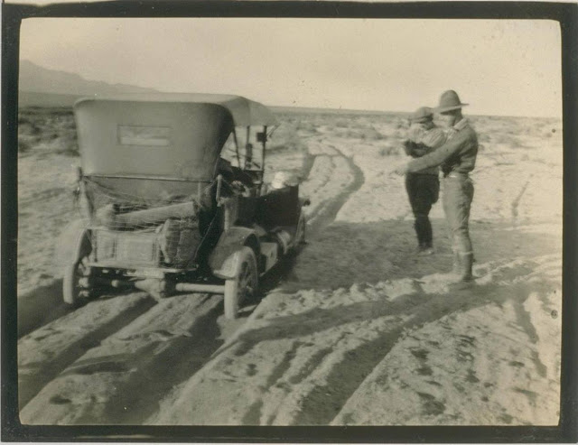
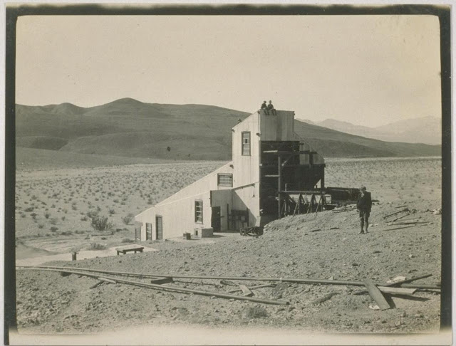
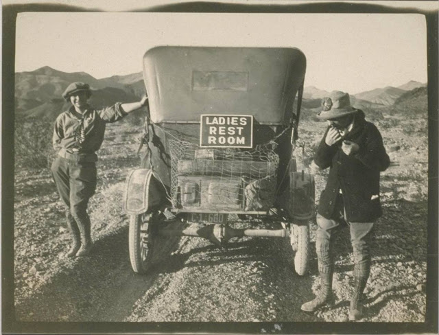
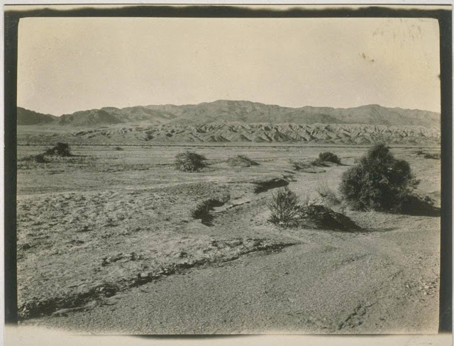
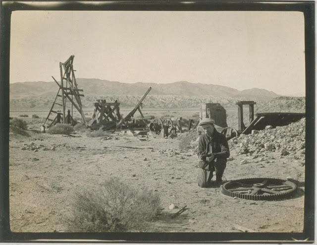
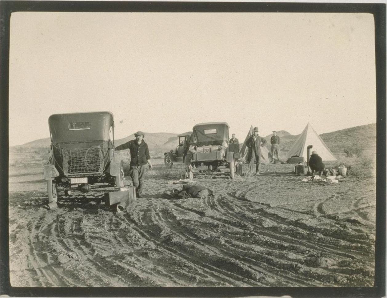
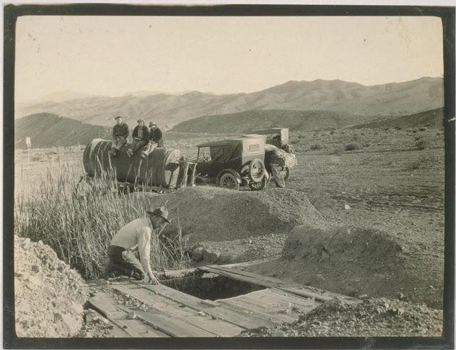
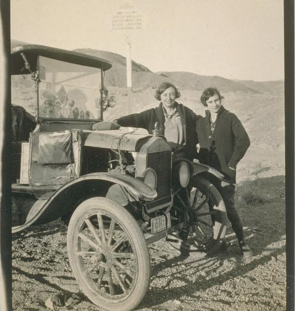
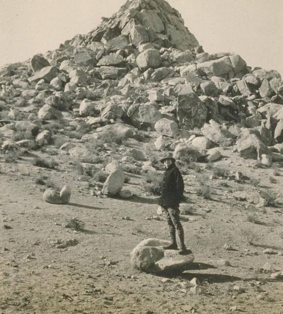
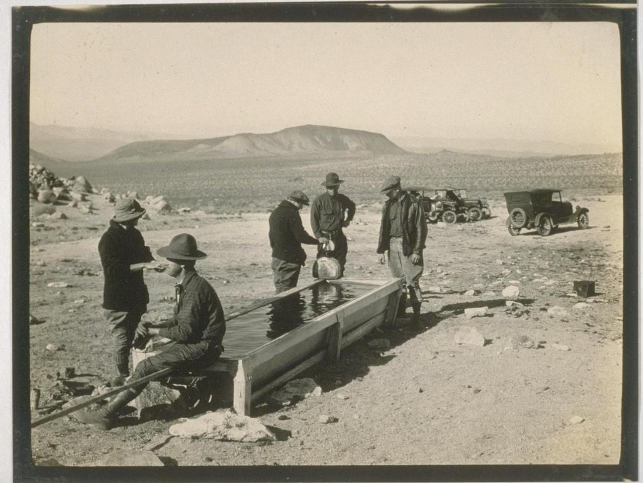
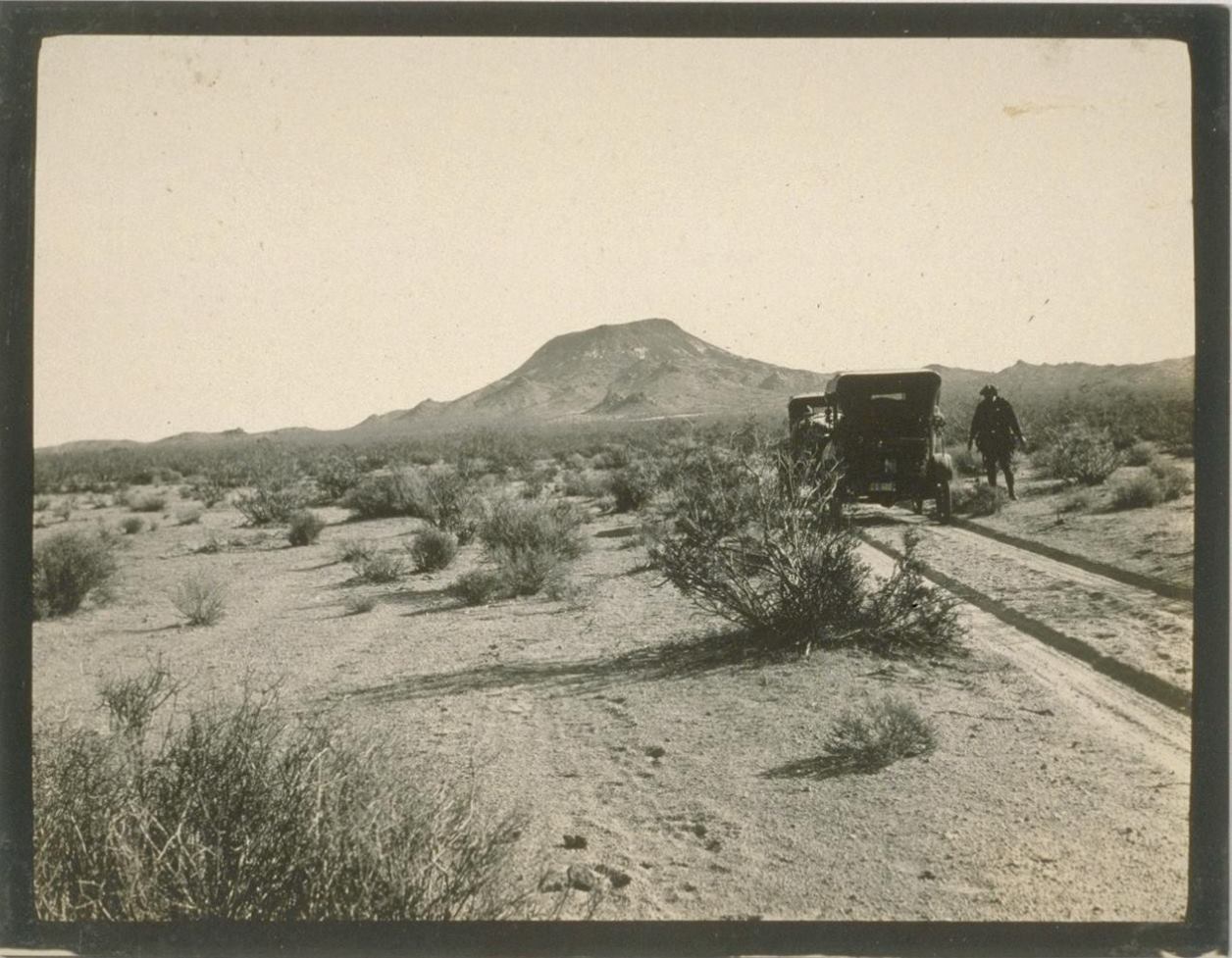
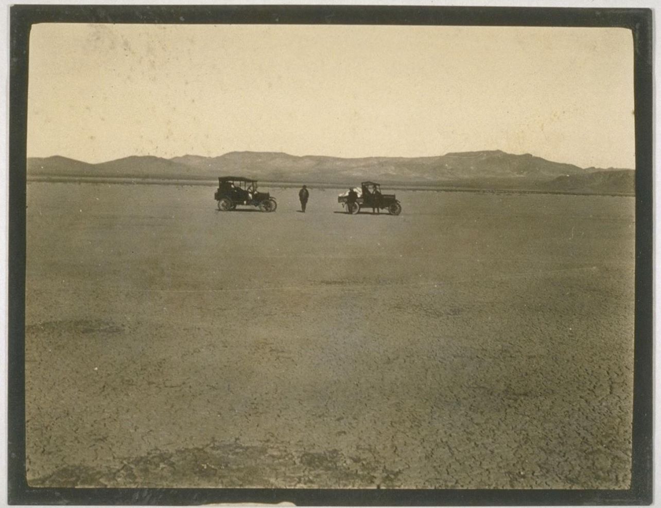
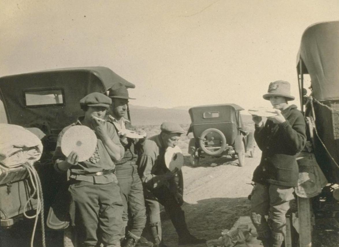
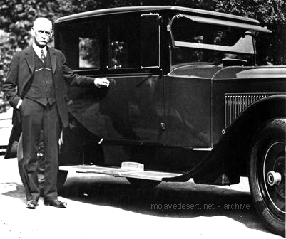
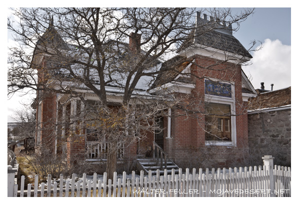
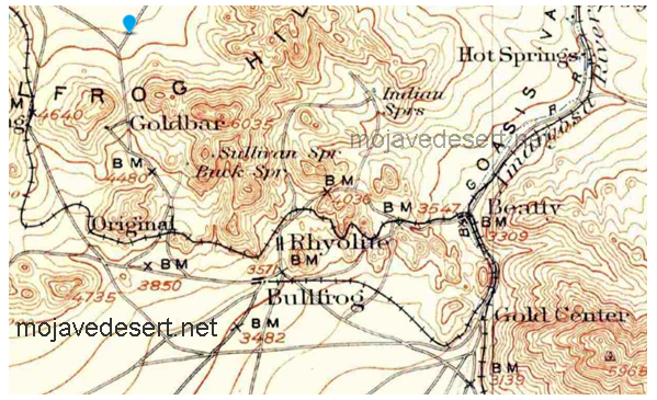
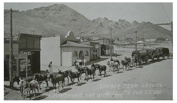
The Death Valley Automobile Trip photograph album containing 76 prints appears to be the record of a sightseeing trip made from Los Angeles to Death Valley in 1926. Neither the diarist nor the photographer is identified. The album displays no one emphasis: it consists of a broad range of photographs, from automobiles and sightseers to the landscape, abandoned mines, schoolhouses, hotels, and homesteads of Death Valley. . .
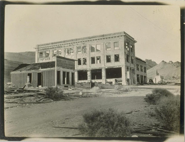
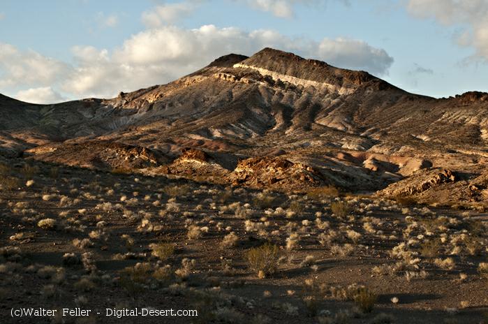
Rhyolite ghost townDevil’s Throne, Mushroom Rock
death-valley-automobile-trip-1926-24
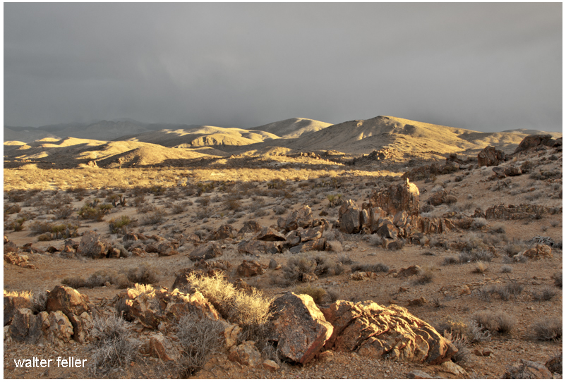
If you want to see the desert pick a fine day and go to the desert. It will be cloudless, hot, and asleep and pretty much as you expect it.
If you want to be in the desert while it is awake and alive and changing its own character–go when there is drama in the skies and in the wind. Go when its army of clouds cast unshaped shadows of camouflage on its colored hills. Go when rain is pouring down from the heavens in patches and flooding the landscapes and carving the canyons and washes. Go when the wind is blowing sand that scars its cliffs and uprooting the Joshua trees that have become old and weak. Go while the desert is growing, reshaping, and in a dubious struggle with itself. Go then.
— Wyatt had bought a brand new auto and was taking Josie out to visit a friend in Arizona. Somewhere south of Needles, a large bull leapt out from behind a creosote bush. The bull huffed and puffed and stomped and scrapped his hooves, lowered his head and charged the brand-new shiny-clean car. The bull came at the door on Josie’s side. She screamed. She was afraid the bull would kill her. However, she had no reason to fear death as Wyatt, drew his gun and put 3 shots into his thick skull right between its wide-set eyes. This killed the bull instantly. The bull had messed up the door pretty bad. Then all of a sudden some guy jumped out of the creosote yelling and screaming about the “prize bull” Wyatt just killed. An argument ensued. It seemed that Wyatt knew this guy’s boss and was the friend he was taking Josie to visit. It was pretty funny. Sort of. I don’t know who, if anyone, paid to get Wyatt’s door fixed. I imagine they ate the bull.
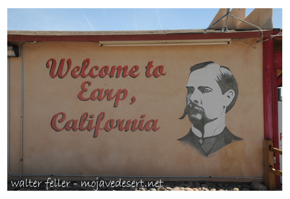
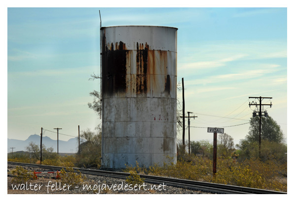
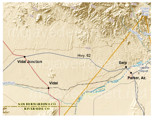
Earp, California is an unincorporated community in San Bernardino County in the Sonoran/Mojave Desert transition next to the Colorado River at the California/Arizona state line in Parker Valley.
Welcome to Earp, California
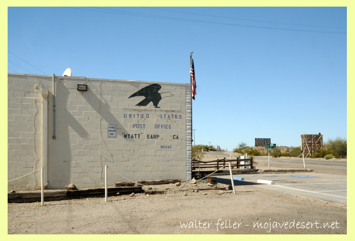
Earp post office at the eastern end of Highway 62, ZIP 92242.
In 1910 the little town was named Drennan. In 1929 Drennan was renamed Earp in 1929 in honor of the nefarious Old West lawman and entrepreneur Wyatt Earp. Wyatt and Josephine Sarah Marcus, his common-law wife, lived in the area seasonally from about 1906 staking more than 100 claims near the base of the Whipple Mountains.
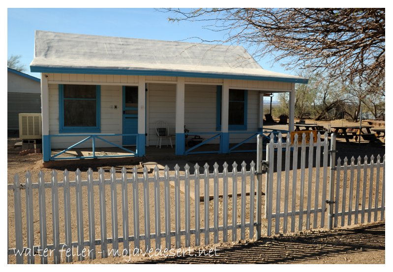
Downtown Vidal, California
Wyatt Earp, the legendary law man, gunfighter, gambler, businessman and miner along with his wife, Josephine, inhabited this “dream-come-true” cottage from 1925 through 1928, winter and spring months, while he worked his “Happy Days” mines in the Whipple Mountains a few miles north of this site. This is the only permanent residence they owned in their long lives.
They bought a small cottage in nearby Vidal and lived there during the fall, winter and spring months of 1925 – 1928, while he worked his “Happy Days” mines in the Whipple Mountains a few miles north. It was the only place they owned the entire time they were married. They spent the winters of his last years working the claims but lived in Los Angeles during the summers, where Wyatt died on January 13, 1929.
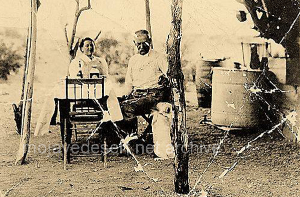
Josie & Wyatt and dog at Happy Days mine west of Parker, Az.
In December of 1849 anxious gold seekers and their wagons broke away from the Mojave San Joaquin Company (Mojave Sand-walking Company) to take a shortcut to the goldfields of California. Their map was incomplete and vague not informing these wayward pioneers of the numerous ranges of mountains between them and their destination. As a result they lost their way in the rocky canyons and sandy washes leading down into what we now know as Death Valley.
It was obvious to the travelers that Indians lived in the area, but they all had fled from the wanderers with one exception. Both Julia Brier and William Manly, members of this band of Lost 49ers recorded the first known encounter with this remaining Timbisha Shoshone Indian.
The next morning the company moved on over the sand to — nobody knew where. One of the men ahead called out suddenly, “Wolf! Wolf!” and raised his rifle to shoot.
“My God, it’s a man!” his companion cried. As the company came up we found the thing to be an aged Indian lying on his back and buried in the sand — save his head. He was blind, shriveled and bald and looked like a mummy.
He must have been one hundred and fifty years old. The men dug him out and gave him water and food. The poor fellow kept saying, “God bless pickaninnies!” Wherever he had learned that. His tribe must have fled ahead of us and as he couldn’t travel he was left to die.
Excerpt from the December 25, 1898 edition of The San Francisco Call
Our Christmas Amid the Terrors of Death Valley – Julia Brier
Next morning I shouldered my gun and followed down the cañon keeping the wagon road, and when half a mile down, at the sink of the sickly stream, I killed a wild goose. This had undoubtedly been attracted here the night before by the light of our camp fire. When I got near the lower end of the cañon, there was a cliff on the north or right hand side which was perpendicular or perhaps a little overhanging, and at the base a cave which had the appearance of being continuously occupied by Indians. As I went on down I saw a very strange looking track upon the ground. There were hand and foot prints as if a human being had crawled upon all fours. As this track reached the valley where the sand had been clean swept by the wind, the tracks became more plain, and the sand had been blown into small hills not over three or four feet high. I followed the track till it led to the top of one of these small hills where a small well-like hole had been dug and in this excavation was a kind of Indian mummy curled up like a dog. He was not dead for I could see him move as he breathed, but his skin looked very much like the surface of a well dried venison ham. I should think by his looks he must be 200 or 300 years old, indeed he might be Adam’s brother and not look any older than he did. He was evidently crippled. A climate which would preserve for many days or weeks the carcass of an ox so that an eatable round stake could be cut from it, might perhaps preserve a live man for a longer period than would be believed.
 from: Half a Century Chasing Rainbows
 By Frank "Shorty" Harris as told to Phillip Johnston
Touring Topics: Magazine of the American Automobile Association of Southern California - October 1930
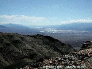
View of Death Valley from Keane Wonder
The best strike I ever made was in 1904 when I discovered the Rhyolite and Bullfrog district. I went into Boundary Canyon with five burros and plenty of grub, figuring to look over the country northeast from there. When I stopped atKeane Wonder Mine, Ed Cross was there waiting for his partner, Frank Howard, to bring some supplies from the inside. For some reason, Howard had been delayed, and Cross was low on grub.
“Shorty,” he said, “I’m up against it, and the Lord knows when Howard will come back. How are the chances of going with you?”
“Sure, come right along,” I told him, “I’ve got enough to keep us eating for a couple of months.”
Amargosa Desert
So we left the Keane Wonder, went through Boundary Canyon, and made camp at Buck Springs, five miles from a ranch on the Amargosa where a squaw man by the name of Monte Beatty lived. The next morning while Ed was cooking, I went after the burros. They were feeding on the side of a mountain near our camp and about half a mile from the spring. I carried my pick, as all prospectors do, even when they are looking for their jacks—a man never knows just when he is going to locate pay-ore. When I reached the burros, they were right on the spot where the Bullfrog mine was afterward located. Two hundred feet away was a ledge of rock with some copper stains on it. I walked over and broke off a piece with my pick—and gosh, I couldn’t believe my own eyes. The chunks of gold were so big that I could see them at arm’s length—regular jewelry stone! In fact, a lot of that ore was sent to jewelers in this country and England, and they set it in rings, it was that pretty! Right then, it seemed to me that the whole mountain was gold.
I let out a yell, and Ed knew something had happened; so he came running up as fast as he could. When he got close enough to hear, I yelled again: “Ed we’ve got the world by the tail, or else we’re coppered!”
We broke off several more pieces, and they were like the first—just lousy with gold. The rock was green, almost like turquoise, spotted with big chunks of yellow metal, and looked a lot like the back of a frog. This gave us an idea for naming our claim, so we called it the Bullfrog. The formation had a good dip, too. It looked like a real fissure vein; the kind that goes deep and has lots of real stuff in it. We hunted over the mountain for more outcroppings, but there were no other like that one the burros led me to. We had tumbled into the cream pitcher on the first one—so why waste time looking for skimmed milk?
That night we built a hot fire with greasewood, and melted the gold out of the specimens. We wanted to see how much was copper, and how much was the real stuff. And when the pan got red hot, and the gold ran out and formed a button, we knew that our strike was a big one, and that we were rich.
“How many claims do you figure on staking out?” Ed asked me. “One ought to be plenty,” I told him. “If there ain’t enough in one claim, there ain’t enough in the whole country. If other fellows put extensions on that claim of ours, and find good stuff, it will help us sell out for big money.” Ed saw that that was a good argument, so he agreed with me.
After the monuments were placed, we got some more rich samples and went to the county seat to record our claim. Then we marched into Goldfield, and went to an eating-house. Ed finished his meal before I did, and went out into the street where he met Bob Montgomery, a miner that both of us knew. Ed showed him a sample of our ore, and Bob couldn’t believe his eyes.
“Where did you get that?” he asked. “Shorty and I found a ledge of it southwest of Bill Beatty’s ranch,” Ed told him. Bob thought he was having some fun with him and said so. “Oh, that’s just a piece of float that you picked up somewhere. It’s damn seldom ledges like that are found!” Just then I came walking up, and Ed said, “Ask Shorty if I ain’t telling you the truth.” “Bob,” I said, “that’s the biggest strike made since Goldfield was found. If you’ve got any sense at all, you’ll go down there as fast as you can, and get in on the ground floor!”
Goldfield, Nevada
That seemed to be proof enough for him, and he went away in a hurry to get his outfit together—one horse and a cart to haul his tools and grub. He had an Indian with him by the name of Shoshone Johnny, who was a good prospector. Later on, it was this Indian who set the monuments on the claim that was to become the famous Montgomery-Shoshone Mine.
It’s a might strange thing how fast the news of a strike travels. You can go into a town after you’ve made one, meet a friend on the street, take him into your hotel room and lock the door. Then, after he has taken a nip from your bottle, you can whisper the news very softly in his ear. Before you can get out on the street, you’ll see men running around like excited ants that have had a handful of sugar poured on their nest. Ed and I didn’t try to keep our strike a secret, but we were surprised by how the news of it spread. Men swarmed around us and asked to see our specimens. They took one look at them, and then started off on the run to get their outfits together.
Bullfrog, Rhyolite, Beatty — 1908
I’ve seen some gold rushes in my time that were hummers, but nothing like that stampede. Men were leaving town in a steady stream with buckboards, buggies, wagons, and burros. It looked like the whole population of Goldfield was trying to move at once. Miners who were working for the big companies dropped their tools and got ready to leave town in a hurry. Timekeepers and clerks, waiters and cooks—they all got he fever and milled around, wild-eyed, trying to find a way to get out to the new “strike.” In a little while, there wasn’t a horse or wagon in town, outside of a few owned by the big companies, and the price of burros took a big jump. I saw one man who was about ready to cry because he couldn’t buy a jackass for $500.
A lot of fellows loaded their stuff on two-wheeled carts—grub, tools, and cooking utensils, and away they went across the desert, two or three pulling a cart and the pots and pans rattling. When all the carts were gone, men who didn’t have anything else started out on that seventy-five-mile hike with wheelbarrows; and a lot of ’em made it alright—but they had a hell of a time!
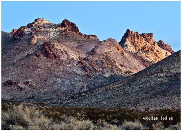
Bullfrog Hills
When Ed and I got back to our claim a week later, more than a thousand men were camped around it, and they were coming in every day. A few had tents, but most of ‘em were in open camps. One man had brought a wagon load of whiskey, pitched a tent, and made a bar by laying a plank across two barrels. He was serving the liquor in tin cups, and doing a fine business.
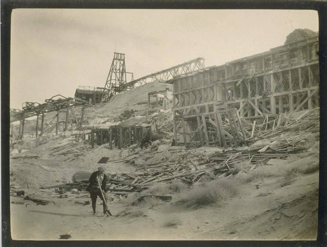
That was the start of Rhyolite, and from then on things moved so fast that it made even us old-timers dizzy. Men were swarming all over the mountains like ants, staking out claims, digging and blasting, and hurrying back to the county seat to record their holdings. There were extensions on all sides of our claim, and other claims covering the country in all directions.
Rhyolite, Nv. – 1907
In a few days, wagon loads of lumber began to arrive, and the first buildings were put up. These were called rag-houses because they were half boards and half-canvas. But this building material was so expensive that lots of men made dugouts, which didn’t cost much more than plenty of sweat and blisters.
When the engineers and promoters began to come out, Ed and I got offers every day for our claim. But we just sat tight and watched the camp grow. We knew the price would go up after some of the others started to ship bullion. And as time went on, we saw that we were right. Frame shacks went up in the place of rag-houses and stores, saloons, and dance halls were being opened every day.
Bids for our property got better and better. The man who wanted to buy would treat me with plenty of liquor before he talked business, and in that way, I got all I wanted to drink without spending a bean. Ed was wiser, though, and let the stuff alone—and it paid him to do it too, for when he did sell, he got much more for his half than I got for mine.
One night, when I was pretty well lit up, a man by the name of Bryan took me to his room and put me to bed. The next morning, when I woke up, I had a bad headache and wanted more liquor. Bryan had left several bottles of whiskey on a chair beside the bed and locked the door. I helped myself and went back to sleep. That was the start of the longest jag I ever went on; it lasted six days. When I came to, Bryan showed me a bill of sale for the Bullfrog, and the price was only $25,000. I got plenty sore, but it didn’t do any good. There was my signature on the paper and beside it, the signatures of seven witnesses and the notary’s seal. And I felt a lot worse when I found out that Ed had been paid a hundred and twenty-five thousand for his half, and had lit right out for Lone Pine, where he got married. Today he’s living in San Diego County, has a fine ranch, and is very well fixed.
As soon as I got the money, I went out for a good time. All the girls ate regularly while old Shorty had the dough. As long as my stake lasted I could move and keep the band playing. And friends—I never knew I had so many! They’d jam a saloon to the doors, and every round of drinks cost me thirty or forty dollars. I’d have gone clean through the pay in a few weeks if Dave Driscol hadn’t given me hell. Dave and I had been partners in Colorado and Utah, and I thought a great deal of him. Today he’s living over in Wildrose Canyon and going blind. Well, I had seven or eight thousand left when Dave talked to me. “Shorty,” he said, “If you don’t cut this out you’ll be broke in a damn short time and won’t have the price of a meal ticket!” I saw that he was right, and jumped on the water wagon then and there—and I haven’t fallen off since.
Rhyolite grew like a mushroom. Gold Center was started four miles away, and Beatty’s ranch became a town within a few months. There were 12,000 people in the three places, and two railroads were built out to Rhyolite. Shipments of gold were made every day, and some of the ore was so rich that it was sent by express with armed guards. And then a lot of cash came into Rhyolite—more than went out from the mines. It was this sucker money that put the town on the map quickly. The stock exchange was doing a big business, and I remember that the price of Montgomery-Shoshone got up to ten dollars a share.
Beatty, Nevada
Businessmen of Rhyolite were live ones, alright. They decided to make the town the finest in Nevada—and they came mighty near doing it. Overbury built a three-story office building out of cut stone—it must have cost him fifty thousand. The bank building had three stories too, and the bank was finished with marble and bronze. There were plenty of other fine business houses and a railroad station that would look mighty good in any city.
Money was easy to get and easy to spend in those days. The miners and muckers threw it right and left when they had it. Many a time I’ve seen ‘em eating bacon and beans, and drinking champagne. Wages were just a sideline with them—most of their money was made in mining stock.
Rhyolite was a great town, and no mistake—as live as the Colorado camps were thirty years before, but not so bad. We had a few gunfights, and several tough characters got their light shot out, which didn’t make the rest of us sore. We were glad enough to spare ‘em. I saw some of those fights myself, but I never took any part in the fireworks. “Shorty, the foot racer” was what they called me because I always ducked around the corner when the bullets began to fly. I knew they were not meant for me, but I wasn’t taking any chances.
They called him “Shorty” because he was short. 😉
There was plenty of gold in those mountains when I discovered the original Bullfrog, and there’s plenty there yet. A lot of it was taken out while Rhyolite was going strong—$6,000,000 or $7,000,000—but they quit before they got the best of it. Stock speculation—that’s what killed Rhyolite! The promoters got impatient. They figured that money could be made faster by getting gold from the pockets of suckers than by digging it out of the hills. And so, when the operators of the Montgomery-Shoshone had a little trouble; when they ran into the water and struck a sulfite ore which is refractory and has to be cut and roasted to be turned into money—the bottom dropped out of the stock market and the town busted wide open, She died quick, too. Most of the tin horns lit out for other parts, and that’s a sure sign a mining camp is going on the rocks.
If the right people ever got hold of Rhyolite they’ll make a killing, but they’ll have to be really hard rock miners and not the kind that does their work only on paper. Rhyolite is dead now—dead as she was before I made the big strike. Those fine buildings are standing out there on the desert, with the coyotes and jackrabbits playing hide and seek around them.
-|-
from: Half a Century Chasing Rainbows By Frank “Shorty” Harris as told to Phillip Johnston Touring Topics: Magazine of the American Automobile Association of Southern California October 1930
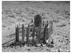
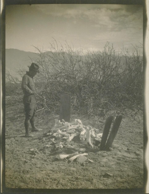
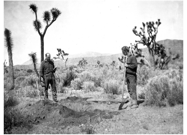
Bill Keys was the one who found Johnny Lang dead, wrapped in a tarp at the top of Lost Horse Valley in what is now known as Joshua Tree National Park. Johnny spent his last night, probably hungry and cold, on his way to get supplies to take back to the run down shack he lived in further up the canyon toward the Lost Horse Mine that he once owned. Despite the rumors of a secret cache of gold Johnny had hi-graded from the mine, he had nothing more than a piece of bacon in his pocket to chew on during his journey to the store.
Bill Keys at Johnny’s grave
Bill Keys, noted area rancher, had found the body, reported it and was instructed to bury the undernourished old man. He would be paid by the coroner for such service. Keys, dug a deep enough hole, laid Johnny’s corpse in it, set a grave marker and threw dirt over the affair.
As Johnny’s legend regarding possibly hidden gold grew, someone foolishly went out and dug up the grave to see if his gold had been buried with him. It had not and Bill went out and finished the burial, again.
Years later Johnny’s body was again dug up–with a backhoe. This time, however, his skull was stolen. Johnny was reburied. This time the grave marker was placed away from the grave to hide the exact location, and that seems to have taken care of the problem. … This time.
Editor; Dan De Quille – Virginia City Territorial Enterprise – 1874
A gentleman who has just arrived from the borax fields of the desert regions surrounding the town of Columbus, in the eastern part of the state, gives us the following account of the sad fate of Mr. Jonathan Newhouse, a man of considerable inventive genius. Mr. Newhouse had constructed what he called a “solar armor,” and apparatus intended to protect the wearer from the fierce heat of the sun in crossing deserts and burning alkali plains.
The armor consisted of a long, close-fitting material; being about an inch in thickness. Before starting across a desert this armor was to be saturated with water. Under the right arm was suspended an Indian rubber sack filled with water and a small gutta-percha tube leading to the top of the hood. In order to keep the armor moist, all that was necessary to be done by the traveler, as he progressed over the burning sands, was to press the sack occasionally, when a small quantity of water would be forced up and thoroughly saturate the hood and the jacket below it. Thus, by the evaporation of the moisture in the armor, it was calculated might be produced almost any degree of cold.
Mr. Newhouse went down to Death Valley, determined to try the experiment of crossing that terrible place in this armor. He started out into the valley one morning from the camp nearest its borders, telling the man at the camp, as he laced his armor on his back, that he would return in two days.
The next day in Indian who could speak but a few words of English came up to the camp in a great state of excitement. He made the men understand that he wanted them to follow him. At the distance of about 20 miles out into the desert the Indian pointed to a human figure seated against a rock. Approaching they found it to be Newhouse still in his armor. He was dead and frozen stiff.
His beard was covered with frost and– though the noon day sun poured down its fiercest rays– and icicle over a foot in length home from his nose. There he had perished miserably, because his armor had worked but too well, and because it was laced up behind where he could not reach the fastenings.”
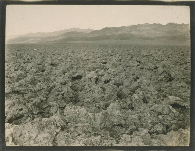
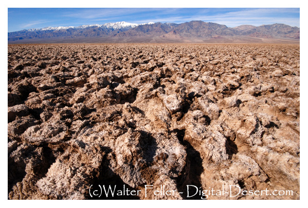
Devil’s Golf Course
This was Death Valley’s most widely publicized death. It was reported almost halfway around the world, and this terrible death, well, it never happened–it was simply a yarn as used as filler on a dull day in that summer of 1874.
Lucerne Valley post office – Photo courtesy Charles Rader
In 1930, Lucerne Valley boasted having this post office building on the Box “S” Ranch in this widely homesteaded area. Famed for its pure Mojave dry air, World War I veterans who suffer being gassed in France found breathing here are easy. One section of the valley is called “Little Inglewood.” This stems from many homesteaders, originally from Inglewood, California, moving there in the 1920s and 1930s.
from – Images of America – Mojave Desert by John Swisher
by Betty J. Tucker – Desert Magazine April, 1971
(photos – Walter Feller)
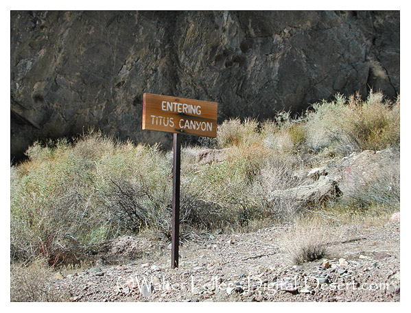
The road and scenery through Titus Canyon in Death Valley produces all the ups and downs of a young love, then steadies out into the young matronly area. Further on, it matures and gains
the stature of sedate old age.
Titus Canyon Road
That’s a pretty good life span for a mere 25 miles. The only problem is that occasionally heavy rains rip out the road, so be sure and check with the rangers. Trailers cannot be taken on this road and I wouldn’t recommend trucks and campers, although we saw one go through. At times the high center of the road forces you into some creative driving.We did it in a dune buggy.
The road into Titus Canyon leaves the Beatty Road and crosses the desert between the Bullfrog Hills and the Grapevine Mountains. Then it begins to climb. This road is one way and it is easy to see why. The steep uphill grades and sharp hairpin curves are not conducive to meeting oncoming traffic. There was that thrill of a first young love—the frightening steepness and sheer drop-offs, but still so breathtakingly beautiful that I wasn’t even afraid. The dune buggy has such a short wheelbase it takes the sharpest corners with ease.
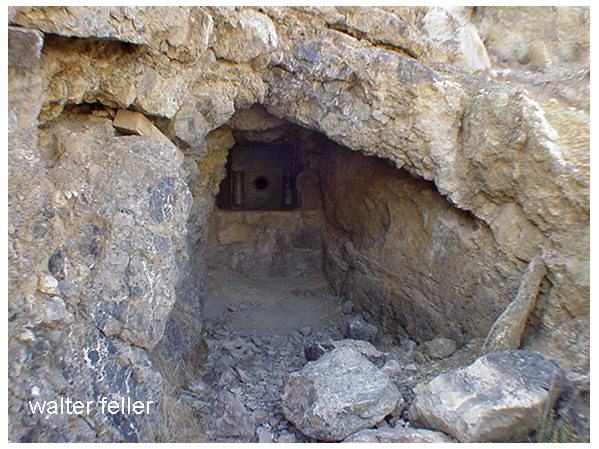
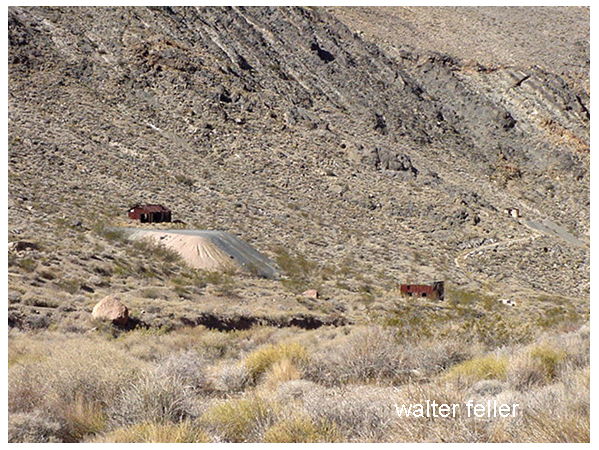
After cresting at Red Pass, elevation 5,250, we dropped down into a beautiful green valley. Here, nestled comfortably in the yellow flowered brittle bush was the ruins of Leadfield.
He blasted some tunnels and liberally salted them …
This child was the brainchild of C. C. Julian who would’ve sold ice to an Eskimo. He wandered into Titus Canyon with money in mind. He blasted some tunnels and liberally salted them with lead ore he had brought from Tonopah. Then he sat down and drew up some enticing maps of the area. He moved to usually dry and never deep Amargosa River miles from its normal bed.
Leadfield ghost town
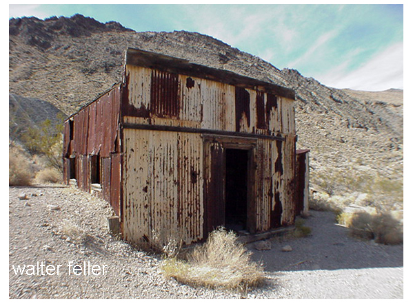
He drew pictures of ships steaming up the river hauling out the bountiful ore from his mines. Then he distributed handbills and lowered Eastern promoters into investing money. Miners flocked in at the scent of a big strike and dug their hopeful holes. They built a few shacks. Julian was such a promoter he even conned the US government into building a post office here.
Leadfield post office
So for six months, August, 1926 to February, 1927, over 300 people lived here and tried to strike it rich. They dug and lost.
What remains of this fiasco is rather amazing to behold. It most certainly looks like the ghost of a prosperous mine. The false front, cream-colored, corrugated tin post office is still in good shape. There is a built-in wooden desk in some small shelves on the walls. Of the narrow trail there are two more lime green corrugated tin buildings.
Blacksmith’s shop – the wooden block for his anvil and coke bin
Near it is the blacksmith’s building. The wooden block that held his anvil is there as is the bin full of coke. Both of these buildings are lined with asbestos. There are several small holes where the miners tried to find the promised ore, plus a couple of rather large shafts.
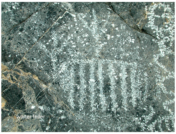
2 1/2 miles below Leadfield is Klare Spring, the major water supply for the town. Miners stood there in frequent baths here and hold water back to camp. Beside this spring you will find Indian petroglyphs.
Klare Springs
We sat on a couple of sun warmed rocks and had a snack. The water trickled by any couple of ravens performed a spectacular air ballet for us. It was an easy to remember that Titus Canyon got its name through a tragedy.
Titus took half of the stock and went to look for more water.
In 1907, Morris Titus, a young mining engineer, and two of his friends, Mullan and Weller, left Rhyolite intending to cross Death Valley and do some prospecting in the Panamints. They found the waterhole dry that they had hoped to use. They had only 20 gallons of water for themselves, 19 burros and two horses. Eventually they found a hole where they could get a cup bowl every four hours. While Mullan and Weller waited, Titus took half of the stock and went to look for more water. He never came back. Next day Weller took the remaining stock and set out to look for Titus. He, too, disappeared. Mullan was found a month later and taken to Rhyolite, more dead than alive. As Titus was known to carry large quantities of gold with him, his family instigated an extensive search. No sign was ever found of him. Some thought he might have broken through a salt crust and gone into the mire below. Whatever happened, he has a most beautiful monument in having this particular canyon named after him.
From: Shoshone Country; Resting Springs – Loafing Along Death Valley Trails by W. Caruthers
Resting Springs
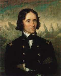
Early in 1843, John C. Fremont led a party of 39 men from Salt Lake City northward to Fort Vancouver and in November of that year, started on the return trip to the East.
Fremont 1844 – annotated
This trip was interrupted when he found his party threatened by cold and starvation and he faced about; crossed the Sierra Nevada and went to Sutter’s Fort. After resting and outfitting, he set out for the East by the southerly route over the old Spanish trail, which leads through the Shoshone region.
Bitter Springs
At a spring somewhere north of the Mojave River he made camp. The water nauseated some of his men and he moved to another. Identification of these springs has been a matter of dispute and though historians have honestly tried to identify them, the fact remains that none can say “I was there.”
In the vicinity were several springs any of which may have been the one referred to by Fremont in his account of the journey. Among these were two water holes indicated on early maps as Agua de Tio Mesa, and another as Agua de Tomaso.
Red Pass on the Old Spanish Trail between Bitter Springs and Salt Spring
There are several springs of nauseating water in the area and some of the old timers academically inclined, insisted that Fremont probably camped at Saratoga Springs, which afforded a sight of Telescope Peak or at Salt Spring, nine miles east on the present Baker-Shoshone Highway at Rocky Point.
Salt Spring
Kit Carson was Fremont’s guide. Fremont records that two Mexicans rode into his camp on April 27, 1844, and asked him to recover some horses which they declared had been stolen from them by Indians at the Archilette Spring, 13 miles east of Shoshone.
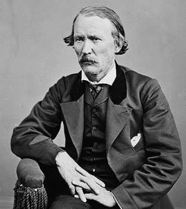
Christopher “Kit” Carson
One of the Mexicans was Andreas Fuentes, the other a boy of 11 years—Pablo Hernandez. While the Indians were making the raid, the boy and Fuentes had managed to get away with 30 of the horses and these they had left for safety at a water hole known to them as Agua de Tomaso. They reported that they had left Pablo’s father and mother and a man named Santiago Giacome and his wife at Archilette Spring.
With Fremont, besides Kit Carson, was another famed scout, Alexander Godey, a St. Louis Frenchman—a gay, good looking dare devil who later married Maria Antonia Coronel, daughter of a rich Spanish don and became prominent in California.
In answer to the Mexicans’ plea for help, Fremont turned to his men and asked if any of them wished to aid the victims of the Piute raid. He told them he would furnish horses for such a purpose if anyone cared to volunteer. Of the incident Kit Carson, who learned to write after he was grown, says in his dictated autobiography: “Godey and myself volunteered with the expectation that some men of our party would join us. They did not. We two and the Mexicans … commenced the pursuit.”
Fuentes’ horse gave out and he returned to Fremont’s camp that night, but Godey, Carson, and the boy went on. They had good moonlight at first but upon entering a deep and narrow canyon, utter blackness came, even shutting out starlight, and Carson says they had to “feel for the trail.”
Amargosa River, Tecopa
One may with reason surmise that Godey and Carson proceeded through the gorge that leads to the China Ranch and now known as Rainbow Canyon. When they could go no farther they slept an hour, resumed the hunt and shortly after sunrise, saw the Indians feasting on the carcass of one of the stolen horses. They had slain five others and these were being boiled. Carson’s and Godey’s horses were too tired to go farther and were hitched out of sight among the rocks. The hunters took the trail afoot and made their way into the herd of stolen horses.
Rainbow Canyon/China Ranch
Says Carson: “A young one got frightened. That frightened the rest. The Indians noticed the commotion … sprang to their arms. We now considered it time to charge on the Indians. They were about 30 in number. We charged. I fired, killing one. Godey fired, missed but reloaded and fired, killing another. There were only three shots fired and two were killed. The remainder ran. I … ascended a hill to keep guard while Godey scalped the dead Indians. He scalped the one he shot and was proceeding toward the one I shot. He was not yet dead and was behind some rocks. As Godey approached he raised, let fly an arrow. It passed through Godey’s shirt collar. He again fell and Godey finished him.”
Tecopa
Subsequently it was discovered that Godey hadn’t missed, but that both men had fired at the same Indian as proven by two bullets found in one of the dead Indians. Godey called these Indians “Diggars.” The one with the two bullets was the one who sent the arrow through Godey’s collar and when Godey was scalping him, “he sprang to his feet, the blood streaming from his skinned head and uttered a hideous yowl.” Godey promptly put him out of his pain.
They returned to camp. Writes Fremont: “A war whoop was heard such as Indians make when returning from a victorious enterprise and soon Carson and Godey appeared, driving before them a band of horses recognized by Fuentes to be part of those they had lost. Two bloody scalps dangling from the end of Godey’s gun….”
John Charles Fremont
Fremont wrote of it later: “The place, object and numbers considered, this expedition of Carson and Godey may be considered among the boldest and most disinterested which the annals of Western adventure so full of daring deeds can present.” It was indeed a gallant response to the plea of unfortunates whom they’d never seen before and would never see again.
When Fremont and his party reached the camp of the Mexicans they found the horribly butchered bodies of Hernandez, Pablo’s father, and Giacome. The naked bodies of the wives were found somewhat removed and shackled to stakes.
Fremont changed the name of the spring from Archilette to Agua de Hernandez and as such it was known for several years. He took the Mexican boy, Pablo Hernandez, with him to Missouri where he was placed with the family of Fremont’s father-in-law, U. S. Senator Thomas H. Benton. The young Mexican didn’t care for civilization and the American way of life and in the spring of 1847 begged to be returned to Mexico. Senator Benton secured transportation for him on the schooner Flirt by order of the Navy, and he was landed at Vera Cruz—a record of which is preserved in the archives of the 30th Congress, 1848.
Three years later a rumor was circulated that the famed bandit, Joaquin Murietta was no other than Pablo Hernandez (This was indeed, just a rumor as the dates were mismatched by at least ten years -ed.)
Lieutenant, afterward Colonel, Brewerton was at Resting Springs in 1848 with Kit Carson who then was carrying important messages for the government to New Mexico. He found the ground white with the bleached bones of other victims of the desert Indians. Brewerton calls them Pau Eutaws.
Death Valley was having one of its periodic wind storms when the tourists drove up in front of Inferno store to have their gas tank filled.
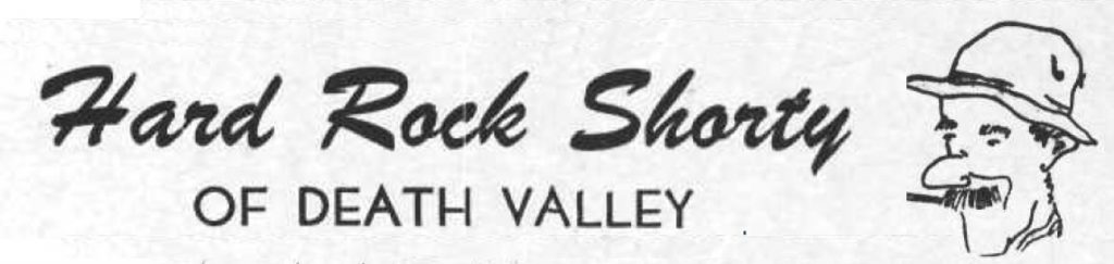
Hard Rock Shorty was seated on the bench under the lean-to porch with his hat pulled down to his ears to keep it from blowing away.
Desert wind storm
“Have many of these wind storms?” one of the dudes asked.
“Shucks, man, this ain’t no wind storm. Jest a little breeze like we have nearly every day. You have to go up in Windy Pass in the Panamints to find out what a real wind is like.
“Three-four years ago I wuz up there doin’ some prospectin’. Got together a little pile o’ wood an’ finally got the coffee to boilin’. Then I set it on a rock to cool while I fried the eggs.
“About that time one of them blasts o’ wind come along and blowed the fire right out from under the fryin’ pan. Blowed ‘er away all in one heap so I kept after it tryin’ to keep that fryin’ pan over the fire to git my supper cooked.
“I usually like my eggs over easy, but by the time 1 got one side done I wuz all tired out so I let ‘er go at that. Had to walk four miles back to the coffee pot.”
Once I asked Shorty Harris how he obtained his grubstakes. “Grubstakes,” he answered, “like gold, are where you find them. Once I was broke in Pioche, Nev., and couldn’t find a grubstake anywhere. Somebody told me that a woman on a ranch a few miles out wanted a man for a few days’ work. I hoofed it out under a broiling sun, but when I got there, the lady said she had no job. I reckon she saw my disappointment and when her cat came up and began to mew, she told me the cat had an even dozen kittens and she would give me a dollar if I would take ’em down the road and kill ’em.
“‘It’s a deal,’ I said. She got ’em in a sack and I started back to town. I intended to lug ’em a few miles away and turn ’em loose because I haven’t got the heart to kill anything.
“A dozen kittens makes quite a load and I had to sit down pretty often to rest. A fellow in a two-horse wagon came along and offered me a ride. I picked up the sack and climbed in.
“‘Cats, eh?’ the fellow said. ‘They ought to bring a good price. I was in Colorado once. Rats and mice were taking the town. I had a cat. She would have a litter every three months. I had no trouble selling them cats for ten dollars apiece. Beat a gold mine.’
Prospector with grubstake essentials
“There were plenty rats in Pioche and that sack of kittens went like hotcakes. One fellow didn’t have any money and offered me a goat. I knew a fellow who wanted a goat. He lived on the same lot as I did. His name was Pete Swain.
“Pete was all lit up when I offered him the goat for fifty dollars. He peeled the money off his roll and took the goat into his shack. A few days later Pete came to his door and called me over and shoved a fifty-dollar note into my hands. ‘I just wanted you to see what that goat’s doing,’ he said.
“I looked inside. The goat was pulling the cork out of a bottle of liquor with his teeth.
“‘That goat’s drunk as a boiled owl,’ Pete said. ‘If I ever needed any proof that there’s something in this idea of the transmigration of souls, that goat gives it. He’s Jimmy, my old sidekick, who, I figgered was dead and buried.’
“‘Now listen,’ I said. ‘Do you mean to tell me you actually believe that goat is your old pal, whom you drank with and played with and saw buried with your own eyes, right up there on the hill?’
“‘Exactly,’ Pete shouted, and he peeled off another fifty and gave it to me. So, you see, a grubstake, like gold, is where you find it.”
from: Loafing Along Death Valley Trails A Personal Narrative of People and Places Author: William Caruthers
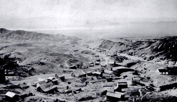
During the great silver boom in the Calicos, a small community grew up around the Bismarck mine in the next canyon east of Calico camp. Together with the miners of the Garfield, Odessa, Occidental and other mines, there were perhaps 40 persons in the area, which was known as East Calico.
While Calico was less than a mile away, by airline, the direct trail was steep and rugged and the road roundabout. The government did not consider the population sufficient for a post office, and the miners didn’t care to hike into Calico for their mail. So they contributed to a fund to pay a boy named Dave Nichols to bring the mail over, by burro, from the mother camp. But Dave found a better job and no one else wanted to be mail man.
Calico 1884
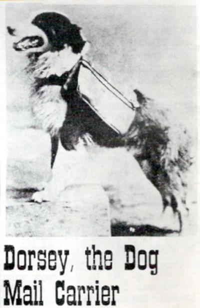
About that time a man named Stacy, brother of the Stacy who was postmaster at Calico (their first names have variously been given as James, William, Everett and Alwin) opened a store at Bismark. The Stacys had a dog named Dorsey, a big Scotch collie who had come to them for shelter one stormy night. The Bismarck Stacy took the collie’ with him to East Calico.
Dorsey, the Dog Mail Carrier
But Dorsey’s affections were divided, and after a few days at Bismarck, he ran away back to Calico. Postmaster Stacy attached a note to his neck, switched him and sent him back to Bismarck. After a few such runaways, Postmaster Stacy conceived the notion of tying a sack with newspapers in it on Dorsey’s back when he sent him home. Dorsey delivered them successfully, and soon little saddlepacks labeled “U. S. Mail” were made and attached to the dog’s back and a regular mail service set up between the two camps on a thrice-weekly schedule.
Dorsey soon became one of Calico’s most famous characters, but success did not go to his head.
Though he was not a civil service employee and his mail route entirely unofficial, he was faithful in the completion of his appointed rounds. Though the miners enjoyed attempting to lead him astray or tamper with the mail, he managed to elude them, then resume his course.
There is only one instance of possible misuse of his office on record. One Christmas Herman Mellen was living in a cave near Bismarck and his mother sent him a box of candy and sweets. Stacy had tied this box under Dorsey’s neck, and when he arrived at Bismarck the bottom was out and the contents missing. Whether temptation had proven too strong, the goodies had been hijacked or whether the package had broken open, allowing the contents to spill out was never determined.
The famous dog mail carrier continued his route for two years, until a dip in the boom caused the mines of East Calico to close and mail service became unnecessary. When the Stacys left Calico, they gave Dorsey to John S. Doe, wealthy San Francisco man interested in Calico mines, and Dorsey spent the rest of his life in comfort and ease in the Bay City.
Calico Print- Established 1882 by Vincent & Overshiner Published at Calico Silver Camp San Bernardino County, California EDITED BY HAROLD AND LUCILE WEIGHT Copyright by THE CALICO PRESS
Fortifications along the western extension of the Santa Fe trail, route of the Whipple survey, were built initially because of Indian attacks on covered wagon trains of settlers. The Mojave War followed the massacre of one train by Indians at the Colorado River crossing a few miles above the present Needles.
Paiute Creek
The Army was not slow in punishing the Mojave tribes, and entire regiment being collected at Fort Yuma and going upstream. This was in the winter of 1858-59. The initial fort, Ft. Mojave, was established at the time. Supplying of this river outpost was both expensive and difficult.
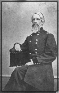
Soldiers attacked
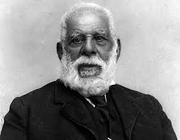
Lt. Col. William Hoffman
The road over the desert San Bernardino had been given a bad name by Lt. Col. William Hoffman would take in the company of mounted infantry in a small dragoon escort from the Cajon Pass to the river. Hoffman’s command had been attacked by Indians in route. The Col. was under orders to find a site for a desert fort. He saw nothing between Summit Valley in the river he considered a likely site. In fact, Hoffman condemned the entire route as unsuited for travel.
It is probable the Hoffman report influenced the Army in initially supplying Fort Mojave by steamer from Yuma. When the river was slow and supplies could not be taken at far upstream the fort garrison was desperate. At this juncture In Winfred Scott Hancock, the same officer who appeared in a recent issue of the series, called on the Banning stage and freight lines to take supplies through. Banning’s experience Teamsters had no trouble They drove again heavy freight wagons, each drawn by eight mule teams to the river in 16 days. The Fort Mojave garrison again had both food and ammunition.
Cady Old Site
Hancock at the time an assistant quartermaster, prove that not only the Mojave Valley road was practical. He also reduce the Army’s transport expense to Fort Mojave by two thirds. The hall from drum barracks at Wilmington to the Colorado River via Cajon Pass cost only a third as much per pound as the long water haul around Baja California and transfer shipment to river steamer.
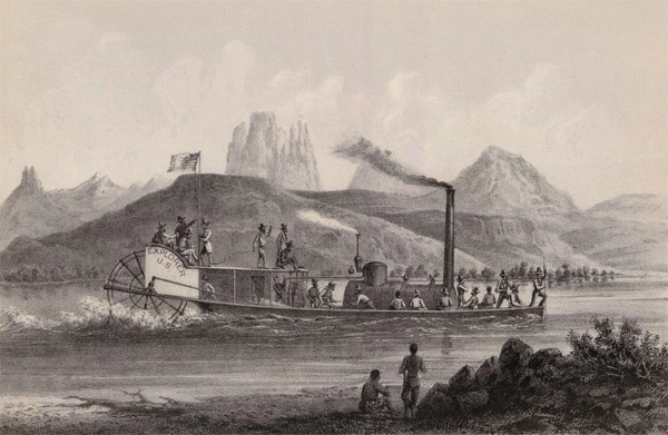
Ives Expedition steamboat and crew heading up the Colorado River, 1857.
The site of Camp Cady was used as an Indian “fort” even before California became a part of the United States. Indians engaged in stealing horses from the Mexican ranchos built a crude sort of stronghold on the rocky hillsides of the Mojave River near that spot. It was a few miles East of the old Spanish Trail and also guarded the entrance to narrow Afton Canyon which could serve as an escape route if pursuit became too hot.
Afton Canyon
There is documentary evidence of the Indian use of their crude stronghold in 1845 point Benjamin Wilson, the Don Benito of Mexican rule, meeting Indians there in battle in 1845 a few days after the historic discovery of Bear Valley.
Governor Pio Pico
Wilson’s account of the pursuit of the horse thieves attributed depredations to renegade Indians from Mission San Gabriel but it is probable Sun desert tribes had Braves in the raiding parties. Wilson was alcalde at Jurupa and was called upon by Gov. Pico to punish the Indians. The acalde gathered a large posse including 22 young Californians mounted on fleet horses. The larger party in fact train went up Cajon Pass. Wilson in the young ranchers took the route up to Santa Ana Canyon, enjoyed hunting bear in what Wilson named Bear Valley, and joined the pack train somewhere near Rancho Verde in the present Apple Valley.
Wilson, wounded by a poisoned arrow, had his life saved by Lorenzo Trujillo. Trujillo, a New Mexican, was leader in the little colony of Agua Mansa and its twin town, Trujillo. In the Apple Valley fight the Indians were defeated in three of them killed. Wilson shot the notorious Joaquin, the ex-mission Indian, who was a ringleader among the horse thieves.
Don Benito Wilson
Several of Wilson’s Horseman pursued the remnant of the Indians down the Mojave though the wounded Wilson was forced to turn back. Nothing Indians halted in their crude fort near the site of Camp Cady. There, though the entrenched behind rocks, they were again defeated and dispersed.
In addition to the soldiers at the Mojave Desert forts there were a few civilians quartered at some of the posts. For instance, the returns of Camp Cady for December 1866 indicate an assistant wagon master was stationed there. He was paid $75 a month. Teamsters, their number not specified, received hundred and $75 a month, and herders $35 a month. Other notations would indicate the herders, at least some of them, were Indians. The Teamsters, whose work was the most skilled, where the aristocrats of the road whether they drove Concord stages and six horses or whipped along multiple freight teams. The Army officers themselves received far less pay.
There were also, at least at Cady and Mojave, sutler stores. The Army had no canteen or post exchange in that. And contractors, called settlers, were granted the privilege of establishing stores on military reservations and also, for that matter, with armies in the field. Suites that supplemented the monotonous menu, tobacco and whiskey as well as such notions as red, writing paper and ink were for sale at the sutler stores.
He (Hoffman) saw nothing between Summit Valley in the river he considered a likely site. In fact, Hoffman condemned the entire route as unsuited for travel.
Soldiers receiving $7.50 a month did not have much money to spend but there was no place to go and as a result the software store almost invariably raked in the Army man’s wages. Passing travelers also helps well the sutler income.
The system was a poor one, and the cause of continuous complaint. The soldier, at times was victimized both by high prices in shoddy material. At one juncture soldier resentment in Camp Cady passed the usual grumbling stage and the garrison simply looted the store.
Looting did not satisfy the enraged soldiery. They set fire to the store and literally drove the hated sutler from the camp. The sutler came to San Bernardino and swore out complaints. That was in August 1867 after Camp Cady was manned by regulars.
First Lieut. Manual Eyre Jr. in command at Cady, reported the affair to first Lieut. C. H. Shepherd, assistant adjutant general at Fort Mojave. He said:
“Yesterday the sheriff was here and took with him five of my men for preliminary examination under charges of arson and robbery. The case is stated in my letter addressed to a AAAG at your headquarters, dated August 8, 1867. I should, I think, be in San Bernardino during the trial of these men, if they are held for trial. I also desire to present before the grand jury’s citizens who have harbored deserters.
“The posted by you till will be established under superintendence of an officer from Mojave. Could not an officer be spared temporarily to relieved Lieut. Drum and allow him to relieve me for 10 days or two weeks? If the Rock Springs garrison is withdrawn, I can leave Lieut. Drum here in command until my return?
“The intention of this man Dead (the sutler) is evident to me. He will try to obtain money from these men to let them off. If so, I would like to be present to prosecute him for attempting to compound a felony. I am of the opinion that, as much as I dislike it, I should be in San Bernardino as soon as possible, even if the men are released after preliminary examination when, of course they would be turned loose 100 miles from camp to find their way as they see fit.”
Both because it served as a headquarters post, and because it was maintained long after the little way stations along the Old Government Road were abandoned, Fort Mojave is far better known than such points as Fort Piute, Rock Springs, Marl Spring, Fort Soda, Bitter Spring, Resting Springs or even Cady.
Fort Pah-ute ruins
Until recent years Fort Mojave was maintained as an Indian school. When it ceased to be an army post, however, it is records were moved. Some were taken to Whipple barracks in Prescott, others to the Presidio at San Francisco. For Mojave, however had a wealth of old records that escaped attention of the detail entrusted to their moving. Within the past few years the grounds of the old fort were converted to agricultural use. The remains of an old adobe building were bulldozed flat. In the process the bulldozer broke through an old wooden floor long covered with several inches of earth. The accident disclosed a long forgotten cellar. In it were scores of packing boxes containing more records. These were assembled and shipped to Washington. Stacked in a line these rediscovered records stretch 29 feet.
As yet this latest ” mine” of Pioneer Army records has not been made available to historical researchers. Presumably in a few years, however, they will have been cleaned, indexed and deposited in the national archives and will furnish a far more detailed commentary on conditions in the Southwest during the pre-railroad decades,, and on Army activities at a dozen or more all but forgotten published such as Las Vegas, Resting Springs, El Dorado Canyon, and numerous early Arizona camps. Frequent transfers of headquarters seem to have made Fort Mojave a convenient depository for numerous papers no one wanted to which, under regulations, could not be destroyed. Paperwork in the military was almost as involved in the mid-19th century as it is today. Doubtless the company clerk of the Battalion Sgt. major of 1867 rebelled inwardly at the detail required of his job and doubtless to adjutants were hard put to find storage space for the growing mountains of paper but to their credit it must be noted they observed the rules and did not indulge in the periodic bonfires that mark some of the other branches of the federal service. For instance, research on Colorado River steamers is difficult because the customs offices of registry made it a practice to destroy old records.
The most famous lost mine in the Death Valley area is the Lost Breyfogle. There are many versions of the legend, but all agree that somewhere in the bowels of those rugged mountains is a colossal mass of gold, which Jacob Breyfogle found and lost.
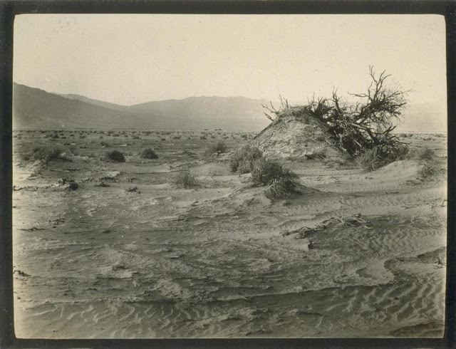
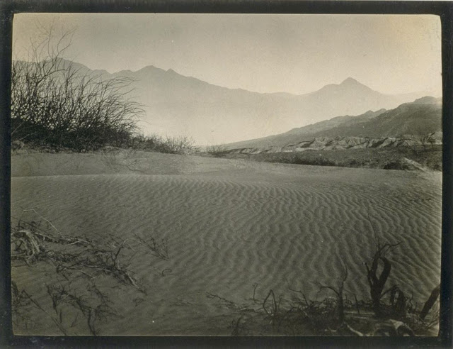
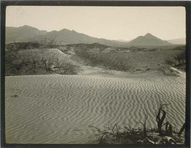
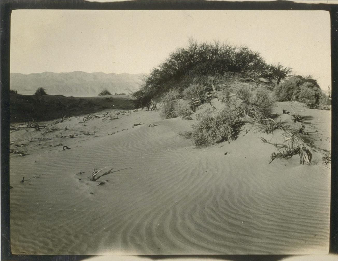
Mesquite Flats Sand Dunes – Death Valley
Jacob Breyfogle was a prospector who roamed the country around Pioche and Austin, Nevada, with infrequent excursions into theDeath Valleyarea. He traveled alone.
Indian George, Hungry Bill, and Panamint Tom saw Breyfogle several times in the country around Stovepipe Wells, but they could never trace him to his claim. When followed, George said, Breyfogle would step off the trail and completely disappear. Once George told me about trailing him into the Funeral Range. He pointed to the bare mountain. “Him there, me see. Pretty quick—” He paused, puckered his lips. “Whoop—no see.”
Breyfogle left a crude map of his course. All lost mines must have a map. Conspicuous on this map are the Death Valley Buttes which are landmarks. Because he was seen so much here, it was assumed that his operations were in the low foothills. I have seen a rough copy of this map made from the original in possession of “Wildrose” Frank Kennedy’s squaw, Lizzie.
Breyfogle presumably coming from his mine, was accosted near Stovepipe Wells by Panamint Tom, Hungry Bill, and a young buck related to them, known as Johnny. Hungry Bill, from habit, begged for food. Breyfogle refused, explaining that he had but a morsel and several hard days’ journey before him. On his burro he had a small sack of ore. When Breyfogle left, Hungry Bill said, “Him no good.”
Incited by Hungry Bill and possible loot, the Indians followed Breyfogle for three or four days across the range. Hungry Bill stopped en route, sent the younger Indians ahead. At Stump Springs east ofShoshone, Breyfogle was eating his dinner when the Indians sneaked out of the brush and scalped him, took what they wished of his possessions and left him for dead.
Ash Meadows Charlie, a chief of the Indians in that area confided to Herman Jones that he had witnessed this assault. This happened on the Yundt Ranch, or as it is better known, the Manse Ranch. Yundt and Aaron Winters accidentally came upon Breyfogle unconscious on the ground. The scalp wound was fly-blown. They had a mule team and light wagon and hurried to San Bernardinowith the wounded man. The ore, a chocolate quartz, was thrown into the wagon.
Resting Springs
“I saw some of it at Phi Lee’s home, theResting Spring Ranch,” Shorty Harris said. “It was the richest ore I ever saw. Fifty pounds yielded nearly $6000.”
Breyfogle recovered, but thereafter was regarded as slightly “off.” He returned to Austin, Nevada, and the story followed.
Wildrose (Frank) Kennedy, an experienced mining man obtained a copy of Breyfogle’s map and combed the country around the buttes in an effort to locate the mine. Kennedy had the aid of the Indians and was able to obtain, through his squaw Lizzie, such information as Indians had about the going and coming of the elusive Breyfogle.
“Some believe the ore came from around Daylight Springs,” Shorty said, “but old Lizzie’s map had no mark to indicate Daylight Springs. But it does show the buttes and the only buttes in Death Valley are those above Stovepipe Wells.
“Kennedy interested Henry E. Findley, an old time Colorado sheriff and Clarence Nyman, for years a prospector for Coleman andSmith(thePacific Borax Company). They induced Mat Cullen, a rich Salt Lake mining man, to leave his business and come out. They made three trips into the valley, looking for that gold. It’s there somewhere.”
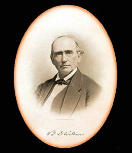
Francis Marion “Borax” Smith
At Austin, Breyfogle was outfitted several times to relocate the property, but when he reached the lower elevation of the valley, he seemed to suffer some aberration which would end the trip. His last grubstaker was not so considerate. He told Breyfogle that if he didn’t find the mine promptly he’d make a sieve of him and was about to do it when a companion named Atchison intervened and saved his life. Shortly afterward, Breyfogle died from the old wound.
Indian George, repeating a story told him by Panamint Tom, once told me that Tom had traced Breyfogle to the mine and after Breyfogle’s death went back and secured some of the ore. Tom guarded his secret. He covered the opening with stone and leaving, walked backwards, obliterating his tracks with a greasewood brush. Later when Tom returned prepared to get the gold he found that a cloudburst had filled the canyon with boulders, gravel and silt, removing every landmark and Breyfogle’s mine was lost again.
“Some day maybe,” George said, “big rain come and wash um out.”
Among the freighters of the early days was John Delameter who believed the Breyfogle was in the lower Panamint. Delameter operated a 20 mule team freighting service between Daggett and points in both Death Valley and Panamint Valley. He told me that he found Breyfogle down in the road about twenty-eight miles south of Ballarat with a wound in his leg. Breyfogle had come into the Panamint from Pioche, Nevada, and said he had been attacked by Indians, his horses stolen, while working on his claim which he located merely with a gesture toward the mountains.
Subsequently Delameter made several vain efforts to locate the property, but like most lost mines it continues to be lost. But for years it was good bait for a grubstake and served both the convincing liar and the honest prospector.
Nearly all old timers had a version of the Lost Breyfogle differing in details but all agreeing on the chocolate quartz and its richness.
That Breyfogle really lost a valuable mine there can be little doubt, but since he is authentically traced from the northern end of Death Valley to the southern, and since the chocolate quartz is found in many places of that area, one who cares to look for it must cover a large territory.
From: Chapter XXII Lost Mines. The Breyfogle and Others Loafing Along Death Valley Trails by William Caruthers
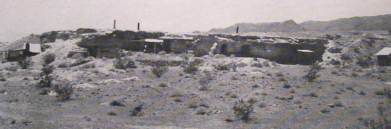
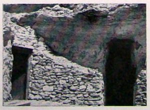
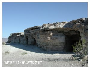
They belong to the occupants while they live there, and the first man to move-in is the next owner. It is not a written law, but is a habit and custom of the country and is respected by rich and poor alike.
It started with Dobe Charley when he needed a home. A tent was too hot in summer and too cold in winter. he pondered the problem through one cold windy winter and one hot desert summer.
When “camping out” became too unbearable he took refuge in an old deserted mine tunnel a few miles from Shoshone, and was comfortable. He was protected from all weather hazards, but it was too isolated to suit his tastes.
Shoshone, Ca.
” Why not make a tunnel in a hill closer to town?” the idea grew, and he looked all over the hills close around. Finally he picked out what he considered an ideal place.
It was a cliff of hard adobe mud, within easy walking distance of the general store and post office. Not that he intended to walk, that is, that while his motorcycle would run.
He dug out a whole as big as a medium sized room and put a door on it. When it was finished to his satisfaction, he moved in and became the envy of all the loafers in the little desert oasis on the fringe of Death Valley.
Joe Volmer, a retiring, middle-aged man, got himself a dwelling nearby. His consisted of several rooms connected by tunnels. To enter one of the rooms one must pull aside a cupboard and go a short distance down a ladder through a narrow passageway.
Ashford Brothers
The Ashford brothers, Harold and Rudy, decided to follow suit. They were dapper little fellows, very English and very neat and clean. Their cliff dwelling reflected them, neat and across the gulch from the others. like its occupants, it stood a little apart from its companions.
Bill, big and lazy, liked Doublin Gulch, but hadn’t the ambition to dig a dwelling. He built his one-room shack on a level place against the cliff.
Crowly, aggressive and authoritative, look it over and chose the point of the hill, a position dominating all the other cliff houses. An imposing location, but like its builder, it was untidy.
Crowly appointed himself a sort of Mayor of Doublin Gulch. If the others resented it they gave no indications. Mostly they did not mind as long as no one interfered with their way of life.
Cool in the summer–and a great view!
Other men settled along the cliff. Thrown together by circumstances, these men were a variable lot. For the most part their past was a closed book. Some, no doubt, came to escape this or that, but on the whole they lived as they pleased, working at the nearby mines until they had saved a stake, returning to their cliff dwelling to live the leisurely until it was gone.
When one has finished with this life and needs his home no longer, another drifter, perhaps fleeing from his past or maybe just tired of the sorrows and troubles of the outside world and finding solace in the desert, moves in.
Thus these cliff dwellings of Doublin Gulch have passed from one occupant to another.
Who can tell what secrets they have hidden or what sorrows have been soothed by the quiet and solitude of these rugged refuges thrusting their doors from the face of the cliff like turtle’s heads from under their shells.
Ghost Town News Knott’s Berry Place Buena Park, Calif. December 1944
“Warm in the winter, cool in the summer, the caves carved into the soft material of the banks of this wash were home, at one time or another, to people … ”
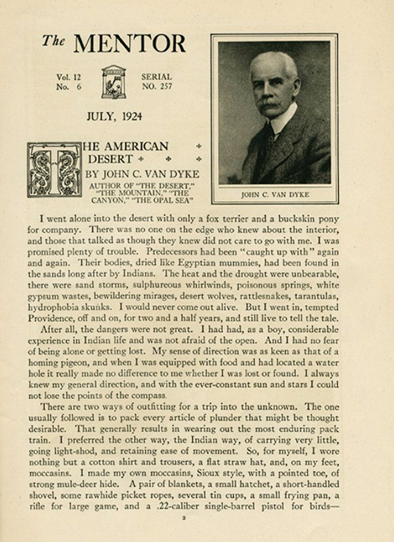
I went alone into the desert with only a fox terrier and a buckskin pony, for company. There was no one on the edge who knew about the interior and those that talked as though they knew did not care to go with me. I was promised plenty of trouble. Predecessors had been “caught up with” again and again. Their bodies, dried like Egyptian mummies, had been found in the sands long after by Indians. The heat and the drought were unbearable, there were sand storms, sulphurcous whirlwinds, poisonous springs, white gypsum wastes, bewildering mirages, desert wolves, rattlesnakes, tarantulas, hydrophobia skunks. I would never come out alive. But I went in, tempted Providence, off and on, for two and a half years, and still live to tell the tale. After all, the dangers were not great. I had had, as a boy, considerable experience in Indian life and was not afraid of the open. And I had no fear of being alone or getting lost. My sense of direction was as keen as that of a homing pigeon, and when I was equipped with food and had located a water hole it really made no difference to me whether I was lost or found. I always knew my general direction, and with the ever-constant sun and stars I could not lose the points of the compass There are two ways of outfitting for a trip into the unknown. The one usually followed is to pack every article of plunder that might be thought desirable. ‘chat generally results in wearing out the most enduring pack train. I preferred the other way, the Indian way, of carrying very little, going light-shod, and retaining ease of movement. So, for myself, I wore nothing but a cotton shirt and trousers, a flat straw hat, and, on my feet, moccasins. I made my own moccasins, Sioux style, with a pointed toe, of strong mule-deer hide. A pair of blankets, a small hatchet, a short-handled shovel, some rawhide picket ropes, several tin cups, a small frying pan, a rifle for large game, and a .22-caliber single-barrel pistol for birds—
“Las Vegas is a symbol, above all else, of the impermanence of man in the desert, and not least because one is never not aware of the desert’s all pervading presence; wherever man has not built nor paved over, the desert grimly endures – even on some of the pedestrian islands down the center of the Strip! The presence of such an enclave of graceless pleasures in such an environment is so improbable that only science fiction can manage it; the place is like the compound of an alien race, or a human base camp on a hostile planet. To catch this image you need to see Las Vegas from the air by night, or better still, late in the afternoon, as I first saw it, when there is just purple sunset light enough in the bottom of the basin to pick out the crests of the surrounding mountains, but dark enough for every little lamp to register. Then – and only then – the vision is not tawdry, but is of a magic garden of blossoming lights, welling up at its center into fantastic fountains of everchanging color. And you turned to the captain of your spaceship and said, ‘Look Sir, there must be intelligent life down there,’ because it was marvelous beyond words. And doomed – it is already beginning to fade, as energy becomes more expensive and the architecture less inventive. It won’t blow away in the night, but you begin to wish it might, because it will never make noble ruins . . . .”
Peter Reyner Banham. 1982. Scenes in America Deserta. Salt Lake City: Gibbs M. Smith. Pages 42-43.
Does this …
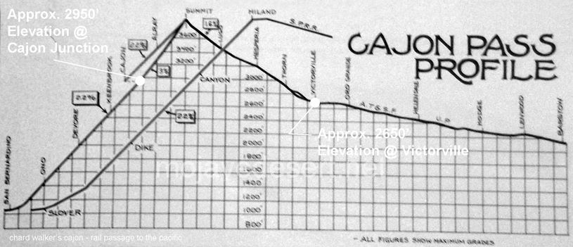
… Blow your mind? — Cajon Junction (el. 2950′) at I-15 and Hwy. 138 is actually at about a 300′ higher elevation than Victorville (el. 2650′). The slope from the summit to Victorville is gradual, not as noticeable, and provides us with the illusion that we are further up than we actually are.
The Old Spanish Trail had become increasingly used as a pack mule trail between New Mexico and California, and with this traffic came the opportunity for those to take advantage of the distance and desperate nature of the land.
Hundreds and sometimes even thousands of stolen horses from the ranchos would burst through Coyote Canyon beginning their ‘journey of death’ across the Mojave.
California horses were beautiful creatures, and the mules were taller and stronger than those in New Mexico and they were easy to steal. The rolling hills and plains presented clear paths to the Cajon where numerous hidden canyons and washes were available to slip into and prepare for the furious run across the desert. Horses would be stolen in herds from many different ranchos at once. Hundreds of horses, even thousands could be commandeered and driven by just a few experienced thieves.
Narrows, Crowder Cyn., Cajon Pass
Chief Walkara, ‘Hawk of the Mountains’ and the greatest horse thief in all of history along with his band of renegade Chaguanosos , and notables such as Jim Beckwourth and Pegleg Smith would work together in this illegal trade. During one raid they were said to have coordinated the theft of 3,000-5,000 horses, driving them to Fort Bridger to trade for more horses to run to New Mexico to trade again. Horses would fall from exhaustion every mile and the local bands of Paiute would feast on the remains.
The rich ranchos of southern California.
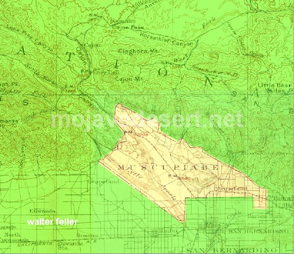
In 1843 Michael White was granted one league of land at the mouth of the Cajon Pass called Rancho Muscupiabe. At a point overlooking the trails leading into and away from the canyon he was expected to thwart the raiders and horse thieves that were plaguing the Southern California ranchos. In theory it was a good plan but in practice it did not work so well.
From the piedmont between Devil and Cable canyons, Miguel Blanco could keep an eye out for the horse thieves entering the Cajon.
He built his home of logs and earth and constructed corrals for his stock. However, the location between Cable and Devil Canyon only served as a closer and more convenient target for the Indian thieves. His family was with him, but after six weeks until it became too dangerous. He left after nine months without any livestock and in debt.
The Old Spanish Trail went down this slope to behind Miguel Blanco’s rough-hewn homestead. Indians would watch from this forest for Miguel to leave and they would slip down and steal everything that could be stolen.
Miguel sold his property, however, Miguel had misread the grant, letting the rancho go for much less than it was worth. The land described on the grant was roughly 5 times larger than Miguel thought. Blanco brought a suit but lost.
Muscupiabe Rancho
As the late 1840s and 1850s rolled by wagon roads were being developed in the canyon minimizing the effectiveness of the maze of box canyons being used to cover the escape of desperadoes on horseback. With California becoming a state frontiersmen such as Beckwourth and Peg Leg Smith would not steal from fellow Americans. Horse-thieving under U.S. law had become a crime where before it was just stealing horses from Mexicans. That was only serious if caught in the act. Americans would never extradite them. For the most part, that was the end of the horse stealing raids.
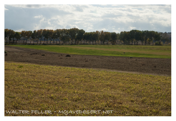
“During his years at the upper crossing, Captain Lane, as Aaron was known throughout much of his life in California, had ample opportunity to discover where the richest farmlands lie along the Mojave River.”
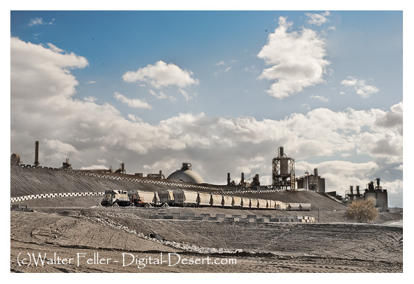
Riverside Cement in Oro Grande, CA started in 1907 as the Golden State Cement Plant. It was shut down during the depression and restarted as Riverside Cement in 1942. The plant was enlarged and completely rebuilt in the late 40s. In late 1997, TXI purchased Riverside Cement.
Book Review: 101 moments in Eastern Sierra History
by Dave Babb
“In the 1890s, Mr. W.K. Miller established a six horse stage line between Keeler, on the northeast shore of Owens Lake, and Mojave.
The stage left Keeler and Mojave every other day at noon. In those days the trip took nearly 24 hours of continuous dusty travel through cactus and sand, and around hummocks.
The coach was that typical Concorde carriage of the day, square and rather high. It had a door on each side, and multiple layers of leather straps served as springs.
Inside, two seats face each other and eight people could be seated. A ninth could ride on top with the driver and kids could sit on their parents laps. The fare was $10 per person.
The first leg of the trap, from Keeler to Olancha, was the roughest part of all — taking up to six hours. After a change of horses, which took about five minutes, Haiwee could be reached in another three hours.
They changed horses eight times during the trip, and had to average about 5 mph to make a few Mojave by noon. Some 60 horses were kept in reserve to keep the stage rolling in on time.
Passengers carried their own food and water, and comfort stops were made upon request — behind the nearest bush at the back of the stage.”
Dave Babb first came to the eastern Sierra in 1952, at the age of 13 for a two-week camping and hiking trip along the John Muir Trail. after completing his education receiving BS and MS degrees in wildlife biology he returned to Bishop with his wife and their three children.
He has authored or co-authored nearly two dozen publications on the history and natural resources of the Inyo-Mono region and written more than 170 articles on Eastern Sierra wildlife.
This is a great little book to own, entertaining and informative.
You may be able to find it here.
101 moments in Eastern Sierra History
by Dave Babb
Published by Community Printing
ISBN 10: 0912494395 ISBN 13: 9780912494395
The tools of the desert dwellers varied with specific material available and with the individual Takic or Numic bands of Uto-Aztecan speaking Indians: Vanyume, Paiute, Chemehuevi or Kawiisu. Simple wood fire drills enabled Native Americans to make fire. By burning roots of a tree or bush, the Paiute preserved the fire. Use of rolled up juniper bark which when lit held fire for a long time.
They made stone mortars and metates (some portable) for grinding food and paint. A stick served as a stirrer; a tortoise shell, sheep horn or pottery as dippers; a rabbit scapula or carved wood as a spoon; a sheep’s horn, coiled basketry or pottery became dishes. Tortoise carapace had been reported used as diggers, bowls, dishes to hold seeds. In Oro Grande specimens of tortoise shell rattles have been found. Waterproof baskets, animals’ stomachs, and pottery “canteens” served as water carriers. Knives and drills were, of course, made from flaked stones and shaped bone. The yucca spine with fiber attached served as needle and thread. Sinew provided strong twine and backing for bows. Glue came from boiled sheep’s horn. For tanning skins, aborigines used the brain of larger animals. Professional tanners contend that the brain size of each animal is large enough to tan that animal’s skin. Paiute people utilized desert hardwood for their three to four feet long bows, sometimes
backed with sinew. Chemehuevi sinew-backed bows, often recurved, were powerful and accurate. Some Paiutes and Utes made bows from juniper trees by cutting through the bark. When that section died, they took it off the juniper tree and carved it into sturdy bows.
“When that section died, they took it off the juniper tree and carved it into sturdy bows.”
Arrows, made from reeds or arrow weed, were tipped with local quartz, chalcedony, jasper, or traded for obsidian obtained from the Paiute or Shoshone of Owens Valley. Netting and snares added to the survival tool kit.
Dozens of varieties of juncas, reeds and grasses made baskets for cooking, wearing (as hats) and storing. Some baskets with pitch added to them held water.
Their migratory yearly rounds made it necessary to store food to be retrieved during poor winters. They built water resistant caches with rocks, or into caves, or tree trunks. If grasses came late in January, runners went to their caches for food.
These tools allowed desert Indians to survive in a harsh environment for 5,000 years.


 Death Valley was having one of its periodic wind storms when the tourists drove up in front of Inferno store to have their gas tank filled.