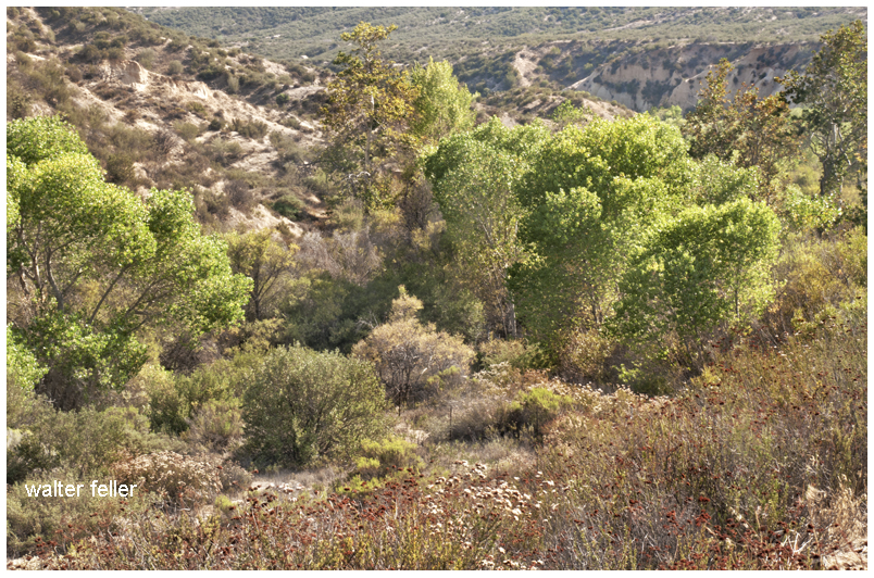
Tag: Old Spanish Trail

  • Nicholas Earp, Sarah Jane Rousseau

    The Long Trail West

    In the final months of 1864, while the nation was still locked in the chaos of the Civil War, a wagon train rolled slowly across the American frontier. Among its passengers were two families whose names—at least in one case—would echo through the pages of Western legend. The Rousseaus were heading west in hopes of a new beginning. Hardened by war and failure, the Earps sought a better future in California. Leading the wagon train was Nicholas Porter Earp, father of Wyatt Earp, and it was here—on the unmarked road between Salt Lake and San Bernardino—that stories of strength, tension, and hardship unfolded, written down by the steady hand of Sarah Jane Rousseau in her trail diary.

    Nicholas Earp was, by any account, a man built for difficult times. Born in 1813, he had lived through the War of 1812 as a boy, served in the Black Hawk War, and later took up arms in the Mexican-American War. He had worked as a farmer, a constable, and a jack-of-all-trades—never truly settling, always looking for something better over the subsequent rise. By 1864, Earp was in his early 50s, grizzled and stiff from rough work. He was also deeply set in his ways.

    Descriptions of Nicholas during the journey paint him as short-tempered, headstrong, and deeply opinionated. He took command of the wagon train with the same kind of stern authority one might expect from a battlefield officer. There was little room for softness on the trail. Rules were rules. And if they weren’t followed, the consequences were loud, and sometimes threatening. This didn’t sit well with everyone.

    While traveling with her husband, Dr. John Rousseau, and their children, Sarah Jane Rousseau kept a diary of the journey. Her writing is a rare window into the human side of westward migration, especially from a woman’s point of view. She recorded weather patterns, daily mileage, and significant encounters. But she also took note of personalities and frictions along the trail, and Nicholas Earp features more than once in that record, which is not always favorable.

    At one point, Sarah wrote that Earp threatened to whip children—including, perhaps, her own. The details are brief, as was her style, but the implication is clear: he had a temper and believed in discipline the old-fashioned way. To modern readers, this feels shocking and harsh, but in 1864, it wasn’t unusual.

    Earp’s behavior was fairly common for the time. Discipline, especially of children, often came with raised voices and raised hands. A man like Nicholas, shaped by war and hardship, would have seen his role as head of the train—and his family—as one of control, protection, and order. His approach to leadership was informed by a world in which survival often depended on obedience. There was little room for backtalk or disobedience when you were facing down the deserts of Utah and Nevada, with limited water and no help for miles.

    As the wagons moved south from Salt Lake City, they picked up the Mormon Road, a rough route that cut across the Great Basin and the Mojave Desert. This trail, used by Mormon settlers on their way to California, was dry, dangerous, and unforgiving. The group passed through Beaver and Parowan, Utah, into southern Nevada, and then down into the California desert, where their trials multiplied.

    In her diary entry dated December 4, 1864, Sarah recorded a chilling stop near Salt Spring, on the southern edge of Death Valley. There, they found the remnants of a mining operation where three men had recently been killed—possibly by local Native Americans. Sarah noted the presence of four abandoned buildings and a quartz mill, and the unease in the camp was palpable. The group was vulnerable, tired, and on edge.

    A short time later, they reached Bitter Springs, another desolate stop known for its sparse water supply. According to Sarah, local Native people approached the wagon train but did not attack—perhaps because of the size of the party, or perhaps because their intentions were peaceful. Still, the tension must have been thick in the desert air.

    As the days wore on, tempers grew shorter. Food and water grew scarce. Animals began to falter. And the relationships among the travelers frayed. Nicholas Earp’s hardline leadership—so natural to him—probably became harder to tolerate under such conditions. His background, age, and sense of authority collided with the growing exhaustion of those around him. Sarah’s quiet observations hint at these dynamics, even if she never spells them out directly.

    And then there was Wyatt Earp—just 16 years old, along for the ride with his family. Later, he would become one of the most iconic lawmen of the Old West, but during this journey, he was simply a boy on a horse. Sarah barely mentions him. He rode. He hunted. He wore out horses. He did not yet command attention. His father’s shadow was too long.

    Eventually, the wagons followed the Mojave River, moving past waypoints like Camp Cady or Lane’s Crossing, before climbing the rugged terrain of Cajon Pass. From there, it was a descent into green hills and relative safety. In San Bernardino, they would find civilization—such as it was—and a temporary end to their troubles.

    But that journey, and the roles people played in it, stuck. Sarah’s diary survived to tell the tale. In her pages, we see a woman navigating not just a trail, but a world of personalities, expectations, and power struggles. We see Nicholas Earp not as a villain or a hero, but as a man of his time—unyielding, protective, severe. We see the toll that hard roads take on even the hardest men.

    And in the background, quietly riding along, was a teenager who would one day walk down a dusty street in Tombstone. But for now, he was just Wyatt—young, restless, and learning, perhaps unconsciously, what it meant to survive in a world ruled by men like his father.

  • Historic Victor Valley Wagon Roads

    Primary regional road network — USGS 1901

    Not all-inclusive, this 1901 map shows basic transportation routes between the Cajon Summit on the west and east from there through either the San Bernardino Mountains or Lucerne Valley to where the two roads meet in the Big Bear Valley.

    This map below was made in 1883 and shows an earlier and geographically expanded version of the routes.

    1883 map of route network in the upper Mojave River region (note; no railroad)

    The 1883 map is more inclusive and contains a couple of items I want to keep track of. There are differences but the road segments look about the same.

    I made a copy of the 1883 roads layer and made it red to stand out better.

    There are some nuances between the two maps, and right now the Oro Grande Wash area seems considerably off, fiddling with it some I can get a better fit–but not at these rates. The 1901 would be the more accurate depiction of what went on out there even if it were 35 years or so after the fact.

    Williams USGS survey map 1853

    Note that in the above map the variations of trails from across the valley leading to the Cajon Summit seem not to have been developed at this time and instead the trail along the Mojave River is shown.

    1901 trail routes transposed over modern street map through Hesperia

  • Mormon Mesa

    Mormon Mesa, Overton, Nevada

    It was time to choose the first people. Everyone gathered to make their pleas and arguments. Rabbit’s ideas were mean and stupid. Rabbit wanted to be the first people. He became angry and kicked a large rock into the river changing its course. This is how the Virgin River came to meet the Colorado. . . . And why we are not rabbits.- Paiute legend

    Virgin River
    https://digital-desert.com/virgin-river/

  • The High Desert Illusion

    Does this …
    … Blow your mind?

    profile of elevations in the cajon pass - chard walker
    — Cajon Junction (el. 2950′) at I-15 and Hwy. 138 is actually at about a 300′ higher elevation than Victorville (el. 2650′). The slope from the summit to Victorville is gradual, not as noticeable, and provides us with the illusion that we are further up than we actually are.


  • The Old Spanish Trail had become increasingly used as a pack mule trail between New Mexico and California, and with this traffic came the opportunity for those to take advantage of the distance and desperate nature of the land.

    Crowder (Coyote) Canyon in the Cajon Pass north of San Bernardino
    Hundreds and sometimes even thousands of stolen horses from the ranchos would burst through Coyote Canyon beginning their ‘journey of death’ across the Mojave.

    California horses were beautiful creatures, and the mules were taller and stronger than those in New Mexico and they were easy to steal.  The rolling hills and plains presented clear paths to the  Cajon where numerous hidden canyons and washes were available to slip into and prepare for the furious run across the desert. Horses would be stolen in herds from many different ranchos at once. Hundreds of horses, even thousands could be commandeered and driven by just a few experienced thieves.

    Narrows, Crowder Cyn., Cajon Pass

    Chief Walkara, ‘Hawk of the Mountains’ and the greatest horse thief in all of history along with his band of renegade Chaguanosos , and notables such as Jim Beckwourth and Pegleg Smith would work together in this illegal trade. During one raid they were said to have coordinated the theft of 3,000-5,000 horses, driving them to Fort Bridger to trade for more horses to run to New Mexico to trade again. Horses would fall from exhaustion every mile and the local bands of Paiute would feast on the remains.

    The rich ranchos of southern California.

    In 1843 Michael White was granted one league of land at the mouth of the Cajon Pass called Rancho Muscupiabe. At a point overlooking the trails leading into and away from the canyon he was expected to thwart the raiders and horse thieves that were plaguing the Southern California ranchos. In theory it was a good plan but in practice it did not work so well.

    Devore, ca.
    From the piedmont between Devil and Cable canyons, Miguel Blanco could keep an eye out for the horse thieves entering the Cajon.

    He built his home of logs and earth and constructed corrals for his stock. However, the location between Cable and Devil Canyon only served as a closer and more convenient target for the Indian thieves. His family was with him, but after six weeks until it became too dangerous. He left after nine months without any livestock and in debt.

    The Old Spanish Trail went down this slope to behind Miguel Blanco’s rough-hewn homestead. Indians would watch from this forest for Miguel to leave and they would slip down and steal everything that could be stolen.

    Miguel sold his property, however, Miguel had misread the grant, letting the rancho go for much less than it was worth. The land described on the grant was roughly 5 times larger than Miguel thought.  Blanco brought a suit but lost.

    Muscupiabe Rancho, Michael White, Miguel Blanco
    Muscupiabe Rancho

    As the late 1840s and 1850s rolled by wagon roads were being developed in the canyon minimizing the effectiveness of the maze of box canyons being used to cover the escape of desperadoes on horseback. With California becoming a state frontiersmen such as Beckwourth and Peg Leg Smith would not steal from fellow Americans. Horse-thieving under U.S. law had become a crime where before it was just stealing horses from Mexicans. That was only serious if caught in the act. Americans would never extradite them. For the most part, that was the end of the horse stealing raids.

    • end
  • Victor Valley Crossings

    Fr. Francisco Hermenegildo Tomás Garcés (April 12, 1738 – July 18, 1781) was a Spanish priest who crossed the Mojave Desert in 1776. This map shows his route across the Victor Valley. Following the Mojave River after crossing at Oro Grande, he walked through downtown Victorville, bypassing the rocky narrows and connecting with the river near today’s Mojave Narrows Regional Park. Following the river to where the West fork and Deep Creek join to form the Mojave. He visited with the Indians and then went up Sawpit Canyon and over the mountain ridge, descending into the verdant sycamore grove known today as Glen Helen.

    This map shows Fr. Garces’s route in 1776 during his crossing west. His diary describes him being taken to an Indian village in the mountains.

    Fifty years after Fr. Garcés made his way across the Mojave from the Colorado River, in 1826, Jedediah Smith retraced the trail of Garcés along the river, then up and over the mountains. In 1827, one year after his first crossing, Smith had lost most of his men in a massacre at the Colorado River. Desperate for the safety of civilization, Smith, after crossing the Mojave River in Oro Grande, made his way directly to the Cajon Pass, bypassing the San Bernardino Mountains.

    The direct route over the summit and down the pass eliminates the steep climb and descent over the San Bernardino Mountains.