Back before Route 66 made crossing the desert easy, three friends wanted to cross the Mojave. Of the three buddies there was a “smart dude,” a “not so smart dude,” and a “not smart at all dude.” Before they left the “smart dude” says, “We’ll meet here in an hour. Bring something useful to cross the desert with.”
An hour passes. All three friends return.
The “smart dude” says, “I brought some ice packs to keep our heads cool.”
The “not so smart dude” says, “I brought a pail of water to keep us properly hydrated.”
The “not smart at all dude” smiles real broad and says, “I brought a car door so I can roll down the window when it gets hot.”
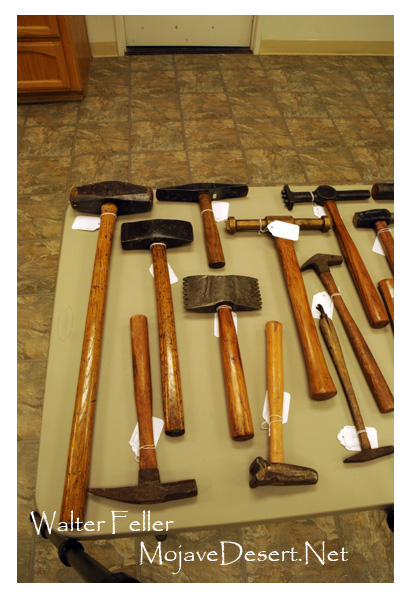
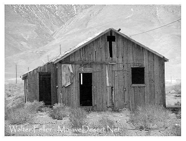
Way in back of a mining claim in a crack near a knob on a knoll up near Rattlesnake Flats there is some thick brush grown around a wobbly old picnic table.
Roy Rogers
My friend tells me that this table once belonged to TV legend, Roy Rogers. I believe this to be true. I am told that, well, look at it; it is a much longer table than normal. My friend has lived down the street and around the corner from the Rogers for years before Roy and Dale passed away. My friend is quite credible.
Roy Rogers’ old picnic table
I sat at the table for a moment. I hardly had to close my eyes to see cowboy cuffed shirts, checkered table cloths, barbecued ribs, potato salad and hear some old time country western pop. The table spoke to me — it said, “Yep — they sat here.”
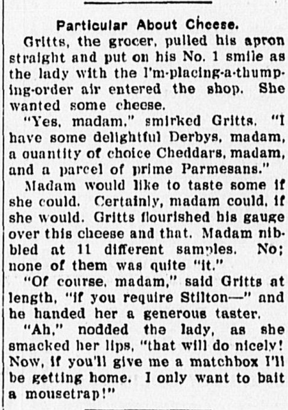
Gritts, the grocer, poses a pretty straight and put on his No. 1 smile As the lady with the I’m-placing-a-thumping-order air entered the shop. She wanted some cheese.
“Yes, madame.” smirked Gritts. “I have some delightful Derbies, madam, a quantity of choice cheddars, and a parcel of prime Parmeasans.”
Particular about Cheese
Madam would certainly like to taste some if she could. Certainly, Madam could, if she would. Gritts flourished his gauge over this cheese and that. Madam nibbled at 11 different samples. No; none of them was quite “it.”
“Of course, Madam,” said Gritts at length, “if you require Stilton–” and he handed her a generous taster.
“Ah,” nodded the lady, as she smacked her lips, “that will do nicely! now, if you’ll give me a matchbox all be getting home. I only want to bait a mouse trap!”
Gold was discovered on December 1, 1849, by Mormons who were led by Jefferson Hunt to take gold seekers and others to southern California over the Old Spanish Trail. Most wagons left Hunt in southern Utah for a short cut to the gold country—ironically, short-cut survivors took up to two months longer to reach Los Angeles. It wasn’t much of a short cut. Those seven wagons that stayed with Hunt camped on the Old Spanish Trail at Salt Creek, near the present Hwy. 127 and Salt Creek Mountains. Some men rode up the Amargosa Spring wash and found gold. The Los Angeles Star dated May 7, 1851, reported the story.
When Hunt’s group arrived in Rancho Chino, owner Col. Isaac Williams sent out his right hand man Davis to examine the gold site. Ben Wilson, later mayor of Los Angeles and ancestor of General George Patton, fitted out another expedition to check on the Salt Springs site. Both expeditions brought back rich specimens and reported a “whole mountain” of gold bearing ore.
But as was the case of desert mining for years to come, there were obstacles to making desert mines pay off: transportation, distance, food and water, machinery to process the gold so that it would be practical to bring the ore to a smelter. Realistically, in the 1850s, miners still thought that in the Sierra Nevada gold country, gold could still be just picked up.
Old Spanish Trail/Salt Lake Road east of Tecopa, CA.
One explorer went to San Francisco and shared his enthusiasm for the Salt Springs gold. Investors in June, 1850, sponsored another party to investigate. When they came back in July, they formed the Los Angeles Mining Company and made plans to take possession and work the area.
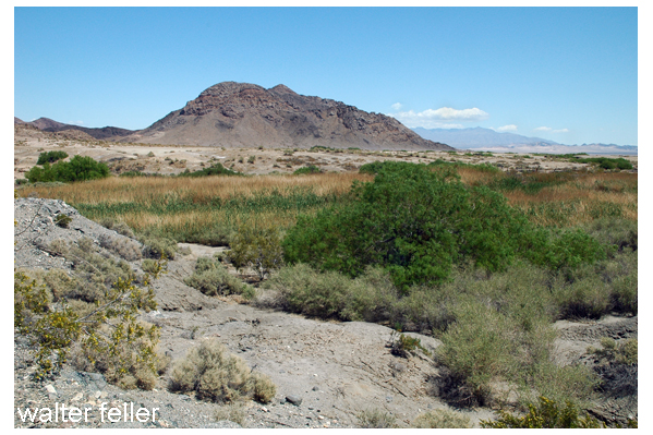
Salt Springs
Another of the Los Angeles initial prospectors. Mr. Davis, went to the Sierras to find a supposed Gold Lake. When he returned to Grass Valley, he told Col. Lamb about his trip to “Gold Mountain,” i.e., Salt Springs. Lamb fitted out another exploratory trip, this time led by Davis. Col. Lamb’s group evidently arrived before the Los Angeles company and claimed what he thought were good areas, and sold three-fourth of his interest under the name Desert Mining Company in January 1851. By that spring the two mining companies had three Mexican arrastres (animal powered rock gold crushers) in operation, two for Desert Mining Company and one for Los Angeles Company. The latter company also bought, according to the Star, “a fine engine and machinery on the Amohave (Mojave) River, a little over half way out” —where it became stuck and was temporarily left in the sands of the Mojave River. The assay samples brought into Los Angeles were too few to be conclusive, but varied from 10 cents to many dollars per pound of rock. One of the companies had dug a mine 30’ deep.
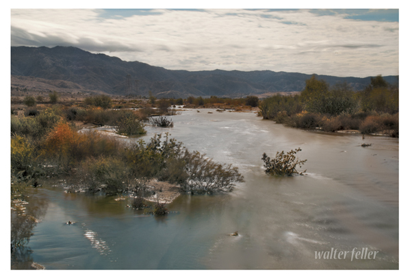
Mojave River
Andrew Sublette, famed trapper and mountain man family of brothers, was encouraged to invest in the Desert Mining Company, his great hope to become wealthy. He had became ill gold mining in the Sierras and went to San Jose to recuperate. In a letter to his brother Solomon, March 20, 1851, from Los Angeles, we see his dreams:
“I am concerned with a Company in a gold mine. It is in the rock and very rich. I have been there for six months and will Start out to that place tomorrow [to] take charge and Start some machinery to grind the rock… I have invested all my means (which was but little) in that mine but hope to get it out with interest.”
He was so poor that he borrowed money at 5% to invest and took the job as “chief field man,” (Superintendent). The company did not have enough resources, and President James F. Hibberd tried to obtain additional operating money with more investors and by attaching assessments for the stock owners to pay, or they would forfeit their stocks. For example, on May 7, [1851 ?] the company set an assessment on $2.00 per share. On June 10 it assessed another $1.00 per share. In August, 1851, the Desert Mining Company failed! Sublette declared insolvency. The partnership of B. D. Wilson and A. Packard dissolved.
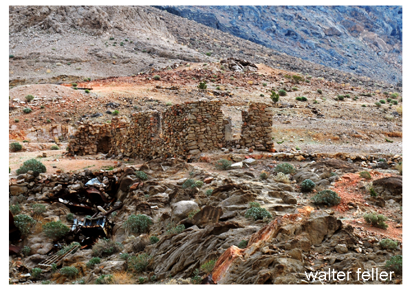
Ruins: Amargosa Mine at Salt Springs
A new mining company Salt Springs Mining Company, was formed. The new President was Benjamin D. Wilson, Albert Packard was Secretary-Treasurer, also partners in a transportation company. Since Andrew Sublette had no money to invest, he continued as chief field man. The company was running again in November 1851.
Always positive it seems, Sublette praised the mine to the Star, and said that Indians had been troublesome, had stolen tools and ruined machinery, but “The workmen were taking out remarkably rich specimens of quartz: on the whole the news is encouraging.” Sublette sold his holding in St. Louis for $6,000 to pay off bills and invest again in Salt Springs Mining. He wrote to his brother again in March 1852 that he had started mining again with new partners and that prospects were good. He hoped to go back to Missouri and visit again soon. His health has been the best it has been for the last two or three years.
Things were really going well.
Ravine in Cajon Pass
But that’s not usual for mining in the Mojave Desert. In the next couple months things were typical for desert mining: Two of his men killed in the Cajon Pass, more Indian difficulties, the 220-mile supply line to Los Angeles, the dwindling supply of money, the calling for stock assessments–all led the Salt Springs Mining Company to try to sell to foreign investors—and that failed, and so did the mining at Salt Springs—for awhile at least.
Sublette, now broke again, went back to his mountain man roots: bear hunting to make some money. He provided some meat for the Los Angeles markets. He was badly wounded, but recovered.
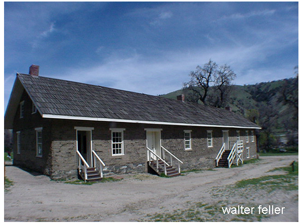
Barracks, Ft. Tejon
Because of his freight experience and his friendship with Wilson, Sublette received a contract to provide supplies to the new Indian reservation at Ft. Tejon. He went into partnership with James Thompson. They prospered and even leased the La Brea Ranch. According to his biographer, Doyce Blackman Nunis, Jr., Andrew Sublette had quite a resume of occupations: trapper, trader, guide, soldiers, hunter, peace officer, miner—and sometimes with ill-health—he found success as a California Indian Department contractor. Yet, within a few months he was dead at age 40.
Andrew Whitley Sublette’s funeral was in the parlor of the El Dorado Saloon in Los Angeles, and as Major Horace Bell said, “…every gringo in town turned out for the funeral.”
Sublette and his partner, James Thompson, hunted for grizzlies in Malibu Canyon. The two became separated, and when Thompson heard a shot he ran toward it, and found “Sublette locked in hand to hand struggle with the ferocious animal. To one side, partly covered by a cloud of dust stirred up from the contest between man and beast, lay the huddled corpse of the attacker’s mate. Apparently Sublette had slain one of the bears with his rifle, and then before he could reload his weapon, was set upon by another. With knife flashing, his hunting dog, Old Buck, adding his bite to the fray, Andrew finally dispatched his assailant with a mortal thrust. Falling near the crumpled carcass Andrew lay bleeding and dying.”
Thompson got help and took him to the Padilla Building where Dr. Thomas Foster frantically tried to stop the bleeding. The next day Sublette’s trapping, hunting and mining days were over. He was buried at Foothill Cemetery, a dramatic end to a short but glorious life of one of America’s great trappers, Andrew Sublette. Despite his illness, he struggled to the end to make a good living in difficult occupations. His last years added interesting facets to the history of the Mojave Desert.
Salt Springs had another 158 years of history. It continued its up’s and down’s in mining, with scandals where “miners mined the investors,” with a great glory hole, and now this important water hole on the Old Spanish Trail is marked by the BLM with a picnic area, restroom, signs and trails. It is just a hundred yards off Hwy. 127.
Thanks to Emmet for most of this information. I also sourced Andrew Sublette: Rocky Mountain Prince 1813 – 1853, by Doyce Blackman Nunis, Jr, at the Huntington Library.
I left Fulton city on the first Monday in May, for Bashan, the land of peace, with my family, nine in number. About 30 miles from there, my little boy, about 3 1/2 years old, fell out of the wagon, and the wheel ran over his neck. I took him up and saw that he was about to depart this life. But not feeling willing to part with him, I administered to the child according to the law and order of the gospel, and the Lord blessed him, and he soon recovered, and is now hearty and well.”
“The Serranos (Spanish, “mountaineers”), a Shoshonean branch comprising numerous local groups, occupied San Bernardino valley, San Bernardino mountains north of Los Angeles and San Bernardino, a portion of Mojave desert north of that range and east of Mojave river, and Tehachapi mountains. This last group, who lived principally on El Paso and Tejon creeks, were the Kitanemuk. In 1853 most of the resident Indians, including not only various Shoshoneans but many Yokuts, were taken to Tule river reservation. Tejon rancheria remains, however, a settlement of various Shoshoneans, but predominantly Kitanemuk”
By Ivan Summers, from the SANTA MONICA EVENING OUTLOOK, Automotive Section, Thursday, January 29, 1925.
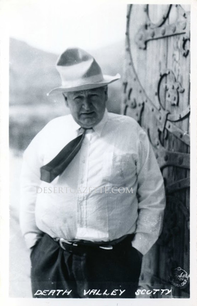
“Oh My Gawd”! The explosion of words roused my dog snoozing nearby. What else would you say when, while pawing through an old box of family junk, an eighty eight year old newspaper smacks your eyeballs? Especially if you’ve had a lifelong addiction to desert minutiae. The absorbing yarn of about 2000 words (with no byline) entails a journey by two Franklin automobiles into and out of Death Valley including a successful meeting with the legendary Death Valley Scotty. The (crumbling) newspaper itself is an historic gem laced with ads touting “Balloon Tires,” the new Maxwell Coupe, the Rio Roadster, the Hudson super six–all iconic in U. S. car history. As well, splashed front page, are several pics of the famous air cooled Franklins in the valley and a photo of that career rascal himself–Scotty!
According to the writer (unnamed) there had been an attempt the previous summer to negotiate Franklin cars from Furnace Creek Ranch to Scotty’s digs. But 126 temp and road (or no road) conditions turned them back for another try in January of 1925.
Good stuff here. They breakfast in Mojave, proceed to Randsberg, Leach Springs and Owl Springs. You can’t do that today as Leach Springs is on sacred military ground. That trip assuredly went
over what still is the Steamwell road out of Johannesberg, through Granite Wells connecting with Owl Springs and on to the Harry Wade road. Then east on Bradburg Wash to Shoshone. Tough going today if
you could even find it.
These guys eventually got to Scotty but with an interesting little aside in Rhyolite. The mining camp had only been “partly disassembled.” A moving picture company was filming something to be entitled “The Air Mail.” (Film archives)??
Scotty, apparently a genial host, saw that the travelers were housed and fed. The writer goes on to inform that Scotty’s house was furnished with elaborate stuff from China with maybe a $6,000 import fee plus other niceties that exceeded $150,000. The story implied that these were Scotty’s digs done with Scotty’s money There was mention by Scott of his ‘partner.’ Albert Johnson, who Scotty mentioned was going to build a million dollar house near his.
Apparently what the Santa Monica writer didn’t know in 1925 was that Scotty was one of the magnificent cons of the early 20th century. He’d been exposed in 1906 and again in 1912 as a fraud and hoaxer. He relieved numerous gullible investors, including Johnson, of many thousands–invested in nonexistent gold mines. He even did some jail time in 1912. Despite this egregious behavior he remained in Johnson’s affection until Johnson passed in 1948.
The Franklin car party’s announced intention was to negotiate the length of the valley, in this instance from North to South. From Scotty’s out of the south end. The article states “this had never been done before.”
Well, uh, not exactly the case. This writer’s father, Herbert S. Summers, made a journey in 1923 in a Model T Ford from south to north at least as far as Furnace Creek Ranch. His route was from Barstow north east past Bicycle Lake, Garlic Springs, Cave Springs and directly up the valley to Furnace Creek Ranch.
Summers wrote a delightful little tale of their adventure describing the perils of mid-summer travel and took numerous photos–still in the family archives.
On exiting Scotty’s, the Franklin party passed by something referred as the “lost wagon” and another site called “Surveyors Well,” neither of which appear on today’s maps. They evidently turned west to take the Wingate Wash (Pass) road paralleling the Epsom Salt Mono Rail and eventually found Mojave, unaware that it was possible to complete the North-South transit through Cave Springs and to Barstow. It in fact (in reverse) had been done.
Death Valley survived Scotty–and is a better place for it
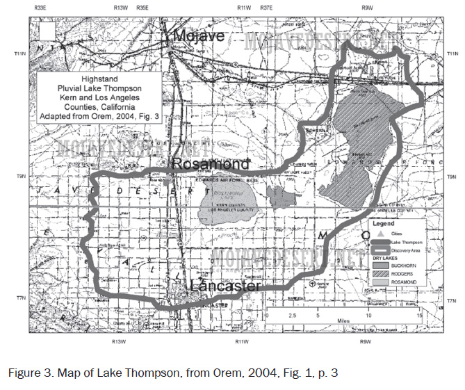
Lake Thompson, an extinct lake that filled part of Antelope Valley during the Quaternary (1.8 to .126 Ma). Rogers and Rosamond dry lakes occupy parts of the ancient bed of Lake Thompson.
In The Year 1910:
Only 14 percent of the homes in America had bathtubs.
A three-minute call from Denver to New York City cost $11.
There were only 8,000 cars in the U.S. and only 144 miles of paved roads.
The average U.S. worker made between $200 and $400 per year.
Two out of every 10 U.S. adults couldn’t read or write.
On the Mojave Desert where water, like gold, in considered a precious element, a bath is often possible only through divine intervention plus human ingenuity. When Bob Alexander, dusty and dirty from a month-long prospecting trip through the Mojave Desert Mountains, awoke one morning in 1867 to an overcast sky and smelled moisture-laden dust in the atmosphere, he grinned from ear to ear.
“Rain, by jeepers!” he prognosticated. “And here’s where Bob takes a bath!”
He hurried through breakfast, and just as he’d finished scraping the last spoonful of chuck from his plate, the rain began to fall. He stripped his clothes off, stepped out of his tent, and stood for a long time under the ample shower. Wet from head to foot, he ducked back into the tent for soap and worked up a generous lather all over his body. He chuckled with glee.
“Better than going to church,” he told himself. “After four weeks of dry camping, cleanliness is sure on a par with godliness, as the feller says.”
With eyes closed to keep out the soap, Bob left the tent. “Hell’s Bells!” he exploded. Typically, the desert shower had ceased as abruptly as it had begun. He squinted at the clouds from under a carefully raised eyelid. They were rising. The sun was breaking through.
Ugly words like blue flames flicked from his angry lips. He groped his way back into the tent, took the first rag he could lay hands on and wiped the soap from his eyes. The sun blazed forth, and the clouds disappeared over a distant mountain rim. Bob watched their departure with baleful eyes.
Providence Mountains
“Dry gulched by a rain storm!” he thundered bitterly, “without enough water to wash a horned toad!” The soap was beginning to dry and draw on Bob’s skin. A quick rub-down served only to increase the irritation. There was nothing to do but to hike to Fort Rock Springs, five miles distant in the Providence Mountains. Here he could find water and relief. Donning his dirty clothes, Bob struck out across the country.
When he reached the Fort entrance, his feet, tough though they were, smarted like blazes and his skin, drawn and puckered under his clothes, itched unmercifully. He stopped in agonized surprise when the sentry order:
“Halt!”
“What the hell!” Bob remonstrated.
“You can’t go in there. The Fort is quarantined. Measles.”
“I’ve got to go in there. I’m all lathered up with soap!”
“Drunk or just crazy?” interrogated the sentry.
“Neither,” Bob returned, exasperated. His voice took on a pathetic tone as he stripped off his shirt to illustrate his story. The sentry listened and looked, his face changing from astonishment to amusement and sympathy.
“Mister,” said the sentry, “orders from Lieutenant Drumm, Commander of this here fort, are that only officers of the Fort, people with passes, and details, are permitted to pass through here.”
Bob was desperate. He retired abjectly. But not for long. In a few minutes, he marched up towards the sentry again, this time, simulating, awkwardly enough, the gait of a soldier on parade. The sentry smiled.
“Halt! Who comes there!” he sputtered, fighting back laughter.
“Detail of one, bound for the Fort,” returned Bob, grimly.
“Pass, detail!” shouted the sentry.
Bob passed, on a dead run, headed for a tub and water.
Taken from The Old West, Pioneer Tales of San Bernardino County
The latest flying saucer report comes from Silver Lake airport near Baker. Two aircraft communicators stationed at Silver Lake report they watched a brilliantly-glowing object speed through the desert sky for nearly 10 minutes Saturday night before it disappeared on the western horizon.
Their report was confirmed by crew members and 25 passengers of a United Airlines plane and by aircraft communicators at a station in Las Vegas, Nevada.
David Stewart of Redondo Beach, first officer of the United plane, said the object was more cigar-shaped than the previously reported pancake-shaped “saucers”.
L. M. Norman and R. E. Connor, the two aircraft communicators at the Silver Lake airport, said the object might have been a meteor.
“We first saw it some 15 degrees above the horizon north of Silver Lake,” Norman said. “It appeared to be a big ball of fire with a large luminous vapor trail.”
“We watched it from 7 to 10 minutes. It looked like it might have been falling, but then it swung off toward the west and disappeared.”
The fiery object was observed not only by the two communicators at Silver Lake, but also by four pilots who had stopped at the airport for an overnight stay.
While the Silver Lake men watched the object, their station was in contact with the United Airlines plane which also spotted it.
Steward, the United officer, said his crew of five men all saw the object, as did the plane’s passengers.
He said his ship was flying at 14,000 feet and that the object flew a parallel course for 20 miles then faded in the distance. He estimated its speed as faster than his plane’s 290 miles per hour.
The tools of the desert dwellers varied with specific material available and with the individual Takic or Numic bands of Uto-Aztecan speaking Indians: Vanyume, Paiute, Chemehuevi or Kawiisu. Simple wood fire drills enabled Native Americans to make fire. By burning roots of a tree or bush, the Paiute preserved the fire. Use of rolled up juniper bark which when lit held fire for a long time.
They made stone mortars and metates (some portable) for grinding food and paint. A stick served as a stirrer; a tortoise shell, sheep horn or pottery as dippers; a rabbit scapula or carved wood as a spoon; a sheep’s horn, coiled basketry or pottery became dishes. Tortoise carapace had been reported used as diggers, bowls, dishes to hold seeds. In Oro Grande specimens of tortoise shell rattles have been found. Waterproof baskets, animals’ stomachs, and pottery “canteens” served as water carriers. Knives and drills were, of course, made from flaked stones and shaped bone. The yucca spine with fiber attached served as needle and thread. Sinew provided strong twine and backing for bows. Glue came from boiled sheep’s horn. For tanning skins, aborigines used the brain of larger animals. Professional tanners contend that the brain size of each animal is large enough to tan that animal’s skin. Paiute people utilized desert hardwood for their three to four feet long bows, sometimes
backed with sinew. Chemehuevi sinew-backed bows, often recurved, were powerful and accurate. Some Paiutes and Utes made bows from juniper trees by cutting through the bark. When that section died, they took it off the juniper tree and carved it into sturdy bows.
“When that section died, they took it off the juniper tree and carved it into sturdy bows.”
Arrows, made from reeds or arrow weed, were tipped with local quartz, chalcedony, jasper, or traded for obsidian obtained from the Paiute or Shoshone of Owens Valley. Netting and snares added to the survival tool kit.
Dozens of varieties of juncas, reeds and grasses made baskets for cooking, wearing (as hats) and storing. Some baskets with pitch added to them held water.
Their migratory yearly rounds made it necessary to store food to be retrieved during poor winters. They built water resistant caches with rocks, or into caves, or tree trunks. If grasses came late in January, runners went to their caches for food.
These tools allowed desert Indians to survive in a harsh environment for 5,000 years.
A selection from: Sun, Sand and Solitude
— By Randall Henderson
Here’s a solution for those who are appalled at the thought of mastering all those tongue-twisting names the scientists have
given the various species of cactus which grow on the desert. George Wharton James offers an answer in his book Wonders of the Colorado Desert. James said he once asked an old desert prospector how many varieties of cacti he was familiar with.
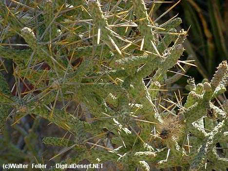
Stick you cactus
“By gosh,” said the prospector. “You city fellers have no idea how many kinds we got. I know every one of ‘em. There’s the “Full of Stickers, All Stickers, Never Fail Stickers, Stick Everybody, Stick and Stay In, Sharp Stickers, Extra Sharp Stickers, Big Stickers, Little Stickers, Stick While You Sleep, Stick While You Wait, Stick ’Em Alive, Stick ’Em Dead, Stick Unexpectedly, Stick anyway, Stick In And Never Come Out, Stick Through Leather, Stick Through Anything, Stick & Fester, Barbed Fishhook Cactus, Rattlesnake Fangs Cactus, Impartial Cactus, Democratic Cactus, The Deep Sticker, and a few others.”
Bathtubs when first introduced in 1840 and laws were passed against their use due to safety reasons. Someone conceived the idea of a bathtub on wheels which visited homes by appointment. The idea worked so well these wheeled tubs were introduced in most of our larger cities and were quite a moneymaker. Most of them were built of steel and copper and about 7 feet long and nearly as wide. At least curtains on a frame gave some privacy.
(Capper’s Weekly, 1930)
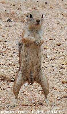
Gary, the white-tailed antelope squirrel, succumbed to type II diabetes on July 29, 2011 after 4 years of surviving solely on corn chips provided by campers and tourists visiting his native national park habitat.
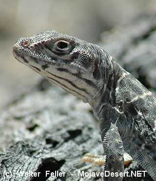
Ed Lizard – Long-nosed leopard lizard. Died at the pointed beak of an adult roadrunner, June 4, 2008.
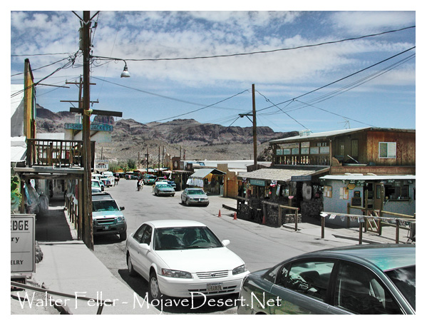
Hesperia, was initially purchased in anticipation of the railroad coming through. Investors stood to make a nice profit from not only the railroad, but in the real estate near by as communities grew.
Hesperia, Ca.
But the railroad was built to Mojave, where trains could easily be routed southward toward Los Angeles, or over the Tehachapis, then north to San Francisco. The Hesperia investment languished and then was passed on to others. The railroad came through much later, but it was not so much of a big deal then.
The following was written and recorded by E.C. Jaeger in 1922. I believe, although dated over 90 years ago, this behavior is just as relevant today as it was then, however, scaled down from our increasing intrusion into their ever-shrinking habitat:
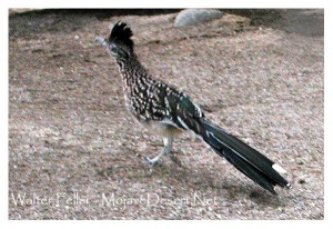
If a female road-runner is approached when on the nest, she generally remains quiet until the intruder is right upon her; then she slips over the back of the nest and flies a short distance to safety, but where she can still see the unwelcome caller. At times she has been known to permit herself to be caught rather than forsake her young.
Geococcyx californianus
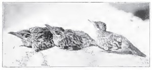
Baby roadrunners about one third grown
A member of the Cooper Ornithological Club (Mr. J. R. Pemberton) gives a most interesting report concerning the actions of a female roadrunner whose nest he found some ten feet above ground in a sycamore tree. As the observer began climbing up to the nest, the bird hopped to the ground.
“Immediately,” says Mr. Pemberton, “it began to squirm, scramble, and drag itself away across an open space and in full view. The bird was simulating a broken leg instead of a broken wing! The bird held its wings closed throughout the demonstration, though frequently falling over on its side in its enthusiasm. The whole performance was kept entirely in my view, the bird gradually working away from the tree until it was some thirty-five feet distant, when it immediately ran back to the base of the tree and repeated the whole show. I had been so interested up to now that I had failed to examine the nest, which, when looked into, contained five young probably a week old. When I got to the ground the bird continued its ‘stunt’ rather more frantically than before, and in order to encourage the bird, I followed and was pleased to see it remain highly consistent until I was decoyed to a point well outside the grove. Here the bird ran suddenly away at full speed and in a direction still away from the nest.”
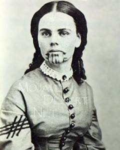
Indians living in harmony with nature is an idealization to say the least. Life was hard and often got harder as evidenced by Olive Oatman’s observations of the Mojave Indians in the 1850s.
“One day I was out gathering. Chottatoe, when I was suddenly surprised and frightened by running upon one of the victims of this stupid, barbarous inhumanity. He was a tall, bony Indian of about thirty years. His eye was rather sunken, his visage marred, as if he had passed through extreme hardships. He was lying upon the ground, moaning and rolling from side to side in agony the most acute and intense. I looked upon him, and my heart was moved with pity. Little Mary said, ‘I will go up and find out what ails him.’ On inquiry we soon found that he had been for some time ill, but not so as to become utterly helpless. And not until one of their number is entirely disabled, do they seem to manifest any feeling or concern for him. The physician was called, and soon decided that he was not in the least diseased. He told Mary that nothing ailed him save the want of food ; said that he had been unable for some time to procure his food ; that his friends devoured any that was brought into camp without dividing it with him ; that he had been gradually running down, and now he wanted to die. O there was such dejection, such a forlorn, despairing look written upon his countenance as made an impression upon my mind which is yet vivid and mournful.”
~ Olive Oatman
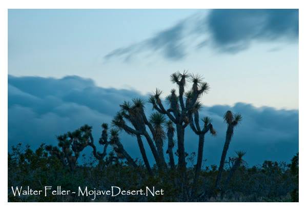
Clouds fall over the mountains onto the desert as if they were a tidal wave in slow motion. Rather than crash on the sand, pieces tear themselves away rising to the sky to make a silent escape.
View from the El Paso Mountains – Red Rock Canyon, California State Park
I first went to the desert to experience what I thought would be sensory deprivation–after all, there was nothing there. It wasn’t like that though. I saw the wild geology, plants of all different kinds, animals fitting every niche, and human history, then even further back in time to the people without names. The closer I looked, the more I saw, and it all connected. These experiences filled my senses; to see the subdued pastels, to hear the cooing mourning doves, to smell the dust and creosote, to feel the rocky earth, and to even taste the gritty wax the dry heat of the desert left thick on my lips. Blazing days, frozen nights, campfires cooking up damned strong coffee. Red sunrises, hallowed and silent sunsets.
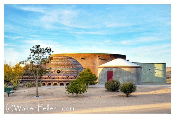
This compound is across the dirt road east of the lake. I’ve heard different things about what this complex is, was, was supposed to be and ended up being as well as a couple different things along the way. Mostly, at this point in time, it has been under construction. It looks cool though and is one of the 7 wonders of Hesperia. I think it probably shrinks anyone who goes inside to about 3/4 scale. I have never seen anyone come out
Sometimes the scenery appears to be the same– It looks like that here and there and over there. Look closer–this sameness is the differences. There are no gradual changes or blending. Everything is this or that. Hard contrast. Then, instead of becoming this faceless hole in our memory, we can become aware of our attachment to common reality.
I suppose the good news is, is that I got this photo of a shack in the little ghost town of Dolomite. I suppose the bad news is that I shot it in 2001 with a low resolution camera. Then again, some good news is that I doubled the size of it and cleaned up a few rough spots on it with my fancy software. And I suppose the bad news is, is that for all my efforts, Dolomite isn’t an authentic ghost town. I’m finding out that it was built for a movie set. It is a bit of good news that the movie was Nevada Smith starring Steve McQueen, one of my favorite movies. The bad news is that I won’t e able to reshoot it because of circumstances beyond my control at the moment. That’s good because it was on private property. It could have been worse when I was caught trespassing the first time. The owner chased me down and started giving me hell for being on his property. So it was a good thing I told him I came in a few miles over and followed the base of the mountain shooting some other ruins while I went along. It was another good thing when he laughed at my little truck and said, “I wouldn’t think you could make it through there in that.” I told him I was just taking some pictures. He told me to “Have at it.”
Desert pack rat nests can be used by the same pack rat families for generations and generations.
Wood rat midden
This rodent is commonly known as the “pack rat” or “trade rat” named for collecting any shiny or metallic object it fancies. Its burrow is easily recognized by the rubbish littered about the entrance.
This is Silverwood Lake. It is named after some guy named Silverwood rather than the silver wood that grows around the lake and Summit Valley. Before they could have the lake there had to be the dam. The dam in this picture is Cedar Springs Dam. Before the dam there was Cedar Springs. It was a small town. It was flooded to make the lake. Everyone moved out first. Some other stuff happened here before that.

 Apparently what the Santa Monica writer didn’t know in 1925 was that Scotty was one of the magnificent cons of the early 20th century. He’d been exposed in 1906 and again in 1912 as a fraud and hoaxer. He relieved numerous gullible investors, including Johnson, of many thousands–invested in nonexistent gold mines. He even did some jail time in 1912. Despite this egregious behavior he remained in Johnson’s affection until Johnson passed in 1948.