Water
In the mid-1880s, a group of ambitious developers set their sights on a stretch of the Mojave Desert, hoping to turn it into a thriving agricultural colony. They called it Hesperia, meaning “western land,” and it was meant to be a modern utopia in the High Desert. The people behind the plan were no small-timers—they included men like Dr. Joseph Widney, a prominent Los Angeles doctor and civic leader, and his brother, Judge Robert Widney. They were joined by big-name financiers like G.A. Bonebrake and E.F. Spence, and even the Chaffey brothers, who had already made their mark with the Ontario Colony.
Together, they formed the Hesperia Land and Water Company in 1885. They bought up around 35,000 acres and began laying out a townsite with wide streets, shaded sidewalks, and big dreams. They even built a grand three-story hotel made of adobe bricks and equipped with the latest luxuries—running water on every floor and indoor toilets, which were almost unheard of in the desert then. A small train depot on the California Southern Railroad made it easy for potential buyers to visit. Salesmen would meet trainloads of visitors with pink lemonade and promises of a blossoming future.
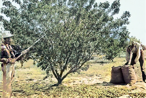
The company needed water, and lots of it, to make all this possible. In 1886, they staked a bold claim on Deep Creek, a fork of the Mojave River. They placed a rock monument near their water intake, intending to divert 5,000 miners’ inches of water per minute for use in Hesperia. They built a dam, canals, and even a steel pipe to carry water under the Mojave River to their new town. It was an impressive engineering feat for the time, and it allowed some early farming to take root—grapes, apples, and even a little wine-making found a foothold.
But the dream didn’t last. The great Southern California land boom collapsed in 1887, and the Hesperia project was one of its casualties. Very few people moved in, and the grand hotel stood nearly empty for years. Despite the setback, the water system stayed in place, and the company managed the land as best it could. Around 1911, the original company was reorganized into the Appleton Land, Water and Power Company, which tried again to breathe life into the project. A few small farms carried on, and the irrigation ditches continued to serve the scattered settlers.
One name that occasionally comes up in the town’s early history is James G. Howland. While not listed as one of the official founders, local accounts suggest he played a leadership role, possibly managing operations on the ground. He may have worked with the Chaffey brothers in Canada before coming to California, and some suggest he acted as a general manager or project overseer in Hesperia. Unfortunately, very little is known about him beyond that. He seems to have left the area or faded from public life after the initial boom ended.
The early efforts of the Hesperia Land and Water Company didn’t create the bustling town they had hoped for, but they left behind more than broken dreams. The water rights they claimed remained valid, and the town’s basic layout stayed the same. When post–World War II developers arrived decades later, they found roads, water systems, and legal groundwork already in place. Despite their failure to spark an immediate colony, these early visionaries planted the seeds— literally and figuratively—for what would eventually grow into the city of Hesperia. Their work, including the rock monument at Deep Creek and the remnants of the grand hotel, still echoes in the town’s heritage today.