Shoshone – Tecopa

10,000 BCE – 1700s
Native peoples, including the Southern Paiute and Western Shoshone, used the Tecopa, Shoshone, Resting Springs, and Amargosa River areas for thousands of years. Springs like Willow Creek and Ibex Springs supported seasonal camps and trade routes connecting the Mojave Desert to the Great Basin.

1829–1830
Antonio Armijo led the first successful trade caravan along what became known as the Old Spanish Trail. His route passed near Resting Springs and the future sites of Tecopa and Shoshone, helping establish a commercial corridor between New Mexico and California.

1844–1859
Resting Springs became an important stop on the Mormon Road, used by emigrants and freight teams. Conflicts occurred between Native groups and travelers. Chief Tecopa led local Paiute resistance before later reaching a peace agreement with settlers. In 1859, Lt. Williamson of the U.S. Army surveyed and recorded Resting Springs as a critical water stop.

1875–1880s
A mining boom brought the founding of Brownsville, later renamed Tecopa, near Willow Creek. Prospectors also worked claims at Ibex Springs, building stone cabins and hauling ore by mule. Resting Springs was reoccupied briefly as a supply stop. Tecopa declined after richer discoveries nearby.

1900
Quon Sing, also known as Ah Foo, developed China Ranch near Tecopa by irrigating fields along Willow Creek. He grew fruit and raised livestock, leaving a legacy that remains part of the landscape today.

1907
The Tonopah and Tidewater Railroad reached Tecopa and Shoshone. A new townsite, called the Tecopa Triangle, was built closer to the rail line. Mining resumed with easier access to markets.

1910
Shoshone was founded by “Dad” Fairbanks as a rail stop and supply point for nearby mines. It soon had a general store, schoolhouse, and housing for workers.

1920s
Mining activity increased at Ibex Springs. Shoshone continued to grow, and Tecopa Hot Springs began to attract visitors as a health retreat. The Shoshone post office was moved from the ghost town of Greenwater.

1930s
Women in Shoshone built the Flower Building for community events. Miners lived in hand-dug dwellings at Dublin Gulch. Mining at Ibex Springs continued at a small scale.

1957
Major mining operations in Tecopa ended. The town shifted toward tourism and retirement. Shoshone remained a traveler’s stop on the way to Death Valley.

1960s–1970s
Under the Small Tracts Act, new homes were built in Tecopa Heights. Ibex Springs was abandoned. Conservation efforts began to grow for the Kingston Range and Amargosa Basin.

1976
The area was included in the California Desert Conservation Area, giving it federal protection. Resting Springs was identified as a riparian habitat and cultural site.

1994
Death Valley became a National Park. Shoshone’s role as a gateway town increased. The Kingston Range and Nopah Range were designated as wilderness areas, preserving places like Ibex Springs.

2000s–present
The Amargosa Conservancy acquired and protected lands around Tecopa, China Ranch, and the river. Shoshone established a museum and promotes its heritage. Tecopa hosts annual events such as the Tecopa Takeover and Firehouse Fling. A public water kiosk was installed in Tecopa Heights. Ibex Springs remains accessible by high-clearance vehicle, with stone ruins and old mining structures still visible.
Death Valley’s Titus Canyon

by Betty J.  Tucker –  Desert Magazine April, 1971
(photos – Walter Feller)

The road and scenery through Titus Canyon in Death Valley produces all the ups and downs of a young love, then steadies out into the young matronly area. Further on, it matures and gains
the stature of sedate old age.

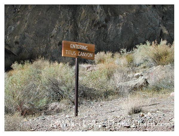
Titus Canyon Road, Death Valley
Titus Canyon Road

That’s a pretty good life span for a mere 25 miles. The only problem is that occasionally heavy rains rip out the road, so be sure and check with the rangers. Trailers cannot be taken on this road and I wouldn’t recommend trucks and campers, although we saw one go through.  At times the high center of the road forces you into some creative driving.We did it in a dune buggy.

The road into Titus Canyon leaves the Beatty Road and crosses the desert between the Bullfrog Hills and the Grapevine Mountains. Then it begins to climb. This road is one way and it is easy to see why. The steep uphill grades and sharp hairpin curves are not conducive to meeting oncoming traffic. There was that thrill of a first young love—the frightening steepness and sheer drop-offs, but still so breathtakingly beautiful that I wasn’t even afraid. The dune buggy has such a short wheelbase it takes the sharpest corners with  ease.

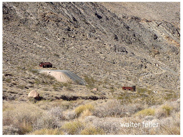
After cresting at Red Pass, elevation 5,250, we dropped down into a beautiful green valley. Here, nestled comfortably in the yellow flowered brittle bush was the ruins of Leadfield.

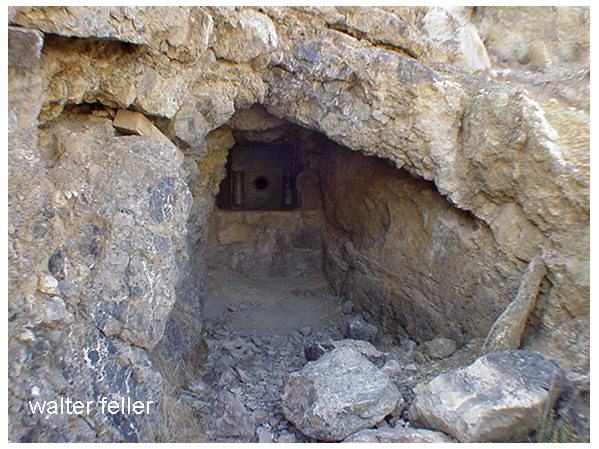
Leadfield tunnel
He blasted some tunnels and liberally salted them …

This child was the brainchild of C. C. Julian who would’ve sold ice to an Eskimo. He wandered into Titus Canyon with money in mind. He blasted some tunnels and liberally salted them with lead ore he had brought from Tonopah. Then he sat down and drew up some enticing maps of the area. He moved to usually dry and never deep Amargosa River miles from its normal bed.

Leadfield ghost town, Death Valley
Leadfield ghost town

He drew pictures of ships steaming up the river hauling out the bountiful ore from his mines. Then he distributed handbills and lowered Eastern promoters into investing money. Miners flocked in at the scent of a big strike and dug their hopeful holes.  They built a few shacks. Julian was such a promoter he even conned the US government into building a post office here.

Leadfield post office, Death Valley
Leadfield post office

So for six months, August, 1926 to February, 1927, over 300 people lived here and tried to strike it rich. They dug and lost.

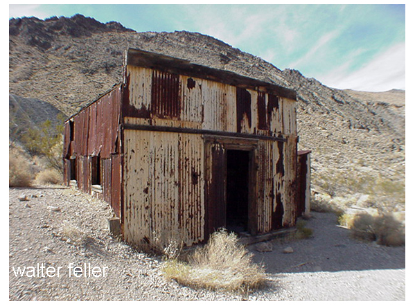
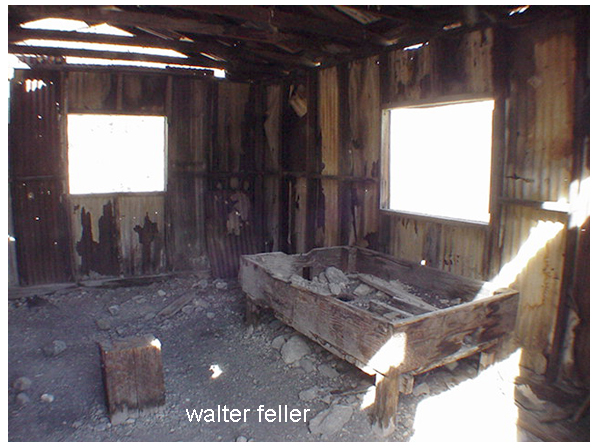
What remains of this fiasco is rather amazing to behold. It most certainly looks like the ghost of a prosperous mine.  The false front, cream-colored, corrugated tin post office is still in good shape. There is a built-in wooden desk in some small shelves on the walls. Of the narrow trail there are two more lime green corrugated tin buildings.

Blacksmith's shop - the wooden block for his anvil and coke bin
Blacksmith’s shop – the wooden block for his anvil and coke bin

Near it is the blacksmith’s building. The wooden block that held his anvil is there as is the bin full of coke.  Both of these buildings are lined with asbestos. There are several small holes where the miners tried to find the promised ore, plus a couple of rather large shafts.

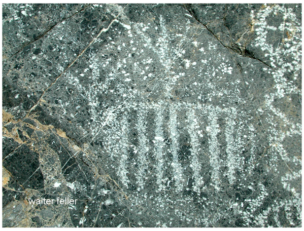
2 1/2 miles  below Leadfield is Klare Spring, the major water supply for the town. Miners stood there in frequent baths here and hold water back to camp. Beside this spring you will find Indian petroglyphs.

Klare Springs, Titus Canyon Road
Klare Springs

We sat on a couple of sun warmed rocks and had a snack. The water trickled by any couple of ravens performed a spectacular air ballet for us.  It was an easy to remember that Titus Canyon got its name through a tragedy.

Titus took half of the stock and went to look for more water.

In 1907, Morris Titus, a young mining engineer, and two of his friends, Mullan and Weller, left Rhyolite intending to cross Death Valley and do some prospecting in the Panamints.  They found the waterhole dry that they had hoped to use. They had only 20 gallons of water for themselves, 19 burros and two horses. Eventually they found a hole where they could get a cup bowl every four hours. While Mullan and Weller waited, Titus took half of the stock and went to look for more water. He never came back. Next day Weller took the remaining stock and set out to look for Titus. He, too, disappeared. Mullan  was found a month later and taken to Rhyolite, more dead than alive. As Titus was known to carry large quantities of gold with him, his family instigated an  extensive search.  No sign was ever found of him. Some thought he might have broken through a salt crust and gone into the mire below. Whatever happened, he has a most beautiful monument in having this particular canyon named after him.

~ end ~

Also see:

Leadfield Ghost Town

History of Leadfield

Stovepipe Wells Area Map

Death Valley Ghost Towns

Titus Canyon Geology