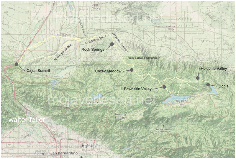
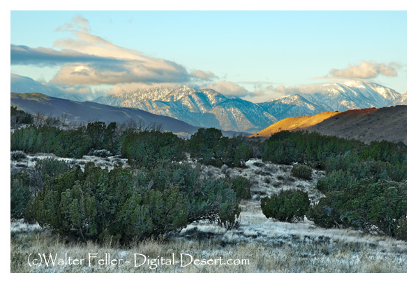
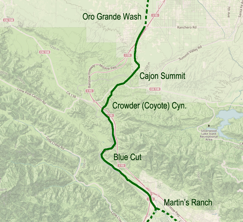
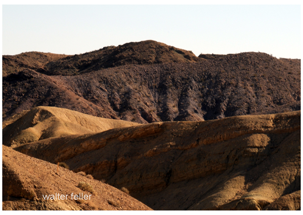
Van Dusen Road/ Coxey Truck Trail from Cajon Summit to Holcomb Valley
He (Hoffman) saw nothing between Summit Valley in the river he considered a likely site. In fact, Hoffman condemned the entire route as unsuited for travel.
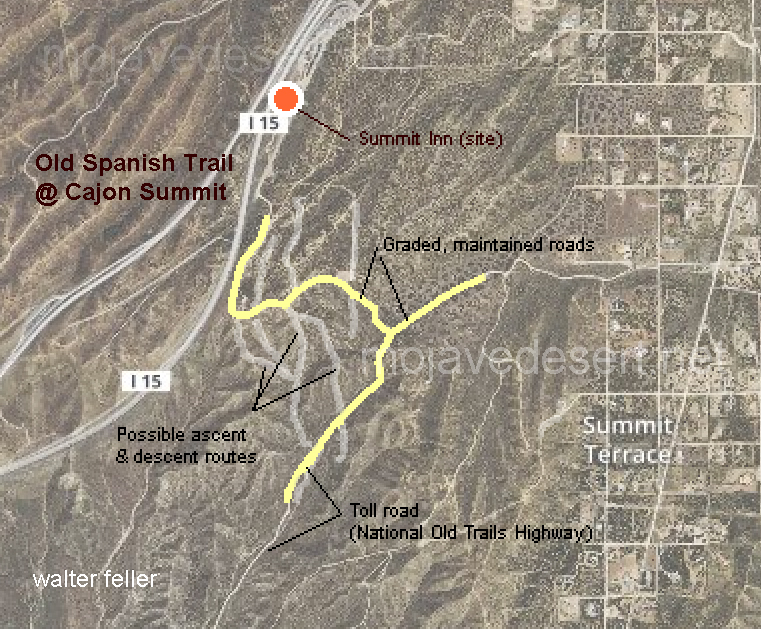
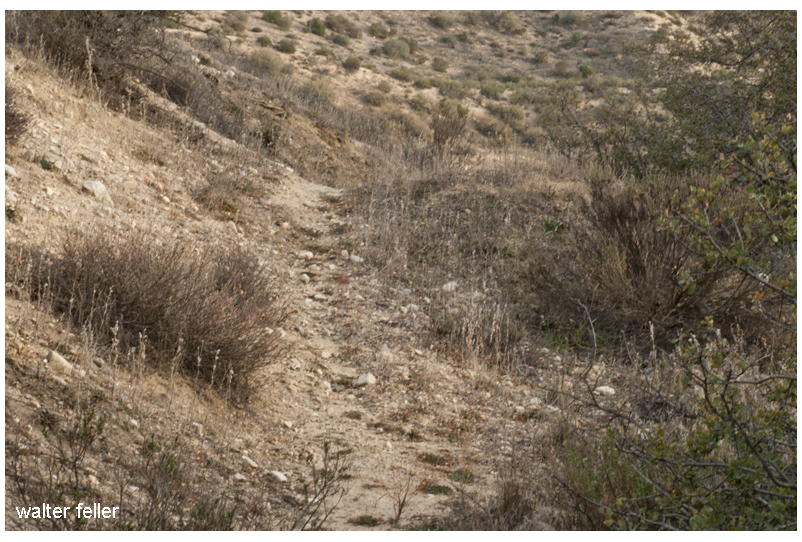
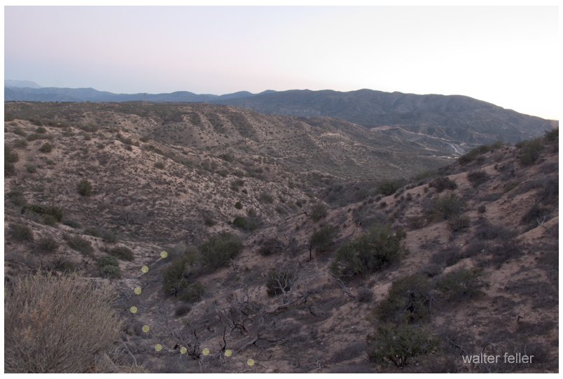
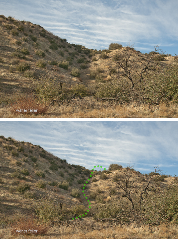
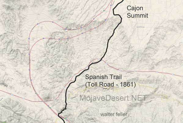
Traces of old trails and graded roads near the Cajon summit.
The direct route over the summit and down the pass eliminates the steep climb and descent over the San Bernardino Mountains.
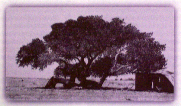
Cottonwood tree at the massacre site in Summit Valley
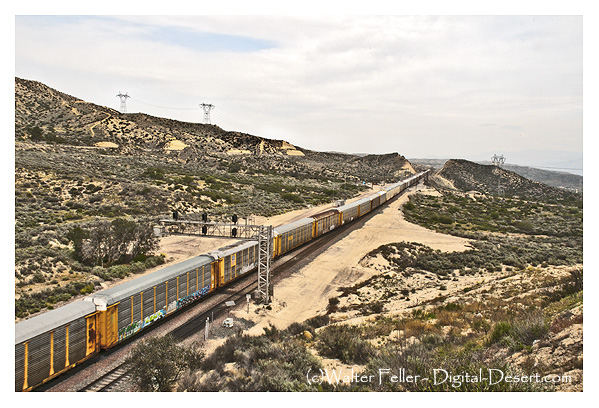
Chard Walker watching trains pass from the terrace beside the Decanso in 1954. From his book, “Railroading in the Pass”
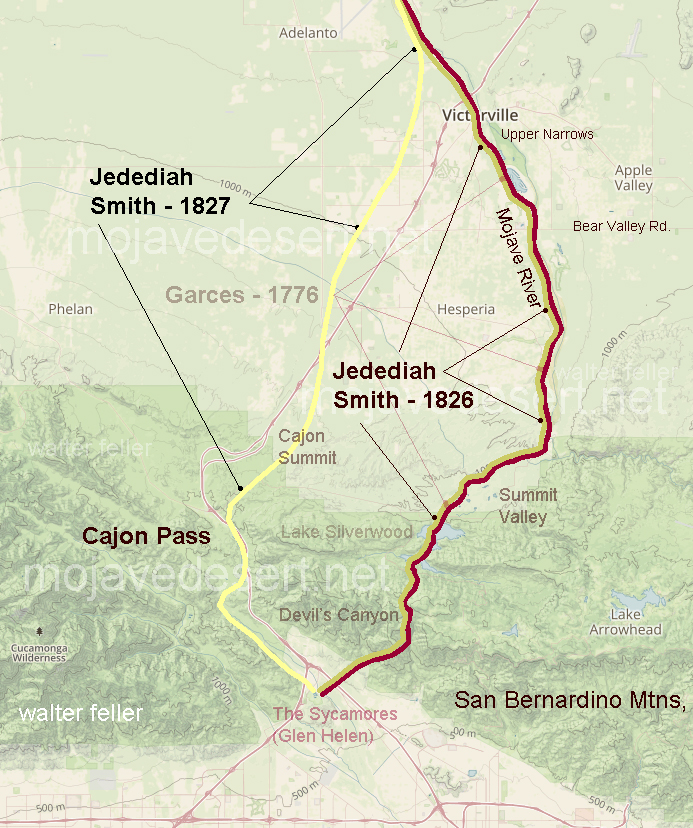
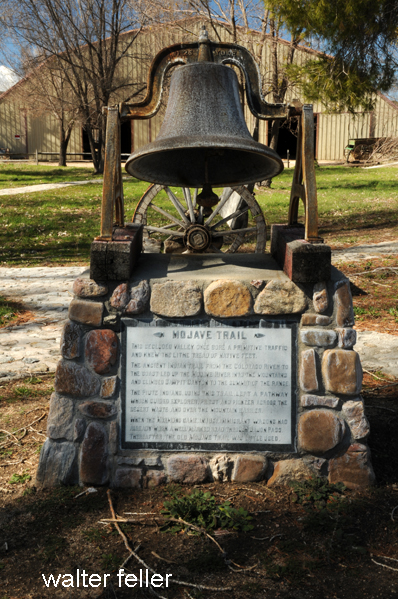
This secluded valley once bore primitive traffic and knew the lithe tread of native feet. The ancient Indian trail from the Colorado River to the coast led up the Mojave River into the mountains and climbed Sawpit Canyon to the summit of the range. The Piute Indians, using this trail, leaving a pathway that guided a Spanish priest, explorers, and pioneers across the desert waste and over the mountain barrier. When the Mormons came, in 1851, immigrant wagons wore a well-marked road through Cajon Pass. Thereafter, the old Mojave Trail through Summit Valley was little used.
Traders in the caravans coming to California did not just trade with those at the missions, but with any group or community they came across. The little settlement of Agua Mansa enjoyed the benefit of being the first village of any size once the mule trains dropped in from the mountains after crossing the deserts.
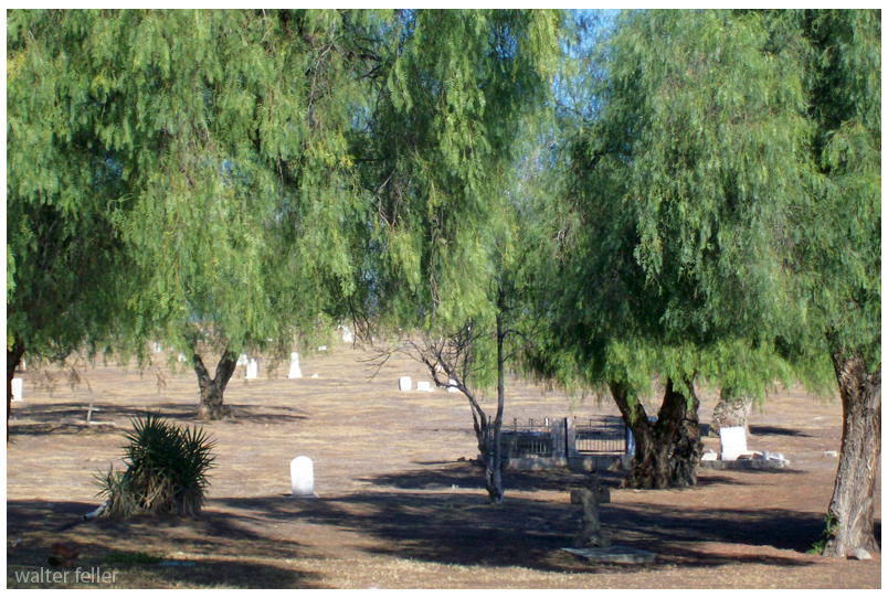
Agua Mansa cemetery
It was called Aqua Mansa, meaning Gentle Water, and was composed entirely of immigrants from New Mexico, numbering some 200 souls–simple, good souls they were, too, primitive in their style of living, kind and hospitable to strangers, rich in all that went to make people happy and content, never having been, up to that time, vexed by the unceremonious calls of the tax collector, owing allegiance to none save the simple, kindhearted old priest who looked after their spiritual welfare. With peace and plenty surrounding them, the good people of Aqua Mansa went to make as contented and happy of people as could be found in the universe.
Originally, possibly a footpath for trade and society. There is no written record of that. After explorers, and then trade caravans wore in mule trails and braided paths as travelers do, to find the path of least resistance. Following the Mojave River, and to get to the hills and valleys of southern California this route was the most direct way, and indeed it was the only way for miles and miles in either direction where wagons could pass through the mountains.
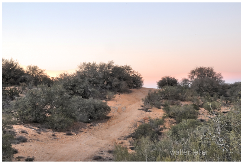
Road over the divide at the summit.
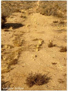
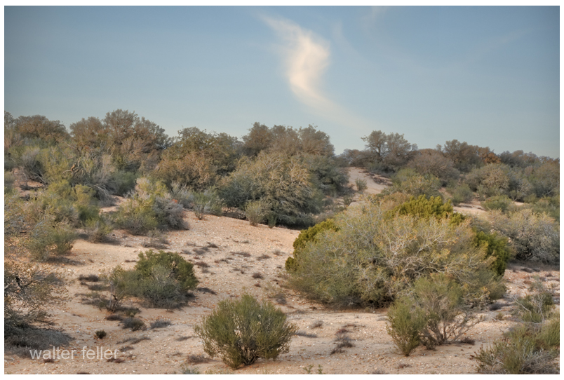
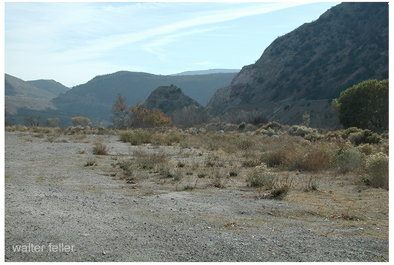
All the frayed trails come together at essentially one point. Within a few yards either way, most all travelers would pass through this trail bottleneck. If there were remnants or traces of old wagon roads where pioneers and freighters passed through and they could still be seen, it would be here where this faint suggestion of an old trail can be observed.
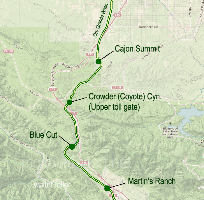
Another cut into the hillside.Cut in road near the summitAt the southern end of the toll road was Martin’s Ranch. The northern end was just beyond the Cajon Summit.Footpaths are as wide as a man’s gait. Mule trails are wider with their broad stance and cargo.
I have heard that Captain Jefferson Hunt brought the first wagon through the pass. Since he succeeded at that, Captain Hunt became instrumental in bringing the early pioneer wagon trains across the Mojave Desert.
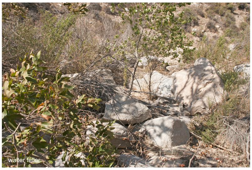
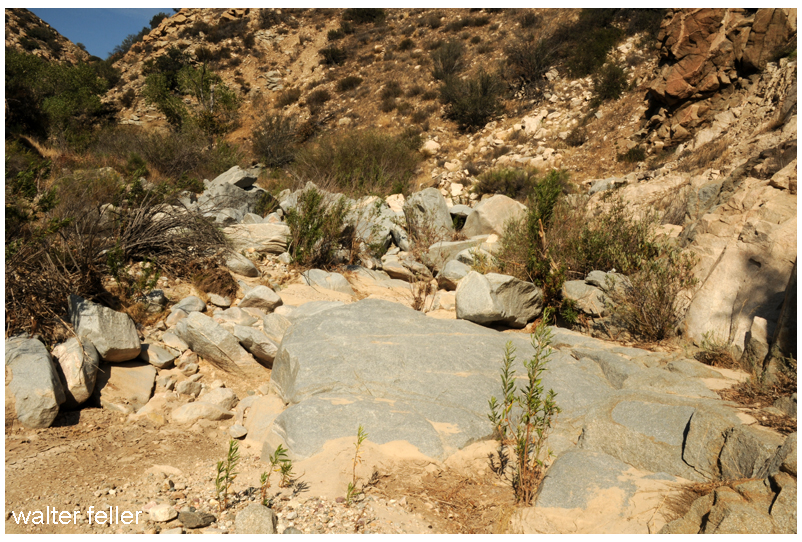
The bottom of the canyon, about the last half mile, was strewn with boulders and impassible by any wheeled vehicle.
Steep at the top and rocky at the bottom, the solution was to disassemble wagons at the bottom and use mules to pack everything through the rocks on the mule trail, then put it all back together.
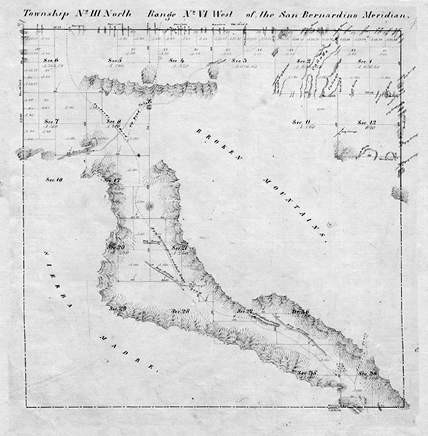
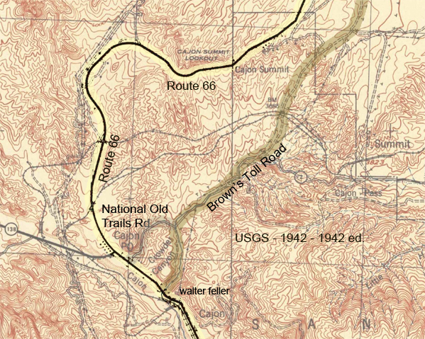
This map, dated 1859, shows the beginnings of the Cajon road network.There were two ways of coming down or going up the stretch of canyon at the summit; either the low spots between the hills or the one of the long ridges, which ever provided a less steep grade to work with.The best thing about coming up or going down the 2500 ft between the summit and foot of the pass is that it isn’t done all at once. I suppose it is like one would eat an elephant; one bite at a time.
Floods were common and so was the erosion which would cause damage to the already rugged trails. One time this way would be good, the next time another.
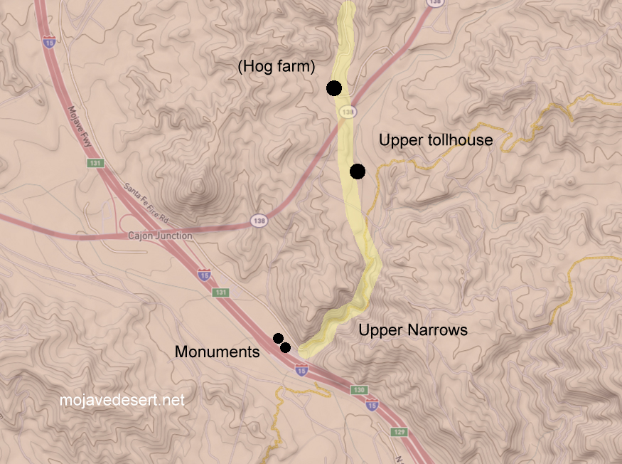
An earthquake in 1899 caused serious damage to the roadway. A bypass was graded in order to avoid the narrows entirely.A generalized map of the upper narrows and toll road through Coyote Canyon in the Cajon Pass.
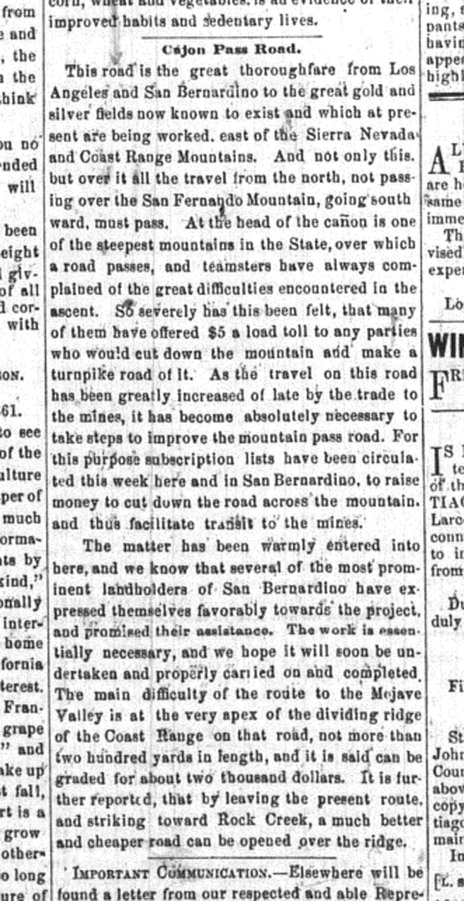
This road is the great thoroughfare from Los Angeles and San Bernardino to the great gold and silver fields now known to exist and which at present are being worked, east of the Sierra Nevada and Coast Range Mountains. And not only this but over it, all the travel from the north, not passing over the San Fernando Mountain, going southward, must pass. At the head of the cañon is one of the steepest mountains in the State, over which a road passes, and teamsters have always complained of the great difficulties encountered in the ascent. So severely has this been felt, that many of them have offered $5 a load toll to any parties who would cut down the mountain and make a turnpike road of it. As the travel on this road has been greatly increased of late by the trade to the mines, it has become absolutely necessary to take steps to improve the mountain pass road. For this purpose subscription lists have been circulated this week here and in San Bernardino, to raise money to cut down the road across the mountain, and thus facilitate transit to the mines. – Los Angeles Star – April 6, 1861
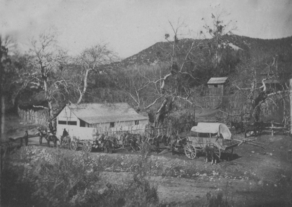
Martin’s Ranch — The southern and of the toll road.Brown significantly improved the old pack trail through the upper narrows.Upper toll gate
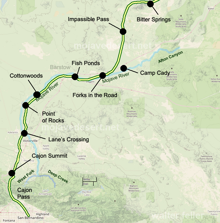
The road which I followed in 1865 crosses from left to right bank of the river a few miles above the Grapevine place said, continues past Cottonwood to Point of Rocks, 22 miles from Grapevine, on a southwest course; at Point of Rocks it turns due south to what was called Lane’s, or the Upper crossing, and there leaves the river entirely to strike straight south by west for Cajon pass in the mountains, reached in 19 miles from Lane’s. This is the way I went, as my itinerary shows: ” Nov. 9. To Martin’s ranch, 29 miles S. from Lane’s crossing; more than half the distance in open country, and then we entered the Cajon pass in the mountains, where there is a tollgate. The pass is a narrow, deep, and tortuous canon, the roughest I have ever traversed on wheels; there was 10 miles of this from the tollgate to Martin’s ranch.” Now Garces has been sent through Cajon pass, with a query, as by Bancroft, Hist. Cala., i, p. 275; but I do not think he went that way. Taking his courses on their face, he continued up the Mojave.
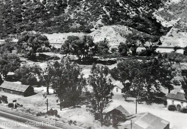
In 1882 John Brown wanted out of the toll road business–the day of the sale the Bear Flat Ranch became Cozy Dell.Bear Flat Ranch – Cozy Dell – Lower toll gate
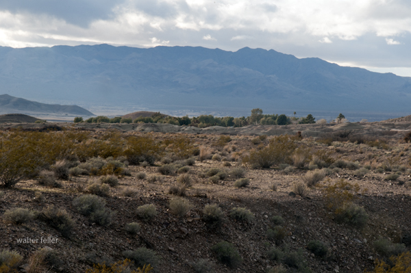
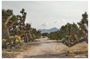
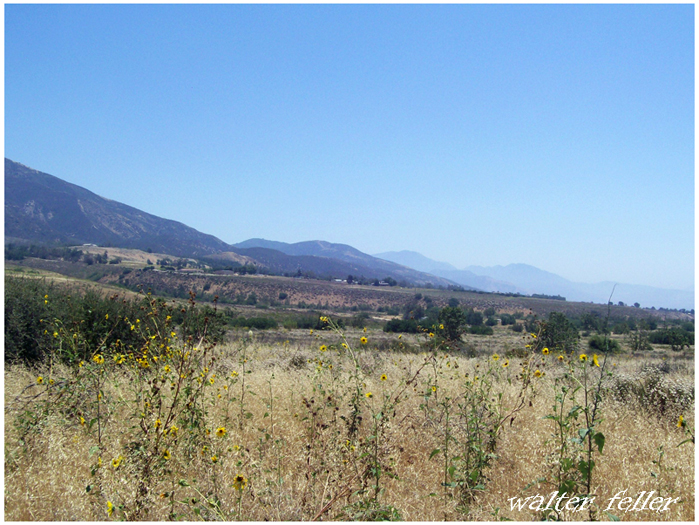
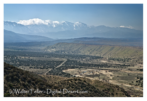
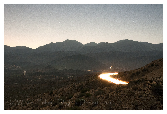
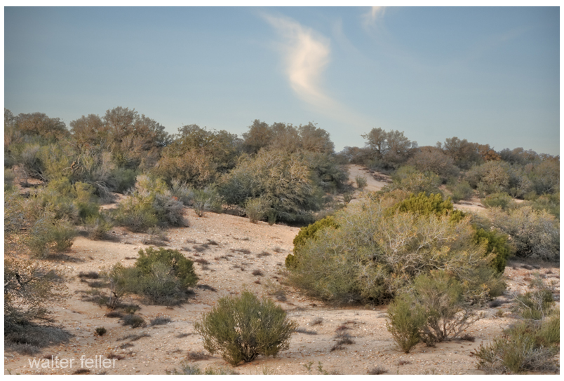
Just east of the Cajon Summit is where the historic traffic corridor in and out of the Mojave Desert narrows and the various alignments come within hollering distance of each other as they cross over the divide between the high desert and Cajon Canyon.
Traces and fragments of footpaths, trails, wagon roads and early highways can be found next to our modern freeway and here they become interwoven, laced and worn or grown over. None of all of this, by any means, obscures the vision of countless travelers of past ages passing this point.
The water of Little Salt Lake is as briny, we were told, like that of Great Salt Lake, and we noticed that its shores were covered with saline incrustations for a mile or more from the water’s edge; but the Mormons stated that the salt was of little value, being impregnated with saleratus and other alkaline matter, which rendered it unfit for use. They obtain their supplies of this article from mines of rock salt in the mountains. The excitement occasioned by the threats of Walkah, the Utah chief, continued to increase during the day we spent at Parowan. Families flocked in from Paragoona, and other small settlements and farms, bringing with them their movables, and their flocks and herds. Parties of mounted men, well-armed, patrolled the country; expresses came in from different quarters, bringing accounts of attacks by the Indians, on small parties and unprotected farms and houses. During our stay, Walkah sent in a polite message to Colonel G. A. Smith, who had military command of the district, and governed it by martial law, telling him that, “The Mormons were d—d fools for abandoning their houses and towns, for he did not intend to molest them there, as it was his intention to confine his depredations to their cattle, and that he advised them to return and mind their crops, for, if they neglected them, they would starve, and be obliged to leave the country, which was not what he desired, for then there would be no cattle for him to take.” He ended by declaring war for four years. This message did not tend to allay the fears of the Mormons, who, in this district, were mostly foreigners, and stood in great awe of Indians.
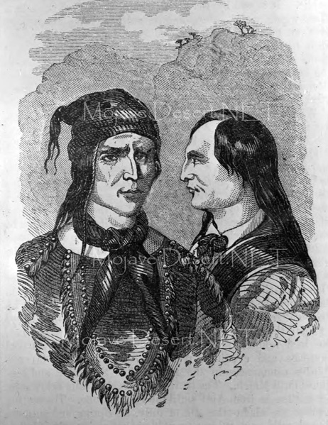
The Utah chieftain who occasioned all this panic and excitement is a man of great subtlety and indomitable energy. He is not a Utah by birth but has acquired such an extraordinary ascendency over that tribe by his daring exploits, that all the restless spirits and ambitious young warriors in it have joined his standard. Having an unlimited supply of fine horses, and being inured to every fatigue and privation, he keeps the territories of New Mexico and Utah, the provinces of Chihuahua and Sonora, and the southern portion of California in constant alarm. His movements are so rapid, and his plans so skillfully and so secretly laid, that he has never once failed in any enterprise and has scarcely disappeared from one district before he is heard of in another. He frequently divides his men into two or more bands, which making their appearance at different points at the same time, each headed, it is given out, by the dreaded Walkah in person, has given him, with the ignorant Mexicans, the attribute of ubiquity. The principal object of his forays is to drive off horses and cattle, but more particularly the first, and among the Utahs we noticed horses with brands familiar to us in New Mexico and California.
This chief had a brother as valiant and crafty as himself to whom he was greatly attached. Both speaking Spanish and broken English they were enabled to maintain intercourse with the whites without the aid of an interpreter. This brother the Mormons thought they had killed, for, having repelled a night attack on a mill, which was led by him, on the next morning they found a rifle and a hatchet which they recognized as his, and also traces of blood and tracks of men apparently carrying a heavy body. Although rejoicing at the death of one of their most implacable enemies, the Mormons dreaded the wrath of the great chieftain, which they felt would not be appeased until he had avenged his brother’s blood in their own. The Mormons were surprised at our having passed in safety through Walkah’s territory, and they did not know to what they were to attribute their escape from destruction. They told us that the cattle tracks which we had seen a few days previously were those of a portion of a large drove lifted by Walkah, and that the mounted men we had noticed in the mountains in the evening of August 1st were scouts sent out by him to watch our movements. They endeavored to dissuade us from prosecuting our journey, for they stated that it was unsafe to travel even between their towns without an escort of from twenty-five to thirty men.
He has adopted the name of Walker (corrupted to Walkah) on account of the close intimacy and friendship which in former days united him to Joe Walker, an old mountaineer, and the same who discovered Walker’s Pass in the Sierra Nevada.
The Mormons had published a reward of fifteen thousand dollars for Walkah’s head, but it was a serious question among them who should “bell the cat.”
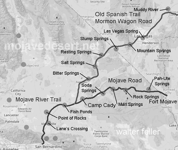
I have heard that the Paiute Indians have a legend–a story they would tell about a giant who crossed the desert with an olla full of water in each arm. With each step he would leave his footprint in the ground, and water would spill from the olla into the hole as he walked on. The giant was so large that these waterholes were one day’s walk between each for a normal-sized man. The Indian learned this and used these waterholes to travel great distances and trade with other Peoples beyond the desert. As time went on and things went the way things do, one such trail became the Mojave Road. — Editor
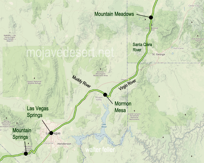
In April 1855, Brigham young, President of the church of Jesus Christ of Latter-Day Saints, called 30 men to leave their families and possessions in the recently settled towns of Utah to serve a mission at the Las Vegas Springs. The verdant meadows watered by the springs had been seasonally inhabited by the Paiute Indians for centuries. The water and meadows made Las Vegas an important stop on the Spanish Trail (called the Mormon Road after 1848).
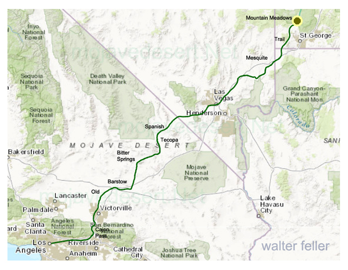
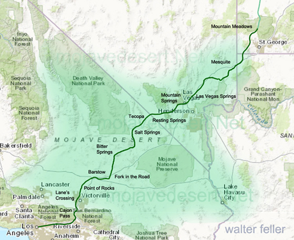
Map of the Old Spanish Trail (Mormon Road) from Mountain Meadows, UT. to Los Angeles, CA.
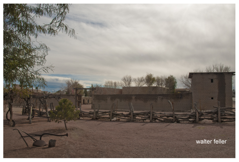
President Young directed this group of newly called missionaries to become self-sufficient, to provide a place of rest insecurity for travelers between California and Salt Lake City, and to teach the Indians the gospel of Jesus Christ. In the heat of the summer, in June 1855, the missionaries arrived at this site. The mission, intended to be permanent, was first Anglo-American settlement in Las Vegas Valley.
Mormon Fort – Las Vegas, Nv.
By summer’s end there irrigating gardens were producing fresh vegetables and grains. A new fort was under construction, and a spirit of cooperation and mutual learning was being established with the native inhabitants. They also discovered a deposit of lead or in the nearby mountains. More missionaries were sent to smelt the complex ore in large quantities, but the attempt was unsuccessful.
On 23 February 1857 church leaders sent word to the settlement that the mission was to be disbanded. These early pioneers returned to Utah the left a legacy of faith, devotion, and service shown by their willingness to settle in this hostile environment.
Of all the brother acts operating in and around San Bernardino County during the Mormon period, Few accomplished more for the ultimate benefit of the area than the Stoddard boys, Arvin and Sheldon.
Neither cut an imposing figure. Arvin, the quiet one, was only 5’5″ tall and weighed 135 pounds soaking wet, while Sheldon wasn’t much larger. But what they lacked in height they more than made up in spirit.
Arvin, however, had an imposing ally in his wife Caroline. She was 6 feet tall and weighed well over 200 pounds — a formidable Amazon and an extremely vocal one too. One is tempted to ask if she carried him across the threshold on their wedding night.
She became Arvin’s mouthpiece and did not hesitate to make her opinions known, particularly when the chips were down. As their grandson, R. Jackson Stoddard wrote in the March 1970 issue of the LA Westerners Branding Iron, “For although she followed the will of her husband, in many cases the will of her husband was truly only a reflection of her own wants and desires.”
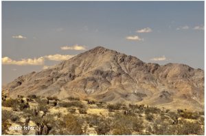
Stoddard Mountain
Today, a stretch of the Mojave Desert between Victorville and Daggett is blanketed with sites bearing the Stoddard’s names. They include the Stoddard Mountains, Stoddard Hills, Stoddard gulch, Stoddard Valley, Stoddard Well and Stoddard Wells Road — all directly attributable to Arvin’s work in the area during the 1850s and 60s.
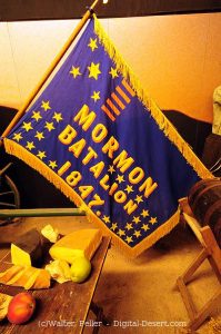
Flag of the Mormon Battailion (note spelling)
There were four Stoddard Brothers at the beginning; Rufus, Albert, Arvin and Sheldon, who were all born in Canada. When their father died in 1838, mother Jane gathered them all up and crossed the United States border, first to Ohio in then to Warsaw, Illinois, where she became hooked on the Mormon religion. When the church made it’s great trek to Salt Lake City in 1847, she and her boys were in the initial contingent.
Rufus was the first of the boys to reach California, arriving in San Diego as a member of the MormonBattalion. After his group was disbanded in Los Angeles, he remained in the area for almost a year before he rejoining his family at Salt Lake City in 1849.
Sheldon was the next to go. Leaving Salt Lake in 1848, along with 30 other men found for the placer diggings near hang town, they traveled as far as Mountain Meadows with a larger company who hired Capt. Jefferson Hunt to guide them to Los Angeles over the Old Spanish Trail.
At the Meadows they left Hunt’s party and turned west to take what they thought was a shortcut to the gold fields and for the next 17 days blindly followed a false trail without a guide, compass or map to go by.
On the 18th day, hopelessly lost in facing death without water their lives were spared when a sudden rain squall drenched the area. As Sheldon later wrote, “We caught the water by spreading out our rubber blankets on the ground and drank it with a spoon.”
They then turned east on the Muddy River, followed at South until they fortunately encountered Capt. Hunt’s company again and accompanied it up the Mojave River, through Cajon Pass and down to the Chino Ranch.
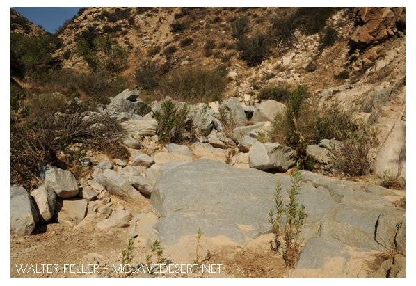
Crowder Canyon – Old Spanish Trail
Tragically enough, on the same trip another group of would-be minors left Hunt’s command at Provo, Utah, insisting they also knew a shorter route to the gold fields, only to blunder into Death Valley, where five died before the survivors made it to Los Angeles.
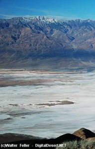
Death Valley
From Chino the party went on to Mariposa, where they broke up to mine, while Stoddard ran a trading post in nearby Carson Valley for a few months before returning to Salt Lake with a herd of horses and mules.
in March 1851 Sheldon married Jane Hunt, daughter of Capt. Hunt, and the following month they accompanied the first group of Mormon colonizers to the San Bernardino Valley, making temporary camp at Sycamore Grove.
After the Mormons purchased the San Bernardino Rancho that September, and moved down into the valley, Sheldon built the first log cabin in the settlement on First Street,, west of I Street. His cabin was later moved to and made part of the Westside of this stockade constructed on the present courthouse site as protection against hostile Indians.
For the next 14 years Sheldon Stoddardwas engaged in freighting and carrying mail between San Bernardino and Salt Lake City, crossing the Mojave 24 times in all. In 1865 he made one trip to Nevada in Montana with a mule team which covered over 1300 miles, and took six months to complete.
Arvin Stoddard and his wife also came to San Bernardino with the first Mormon train and lived in the stockade for three years before receiving an urgent message from Mormon leader Brigham Young, authorizing him to investigate a gold strike in the Calico Hills to see if he could ” obtain as much gold as possible to help finance the founding and furtherance of the faith,” keeping only enough to live on during the venture.
Calico Hills
Arvin and Caroline, ardent church devotees, packed their wagon and with their poor young children in tow, headed for the hills without hesitation.
Mojave River at Afton Canyon
But before looking for gold, Arvin searched for water to raise crops to feed his family and stock and to flush through sluice boxes used to separate flakes of gold from the desert sand.
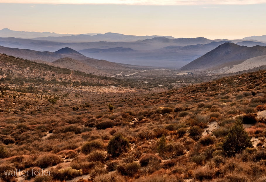
One of his more successful wells, known as Stoddard Well, is still flowing today and besides furnishing the family with ample water, also provided an impetus for others to break out a new road on almost a straight line from Lane’s Crossing, near today’s Oro Grande, to Fish Ponds Station between present-day Barstow and Daggett, thereby saving many miles compared with the old route, which followed the westward band of the Mojave River.
Although it took him almost 8 years of prospecting, Arvin finally struck a rich claim and extracted a sum that Caroline estimated at $60,000 before calling it quits and lighting out for Salt Lake City to hand to Brigham Young.
But before they reach the Mormon Temple, they were held up by Indians and robbed of all their hard-earned loot, except for a few thousand dollars hidden in Caroline’s underwear.
As her grandson related, “The Indians were neither red nor brown. they were more white than any Indian she (Caroline) had ever seen.” Caroline deduced they were renegade Mormons, acting on behalf of the church, and although her suspicions were never resolved, her once benevolent attitude toward the Mormon hierarchy changed overnight and led to her eventual break with the church.
In 1869 the Arvin Stoddards move to Milford, Utah, where they build a hotel called, naturally, “The Stoddard House,” where they lived until Caroline died in 1904.
Sheldon Stoddard remained in San Bernardino for the rest of his life, Rev. and honored by all who knew him for his contributions to the county and state.
Blue Cut – Cajon Pass
After serving as president of the pioneer society, he spent his final years surrounded by old friends like John Brown and Billy Holcomb. They camped and fished together in their mountain retreats and dedicated monuments to the pioneers in Cajon Pass. he was active up to the day of his death in 1919 at the age of 89.
From:
Heritage Tales 1988 by Fred Holladay published by the City of San Bernardino Historical and Pioneer Society
In 1849 in the rush to the goldfields of California the Bennett-Arcane party of the Mojave-San Joaquin wagon train decided to try an unknown shortcut and became stranded in what is now known as Death Valley. Two young men, William L. Manly and John Rogers walked out, across the desert and into the canyons north of Los Angeles. At a rancho in San Francisquito canyon they managed to get a white horse and a one-eyed mule as well as supplies then they walked back to those who were remaining at the camp. Once they returned they led the lost party to safety. Following are their observations of the topography of the Mojave and how Manly claimed Death Valley got its name.
While waiting for the women Bennett and Arcane wanted to go out and get a good view of the great snowy mountain I had told them so much about. The best point of view was near our camp, perhaps three or four hundred yards away, and I went with them. This place where we now stood was lower than the mountains either north or south, but were difficult to climb, and gave a good view in almost every direction, and there, on the back bone of the ridge we had a grand outlook, but some parts of it brought back doleful recollections. They said they had traveled in sight of that mountain for months and seen many strange formations, but never one like this, as developed from this point. It looked to be seventy-five miles to its base, and to the north and west there was a succession of snowy peaks that seemed to have no end. Bennett and Arcane said they never before supposed America contained mountains so grand with peaks that so nearly seemed to pierce the sky. Nothing except a bird could ever cross such steep ranges as that one.
West and south it seemed level, and low, dark and barren buttes rose from the plain, but never high enough to carry snow, even at this season of the year. I pointed out to them the route we were to follow, noting the prominent points, and it could be traced for fully one hundred and twenty-five miles from the point on which we stood. This plain, with its barren ranges and buttes is now known as the Mojave Desert. This part of the view they seemed to study over, as if to fix every point and water hole upon their memory. We turned to go to camp, but no one looked back on the country we had come over since we first made out the distant snow peak, now so near us, on November 4th 1849. The only butte in this direction that carried snow was the one where we captured the Indian and where the squashes were found.
The range next east of us across the low valley was barren to look upon as a naked, single rock. There were peaks of various heights and colors, yellow, blue fiery red and nearly black. It looked as if it might sometime have been the center of a mammoth furnace. I believe this range is known as the Coffin’s Mountains. It would be difficult to find earth enough in the whole of it to cover a coffin.
Just as we were ready to leave and return to camp we took off our hats, and then overlooking the scene of so much trial, suffering and death spoke the thought uppermost saying:–“_Good bye Death Valley!”_ then faced away and made our steps toward camp. Even after this in speaking of this long and narrow valley over which we had crossed into its nearly central part, and on the edge of which the lone camp was made, for so many days, it was called Death Valley.
Many accounts have been given to the world as to the origin of the name and by whom it was thus designated but ours were the first visible footsteps, and we the party which named it the saddest and most dreadful name that came to us first from its memories.
From: Shoshone Country; Resting Springs – Loafing Along Death Valley Trails by W. Caruthers
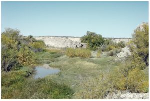
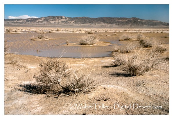
Resting Springs
Early in 1843, John C. Fremont led a party of 39 men from Salt Lake City northward to Fort Vancouver and in November of that year, started on the return trip to the East.
Fremont 1844 – annotated
This trip was interrupted when he found his party threatened by cold and starvation and he faced about; crossed the Sierra Nevada and went to Sutter’s Fort. After resting and outfitting, he set out for the East by the southerly route over the old Spanish trail, which leads through the Shoshone region.
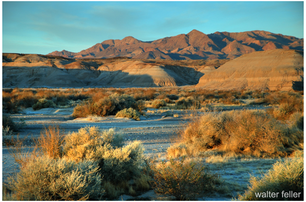
Bitter Springs
At a spring somewhere north of the Mojave River he made camp. The water nauseated some of his men and he moved to another. Identification of these springs has been a matter of dispute and though historians have honestly tried to identify them, the fact remains that none can say “I was there.”
In the vicinity were several springs any of which may have been the one referred to by Fremont in his account of the journey. Among these were two water holes indicated on early maps as Agua de Tio Mesa, and another as Agua de Tomaso.
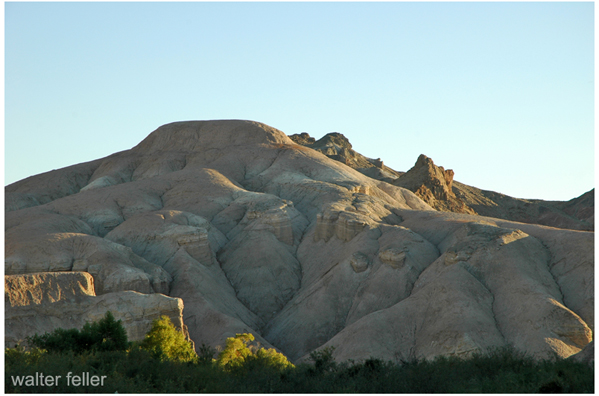
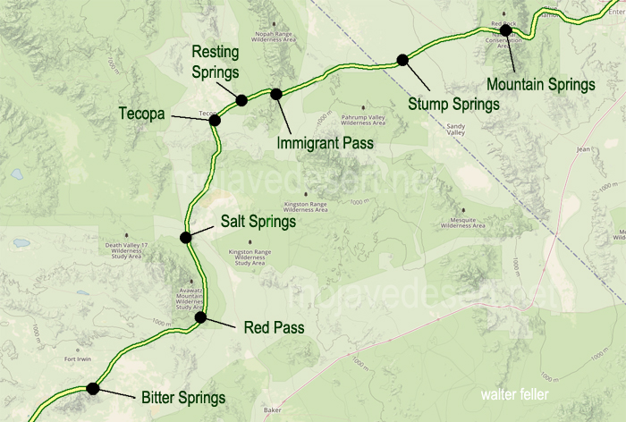
Red Pass on the Old Spanish Trail between Bitter Springs and Salt Spring
There are several springs of nauseating water in the area and some of the old timers academically inclined, insisted that Fremont probably camped at Saratoga Springs, which afforded a sight of Telescope Peak or at Salt Spring, nine miles east on the present Baker-Shoshone Highway at Rocky Point.
Salt Spring
Kit Carson was Fremont’s guide. Fremont records that two Mexicans rode into his camp on April 27, 1844, and asked him to recover some horses which they declared had been stolen from them by Indians at the Archilette Spring, 13 miles east of Shoshone.
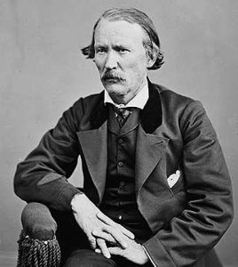
Christopher “Kit” Carson
One of the Mexicans was Andreas Fuentes, the other a boy of 11 years—Pablo Hernandez. While the Indians were making the raid, the boy and Fuentes had managed to get away with 30 of the horses and these they had left for safety at a water hole known to them as Agua de Tomaso. They reported that they had left Pablo’s father and mother and a man named Santiago Giacome and his wife at Archilette Spring.
With Fremont, besides Kit Carson, was another famed scout, Alexander Godey, a St. Louis Frenchman—a gay, good looking dare devil who later married Maria Antonia Coronel, daughter of a rich Spanish don and became prominent in California.
In answer to the Mexicans’ plea for help, Fremont turned to his men and asked if any of them wished to aid the victims of the Piute raid. He told them he would furnish horses for such a purpose if anyone cared to volunteer. Of the incident Kit Carson, who learned to write after he was grown, says in his dictated autobiography: “Godey and myself volunteered with the expectation that some men of our party would join us. They did not. We two and the Mexicans … commenced the pursuit.”
Fuentes’ horse gave out and he returned to Fremont’s camp that night, but Godey, Carson, and the boy went on. They had good moonlight at first but upon entering a deep and narrow canyon, utter blackness came, even shutting out starlight, and Carson says they had to “feel for the trail.”
Amargosa River, Tecopa
One may with reason surmise that Godey and Carson proceeded through the gorge that leads to the China Ranch and now known as Rainbow Canyon. When they could go no farther they slept an hour, resumed the hunt and shortly after sunrise, saw the Indians feasting on the carcass of one of the stolen horses. They had slain five others and these were being boiled. Carson’s and Godey’s horses were too tired to go farther and were hitched out of sight among the rocks. The hunters took the trail afoot and made their way into the herd of stolen horses.
Rainbow Canyon/China Ranch
Says Carson: “A young one got frightened. That frightened the rest. The Indians noticed the commotion … sprang to their arms. We now considered it time to charge on the Indians. They were about 30 in number. We charged. I fired, killing one. Godey fired, missed but reloaded and fired, killing another. There were only three shots fired and two were killed. The remainder ran. I … ascended a hill to keep guard while Godey scalped the dead Indians. He scalped the one he shot and was proceeding toward the one I shot. He was not yet dead and was behind some rocks. As Godey approached he raised, let fly an arrow. It passed through Godey’s shirt collar. He again fell and Godey finished him.”
Tecopa
Subsequently it was discovered that Godey hadn’t missed, but that both men had fired at the same Indian as proven by two bullets found in one of the dead Indians. Godey called these Indians “Diggars.” The one with the two bullets was the one who sent the arrow through Godey’s collar and when Godey was scalping him, “he sprang to his feet, the blood streaming from his skinned head and uttered a hideous yowl.” Godey promptly put him out of his pain.
They returned to camp. Writes Fremont: “A war whoop was heard such as Indians make when returning from a victorious enterprise and soon Carson and Godey appeared, driving before them a band of horses recognized by Fuentes to be part of those they had lost. Two bloody scalps dangling from the end of Godey’s gun….”
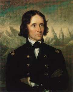
John Charles Fremont
Fremont wrote of it later: “The place, object and numbers considered, this expedition of Carson and Godey may be considered among the boldest and most disinterested which the annals of Western adventure so full of daring deeds can present.” It was indeed a gallant response to the plea of unfortunates whom they’d never seen before and would never see again.
When Fremont and his party reached the camp of the Mexicans they found the horribly butchered bodies of Hernandez, Pablo’s father, and Giacome. The naked bodies of the wives were found somewhat removed and shackled to stakes.
Fremont changed the name of the spring from Archilette to Agua de Hernandez and as such it was known for several years. He took the Mexican boy, Pablo Hernandez, with him to Missouri where he was placed with the family of Fremont’s father-in-law, U. S. Senator Thomas H. Benton. The young Mexican didn’t care for civilization and the American way of life and in the spring of 1847 begged to be returned to Mexico. Senator Benton secured transportation for him on the schooner Flirt by order of the Navy, and he was landed at Vera Cruz—a record of which is preserved in the archives of the 30th Congress, 1848.
Three years later a rumor was circulated that the famed bandit, Joaquin Murietta was no other than Pablo Hernandez (This was indeed, just a rumor as the dates were mismatched by at least ten years -ed.)
Lieutenant, afterward Colonel, Brewerton was at Resting Springs in 1848 with Kit Carson who then was carrying important messages for the government to New Mexico. He found the ground white with the bleached bones of other victims of the desert Indians. Brewerton calls them Pau Eutaws.
Mountain Meadows–the dark valley where in late 1857 the murder of 135 men, women and children took place. They were rendered defenseless and surrendered after several days of siege on their defensive circle of wagons losing 10 men in the battle. The unsuspecting victims, expecting to be led to a local town were marched up a hill and the slaughter began in earnest.
The Old Spanish Trail enters the Mojave from the northeast south of Mountain Meadows in Utah.
In 1864 Sarah Rousseau came through the site on her way to California with the Earp family noting the following comments in her diary;
“They arrived here in September, ’57, where they were murdered in cold blood by the Mormons. There was a monument raised to their memory once before, but the Mormons tore it down. This spring sometime in May, some soldiers came through California and erected this monument and dared any of the Mormons to touch it.
Mountain Meadows
There were survivors. She continued;
“There were 150 cruelly butchered men women and children, only six small children, too young to tell the tale, were suffered to live. They are at Salt Lake City. I cannot for a moment suppose that such barbarism will be buried in oblivion. “Oh, it cannot be.” It will be brought to light and the aggressors punished.
Mountain Meadows
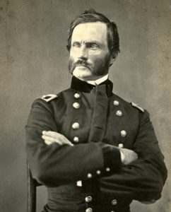
Brevet Major Henry Carleton led his troops into the area discovering the hastily buried bodies at the massacre site.
Maj. J. H. Carleton
In his special report of 1859 the Major did not hold back his distaste for Mormons and these events;
“In pursuing the bloody thread which runs throughout this picture of sad realities, the question how this crime, that for hellish atrocity has no parallel in our history, can be adequately punished often comes up and seeks in vain for an answer. Judge Cradlebaugh says that with Mormon juries the attempt to administer justice in their Territory is simply a ridiculous farce. He believes the Territory ought at once to be put under martial law. This may be the only practical way in which even a partial punishment can be meted out to these Latter-Day devils.
“But how inadequate would be the punishment of a few, even by death, for this crime for which nearly the whole Mormon population, from Brigham Young down, were more or less instrumental in perpetrating.
In his book, Roughing It, Mark Twain described the reaction of the pubic upon hearing of the mass murder: “The whole United States rang with its horrors.”
Hindered by the Civil War and other events indictments were issued but the only one convicted was a Mr. John D. Lee who was executed by firing squad in 1877, 20 years after the fact.
Sometimes the fastest way from point A to point B would be a straight line.
To the uninitiated, there is something rather uncertain about the reasons why a person will take time to view a location or an artifact. Ask the visitor why they make the trek or handle an object. The response may take the form of a smile, and perhaps the timeworn cliché ” because it was there.” That smile in phrase only does partial justice in explaining personal gratification.
Why should we visit sites where history of any magnitude happened? Perhaps it is because a fresh vista creates a more objective insight in pursuit of historical knowledge. Personal enjoyment and related benefits require one to approach a subject with a receptive and determined mindset.
In stories about stagecoaches and freight wagons we may be entertained or learn about animals, load, dust, storm, good, evil, driver, passenger, comedy, sadness and so forth – a whole range of emotions. a writer may have captured our imagination in words, but obtaining a complete and satisfying grasp of the event is a personal quest.
Salt Lake Wagon Road
Often our inquisitiveness may provide answers only by standing on the spot, embracing the environment, and getting the feeling of how it may have been back when. Imagine sound, the smell of man, equipment noise in animals doing the work. Anticipate the next riser dip the road and how it must have affected progress. Consider the impact on those traveling in good, bad, or indifferent weather. Envision people, dress, available tools, and reasons for passing this way. Think of small but important details, such as animal harnesses, conveyancing station construction. Perhaps the preceding thoughts may help create for you a new perspective and enjoyment of history.
from: Indian Wells Valley Stage and Freight Stops 1874 – 1906 Comments and Directions by Lou Pracchia Historical Society of the Upper Mojave Desert
The Old Spanish Trail had become increasingly used as a pack mule trail between New Mexico and California, and with this traffic came the opportunity for those to take advantage of the distance and desperate nature of the land.
Hundreds and sometimes even thousands of stolen horses from the ranchos would burst through Coyote Canyon beginning their ‘journey of death’ across the Mojave.
California horses were beautiful creatures, and the mules were taller and stronger than those in New Mexico and they were easy to steal. The rolling hills and plains presented clear paths to the Cajon where numerous hidden canyons and washes were available to slip into and prepare for the furious run across the desert. Horses would be stolen in herds from many different ranchos at once. Hundreds of horses, even thousands could be commandeered and driven by just a few experienced thieves.
Narrows, Crowder Cyn., Cajon Pass
Chief Walkara, ‘Hawk of the Mountains’ and the greatest horse thief in all of history along with his band of renegade Chaguanosos , and notables such as Jim Beckwourth and Pegleg Smith would work together in this illegal trade. During one raid they were said to have coordinated the theft of 3,000-5,000 horses, driving them to Fort Bridger to trade for more horses to run to New Mexico to trade again. Horses would fall from exhaustion every mile and the local bands of Paiute would feast on the remains.
The rich ranchos of southern California.
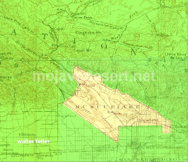
In 1843 Michael White was granted one league of land at the mouth of the Cajon Pass called Rancho Muscupiabe. At a point overlooking the trails leading into and away from the canyon he was expected to thwart the raiders and horse thieves that were plaguing the Southern California ranchos. In theory it was a good plan but in practice it did not work so well.
From the piedmont between Devil and Cable canyons, Miguel Blanco could keep an eye out for the horse thieves entering the Cajon.
He built his home of logs and earth and constructed corrals for his stock. However, the location between Cable and Devil Canyon only served as a closer and more convenient target for the Indian thieves. His family was with him, but after six weeks until it became too dangerous. He left after nine months without any livestock and in debt.
The Old Spanish Trail went down this slope to behind Miguel Blanco’s rough-hewn homestead. Indians would watch from this forest for Miguel to leave and they would slip down and steal everything that could be stolen.
Miguel sold his property, however, Miguel had misread the grant, letting the rancho go for much less than it was worth. The land described on the grant was roughly 5 times larger than Miguel thought. Blanco brought a suit but lost.
Muscupiabe Rancho
As the late 1840s and 1850s rolled by wagon roads were being developed in the canyon minimizing the effectiveness of the maze of box canyons being used to cover the escape of desperadoes on horseback. With California becoming a state frontiersmen such as Beckwourth and Peg Leg Smith would not steal from fellow Americans. Horse-thieving under U.S. law had become a crime where before it was just stealing horses from Mexicans. That was only serious if caught in the act. Americans would never extradite them. For the most part, that was the end of the horse stealing raids.
Wagon wheel furrows cut deep in the sand, winding through desolate desert land, on through arroyos, climbing a rise to snow-covered mountains that reach to the skies; ruts that the elements tried to erase from the deserts redoubtable face, but fate has preserved, through all of these years, the trail of the wagon train pioneers.
We follow their route in a multi-wheel drive and marvel that anyone could survive. Through famines, and droughts, and blizzards and rain on a rumbling ox-drawn wagon train, and eke out a living from off of a land of solitude, emptiness, cactus and sand; Did they vision rainbows way over there where we find a cauldron and the smog laden air?
What will the future historians find when they search for the trails we leave behind? Will our many-lane highway be plain to see, that leads toward that “Great Society?” Or maybe they’ll excavate someday, through atomic ashes to our freeway, and wonder how anyone could survive, on a careening, rumbling, four-wheel-drive.
Mohave III – Scrapbooks of History, Mohahve Historical Society, 1966


 In 1849 in the rush to the goldfields of California the Bennett-Arcane party of the Mojave-San Joaquin wagon train decided to try an unknown shortcut and became stranded in what is now known as Death Valley. Two young men, William L. Manly and John Rogers walked out, across the desert and into the canyons north of Los Angeles. At a rancho in San Francisquito canyon they managed to get a white horse and a one-eyed mule as well as supplies then they walked back to those who were remaining at the camp. Once they returned they led the lost party to safety. Following are their observations of the topography of the Mojave and how Manly claimed Death Valley got its name.