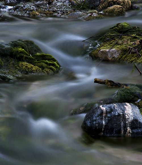
This is a beautiful long-exposure photograph of a flowing stream over mossy rocks. Here’s the critique and rating:
Composition:
The use of the rocks to anchor the flow is well-executed, especially the striking striped rock in the lower right, which adds visual interest.
The scene feels intimate and immersive, pulling the viewer into a quiet, almost meditative space.
The flow of water naturally guides the eye across the image, suggesting motion and calm.
Lighting & Color:
Low light conditions were managed well. The smooth, silken look of the water against the sharp, textured rocks and moss creates a strong contrast.
The green tones in the moss are rich but subdued—natural rather than over-saturated.
The color palette leans dark overall, which adds a moody, tranquil atmosphere; however, it slightly obscures details in the upper section.
Technical Aspects:
The long exposure is effective and well-balanced, with no overexposure or blown highlights in the water.
The focus is crisp on the rocks, particularly the striped one, which serves as a visual focal point.
There’s a delicate balance between softness in the water and sharpness in the static elements—nicely done.
Suggestions:
Brightening just the midtones or selectively dodging parts of the moss could bring out more detail and give the image a subtle lift without ruining the mood.
Cropping a bit from the top might tighten the composition, keeping focus on the dynamic lower half.
Rating: 8.7/10 A well-executed, contemplative nature shot with pleasing composition and masterful exposure control. The image quietly invites the viewer to pause and observe the small, beautiful rhythms of nature.
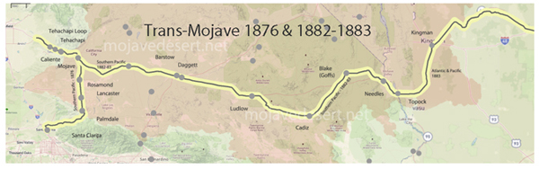
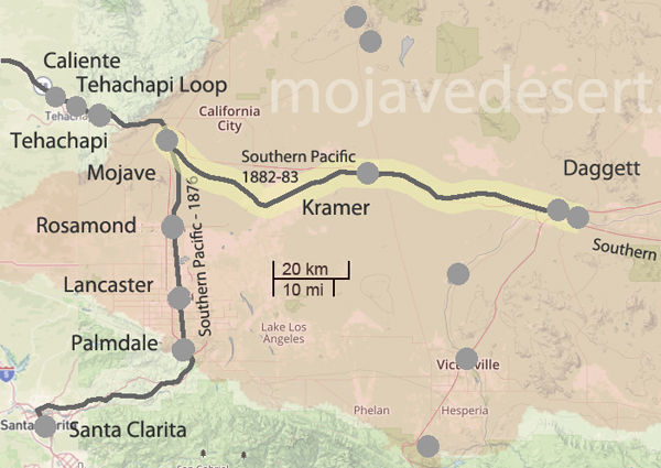
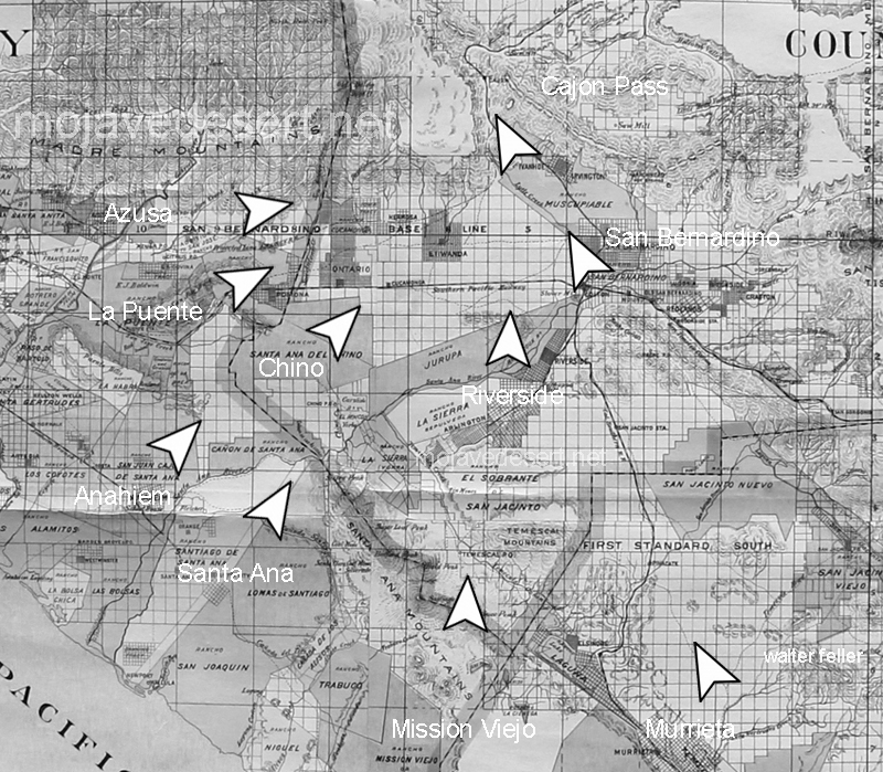
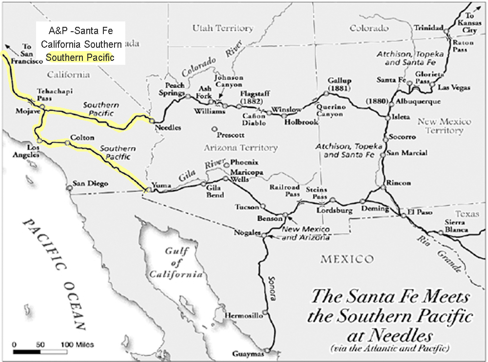
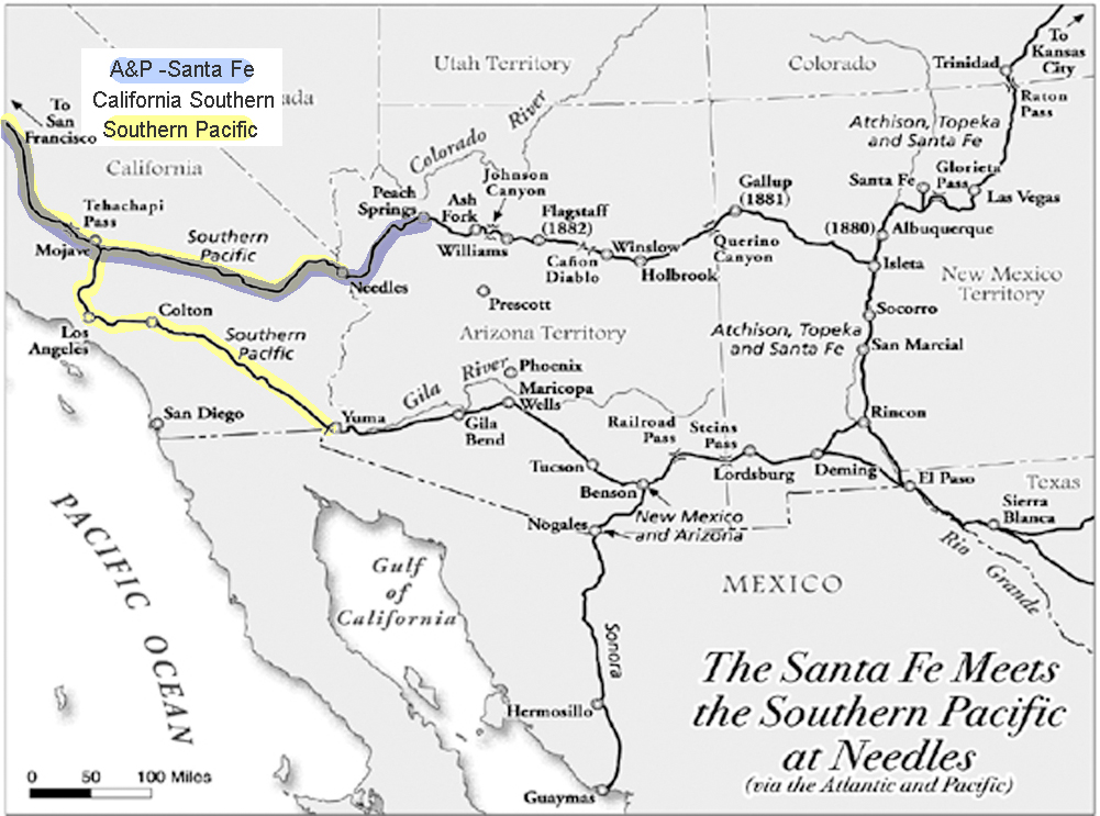
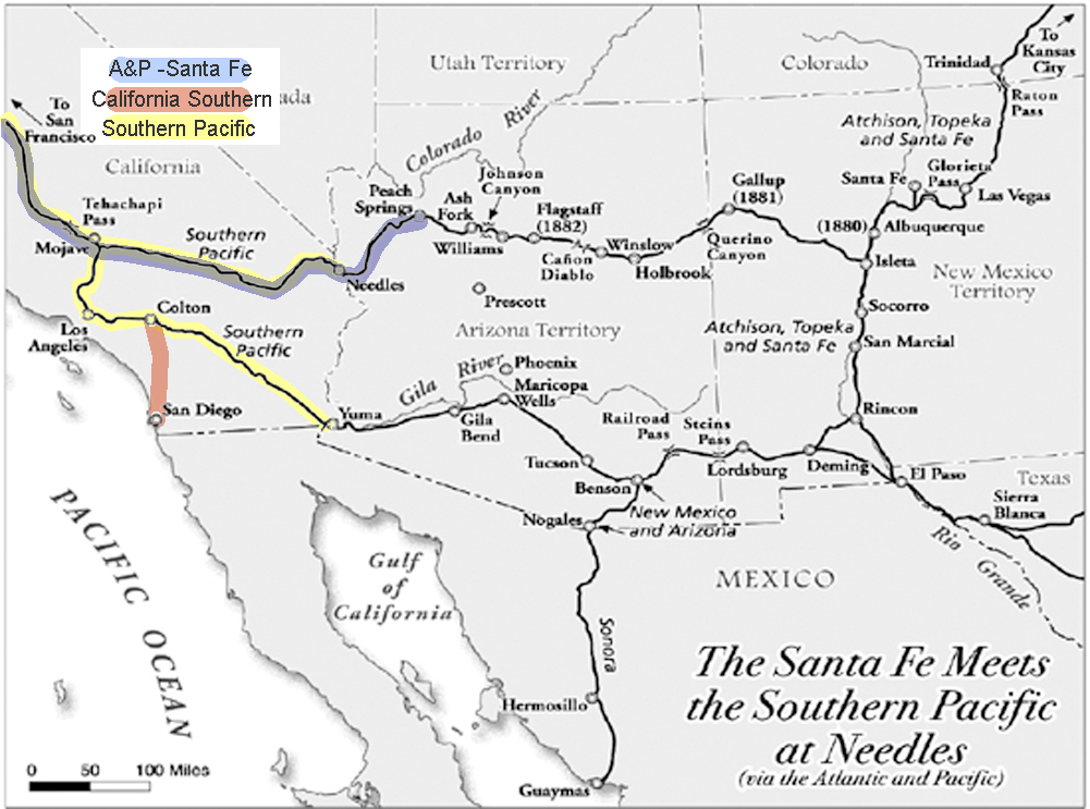
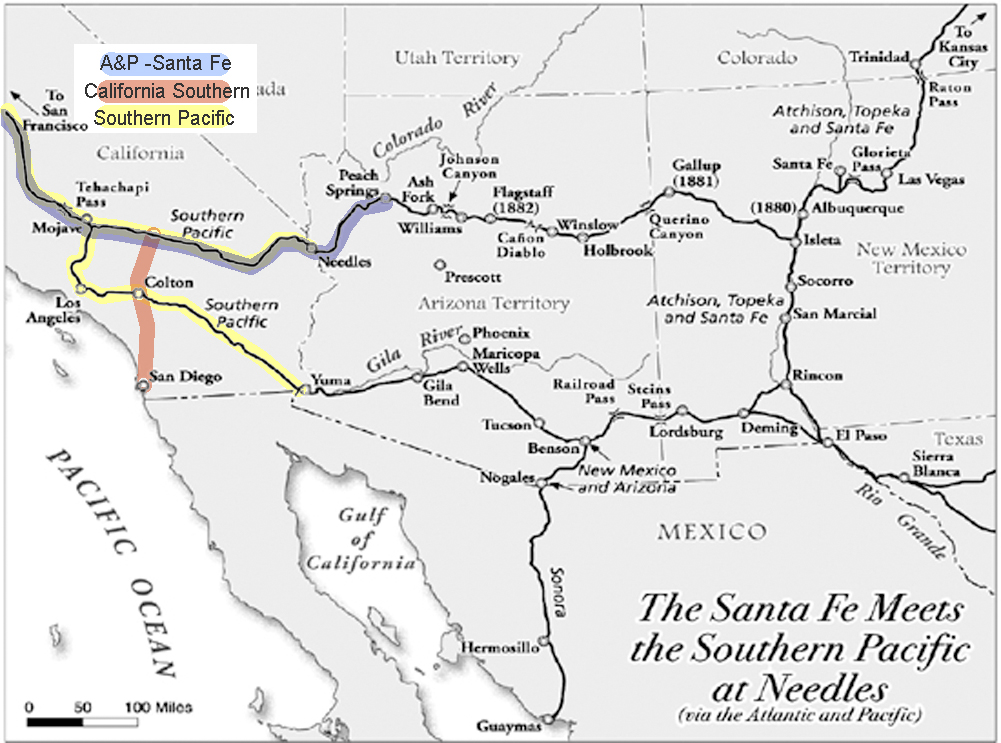
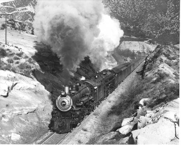
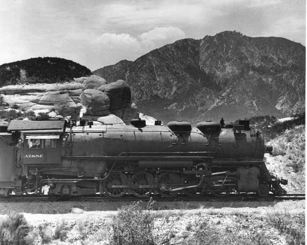
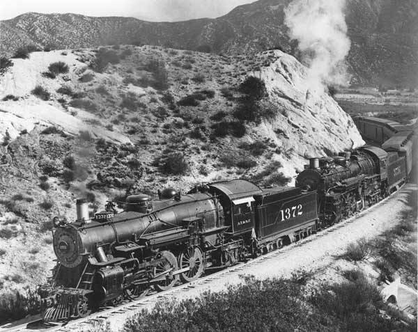
Initially, negotiations between the California Southern and the Southern Pacific over securing a route from Needles to the Pacific Coast proved difficult. The Southern Pacific, which held effective control over the only existing line across the Mojave Desert, was in no hurry to assist a potential rival. The Southern Pacific’s leadership, accustomed to monopolizing rail access into and across California, viewed any arrangement that would aid an eastern competitor with deep suspicion.
Faced with obstruction and unreasonable demands, the California Southern and the Atlantic and Pacific Railroads—both closely tied to eastern capital—announced a bold plan. If the Southern Pacific would not cooperate on reasonable terms, they declared they would jointly undertake the construction of an entirely new and independent railroad across the desert. This proposed line would have paralleled the Southern Pacific’s existing track but remained free of its influence, offering the first serious threat to the Southern Pacific’s dominance over desert transportation.
The announcement was not a mere bluff. Surveys were conducted, routes were studied, and eastern investors, eager to establish a competitive foothold in the California market, were prepared to finance the new line. The specter of competition alarmed the Southern Pacific. It recognized that the construction of a rival road could undermine its existing investments, dilute its control, and establish a permanent eastern presence in southern California on terms not of its choosing.
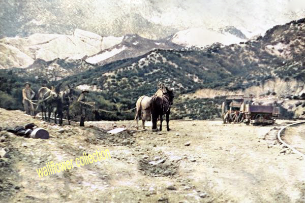
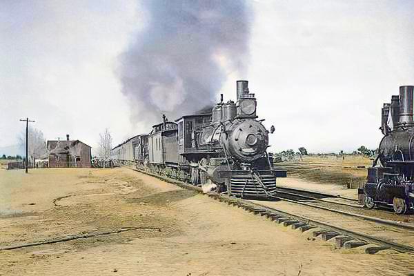
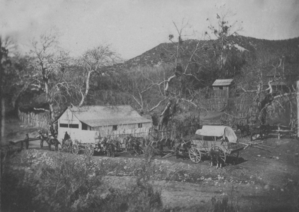
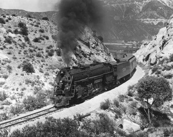
California Southern Railroad construction in Cajon Pass
To avoid a costly and unpredictable conflict, the Southern Pacific made a calculated decision. In October 1884, it agreed to sell the line between Needles and Mojave—a route built initially by its construction arm, the Pacific Improvement Company. By doing so, the Southern Pacific sidestepped a potential rival and still profited from its investment in the desert.
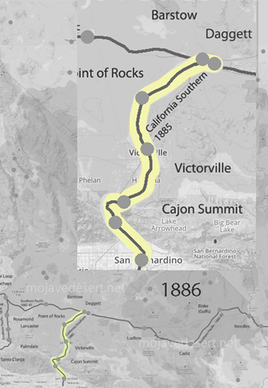
The transfer was a turning point. With control of the Needles-Mojave line secured, the California Southern could at last resume construction in earnest, repairing flood damage and completing its transcontinental link. By late 1885, trains could run from San Diego to Barstow, and by 1886, the California Southern itself had been acquired by the Atchison, Topeka, and Santa Fe Railway, effectively sealing the eastern invasion into California’s rail market.
California Southern and Atlantic and Pacific Railroad: Timeline with Notes (1880–1886)
October 12, 1880 – Charter Granted The California Southern Railroad Company is chartered to build a line from San Diego to San Bernardino, opening a new southern route to inland California.
May 23, 1881 – Extension Planned The California Southern Extension Company is chartered to extend the line northeast to connect with the Atlantic and Pacific Railroad, originally aiming for a point about 80 miles from San Bernardino.
August 1882 – Reaches Colton Track completed to Colton; the line begins to make inroads into Southern Pacific territory.
September 13, 1883 – Main Line Opened Full operation begins between San Diego and San Bernardino. California Southern faces strong opposition from the Southern Pacific almost immediately.
Winter 1883–1884 – Severe Flood Damage Torrential rains devastate Temecula Canyon. Thirty miles of track are destroyed, bridges are washed away, and ties are seen floating far out to sea. The company faces ruin unless major repairs are undertaken.
Early 1884 – Strategic Setback Southern Pacific, exercising influence over the Atlantic and Pacific Railroad, forces the eastern connection to be built at Needles on the Colorado River—far beyond the original plan—meaning California Southern must now cross 300 miles of mountain and desert.
Mid-1884 – Threat of Independent Construction In response, the California Southern and Atlantic and Pacific announce that if necessary, they will build a completely independent railroad across the desert to avoid using Southern Pacific lines. Surveys are ordered, and eastern backers prepare financing.
October 1884 – Southern Pacific Relents Rather than risk parallel competition, the Southern Pacific agrees to sell the Needles-to-Mojave line to the California Southern Railroad. The Pacific Improvement Company, an entity under the control of Southern Pacific, had built the track.
November 1885 – Line Repaired and Completed After extensive repairs and new construction, the California Southern opens through service from San Diego to Barstow, near the junction of the Atlantic and Pacific at Needles.
October 1886 – Control Transferred to Santa Fe The California Southern is formally absorbed into the Atchison, Topeka, and Santa Fe Railway system, becoming part of a major transcontinental route and ending Southern Pacific’s near-monopoly over southern California rail traffic.
The struggles and ultimate success of the California Southern Railroad marked a turning point in the history of Southern California. By securing a route independent of the Southern Pacific’s control, the California Southern, under the wing of the Atchison, Topeka, and Santa Fe, opened the region to competition, lower freight rates, and new waves of settlement and development.
No longer isolated or captive to a single powerful railroad, San Diego and the inland valleys could now connect directly to the markets of the East. The great deserts and mountains that had once seemed impassable barriers became corridors of commerce and migration. In many ways, the hard-fought efforts of the California Southern and its allies helped lay the groundwork for the explosive growth of Southern California that would follow in the decades to come. It was a victory not only of rails and capital, but of determination against monopoly and geographic hardship.
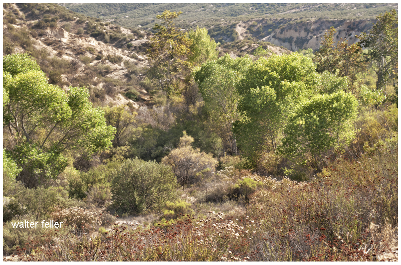
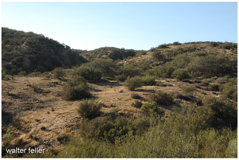
From across the Mojave and along the Mojave River, springs and other water sources shaped the trail down Cajon Canyon and into the southern California valleys. Trails from all directions met in this canyon and that in itself would possibly indicate that in the overall scheme of things some variety of trade may have taken place here where the trails cross.
Amuscupiabit – Cajon Canyon
During the winter months when snow is capping the mountains and the weather is cold the Cajon valley would have generally been warmer. With a good year, there would have been plenty to harvest and forage as well as game to hunt. Drought years may have brought little with it and the camp would have been a starvation camp with little to eat.
Rancherias
A rancheria, as the Mexicans called it, would have been a small settlement of Indians living in temporary huts while maintaining seasonal subsistence activities and trade.
It was among these rancherias … that the missions found the most fertile fields for producing laborers. Whether by trickery or physical force the villagers into the Catholic fold. Being taken to the mission was most likely the fate of the residents of the Serrano rancheria Amuscupiabit in the heart of the Cajon Pass.
The Old Spanish Trail had become increasingly used as a pack mule trail between New Mexico and California, and with this traffic came the opportunity for those to take advantage of the distant location and desperate nature of the land.
Hundreds and sometimes even thousands of stolen horses from the ranchos would burst through Coyote Canyon beginning their ‘journey of death’ across the Mojave.
California horses were beautiful creatures, and the mules were taller and stronger than those in New Mexico and they were easy to steal. The rolling hills and plains presented clear paths to the Cajon where numerous hidden canyons and washes were available to slip into and prepare for the furious run across the desert. Horses would be stolen in herds from many different ranchos at once. Hundreds of horses, even thousands could be commandeered and driven by just a few experienced thieves.
Chief Walkara, ‘Hawk of the Mountains ‘ and the greatest horse thief in all of history along with his band of renegade Chaguanosos, and notables such as Jim Beckwourth andPegleg Smithwould work together in this illegal trade. During one raid they were said to have coordinated the theft of 3,000-5,000 horses, driving them to Fort Bridger to trade for more horses to run to New Mexico to trade again. Horses would fall from exhaustion every mile and the local bands of Paiute would feast on the remains.
Coyote Canyon
. . . A few years later Mr. White established a camp in San Bernardino county at the mouth of Lytle creek and again started in the cattle business. Here he was joined by two other white men, who after agreeing to a plan to take up all of the valley lands deserted him before the consummation of the scheme. The Indians learning that he was alone decided that it would be a good time to make a raid and drive away the herds, and under the leadership of Chief Coyote, who was one of the craftiest and most vicious in that section, they accomplished their purpose. The next morning in company with an Indian boy of seventeen years, who was friendly to him, Mr. White started out to find the stock and overtook the thieves at the head of Cajon Pass. Here the Indians had camped and killed a horse, upon which they were feasting when Mr. White discovered them. Cleverly circling the camp he managed to get ahead of them and was endeavoring to stampede the stock when Chief Coyote saw him and started toward him. Waiting until the Indian was within forty or fifty yards of him Mr. White took steady aim and shot him dead, the report of the gun stampeding the cattle. They returned home, Mr. White and the Indian boy following and reaching the valley in safety after having killed a number of other redskins. The boy had been of great assistance to him by loading his extra gun.
When the governor heard of this affair he sent for Mr. White and ascertaining that he had no land but desired to receive a grant, application was made and surveys taken, and in a few years he received papers conveying to him thirty-two thousand acres of land.
A HISTORY of CALIFORNIA Extended History of Its Southern Coast Counties – Vol II — J. M. GUINN 1907
The rich ranchos of southern California.
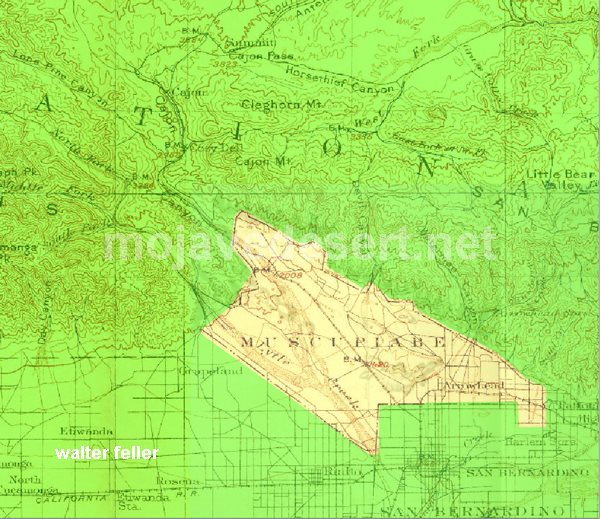
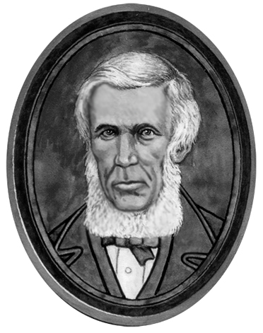
In 1843 Michael White was granted one league of land at the mouth of the Cajon Pass called Rancho Muscupiabe. At a point overlooking the trails leading into and away from the canyon he was expected to thwart the raiders and horse thieves that were plaguing the Southern California ranchos. In theory, it was a good plan but in practice, it did not work so well.
From the piedmont between Devil and Cable canyons, Miguel Blanco could keep an eye out for the horse thieves entering the Cajon.
He built his home of logs and earth and constructed corrals for his stock. However, the location between Cable and Devil Canyon only served as a closer and more convenient target for the Indian thieves. His family was with him, but after six weeks until it became too dangerous. He left after nine months without any livestock and in debt.
The Old Spanish Trail went down this slope to behind Miguel Blanco’s rough-hewn homestead. Indians would watch from this forest for Miguel to leave and they would slip down and steal everything that could be stolen.
Miguel sold his property, however, Miguel had misread the grant, letting the rancho go for much less than it was worth. The land described on the grant was roughly 5 times larger than Miguel thought. Blanco brought a suit but lost.
Muscupiabe Rancho
As the late 1840s and 1850s rolled by wagon roads were being developed in the canyon minimizing the effectiveness of the maze of box canyons being used to cover the escape of desperadoes on horseback. With California becoming a state frontiersmen such as Beckwourth and Peg Leg Smith would not steal from fellow Americans. Horse-thieving under U.S. law had become a crime where before it was just stealing horses from Mexicans. That was only serious if caught in the act. Americans would never extradite them. For the most part, that was the end of the horse-stealing raids.
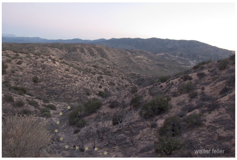
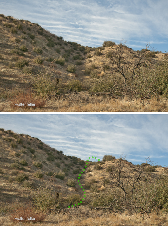
There are numerous names of features within the story of the Cajon Canyon complex; Mormon Rocks, Lost Lake, Lone Pine Canyon, and more. There is one canyon, however, the most popular variation of the Old Spanish Trail as it entered southern California was known as Coyote Canyon.
Mission San Gabriel
In the early 1840s, Englishman Michael White and William Workman were partners in a store in New Mexico. White sold his part of the business and came west to live on one hundred acres his wife purchased from the Catholic Church. On this property near Mission San Gabriel, Michael White established a home. Indian raids were discouraging, but Mr. White worked on and ultimately succeeded in raising cattle. His herd grew and he looked for range land. Mr. White and two other men made an agreement to help each other raise cattle in the valley northwest of San Bernardino.
The Story of Coyote Canyon
It was near the mouth of the Cajon Canyon where he built his camp. However, the ‘partners’ failed to show up leaving Miguel to his own defense if there were an attack.
Miguel Blanco
One morning Mr. White woke up to find his cattle missing–the culprits most likely were ‘Chaguanosos.’ The Chaguanosos were a band of Indians exiled and cast away from all, the worst of the worst, cast from their own tribes, notorious and deadly in their own right. These men would steal anything and everything and kill anyone that attempted to stop them. These renegades committed many of the raids on the animals of the ranchos. There was Chief Coyote who was known in the area to be cunning, and violent and leading a band of these heartless men.
During the dark of night, the Chief and his thieves drove away over 400 head of Mr. White’s herd. Michael White was alone save for a seventeen-year-old Indian boy. Together, they rode off to attempt to halt the theft. They needed to keep the band of thieves from leaving the Cajon Canyon and entering the Mojave Desert–they had to head them off at the pass.
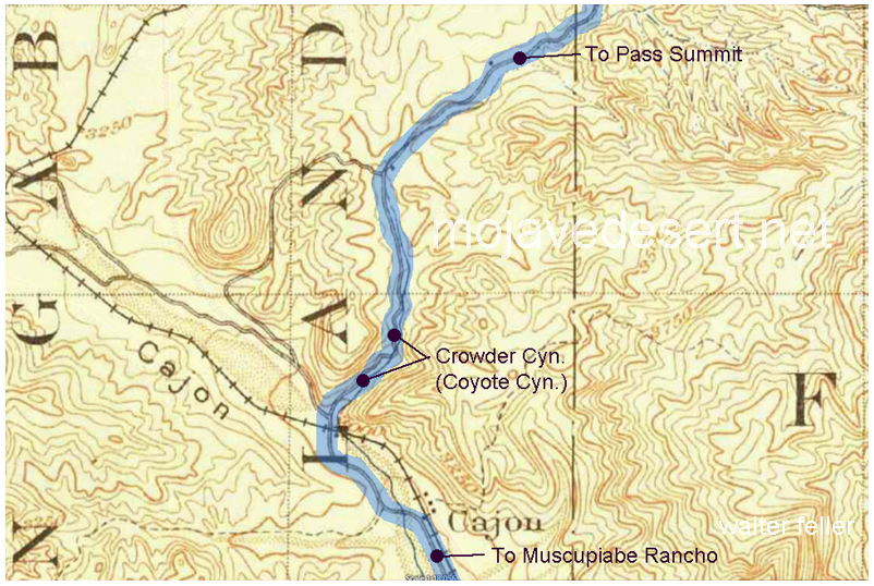
Crowder (Coyote) Canyon – Initially named ‘Coyote’ canyon, for the horse thief, Chief Coyote who was killed within the narrow canyon walls by protector of the Cajon Pass, Miguel Blanco,
Mr. White and the Indian boy rode up the canyon, circled around, and came in between the outlaws and the top of the pass. The thieves were unaware as they were greedily feasting on a horse they had killed.
Mr. White thought to stampede the herd back down through the narrows trapping the Chaguanosos from escape.
Michael drew the attention of Chief Coyote. The renegade charged him. Michael aimed and fired. The shot knocked the Chief off of his horse. He fell into the brush. Dead. The gunshot startled the cattle and they stampeded over the camp and back down the canyon surprising those in the camp. There was a gunfight. White would fire his gun and one by one the Chaguanosos fell dead in the canyon. The boy reloaded the extra gun and kept Michael White fighting. Several of the renegades escaped in the dust and confusion.
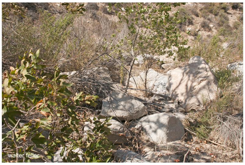
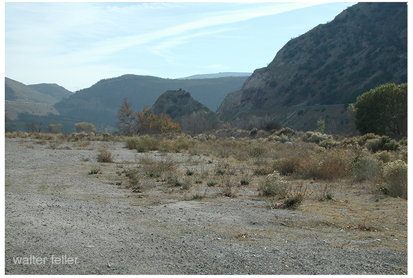
A possible site of Campo de la Puente (Camp on the bridge)
The stolen animals were rounded up and returned to the glen at the mouth of the Cajon canyon.
Calling the canyon ‘Coyote Canyon’ wasn’t in honor of a great chief. It was simply a ravine where a bad guy was killed. That is how the canyon became known as Coyote Canyon.
However, the story doesn’t end there- The Governor of California heard of this heroic episode and found that Mr. White had no land but desired to. So, Michael White became naturalized as Miguel Blanco, a citizen of Mexico, and received a grant for 32,000 acres (50 square miles) of land northwest of the Lugo Rancho San Bernardino. With this land situated on a high point of the bajada that runs the southwestern base of the San Bernardino mountains, he was to guard and defend the southern California ranchos from further raids from horsethieves.
Of course, the story doesn’t really end there, either- This is the beginning of the story of Miguel Blanco and the Rancho Muscupiabe.
The Southern Pacific had a monopoly on Southern California’s Transcontinental Railroads. Nothing came in or went out on any other rails than Southern Pacific rails.
However, the Southern Pacific at Needles needed to connect with the bridge at the Colorado River to the Atlantic and Pacific. In order to do this, they worked out an agreement wherein the Atlantic & Pacific could use their rails to ship to and from San Francisco. Southern California still remained in a monopoly.
San Diego wanted a share in the rapid growth of the state. With the high cost of getting there, most tourists simply stopped in Los Angeles.
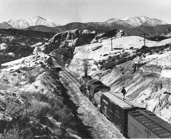
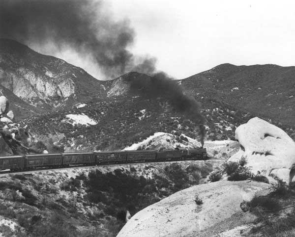
The California Southern, backed by investors from Boston, built from San Diego to Colton, but the Southern Pacific delayed their progress further north for over a year in what became known as the ‘Frog War.’ ‘Frog’ is the term for a rail crossing rail assembly so that either track can cross the other.
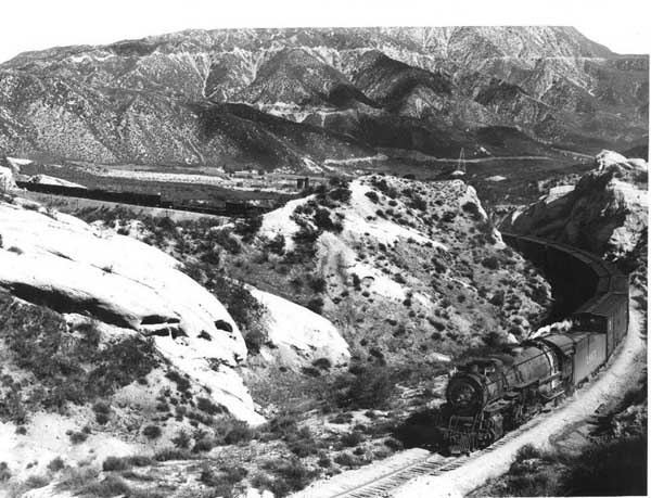
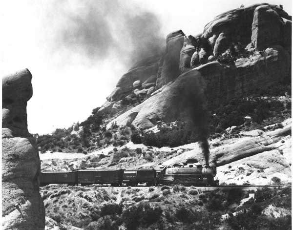
Formidable, but not impossible, building through the Cajon Pass to the Mojave River, through the upper and lower narrows, and then along in the same direction to Waterman, now known as Barstow. San Diego now had the benefit of a link to a transcontinental railroad and Southern California had a competitive transportation network.
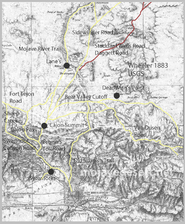
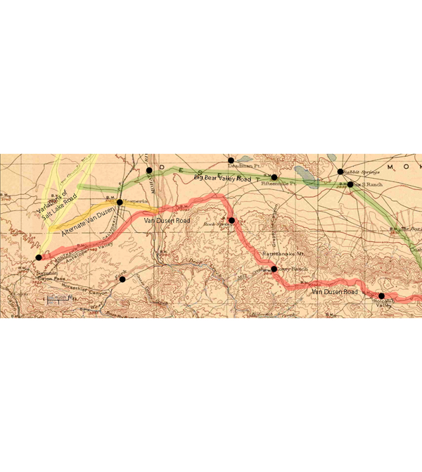
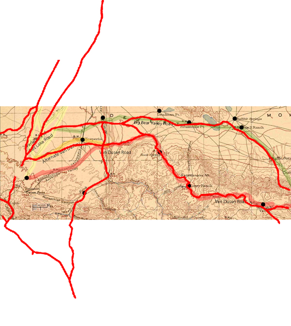
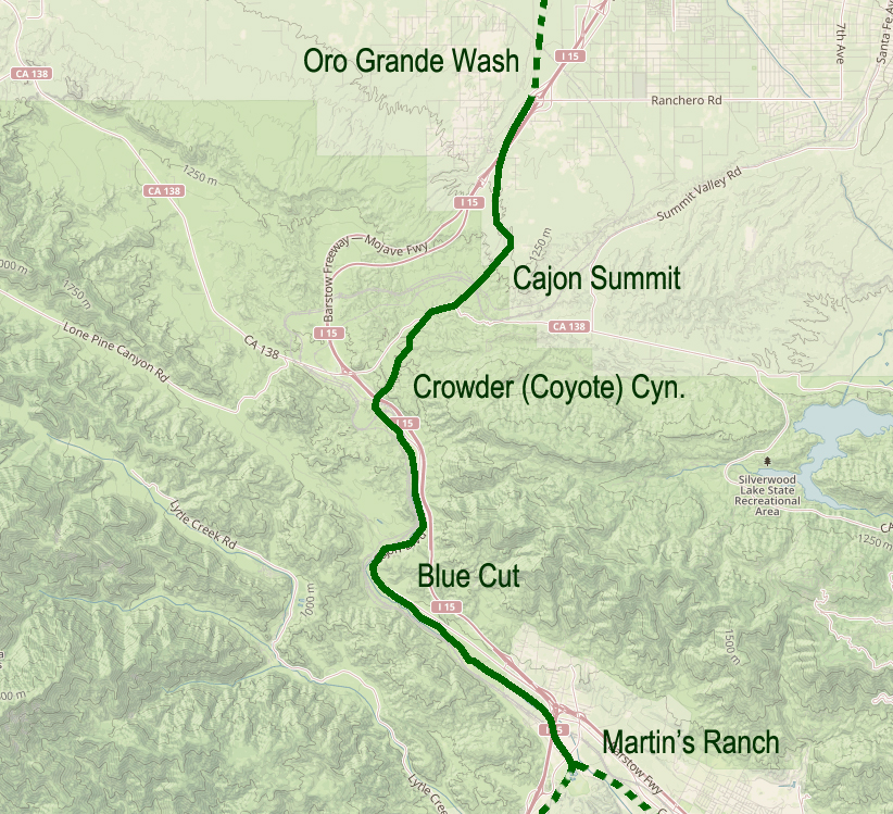
Not all-inclusive, this 1901 map shows basic transportation routes between the Cajon Summit on the west and east from there through either the San Bernardino Mountains or Lucerne Valley to where the two roads meet in the Big Bear Valley.
This map below was made in 1883 and shows an earlier and geographically expanded version of the routes.
1883 map of route network in the upper Mojave River region (note; no railroad)
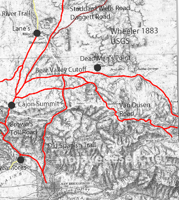
The 1883 map is more inclusive and contains a couple of items I want to keep track of. There are differences but the road segments look about the same.
I made a copy of the 1883 roads layer and made it red to stand out better.
There are some nuances between the two maps, and right now the Oro Grande Wash area seems considerably off, fiddling with it some I can get a better fit–but not at these rates. The 1901 would be the more accurate depiction of what went on out there even if it were 35 years or so after the fact.
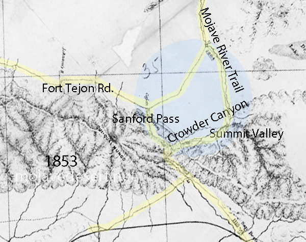
Williams USGS survey map 1853
Note that in the above map the variations of trails from across the valley leading to the Cajon Summit seem not to have been developed at this time and instead the trail along the Mojave River is shown.
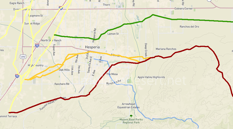
1901 trail routes transposed over modern street map through Hesperia
Originally, possibly a footpath for trade and society. There is no written record of that. After explorers, and then trade caravans wore in mule trails and braided paths as travelers do, to find the path of least resistance. Following the Mojave River, and to get to the hills and valleys of southern California this route was the most direct way, and indeed it was the only way for miles and miles in either direction where wagons could pass through the mountains.
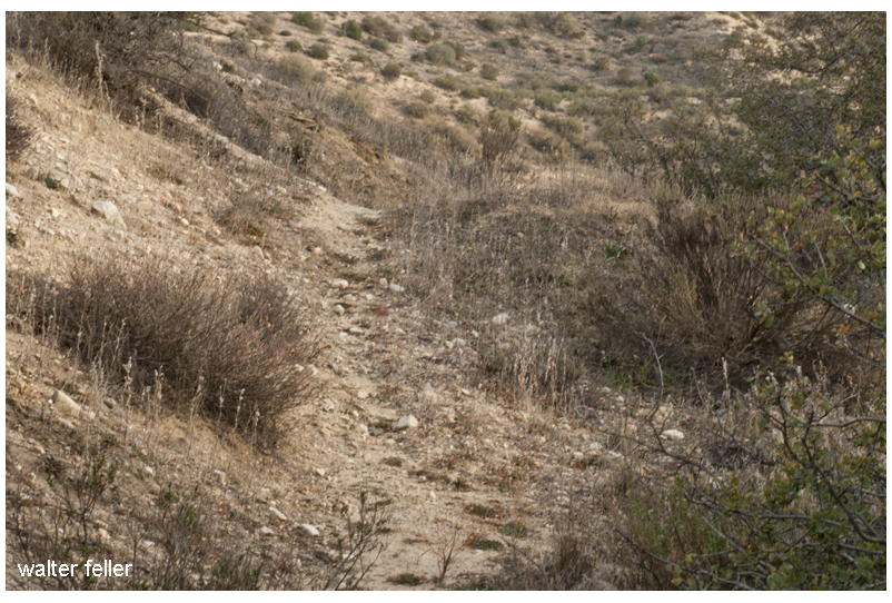
Road over the divide at the summit.
All the frayed trails come together at essentially one point. Within a few yards either way, most all travelers would pass through this trail bottleneck. If there were remnants or traces of old wagon roads where pioneers and freighters passed through and they could still be seen, it would be here where this faint suggestion of an old trail can be observed.
Another cut into the hillside.Cut in road near the summitAt the southern end of the toll road was Martin’s Ranch. The northern end was just beyond the Cajon Summit.Footpaths are as wide as a man’s gait. Mule trails are wider with their broad stance and cargo.
I have heard that Captain Jefferson Hunt brought the first wagon through the pass. Since he succeeded at that, Captain Hunt became instrumental in bringing the early pioneer wagon trains across the Mojave Desert.
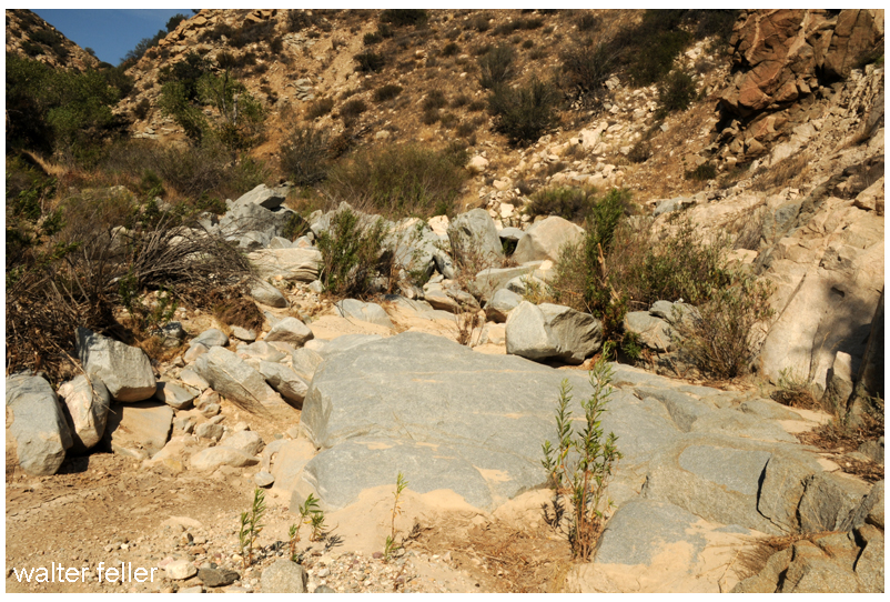
The bottom of the canyon, about the last half mile, was strewn with boulders and impassible by any wheeled vehicle.
Steep at the top and rocky at the bottom, the solution was to disassemble wagons at the bottom and use mules to pack everything through the rocks on the mule trail, then put it all back together.
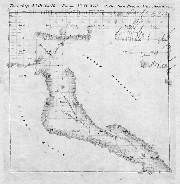
This map, dated 1859, shows the beginnings of the Cajon road network.There were two ways of coming down or going up the stretch of canyon at the summit; either the low spots between the hills or the one of the long ridges, which ever provided a less steep grade to work with.The best thing about coming up or going down the 2500 ft between the summit and foot of the pass is that it isn’t done all at once. I suppose it is like one would eat an elephant; one bite at a time.
Floods were common and so was the erosion which would cause damage to the already rugged trails. One time this way would be good, the next time another.
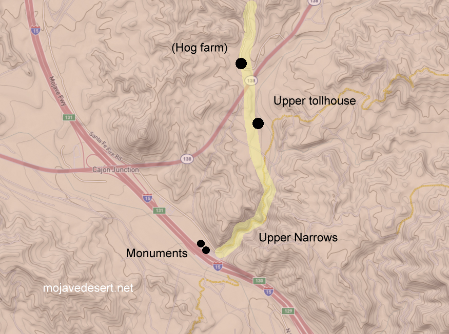
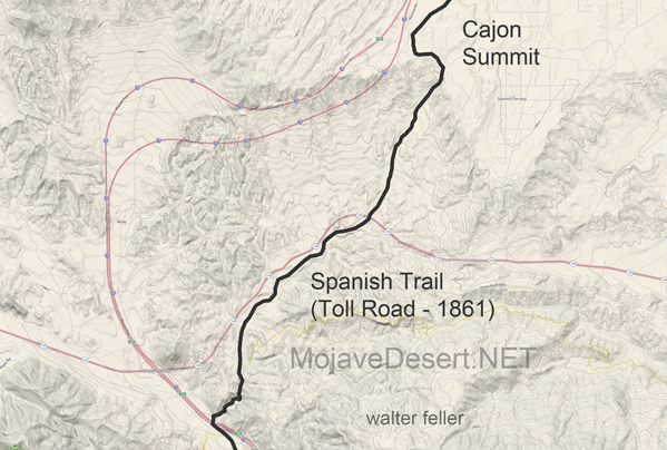
An earthquake in 1899 caused serious damage to the roadway. A bypass was graded in order to avoid the narrows entirely.A generalized map of the upper narrows and toll road through Coyote Canyon in the Cajon Pass.
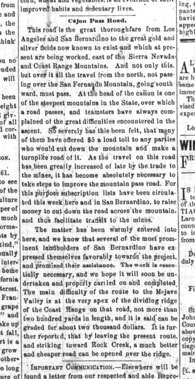
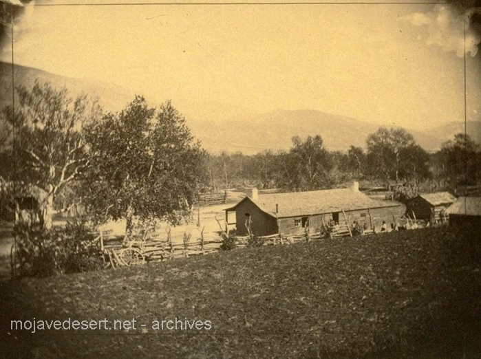
This road is the great thoroughfare from Los Angeles and San Bernardino to the great gold and silver fields now known to exist and which at present are being worked, east of the Sierra Nevada and Coast Range Mountains. And not only this but over it, all the travel from the north, not passing over the San Fernando Mountain, going southward, must pass. At the head of the cañon is one of the steepest mountains in the State, over which a road passes, and teamsters have always complained of the great difficulties encountered in the ascent. So severely has this been felt, that many of them have offered $5 a load toll to any parties who would cut down the mountain and make a turnpike road of it. As the travel on this road has been greatly increased of late by the trade to the mines, it has become absolutely necessary to take steps to improve the mountain pass road. For this purpose subscription lists have been circulated this week here and in San Bernardino, to raise money to cut down the road across the mountain, and thus facilitate transit to the mines. – Los Angeles Star – April 6, 1861
Martin’s Ranch — The southern and of the toll road.Brown significantly improved the old pack trail through the upper narrows.Upper toll gate
The road which I followed in 1865 crosses from left to right bank of the river a few miles above the Grapevine place said, continues past Cottonwood to Point of Rocks, 22 miles from Grapevine, on a southwest course; at Point of Rocks it turns due south to what was called Lane’s, or the Upper crossing, and there leaves the river entirely to strike straight south by west for Cajon pass in the mountains, reached in 19 miles from Lane’s. This is the way I went, as my itinerary shows: ” Nov. 9. To Martin’s ranch, 29 miles S. from Lane’s crossing; more than half the distance in open country, and then we entered the Cajon pass in the mountains, where there is a tollgate. The pass is a narrow, deep, and tortuous canon, the roughest I have ever traversed on wheels; there was 10 miles of this from the tollgate to Martin’s ranch.” Now Garces has been sent through Cajon pass, with a query, as by Bancroft, Hist. Cala., i, p. 275; but I do not think he went that way. Taking his courses on their face, he continued up the Mojave.
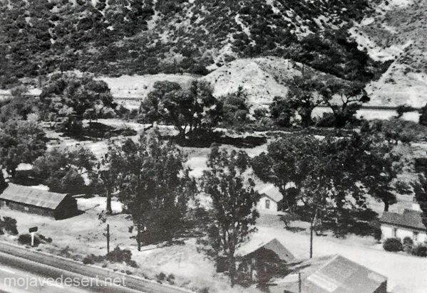
In 1882 John Brown wanted out of the toll road business–the day of the sale the Bear Flat Ranch became Cozy Dell.Bear Flat Ranch – Cozy Dell – Lower toll gate
Just east of the Cajon Summit is where the historic traffic corridor in and out of the Mojave Desert narrows and the various alignments come within hollering distance of each other as they cross over the divide between the high desert and Cajon Canyon.
Traces and fragments of footpaths, trails, wagon roads and early highways can be found next to our modern freeway and here they become interwoven, laced and worn or grown over. None of all of this, by any means, obscures the vision of countless travelers of past ages passing this point.
In 1873 Scottish inventor John Loudon McAdam created an inexpensive type of paving that used rocks and gravel, was put down while it was soft and cured as it was driven on.
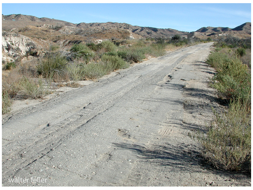
Stretch of macadam pavement on old road to and from the summit
John Loudon McAdam and Macadam
Merriam-Webster: In 1783, inventor John Loudon McAdam returned to his native Scotland after amassing a fortune in New York City. He became the road trustee for his district and quickly set his inventiveness to remedying the terrible condition of local roads. After numerous experiments, he created a new road surfacing material made of bits of stone that became compressed into a solid mass as traffic passed over them. His invention revolutionized road construction and transportation, and engineers and the public alike honored him by using his name (respelled macadam) as a generic term for the material or pavement made from it. He is further immortalized in the verb macadamize, which names the process of installing macadam on a road.
The Old Spanish Trail had become increasingly used as a pack mule trail between New Mexico and California, and with this traffic came the opportunity for those to take advantage of the distance and desperate nature of the land.
Hundreds and sometimes even thousands of stolen horses from the ranchos would burst through Coyote Canyon beginning their ‘journey of death’ across the Mojave.
California horses were beautiful creatures, and the mules were taller and stronger than those in New Mexico and they were easy to steal. The rolling hills and plains presented clear paths to the Cajon where numerous hidden canyons and washes were available to slip into and prepare for the furious run across the desert. Horses would be stolen in herds from many different ranchos at once. Hundreds of horses, even thousands could be commandeered and driven by just a few experienced thieves.
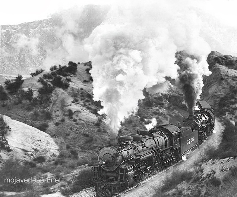
Narrows, Crowder Cyn., Cajon Pass
Chief Walkara, ‘Hawk of the Mountains’ and the greatest horse thief in all of history along with his band of renegade Chaguanosos , and notables such as Jim Beckwourth and Pegleg Smith would work together in this illegal trade. During one raid they were said to have coordinated the theft of 3,000-5,000 horses, driving them to Fort Bridger to trade for more horses to run to New Mexico to trade again. Horses would fall from exhaustion every mile and the local bands of Paiute would feast on the remains.
The rich ranchos of southern California.
In 1843 Michael White was granted one league of land at the mouth of the Cajon Pass called Rancho Muscupiabe. At a point overlooking the trails leading into and away from the canyon he was expected to thwart the raiders and horse thieves that were plaguing the Southern California ranchos. In theory it was a good plan but in practice it did not work so well.
From the piedmont between Devil and Cable canyons, Miguel Blanco could keep an eye out for the horse thieves entering the Cajon.
He built his home of logs and earth and constructed corrals for his stock. However, the location between Cable and Devil Canyon only served as a closer and more convenient target for the Indian thieves. His family was with him, but after six weeks until it became too dangerous. He left after nine months without any livestock and in debt.
The Old Spanish Trail went down this slope to behind Miguel Blanco’s rough-hewn homestead. Indians would watch from this forest for Miguel to leave and they would slip down and steal everything that could be stolen.
Miguel sold his property, however, Miguel had misread the grant, letting the rancho go for much less than it was worth. The land described on the grant was roughly 5 times larger than Miguel thought. Blanco brought a suit but lost.
Muscupiabe Rancho
As the late 1840s and 1850s rolled by wagon roads were being developed in the canyon minimizing the effectiveness of the maze of box canyons being used to cover the escape of desperadoes on horseback. With California becoming a state frontiersmen such as Beckwourth and Peg Leg Smith would not steal from fellow Americans. Horse-thieving under U.S. law had become a crime where before it was just stealing horses from Mexicans. That was only serious if caught in the act. Americans would never extradite them. For the most part, that was the end of the horse stealing raids.