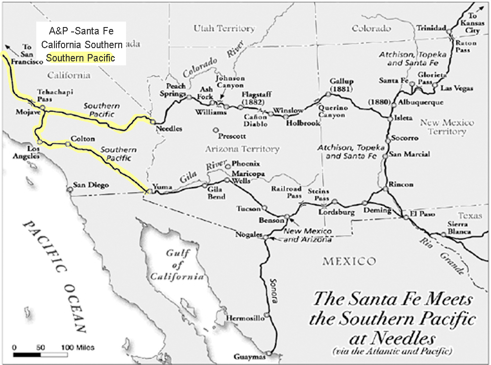
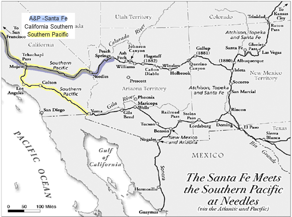
The Southern Pacific had a monopoly on Southern California’s Transcontinental Railroads. Nothing came in or went out on any other rails than Southern Pacific rails.
However, the Southern Pacific at Needles needed to connect with the bridge at the Colorado River to the Atlantic and Pacific. In order to do this, they worked out an agreement wherein the Atlantic & Pacific could use their rails to ship to and from San Francisco. Southern California still remained in a monopoly.
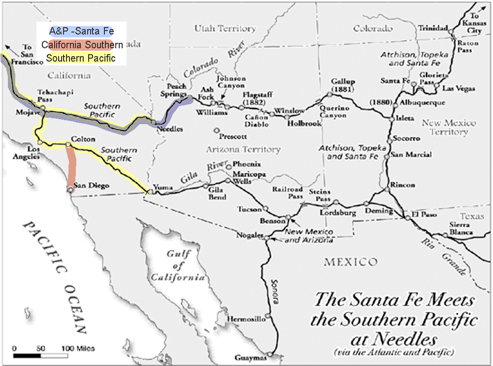
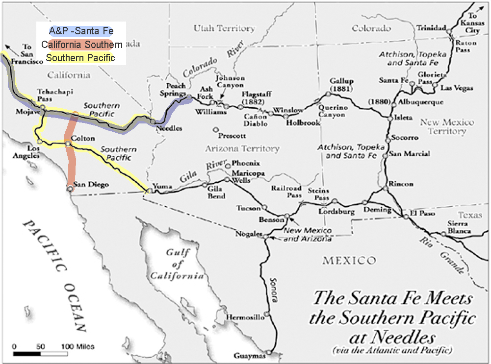
San Diego wanted a share in the rapid growth of the state. With the high cost of getting there, most tourists simply stopped in Los Angeles.
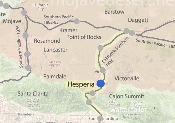
The California Southern, backed by investors from Boston, built from San Diego to Colton, but the Southern Pacific delayed their progress further north for over a year in what became known as the ‘Frog War.’ ‘Frog’ is the term for a rail crossing rail assembly so that either track can cross the other.
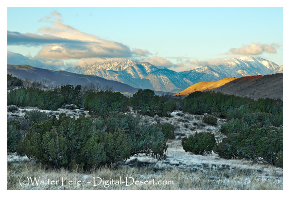
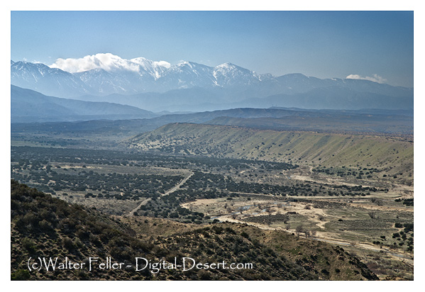
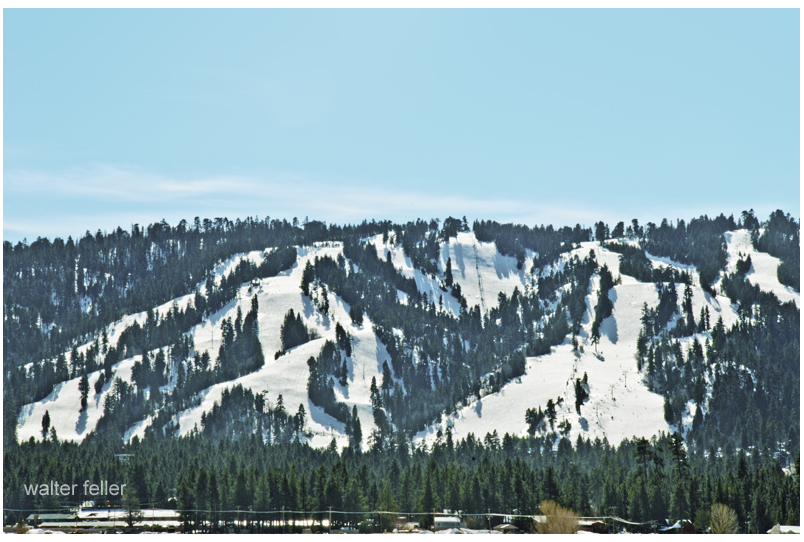
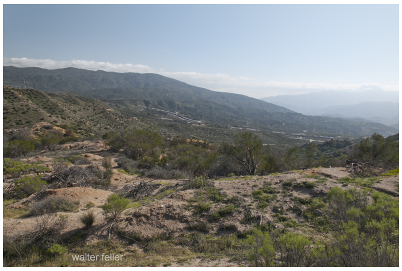
Formidable, but not impossible, building through the Cajon Pass to the Mojave River, through the upper and lower narrows, and then along in the same direction to Waterman, now known as Barstow. San Diego now had the benefit of a link to a transcontinental railroad and Southern California had a competitive transportation network.
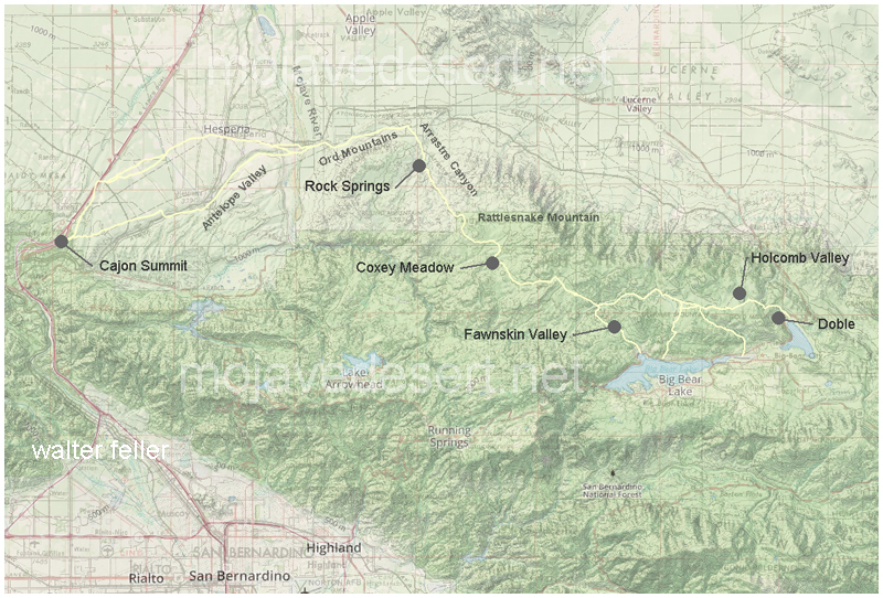
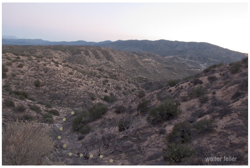
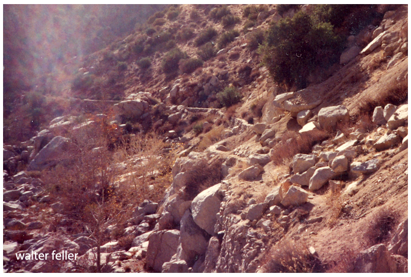
Van Dusen Road/ Coxey Truck Trail from Cajon Summit to Holcomb Valley
He (Hoffman) saw nothing between Summit Valley in the river he considered a likely site. In fact, Hoffman condemned the entire route as unsuited for travel.
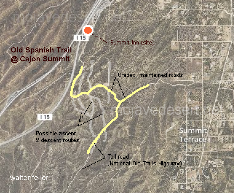
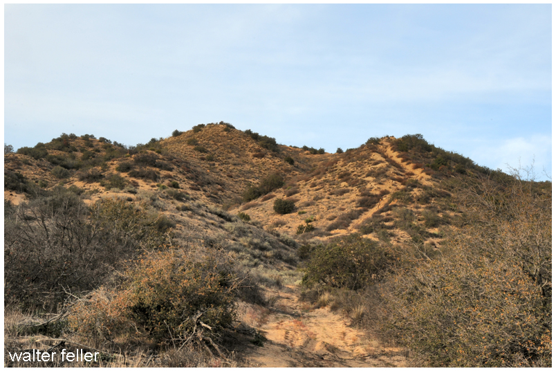
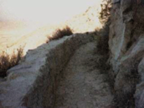
Traces of old trails and graded roads near the Cajon summit.
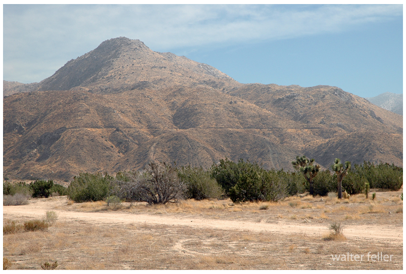
The direct route over the summit and down the pass eliminates the steep climb and descent over the San Bernardino Mountains.
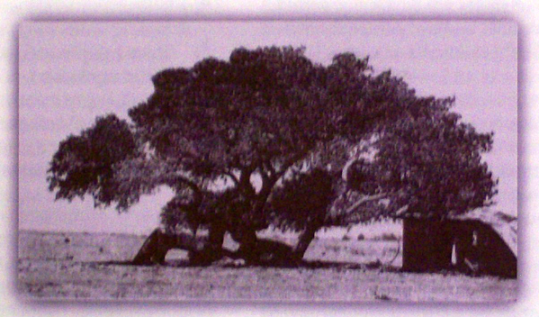
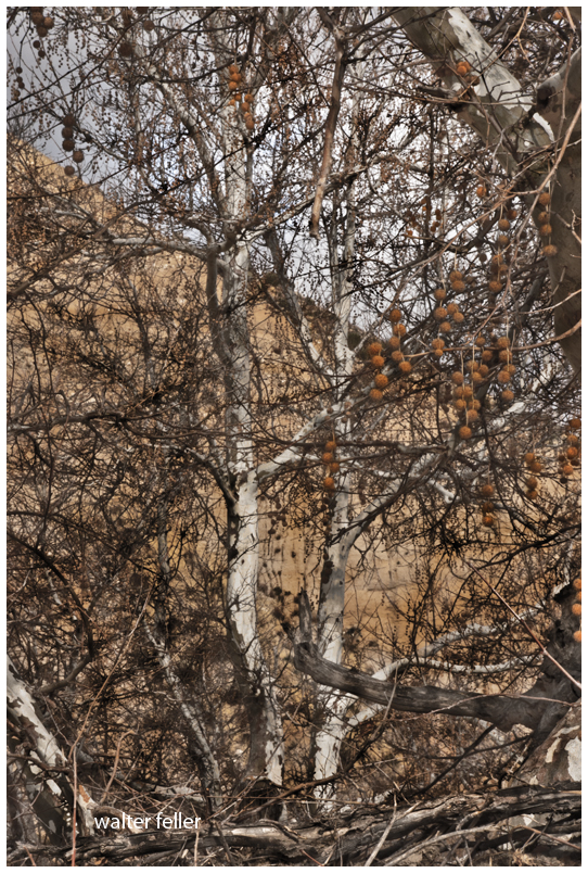
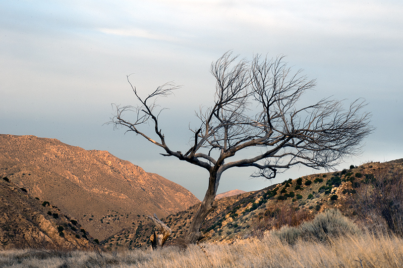
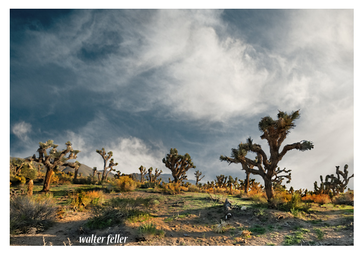
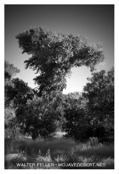
Cottonwood tree at the massacre site in Summit Valley
Chard Walker watching trains pass from the terrace beside the Decanso in 1954. From his book, “Railroading in the Pass”
Some rocks (not this one) will speak. I remember the first time a rock ever spoke to me. I was out near the Colorado River in a wash littered with evenly shaped cobbles. They were slightly different subtle colors, red, blue, gray, pink, and so on, and so forth. They were so very pretty lying in the wash with blue sky, billowing clouds, and all of that was attractively scattered here, there, and everywhere.
One rock stood out to me. I picked it up and took a good look. It was a little bigger than the palm of my hand in a comfortably rounded shape. There were no blemishes or markings or really anything that would note this stone as different from any other stone in the wash. However, it felt different. It felt like it knew me and was waiting for the day that I would come and pick it up. Today.
Then it spoke to me. I stood there dumbfounded, mouth agape for quite a long time. The rock had said, “I want to go to your house.”
“Then what?” I thought.
It heard my thoughts. It must be, like, telepathic.
“You need me,” the rock said. It continued; “I am the exact size you need to cover that big red plastic tumbler that you use to soak pieces of mesquite in water to give your BBQ smokey flavor. I am the correct weight to keep the wood submerged so that it may get wet.”
So I brought it home and it was right. It has been perfect for the job. I use it every BBQ. Now, when the rock speaks to me you know what it says? It says nothing. Not a word. Not a sound. Just like it is just a rock.
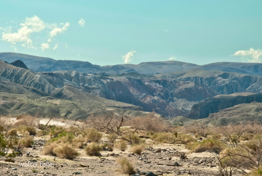
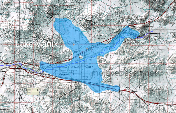
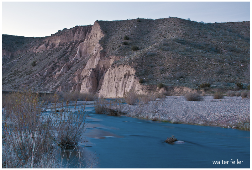
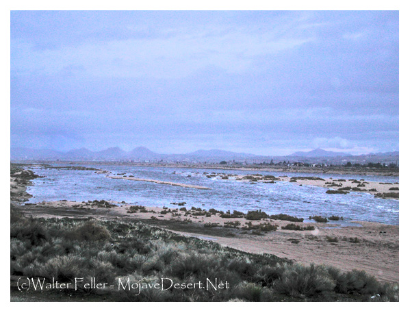
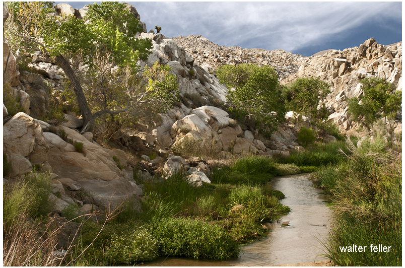
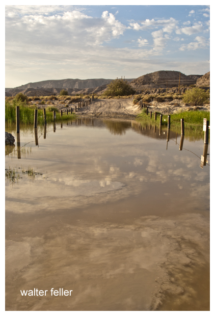
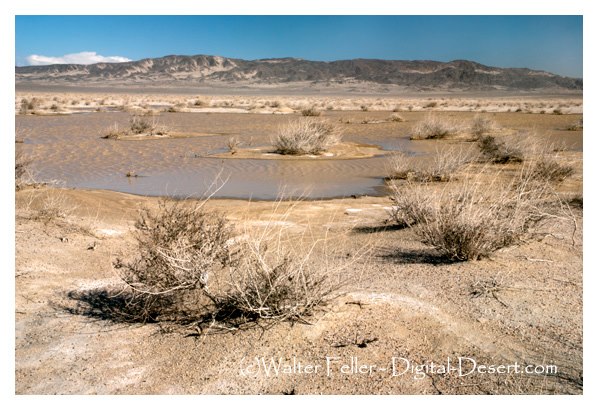
At the mouth of Afton Canyon, it may be easier to visualize a great lake, Lake Manix, breaching its shores and its waters carving this terrible and yet beautiful gorge through the layers of the millions and millions of years of earth that have gone before. At least at one time, it was believed this all occurred rapidly, over the course of a few weeks, raging in colossal destruction. Now, I believe, the evidence shows it was not just one seismic event that provoked this tearing of the landscape, that it took place over thousands of years driven on by multiple events and changes in climate.
They were brothers, airborne, spiraling to earth together. Brothers as brothers can be, they remained brothers until they fell on the divide together; one splashed toward the ocean, and the larger of the two trickled toward the desert. That large raindrop would do fine; however, the small one would have to find its own invent an ocean. Until then, the little raindrop did what most other raindrops do, and that is to fall.
At this point, many raindrops would soak into the earth joining the stormwater underground. These rainshadow renegades would travel to the aquifers deep into the earth below to ancient, private, and murky waters.
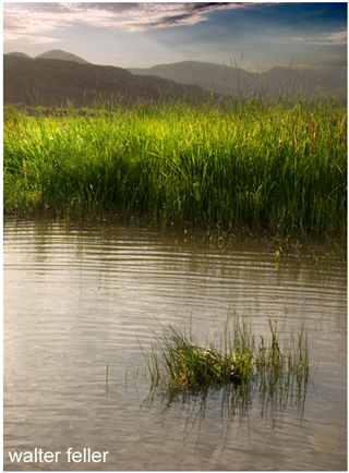
From sticks and dead leaves and rocks and out of crevices other little raindrops dripped to trickle together in intricate alpine streams hastily making way through a myriad of delicate and fragile waterfalls, into pools, then resting a few moments before being pushed out by the increasing deluge behind them.
From these streams to creeks the raindrops gathered rushing rather blindly through boulders and fallen trees in the narrow canyon joined by other smaller canyons and joining itself to larger creeks coming from larger canyons until swirling and twisting, colored with mud and dirty foam, all of a sudden coming together to become a river.
“Rejoice, rejoice, rejoice,” thought the little raindrop. It had found its way–to a river that should by all accounts transport it to the sea.
That didn’t happen, though. The river fell into the quicksands and disappeared into an eerie underworld layered below the clouded skies, under the sands of the empty river, and above the dark and mysterious aquifer.
Later, there was the bright and sunny sky overhead when the raindrop, risking evaporation, surfaced for a breath then soaked back into the safety of the shallows.
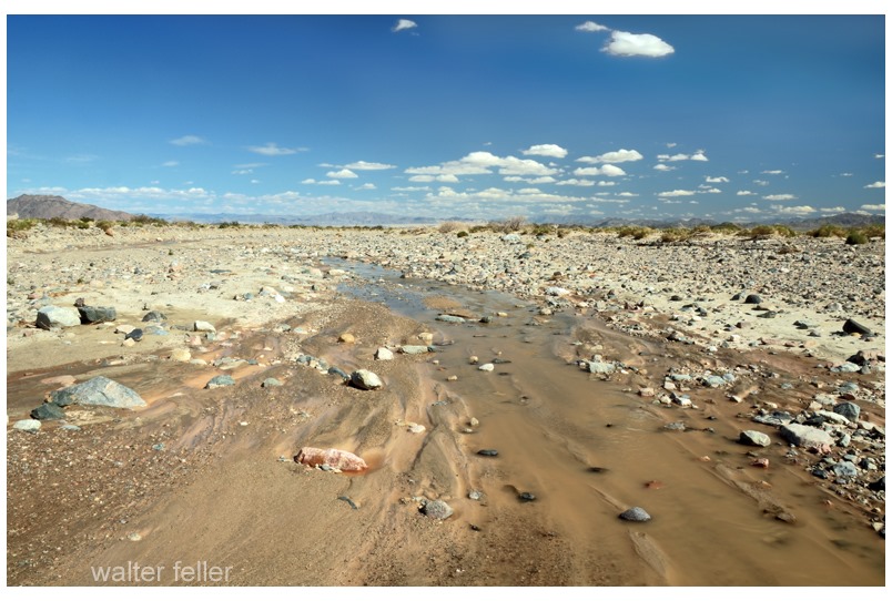
Again and one more time again this happened. Finally, there is no finally. The little raindrop simply never came back. After all, it was just a raindrop, and this river in the desert never reaches the sea.
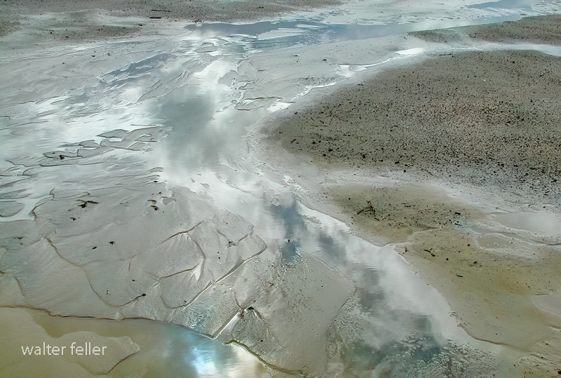
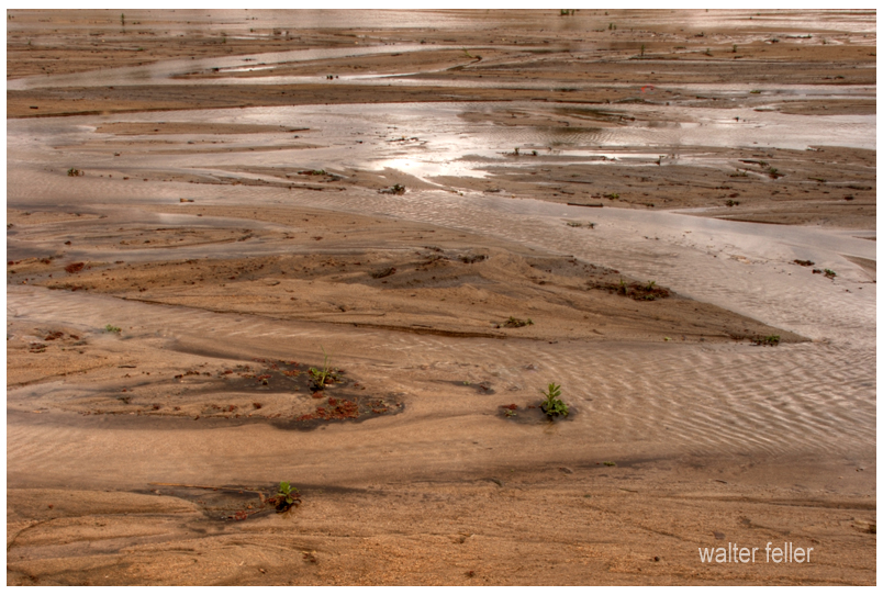
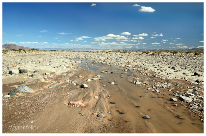
It is the strangest thing; the river; I follow it downstream and it becomes smaller and smaller and smaller. With every step, it becomes less and less and less. The water diminishes and depletes until it is just a trickle, until a glisten, until just a wet spot surrounded by damp sand, and then nothing. That is how this river ends–not mightily at an ocean, but quietly, subdued in the sand and rubble and stone becoming as if it never were.
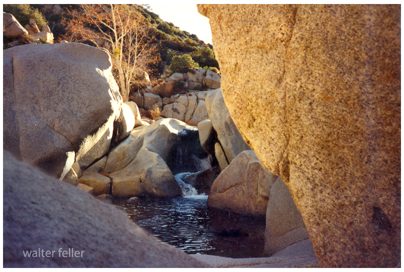
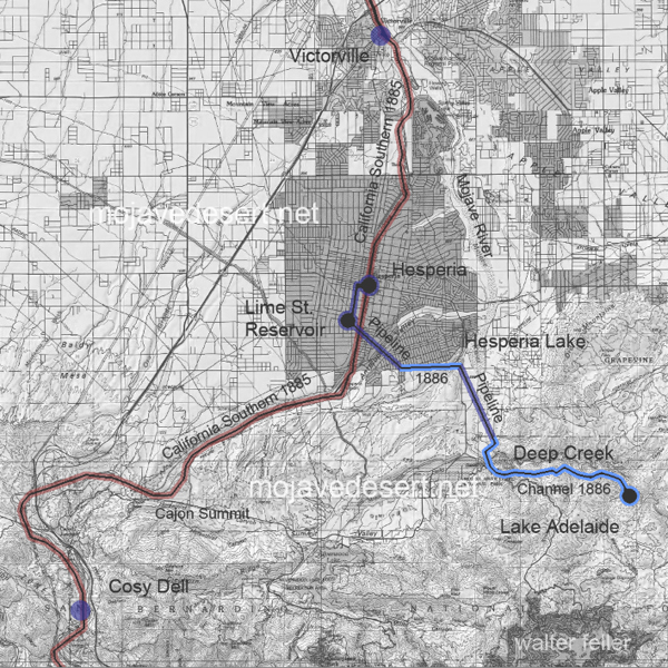
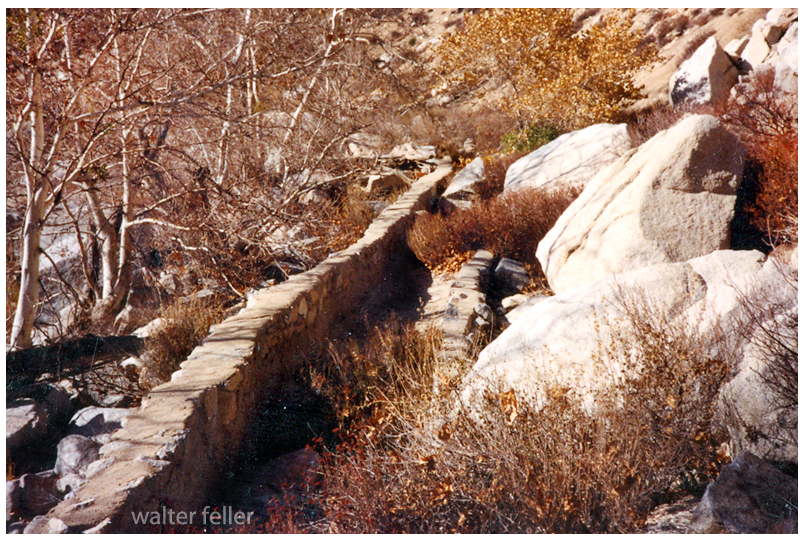
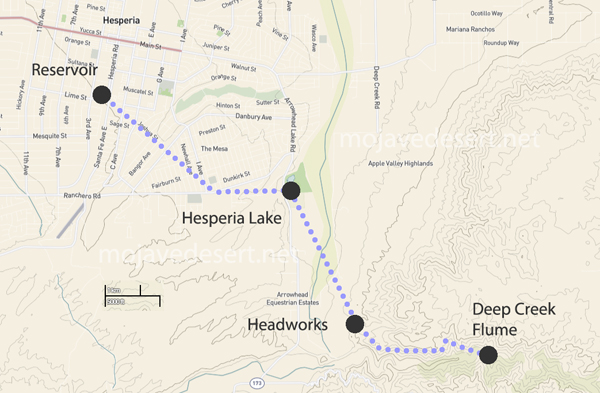
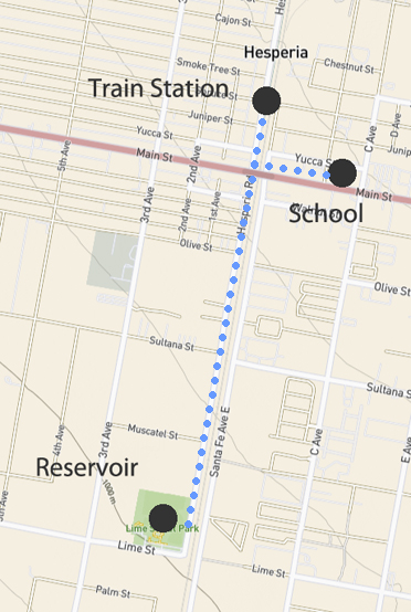
A small dam was erected to raise the water level up against a gate to a flume that could be opened letting water from Deep Creek flow into a stone-walled channel. This channel ran along a carefully continuous slope to a headwater, into a pipeline across theMojave River, then on to an open reservoir in what is now the City of Hesperia, Ca.
Lake Adelaide – Deep Creek – Hesperia’s water source of the late 1800s and onward . . .Gate at end of the flume. Looking upstream.Canal at flume looking downstream.
The slope along the canal has to be even to avoid turbulent flow. The walls need to be high enough all along the canal to maintain volume, accommodate hydraulic jump and prevent sloshing over the side. A smooth, even flow like that is called laminar flow.
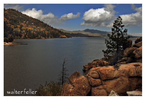
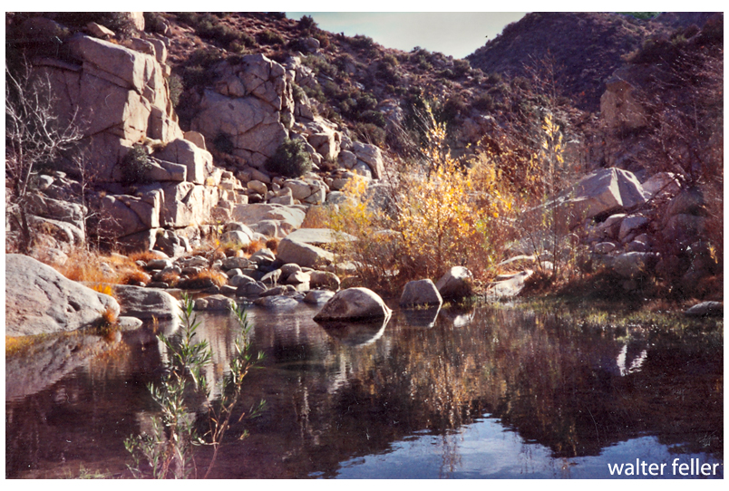
Stunning Lake Adelaide
The smooth flow we look for in an open channel aqueduct is called ‘laminar flow.’ As water passes through the 3 or 4 miles, if the flow is turbulent, all kinds of contaminants may become entrapped and entrained in the water, which is undesirable.
The floor of the channel needed to be flat and to hold a uniform, gentle, even slope for a long distance.
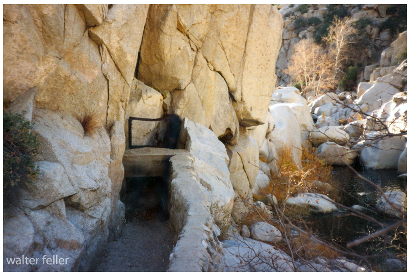
So, water diverted at the flume passes through the gate and into a specifically engineered channel to be delivered to the next step, the headworks.
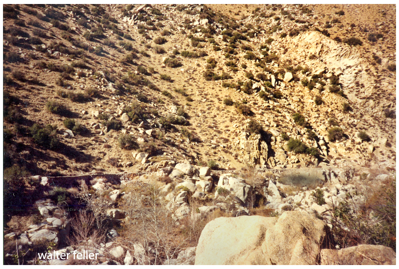
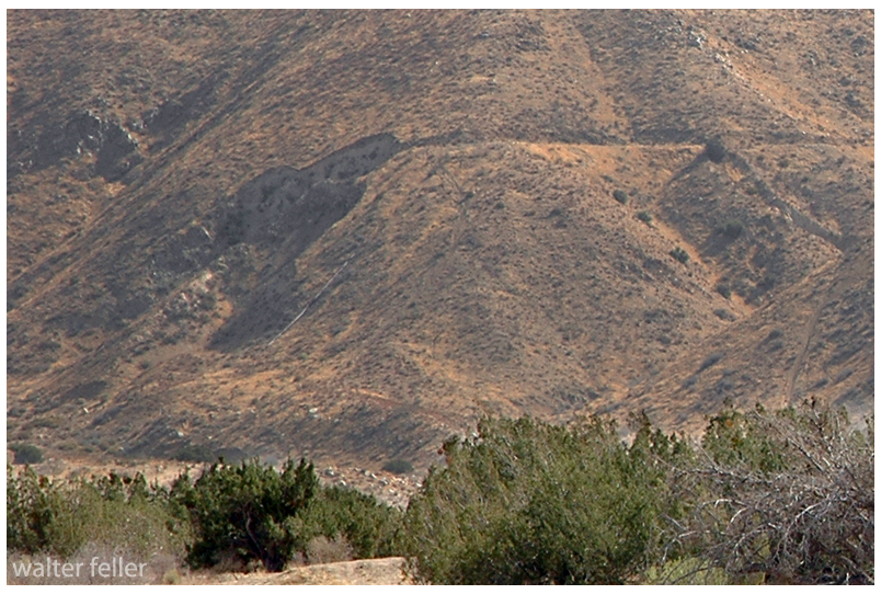
This is the last stretch before the water leaves the mountains. The headworks were at the washed out area to the left.
Think of the headworks as sort of a funnel with the water pouring from the channel into the top of the siphon. There most likely was a grate on there to keep large objects from falling into the pipeline and clogging it.
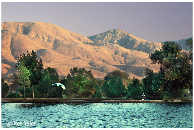
Headworks at the top of the siphonLooking north (downstream) at Mojave River from southern side of Deep Creek CanyonHesperia Lake, looking southeast toward mountains.
The pipeline changes direction at Hesperia Lake. The origin of the lake is not exactly clear. One story I have heard is that the lake began when the pipeline was leaking and the water did not drain. There is a shallow well in the park that empties into the lake. The spiral-coiled pipe that was used may very well have sprung a leak under the high pressure of being the lowest point of the siphon, as well as a turning point in the line.
Map of water transmission system.
The pipeline turned west at the lake and continued up the little canyon crawling up to the area locally known as ‘the mesa.’ The pipeline then terminated at an open reservoir at what is now Lime Street Park.
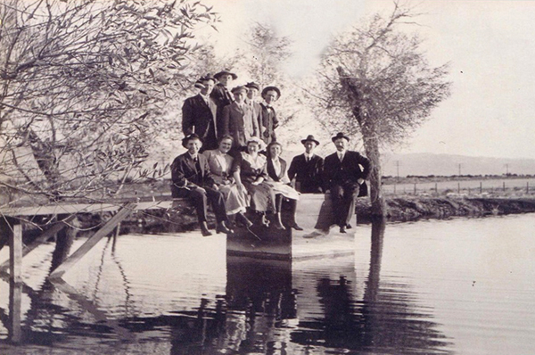
Reservoir at end of the pipeline. (courtesy Hesperia Old Time Museum)
All of this rather than dig a hole for a well.
Rotary drilling was being developed, still. Water was down 500-600′ below the surface at this specific location where the reservoir needed to be. Building this canal the 12-14 miles it was, was preferable to digging a well that deep by hand.
The location of the reservoir was well thought out. The water needed to be here for the community that was being developed. Also, water in an open reservoir that could be seen from a train window was a big attraction for those interested in the area.
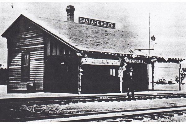
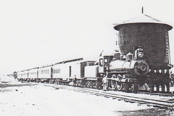
The canal and pipeline were completed in 1886 when the California Southern track was finished and trains began running.
The water in the reservoir would be fed into the water system to fill the tank at the little railroad station across the street from where Walters’ General Store and the Hesperia Hotel would be built, and at the school just over on the east side of the tracks. There at the little schoolhouse at the center of the little community the water that would be delivered at a pressure of 45 PSI, which is about the perfect pressure for use in a home or commercial business.
Water at this location was critical. 500 feet below the surface there was plenty of water, but the drilling technology to get to it was 30-40 years in the future.
circa – 1900
So, hopefully, all things have been considered and that is the story of how and why water was brought to our mesas and providing our opportunity to grow into the collective mega-empire we are to this very day. IMO.
Until the early 19th century, water wells were still dug by hand. In 1808 in the United States, mechanical drilling was invented by the Ruffner Brothers. The Ruffner Brothers successfully first used mechanical drilling in Charleston, West Virginia to access water and salt at Great Buffalo Lick. This invention allowed many more wells to be drilled efficiently all over America.
By the 1820s and 1830s, auger boring machines came on the scene. These machines allowed wells to be drilled deeper and for the water to remain uncontaminated as it came up through pipes made of the first iteration of steel. By the early 20th-century rotary drilling technology became standard after the invention of the roller cone drill bit in 1908 by Howard Hughes Sr. Hughes invention is still used today for many types of drilling.
The 1940s brought the invention of portable drilling tools – until then they were all platform-based. And that brings us to the technology that is still in use today.
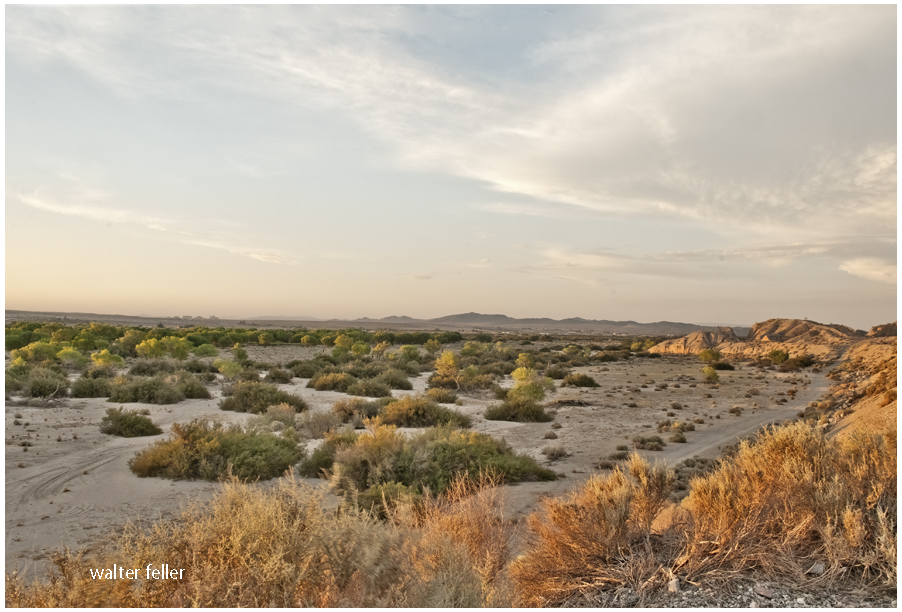
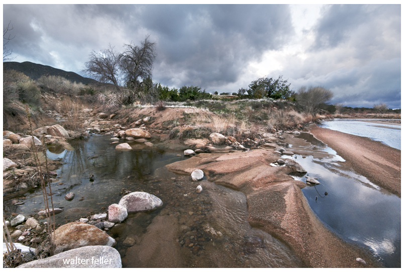
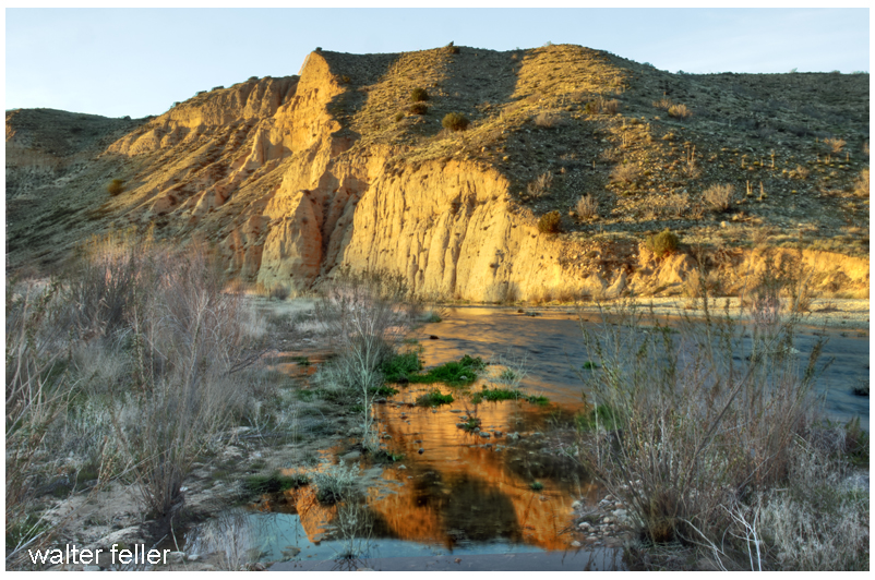
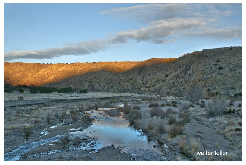
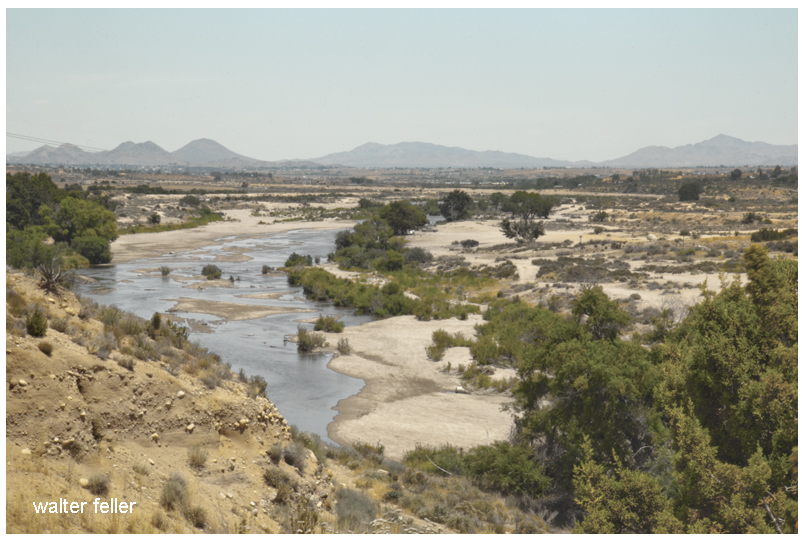
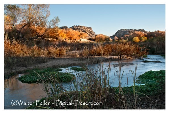
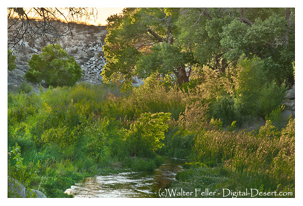
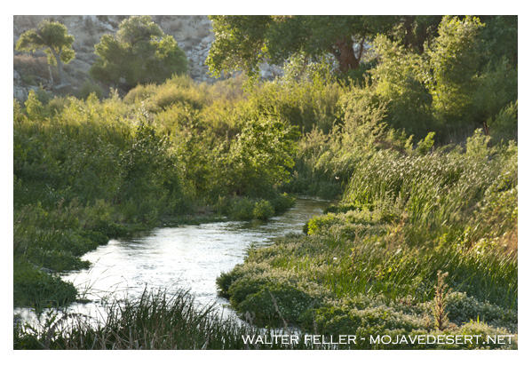
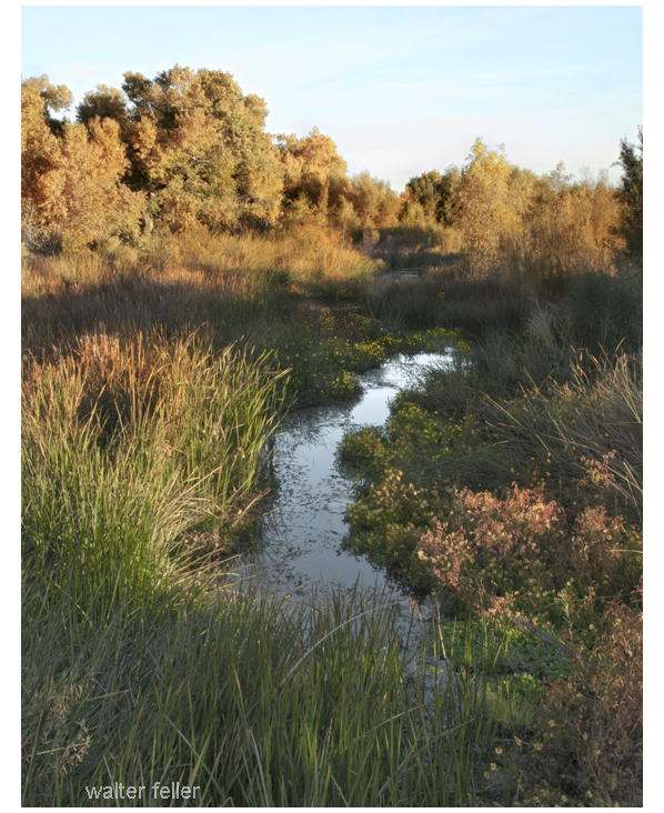
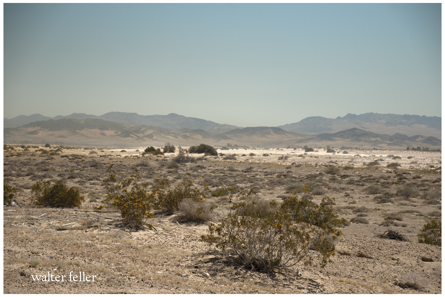
Rather than growing wider and emptying into the sea the Mojave River becomes smaller and smaller finding its way in the sand between the cobbles and rocks curling into crescent -shaped dark meanders and swales transitioning to dry sand and finally, collections of same sized stones.
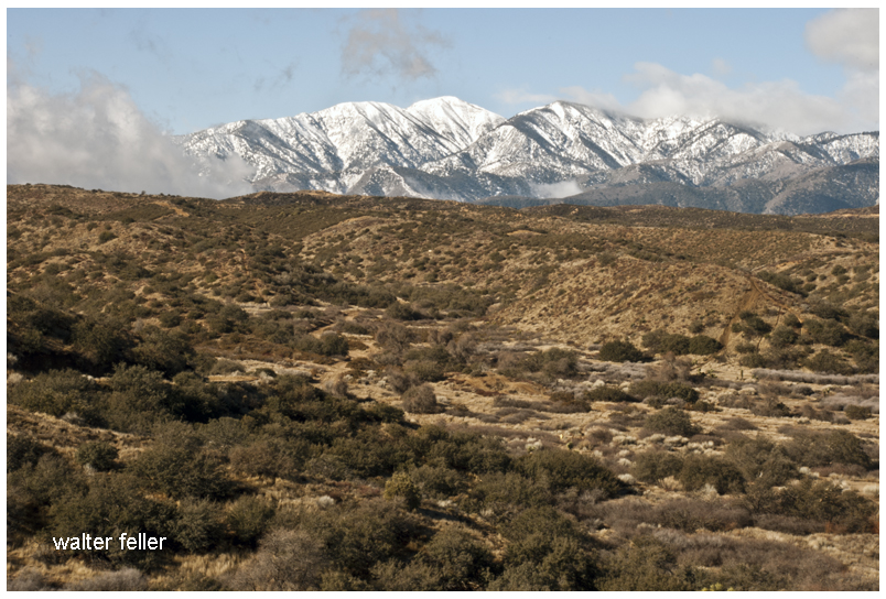
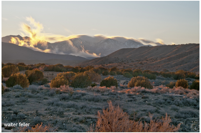
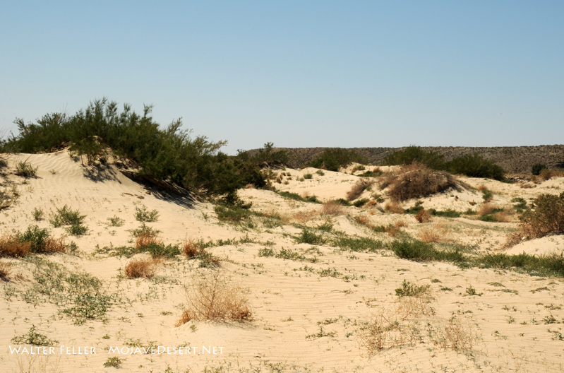
I suppose, if there is any hard and clear boundary to the Mojave Desert that this is where it is. Over time, the Mojave River has cut away the bluff in Summit Valley, east of the Cajon Pass, as the Mojave Desert moves with the rest of the Mojave Block as it separates from the San Bernardino mountain range.
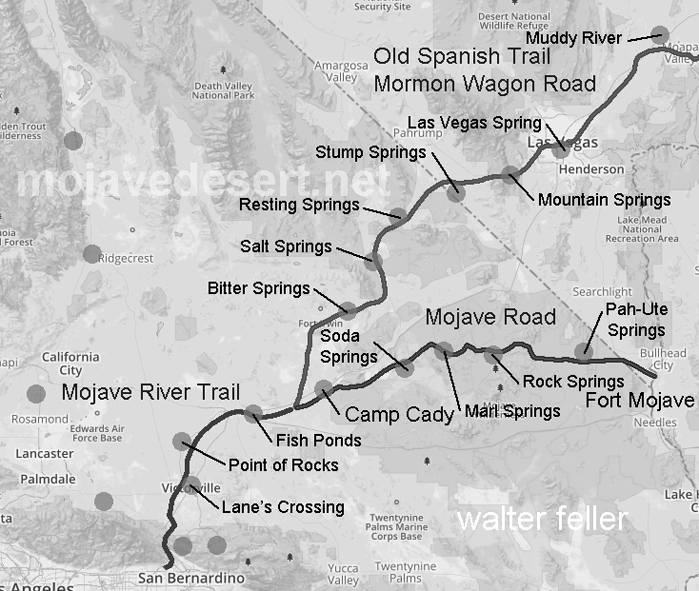
I have heard that the Paiute Indians have a legend–a story they would tell about a giant who crossed the desert with an olla full of water in each arm. With each step he would leave his footprint in the ground, and water would spill from the olla into the hole as he walked on. The giant was so large that these waterholes were one day’s walk between each for a normal-sized man. The Indian learned this and used these waterholes to travel great distances and trade with other Peoples beyond the desert. As time went on and things went the way things do, one such trail became the Mojave Road. — Editor
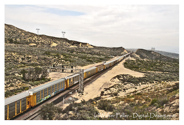
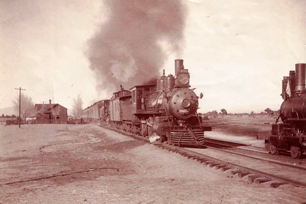
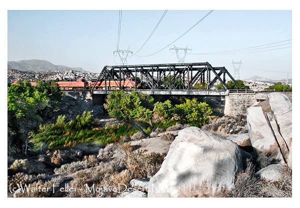
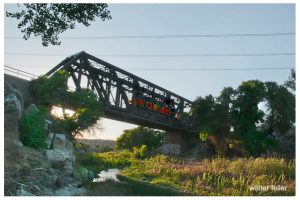
“One of Victor’s (Jacob Nash Victor) greatest contributions was supervision of a number of bridges constructed in San Bernardino County. The first and longest of these was the railroad crossing of the Mojave River in the lower narrows. It is not known just how directly involved he or Perris (Fred T. Perris) were with this project, since their correspondence includes a letter regarding recommendation from New England of another engineer-bridge builder anxious for employment just then. Whoever was directly responsible, huge granite blocks were shaped to fit snugly into cemented buttresses, which have not cracked or moved in over 100 years of continuous use and several devastating floods. The iron bridge, described as one of the finest structures of its kind on this coast, was brought in sections by railroad to Barstow and freighted from there to the site. This bridge was replaced early in the 20th century, including a second set of tracks, but the subsequent structures have all continued to utilize the same basic foundation buttresses. This would be the oldest structure in the region (the buttresses were built in 1885).”
~ History of the Victor Valley – Lyman
Published by Mohahve Historical Society
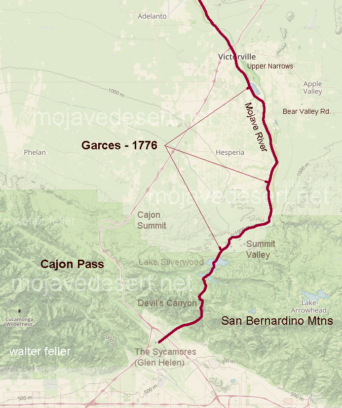
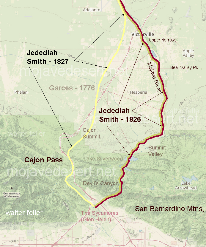
Fr. Francisco Hermenegildo Tomás Garcés (April 12, 1738 – July 18, 1781) was a Spanish priest who crossed the Mojave Desert in 1776. This map shows his route across the Victor Valley. Following the Mojave River after crossing at Oro Grande, he walked through downtown Victorville, bypassing the rocky narrows and connecting with the river near today’s Mojave Narrows Regional Park. Following the river to where the West fork and Deep Creek join to form the Mojave. He visited with the Indians and then went up Sawpit Canyon and over the mountain ridge, descending into the verdant sycamore grove known today as Glen Helen.
This map shows Fr. Garces’s route in 1776 during his crossing west. His diary describes him being taken to an Indian village in the mountains.
Fifty years after Fr. Garcés made his way across the Mojave from the Colorado River, in 1826, Jedediah Smith retraced the trail of Garcés along the river, then up and over the mountains. In 1827, one year after his first crossing, Smith had lost most of his men in a massacre at the Colorado River. Desperate for the safety of civilization, Smith, after crossing the Mojave River in Oro Grande, made his way directly to the Cajon Pass, bypassing the San Bernardino Mountains.
The direct route over the summit and down the pass eliminates the steep climb and descent over the San Bernardino Mountains.
Leaving the headwaters of the Verde River in Arizona the party traveled to the Colorado River to the Mohave villages scattered along the east bank between what is now Topock and Bullhead City in Arizona. From there they traveled toward the middle of the desert, possibly on the route of either Fr. Garces in 1776, or further north on the trail taken by Jedediah Smith in 1826 and 1827, these converging at the mouth of the Mojave River east of Afton Canyon. It was two days before they found water after reaching the Mojave River. This may have placed them just east of today’s Barstow, California at a place that was known years later as Fish Ponds.
After four days travel we found water. Before we reached it, the pack mules were strung along the road for several miles. They smelled the water long before we had any hopes of finding any, it made all the best use of the strength left them after their severe sufferings to reach it as soon as they could. We remained here two days. It would have been impracticable to continue the march without giving the men and animals the rest which they so much required.
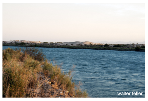
Colorado River at Moab across from Topock, Az.
After remaining in camp two days we resumed our expedition and for four days traveled over a country similar to that which we had traversed before our arrival at the last water. There was no water to be found during this time, and we suffered extremely on the account of it. On the fourth day we arrived on the Colorado of the West, below the great Canyon.
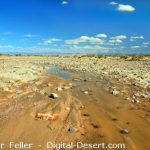
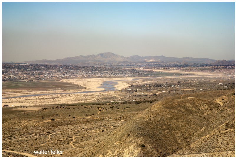
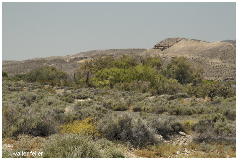
Mojave River fan
Our joy when we discovered the stream can better be imagined than described. We also had suffered greatly for want of food. We met a party of the Mojave Indians and purchase from them a mare, heavy with foal. The mare was killed and eaten by the party with great gusto; even the foal was devoured. We encamped on the banks of the Colorado three days, recruiting our animals and trading for provisions with the Indians, from home we procured a few beans and some corn. Then we took a southwestern course and in three days march struck the bed of the stream running northeast, which rises in the Coast Range and its lost in the sands of the great basin. We proceeded up the stream for six days, and two days after our arrival on it we found water. We then left the stream and traveled in a westerly direction, and in four days arrived at the of Mission San Gabriel.
San Gabriel Mission
At the mission there was one priest, 15 soldiers, and about 1000 Indians. They had about 80,000 head of stock, fine fields and vineyards, in fact, it was a paradise on earth. We remained one day at the mission, receiving good treatment from the inhabitants, and purchasing from them what deep we required. We had nothing but butcher knives to trade, and for four of these they would give us a beef.
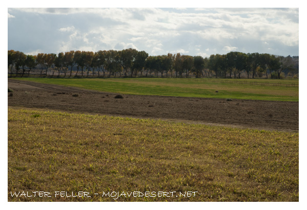
Mrs. Kemper Campbell, with her husband and their law partner, Mr. Sorenson, acquired the Verde Ranch in 1924. Mrs. Campbell, now 76 years of age, recalls that the original Verde ranch was approximately 4000 acres. The Campbells retained the north portion of 1900 acres, while Mr. Sorenson retained the south portion. Part of the Kalin ranch, from the south portion along Bear Valley Road, is now being developed for the new Victor Valley College.
Verde/Kemper Campbell Ranch
Mrs. Campbell describes the red House is consisting of nine rooms and in good repair. The “red house” was built in 1870 by John Brown Sr. and was used by the Mormons as a hotel and stopover. It was a meeting place of the pioneers on their journeys south to the San Bernardino Valley. In 1867, John Brown homesteaded the Verde Rancho, which became the first major ranch of the Mojave River Valley. Horse and cattle raising and production of alfalfa have been the major uses of the ranch by a succession of owners: the Coles, Sterlings and Greers before the Campbells and Mr. Sorenson became owners. The Campbells operated their portion as a working ranch. In the 1930s they added attractions for guests, and for many years it was well known as the “North Verde.” after the death of their oldest son during World War II the name was changed to “Kemper Campbell Jr. Ranch” in his memory.
Adapted from Mohahve I – Scrapbooks of History, page 93 – Mohahve Historical Society
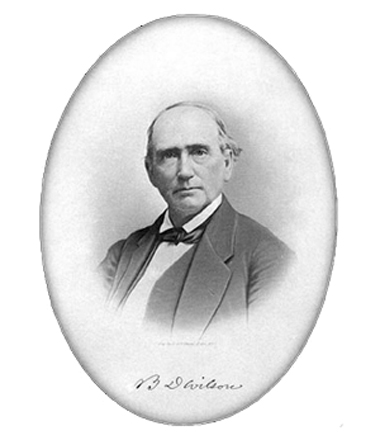
in the summer of 1845, Benjamin D Wilson, own part of the interest in the Jurupa Rancho, site of the present city of Riverside, led a troop of Calvary in search of cattle rustlers.
Setting out from San Bernardino Valley, he divided his command. Most of the men he sent through Cajon Pass, keeping only 22 Mexican troopers with him to follow a trail across the mountains. Two days later, Wilson and his men reached the lake where they sighted scores of grizzly bears.
Big Bear Lake
Most of the soldiers had been vaqueros. They formed in pairs and drew reatas, each pair attacking a bear. One looped a rope around bear’s neck; his companion roped same bear by a hind foot. Then the men drew apart to stretch the rope taut and hold the bear a prisoner. They bagged and skinned eleven bears, stretched their hides and continued across the mountains to join the rest of the command on the desert at Rancho Las Flores, on the Mojave River.
Here the reunited party engaged Indians in a fight, after which Wilson and his 22 vaquero-troopers returned home by the way of the lake. They again found the place overrun with bears, and the same 22 soldiers brought in eleven more bears– enough to give them a bear rug apiece as a trophy. It was then that Wilson gave the name of Bear Lake to the little body of water.
Years later the name was changed to Baldwin Lake. The name survives, however, in Big Bear Lake which was created in the site of the Talmadge Ranch in 1884 when a dam was built to provide a constant water supply for the Redlands District.
–
adapted from ~ Pioneer Tales of San Bernardino County – WPA – 1940.
The characteristic account of the hazards of traveling through the Mojave during pioneer days appears in the journal of General John Charles Fremont. Leading a party of topographical engineers, with the famous Kit Carson and Alex Godey as scouts, Fremont was on the last leg of an exploration trip through Oregon and California, and was headed for Salt Lake City when he called camp at the lagoons 8 miles below Yermo for the purpose of killing and jerking enough beef for the long “jornada” to the next waterhole.
Here, on the afternoon of April 24, 1844, Fremont was surprised by the sudden appearance of two Mexicans, one a man, Andreas Fuentes, the other an 11-year-old boy named Pablo Hernandez. They were members of an advance party of six men and women who had left Los Angeles well ahead of a large caravan, in order that they might travel leisurely with their head of 30 horses. They had reached Agua Archilette (now Resting Springs) , where they decided to remain until the caravan overtook them. While camped here, they were visited by several seemingly friendly Indians. A few days after this they were surprised to see approaching them a large number of Indians, estimated to be about 100.
Agua de Archilette (Resting Springs)
The commander of the Mexican party shouted to Fuentes and Pablo, who were on guard duty, to drive the horses to their former water hole. The guards were mounted according to custom and managed to stampede the horses through the Indian lines despite a volley of arrows. Knowing they would be pursued, the man and boy drove the horses about 60 miles, halting only to change mounts. When they reached Agua de Tomaso (now Bitter Springs) they left the horses there and pressed on, hoping to meet the oncoming caravan. Exhausted, the two were overjoyed to find the Fremont party.
Agua de Tomosa (Bitter Springs)
The Fremont cavalcade broke camp immediately, left the river and, turning north, followed the old Spanish trail 25 miles to Agua de Tomaso. Here they found traces of recent origin that showed the Indians had captured the horses and run off with them. Carson and Godey, accompanied by Fuentes, decided to follow the marauders. That evening, Fuentes returned alone, his horse having given out.
The scouts had been taken about 30 hours. They estimated their trip had taken them about 100 miles. At nightfall of the first day they had entered the mountains. Bright moonlight made the pursuit easy for a time, but when they entered a defile, it became necessary to dismount and feel for the trail with their hands. At midnight they lay down to sleep.
Cold as it was, they dared not to make a fire and till morning when in a little ravine, they kindled a tiny blaze to warm themselves before starting on.
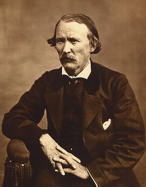
Christopher “Kit” Carson
At daylight they continued their pursuit and about sunrise ran across a few of the missing horses. Concealing their exhausted mounts behind a pile of rocks, they crept toward the crest of a nearby hill, from which they could look down on four lodges and about 30 Indians were gorging themselves on horse meat.
The cautious movements of the scouts disturbed a horse grazing nearby, which snorted, giving warning of their presence to the feasting Indians. The scouts charged, shouting as they went. Carson downed in the Indian with his first shot. Godey shot twice and hit another. Godey received an arrow through his shirt collar. The rest of the Indians fled, no doubt believing the two men were the advance of a large party.
Carson stood guard while Godey dashed down to scalp the two prostrate figures. As he stripped the scalp from one of them, the Indian regained consciousness and screamed. An old squaw, ascending a nearby hill, turned, hurled a handful of gravel down on Godey, and screeched maledictions. Godey mercifully killed the man. Then the scouts returned to the herd and drove it off without interference.
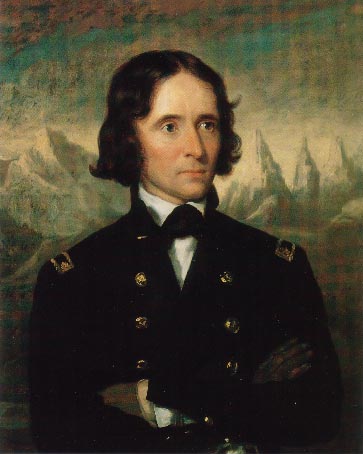
John C. Fremont
The scouts’ story told, Fremont ordered camp broken. The party proceeded north across the open plain. Two days later, Fremont came across the bodies of two men, Hernandez, father of Pablo, and another member of the Mexican advance party. Both had been mutilated. Later the bodies of the two women who completed the advance party were discovered, also murdered and mutilated.
adapted from ~ Pioneer Tales of San Bernardino County – WPA – 1940.
In 1840, raiders under Peg-leg Smithand Wakara, an Indian renegade, made a simultaneous attack against a number of ranches in Southern California and drove off hundreds of horses. Some of these horses came from as far north as San Luis Obispo, but all were run south and into the Mojave Desert through the Cajon Pass.
Horse Thief Springs – Kingston Range
When Peg-leg was asked how many horses had been stolen, he replied, “Only about 3,000. The Spaniards followed us and got half of what we started away with, damn them.” During that wholesale raid, Wakara, alone, is believed to have led about 1,000 tame horses from the mission corral at San Luis Obispo.
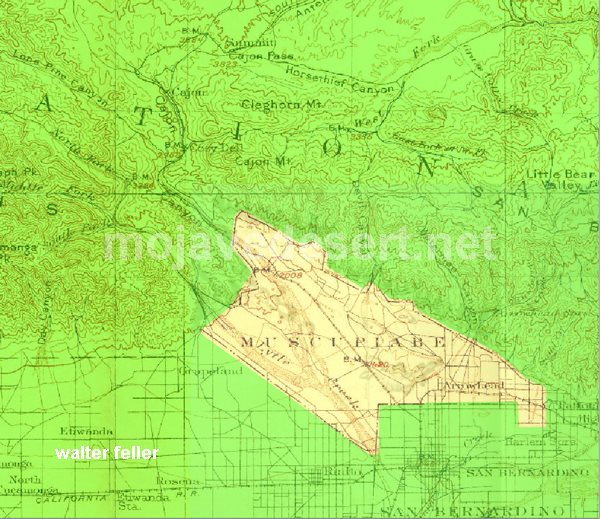
In 1843, Michael White obtained a grant to the El Cajon de Muscupiabe Rancho in Cajon Canyon, for the purpose of guarding the pass against the Indian raiders. It was the practice of the marauders to slip through the pass in the San Bernardino Mountains, and, under cover of darkness, to rob and pillage. Their constant raiding depleted the Californian’s herds.
In the early fall of 1845, Governor Pio Pico sent against the plundering Indians a force of 80 well-armed men under the command of Benjamin D Wilson. Wilson was a native of Tennessee and had been a trapper in New Mexico when he joined the Workman party which entered San Bernardino County in 1841. In 1843 he purchased one-half interest in the Jurupa Grant with Juan Bandini.
Following the instructions of the governor, Wilson planned and outfitted its expeditionary force. A pack train and 58 soldiers passed through the Cajon, and Wilson, with 28 Californians, crossed the mountains. From Bear Valley, the Wilson party followed the East Fork of the Mojave River down to the Mojave desert floor. There they joined the other division. For several days the expedition marched northward along the Mojave River. Wilson, riding a mule, was usually two or 3 miles in advance, looking for Indian signs.
On the fourth or fifth day, Wilson saw four Indians coming toward him along the trail. Certain they had not seen him, he turned his mule into the river bed and kept under cover until he judged he was opposite them. When he climbed the bank he called in the savages responded in a friendly manner.
It had been Wilson’s intention to take the Indians prisoner in order to obtain some much-needed information, but one of the four was a renegade Indian for all Southern California had been looking– at the notorious Joaquin. Joaquin had been trained as a page by the Catholic Church at the San Gabriel Mission, but a career of crime brought him the customary reward: a branded lip and a cropped ear.
Mission San Gabriel
Wilson commenced a conversation in Spanish, and the Indians to them to be nothing more than a traveler until his force came into view. Joaquin, realizing that Wilson was the vanguard of this group, jerked an arrow from his quiver and strung his bow. Wilson fired from the hip at the same time Joaquin loosed his arrow. The Indian shaft struck Wilson in the right shoulder; the white man’s bullet pierced Joaquin’s breast area the force of the arrow caused Wilson to drop his gun, but the shot had brought Joaquin to the ground where he lay cursing the white race.
The other three Indians made off across the desert. Wilson ordered his soldiers to take their life. The Indians resisted and were killed. Joaquin watching the slaying of his kinsman continued to pour profanity on Wilson and his kind until a soldier put him to death.
Don Benito Wilson – 1870
Upon examination of his wound, Wilson found that he had been struck by an arrow made poisonous by putrid meat blood. The Comanche Indian, Lorenzo Trujillo, who had accompanied Wilson from New Mexico suck the blood from the extremely painful wound. Although the swelling began to reduce, Wilson was unable to travel, so he kept five men with him and sent the remainder down the river to find the Indian camp.
After several days, his command returned to report that they had struck a fresh Indian trail about 10 leagues below Wilson’s camp. Following the trail up a rocky mountain, they discovered Indians hidden among the rocks. The Californians made an attack but were obliged to retreat with several badly wounded men, leaving the Indians in command of their natural fortress. Wilson’s wound now healed, this first major battle between San Bernardino settlers and Mojave marauders pronounced a draw, and the punitive expedition withdrew to return the wounded man home.
adapted from ~ Pioneer Tales of San Bernardino County – WPA – 1940.
Huntington’s Station was the first trading post in the area, and although Heber Huntington only owned it from 1873 to 1878, it remained known as Huntington’s Station until the the railroad came through and renamed it Victor. The river crossing with a few modern exceptions as the Narrows Bridge, Rainbow Bridge, and the cement plant looks much the same today as it did in 1872 when Mecham built what has become Stoddard Wells Road.
“During his years at the upper crossing, Captain Lane, as Aaron was known throughout much of his life in California, had ample opportunity to discover where the richest farmlands lie along the Mojave River.”


 regarding recommendation from New England of another engineer-bridge