Category Archives: Roads

Roads to Yesterday — Van Dusen Road

L. Burr Belden
San Bernardino  Sun-Telegram  September 6, 1959

In 1861 the county of San Bernardino contracted with John Brown to build a toll road through the Cajon Pass from Devore to Cajon Summit. That would do fine to get wagons and freight between San Bernardino and the Mojave Desert. At the same time the county also approved a subscription road to be built by Jed Van Dusen from near the summit through the mountains so equipment and supplies could be freighted to the mines in Holcomb Valley.

History in the Making

Mountain Road Cost Miners $2,000 in Gold

Brown’s Toll Road

Back in the early 1860s the gold rich but food poor miners of Holcomb Valley decided the number one need for their mountain metropolis was a road.  in typical pioneer fashion instead of looking to San Bernardino, Sacramento or Washington these miners resolved to build the road.

At the time supplies for Holcomb Valley were brought up by way of a packed train trail up Santa Ana Canyon from the San Bernardino Valley and thence to Holcomb Valley by trails threading either Polique or Van Dusen Canyons.  these trails served for burros,  mules or horses but the only way to get a wagon to the gold mines  was to take it apart and load its pieces on pack animals.

Toll Road up Cajon

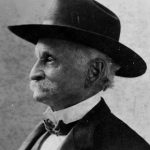
John Brown Sr.

The Holcomb Valley mines were reputedly among the richest in California. Free gold, as the placers were known,  was becoming hard to obtain in quantities up in the worked over streams of the Mother Lode and accordingly thousands of footloose miners poured into Holcomb Valley making an increasingly heavy strain on the thin supply line.

Down in San Bernardino John Brown Sr. a resourceful Rocky Mountain man, who was one of the leaders in the settlement both during and subsequent to the Mormon regime, had an experienced eye for trade routes. Brown was probably one of the first to vision San Bernardino as a trade center due to its central location and proximity of favorable mountain gateways.

Brown saw that San Bernardino could obtain an even better share of overland travel with better roads. Accordingly he planned to make  the Cajon Pass gateway the  preferable way east. He applied to the Board of Supervisors and was granted a toll road franchise. His road utilized the East Cajon route  which he improved so it could accommodate wagons. Then Brown went farther and started a ferry over the Colorado River at Fort Mohave.

Builder Paid $2,000

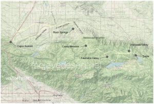
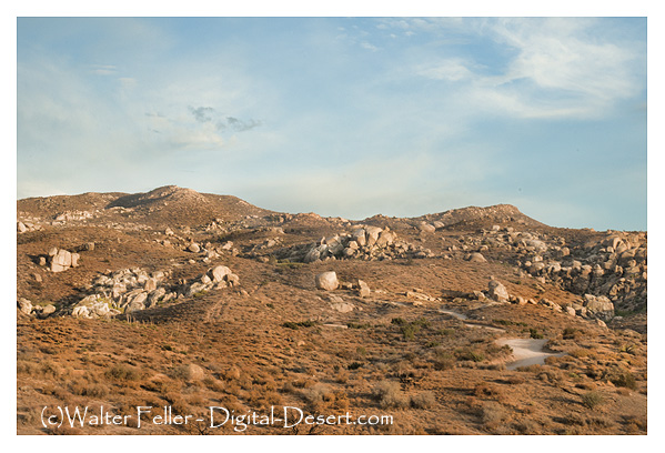
Van Dusen Road/ Coxey Truck Trail from Cajon Summit to Holcomb Valley

Van Dusen Road/ Coxey Truck Trail from Cajon Summit to Holcomb Valley

The Brown Road diverted Holcomb Valley traffic  away from the Santa Ana trail. A new trail was blazed down Holcomb Creek, Willow Creek and Arrastre Creek to reach the Mojave Desert floor  in the vicinity of Deadman Point.  From Deadman Point  it was an easy open  path to Brown’s road.

Van Dusen Rd.

Van Dusen Road at east bank Mojave River

Miners  and supply men who used the new trail  saw that it could be widened to accommodate wagons. The usual method of making a road would have been for the Holcomb Valley miners  to turn out with their picks and shovels, but that meant leaving their claims just when water was high enough for gold washing. Accordingly a person of $2,000  in gold dust was raised and Jed Van Dusen, the camp blacksmith, was hired to build the road. He did just that. Van Dusen was a resourceful fellow. He had assembled a wagon from parts brought up to Holcomb Valley by pack train. In between running his smithy he had some good claims he worked in the canyon  that has been given his name. Van Dusen’s chief claim to fame, however, was neither his skill as a road builder, blacksmith or miner. it rested on the fact he was father of a very pretty little girl named  Belle.

Dead Man's Point

Dead Man’s Point

Daughter Honored

When the miners cast about for a name for their town in Holcomb Valley  they found W. F. (Billy) Holcomb  reluctant to have it named for him. Then someone had an idea. Why not name the camp for Jed Van Dusen’s little girl? So Belleville became the name of the big roaring mining camp that had almost as many residents as the rest of the county.

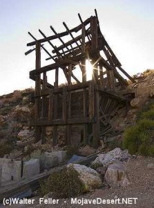
gold mine

Lucky Baldwin’s Gold Mountain

For a dozen years or so the Van Dusen built road  carried the heaviest traffic in the county. The travel to the mines,  of course, was a great help to the Brown tollway. Heavy machinery needed for quartz mining  was hauled over the road as gold veined ledges were discovered. The latter  included two of the most famous gold mines San Bernardino County history, E. J.  (Lucky) Baldwin’s  Gold Hill property and Richard Garvey’s Greenlead.

During Civil War days the Van Dusen –  built road carried a strange assortment of passengers and cargo. Liquors for Greek George’s  notorious  saloons and dance halls, staple goods, the inevitable blasting powder and large bullion shipments. Strangest of all travelers, however, was a ragged troop of filibusters recruited in Visalia  who called themselves Confederate calvarymen  and commanded by Mariposa County’s  stormy Assemblyman  Dan Showalter. Showalter and his motley horsemen were trying to reach southern lines in Texas but a few weeks later ran into California volunteers near Warner’s Ranch and were taken prisoner.

This was the same Showalter who had recently slain San Bernardino County’s  Assemblyman  Charles Piercy in a duel at San Rafael. The duel  was fought with rifles at 40  paces. First shots of both antagonists went wild and Showalter allegedly jumped the gun and shot the second time at the count of two, killing Piercy. Showalter was a fugitive when he was in Holcomb Valley but secessionist  sentiment plus that of roughs  who wanted no government at all  served to protect the fact it was San Bernardino County’s legislator  he had slain.

The roughs around Belleville  ran things with a high hand, at least until Greek George fell mortally wounded from the knife of ” Charlie  the Chink”  in the drunken aftermath of a Fourth of July celebration. In a reminiscent account written 35 years later Billy Holcomb told of that fatal July 4 and of George’s killing three men before his fatal combat with  the celestial.
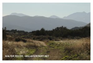
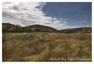
Coxey Meadows - Van Dusen Road

Van Dusen Road

It was members of George’s gang, left more or less leaderless, who held up an outgoing stagecoach and relieved the Wells Fargo messenger of $60,000. It was the disgusted miners,  anxious to drive out the roughs, who pursued the highway men and killed them all. The last bandit  was slain a bit too quick for he died while trying to tell where the $60,000 was  hidden. As far as is known it has never been found, a sizable  cache of gold bars  that has  lured treasure seekers  unsuccessfully  for something like 90 years.

Baldwin Garvey Feud

The Van Dusen Road carried the ballot boxes in the weird election when Belleville tried to become county seat, and probably succeeded in polling a countrywide majority but lost on the official count by the “accident”  of a  Belleville  precinct’s box being lost in a bonfire  down in San Bernardino.

After the richer placer deposits had been worked Belleville and upstream Beardstown  dwindled in size. The emphasis’s one to hard rock mining which required less men more capital and tools. In the hard rock field the giant was Baldwin, who at one time was running a 40- stamp mill at Gold Hill and the operation was supporting a good-sized town, the town of Doble.

Elias Jackson “Lucky” Baldwin

Next in size to Baldwin’s operation were those of Garvey.  Garvey had owned Gold Hill at one time and reportedly sold it to Baldwin for $200,000. The Garvey family always contended that Baldwin took a bill of sale for the mine  but neglected to pay the Irish-born Garvey all the promised money. Garvey trusted his supposed  friend.

Garvey held onto the Greenlead, which is almost at the side of the Van Dusen Road in lower Holcomb Valley. When hard times depressed  Los Angeles real estate  Garvey found he owed $300,000 on the land no longer worth the amount of the mortgages. Three shifts worked the Greenlead and Garvey paid all  but $90,000 of the $300,000 debt. The family held onto the Greenlead.  It had been leased, sold and worked from time to time. The new owner from Sherman Oaks was on the property a year ago with plans for reopening the long tunnels where there is still said to be quantities of ore  rich enough to pay for mining even under current costs.

Long Cattle Drives

In the wake of the minors cattlemen moved into the San Bernardino Mountains. The old road to Holcomb Valley saw huge drives in both spring and fall as cattle were moved from desert ranges to the mountains and back again.

When the first dam was built at Bear Valley in the 1880s A. E.  Taylor hauled supplies over the old road, then completed and used the road up Cushenbury direct to Bear Valley. Advent  of the Cushenbury gateway, now Highway 18, and the later Mill Creek and crest routes serve to diminish the importance of the old route but it was not closed.

Coxey Meadows

Coxey Meadows

Halfway down to the desert, at the well-known landmark of Coxey’s Ranch, the Forest Service  had one of its early ranger stations. It was one of the picturesque log cabin structures typical of such stations 40 years ago. A search for the station earlier this summer disclosed that he had reverted to the status of a guard station and that two or three years ago it was burned when a gasoline lantern or stove exploded. The old corral remains Coxey’s. Today’s guards camp out and have telephone service.

The old road is a popular one with Forest visitors who like to get away from the pavement and camp out. There are public grounds at Horse Springs, Big Pine Flats, and that Hannah Flats. Numerous Springs make the route a well watered one that it is no place for a pavement driver with a low center car.

  • end

Some Thoughts

Sometimes the fastest way from point A to point B would be a straight line.

To the uninitiated, there is something rather uncertain about the reasons why a person will take time to view a location or an artifact. Ask the visitor why they make the trek or handle an object. The  response may take the form of a smile, and perhaps the timeworn cliché ” because it was there.”  That smile in phrase only does partial justice in explaining personal gratification.

Why should we visit sites where history of any magnitude happened?  Perhaps it is because a fresh vista creates a more objective insight in pursuit of historical knowledge. Personal enjoyment and related benefits require one to approach a subject with a receptive and determined mindset.

In stories about stagecoaches and freight wagons  we may be entertained or learn about animals, load, dust, storm, good, evil, driver, passenger, comedy, sadness and so forth –  a whole range of emotions. a writer may have captured our imagination in words, but obtaining a complete and satisfying grasp of the event is a personal quest.

Salt Lake Wagon Road

Often our inquisitiveness may provide answers only by standing on the spot, embracing the environment, and getting the feeling of how it may have been back when. Imagine sound, the smell of man, equipment noise in animals doing the work. Anticipate the next riser dip the road and how it must have affected progress. Consider the impact on those traveling in good, bad, or indifferent weather.  Envision people, dress, available tools, and reasons for passing this way. Think of small but important details, such as animal harnesses, conveyancing station construction.  Perhaps the preceding thoughts may help create for you a new perspective and enjoyment of history.

from:
Indian Wells Valley Stage and Freight Stops 
1874 – 1906
Comments and Directions by Lou Pracchia
Historical Society of the Upper Mojave Desert

All in Favor Say “Eye.”

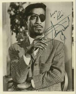
I was standing here one day taking some train shots and some guy told me this was where Say Davis Jr. had the accident where he lost his eye. I asked him if he knew if or not that it had been found? He told me it hadn’t and I told him I would look around before I left.

Strange, but not true … (or, All in favor, say “Eye.”) Oro Grande, Ca.

 Route 66 in Oro Grande, CA

I knew better.  I didn’t know the story or location in detail, so I looked it up on the ‘Google.’ Google has ‘everything’ (Dad was right).

This is not where Sammy Davis Jr. was in an auto accident and lost his eye–it would have been found by now if it were!

I know. I went and looked for it.

http://digital-desert.com/oro-grande-ca/

So I was curious;

A MYSTERY FROM THE MYSTERIES OF THE MYSTERIOUS MOJAVE

Where did Sammy Davis Jr. Lose His Eyeball?

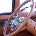
Bullet-shaped horn button on '55 Caddy

Bullet-shaped horn button on ’55 Caddy

As he was making a return trip home to Los Angeles from Las Vegas, Davis lost his left eye to the bullet-shaped horn button (a standard feature in 1954 and 1955 Cadillacs) in an automobile accident on November 19, 1954, in San Bernardino, California. The accident occurred at a fork in U.S. Route 66 at Cajon Boulevard and Kendall Drive (34.2072°N 117.3855°W).

Kendall Rd. & Cajon Blvd.

Kendall Rd. & Cajon Blvd.


BTW; His eyeball is not there either–I looked. If the ‘Google’ says that’s it, that’s it!

The Old Spanish Trail had become increasingly used as a pack mule trail between New Mexico and California, and with this traffic came the opportunity for those to take advantage of the distance and desperate nature of the land.

Crowder (Coyote) Canyon in the Cajon Pass north of San Bernardino
Hundreds and sometimes even thousands of stolen horses from the ranchos would burst through Coyote Canyon beginning their ‘journey of death’ across the Mojave.

California horses were beautiful creatures, and the mules were taller and stronger than those in New Mexico and they were easy to steal.  The rolling hills and plains presented clear paths to the  Cajon where numerous hidden canyons and washes were available to slip into and prepare for the furious run across the desert. Horses would be stolen in herds from many different ranchos at once. Hundreds of horses, even thousands could be commandeered and driven by just a few experienced thieves.

Narrows, Crowder Cyn., Cajon Pass

Chief Walkara, ‘Hawk of the Mountains’ and the greatest horse thief in all of history along with his band of renegade Chaguanosos , and notables such as Jim Beckwourth and Pegleg Smith would work together in this illegal trade. During one raid they were said to have coordinated the theft of 3,000-5,000 horses, driving them to Fort Bridger to trade for more horses to run to New Mexico to trade again. Horses would fall from exhaustion every mile and the local bands of Paiute would feast on the remains.

The rich ranchos of southern California.

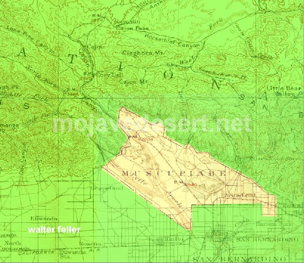
In 1843 Michael White was granted one league of land at the mouth of the Cajon Pass called Rancho Muscupiabe. At a point overlooking the trails leading into and away from the canyon he was expected to thwart the raiders and horse thieves that were plaguing the Southern California ranchos. In theory it was a good plan but in practice it did not work so well.

Devore, ca.
From the piedmont between Devil and Cable canyons, Miguel Blanco could keep an eye out for the horse thieves entering the Cajon.

He built his home of logs and earth and constructed corrals for his stock. However, the location between Cable and Devil Canyon only served as a closer and more convenient target for the Indian thieves. His family was with him, but after six weeks until it became too dangerous. He left after nine months without any livestock and in debt.

The Old Spanish Trail went down this slope to behind Miguel Blanco’s rough-hewn homestead. Indians would watch from this forest for Miguel to leave and they would slip down and steal everything that could be stolen.

Miguel sold his property, however, Miguel had misread the grant, letting the rancho go for much less than it was worth. The land described on the grant was roughly 5 times larger than Miguel thought.  Blanco brought a suit but lost.

Muscupiabe Rancho, Michael White, Miguel Blanco
Muscupiabe Rancho

As the late 1840s and 1850s rolled by wagon roads were being developed in the canyon minimizing the effectiveness of the maze of box canyons being used to cover the escape of desperadoes on horseback. With California becoming a state frontiersmen such as Beckwourth and Peg Leg Smith would not steal from fellow Americans. Horse-thieving under U.S. law had become a crime where before it was just stealing horses from Mexicans. That was only serious if caught in the act. Americans would never extradite them. For the most part, that was the end of the horse stealing raids.

  • end

Victor Valley Crossings

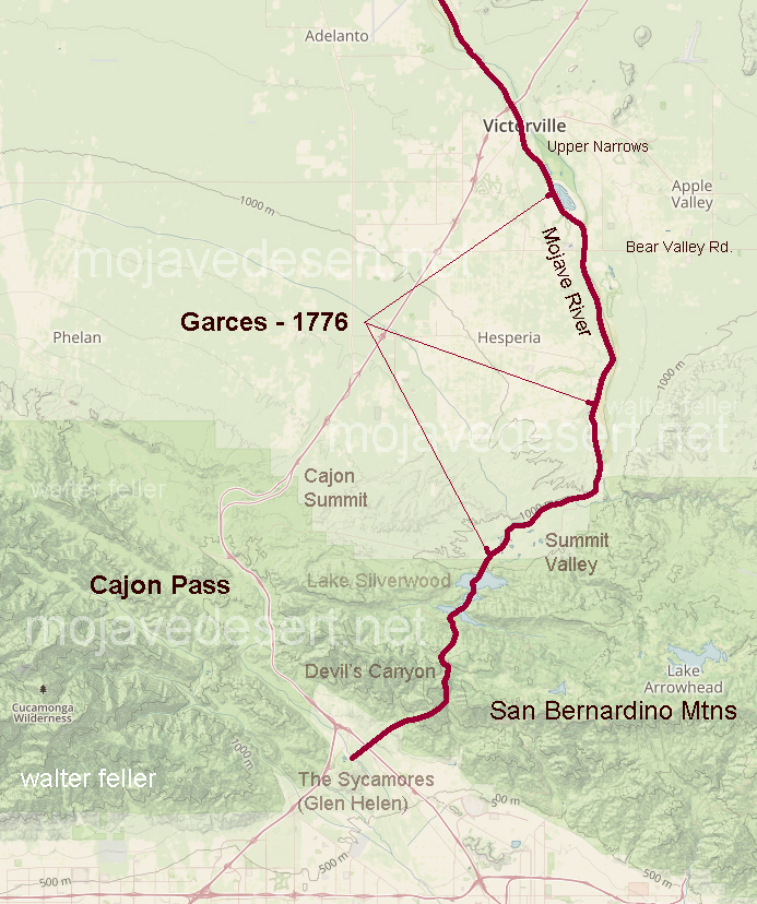
Fr. Francisco Hermenegildo Tomás Garcés, (April 12, 1738 – July 18, 1781) was a Spanish priest who crossed the Mojave Desert in 1776. This map shows his route across the Victor Valley. Following the Mojave River after crossing at Oro Grande he walked through what is now downtown Victorville bypassing the rocky narrows and connecting back with the river near today’s Mojave Narrows Regional Park. Following the river to where the West fork and Deep Creek join to form the Mojave. He visited with the Indians then made his way up Sawpit Canyon and over the mountain ridge descending into the verdant sycamore grove that is known today as Glen Helen.

This map shows the route of Fr. Garces in 1776 during his crossing west. His diary it describes him being taken to an Indian village in the mountains.

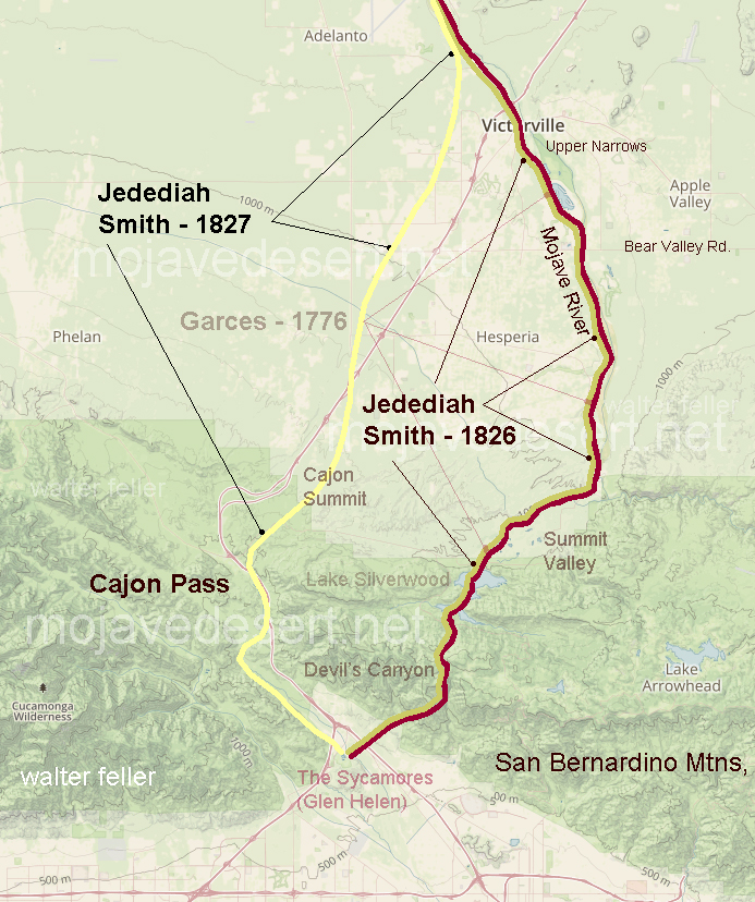
50 years after Fr. Garcés made his way across the Mojave from the Colorado River, in 1826, Jedediah Smith retraced the trail of Garcés along the river then up and over the mountains. In 1827, one year after his first crossing, Smith had lost most of his men in a massacre at the Colorado River. Desperate for the safety of civilization, Smith, after crossing the Mojave River in Oro Grande, made his way directly to the Cajon Pass bypassing the San Bernardino Mountains.

The direct route over the summit and down the pass eliminates the steep climb and descent over the San Bernardino Mountains.

An Invitation to Summit

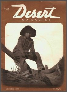
Letters to Desert Magazine, Oct. 1942 

Dear Sir:

When I came over here three months ago, I brought four copies of Desert with me. Needless to say they have become rather dogeared as I have read them from cover to cover several times, and passed them around to my friends who have enjoyed them immensely.

Desert Magazine, Oct. 1942

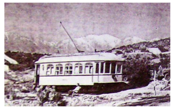
The last day I was in sunny Southern California (it rained all the time I was in Frisco waiting to embark), I made one last sojourn to our desert retreat—the summit of Cajon Pass. Few people know of this unique retreat, except those who pass by on the trains, and then all they see is a street-car tucked away on the side of a hill, 200 yards from the tracks.

The street-car is the former Los Angeles railway’s funeral car Descanso. A group of railfans, known as Railroad Boosters, became interested when it was known the car was to be scrapped, and decided something should be done about it. So far as we were able to tell the Descanso was the only funeral car in existence, and to delegate such an ornate car to the junk heap was not a very fitting end. The L. A. railway then told us that if we could find a place to put it we could have it as a sort of museum piece. After several months of scouting around, we decided on summit. On July 4, 1940, the Descanso was hauled up to summit by flatcar on the Santa Fe. Eight of us spent a very strenuous day unloading the car. It weighed 18 tons.

Chard Walker watching trains pass from the terrace beside the Decanso in 1954. From his book, “Railroading in the Pass”

Three weekends were spent in getting the car to its present position, by the tedious process of laying a section of track in front, pulling the car up with a truck by means of block and tackle, then picking up the section in the rear, placing it up front again, etc. Then began the process of scraping off the old paint, removing the seats, and taking out a few of the unnecessary controllers, etc.

Route 66, Cajon Pass

In the two years that have passed since its arrival at summit, the Descanso has gradually transformed from a dirty looking old streetcar, to that of a newly painted, well furnished cabin. From the exterior it still has the same general appearance of a streetcar as it still is on wheels on a section of rail, the trolley is still up, and still has the stained glass in the upper halves of the windows.

Quite a change has taken place on the interior though. Only two of the original seats are left in place with a folding table in between. A pot bellied stove, and a wheesy old phonograph well stocked with records, dominate the center of the car, while an icebox, a few chairs and another table and a small but complete kitchen take up the rest of the available space. Eventually we may put some folding bunks in one end, but due to material shortage, we content ourselves with sleeping on the floor in our sleeping bags.

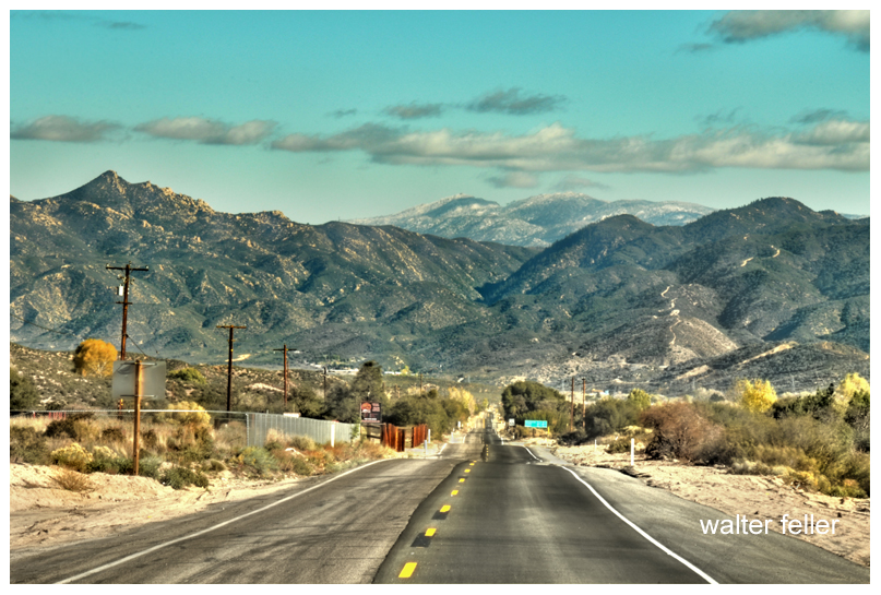
Highway 138 entering Horse Thief Canyon - Summit Valley
Highway 138 entering Horse Thief Canyon (Summit Valley)

We find it an ideal spot to go on a weekend, either as a home camp for a small hunting expedition, or for hiking up and down the railroad, the mountains, or just to lie around in the sun and watch the trains go by.

For anyone wishing to visit Summit, just go up Cajon Pass on U. S. 66 to Camp Cajon, and turn east (right if leaving from San Bernardino). This road is known as the back road to Arrowhead. It’s about five miles from 66 to Summit which can’t be missed as the road leaves the twisting mountain road onto the level Summit valley road. Off to the left about a quarter of a mile is the railroad station of Summit with its scattering of section houses and the post office. The Descanso is directly behind the station.

Summit
Summit

In closing I wish to extend a cordial welcome to anyone visiting Summit, and wish I could be there and meet them personally. Until the war ends I’ve got to be content to visit the desert via Desert Magazine.

Robert W. McGrew – Honolulu, Territory of Hawaii

Van Dusen Road Notes

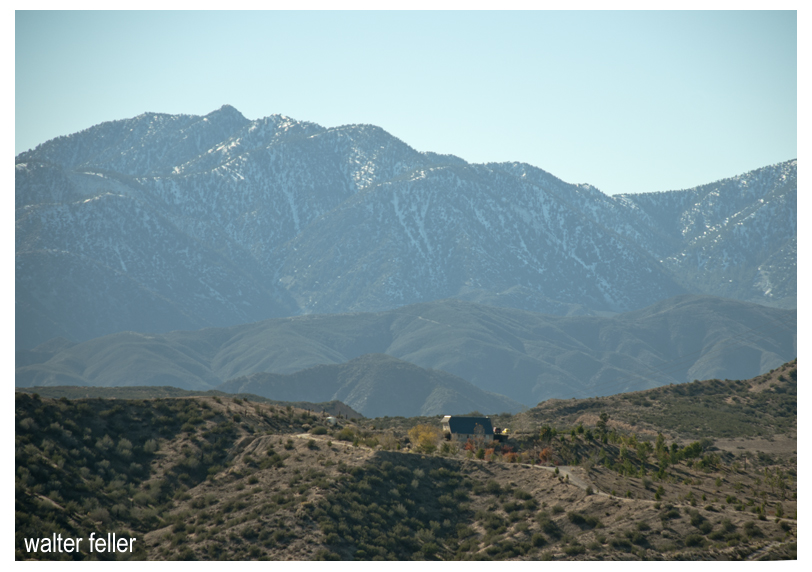
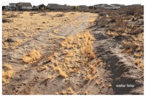
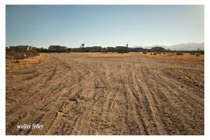
Point of Van Dusen Road crossing Mojave River, Hesperia, CA. Looking toward Apple Valley and Marianas Mountains

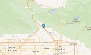
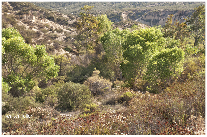
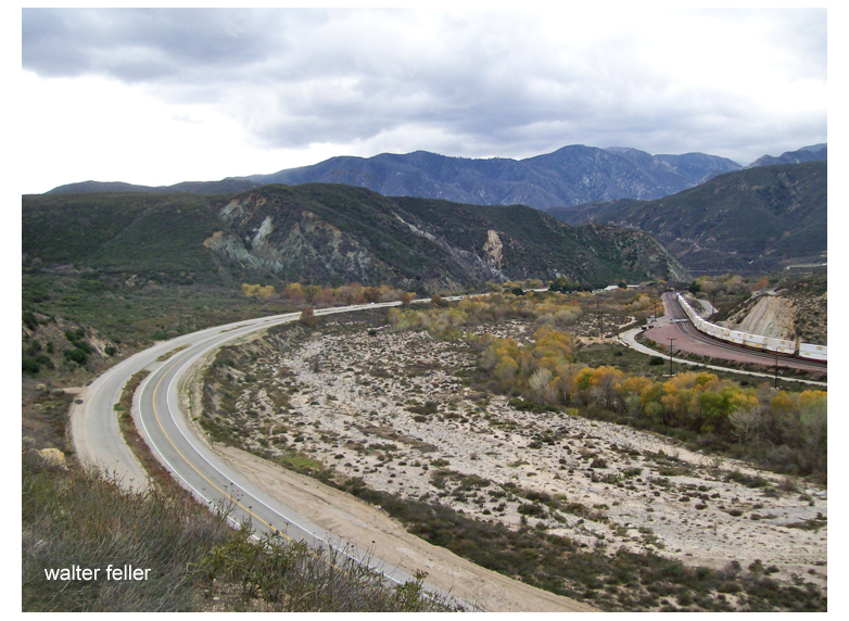
The Van Dusen Road branched off from John Brown’s toll road heading east along the ridge after reaching the Cajon Summit.   The road  found its way down the Antelope Valley Wash to the Mojave River.  At this point the trail crossed through the soft sand and ascended through a small  canyon  at the base of the mountains, finding its way east then southeast to Rock Springs. From the springs the road then branched to the left heading east to Holcomb Valley becoming what is now known as the Coxey Truck Trail.

Looking west up Antelope Valley Wash from the Mojave River toward Cajon Summit

by Walter Feller – 2017

$150,000 Summit Road Route Being Considered

Summit Valley Road

Summit Valley Road

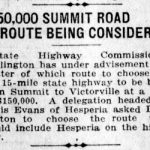
State Highway Commissioner Darlington has under advisement the matter of which route to choose for the 15-mile state highway to be built from Summit to Victorville at a cost of $150,000.  A delegation headed by Louis Evans of Hesperia asked Darlington to choose the route that would include Hesperia on the highway.

Los Angeles Herald, Number 58, 8 January 1919

Pioneer Trail

Pioneer Trail – by Mintor Jackson Steorts

Wagon wheel furrows cut deep in the sand,
winding through desolate desert land,
on through arroyos, climbing a rise
to snow-covered mountains that reach to the skies;
ruts that the elements tried to erase
from the deserts redoubtable face,
but fate has preserved, through all of these years,
the trail of the wagon train pioneers.

We follow their route in a multi-wheel drive
and marvel that anyone could survive.
Through famines, and droughts, and blizzards and rain
on a rumbling ox-drawn wagon train,
and eke out a living from off of a land
of solitude, emptiness, cactus and sand;
Did they vision rainbows way over there
where we find a cauldron and the smog laden air?

What will the future historians find
when they search for the trails we leave behind?
Will our many-lane highway be plain to see,
that leads toward that “Great Society?”
Or maybe they’ll excavate someday,
through atomic ashes to our freeway,
and wonder how anyone could survive,
on a careening, rumbling, four-wheel-drive.

Mohave III – Scrapbooks of History, Mohahve Historical Society, 1966

Back on the Trail

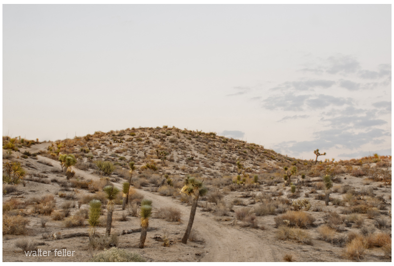
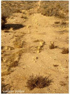
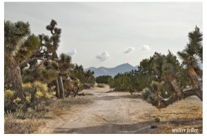
Photo of a possible trace of the Old Spanish Trail/Mormon Road near Hesperia

“It looked a lot straighter on the map.” – Anonymous

The Mormon Road going south across the Oro Grande Wash would come up and head straight into the Joshua trees and juniper woodland.  The slope was fair, the ground hard and the trail reasonably straight.  There were variations, though.  To the eyes of one, one way around a bush may look easier than it does to another.  Trails evolve.  If one branch is significantly better than another, that branch becomes wider and more popular. These branches and shortcuts may join together later.  These variations due to mankind and weather begin a process I have heard to be called, “braiding.”  It is quite possible for the main alignment, the busiest, the center-most version in the corridor to remain in use providing its continued existence to this very day.

Las Vegas Valley – Setting the Stage

During the Spanish Colonial Period (1542-1821) in the American Southwest, the Spanish empire was competing for control over resources with the British, French, and Russian monarchies. They attempted to link colonies in the Spanish territories, later known as the New Mexico and California, by establishing trade routes to form a passageway across the entire Southwest desert region. The Old Spanish Trail was used commercially to link the towns that would later become Los Angeles, California, and Santa Fe, New Mexico, from 1829 until 1848. The abundant spring water available in the Las Vegas (meaning “the meadows” in Spanish) Valley made it an ideal resting point on the trail.

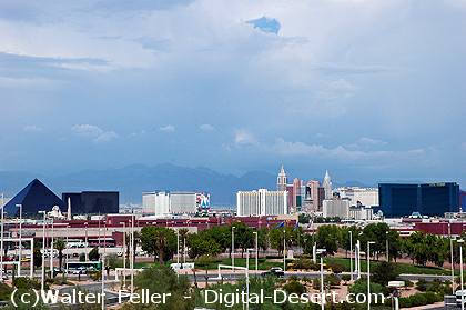
Las Vegas

Las Vegas

The presence of the valley springs also drew the Southern Paiute Indians, a nomadic people moving frequently during the year, who made the valley their winter homeland. They raised small crops near the springs in the valley, which provided water and food for the Indians inhabiting the area and later for travelers making their way across the desert.

The Las Vegas Valley would become an attractive place for other European-American settlers as well. One group of settlers looking for a new home was the Mormons–also known as the Church of Jesus Christ of Latter-day Saints–a religious sect organized by Joseph Smith in New York in 1830. Based on the Book of Mormon, which Smith said was revealed to him by heavenly messengers, this religious body felt called to restore the authentic church established by Jesus and his Apostles. The history of the Mormons is dramatic–filled with persecution, an exodus from the eastern part of the United States, and ultimately successful establishment of a thriving religious society in a desert. The Mormons formed in upstate New York, an area where the Second Great Awakening was most popular as the United States underwent a widespread flowering of religious sentiment and unprecedented expansion of church membership. The group was forced to move several times because of conflicts with residents in various places where they settled, including Ohio, Missouri, and Illinois. They were accused of blasphemy and inciting slave insurrections. After Smith was killed by an angry mob in Illinois in 1844, it became necessary for the Mormons to find a new home once again.

A new leader emerged to guide the Mormons to a new Zion at the Great Salt Lake. Under the direction of Brigham Young, they began an arduous journey West to what would become Utah, where they arrived in July of 1847. In 1848, after the war with Mexico, the United States acquired the majority of what now constitutes the American Southwest. The Mormons petitioned Congress to become the State of Deseret, a word from the Book of Mormon signifying honeybee which was considered an industrious creature, but they were only allowed territorial status. Congress established the Territory of Utah, named for a local Indian tribe, and President Fillmore appointed Brigham Young governor in 1851. Young also became superintendent of Indian affairs. He oversaw the building of Salt Lake City and hundreds of other southwestern communities.

In the middle of the 19th century, the idea of “Manifest Destiny”–a phrase used to explain continental expansion by the U.S.–was embraced by many American people, including the Mormons. They began an industrious campaign to colonize Utah and beyond, establishing hundreds of settlements throughout the West and Southwest. As part of this process, Brigham Young called on volunteers to create a Las Vegas Mission, which would be strategically located alongside the Mormon Road (a portion of the Old Spanish Trail between New Mexico and California), halfway between the Mormon settlements of southern Utah and the San Bernardino Mission in southern California. There were eventually 96 settlements that included Lehi, Provo, Payson, Nephi, Fillmore, Beaver, Parowan and Cedar City. Meanwhile, the discovery of gold in California in 1848 made southern Nevada a corridor for westward emigrants and gold seekers. A gold seeker wrote in his diary on November 21, 1849 about stopping at the Las Vegas creek. Offering the only reliable supply of water for a 55-mile stretch along the Mormon Road, the Las Vegas Valley’s springs were important for watering the mules, horses and oxen of travelers crossing the region’s harsh desert environment. With the opening of the San Bernardino settlement in 1851, there was an additional need for a way station at the Las Vegas springs to provide supplies and rest. The mission the Mormons established as part of the Church’s westward expansion out of Utah became the first non-native settlement in the area, and the Mormons hoped to bring the American Indians into their flock. Although the Mormons occupied the site only from 1855 to 1858, it affected the development of what was to become southern Nevada.

Source – National Park Service

The Division of Trails

Old Spanish Trail in Victorville, Ca. Mojave Desert

The Division of Trails

There is a book titled “Trails across the Mojave” that describes a fork in the Old Spanish Trail that splits off to John Brown’s toll road on the left and the Mormon Hogback and Sanford’s Pass to the southwest. Now the photo showing the fork located according to the directions provided most likely has no resemblance to what the original trail looked like if it were indeed at this particular point. I would say this fork is basically the same alignment in the same location as the trail was 150 years ago. The left goes to Cajon Summit while the right leads to Phelan to descend into the West Cajon Valley.

There is another important location to be remembered, it is the “Division of Trails”  that goes over Cajon Pass. The word “Cajon” is Spanish and means “box”. The steep sides of the formidable mountain pass made the name appropriate.  The rigors of El Cajon must be faced to arrive in San Bernardino Valley. The high Sierra Mountains were the last barrier to the weary travelers.

Here the trails divided. The left fork was the way used by the pack-trains of the Spanish traders and was called the Old Spanish Road. The other road was chosen by the Mormons for they had wagons which could not be pulled up or down the narrow canyon which the Spanish had followed. So, the Mormons made a bend westward to the right to avoid the higher portion of the mountains.  This division of trails is today a a few hundred yards to the east of Highway 395 at the crossroad of Duncan Road.

The Spanish trail turned back to the left and slowly climbed the summit, entering the edge of Horse Thief Canyon. From there they traveled down grade about 6 miles until reaching Crowder Canyon (earlier called Coyote Canyon), then from Cajon junction the road went south which is located today on the present Highway 66. This section in the 1860s and 1870s was known as John Brown’s toll road.

Trails across the Mojave – Grace Jackson, Lucille Matson – 1970

A Story of Four Indian Boys

Devil's Canyon, San Bernardino National Forest, Old Spanish Trail

Devil’s Canyon

One day a wagon train rolled in off the desert to San Bernardino. On this wagon train there were four sick and hungry Paiute Indian boys.

Each one of these boys was placed with separate families in San Bernardino, and each one of the boys, living in a good Mormon home, got better.

One boy went rabbit hunting with his foster brother. There they ran into the Thomas brothers who were also out hunting. One brother got into an argument with the Indian boy. They get louder and louder then the Thomas boy raised and aimed his pistol at the Indian and the Indian immediately raised his rifle and shot Thomas. He fell over dead.

Obviously, it was self-defense and no matter how they looked at it at trial it came out self defense. The Indian was acquitted and went free.

Sawpit Canyon. Old Spanish Trail

Sawpit Canyon

Life went on and things seemed as if things were forgotten and when it came time for the Indian boys to go home, an escort was provided for them. The escort was made up of one of the Thomas’ and several of his friends.

The party left San Bernardino and rather than going up the Cajon Pass, they took the old trail up Devil’s Canyon to the ridge then dropped down into Sawpit Canyon. The area was heavily forested and the young Paiute that had killed the Thomas boy figured out what was going on and slipped into the woods escaping.

Summit Valley, Las Flores Ranch

Summit Valley

The remaining three boys were brought down into what is now the Las Flores Ranch area and summarily murdered. Then they were decapitated and their heads placed on the top of long poles.

Not much was ever mentioned of the incident afterwards most, likely because the boys killed were Indian.

A few years later a caretaker on the property found two of the skulls. He took them and nailed one to each of the gate posts at the entry to the ranch. Being the braggart that he was, he would tell the story of the Indian skulls nailed to the gate and if an Indian wanted to know what that story was, they were welcome to come and an he would happily show them.

(retold from History of Victor Valley – Lyman)

Huntington’s Station

Huntington’s Station was the first trading post in the area, and although Heber Huntington only owned it from 1873 to 1878, it remained known as Huntington’s Station until the the railroad came through and renamed it Victor. The river crossing with a few modern exceptions as the Narrows Bridge, Rainbow Bridge, and the cement plant looks much the same today as it did in 1872 when Mecham built what has become Stoddard Wells Road.

Mojave River, Victorville

Mojave River at Huntington’s Crossing


Are We there Yet?

A TOURIST ASKED
a Desert Rat, “How far would you say it was to Barstow?”

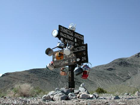
Teakettle Junction, Death Valley National Park

Teakettle Junction, Death Valley National Park

“Well,” calculated the Desert Rat, “It’s 24,992 miles the direction you’re going; ’bout 27 if you turn ’round.”

Adapted from H. Oliver’s Desert Rat Scrapbook.