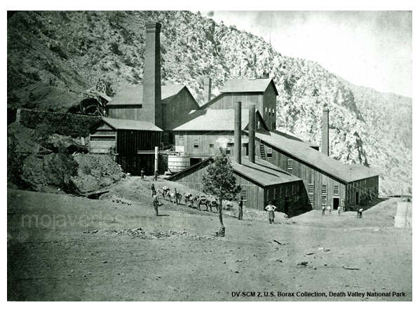
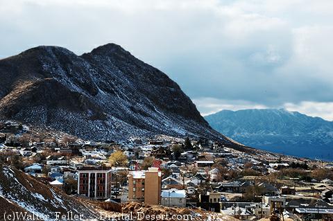
Category Archives: Geography

Modern Cliff Dwellers

by Glenn Adams

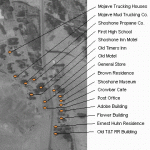
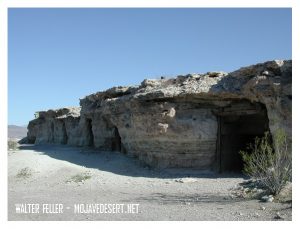
A rental sign  could honestly read, “Doublin Gulch, modern cliff  dwellings for men only.”  But these living quarters, carved out of the earth, are never rented.

They belong to the occupants while they live there,  and the first man to move-in is the next owner. It is not a written law, but is a habit and custom of the country and is respected by rich and poor alike.

It started with Dobe Charley  when he needed a home. A tent was too hot in summer and too cold in winter. he pondered the problem through one  cold  windy winter and one hot desert summer.

When “camping out”  became too unbearable he took refuge in an old deserted mine tunnel a few miles from Shoshone, and was comfortable. He was protected from all weather hazards, but it was too isolated to suit his tastes.

Shoshone, Ca.

Shoshone, Ca.

” Why not make  a tunnel in a hill  closer to town?”  the idea grew, and he looked all over the hills close around. Finally he picked out what he considered an ideal place.

It was a cliff of hard adobe  mud, within easy walking distance of the general store and post office. Not that he intended to walk, that is, that while his motorcycle would run.

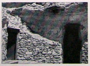
He dug out a whole as big as a medium sized room and put a door on it. When it was finished to his satisfaction, he moved in and became the envy of all the loafers in the little desert oasis on the fringe of Death Valley.

Joe Volmer,  a retiring, middle-aged man, got himself a dwelling nearby. His consisted of several rooms connected by tunnels. To enter one of the rooms one must pull aside a cupboard and go a short distance down a ladder through a narrow passageway.

Ashford Brothers, Shshone, Ca

Ashford Brothers

The Ashford brothers, Harold and Rudy, decided to follow suit. They were dapper little fellows, very English and very neat and clean. Their cliff dwelling reflected them, neat and across the gulch from the others. like its occupants, it stood a little apart from its companions.

Bill, big and lazy, liked Doublin Gulch, but hadn’t  the ambition to dig a dwelling. He built his one-room shack on a level place against the cliff.

Crowly,  aggressive and authoritative, look it over and chose the point of the hill,  a position dominating all the other cliff houses. An imposing location, but like its builder, it was untidy.

Crowly  appointed himself a sort of Mayor of Doublin Gulch. If the others resented it  they gave no indications. Mostly they did not mind as long as no one interfered with their way of life.

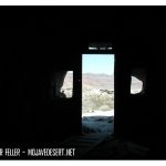
Cool in the summer–and a great view!

Other men settled along the cliff. Thrown together by circumstances, these men were a variable lot. For the most part their past was a closed book. Some, no doubt, came to escape this or that, but on the whole they lived as they pleased, working at the nearby mines until they had saved a stake, returning to their cliff dwelling to live the leisurely until it was gone.

When one has finished with this life and needs his home no longer, another  drifter,  perhaps fleeing from his past or maybe just tired of the sorrows and troubles of the outside world and finding solace in the desert, moves in.

Thus these cliff dwellings of Doublin Gulch have passed from one occupant to another.

Who can tell what secrets they have hidden or what sorrows have been  soothed  by the quiet and solitude of these rugged refuges thrusting their doors from the face of the cliff like turtle’s heads  from under their shells.

Ghost Town News
Knott’s Berry Place
Buena Park, Calif.
December 1944

Dublin Gulch Photos

Warm in the winter, cool in the summer, the caves carved into the soft material of the banks of this wash were home, at one time or another, to people …

Dublin Gulch

Dublin Gulch

Scenes in America Deserta

by Peter Reyner Banhamorld:

Las Vegas, Nv.
Las Vegas, Nv.

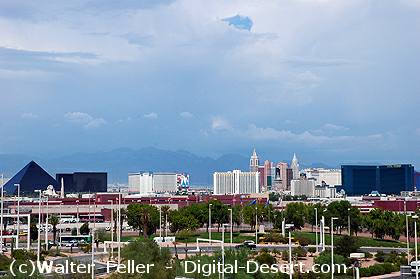
“Las Vegas is a symbol, above all else, of the impermanence of man in the desert, and not least because one is never not aware of the desert’s all pervading presence; wherever man has not built nor paved over, the desert grimly endures – even on some of the pedestrian islands down the center of the Strip! The presence of such an enclave of graceless pleasures in such an environment is so improbable that only science fiction can manage it; the place is like the compound of an alien race, or a human base camp on a hostile planet. To catch this image you need to see Las Vegas from the air by night, or better still, late in the afternoon, as I first saw it, when there is just purple sunset light enough in the bottom of the basin to pick out the crests of the surrounding mountains, but dark enough for every little lamp to register. Then – and only then – the vision is not tawdry, but is of a magic garden of blossoming lights, welling up at its center into fantastic fountains of everchanging color. And you turned to the captain of your spaceship and said, ‘Look Sir, there must be intelligent life down there,’ because it was marvelous beyond words. And doomed – it is already beginning to fade, as energy becomes more expensive and the architecture less inventive. It won’t blow away in the night, but you begin to wish it might, because it will never make noble ruins . . . .”

Peter Reyner Banham. 1982. Scenes in America Deserta. Salt Lake City: Gibbs M. Smith. Pages 42-43.

Victor Valley Volcano

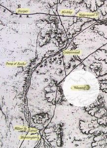
The Wheeler map made in the 1880s shows a volcano between what is Victorville and Barstow.

The questions is; Is the “Volcano” either Stoddard Mountain or Bell Mountain?

Wheeler map 1880s Mojave Desert

Volcano location on 1880s map.

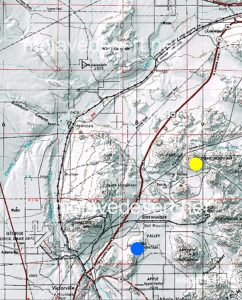
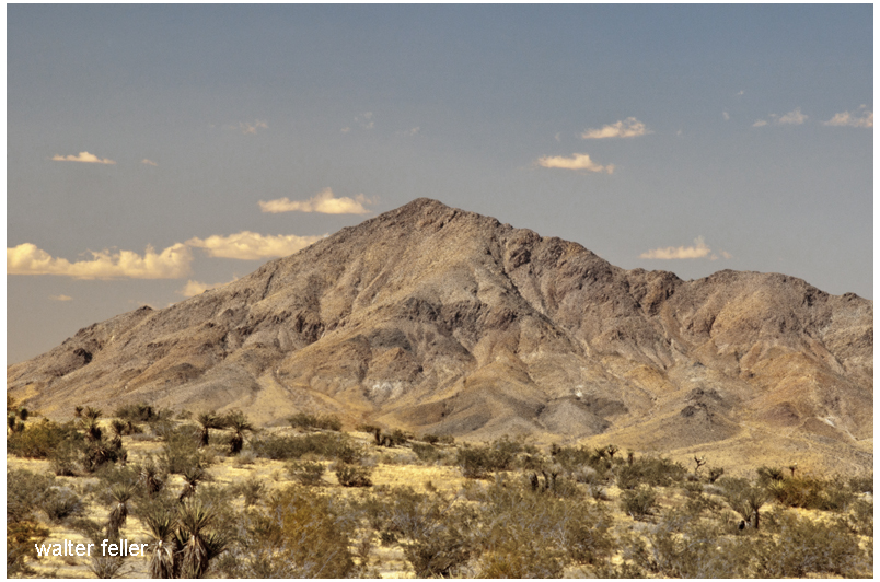
Stoddard Mountain and Bell Mountain (USGS map.

This USGS map shows the location of both Stoddard Mountain (yellow dot) and Bell Mountain (blue dot).

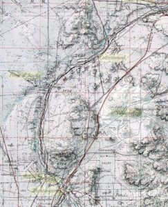
Both maps are superimposed and reconciled to critical match points.

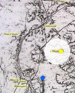
The USGS map layer is replaced with the 1880s map layer and the layer with the location dots is turned on.

 So it looks as if the “Volcano” is nowadays known as Stoddard Mountain.

Stoddard Mountain

Stoddard Mountain

Maybe next time; Is Stoddard Mountain a real volcano?

The High Desert Illusion

Does this …
… Blow your mind?

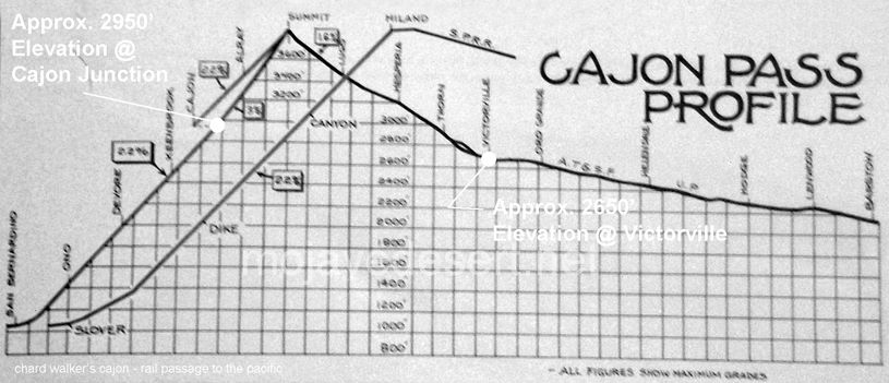
profile of elevations in the cajon pass - chard walker
— Cajon Junction (el. 2950′) at I-15 and Hwy. 138 is actually at about a 300′ higher elevation than Victorville (el. 2650′). The slope from the summit to Victorville is gradual, not as noticeable, and provides us with the illusion that we are further up than we actually are.


The Old Spanish Trail had become increasingly used as a pack mule trail between New Mexico and California, and with this traffic came the opportunity for those to take advantage of the distance and desperate nature of the land.

Crowder (Coyote) Canyon in the Cajon Pass north of San Bernardino
Hundreds and sometimes even thousands of stolen horses from the ranchos would burst through Coyote Canyon beginning their ‘journey of death’ across the Mojave.

California horses were beautiful creatures, and the mules were taller and stronger than those in New Mexico and they were easy to steal.  The rolling hills and plains presented clear paths to the  Cajon where numerous hidden canyons and washes were available to slip into and prepare for the furious run across the desert. Horses would be stolen in herds from many different ranchos at once. Hundreds of horses, even thousands could be commandeered and driven by just a few experienced thieves.

Narrows, Crowder Cyn., Cajon Pass

Chief Walkara, ‘Hawk of the Mountains’ and the greatest horse thief in all of history along with his band of renegade Chaguanosos , and notables such as Jim Beckwourth and Pegleg Smith would work together in this illegal trade. During one raid they were said to have coordinated the theft of 3,000-5,000 horses, driving them to Fort Bridger to trade for more horses to run to New Mexico to trade again. Horses would fall from exhaustion every mile and the local bands of Paiute would feast on the remains.

The rich ranchos of southern California.

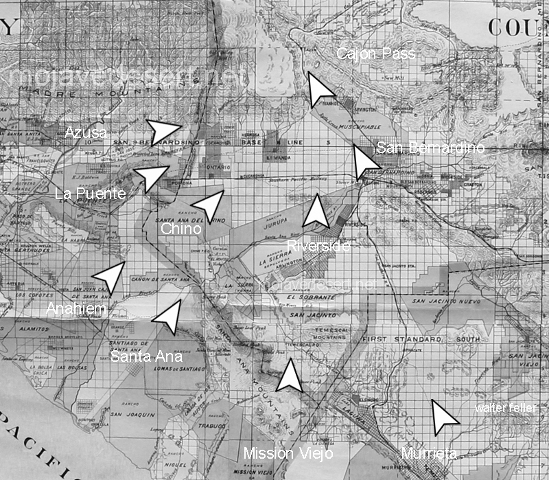
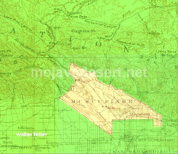
In 1843 Michael White was granted one league of land at the mouth of the Cajon Pass called Rancho Muscupiabe. At a point overlooking the trails leading into and away from the canyon he was expected to thwart the raiders and horse thieves that were plaguing the Southern California ranchos. In theory it was a good plan but in practice it did not work so well.

Devore, ca.
From the piedmont between Devil and Cable canyons, Miguel Blanco could keep an eye out for the horse thieves entering the Cajon.

He built his home of logs and earth and constructed corrals for his stock. However, the location between Cable and Devil Canyon only served as a closer and more convenient target for the Indian thieves. His family was with him, but after six weeks until it became too dangerous. He left after nine months without any livestock and in debt.

The Old Spanish Trail went down this slope to behind Miguel Blanco’s rough-hewn homestead. Indians would watch from this forest for Miguel to leave and they would slip down and steal everything that could be stolen.

Miguel sold his property, however, Miguel had misread the grant, letting the rancho go for much less than it was worth. The land described on the grant was roughly 5 times larger than Miguel thought.  Blanco brought a suit but lost.

Muscupiabe Rancho, Michael White, Miguel Blanco
Muscupiabe Rancho

As the late 1840s and 1850s rolled by wagon roads were being developed in the canyon minimizing the effectiveness of the maze of box canyons being used to cover the escape of desperadoes on horseback. With California becoming a state frontiersmen such as Beckwourth and Peg Leg Smith would not steal from fellow Americans. Horse-thieving under U.S. law had become a crime where before it was just stealing horses from Mexicans. That was only serious if caught in the act. Americans would never extradite them. For the most part, that was the end of the horse stealing raids.

  • end

Victor Valley Crossings

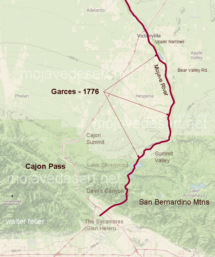
Fr. Francisco Hermenegildo Tomás Garcés, (April 12, 1738 – July 18, 1781) was a Spanish priest who crossed the Mojave Desert in 1776. This map shows his route across the Victor Valley. Following the Mojave River after crossing at Oro Grande he walked through what is now downtown Victorville bypassing the rocky narrows and connecting back with the river near today’s Mojave Narrows Regional Park. Following the river to where the West fork and Deep Creek join to form the Mojave. He visited with the Indians then made his way up Sawpit Canyon and over the mountain ridge descending into the verdant sycamore grove that is known today as Glen Helen.

This map shows the route of Fr. Garces in 1776 during his crossing west. His diary it describes him being taken to an Indian village in the mountains.

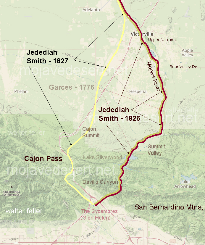
50 years after Fr. Garcés made his way across the Mojave from the Colorado River, in 1826, Jedediah Smith retraced the trail of Garcés along the river then up and over the mountains. In 1827, one year after his first crossing, Smith had lost most of his men in a massacre at the Colorado River. Desperate for the safety of civilization, Smith, after crossing the Mojave River in Oro Grande, made his way directly to the Cajon Pass bypassing the San Bernardino Mountains.

The direct route over the summit and down the pass eliminates the steep climb and descent over the San Bernardino Mountains.

An Invitation to Summit

Letters to Desert Magazine, Oct. 1942 

Dear Sir:

When I came over here three months ago, I brought four copies of Desert with me. Needless to say they have become rather dogeared as I have read them from cover to cover several times, and passed them around to my friends who have enjoyed them immensely.

Desert Magazine, Oct. 1942

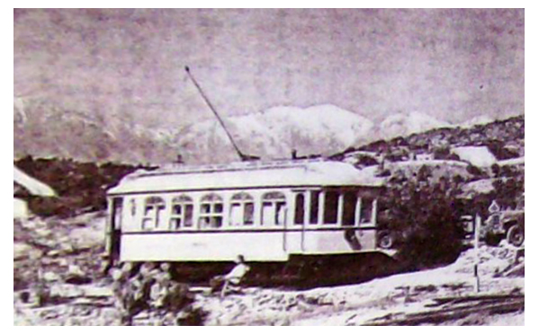
The last day I was in sunny Southern California (it rained all the time I was in Frisco waiting to embark), I made one last sojourn to our desert retreat—the summit of Cajon Pass. Few people know of this unique retreat, except those who pass by on the trains, and then all they see is a street-car tucked away on the side of a hill, 200 yards from the tracks.

The street-car is the former Los Angeles railway’s funeral car Descanso. A group of railfans, known as Railroad Boosters, became interested when it was known the car was to be scrapped, and decided something should be done about it. So far as we were able to tell the Descanso was the only funeral car in existence, and to delegate such an ornate car to the junk heap was not a very fitting end. The L. A. railway then told us that if we could find a place to put it we could have it as a sort of museum piece. After several months of scouting around, we decided on summit. On July 4, 1940, the Descanso was hauled up to summit by flatcar on the Santa Fe. Eight of us spent a very strenuous day unloading the car. It weighed 18 tons.

Chard Walker watching trains pass from the terrace beside the Decanso in 1954. From his book, “Railroading in the Pass”

Three weekends were spent in getting the car to its present position, by the tedious process of laying a section of track in front, pulling the car up with a truck by means of block and tackle, then picking up the section in the rear, placing it up front again, etc. Then began the process of scraping off the old paint, removing the seats, and taking out a few of the unnecessary controllers, etc.

Route 66, Cajon Pass

In the two years that have passed since its arrival at summit, the Descanso has gradually transformed from a dirty looking old streetcar, to that of a newly painted, well furnished cabin. From the exterior it still has the same general appearance of a streetcar as it still is on wheels on a section of rail, the trolley is still up, and still has the stained glass in the upper halves of the windows.

Quite a change has taken place on the interior though. Only two of the original seats are left in place with a folding table in between. A pot bellied stove, and a wheesy old phonograph well stocked with records, dominate the center of the car, while an icebox, a few chairs and another table and a small but complete kitchen take up the rest of the available space. Eventually we may put some folding bunks in one end, but due to material shortage, we content ourselves with sleeping on the floor in our sleeping bags.

Highway 138 entering Horse Thief Canyon - Summit Valley
Highway 138 entering Horse Thief Canyon (Summit Valley)

We find it an ideal spot to go on a weekend, either as a home camp for a small hunting expedition, or for hiking up and down the railroad, the mountains, or just to lie around in the sun and watch the trains go by.

For anyone wishing to visit Summit, just go up Cajon Pass on U. S. 66 to Camp Cajon, and turn east (right if leaving from San Bernardino). This road is known as the back road to Arrowhead. It’s about five miles from 66 to Summit which can’t be missed as the road leaves the twisting mountain road onto the level Summit valley road. Off to the left about a quarter of a mile is the railroad station of Summit with its scattering of section houses and the post office. The Descanso is directly behind the station.

Summit
Summit

In closing I wish to extend a cordial welcome to anyone visiting Summit, and wish I could be there and meet them personally. Until the war ends I’ve got to be content to visit the desert via Desert Magazine.

Robert W. McGrew – Honolulu, Territory of Hawaii

1917 Summit Valley History

From a handwritten copy on file at the Victor Valley College Library – Author Unknown

More than 30 years ago the green grass and running water of Summit Valley attracted the white people who later became the first settlers here. Mr. Houghton took up a Government claim, the plan now included in the Las Flores Ranch. Cattle were driven in from Arizona to be fattened and then driven to market San Bernardino. This entire valley was given over as a cattle range. The grassy slopes afforded splendid pasture lands and Mr. Houghton was well pleased.

Las Flores Ranch, Summit Valley, Hesperia

Las Flores Ranch

Still there were some hardships to be endured in this new country. Many wild animals roam the hills, mountain lions stole the young cattle in the small brown bears came in droves to find what they could  to eat.  At times Mrs. Houghton and the children were obliged to climb into the attic of their house to be safe from the bears.  After robbing the  hives of honey, these bears would go back into the nearby hills and mountains, disturbing nothing more.

The Indian inhabitants of the valley were unfriendly and while Mr. Houghton owned the ranch three men were killed by the Indians in ambush.

About 30 years later Mr. Bircham bought the ranch and continued to run it as a cattle ranch. Each year more cattle were put on the range. A great many horses were brought into the valley too. These proved to be a temptation for horse thieves, who made a regular practice of stealing horses and selling them in other places. Finally, the two neighboring canyons received the names of Big and Little Horse Thief Canyon. At length, the horse thieves were driven out, but the smaller of the two canyons still retains the name of Horse Thief Canyon, the larger known as Summit Valley.

Little Horse Thief Canyon

Little Horse Thief Canyon

All traveling was done with horses until a railroad called the Southern California was built. This road went through in the year 1883 and 1884 and followed the old Santa Fe Railway Company.  The highest point along the road was called Summit and a station was established there at once. It was located about 6 miles west of the Bircham Ranch and became their shipping point for supplies.

At the time when it was believed that oil was hidden in the land all through Southern California, the Summit Valley was located for oil, but the government authority on oil found that it was not present in this land.

The Arrowhead Reservoir and Power Company wish to buy up lands in the mountains in order to gain the water rights attached. Mr. Bircham’s holdings of 1200 acres were bought and various other lands nearby.

The ranch was now owned by a company, it was no longer the Bircham Ranch or the Houghton Ranch,  so another name was to be found. The name decided upon was “Las Flores,”  meaning The Flowers, and a very fitting name it was as one looks towards Mount Baldy and its companions, the fields in the summertime seem yellow with flowers.

Summit Valley with San Gabriel Mountains

The ranch was still conducted as a cattle ranch but it was not long before the range, on which the cattle had roamed, was disputed by new settlers. In 1912, Mr. Searle and his family filed on government land for a home. Later in the same year, Mr. Blumberg’s family moved in, then Mr. Watson, and so it has been ever since that time.

There were enough children in 1913 to form a new school district and open the school. Within the next year,  a post office and store were opened. Fertile land with quantities of water upon it brought about these changes in Summit Valley.

At the present time, an option is held on the holdings of the Arrowhead Reservoir and Power Company, to be closed within the next eight months. This land is to be sold with the water rights, for the purpose of irrigating 100,000 acres of land in the Victor Valley changing it into a great garden.

 San Bernardino looks upon this great undertaking with interest. It will mean much to that city since this section in San Bernardino is connected by an automobile and railroad.

Scrapbook of Memories of Summit Valley & Cedar Springs
from before the Tin Lizzy until after Silverwood Lake – collected by Isabelle Rue Rentfro

1864 Travel Tip – Hold Hostages

From the diary of Sarah J. Rousseau , 1864:
Regarding traveling with Indians across the Mojave

Sunday, November 6 … The lava that has been thrown out looks like cinders. The mountains, some of them have a grand appearance, some a red color while others have a white appearance. Some of them I think must be 400 feet high. This canyon is called Diamond. at the mouth it takes us into Santa Clara Valley which we traveled through and down a pretty dangerous hill to Santa Clara Creek where we got food and shelter for horses. Here came a number of Paiute Indians. they are a tribe that is very fond of horse flesh to eat, and will steal anything they can lay their hands on. We have came today 20 miles.

Santa Clara/Virgin River divide

Monday, November 7. Started from camp late this morning. It is a cold, windy time. The Dr. had to prescribe and deal out medicine for a little child that belonged to a Mormon Bishop. About breakfast time a number of Indians came to the camp and we gave some their breakfast. When we started four of them started with us, three of them on foot and one on horseback. They are miserable looking creatures. Some of them almost entirely destitute of clothing. I believe it is their intention to go to the Muddy with us. as for me I would rather have their room than their company. I am afraid of them. We have crossed the Santa Clara 15 times this morning, and have now camped. It is cold and windy, a real disagreeable time.

Sarah Jane Rousseau

Sarah Jane Rousseau

Tuesday, November 8. A cold blustering morning, the wind blowing hard all night. Started from our camp rather late with an escort of from 10 to 15 Paiute Indians. Last night two of them stayed with us as prisoners. Our guide, Mr. Hatten, said it would not do to let them leave camp after dark, as they might get some other Indians, come back and do us some mischief. We started from camp with five, which increased to 15 of them. We crossed the Santa Clara this morning 14 times in after going 12 miles made a dry camp at Camp Springs, having filled our kegs the last crossing place. the Indian chief told the guide we must all give them something for traveling through their country, to renumerate them for using water and grass. We all gave them some flour. We intend to let them have the care of our horses tonight, they are going to take the cattle as well. The Chief with four others we kept as prisoners till morning when they bring back the stock. Then they will be free.

Virgin River

Virgin River

Wednesday, November 9. A pretty warm morning. Started from camp about sunup. The Indians brought back the stock safely back. Left camp with our escort, traveled over some rough roads till noon. This afternoon the road’s much better. Passed over the summit between the Clara and Virgin, went 5 miles in the canyon and camped. Some grass for the stock but no water.

Wagon Master Nicholas Earp Wyatt's dad.

Wagon Master Nicholas Earp

Thursday, November 10. A cool but pleasant morning. Last night the Indians were prisoners again. They left the stock go on to the mountains to feed. We fed five among us. All are willing to do so but Mr. Earp. He swears and cuts up about it, although he derives the same benefit as the rest of us. I fear he may cause us some trouble when we get to the Muddy. … “

History of Lucerne Valley

by Ethel V. Owen

In the early days, natural springs in what now is Lucerne Valley provided good camping grounds for Indians on their way into the San Bernardino Mountains together pinon nuts. The Indians  resented white pioneers settling in the territory and committed some violent acts against them. Instead of discouraging the settlers, caused them to marshal forces and attack the Indians  who were of the Paiute, Chemehuevi and Serrano tribes. in February 1867 a decisive battle at chimney rock caused the Indians to retreat and leave the territory to the white pioneers. (Chimney Rock is at the north edge of Rabbit Dry Lake. A quite complete story of the Chimney Rock Massacre is available at the Lucerne Valley branch of the county library.)

Rabbit Springs

Rabbit Springs

In July, 1873 five men, L. D. Wilson, John E. McFee, W. S. Manning, W. P. Morrison and (?) Holmes located the springs known as Rabbit Springs. They laid claim to the Springs and 100 surrounding acres 20 acres each according to a recorded document.

In 1884 Peter Davidson operated a way station at Rabbit Springs. Travelers could get fresh water, exchange news, rest and sleep over. “Uncle Pete” died in 1906. His grave is at the corner of Kendall Road and Rabbit Springs Road.

Pete Davidson's grave

Pete Davidson’s grave

In 1886,  W. W. Brown brought his family to this valley, which was without a name at the time. Brown had the water rights at the Box S. (The Box S ranch is where the drainage ditch now crosses Highway 18.) The family stayed at “Uncle Pete’s” until an abandoned house could be moved on to the Box S property.

Box S Ranch, Lucerne Valley, CA.

Box S Ranch, Lucerne Valley, CA.

In 1896 Al Swarthout  acquired the Box S, intending to raise cattle. There was plenty of water but not much  forage. Swarthout and a friend found a place about 15 miles to the east, that had even more water and lots of forage.  after one year he gave up on the Box S  and moved to Old Woman Springs Ranch. (It is said the Indians used to leave their old people camped here while the young ones went into the mountains to forage for pinon nuts.)

In 1897 James Goulding came to the Box S  with his wife Anna and two small children, Mamie and George.  Three more children, Minnie, Jim, and Nelly were born in Lucerne Valley. “Dad” Goulding proved the fertility of our soil with his apple orchard, vegetable garden and alfalfa fields.  He also raised cows, horses and other animals. He dug a well which proved to be artesian.

Alfalfa field in Lucerne Valley

Alfalfa field in Lucerne Valley

In 1905 a friend suggested to Goulding that this valley should have a name.  Because of his success in growing alfalfa (also  known as lucerne)  he christened this place Lucerne Valley.

Dad Goulding is generally acknowledged as the founder of Lucerne Valley. In 1907 Goulding legally established Lucerne Valley School District. Hanna Brown, a cousin whose family lived in near by Oro Grande, came to live with the Gouldings so the requirement of six students could be met. The school building was a former cook shack on wheels, 8′ x 18′.  With wheels removed and one end of the inside painted black for a blackboard, the school opened on September 9, 1907 on the Box S Ranch.

In the meantime, more families were settling all over Lucerne Valley, and Goulding donated property in 1910 for a new school where the Baptist Church now stands.

In 1912, people in the east end of the valley thought the  school should be closer to them,  so they formed a new school district  to be known  as Midway. Still another school district, Rodman, was formed in North Valley, in 1915.

View of Lucerne Valley from North Valley

View of Lucerne Valley from North Valley

Then, in 1916, windstorms and fire destroyed both Lucerne Valley and Midway schools. all the students attended Rodman school until the other two were rebuilt, which took a couple of years  because of wartime problems. In 1920 Rodman School District lapsed and joined with Midway, which by then was in its present form.

In 1941 was certain school was condemned as unsafe and all  students went to Midway. The building and grounds were purchased by the Community Church ( not the present Community Church) and used until 1952. It was then that the building burned to the ground during a terrific  windstorm at night.  Construction was begun in 1952 on the new Lucerne Valley School at its present site.

Lucerne Valley’s library began in 1912 with 140 books in the front room of the Box S ranch house. Most of them were for school use, but some could be borrowed by local residents. In 1915 the library was at Midway school. In 1916 storm damage some of the books in the library was moved to the Boom Ranch on Wilshire, northeast of Midway. After being closed during World War I, both Midway school and the library reopened in September 1918. The library continued as a combination school-public library until March 1928, when it became a community branch of the county library system.

The Lucerne school building was condemned for school use, so the library moved in. When the church  bought the building, the library was moved into a smaller room there. Later it was moved into a small, narrow trailer behind the present China House.  Ethel Windschanz Clapton, the librarian, said that looking out the little, porthole shaped windows during a strong wind made her feel like she was on a sinking ship.

The library moved begin to the building which was occupied by the Sheriff’s office. Mrs. Vera Russell was one of the librarians at that location. The library then moved into the building generously provided by John Russell (Vera’s  son) at very low rent.  From there moved into its beautiful new permanent home for which ground was broken March 17, 1988.

Lucerne Valley post office was established in 1912 at the ranch of John and Rosa Koehly, who came here in 1909. It was on the southeast corner of Rabbit Springs Road and Post Office road.  (Have you wondered about the road name?) Rosa Koehly  was postmistress. Some days only eight cents worth of stamps were canceled, so that was the postmistress’s salary.

In 1935, the post office moved to a one-room building on the highway, west of the Box S Ranch, with Ed Smith as postmaster.  (Ed Smith was also a licensed electrician  and Scoutmaster of Troop 71,  Lucerne Valley’s first Boy Scout troop, from 1928 to 1933. Some of those scouts are still living here, among them  Harold Reed and Dick Owen.)

Downtown Lucerne Valley, CA.

Downtown Lucerne Valley, CA.

Later the post office moved again, to shared the Clark building with John Hutson’s and Irving Seeberg’s hardware store. ( The Clark building is now occupied by the China House.)  Flora and Clark was postmistress. The post office moved again to “the triangle”  on Verdugo Road at Oracle Road ( now renamed Oracel  by the county street sign makers.)  Early postmasters there were  Vern Ely and Ray Bonin. The post office is now in its permanent location on Highland Avenue south of Highway 18.

A volunteer fire department was first organized during World War II, along with fire watchers, skywatchers, plane watchers, civil defense, etc. In the early 50s a fire house was built with donated material (cinderblock) and volunteer labor.  it was located about where Shell gas station/ Halleck’s Market  is now. They had a unique system. People would phone Dick’s Center Store to report fires. Dick Grobaty would then press a button on his wall, which was wired to the siren on top of the firehouse. That was how the  volunteer firemen were summoned. The building was torn down after a  short period and the present County fire district was formed in 1962-63. At that time it still operated with volunteer firemen and one paid chief.

Lucerne dry lake

Lucerne dry lake

Some of the descendants of the early settlers still live here. John Russell’s father, William Russell in 1911 had filed on land called Lucerne Springs which brought son John here to live in 1949. He has been building houses and commercial buildings ever since. Also in 1911, Theodore P. Owen filed on 640 acres to miles north of Midway school his son, Dick, has come and gone but has lived here steadily since 1950.

View from shack at Gobar Ranch

View from shack at Gobar Ranch

Athene Siewerda  was another very early settler. She was the first to have pistachio trees here. Her son, Joe Sherman, lives here now  Orlando (Jake)  and Mildred Jacobs came here in 1928. There were about 250 people in Lucerne Valley then. At the Jacobs home in North Valley, Jake bake 60 or 70 loaves of bread, sweet rolls, cakes and pies on Saturdays and sold them through Max Lewis’s grocery store. Later he rented from Goulding  the building now housing the Rosebud Gift Shop and established Homestead Bakery and Grocery. At that same time Mildred ran the Jackrabbit Café, located on land now occupied by Halleck’s Market.  In 1936 Jake in Mildred moved their house onto land they bought from the Southern Pacific Railroad, the southeast corner of Barstow Road and old woman Springs Road. The Jacobs  donated 10 acres of their land which is now Pioneer Park. As Jake’s health failed, Mildred gave up  the café  and ran the Homestead Bakery. She, along with other citizens, still found time to clear implant for the park, along with other citizens. The Jacobs had two daughters, Shirley Ann  and Millie Lou. Millie Lou lives in Maryland and Shirley Ann (Mrs. Bob Fuller)  lives in Apple Valley.

Ethel Owen came in 1946 as Ethel  Johnston and built Lucerne Valley’s first beauty shop.  Ethel  and Dick Owen  were married in 1950 in the old community church and their daughter, Lilli Ann, born in 1952, was dedicated there shortly before it burned down.

The foregoing was prepared by  Ethel Owen  on March 25, 1988 from material obtained from Lucerne Valley library and from her own memory. She apologizes for any inaccuracy of dates of facts and/or  omissions. There is much to be added that could not be contained in these pages.

From: History of Lucerne Valley by Ethel V. Owen
Mohahve V – Scrapbooks of History – 1991, 2016
Mojave Historical Society

The Cajon Pass — Yesterday

by Myra McGinnis 1968

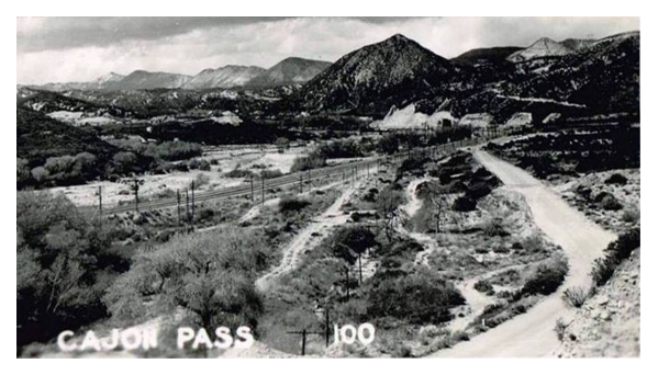
Long years ago, Cajon Pass became the gateway into the desert interior of California.   The word “cajon”  means box in Spanish and was fittingly applied to the area that has served as a pass through the rugged country between the desert and the valley lands west.

San Gabriel Mountains

Cajon  is not a pass through a mountain. It is a pass between two mountain ranges —  San Bernardino and San Gabriel Mountains which overlap. It was through or around this pass that the early settlers had to travel. Either way, it was a difficult trek of uncharted roads and highways. for that time and era, it would seem that settlers might want to stay on the eastern side of the ranges and settle down rather than try to get horses and wagons over the steep and hazardous mountains.

Horse-drawn wagon

Many years in the past the Pass  became  the “gateway into the wilds of the interior.”  What an interior it is!  coming or going from the coastal area of Southern California that great mass of mountain peaks and sheer drops from the high precipices are startling and they culminate into the one of the most rugged as well as one of the most beautiful in the West.

The fact that this pass was at the western end of the Old Spanish Trail made it an important spot in the emigrant days.

Old trail
Old road over the divide near the summit of the Cajon.

Camp Cajon, 3 miles above the Blue Cut was once an Indian village. Here the pass becomes wider, a fan-shaped site bounded by the divide on the upper edge. the divide is the desert rim. Eroding water cause the formation of the two major divisions which are known as East and West Cajon.

The divide at the top of the pass

Long before the Cajon Pass was an accepted one and used freely, the wilderness of the Cajon region was a hideout for renegade Indians and white men.  Cattle and horse stealing became so common that the people of the lower valleys had to take to battle.  Once in the interior of the vast mountain area beyond Cajon it was almost impossible to recover the animals.

Brown's toll road
Brown’s toll road through the Pass.

One of the historic roads that benefited the desert for many years was built by John Brown Sr. , an early desert  settler. This was the toll road that he built to connect the desert territory with the outside areas. The toll road served the public for 20 years. It was built from the Cajon Pass to the old Verde Ranch adjacent to Victorville.

from: The Cajon Pass — Yesterday
by Myra McGinnis 1968
Mohahve IV – Scrapbooks of History
Mohahve Historical Society

Chapter X: The Mojave Desert

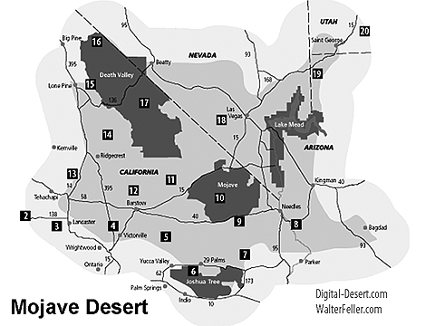
Mojave Desert

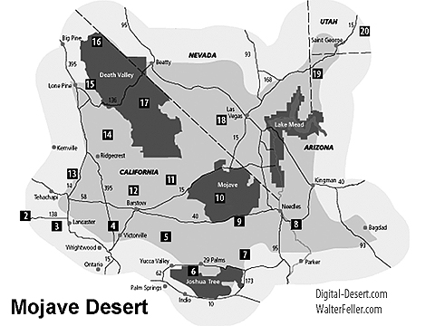
Mojave Desert Map

An exceedingly interesting region of California is known as the Mojave Desert. The region is traversed for a distance of 100 miles by the Mojave River, from which it gets its name. The area includes Inyo and San Bernardino counties, and eastern Kern, northeastern Los Angeles, and northern and eastern Riverside counties. Death Valley lies to the north. There is no definite line of demarcation separating the desert to the south from the similarly desert region lying to the east of Owens Lake, and including Death Valley and the Amargosa Desert.

Location and Extent

49 Palms Oasis

Mojave Desert is separated from the Colorado Desert, which lies to the south, by a series of southeasterly trending mountain ranges. The San Bernardino Range extends southeast from Cajon Pass more than 100 miles, and the Cottonwood, Chuckawalla, and Chocolate ranges extend to the Colorado River. The San Gabriel Range separates the desert from the Los Angeles basin on the south. The Desert is bounded on the west by the southern Sierra Nevada Range and the Tehachapi Mountains. It extends north to the latitude of Mount Whitney, and east to the State line and into Nevada. On the south and east it extends to the Colorado River, which forms the boundary of the State of Arizona. It is a part of the Great Basin region of North America. This vast desert region embraces more than 30,000 square miles, an area almost as large as that of the State of Maine. It is a vast arid region destitute of any drainage streams that reach the ocean. The water supply, such as there is, is obtained from springs and wells. The region is much broken by mountains and hills, often rough and rocky.

San Bernardino Mountain Range

San Bernardino Mountain Range


Soda Lake

Soda Lake

The topography is typical of the western deserts, consisting of bare mountain ranges and isolated knobs separated by nearly flat arid belts of varying width. The mountains rise abruptly from the desert, in places almost precipitously. The appearance of the mountains suggests that they are the summits of more massive ranges whose lower slopes are submerged beneath unconsolidated desert deposits. It is thought the irregularly distributed ranges and peaks of the southeastern Mojave Desert are ridges and peaks of a former vast mountain system comparable to the Sierra Nevada, which has been lowered by subsidence of the region, and by erosion, which has resulted in tremendous valley-filling. Alluvial fans occur at the mouths of gullies, and these unite into broad aprons which slope gently toward the centers of the basins. In the center is generally a flat nearly level area known as a playa, dry lake, or alkali flat. Such flats may be covered with water during parts of the year, and they are commonly covered with a white crust of alkali or salt. Toward the west the surface of the desert is generally level. Toward the east it is marked by isolated knobs and short ranges of mountains having no system of arrangement, and separated by broad stretches of alluvial deposits in the form of fans and playas. To the north, in Inyo County, mountain ranges are prominent and are arranged in a somewhat definite north-south system.

A striking feature of the landscape in many parts of the desert is the presence of flat areas ranging in extent from a few acres to many square miles, which are entirely devoid of vegetation. This intensely arid region, lying between the Sierra Nevada Range and the Colorado River, is in extreme contrast with the region lying west and south of the San Gabriel Range, in Los Angeles and Orange counties. However, wherever sufficient water can be obtained in the desert ranches have been developed, and their bright green is a welcome sight to the traveler weary of the interminable desert waste and the dark, forbidding mountains. Many of the valleys or basins that separate the mountain ranges are absolutely desert, totally destitute of water,  and treeless for distances representing many days’ journey, gray sage brush alone giving life to the landscape. In the larger basins the land slopes toward a central depression into which an intermittent stream may convey water during rainy seasons, forming playas or mud plains. Some larger valleys have permanent lakes, and these are saline or alkaline. The shores of such lakes are devoid of all forms of life except salt-loving plants.

Arid Conditions Due to Mountains

The great Sierra Nevada mountain system is the factor which determines the climate of the  desert region. The moisture-laden winds from the Pacific Ocean shed their moisture upon the high mountains, and the lands to the east are left literally “high and dry.”

Death Valley Region

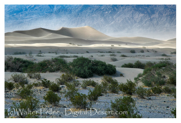
Mesquite Flats Sand Dunes, Death Valley

Mesquite Flats Sand Dunes

Saratoga Springs

Saratoga Springs, Death Valley

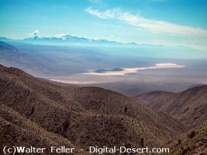
An outstanding feature of this great desert region is Death Valley. This remarkable sink of the earth’s crust is located about 50 miles east of the Sierra Nevada Range, 6 to 35 miles west of the Nevada State line. This depression of the earth’s crust has a length of more than 80 miles, and in width ranges from two to eight miles. It is 60 to 70 miles east of Mount Whitney, the highest point in the United States. The lowest point in Death Valley, according to the U. S. Geological Survey, is 296 feet below sea level. This point is three miles east of Bennett’s well, about 30 miles in a direct line west from Death Valley Junction on the Tonopah & Tidewater railroad, and  about the same distance northwest from Saratoga Springs, following the road down the valley. The rainfall does not exceed two to three inches annually, with no precipitation at all some years. Mountain ranges on either side of the Valley rise nearly to the line of perpetual snow. Funeral Mountains and Black Mountains, of the Amargosa Range, rise on the eastern side of the Valley to altitudes of 5,000 to 7,000 feet, while on the west the Panamint Range reaches a height of more than 10,000 feet.

High Temperature and Low Humidity

The most marked feature of the desert climate is the unusually high summer temperature and the low relative humidity. Temperatures in this arid region rise to 125 to 130 during the
summer months, and seldom during these months fall below 70. The humidity is low so that conditions are more endurable than would be the case under such conditions of heat in regions
of higher humidity. The highest officially recorded temperature of any place in the world is that of 134 at Greenland ranch in Death Valley. This is said to be the dryest and hottest place in the United States. A low temperature of 15 F. has been recorded at Greenland ranch. The difference between the highest and lowest recorded temperatures however is not as great in this desert region as in some parts of the United States. In the Dakotas and Montana differences of 150 have been recorded. In the desert region sunstroke is almost unknown, due to the low humidity. Because of the dryness of the air the moisture given off by the body quickly evaporates producing a cooling effect. Travelers in the desert should be provided with a sufficient water supply. One should never go far from a source of water, in winter or summer, without enough water to last until another supply can be reached. Travelers should carry at least two to four gallons of water per person for each 24 hours.

Three Rivers that Do Not Reach the Sea

Three rivers enter upon the vast domain of the Mojave Desert from high mountain ranges, but none delivers any water to the ocean. These are the Mojave, the Owens, and the Amargosa rivers. The rivers originate on high mountain ranges, fed by melting snows that gather upon the high ranges and peaks, and by rains that are condensed from the wind-borne clouds at high altitudes. These all start as rapidly flowing turbulent torrents. They continue for many miles as intermittent streams, but ultimately disappear by evaporation after passing into the porous soils and sands, detritus from the erosion of the mountain slopes. Other streams that flow as mountain torrents to the great desert plain sink at once into the sands and are “lost” as streams.

West Fork - Mojave River

West Fork – Mojave River


The Mojave is a typical desert river. It rises in the high San Bernardino Mountains, in southwestern San Bernardino County. The waters gather in the mountains and form a perennial stream. Within a short distance it emerges upon the desert plain, and much of the water sinks into the porous alluvium. The course of the stream is in a northerly direction to Barstow, where it turns to the northeast. In times of flood the water may be carried 40 miles east of Daggett to Soda Lake. Water sometimes flows into Silver Lake, another playa a mile or two to the north of Soda Lake. During many years no water from the river reaches the playas, but in years of extreme flood the water may be several feet deep in the playas and remain for
several months. The water that reaches the playas disappears by evaporation. The river ends in these depressions. The region of these playas has been called “the Sink of the Mojave.”

Aguereberry Point

Aguereberry Point

Owens River is the principal stream occupying Owens Valley. Owens Valley is a long narrow depression lying between the Inyo Range on the east and the Sierra Nevada Range on the
west. Between these two ranges Owens River flows south to its end in the saline sea called Owens Lake. The valley is thought to have originated as an enclosed and undrained basin
through profound faulting of the crust of the earth. The origin of the valley is thought to be similar to that of Death Valley and most of the enclosed undrained areas of the Great Basin. This great structural valley extends from the great bend of Owens River north of Bishop southeast to the southern end of Owens Lake, a distance of 100 miles. It is wholly in Inyo County.

Owens River rises in the Sierra Nevada Mountains near San Joaquin Pass and descends the rugged eastern slopes as a turbulent stream. The river emerges from a deep canyon cut in a
table-land of volcanic lava north of Bishop and enters upon the level floor of Owens Valley, whence it pursues a meandering course southeastward to Owens Lake. It is one of the few
perennial streams of the Great Basin. Owens Lake, into which the river empties, lies in an undrained depression at the south end of the valley, from which the water disappears by evaporation. The waters of the lake constitute a dense brine containing common salt, sodium carbonate, potassium sulphate, borax, and other salts. The recovery of sodium carbonate is an important chemical industry established near Keeler. About 40 miles above the point where the river enters Owens Lake, near Big Pine, the pure mountain water is diverted through the Los
Angeles Aqueduct and conveyed to that city.

Fresh Water of Owens River forms Saline Lake

The waters that gather from the mountains to form Owens River are “pure” as surface waters go. Even the pure clear sparkling waters of mountain streams contain some mineral matter dissolved from the rocks. By long continued evaporation from Owens Lake the contained mineral matter becomes concentrated so that the waters of Owens Lake are strongly saline. The river waters diverted by the Los Angeles Aqueduct are essentially pure. The salts now contained in solution in Owens Lake were undoubtedly derived by the slow accumulation and concentration of the river waters entering the basin.

In the geologic past Owens Lake overflowed and supplied water to a series of lakes in Indian Wells, Searles, and Panamint valleys. On the bottoms of these lakes deposits occurred consisting principally of clay, with minor amounts of sand and almost no gravel. In most places they include some chemically deposited salts. In a few places these salts are of economic value.

Amargosa River rises in a group of springs about 17 miles northeast of Bullfrog, Nevada. It is dry the greater part of the time throughout much of its course. It is about 140 miles long. Its course is east of south through Franklin Dry Lake, thence south through a canyon about 10 miles long to the southern end of Death Valley. Here it turns westward to Saratoga Springs, where it flows northwestward to the sink of Death Valley. The northern end of Death Valley lies nearly due west of the head of the river, so that the depression which is occupied by the Amargosa River as a whole is in the form of a long and narrow U. Ordinarily there is water at only a few places along the course of the channel, but when a cloud-burst occurs it may become a raging torrent for a few hours. For many years the river has not been known to carry enough water to flow on
the surface as far as the lowest depression of Death Valley. The waters of the Amargosa are briny along its lower course. Where it spreads out into the large playa at Resting Springs
Dry Lake it leaves fields of salt as well as of borax and niter. Hot springs discharge into it at a number of places.

Coyote Dry Lake

Coyote Dry Lake

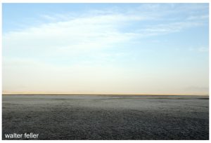
Playas or “dry lakes” are widely distributed throughout the desert region. It is somewhat paradoxical to speak of a “dry” lake. Often flat dry surfaces of saline mud are ripple-marked
from the wind before the water disappeared. Seen from a distance such “dry lakes” may deceive the traveler, the dry flat bottom having the appearance of a water surface. The term
“dry lake” seems therefore not entirely inappropriate. In the desert region the rainfall is very light, but sporadic. Mountain torrents tear down the slopes with great erosional force after
sudden rains. Broad basins between mountain ranges are generally filled, often to depths of hundreds of feet, with alluvial wash from the surrounding mountains. In the lowest parts of such basins water may gather after storms, and large areas may be covered by shallow sheets of water for a time. Soon, however, the waters disappear by evaporation, and the lowest part of the basin becomes a salt-encrusted flat pan, or dry lake.

Soda Lake

Soda Lake

Salt Deposits Accumulate on Lake Bottoms

Scores of dry lakes or playas range in size from a few acres to lake beds several miles across. One of the largest and most important playas is Searles Lake, which has an area of about 60
square miles. This playa is important because of the extensive deposit of crystalline salt in the central part of the broad basin. Solid salt beds embrace an area of 11 or 12 square miles, and
extend to depths of 60 to 100 feet. It is unique in that the salt is nearly pure crystalline mineral (sodium chloride), and not interbedded or mixed with dust or clay, as is the case in many playas where saline deposits occur. This deposit of salt is free from earth sediments, it is thought, because of settling basins in Indian Wells and Salt valleys through which waters passed from Owens Lake during Quaternary (Pleistocene) time when waters from Owens Valley evaporated here. Death Valley contains an immense salt field. It extends fully 30 miles south from the old borax works. It varies in width from two to four miles. Borax was once manufactured two or three miles north of the point where Furnace Creek emerges from the hills of the west slope of Black Mountains (Amargosa Range) .

World's tallest thermometer (134')

World’s tallest thermometer (134′), Baker, CA.

Soda Lake, southwest of Baker, is one of the largest playas in the desert, having an area of approximately 60 square miles.It is here that Mojave River ceases as a stream. To the north, and separated by a low divide, is the playa of Silver Lake. The great structural trough in which these playas lie is continuous with the trough of Death Valley, and it is thought that waters from the Mojave Valley in Pleistocene time moved northward and joined the Amargosa, and then flowed into Death Valley. Strand lines or beaches high above the valley bottom show that a large body of water once filled Death Valley.

Antelope Valley

Poppy Reserve – Antelope Valley

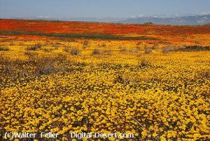
Antelope Valley, lying north and east of the San Gabriel Mountains and south and east of the Tehachapi Mountains, is a closed basin, having no outlet for its surface waters. The rainfall is so slight and the evaporation is so great that not enough water reaches the bottom of the valley to form a lake. Several playas occur, the largest of which are Rosamond, Rogers, and Buckhorn. It is thought that at one time (Pleistocene) all three formed a single large playa. The rainfall in Antelope Valley ranges from 3 or 4 inches to 1 inches annually, varying widely different years. The greater part of the annual precipitation occurs during the winter months of January, February, and March. The summer rainfall is so slight and so irregular that it is not of much value to agriculture. Irrigation is therefore important. The greatest development of agriculture in the Mojave Desert region has been in the Antelope Valley, where it is claimed 10,000 to 1 5,000 acres are under cultivation. Water for irrigation is obtained from mountain streams.

Geology of the Region Very Complex

Panamint Valley

Panamint Valley

The geology of Mojave Desert and the Death Valley region is very complicated. The region embraces the southwestern  portion of the Great Basin plateau. In the north, in the Death
Valley region, mountain ranges trend in somewhat parallel lines in a generally north-northwest and south-southeast direction. Faults in many cases mark the boundaries of the ranges and valleys. Death Valley, lying west of the Amargosa Range (Funeral and Black mountains) , is a sunken basin in which the floor dips to the east and north toward the great fault scarp which marks the mountain side. The structure of Panamint Valley, lying west of the Panamint Range, suggests that it is a down-faulted block with the greatest depression on the east side of the valley. What is thought to be a fault-plane appears in the abrupt wall of the mountain range on the east. Hot springs at the north end of the valley, and the springs near Ballarat, indicate a zone of faulting along this edge of the valley. The parallel arrangement of the mountains and valleys is generally believed to be due to a series of parallel faults, the valleys representing large blocks that have been lowered relatively with respect to the blocks that have been elevated or tilted to form the mountains.Post Office Spring Ballarat ghost town

Post Office Spring (Ballarat)

Crystalline Basement Rock

1.7 billion year old Crystalline Basement Rock

Very ancient rocks, granites probably of Archaean age, occur in some of the mountains. Whatever rocks may have been deposited over them have been removed by erosion. During the early part of the Paleozoic era (Cambrian period) some parts of the region were submerged beneath the sea. This is shown by beds of limestone and other sea sediments in which fossils have been found. If the sea covered the entire region during Cambrian time the formations that were laid down have been removed by erosion from most of the region. During the long Ordovician, Silurian, and Devonian periods it is thought that the region was land, as no fossils of these ages have been found. Small patches of rocks containing fossils of Carboniferous age have been found, showing that the sea covered parts of the region at least during Cambrian time. Throughout the Mesozoic era the region is thought to have been land, and was greatly eroded. In the early part of the Tertiary period volcanic outbursts occurred and great lava flows spread over large areas. Throughout the long time of the Tertiary and Quaternary periods erosion was actively going on. A large part of the Tertiary lava flows and other rocks were worn away until now only remnants of once continuous formations are left. Disturbance of the rocks by faulting completed the work of deformation and resulted in the present relief. Geological conditions have resulted in the accumulation of mineral deposits. These constitute the greatest resource of the region, and have been the incentive for the early exploration and much of the later industrial development. Of metallic ores those of gold, silver, copper, and iron have been principally mined, but lead, zinc, quicksilver, and many rarer metals also have been found. Non-metallic minerals, as salt, potash, niter, borax, and gypsum occur in many places, some in commercially important quantities. Much literature relating to the minerals and geologic features of the region is available. (See Appendix.)

Lava flow at Fossil Falls

Lava flow at Fossil Falls


From: ADVENTURES IN SCENERY
A Popular Reader of California Geology
BY DANIEL E. WILLARD, A.M.
Fellow American Geographic Society, Fellow A.A.A.S.

Van Dusen Road Notes

Point of Van Dusen Road crossing Mojave River, Hesperia, CA. Looking toward Apple Valley and Marianas Mountains

The Van Dusen Road branched off from John Brown’s toll road heading east along the ridge after reaching the Cajon Summit.   The road  found its way down the Antelope Valley Wash to the Mojave River.  At this point the trail crossed through the soft sand and ascended through a small  canyon  at the base of the mountains, finding its way east then southeast to Rock Springs. From the springs the road then branched to the left heading east to Holcomb Valley becoming what is now known as the Coxey Truck Trail.

Looking west up Antelope Valley Wash from the Mojave River toward Cajon Summit

by Walter Feller – 2017
The Hardy Pioneer

by Jean Goldbranson – 1967

As you whiz down the freeway in a well protected automobile, have you ever wondered what life was like in the good old days as the hardy pioneer planned the trip 50 miles into the desert with wagon and a team of horses?

Excerpts from ‘Water Supply Paper Number 224’  published in 1909 by the US Department of Interior states, “A party leaving a supply station to go 100 miles or more into an uninhabited part of the desert must take along everything needed, even to the most minute detail.”

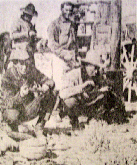
Cowpokes eating a hearty breakfast on the trail.

” This means if the trip is to last for two weeks enough hay and grain for each animal and enough  provisions to last each man that length of time must be taken.

” For four horses, drawing a wagon that carries for persons and their bedding, provisions, and tools, another team of four horses must also be taken to all sufficient hay and grain to feed the eight horses for two weeks.

”  There are but few places in the desert, away from the railroads, where grain or hay of any kind can be procured. As the teams are rarely able to travel faster than a walk, heavy horses that are good walkers should be selected. The tires should be as wide as can be procured. Desirable widths of tires for freight wagons are 6 to 9 inches; for light wagons 3 inches.”

The average Victor Valley pioneer took a week every six months to travel by horse and wagon to San Bernardino, to do his shopping and come back home.  Leaving the desert and spending the first night in Cajon Pass at one of the campsites close to the junction of State Highway 138 or Interstate Highway 15 further on down  at Cozy Dell Campgrounds. it was another day’s journey to San Bernardino, and after doing shopping and visiting for a couple of days, it was a two-day journey back to the desert Homestead. Now with our sleek automobiles, we whisk down to San Bernardino and 45 minutes, sometimes grumbling because it takes so long.

Cozy Dell, Cajon Pass – 1938

Drinking java from an old tin can was a way of life and not a song in the past century.  Living in the open and eating cowboy beans were part of traveling through the desert before the advent of the  auto.  The trails of yesterday became our freeways of today. Our present freeway route from Victorville to Barstow parallels the one the freighters to quit their mule trains to sell supplies to the minors and Calico in the 1880s. Instead of having a well-built bridge to span the Mojave as we do today, they forded the river even when it was high.

from:
Mohahve IV – Scrapbooks of History (c)1984, 2016

Cedar Springs – August 1964

A field trip report by Gladys Steorts

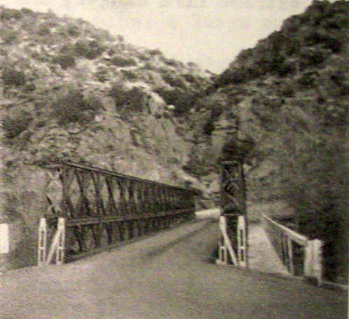
Bridge at Deep Creek


The day was hot. There were only five of us who showed up for the trip. We met at Carl Cambridge’s Museum on Bear Valley Road in Apple Valley in about 9:30 AM and left via Deep Creek Road to Rock Springs Road and across the river to Lake Arrowhead Road and then via Summit Valley Road to Miller Canyon and Lake Gregory Road to Cedar Springs.
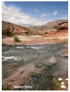
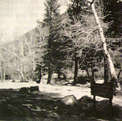
Because of the heat, this was to be more of the picnic been a field trip. We had chosen Cedar Springs because of its location in the big binds and the stream which ran nearby the campground. The site is located on the East Fork of the West Fork of the Mojave River in T2N, R3W, Sec. 6,  San Bernardino County.
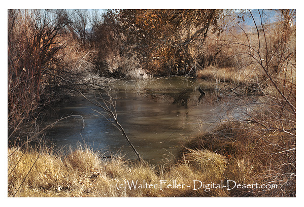
Cedar Springs Campground - Lake Silverwood
Cedar Springs Campground


When we arrived, we found the stream bed entirely dry, and the picnic table which we chose was sitting in the middle of the dry wash. while we enjoyed our picnic lunch, the Martins talk to the early days when they brought their children and grandchildren and camp by this dream which was at that time a swift moving and cool, sparkling little creek. We then tried to imagine what it would be like in a few years when the entire area will be underwater. Already, many of the homes had been removed in preparation for the time when the dam will be billed at the forks of the river, to hold back the waters of the Feather River when they are delivered to the Southland to water the thirsty reservoirs at the Mojave River Valley and the great metropolitan area.
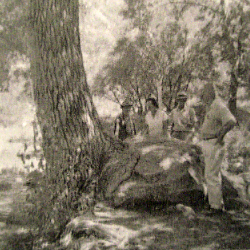
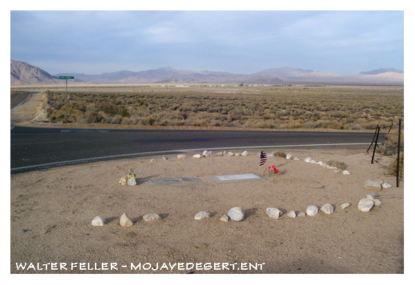
The tree that grew into a rock. Cedar Springs - 1964

The tree that grew into a rock. 1964.


As we sat and talked, we began to look around, and we realize that the well-known landmarks would soon disappear. Nearby, was a huge old pine tree with roots in twined around a very large boulder which had once been at the stream’s edge. Close by was a beautiful old sycamore with a satellite branch, just right for small and not so small boys  to  climb.  downstream was a grand old tree that guarded the  dry stream bed and looked as if it had been watching over the course of the stream for many years.  We took some pictures and left.

Our road led us through Summit Valley to a road which took us  up to Cleghorn Canyon in search of a way to reach a monument which was said to be located at a point where Fr. Francisco Garces (1776)   and Jedediah Smith (1826)  had crossed over from the desert to the San Bernardino Valley.


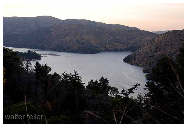
Silverwood Lake

Cedar Springs today sits under Lake Silverwood SRA

We failed to locate a way to reach the monument, but we did find a vast area that had been almost denuded by a destructive forest fire which had swept the area only a few weeks earlier. in the midst of this, we also observed a “guzzler”  which still contained water,  and the ground around was covered with thousands of little tracks which was evidence of the birds and small animals that had somehow  survived the ravages of the flames. Joel Martin mentioned that he had, at one time, worked on a project to help install these guzzlers which were designed to help preserve the wildlife of the county and state.

As we return down the canyon to the Summit Valley Rd., Carl Cambridge suddenly called a stop, and there beside the road, where the road had crossed a dry wash, lay a large metate.  There was also the ruins of an old cabin and signs of placer mining, which told a silent story of a culture and a generation earlier than ours.

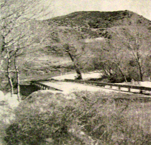
Bridge at fork to Cedar Springs

We retraced our road to where the Summit Valley Road and the road to Cedar Springs meet, to make a survey of his site of an old Indian camp which Carl had told us had been discovered there several years ago, but all that we found were a few fire stones and the dark and soil, evidence that the Indians had once been there.

Although no great historical facts were uncovered, the day proved to be very interesting, and in time it may be looked back upon as being of historic interest because of what was but is no longer.

As we thought about the things that were taking place in the area, we realize that, just as the last remnants of other eras were disappearing, the day would soon come when the landmarks that are so familiar in the area today will soon be gone. So we took more pictures for remembrance.

from:
A Field Trip Report by Gladys Steorts
Mohahve III – Scrapbooks of History (c)1966
Mohahve Historical Society

Old Mormon Fort: Las Vegas, Nevada

During the Spanish Colonial Period (1542-1821) in the American Southwest, the Spanish empire was competing for control over resources with the British, French, and Russian monarchies. They attempted to link colonies in the Spanish territories, later known as the New Mexico and California, by establishing trade routes to form a passageway across the entire Southwest desert region. The Old Spanish Trail was used commercially to link the towns that would later become Los Angeles, California, and Santa Fe, New Mexico, from 1829 until 1848. The abundant spring water available in the Las Vegas (meaning “the meadows” in Spanish) Valley made it an ideal resting point on the trail.

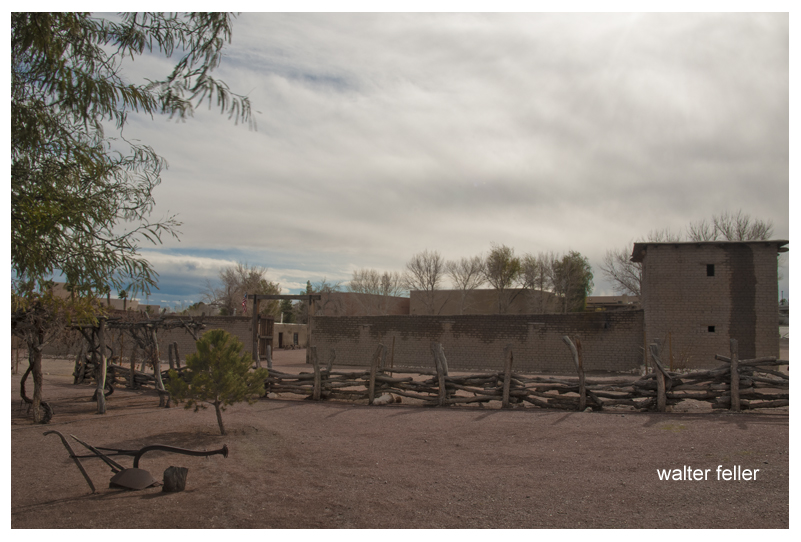
Old Mormon Fort - Las Vegas, Nevada

Old Mormon Fort – Las Vegas, Nevada

The presence of the valley springs also drew the Southern Paiute Indians, a nomadic people moving frequently during the year, who made the valley their winter homeland. They raised small crops near the springs in the valley, which provided water and food for the Indians inhabiting the area and later for travelers making their way across the desert.

The Las Vegas Valley would become an attractive place for other European-American settlers as well. One group of settlers looking for a new home was the Mormons–also known as the Church of Jesus Christ of Latter-day Saints–a religious sect organized by Joseph Smith in New York in 1830. Based on the Book of Mormon, which Smith said was revealed to him by heavenly messengers, this religious body felt called to restore the authentic church established by Jesus and his Apostles. The history of the Mormons is dramatic–filled with persecution, an exodus from the eastern part of the United States, and ultimately successful establishment of a thriving religious society in a desert. The Mormons formed in upstate New York, an area where the Second Great Awakening was most popular as the United States underwent a widespread flowering of religious sentiment and unprecedented expansion of church membership. The group was forced to move several times because of conflicts with residents in various places where they settled, including Ohio, Missouri, and Illinois. They were accused of blasphemy and inciting slave insurrections. After Smith was killed by an angry mob in Illinois in 1844, it became necessary for the Mormons to find a new home once again.

A new leader emerged to guide the Mormons to a new Zion at the Great Salt Lake. Under the direction of Brigham Young, they began an arduous journey West to what would become Utah, where they arrived in July of 1847. In 1848, after the war with Mexico, the United States acquired the majority of what now constitutes the American Southwest. The Mormons petitioned Congress to become the State of Deseret, a word from the Book of Mormon signifying honeybee which was considered an industrious creature, but they were only allowed territorial status. Congress established the Territory of Utah, named for a local Indian tribe, and President Fillmore appointed Brigham Young governor in 1851. Young also became superintendent of Indian affairs. He oversaw the building of Salt Lake City and hundreds of other southwestern communities.

In the middle of the 19th century, the idea of “Manifest Destiny”–a phrase used to explain continental expansion by the U.S.–was embraced by many American people, including the Mormons. They began an industrious campaign to colonize Utah and beyond, establishing hundreds of settlements throughout the West and Southwest. As part of this process, Brigham Young called on volunteers to create a Las Vegas Mission, which would be strategically located alongside the Mormon Road (a portion of the Old Spanish Trail between New Mexico and California), halfway between the Mormon settlements of southern Utah and the San Bernardino Mission in southern California. There were eventually 96 settlements that included Lehi, Provo, Payson, Nephi, Fillmore, Beaver, Parowan and Cedar City. Meanwhile, the discovery of gold in California in 1848 made southern Nevada a corridor for westward emigrants and gold seekers. A gold seeker wrote in his diary on November 21, 1849 about stopping at the Las Vegas creek. Offering the only reliable supply of water for a 55-mile stretch along the Mormon Road, the Las Vegas Valley’s springs were important for watering the mules, horses and oxen of travelers crossing the region’s harsh desert environment. With the opening of the San Bernardino settlement in 1851, there was an additional need for a way station at the Las Vegas springs to provide supplies and rest. The mission the Mormons established as part of the Church’s westward expansion out of Utah became the first non-native settlement in the area, and the Mormons hoped to bring the American Indians into their flock. Although the Mormons occupied the site only from 1855 to 1858, it affected the development of what was to become southern Nevada.

from — The Old Mormon Fort: Birthplace of Las Vegas, Nevada — National Park Service

Panamint Fever

by Cliff Walker

Panamint City

Panamint City

Blond-haired, whiskered veteran prospector Richard C. Jacobs and partner Bob Stewart were grubstaked by W. L. Kennedy, a Kernville merchant. Most grubstakes failed, but these two men wandered over to Panamint Valley, then up the steep 6,000-foot climb of Surprise Canyon and found several types of silver ore exposed by erosion. They made four claims, formed Panamint Mining District, and elected Bob Stewart as recorder. Samples shown to Kennedy assayed from $125 to $3,000 per ton. By April 1873, there were 80 to 90 claims. The Panamint mining started fairly normally until the search for investors brought in wealthy and influential men: two Nevada U. S. Senators, John P. Jones and William M. Stewart, and ex-49er Trenor W. Park, a New York Wall Street investor, formerly a San Francisco lawyer and current director of Pacific Mail Steamship Company and president of the Panama Railroad that linked the two oceans. Experienced in mining and investing, these successful men encouraged others to rush for quick potential riches.

Panamint Fever had started.

Miners from 29 Palms, Ivanpah, Arizona, Nevada, and  northern California came to Panamint Valley and made the horrid trip up Surprise Canyon to the Panamint Mountains on a road that is still more of a dry waterfall than a road. Miners found a small booming city with sounds of hammering, dragging, and building all over, and sounds on higher hills of dynamite exploding. Anybody who wanted to work had a job at $4 per day, board $7 per week—not bad wages for those days. In March 1874 there were over 700 men who already staked about 150 claims and were still prospecting to find that great silver lode like at Virginia City. Men rented a room or a space on the ground at “Hotel de Bum,” a huge tent. Most slept outside in blankets looking at the stars.

Wagons unloaded supplies at the bottom of Surprise Canyon and pack mules made it up the waterfall road, unloading their gear to tent stores, potential wooden and rock buildings,  or to mines further up the hill. Jacobs hired Chinese laborers to cut down the steep grade over the Slate Range so his 10-stamp mill could be brought easily to Surprise Canyon. Owens Valley businessman Bart McGee sculptured a road up Surprise Canyon, thereby enabling wagons to use the waterfall road (where the grade was 500 feet to the mile). Seven stages a week arrived at the new city by the end of 1874.

Panamint City developed almost a mile of businesses for city amenities. According to mining historian Remi Nadeau, the city had a dozen saloons, a water company, six general stores, three bakeries and restaurants, a livery stable, boot shop, meat market, three barbershops, a newspaper called Panamint News, the Bank of Panamint, and another important town amenity: a log cabin brewery. When Martha Camp, a buxom lady from Nevada, brought her ladies to town, the night life in Panamint became livelier—it became a real city!

As usual, gamblers, criminals, gun fighters, and assuredly con-artists, climbed the hill to Panamint. The town soon needed a jail. As a result of a gambling dispute, a shootout in a saloon in which Kirby, a man from Pioche, shot Bill Norton in the leg and ran away when Norton fired back. The only official in town was town recorder W. C. Smith  who discovered Kirby planned to waylay Norton. Smith got the drop on Kirby and suggested he leave town right away. The town later elected Smith Justice of the Peace. Jim Bruce and Edward Barstow, a night watchman of the town, had an argument in Camp’s house. Barstow, drinking too much, left the business but returned later after he sobered a bit and found Bruce in Martha’s bed and shot it out with Bruce. Barstow died. The town needed a cemetery.

A few years later the boom and fever ended. But the effects on the Mojave Desert was great. San Bernardino County appointed Oro Grande’s Aaron Lane as Superintendent of desert roads, namely the Road to Panamint from the Mojave River to the Inyo County line. Desert “Stations”—ranches like gas stations and motels today—were built and profited, especially with freight from San Bernardino over the Cajon Pass. For example, lumber mills in the San Bernardino Mountains supplied much of Panamint’s lumber. Berdoo merchants out- hustled L.A. businessmen. Despite Panamint’s decline in the late ’70s, mining increased in the Mojave Desert, especially with Barstow’s Waterman Mine and the wonderful Calico Hills discoveries. The Mojave Desert became settled by the end of the 1880s.

Mojave River Valley Museum Newsletter –  October 2012


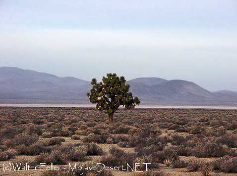
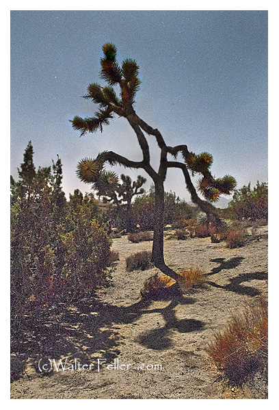
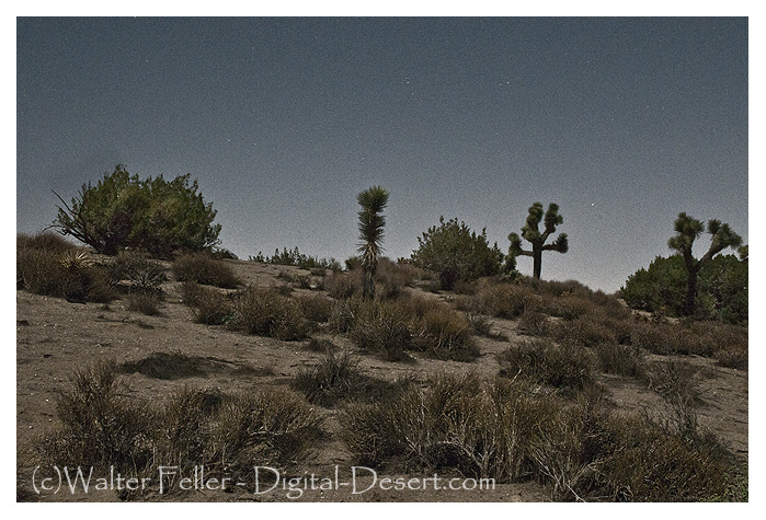
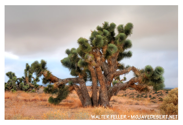
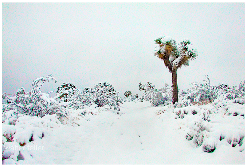
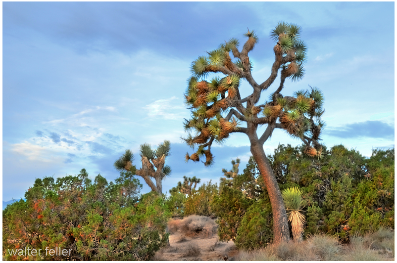
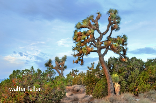
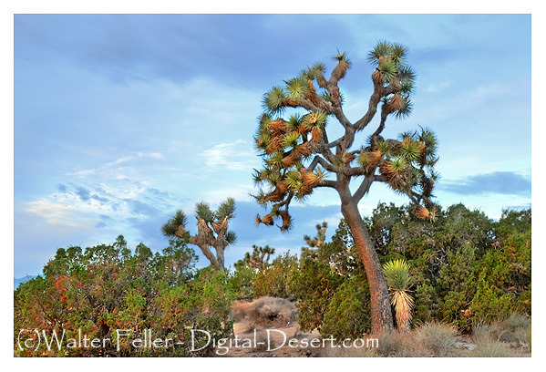
Joshua Tree

Mojave Desert Plants: Trees Joshua Tree
BOTANICAL AND ECOLOGICAL CHARACTERISTICS
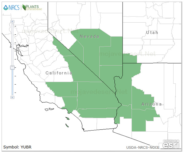
SPECIES: Yucca Brevifolia (Joshua Tree)

GENERAL DISTRIBUTION
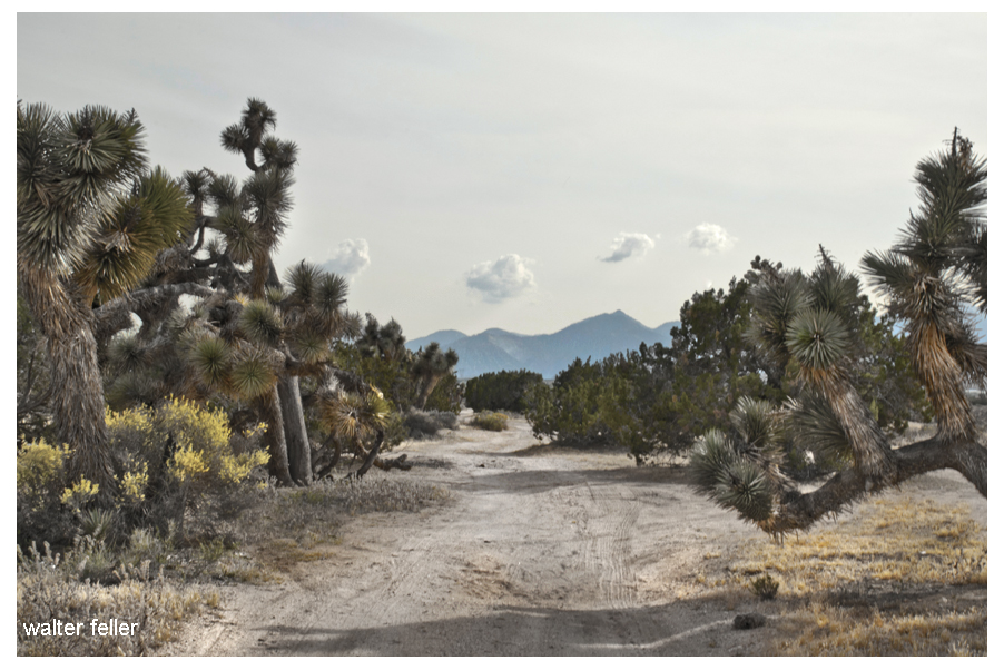
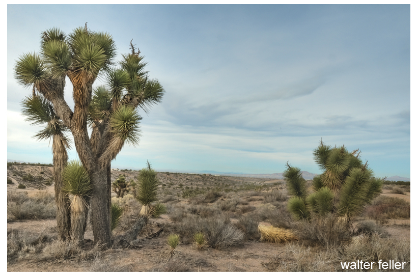
Joshua tree is one of the most characteristic plants of the Mojave Desert and extends southward to the Mojave-Sonoran Desert ecotone. This species grows from southern California, Mexico, and western Arizona eastward into southern Nevada and southwestern Utah.Var. brevifolia reaches its greatest abundance in the vicinity of Joshua Tree National Park; California. var. jaegeriana grows primarily in the eastern portion of the Mojave; var. herbertii is restricted to parts of the western Mojave Desert in California.The Joshua tree was named after the biblical leader, Joshua, as it reminded the Mormon pioneers of the hero raising out-stretched arms toward the heavens.William Lewis Manly referred to them as “cabbage trees” in his book (Death Valley in ’49), about the rescue of the Bennett and Arcane families from Death Valley.Pedro Fages, in his expedition along the edge of the Mojave searching for deserters from the Spanish Army, called the ungainly trees “palm” trees.

Source: Joshua Tree

Back on the Trail

Photo of a possible trace of the Old Spanish Trail/Mormon Road near Hesperia

“It looked a lot straighter on the map.” – Anonymous

The Mormon Road going south across the Oro Grande Wash would come up and head straight into the Joshua trees and juniper woodland.  The slope was fair, the ground hard and the trail reasonably straight.  There were variations, though.  To the eyes of one, one way around a bush may look easier than it does to another.  Trails evolve.  If one branch is significantly better than another, that branch becomes wider and more popular. These branches and shortcuts may join together later.  These variations due to mankind and weather begin a process I have heard to be called, “braiding.”  It is quite possible for the main alignment, the busiest, the center-most version in the corridor to remain in use providing its continued existence to this very day.

Las Vegas Valley – Setting the Stage

During the Spanish Colonial Period (1542-1821) in the American Southwest, the Spanish empire was competing for control over resources with the British, French, and Russian monarchies. They attempted to link colonies in the Spanish territories, later known as the New Mexico and California, by establishing trade routes to form a passageway across the entire Southwest desert region. The Old Spanish Trail was used commercially to link the towns that would later become Los Angeles, California, and Santa Fe, New Mexico, from 1829 until 1848. The abundant spring water available in the Las Vegas (meaning “the meadows” in Spanish) Valley made it an ideal resting point on the trail.

Las Vegas

Las Vegas

The presence of the valley springs also drew the Southern Paiute Indians, a nomadic people moving frequently during the year, who made the valley their winter homeland. They raised small crops near the springs in the valley, which provided water and food for the Indians inhabiting the area and later for travelers making their way across the desert.

The Las Vegas Valley would become an attractive place for other European-American settlers as well. One group of settlers looking for a new home was the Mormons–also known as the Church of Jesus Christ of Latter-day Saints–a religious sect organized by Joseph Smith in New York in 1830. Based on the Book of Mormon, which Smith said was revealed to him by heavenly messengers, this religious body felt called to restore the authentic church established by Jesus and his Apostles. The history of the Mormons is dramatic–filled with persecution, an exodus from the eastern part of the United States, and ultimately successful establishment of a thriving religious society in a desert. The Mormons formed in upstate New York, an area where the Second Great Awakening was most popular as the United States underwent a widespread flowering of religious sentiment and unprecedented expansion of church membership. The group was forced to move several times because of conflicts with residents in various places where they settled, including Ohio, Missouri, and Illinois. They were accused of blasphemy and inciting slave insurrections. After Smith was killed by an angry mob in Illinois in 1844, it became necessary for the Mormons to find a new home once again.

A new leader emerged to guide the Mormons to a new Zion at the Great Salt Lake. Under the direction of Brigham Young, they began an arduous journey West to what would become Utah, where they arrived in July of 1847. In 1848, after the war with Mexico, the United States acquired the majority of what now constitutes the American Southwest. The Mormons petitioned Congress to become the State of Deseret, a word from the Book of Mormon signifying honeybee which was considered an industrious creature, but they were only allowed territorial status. Congress established the Territory of Utah, named for a local Indian tribe, and President Fillmore appointed Brigham Young governor in 1851. Young also became superintendent of Indian affairs. He oversaw the building of Salt Lake City and hundreds of other southwestern communities.

In the middle of the 19th century, the idea of “Manifest Destiny”–a phrase used to explain continental expansion by the U.S.–was embraced by many American people, including the Mormons. They began an industrious campaign to colonize Utah and beyond, establishing hundreds of settlements throughout the West and Southwest. As part of this process, Brigham Young called on volunteers to create a Las Vegas Mission, which would be strategically located alongside the Mormon Road (a portion of the Old Spanish Trail between New Mexico and California), halfway between the Mormon settlements of southern Utah and the San Bernardino Mission in southern California. There were eventually 96 settlements that included Lehi, Provo, Payson, Nephi, Fillmore, Beaver, Parowan and Cedar City. Meanwhile, the discovery of gold in California in 1848 made southern Nevada a corridor for westward emigrants and gold seekers. A gold seeker wrote in his diary on November 21, 1849 about stopping at the Las Vegas creek. Offering the only reliable supply of water for a 55-mile stretch along the Mormon Road, the Las Vegas Valley’s springs were important for watering the mules, horses and oxen of travelers crossing the region’s harsh desert environment. With the opening of the San Bernardino settlement in 1851, there was an additional need for a way station at the Las Vegas springs to provide supplies and rest. The mission the Mormons established as part of the Church’s westward expansion out of Utah became the first non-native settlement in the area, and the Mormons hoped to bring the American Indians into their flock. Although the Mormons occupied the site only from 1855 to 1858, it affected the development of what was to become southern Nevada.

Source – National Park Service

Huntington’s Station

Huntington’s Station was the first trading post in the area, and although Heber Huntington only owned it from 1873 to 1878, it remained known as Huntington’s Station until the the railroad came through and renamed it Victor. The river crossing with a few modern exceptions as the Narrows Bridge, Rainbow Bridge, and the cement plant looks much the same today as it did in 1872 when Mecham built what has become Stoddard Wells Road.

Mojave River, Victorville

Mojave River at Huntington’s Crossing


Human Impact on the Mojave Desert

by Laurie J. Schmidt – EROS Data Center DDAC

What do you do when a fragile desert ecosystem turns into a recreational playground? Leonard Gaydos, Coordinator for the U.S. Geological Survey’s (USGS) Recoverability and Vulnerability of Desert Ecosystems project, and colleagues are using satellite data to develop tools that will help Mojave Desert land managers decide what recreational activities to allow and where to allow them. Specifically, the research team is studying vulnerability and recoverability of desert lands.

“Our goal is to create predictive models of the desert that land managers can use to forecast what is likely to happen to a specific piece of land, given its exposure to various types of disturbances,” said Gaydos.

The Mojave Desert encompasses 125,000 square kilometers in southern Nevada, western Arizona, southwestern Utah, and a quarter of California. Situated between the burgeoning cities of Los Angeles and Las Vegas, it is within a day’s drive of 40 million people.

“The Mojave Desert is increasingly viewed as a playground,” said Gaydos. “It now contains four national parks, with millions of people around the edges.” That wasn’t always the case, he said.

“The Mojave Desert was a place you went to get away from civilization. You didn’t have to worry about disturbing anyone or causing any harm,” Gaydos said. In fact, it was largely for this reason that the U.S. military established most of its training facilities there. “It was the last piece of open space in the continental United States where the military could conduct training and not disturb anyone,” Gaydos said.

But, the Mojave’s growing pains make an ideal case study for researching long-term effects of disturbances to desert ecosystems. Land managers are now faced with the daunting task of dealing with competing demands on the land, including impacts from all-terrain vehicles, motorcycles, military activities, and grazing livestock.

“It is incumbent upon the U.S. military, the Bureau of Land Management, the National Park Service, and other land managers to understand the effects of these disturbances on the land,” said Gaydos. “All compact the soil and disturb resources at the land’s surface.”

The project requires a combination of expertise, involving researchers who have worked extensively in adjacent arid land regions, such as southern Arizona, the Grand Canyon, and southeast Utah’s Canyonlands. “The project’s multidisciplinary nature means that scientists on the project team are learning from each other,” said Gaydos. “We have geologists out in the field looking for soil crusts and counting tortoise burrows — not traditional tasks for a geologist.”Map of Desert Southwest

Shaded-relief model of the Desert Southwest (Image courtesy of the USGS Recoverability and Vulnerability of Desert Ecosystems project.

Remote sensing is one of the most valuable tools the team is using. “Satellite imagery enables us to look at the age and characteristics of a site’s surface geology, which is essential to understanding the rate at which that site will recover from disturbances,” said Gaydos.

The scientists use geologic maps created from Landsat 5 data, supplied by the EROS Data Center Distributed Active Archive Center (EDC DAAC) in Sioux Falls, SD. In addition, Landsat data have proved invaluable for identifying study unit boundaries when the team is working in the Mojave. The team also plans to use satellite data to examine dust movement in the desert, an important symptom of disturbance.

The researchers work with high-tech tools such as digital ortho-photos created by the USGS, and imagery from the Advanced Visible and Infrared Imaging System (AVIRIS). Digital ortho-photos are produced by applying corrections to aerial photos using an elevation model. “This process enables us to remove distortions from aerial photos so that they scale correctly, which helps us interpret what we’re seeing,” said Gaydos.

The multi-band capability of the AVIRIS sensor enables computer enhancement of land features, a vital part of the geologic mapping process. “This application of AVIRIS data is still experimental, but it shows lots of promise in mapping the surface geology of the Mojave Desert,” said Gaydos.

These tools have greatly contributed to some of the project’s key findings. First, the research team found that under most circumstances, land seems to recover faster in the years immediately following the disturbance than in later years. In addition, not all areas recover at the same rate.

“The good news is that the desert seems to recover faster than earlier models predicted. The bad news is that it still takes the land a long time to return to its original state, and, in some cases, it may never be exactly what it was before the disturbance occurred,” said Gaydos.

As an example, Gaydos described one of the project’s test sites that lies near an old railroad line built in the early 1900s. For the past 50 years or so since the railroad was abandoned, a berm has acted as an artificial dam for surface processes, such as erosion and runoff. By digging trenches on the slope side of the railroad line, team members measured nearly a dozen flood events. Successive flash-floods rinsed sediment down and built up the surface nearly a meter. “This tells us that we’re dealing with a very dynamic system in the Mojave,” said Gaydos. “At various intervals, flood events wash the sediment down, the plants adapt, and the desert renews itself.”

Land management ranks are also subject to renewal. To keep changing land management and restoration staffs apprised of current findings, Gaydos and his team must maintain regular communications with those in the field.

Sustaining investment is critical, according to Gaydos, because the project still has a way to go. “In the past, the Mojave Desert has been benignly neglected,” he said. “People haven’t worried about it much — it’s not Yellowstone or the Everglades, or any of the places that tend to come to mind when people think of protecting the environment.”

Fortunately, those values seem to be changing, and the desert “playground” is now deemed a valuable resource.

The Mojave A to Z (Antelope Valley to Zion)

The Mojave High Desert is one desert rather than a series of separate entities- That we are the same through the diversity that binds us. By becoming aware of our combined identity, we may be able to appreciate, and better understand issues affecting our Mojave Desert on a holistic level. In this presentation we meander back and forth across the Mojave Desert in photographs to illustrate this concept.

Map of the Mojave Desert

The Mojave – Antelope Valley to Zion


Hesperia, California

Photos of Hesperia, in the Victor Valley

The Man who Mapped California

Thomas Wilson Dibblee, Jr. (1911-2004)

Tom Dibblee was born in 1911 in Santa Barbara, California. He first became interested in geology in 1929, when his father hired a geologist to investigate the oil potential on the family property. After Tom graduated from Stanford University, he spent 16 years working for oil companies and then 25 years working for the U.S. Geological Survey. Much of this time was spent alone in the field making geologic maps of California. Tom retired in 1977 and became a Research Associate with the University of California Santa Barbara, and, at the request of the U.S. Forest Service, he began mapping the 1.2 million acres of the Los Padres National Forest. During his career, he mapped over 40,000 square miles of  California (about a quarter of the state), a feat that probably will never be equaled. Tom was the first man to map the entire San Andreas Fault. In fact, his early work  on the fault indicated that it had moved more than  300 miles, and this became a critical piece to  understanding plate tectonics.

The nonprofit Thomas Wilson Dibblee Jr. Geological Foundation was created to publish and distribute his maps.

Tom received the U.S. Geological Survey Distinguished Service Award in 1967, the American Association of Petroleum Geologists’ Human Needs Award in 1981, and the Presidential Volunteer Action Award from President Reagan in 1983.

Tom passed away on November 24, 2004.

source – USGS

The San Andreas Fault

A Quick Tour of the Mojave

The Whole Mojave A-Z

The Mojave High Desert is one desert rather than a series of separate entities- That we are the same through the diversity that binds us. By becoming aware of our combined identity, we may be able to appreciate, and better understand issues affecting our Mojave Desert on a holistic level. In this presentation we meander back and forth across the Mojave Desert in photographs to illustrate this concept.

Map of Mojave Desert

New Pages

Both pages in this update are out of the Mojave, but were essential to the Mojave as destinations and bases of operation.

Mission San Gabriel

Image of Mission San Gabriel

San Gabriel Mission

The mission was the destination for early explorers, trappers, and traders to southern California.

San Bernardino, California

San Bernardino and San Bernardino valley

San Bernardino, California as seen from the San Bernardino mountain range

Initially starting as an “Astencia” or outpost to the San Gabriel mission, Mormons purchased the land from The Lugo brothers and turned it into a stronghold and ultimately into the gateway to southern California.