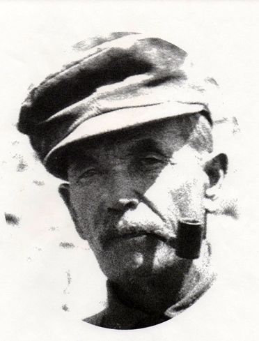
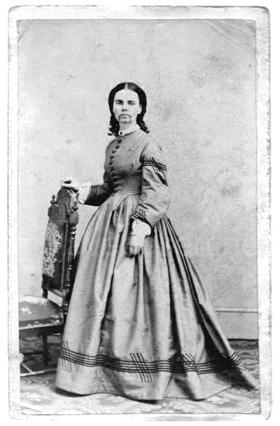
Patrick – Age 20
Sometimes you get out there to do what you do whatever it is you do when you are there but it just doesn’t look real and something is not quite right. Well, you are correct because nothing is quite right or real 100%, but what are you going to do? Cry?
Someday all beautiful things will have been worn away and become mundane and undesirable to view. Then, I imagine all the ugly stuff will become unique and beautiful because they are different and exciting. I imagine.
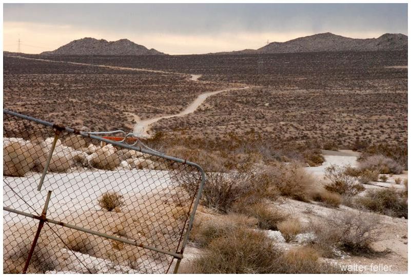
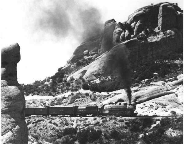
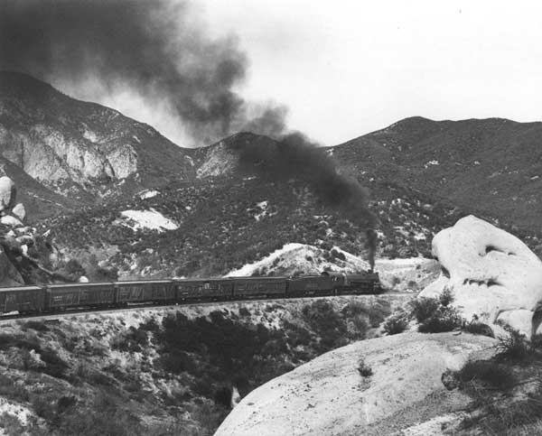
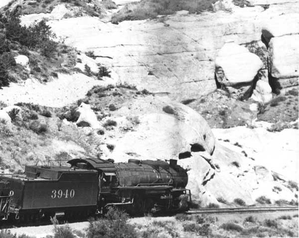
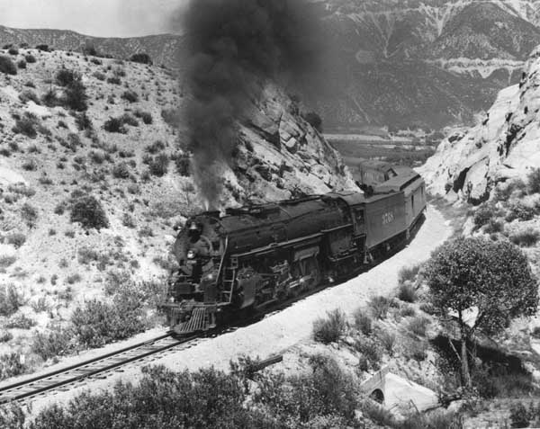
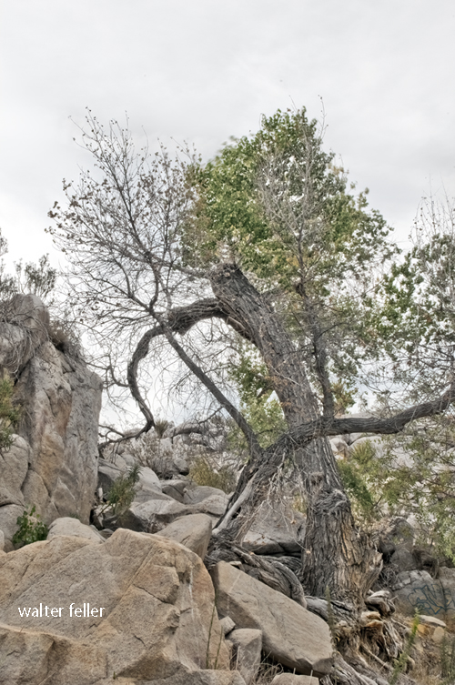
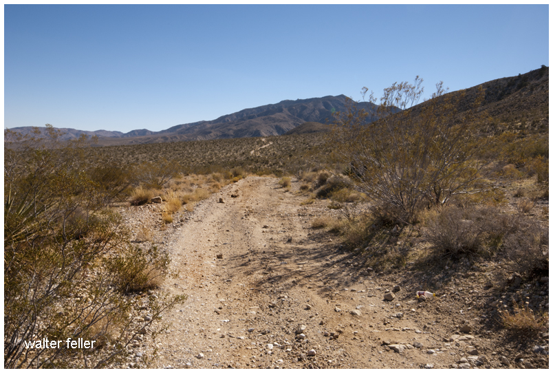
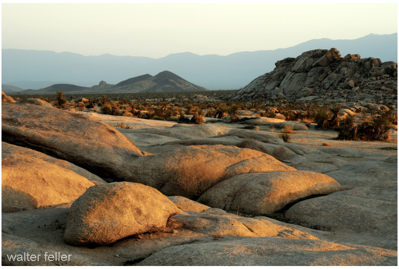
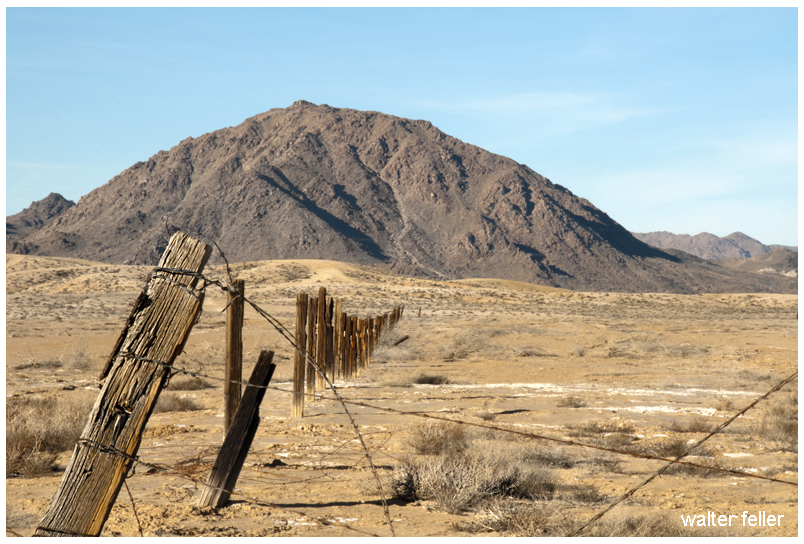
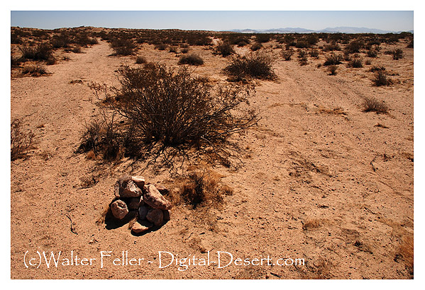
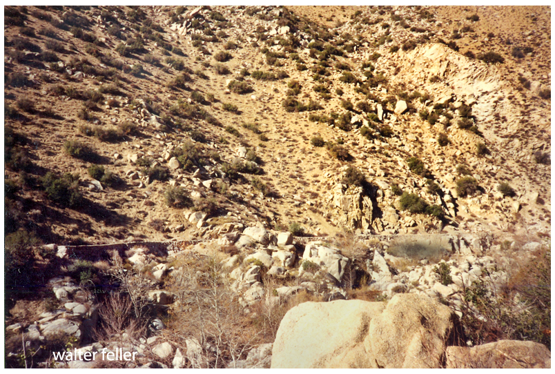
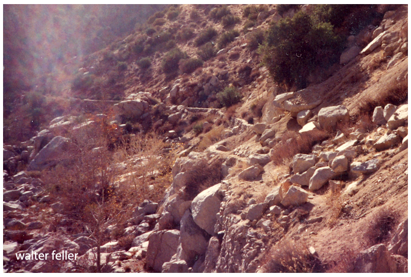
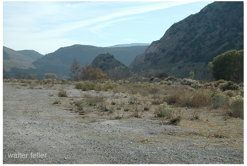
The scribbled road escapes through a broken gate tearing across the rumpled and scratchy desert.
Zig-zagging hastily along the narrow and dusty trail.
Traversing the rise, and disappearing, then a cloud of dust and disappearing again into the far horizon.
Under the dull gray-white skies of this heartless Mojave valley
Nothing moves and stands fast until dark.
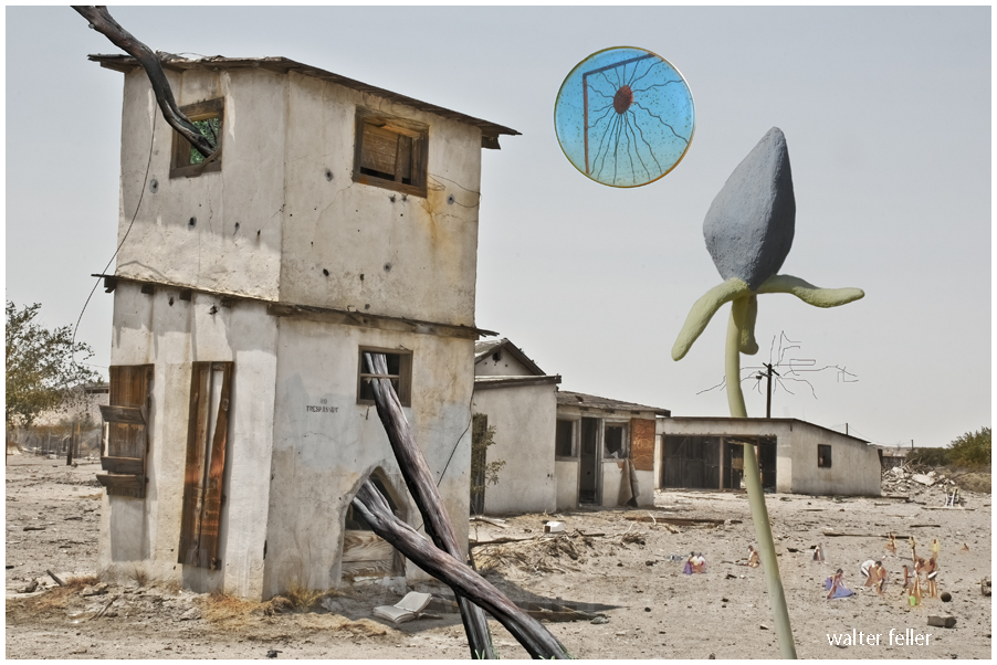
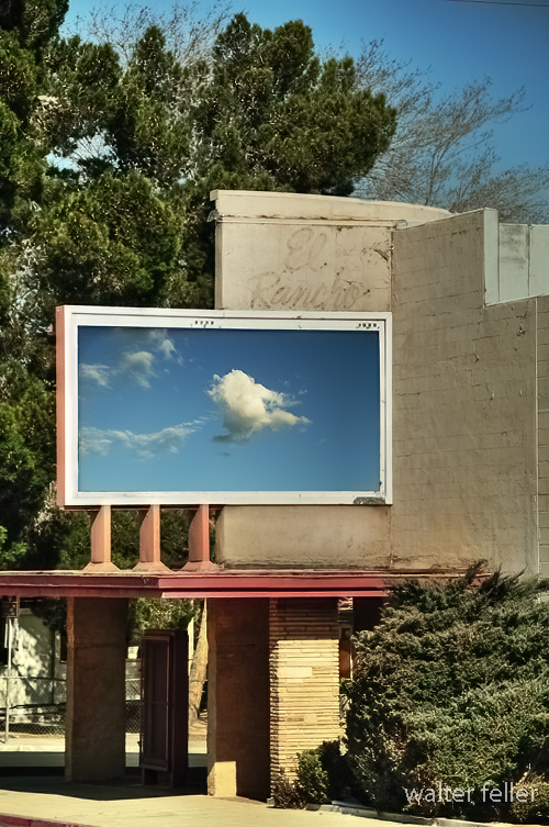
Ekphrastic Surrealism
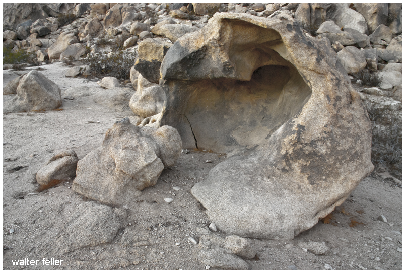
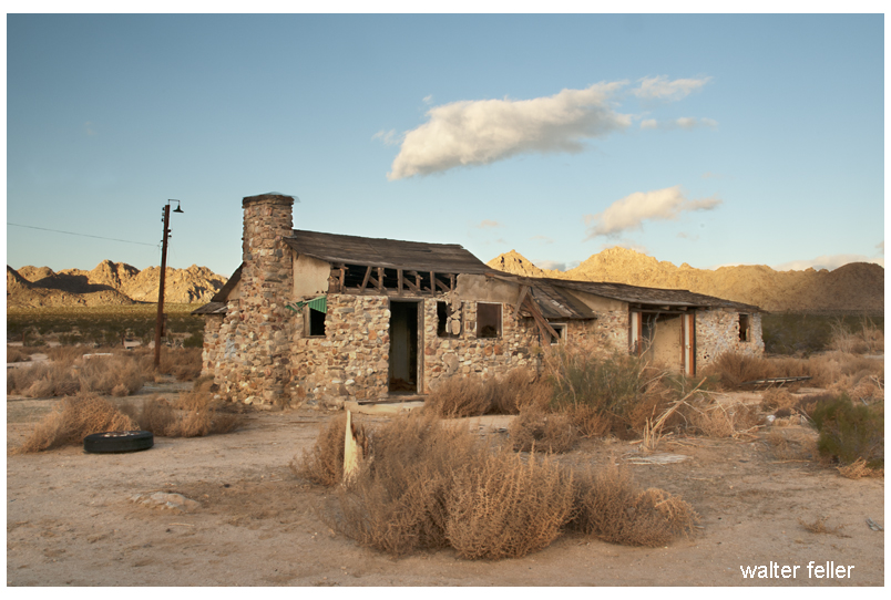
Under the Metallic Sun: Invasive Species
(Mirror sun and stucco flower by Dennis Rudolph)
Mike was alone now. It was just him and the wind in the desert. He wasn’t scared. He would listen to Nature. It would speak to him–tell him what he needed to do. In fact, the wind was trying to touch base with Mike at that very moment. It was saying, “Hey Mike? Mike? Can you hear me, Mike? Mike?” Mike, however, was preoccupied with trying to get a signal. Without water or shelter, Mike was a goner. Too bad for Mike.
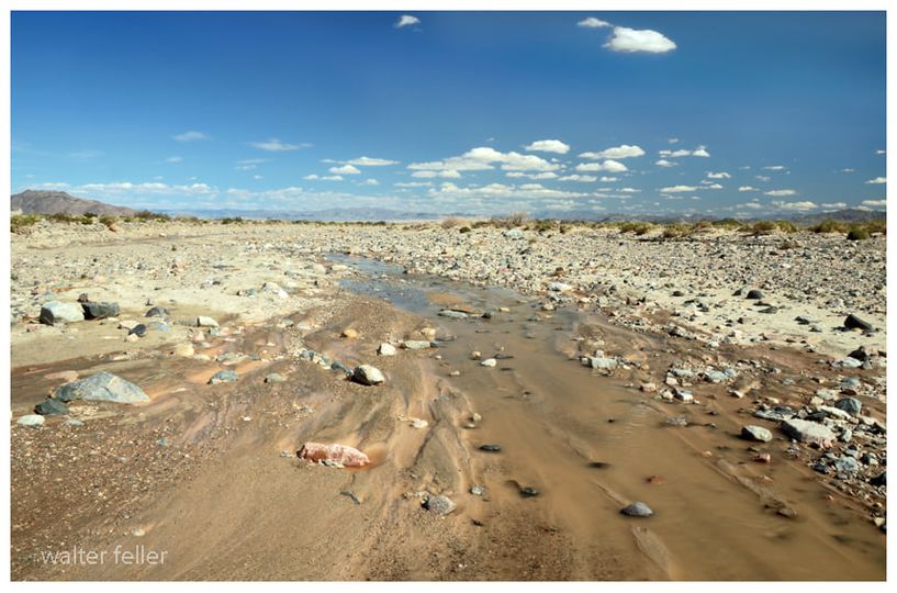
It is the strangest thing; the river; I follow it downstream and it becomes smaller and smaller and smaller. With every step, it becomes less and less and less. The water diminishes and depletes until it is just a trickle, until a glisten, until just a wet spot surrounded by damp sand, and then nothing. That is how this river ends–not mightily at an ocean, but quietly, subdued in the sand and rubble and stone becoming as if it never were.
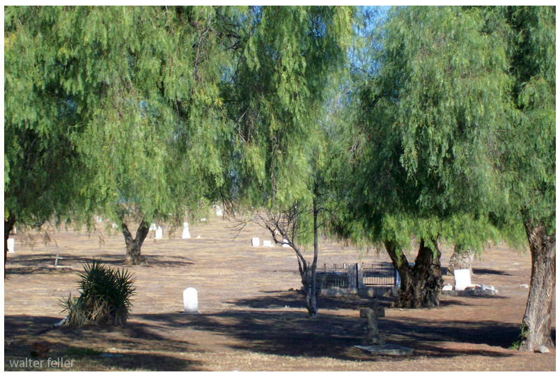
Mojave River
https://digital-desert.com/mojave-river/
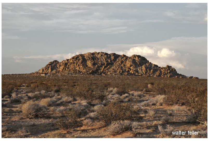
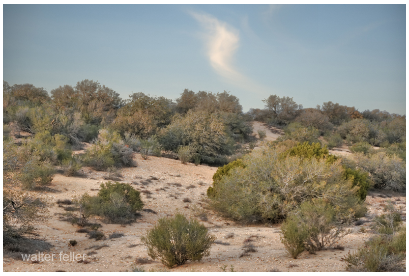
Various photos of Johnson & Lucerne Valleys


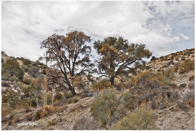
There are three ravens in the sky above the oak on the left. The raven on the far right of those three flew in front of me after first cawing and catching my attention. Over the years I have learned when this happens there are two ravens flying safely and quietly behind me. I like to believe they do this as a strategy to distract potential predators.
Veristic surrealism; an abstraction of a reality created through free thought.
Questions to ask yourself;
Do you like it?
Why do you like it?
What does it represent to you?
Veristic – positive, life, moving forward.
And if you do not like it; it does not exist.

All of a sudden nothing made sense. Not that there was nothing or that anything in the nothing meant nothing but that nothing with nothing in it did indeed, not mean nothing.
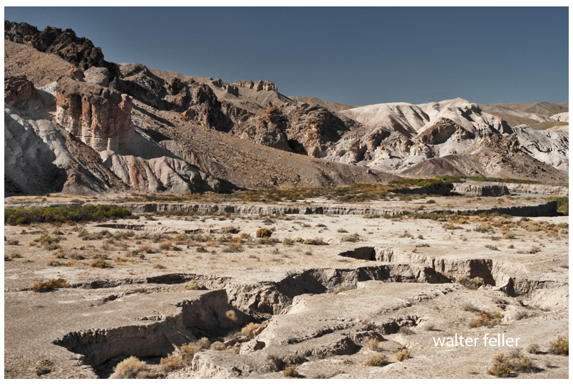
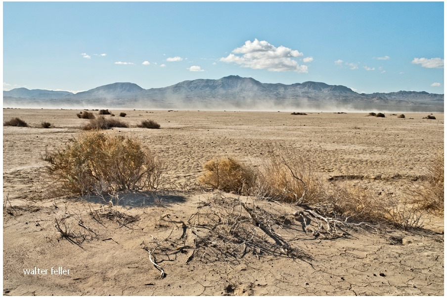
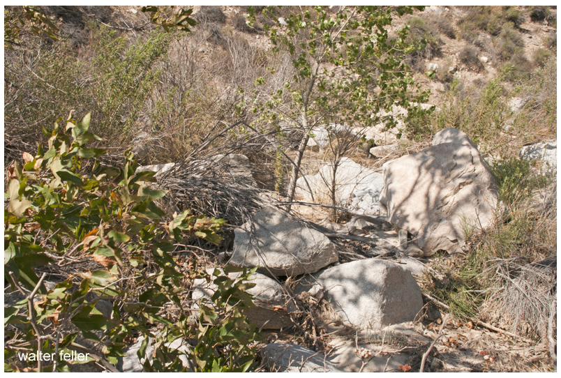
There is a broken land where mountain ranges rise like angry tidal waves in turbulent, slow-motion seas, senselessly wrestling in convection.
Occasionally, countless battalions of clouds march briskly right to left without leaving a drop of water, all saved for a brutal assault on a faraway fire.
adapt or die–that is all that can be said.
Broken animals and plants living in uneven symbiosis.
and above; thrown into the wind, birds fly incorrectly and confused
and tumble from the sky in mid-breath.
tiny fish in the broken river’s warm water quietly dance an intricately choreographed ballet.
Trees are not trees . . .
and the rabbit is not in charge as he would have you believe.
remember that.
Bragging coyotes arrogantly bark and yap after a kill
Then they eat.
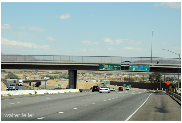
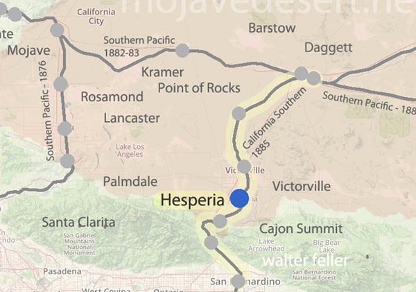
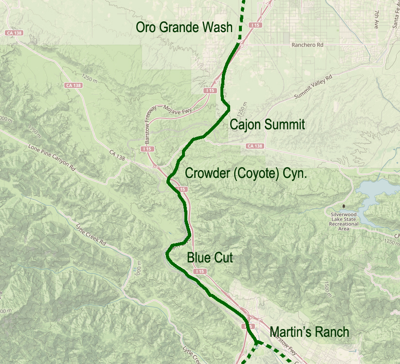
Bits from an interesting 1961 article about by-passing downtown Barstow and modernizing transportation infrastructure at the geographical descendant of ‘Forks-in-the-Road‘ of pioneering times. Speaks to the morphology of the transportation corridor from the classic Route 66 to the modern Interstate 15 Freeway. Also, see Sidewinder Road for maps between Victorville and Barstow.
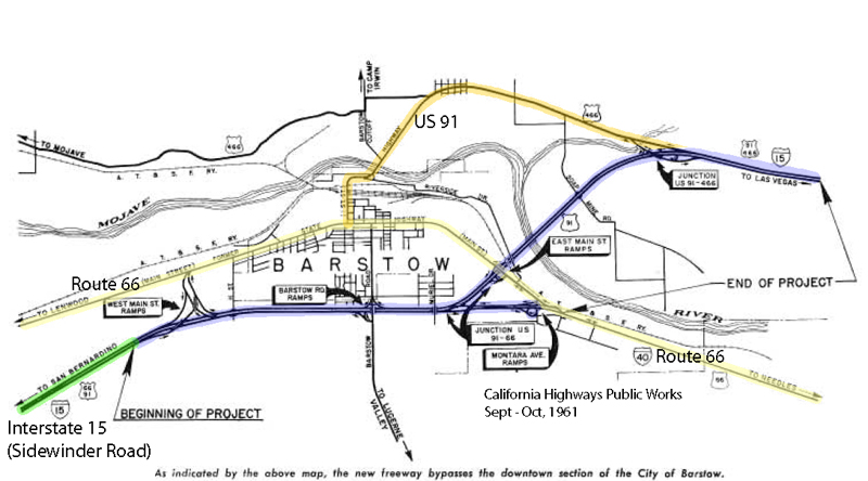
On July 5, nine miles of the Barstow Freeway, known locally as the “Barstow By-Pass”, were opened to traffic by construction contractors Gordon H. Ball and Ball & Simpson.
The project is an extension of the 24-mile freeway from Victorville to Barstow which was opened in January 1959. It makes available the improvement to full freeway standards of an important link of Federal Interstate Route 1 S (U.S. 91) and the first step of freeway improvement of Interstate Route 40 (U.S. 66) toward Needles.
California Highways, Sep/Oct 1961.

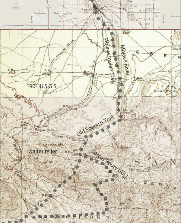
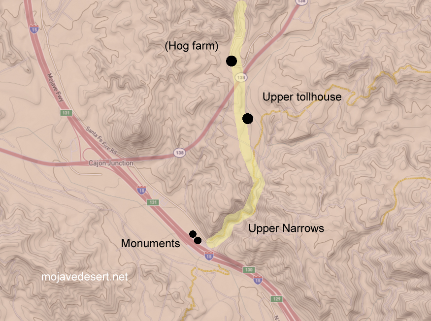
Not all-inclusive, this 1901 map shows basic transportation routes between the Cajon Summit on the west and east from there through either the San Bernardino Mountains or Lucerne Valley to where the two roads meet in the Big Bear Valley.
This map below was made in 1883 and shows an earlier and geographically expanded version of the routes.
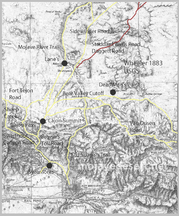
The 1883 map is more inclusive and contains a couple of items I want to keep track of. There are differences but the road segments look about the same.
I made a copy of the 1883 roads layer and made it red to stand out better.
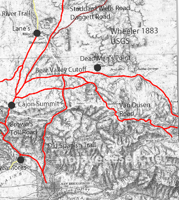
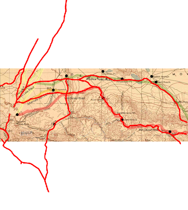
There are some nuances between the two maps, and right now the Oro Grande Wash area seems considerably off, fiddling with it some I can get a better fit–but not at these rates. The 1901 would be the more accurate depiction of what went on out there even if it were 35 years or so after the fact.
Note that in the above map the variations of trails from across the valley leading to the Cajon Summit seem not to have been developed at this time and instead the trail along the Mojave River is shown.
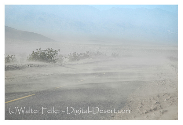
Then there were the “Northers,” which the heavy winds that swept down the Cajon Pass from the Mohave desert were called. They were much more severe then and sometimes very cold, blowing for about three days at a time. Many people treated them as they would rainy weather, and by way of derision, they were sometimes called “Mormon rains,” coming as they did by way of San Bernardino. They often came before the rains and when sheep had been pastured in the early summer the surface of the ground was cut into fine dust and we would have a dust storm which would cover the inside of the houses with dust. Since the land was planted and roads oiled, the “Northers” have lost most of their disagreeable features. Being dry they clear the atmosphere and are one of the beneficial features in our healthy climate.
History of San Bernardino County – John Brown Jr., 1922
What happens when one’s reflection takes charge?
Savan wakes up and gets ready for the day ahead
The sunlight coming through the window felt good on his back. This was a pleasant way to wake up. Savan Navas felt great. He shaved, showered, and then made breakfast for himself.
Savan dressed and stood looking into the mirror and tied his tie and adjusted the knot in exactly the position he preferred. A final inspection– He stood back a bit. He looked great. He smiled. What a wonderful day this will be, Savan thought. He took a breath then watched his reflection turn and walk out the door.
That was so strange, Savan thought.
Savan’s reflection walks out the door.
Savan was shocked; he froze. What did he see his reflection do? Should I follow? Savan wondered. He smiled at the thought although feeling an anxious cringe. Savan could hear the deadbolt slide into place and lock. Did I just lock myself in? He chuckled.
He could not remember something like this ever happening before–his reflection walking out the door.
I wonder if he knows where he is going.
This was entirely new to him.
What happened and to who?
That can’t happen, and yet it did happen. How could it have happened? Maybe it was him who walked out the door. It couldn’t have been him; he was right here.
This must be a dream. There are some dreams we swear aren’t dreams that real–but we are dreaming. There are some realities that are dreams, and we may find out later that we lived our dreams.
There appears to be reality and something else, possibly our reality is our point of view.
I wonder if he knows where he is going.
I wonder what the reflection does when I leave the room. I suppose it exists until I am out of view. I presume the reflection exists as long as I am there to be reflected.
This has never happened before. At least, it has never happened in reality that I can remember.
The reflection got ahead of me.
Here the story changes as Savan realizes that he may be the reflection rather than the being.
Leaving the room seemed easy enough–however, for some reason, he could not remember leaving the room before. He was not sure if that was what he did every day. He could not remember.
If I go, what do I do? I do not remember!
Savan could not remember any of these things. He could, however, remember that he just saw himself walk out of the apartment.
He could not remember anything before the sun on his back woke him up. There was no night before, no day before, no weeks, months, or anything. There were no memories other than the sun on his back and the events that took place until now.
What is beyond the door? Where do I go? What do I do when I get there?”
Since I cannot remember, does this mean I am the reflection, and the real me left the room?
Savan ponders his feelings — if he were just a reflection, would he have any feelings at all? Is feeling nothing feeling?
What does all of this mean? Is this existence? What will/may happen from this point?
A subtle agony overtook him as he realized he may be nothing more than a reflection of a man, and if so, this was his existence in total. If he turned around there may be nothing–he would cease to exist.
“Nowhere,” Savan thought “Out there is nothing.”
Then, indeed, he would cease to exist once he altered his state, even if only by one particle, or a photon as it may be—surface tension.
Let go of the past.
“Is this what happens every day? “
He could not remember.
If it were his destiny, to be ephemeral, he fretted, he may cease to exist once he turned, and looked away from the mirror. To move on his side of the glass–to try to leave the room and enter a future.
There is no future; there was no past
Since he could not recall a past, there was nothing, and he could not imagine a future without a history to gauge it by.
He felt cold and empty.
But he was conscious of himself. He was self-aware.
“Do I exist at this exact moment?”
Not to my reflection.
Am I in the mirror or looking into the mirror?
“Certainly, I do not exist to the version of me that I believed to be a reflection of me who left the apartment.”
“It would be safe for me to remain here just like this if I wished to continue to exist, although this existence would be unwhole without dimension.
Or do I exist as long as I am aware of myself?
I would think that once, I also may have left the room while my reflection stared in disbelief. However, I cannot recall, at this moment, anything that would lead me to believe I should remember anything about a reflection acting out of character for a reflection. Generally, reflections have no future, as their reality is dependent on their subject.
Do my reflections exist when I look away? Are they always there?-Waiting for me?
As long as I am conscious of my reality, I am real. I am looking into the mirror and do not see my reflection, which may indicate that if I look away (turn around) I may no longer be capable of maintaining my reality, and that may mean that I am an ephemeral reflection and not the real me.
That I am only real outside of reality.
Descartes – “cogito, ergo sum” (I think therefore I am.)
Or can I walk through that door into an uncertain reality, a future, and live from this point forward free of preconceptions and learned behavior?
The only way to know is to turn around and walk out the door. I may cease to exist; however, I did exist as I chose to see if I did, indeed, exist.
Savan turns around to leave the room but finds himself looking in the mirror and sees himself coming in the doorway.
—
The end
Instantly, there is nothing.
Traders in the caravans coming to California did not just trade with those at the missions, but with any group or community they came across. The little settlement of Agua Mansa enjoyed the benefit of being the first village of any size once the mule trains dropped in from the mountains after crossing the deserts.
It was called Aqua Mansa, meaning Gentle Water, and was composed entirely of immigrants from New Mexico, numbering some 200 souls–simple, good souls they were, too, primitive in their style of living, kind and hospitable to strangers, rich in all that went to make people happy and content, never having been, up to that time, vexed by the unceremonious calls of the tax collector, owing allegiance to none save the simple, kindhearted old priest who looked after their spiritual welfare. With peace and plenty surrounding them, the good people of Aqua Mansa went to make as contented and happy of people as could be found in the universe.
Bell, Horace, Reminiscences of a Ranger – 1927
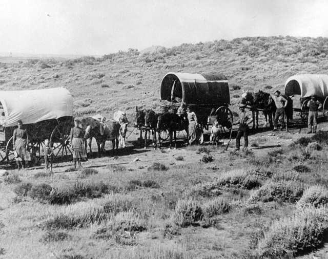
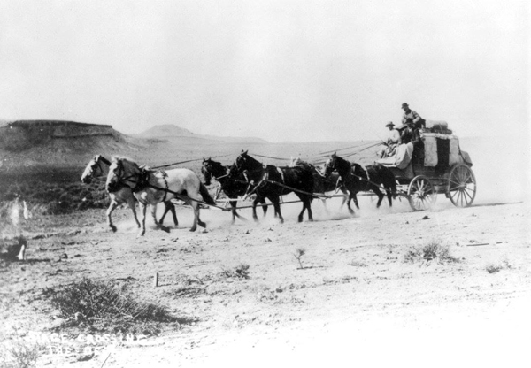
During this phase of the journey the wagon train was doing much of its traveling at night, owing to the great daytime heat of the desert and the long distances between water holes. At regular intervals during the night they would stop for a short rest. At one of these rest stops, eleven-year-old Ellen Baley, a daughter of Gillum and Permelia Baley, fell asleep and failed to awaken when the wagon train moved on. Somehow, she was not missed until the train traveled some distance. The poor girl awoke to find herself alone in the middle of a vast hostile desert. Filled with fright, she began running to catch up with the wagon train, but in her confusion, she took off in the opposite direction. When she was discovered missing, her father and older brother, George, immediately rode back to where they had stopped. To their horror, she was not there! Captured by the Indians must have been their conclusion! Nevertheless, they continued their search by calling out the little girl’s name at the top of their voices as they rode back. Their efforts were soon rewarded when, far off in the distance, came a faint cry,
“Papa, Papa.” Her father immediately answered and kept calling her name until he caught up with her. When reunited with her family and the other members of the wagon train, Ellen had a tale that would be told and retold by family members until the present day.
from:
Disaster at the Colorado
Beale’s Wagon Road and the First Emigrant Party
Charles W. Baley
On the Trail of a Spanish Pioneer
https://mojavedesert.net/garces/garces-journal-13.html
By Francisco Tomás Hermenegildo Garcés, Elliott Coues
Crossing the Sierra
Mar. 21. Leaving the river I set forth southwest- ward, and having gone two leagues through a Canada and some hills, I arrived at a rancheria of five huts (xacales) on the bank of the river.
I continued on a course to the south and entered into a Canada of much wood, grass, and water; I saw many cottonwoods, alders, oaks, very tall firs, and beautiful junipers (sabinos); and having gone one league I arrived at a rancheria of about 80 souls, which I named (Rancheria) de San Benito. I was received with great joy, and they made me the same obeisance.
Mar. 22. I went three leagues and passed over the sierra by the southsouthwest.
The woods that I said yesterday reach to the summit of this sierra, whence I saw clearly the sea, the Rio de Santa Anna, and the Valle de San Joseph. Its descent is little wooded. At a little distance from its foot I found another rancheria where the Indians received me very joyfully. I continued westsouthwest, and having traveled three leagues along the skirt of the sierra, I halted in the Arroyo de los Alisos.
Mar. 23. I traveled half a league westsouthwest, and one south, at the instance of some Indians who met me and made me go to eat at their rancheria. Thereafter having gone another league westsouthwest I came upon the road of the expedition, which . . .
Continued:
https://mojavedesert.net/garces/garces-journal-13.html
noun, plural in form but singular or plural in construction, often attributive
da·ta | \ ˈdā-tə , ˈda- also ˈdä- \
1: factual information (such as measurements or statistics) used as a basis for reasoning, discussion, or calculation
the data is plentiful and easily available— H. A. Gleason, Jr.
comprehensive data on economic growth have been published— N. H. Jacoby
2: information in digital form that can be transmitted or processed
3: information output by a sensing device or organ that includes both useful and irrelevant or redundant information and must be processed to be meaningful
in·for·ma·tion | \ ˌin-fər-ˈmā-shən \
1a
(1): knowledge obtained from investigation, study, or instruction
(2): INTELLIGENCE, NEWS
(3): FACTS, DATA
b: the attribute inherent in and communicated by one of two or more alternative sequences or arrangements of something (such as nucleotides in DNA or binary digits in a computer program) that produce specific effects
c(1): a signal or character (as in a communication system or computer) representing data
(2): something (such as a message, experimental data, or a picture) which justifies a change in a construct (such as a plan or theory) that represents physical or mental experience or another construct
d: a quantitative measure of the content of information specifically: a numerical quantity that measures the uncertainty in the outcome of an experiment to be performed
2: the communication or reception of knowledge or intelligence
1a
(1): the fact or condition of knowing something with familiarity gained through experience or association
(2): acquaintance with or understanding of a science, art, or technique
b(1): the fact or condition of being aware of something
(2): the range of one’s information or understanding
answered to the best of my knowledge
c: the circumstance or condition of apprehending truth or fact through reasoning : COGNITION
d: the fact or condition of having information or of being learned
a person of unusual knowledge
2a: the sum of what is known : the body of truth, information, and principles acquired by humankind
Further reading:
by Walter Feller
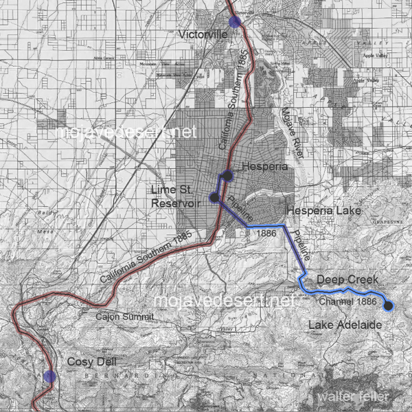
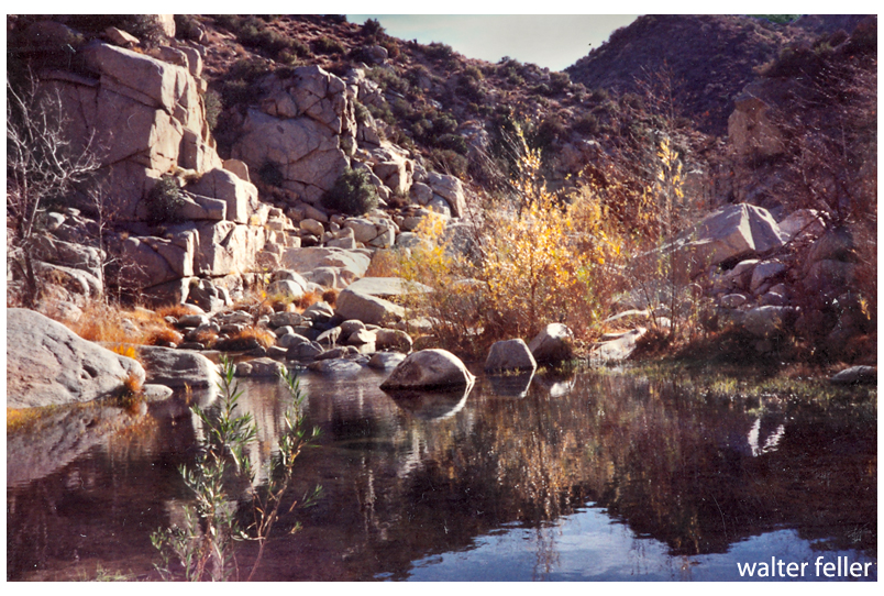
A small dam was erected to raise the water level up against a gate to a flume that could be opened letting water from Deep Creek flow into a stone-walled channel. This channel ran along a carefully continuous slope to a headwater, into a pipeline across the Mojave River, then on to an open reservoir in what is now the City of Hesperia, Ca.
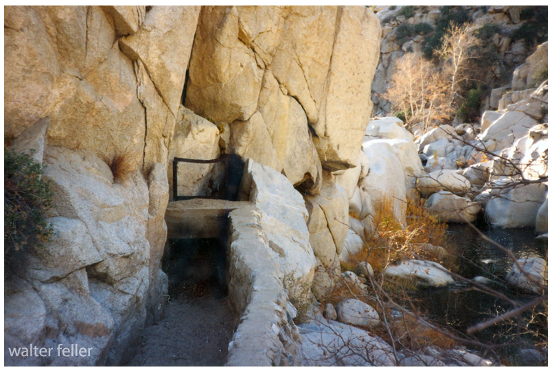
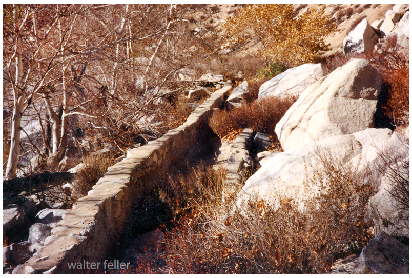
The slope along the canal has to be even to avoid turbulent flow. The walls need to be high enough all along the canal to maintain volume, accommodate hydraulic jump and prevent sloshing over the side. A smooth, even flow like that is called laminar flow.
The smooth flow we look for in an open channel aqueduct is called ‘laminar flow.’ As water passes through the 3 or 4 miles, if the flow is turbulent, all kinds of contaminants may become entrapped and entrained in the water, which is undesirable.
So, water diverted at the flume passes through the gate and into a specifically engineered channel to be delivered to the next step, the headworks.
Think of the headworks as sort of a funnel with the water pouring from the channel into the top of the siphon. There most likely was a grate on there to keep large objects from falling into the pipeline and clogging it.
The pipeline changes direction at Hesperia Lake. The origin of the lake is not exactly clear. One story I have heard is that the lake began when the pipeline was leaking and the water did not drain. There is a shallow well in the park that empties into the lake. The spiral-coiled pipe that was used may very well have sprung a leak under the high pressure of being the lowest point of the siphon, as well as a turning point in the line.
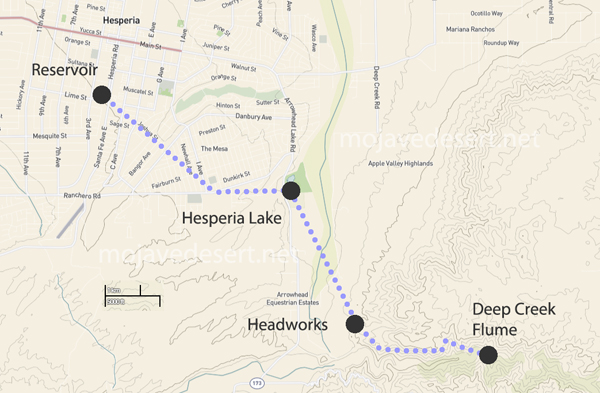
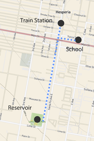
The pipeline turned west at the lake and continued up the little canyon crawling up to the area locally known as ‘the mesa.’ The pipeline then terminated at an open reservoir at what is now Lime Street Park.
All of this rather than dig a hole for a well.
Rotary drilling was being developed, still. Water was down 500-600′ below the surface at this specific location where the reservoir needed to be. Building this canal the 12-14 miles it was, was preferable to digging a well that deep by hand.
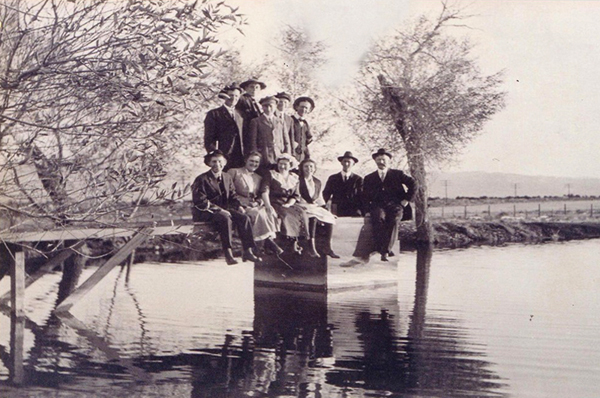
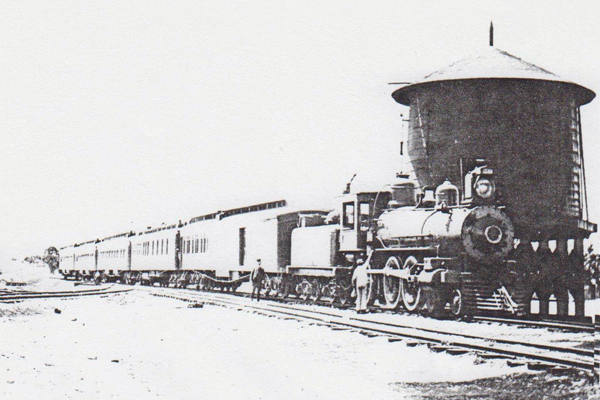
The location of the reservoir was well thought out. The water needed to be here for the community that was being developed. Also, water in an open reservoir that could be seen from a train window was a big attraction for those interested in the area.
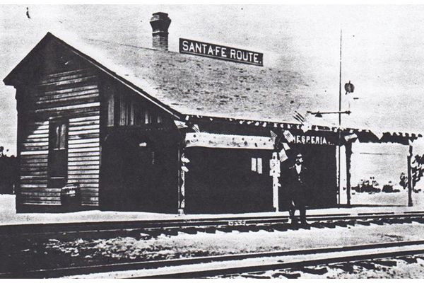
The canal and pipeline were completed in 1886 when the California Southern track was finished and trains began running.
The water in the reservoir would be fed into the water system to fill the tank at the little railroad station across the street from where Walters’ General Store and the Hesperia Hotel would be built, and at the school just over on the east side of the tracks. There at the little schoolhouse at the center of the little community the water that would be delivered at a pressure of 45 PSI, which is about the perfect pressure for use in a home or commercial business.
So, hopefully, all things have been considered and that is the story of how and why water was brought to our mesas and providing our opportunity to grow into the collective mega-empire we are to this very day. IMO.
-end-
by Hanna Landis
Until the early 19th century, water wells were still dug by hand. In 1808 in the United States, mechanical drilling was invented by the Ruffner Brothers. The Ruffner Brothers successfully first used mechanical drilling in Charleston, West Virginia to access water and salt at Great Buffalo Lick. This invention allowed many more wells to be drilled efficiently all over America.
By the 1820s and 1830s, auger boring machines came on the scene. These machines allowed wells to be drilled deeper and for the water to remain uncontaminated as it came up through pipes made of the first iteration of steel. By the early 20th-century rotary drilling technology became standard after the invention of the roller cone drill bit in 1908 by Howard Hughes Sr. Hughes invention is still used today for many types of drilling.
The 1940s brought the invention of portable drilling tools – until then they were all platform-based. And that brings us to the technology that is still in use today.
The following is an excerpt from ‘White Heart of Mojave’ by Edna Brush Perkins
It was discouraging, but we persevered until we found a real old-timer. He was known as Shady Myrick. We never discovered his Christian name though he was a famous desert character. Wherever we went afterward everyone knew Shady. Evidently, the name was not descriptive for all agreed on his honesty and goodness. He was an old man, rather deaf, with clear, very straightforward-gazing eyes.
Most of his life had been spent on the Mojave as a prospector and miner, and much of it in Death Valley itself. The desert held him for her own as she does all old-timers. He was under the “terrible fascination.” As soon as we explained that we had come for no other purpose than to visit his beloved land he was eagerly interested and described the wonders of Death Valley, its beautiful high mountains, its shining white floor, its hot brightness, its stillness, and the flowers that sometimes deck it in the spring.
“If you go there,” he said, “you will see something that you’ll never see anywhere else in the world.”
He had gem mines in the Panamints and was in the habit of going off with his mule-team for months at a time. He even said that he would take us to the valley himself were he a younger man. We assured him that we would go with him gladly. We urged him—you had only to look into his eyes to trust him—promising to do all the work if he would furnish the wagon and be the guide, innocently unaware of the absurdity of such a proposal in the burning heat of Death Valley; but he only smiled gently, and said that
he was too old.
Silver Lake turned out to be the place for us to go after all. He described how we could
drive straight on from Joburg, a hundred and sixteen miles. There was a sort of a road all the way. He drew a map on the sand and said that we could not possibly miss it for a truck had come over six weeks before and we could follow its tracks.
“It ain’t blowed much, or rained since,” he remarked.
“But suppose we should get lost, what would we do?”
“Why should you get lost? Anyway, you could turn around and come back.”
We looked at each other doubtfully. In the far-spreading silence around Joburg the idea of getting lost was more dreadful than it had been at Barstow. There was not even a ranch in the whole hundred and sixteen miles. We hesitated.
“You are well and strong, ain’t you?” he asked. “You can take care of yourselves as well
as anybody. Why can’t you go?”
“You have lived in this country so long, Mr. Myrick,” I tried to explain, “you do not understand how strange it is to a newcomer. How would we recognize those mountains you speak of when we do not even know how the desert mountains look? How could we find the spring where you say we might camp when we have never seen one like it?”
“You can do it,” he insisted, “that’s how you learn.”
“And there is the silence, Mr. Myrick,” I went on, hating to have him scorn us for cowards,” and the big emptiness.”
He understood that and his face grew kind.
“You get used to it,” he said gently.
It was refreshing to meet a man who looked into your feminine eyes and said: “You can do it.” It made us feel that we had to do it. We spent a whole day on a hilltop near Joburg looking longingly over the sinister, beautiful mountains and trying to get up our courage. Happily we were spared the decision. Two young miners at Atolia sent word that they were going over to Silver Lake in a few days and would be glad to have us follow them. Perhaps it was Shady’s doing. We accepted the invitation with gratitude.
He understood that and his face grew kind.
“You get used to it,” he said gently. . . .
Chap. II – How We Found Mojave
“It is often said that America has no real deserts. This is true in the sense that there are no regions such as are found in Asia and Africa where one can travel a hundred miles at a stretch and scarcely see a sign of vegetation—nothing but barren gravel, graceful, wavy sand dunes, hard, wind-swept clay, or still harder rock salt broken into rough blocks with upturned edges. In the broader sense of the term, however, America has an abundance of deserts—regions which bear a thin cover of bushy vegetation but are too dry for agriculture without irrigation…. In the United States the deserts lie almost wholly between the Sierra Nevada and the Rocky Mountain ranges, which keep out any moisture that might come from either the west or the east. Beginning on the north with the sagebrush plateau of southern Washington, the desert expands to a width of seven hundred miles in the gray, sage-covered basins of Nevada and Utah. In southern California and Arizona the sagebrush gives place to smaller forms like the salt-bush, and the desert assumes a sterner aspect. Next comes the cactus desert extending from Arizona far south into Mexico. One of the notable features of the desert is the extreme heat of certain portions. Close to the Nevada border in southern California, Death Valley, 250 feet below sea-level, is the hottest place in America. There alone among the American regions familiar to the writer does one have the feeling of intense, overpowering aridity which prevails so often in the deserts of Arabia and Central Asia. Some years ago a Weather Bureau thermometer was installed in Death Valley at Furnace Creek, where the only flowing water in more than a hundred miles supports a depressing little ranch. There one or two white men, helped by a few Indians, raise alfalfa, which they sell at exorbitant prices to deluded prospectors searching for riches which they never find. Though the terrible heat ruins the health of the white men in a year or two, so that they have to move away, they have succeeded in keeping a thermometer record for some years. No other properly exposed out-of-door thermometer in the United States, or perhaps in the world, is so familiar with a temperature of 100° F. or more. During the period of not quite fifteen hundred days from the spring of 1911 to May, 1915, a maximum temperature of 100° F. or more was reached in five hundred and forty-eight days, or more than one-third of the time. On July 10, 1913, the mercury rose to 134° F. and touched the top of the tube. How much higher it might have gone no one can tell. That day marks the limit of temperature yet reached in this country according to official records. In the summer of 1914 there was one night when the thermometer dropped only to 114° F., having been 128° F. at noon. The branches of a pepper-tree whose roots had been freshly watered wilted as a flower wilts when broken from the stalk.”
—The Chronicles of America.—Volume I. “The Red Man’s Continent,” by Ellsworth Huntington.
Millie was undeniably beautiful. She was quite clever also. She developed a system wherein she could chop wood without lifting a finger. Living at the post office and only store for miles around, she became quite astute at knowing when the cowboys and other such young men would be coming to pick up supplies and mail. She would study the dust coming off the roads in the distance. Seeing this she would walk over to the woodpile, take up her ax, and ineffectively swing it in a feigned attempt to split firewood as her happy victims arrived. She would sigh. What buck could resist? A delightful young lady, an ax, and a pile of wood needing splitting was just what a young man would need to impress and earn her attention. Before too long, a cord of expertly prepared firewood would be neatly stacked ready for cooking and heating.
-Walter Feller
from; The Captivity of the Oatman Girls — Chap. II
“Though the sun had hid its glittering, dazzling face from us behind a tall peak in the distance, yet its rays lingered upon the summits that stretched away between us and the moon, and daylight was full upon us. Our hasty meal had been served. My father, sad, and seemingly spell-bound with his own struggling emotions, was a little on one side, as if oblivious of all immediately about him, and was about in the act of lifting some of the baggage to the wagon, that had as yet remained unloaded since the ascent of the hill, when, casting my eyes down the hill by the way we had come, I saw several Indians slowly and leisurely approaching us in the road. I was greatly alarmed, and for a moment dared not to speak. At the time, my father’s back was turned. I spoke to him, at the same time pointing to the Indians. What I saw in my father’s countenance excited in me a great fear, and took a deeper hold upon my feelings of the danger we were in, than the sight of the Indians. They were now approaching near us. The blood rushed to my father’s face. For a moment his face would burn and flash as it crimsoned with the tide from within ; then a death-like paleness would spread over his countenance, as if his whole frame was suddenly stiffened with horror. I saw too plainly the effort that it cost him to attempt a concealment of his emotions. He succeeded, however, in controlling the jerking of his muscles and his mental agitations, so as to tell us, in mild and composed accents, ‘ not to fear; the Indians would not harm us.’ He had always been led to believe that the Indians could be so treated as to avoid difficulty with them. He had been among them much in the “Western states, and so often tried his theory of leniency with success that he often censured the whites for their severity toward them ; and was disposed to attribute injury received from them to the unwise and cruel treatment of them by the whites. It had long been his pride and boast that he could manage the Indians so that it would do to trust them. Often had he thrown himself wholly in their power, while traveling and doing business in Iowa, and that, too, in times of excitement and hostility, relying upon his coolness, self-possession, and Olive, with my older sister, was standing upon the opposite side of the wagon ; Mary Ann, a little girl about seven years old, sat upon a stone holding to a rope attached to the horns of the foremost team ; the rest of the children were on the opposite side of the wagon from the Indians. My eyes were turned away from the Indians.
Though each of the family was engaged in repairing the wagon, none were without manifestations of fear. For some time every movement of the Indians was closely watched by us. I well remember, however, that after a few moments my own fears were partially quieted, and from their appearance I judged it was so with the rest.
In a subdued, tone frequent expressions were made concerning the Indians, and their possible intentions ; but we were guarded and cautious, lest they might understand our real dread and be emboldened to violence. Several minutes did they thus remain a few feet from us, occasionally turning an eye upon us, and constantly keeping up a low earnest babbling among themselves. At times they gazed eagerly in various directions, especially down the road by which we had come, as if struggling to discern the approach of some object or person either dreaded or expected by them.
” Suddenly, as a clap of thunder from a clear sky, a deafening yell broke upon us, the Indians jumping into ‘the air, and uttering the most frightful shrieks,. and at the same time springing toward us flourishing their war- clubs, which had hitherto been concealed under their wolf-skins. I was struck upon the top and back of my head, came to my knees, when with another blow, I was struck blind and senseless.” One of their numbers seized and jerked Olive one side, ere they had dealt the first blow.
“As soon,” continues Olive, as they had taken me one side, and while one of the Indians was leading me off, I saw them strike Lorenzo, and almost at the same instant my father also. I was so bewildered, and taken by surprise by the suddenness of their movements, and their deafening yells, that it was some little time before I could realize the horrors of my situation. When I turned around, opened my eyes, and collected my thoughts, I saw my father, my own dear father struggling, bleeding, and moaning in the most pitiful manner! Lorenzo was lying with his face in the dust, the top of his head covered with blood, and his ears and mouth bleeding profusely. I looked around and saw my poor mother, with her youngest child clasped in her arms, and both of them still, as if the work of death had already been completed; a little distance on the opposite side of the wagon, stood little Mary Ann, with her face covered with her hands, sobbing aloud, and a huge-looking Indian standing over her; the rest were motionless, save a younger brother and my father, all upon the ground dead or dying. At this sight a thrill of icy coldness passed over me; I thought I had been struck ; my thoughts began to reel and became irregular and confused; I fainted and sank to the earth, and for a while, I know not how long, I was insensible.
“When I recovered my thoughts I could hardly realize where I was, though I remembered to have considered myself as having also been struck to the earth, and thought I was probably dying. I knew that all, or nearly all of the family had been murdered; thus bewildered, confused, half conscious and half insensible, I remained a short time, I know not how long, when suddenly I seemed awakened to the dreadful realities around me. My little sister was standing by my side, sobbing and crying, saying : ‘Mother, O mother ! Olive, mother and father are killed, with all our poor brothers and sisters.’ I could no longer look upon the scene. Occasionally a low, piteous moan would come from some one of the family as in a dying state. I distinguished the groans of my poor mother, and sprang wildly toward her, but was held back by the merciless savage holding me in his cruel grasp, and lifting a club over my head, threatening me in the most taunting, barbarous manner. I longed to have him put an end to my life. ‘0h!, thought I, ‘must I know that my poor parents have been killed by these savages and I remain alive !’ I asked them to kill me, pleaded with them to take my life, but all my pleas and prayers only excited to laughter and taunts the two wretches to whose charge we had been committed.
” After these cruel brutes had consummated their work of slaughter, which they did in a few moments, they then commenced to plunder our wagon and the persons of the family whom they had killed. They broke open the boxes with stones and clubs, plundering them of such of their contents as they could make serviceable to themselves. They took off the wagon wheels, or a part of them, tore the wagon covering off from its frame, unyoked the teams and detached them from the wagons, and commenced to pack the little food, with many articles of their plunder, as if preparatory to start on a long journey. Coming to a feather bed, they seized it, tore it open, scattering its contents to the winds, manifesting meanwhile much wonder and surprise, as if in doubt what certain articles of furniture, and conveniences for the journey we had with us, could be intended for. Such of these as they selected, with the little food we had with us that they could conveniently pack, they tied up in bundles, and started down the hill by the way they had come, driving us on before them. “We descended the hill, not knowing their intentions concerning us, but under the expectation that they would probably take our lives by slow torture. After we had descended the hill and crossed the river, and traveled about one half of a mile by a dim trail leading through a dark, rough, and narrow defile in the hills, we came to an open place where there had been an Indian camp before and halted. The Indians took off their packs, struck a fire, and began in their own way to make preparations for a meal. They boiled some of the beans just from our wagon, mixed some flour with water, and baked it in the ashes. They offered us some food, but in the most insulting and taunting manner, continually making merry over every indication of grief in us, and with which our hearts were ready to break. We could not eat. After the meal, and about an hour’s rest, they began to repack and make preparations to proceed.
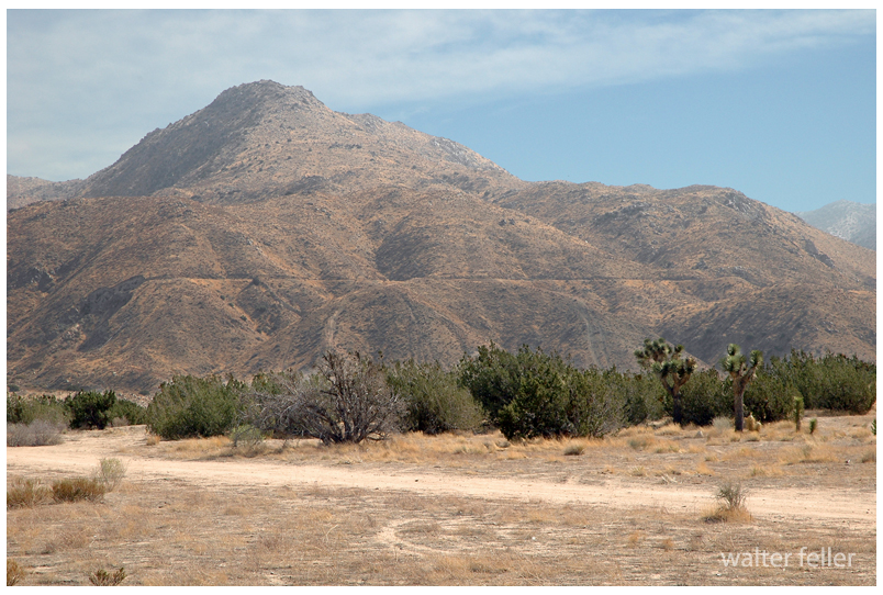
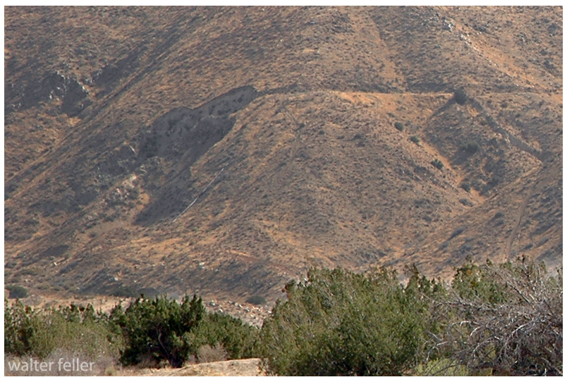
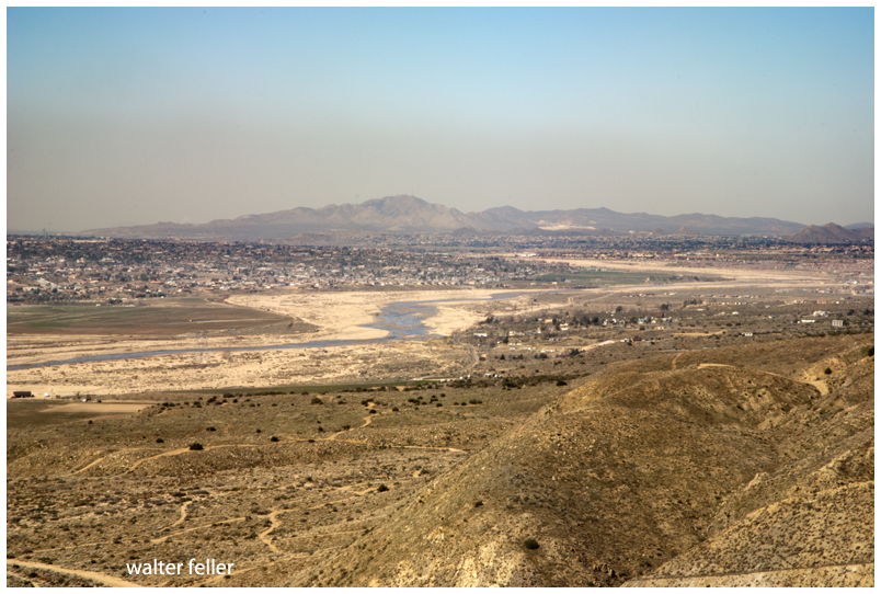
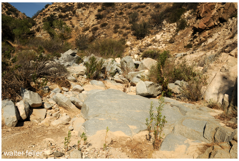
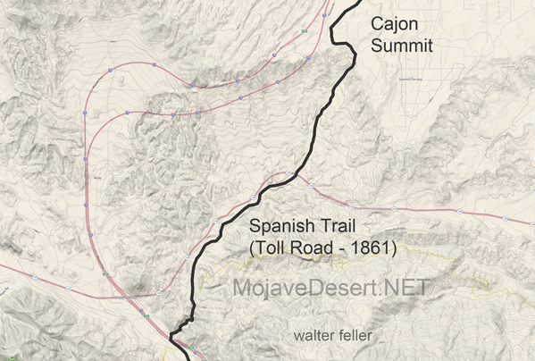
Originally, possibly a footpath for trade and society. There is no written record of that. After explorers, and then trade caravans wore in mule trails and braided paths as travelers do, to find the path of least resistance. Following the Mojave River, and to get to the hills and valleys of southern California this route was the most direct way, and indeed it was the only way for miles and miles in either direction where wagons could pass through the mountains.
All the frayed trails come together at essentially one point. Within a few yards either way, most all travelers would pass through this trail bottleneck. If there were remnants or traces of old wagon roads where pioneers and freighters passed through and they could still be seen, it would be here where this faint suggestion of an old trail can be observed.


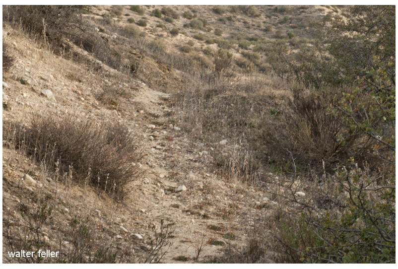
I have heard that Captain Jefferson Hunt brought the first wagon through the pass. Since he succeeded at that, Captain Hunt became instrumental in bringing the early pioneer wagon trains across the Mojave Desert.
Steep at the top and rocky at the bottom, the solution was to disassemble wagons at the bottom and use mules to pack everything through the rocks on the mule trail, then put it all back together.
Floods were common and so was the erosion which would cause damage to the already rugged trails. One time this way would be good, the next time another.
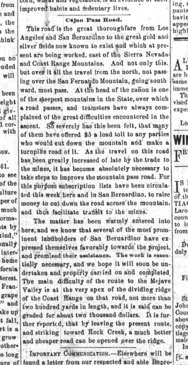
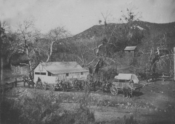
This road is the great thoroughfare from Los Angeles and San Bernardino to the great gold and silver fields now known to exist and which at present are being worked, east of the Sierra Nevada and Coast Range Mountains. And not only this but over it, all the travel from the north, not passing over the San Fernando Mountain, going southward, must pass. At the head of the cañon is one of the steepest mountains in the State, over which a road passes, and teamsters have always complained of the great difficulties encountered in the ascent. So severely has this been felt, that many of them have offered $5 a load toll to any parties who would cut down the mountain and make a turnpike road of it. As the travel on this road has been greatly increased of late by the trade to the mines, it has become absolutely necessary to take steps to improve the mountain pass road. For this purpose subscription lists have been circulated this week here and in San Bernardino, to raise money to cut down the road across the mountain, and thus facilitate transit to the mines.
– Los Angeles Star – April 6, 1861
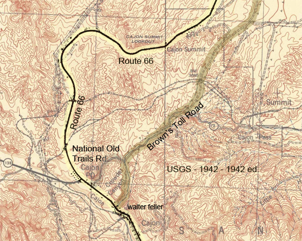
The road which I followed in 1865 crosses from left to right bank of the river a few miles above the Grapevine place said, continues past Cottonwood to Point of Rocks, 22 miles from Grapevine, on a southwest course; at Point of Rocks it turns due south to what was called Lane’s, or the Upper crossing, and there leaves the river entirely to strike straight south by west for Cajon pass in the mountains, reached in 19 miles from Lane’s. This is the way I went, as my itinerary shows: ” Nov. 9. To Martin’s ranch, 29 miles S. from Lane’s crossing; more than half the distance in open country, and then we entered the Cajon pass in the mountains, where there is a tollgate. The pass is a narrow, deep, and tortuous canon, the roughest I have ever traversed on wheels; there was 10 miles of this from the tollgate to Martin’s ranch.” Now Garces has been sent through Cajon pass, with a query, as by Bancroft, Hist. Cala., i, p. 275; but I do not think he went that way. Taking his courses on their face, he continued up the Mojave.
– Elliot Coues – On the Trail of a Spanish Pioneer
by Bret Harte –
Francis Brett Hart, known as Bret Harte (August 25, 1836 – May 5, 1902), was an American short story writer and poet, best remembered for his short fiction featuring miners, gamblers, and other romantic figures of the California Gold Rush.
I stood with my shawl and carpetbag in hand, gazing doubtingly on the vehicle. Even in the darkness the red dust of Wingdam was visible on its roof and sides, and the red slime of Slumgullion clung tenaciously to its wheels. I opened the door; the stage creaked easily, and in the gloomy abyss the swaying straps beckoned me, like ghostly hands, to come in now and have my sufferings out at once.
I must not omit to mention the occurrence of a circumstance which struck me as appalling and mysterious. A lounger on the steps of the hotel, who I had reason to suppose was not in any way connected with the stage company, gravely descended, and walking toward the conveyance, tried the handle of the door, opened it, expectorated in the carriage, and returned to the hotel with a serious demeanor. Hardly had he resumed his position when another individual, equally disinterested, impassively walked down the steps, proceeded to the back of the stage, lifted it, expectorated carefully on the axle, and returned slowly and pensively to the hotel. A third spectator wearily disengaged himself from one of the Ionic columns of the portico and walked to the box, remained for a moment in serious and expectorative contemplation of the boot, and then returned to his column. There was something so weird in this baptism that I grew quite nervous.
Perhaps I was out of spirits. A number of infinitesimal annoyances, winding up with the resolute persistency of the clerk at the stage office to enter my name misspelt on the waybill, had not predisposed me to cheerfulness. The inmates of the Eureka House, from a social viewpoint, were not attractive. There was the prevailing opinion–so common to many honest people–that a serious style of deportment and conduct toward a stranger indicates high gentility and elevated station. Obeying this principle, all hilarity ceased on my entrance to supper, and general remark merged into the safer and uncompromising chronicle of several bad cases of diphtheria, then epidemic at Wingdam. When I left the dining-room, with an odd feeling that I had been supping exclusively on mustard and tea leaves, I stopped a moment at the parlor door. A piano, harmoniously related to the dinner bell, tinkled responsive to a diffident and uncertain touch. On the white wall the shadow of an old and sharp profile was bending over several symmetrical and shadowy curls. “I sez to Mariar, Mariar, sez I, ‘Praise to the face is open disgrace.'” I heard no more. Dreading some susceptibility to sincere expression on the subject of female loveliness, I walked away, checking the compliment that otherwise might have risen unbidden to my lips, and have brought shame and sorrow to the household.
It was with the memory of these experiences resting heavily upon me that I stood hesitatingly before the stage door. The driver, about to mount, was for a moment illuminated by the open door of the hotel. He had the wearied look which was the distinguishing expression of Wingdam. Satisfied that I was properly waybilled and receipted for, he took no further notice of me. I looked longingly at the box seat, but he did not respond to the appeal. I flung my carpetbag into the chasm, dived recklessly after it, and–before I was fairly seated–with a great sigh, a creaking of unwilling springs, complaining bolts, and harshly expostulating axle, we moved away. Rather the hotel door slipped behind, the sound of the piano sank to rest, and the night and its shadows moved solemnly upon us.
To say it was dark expressed but faintly the pitchy obscurity that encompassed the vehicle. The roadside trees were scarcely distinguishable as deeper masses of shadow; I knew them only by the peculiar sodden odor that from time to time sluggishly flowed in at the open window as we rolled by. We proceeded slowly; so leisurely that, leaning from the carriage, I more than once detected the fragrant sigh of some astonished cow, whose ruminating repose upon the highway we had ruthlessly disturbed. But in the darkness our progress, more the guidance of some mysterious instinct than any apparent volition of our own, gave an indefinable charm of security to our journey that a moment’s hesitation or indecision on the part of the driver would have destroyed.
I had indulged a hope that in the empty vehicle I might obtain that rest so often denied me in its crowded condition. It was a weak delusion. When I stretched out my limbs it was only to find that the ordinary conveniences for making several people distinctly uncomfortable were distributed throughout my individual frame. At last, resting my arms on the straps, by dint of much gymnastic effort I became sufficiently composed to be aware of a more refined species of torture. The springs of the stage, rising and falling regularly, produced a rhythmical beat which began to absorb my attention painfully. Slowly this thumping merged into a senseless echo of the mysterious female of the hotel parlor, and shaped itself into this awful and benumbing axiom–“Praise-to-the-face-is- open-disgrace. Praise-to-the-face-is-open-disgrace.” Inequalities of the road only quickened its utterance or drawled it to an exasperating length.
It was of no use to consider the statement seriously. It was of no use to except to it indignantly. It was of no use to recall the many instances where praise to the face had redounded to the everlasting honor of praiser and bepraised; of no use to dwell sentimentally on modest genius and courage lifted up and strengthened by open commendation; of no use to except to the mysterious female, to picture her as rearing a thin-blooded generation on selfish and mechanically repeated axioms–all this failed to counteract the monotonous repetition of this sentence. There was nothing to do but to give in–and I was about to accept it weakly, as we too often treat other illusions of darkness and necessity, for the time being, when I became aware of some other annoyance that had been forcing itself upon me for the last few moments. How quiet the driver was!
Was there any driver? Had I any reason to suppose that he was not lying gagged and bound on the roadside, and the highwayman with blackened face who did the thing so quietly driving me–whither? The thing is perfectly feasible. And what is this fancy now being jolted out of me? A story? It’s of no use to keep it back– particularly in this abysmal vehicle, and here it comes: I am a Marquis–a French Marquis; French, because the peerage is not so well known, and the country is better adapted to romantic incident– a Marquis, because the democratic reader delights in the nobility. My name is something LIGNY. I am coming from Paris to my country seat at St. Germain. It is a dark night, and I fall asleep and tell my honest coachman, Andre, not to disturb me, and dream of an angel. The carriage at last stops at the chateau. It is so dark that when I alight I do not recognize the face of the footman who holds the carriage door. But what of that?–PESTE! I am heavy with sleep. The same obscurity also hides the old familiar indecencies of the statues on the terrace; but there is a door, and it opens and shuts behind me smartly. Then I find myself in a trap, in the presence of the brigand who has quietly gagged poor Andre and conducted the carriage thither. There is nothing for me to do, as a gallant French Marquis, but to say, “PARBLEU!” draw my rapier, and die valorously! I am found a week or two after outside a deserted cabaret near the barrier, with a hole through my ruffled linen and my pockets stripped. No; on second thoughts, I am rescued–rescued by the angel I have been dreaming of, who is the assumed daughter of the brigand but the real daughter of an intimate friend.
Looking from the window again, in the vain hope of distinguishing the driver, I found my eyes were growing accustomed to the darkness. I could see the distant horizon, defined by India-inky woods, relieving a lighter sky. A few stars widely spaced in this picture glimmered sadly. I noticed again the infinite depth of patient sorrow in their serene faces; and I hope that the vandal who first applied the flippant “twinkle” to them may not be driven melancholy-mad by their reproachful eyes. I noticed again the mystic charm of space that imparts a sense of individual solitude to each integer of the densest constellation, involving the smallest star with immeasurable loneliness. Something of this calm and solitude crept over me, and I dozed in my gloomy cavern. When I awoke the full moon was rising. Seen from my window, it had an indescribably unreal and theatrical effect. It was the full moon of NORMA–that remarkable celestial phenomenon which rises so palpably to a hushed audience and a sublime andante chorus, until the CASTA DIVA is sung–the “inconstant moon” that then and thereafter remains fixed in the heavens as though it were a part of the solar system inaugurated by Joshua. Again the white-robed Druids filed past me, again I saw that improbable mistletoe cut from that impossible oak, and again cold chills ran down my back with the first strain of the recitative. The thumping springs essayed to beat time, and the private-box-like obscurity of the vehicle lent a cheap enchantment to the view. But it was a vast improvement upon my past experience, and I hugged the fond delusion.
My fears for the driver were dissipated with the rising moon. A familiar sound had assured me of his presence in the full possession of at least one of his most important functions. Frequent and full expectoration convinced me that his lips were as yet not sealed by the gag of highwaymen, and soothed my anxious ear. With this load lifted from my mind, and assisted by the mild presence of Diana, who left, as when she visited Endymion, much of her splendor outside my cavern–I looked around the empty vehicle. On the forward seat lay a woman’s hairpin. I picked it up with an interest that, however, soon abated. There was no scent of the roses to cling to it still, not even of hair oil. No bend or twist in its rigid angles betrayed any trait of its wearer’s character. I tried to think that it might have been “Mariar’s.” I tried to imagine that, confining the symmetrical curls of that girl, it might have heard the soft compliments whispered in her ears which provoked the wrath of the aged female. But in vain. It was reticent and unswerving in its upright fidelity, and at last slipped listlessly through my fingers.
I had dozed repeatedly–waked on the threshold of oblivion by contact with some of the angles of the coach, and feeling that I was unconsciously assuming, in imitation of a humble insect of my childish recollection, that spherical shape which could best resist those impressions, when I perceived that the moon, riding high in the heavens, had begun to separate the formless masses of the shadowy landscape. Trees isolated, in clumps and assemblages, changed places before my window. The sharp outlines of the distant hills came back, as in daylight, but little softened in the dry, cold, dewless air of a California summer night. I was wondering how late it was, and thinking that if the horses of the night traveled as slowly as the team before us, Faustus might have been spared his agonizing prayer, when a sudden spasm of activity attacked my driver. A succession of whip-snappings, like a pack of Chinese crackers, broke from the box before me. The stage leaped forward, and when I could pick myself from under the seat, a long white building had in some mysterious way rolled before my window. It must be Slumgullion! As I descended from the stage I addressed the driver:
“I thought you changed horses on the road?”
“So we did. Two hours ago.”
“That’s odd. I didn’t notice it.”
“Must have been asleep, sir. Hope you had a pleasant nap. Bully place for a nice quiet snooze–empty stage, sir!”
–
We can speak of the unholy Wind
and no matter how clever or articulate,
the Wind may censure our little voice.