1910–1912 – Survey and planning begin for a rail line to support the construction of the Los Angeles Aqueduct.
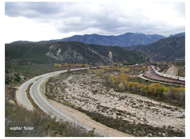
1912–1914 – Construction of the Jawbone Branch (also called the Lone Pine Branch) by the Southern Pacific Railroad. It runs from Mojave to Owenyo, about 90 miles.
1914–1920s – Line supports agriculture, mining, and the cement industry; connects with the narrow-gauge Carson & Colorado at Owenyo.
1930s–1940s – Steam locomotives dominate operations; regular mixed freight runs continue, including to and from Trona and Inyokern.
1950s–1960s – Diesel locomotives gradually replace steam. Traffic declines but continues, with some military use near Inyokern.
1970s – Operations decrease; the northern end of the line sees fewer trains.
1982 – A fire damages Tunnel #1 near Searles. The northern section from Searles to Lone Pine is shut down.
1990s – Rails removed north of Searles.
2000s–present – Southern portion near Trona still used by Trona Railway. Most of the branch is abandoned, but it is still traceable by grade and remnants.
In the early 1850s, as the United States expanded westward, national interest grew in finding a viable transcontinental railroad route. Congress appropriated funds in 1853 for multiple surveying expeditions to explore different potential routes across the West.
Lt. Amiel Weeks Whipple
Under the direction of Secretary of War Jefferson Davis, the Army’s Corps of Topographical Engineers organized surveys along several parallels. Lieutenant Amiel Weeks Whipple, a West Point-trained engineer, was chosen to lead the study near the 35th parallel north, roughly following a westward line from Arkansas to California. The goal was to assess the terrain’s suitability for a railroad, measuring distances and grades, locating mountain passes, and noting the availability of water, timber, fuel, and other resources critical for railway construction. This effort was part of a larger Pacific Railroad Surveys program, which dispatched teams to investigate northern, central, and southern routes for the first transcontinental railroad.
John Milton Bigelow, a physician and botanist
Whipple was already an experienced surveyor. He had worked on the U.S.–Mexico boundary survey after the Mexican–American War and had a reputation for scientific thoroughness. For the railroad survey, Whipple assembled a multidisciplinary team of about seventy men, including Army soldiers for security, teamsters to handle the wagons, and a number of scientists and specialists. The Smithsonian Institution helped select many of the expedition’s experts, reflecting the survey’s dual nature as both a route reconnaissance and a scientific exploration of the largely unmapped Southwest. Notable members of Whipple’s party included John Milton Bigelow, a physician and botanist; Jules Marcou, a geologist from France; and Balduin Möllhausen, a German artist and naturalist who had the backing of famed explorer Alexander von Humboldt. Lieutenant Joseph C. Ives, a young Army engineer, served as Whipple’s second-in-command and led a sub-party during the journey. The team’s diverse expertise meant that, in addition to plotting a railroad route, they would document the region’s flora, fauna, geology, and ethnography in unprecedented detail.
Journey from Fort Smith to New Mexico Territory
Lt. Joseph Christmas Ives
Whipple’s expedition officially commenced in mid-July 1853 at Fort Smith, Arkansas, then a border outpost to Indian Territory (present-day Oklahoma). The caravan – a long train of wagons and pack animals – set westward from Fort Smith on July 15, 1853. The team initially followed established trails where possible: they crossed the Poteau River into Indian Territory and proceeded along rough wagon roads just south of the Canadian River. This path had been traversed a few years earlier by expeditions such as Captain Randolph Marcy’s 1849 wagon road survey to Santa Fe. Even so, much of the region remained sparsely charted. The landscape of eastern Oklahoma was a patchwork of settlements belonging to relocated Native American nations (Choctaw, Chickasaw, Creek, Seminole, Cherokee, among others). As they traveled through these inhabited areas, Whipple often sought advice and guides from local Native people. The party moved steadily but cautiously, averaging only a few dozen miles per day due to the heavy wagons and the need to survey as they went.
Throughout the Indian Territory, Whipple was struck by the relative fertility and land resources. In contrast to earlier notions of the Southern Plains as part of the “Great American Desert,” Whipple described parts of what is now Oklahoma in encouraging terms. His team noted ample timber stands in regions like the Cross Timbers and discovered occurrences of coal, both assets for any future railroad. They found the prairie soils suitable for agriculture, observing that the area could yield abundant crops with sufficient water. Wildlife was surprisingly scarce along their route at first (likely due to overhunting and the presence of settlements). Still, as the expedition progressed into less populated areas, they encountered more game, including herds of bison and the occasional bear on the plains. The surveyors also recorded observations on the Native tribes they met. Whipple, with an ethnographer’s eye, collected information on indigenous languages and customs. He and his colleagues compiled vocabularies of various Native languages and noted the social conditions of the tribes, many of whom had been relocated to the Territory. The hospitality of local Native leaders helped the party traverse the region; in return, Whipple’s reports portrayed the tribes in a largely favorable light and even noted their openness to the idea of a future railroad bringing new opportunities.
By late summer, the expedition reached the Texas Panhandle, entering an environment of open high prairie. Here, the going became more challenging – the trails were faint, water sources more intermittent, and the heat and dryness more intense. In early September, the party was trekking across the flat expanse known as the Llano Estacado (Staked Plain) in what is now the Texas–New Mexico border area. Despite the hardships of travel across these arid plains, Whipple remained optimistic about the route’s potential. He reported that much of the rolling prairie appeared well-suited for laying track, with gentle grades and few significant barriers. Occasional hazards did arise: at one point, massive prairie fires swept across the dry grasslands, forcing the survey team to move camp to avoid the flames hurriedly. Nevertheless, the expedition pressed onward without major incident by carefully timing their marches between water holes and taking guidance from seasoned frontier scouts.
In early October 1853, Whipple’s party reached Albuquerque in the New Mexico Territory. This was a significant milestone and a chance to regroup. Albuquerque had been an outpost on the old Santa Fe Trail, providing a place to resupply and rest after the long plains crossing. Here, the expedition was joined by Lieutenant Ives’s detachment, which had taken a slightly different approach route. Ives and a small group had traveled separately via a southern path, moving from the Gulf of Mexico through Texas (through San Antonio and El Paso) and northward up the Rio Grande to rendezvous with Whipple. The combined expedition, now fully assembled in Albuquerque, prepared to tackle the most demanding portion of the journey: the remote deserts and mountains between New Mexico and California. They hired an experienced guide, Antoine Leroux, a frontiersman familiar with western trails, to assist in navigating the unknown terrain ahead. As autumn turned to winter, Whipple’s caravan departed Albuquerque, heading west into increasingly rugged country.
Across Arizona and the Mojave Desert to California
Leaving the relative civilization of the Rio Grande valley, Whipple’s survey entered what is now Arizona – a land largely unmapped by Americans at that time. The expedition first passed through the lands of the Zuni Pueblo, one of the Indigenous villages in western New Mexico. Whipple was very interested in the pueblo cultures; he paused to exchange greetings and study their way of life briefly, even sketching and describing Zuni architecture and traditions for his report. The party struck out from Zuni across northeastern Arizona, traversing the Painted Desert region. They aimed for the Little Colorado River, which they reached by following ancient Native trails. This stretch was difficult: water and grass were scarce, and the winter cold began to set in. The surveyors likely encountered patches of snow as they ascended in elevation. Still, the group persevered, mapping the terrain carefully. They made note of volcanic formations and other geologic curiosities as they approached the lofty San Francisco Mountains (the San Francisco Peaks near modern Flagstaff, Arizona).
Guided by Antoine Leroux, the expedition found a pass through the San Francisco Mountains and descended into the basin of the Colorado River. By January 1854, they were in some of the most remote territory of the Southwest – a stark land of canyons and plateaus. Here, two Mohave Native American guides joined the party and proved invaluable. The Mohave people inhabited the river valley and deserts around the lower Colorado, and they knew the best routes through the arid labyrinth ahead. Under the guidance of these local scouts, Whipple’s team followed a path down a tributary called Bill Williams Fork to reach the Colorado River itself near the boundary of modern Arizona and California.
Crossing the Colorado River in the winter of 1854 was one of the expedition’s most significant challenges. The river was swift and cold, and the expedition had to build rafts or use whatever boats they could improvise to ferry men, animals, and equipment across. This crossing proveddisastrous – strong currents nearly swept away some of the party’s wagons and scientific collections. A makeshift raft capsized at one point, and several precious items (instruments and specimen jars) were lost to the muddy waters. Fortunately, no lives were lost, and Whipple managed to get his entire command safely to the western bank after considerable effort and delay. By February 7, 1854, the surveyors stood in California, having conquered the last significant natural barrier on their route.
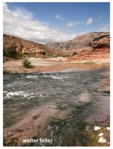
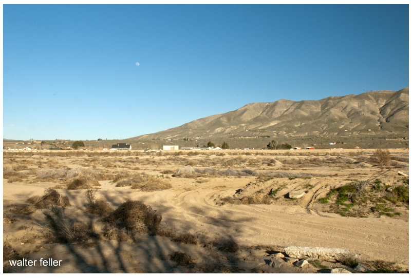
Now the task remained to cross the vast Mojave Desert of southeastern California and reach the settled areas near the Pacific coast. The Mojave presented different obstacles: arid expanses, occasional sand dunes, and long stretches with no reliable water aside from a few springs. Still accompanied by their Mohave guides, Whipple’s party navigated along established Native trails that connected waterholes across the desert. They moved generally northwest from Colorado, eventually picking up the path of the old Mojave Road (a route used by Native Americans and the early Spanish travelers to California). This trail led toward the Mojave River, a critical lifeline in the desert. Following the Mojave River upstream (southwestward), the expedition could find water and grass for their stock at intermittent stream bends and oases.
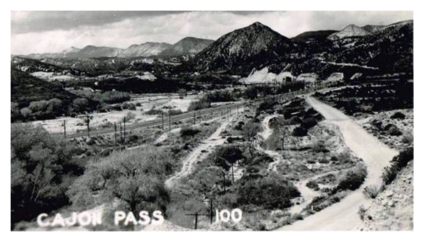
Traveling along the Mojave River, Whipple noted signs of earlier travelers – evidence that this route had been used by Spanish missionaries, American fur trappers, and emigrant wagon parties in years past. They were approaching where the Mojave Road merged with the Old Spanish Trail and the newer Southern California wagon roads. The terrain gradually changed: dry lakes and creosote flats gave way to the higher elevations of the California Coast Range. The expedition’s final hurdle was to cross the San Bernardino Mountains via the Cajon Pass, the same pass used by traders and settlers to enter southern California. Cajon Pass was a natural mountain pass between the Mojave Desert and the coastal valleys. Whipple’s survey assessed this pass carefully, measuring its grade and width, and found it to be a favorable corridor for a railroad line. He reported that Cajon Pass, already well-traveled by wagons, could be engineered for locomotives without extraordinary difficulty – a significant affirmation, since this gap was the gateway to Los Angeles.
After emerging from Cajon Pass, the weary expedition descended into the green fields of southern California. They passed through the outskirts of San Bernardino, a young Mormon-founded community, and finally reached Los Angeles on March 20, 1854. This completed an epic journey of roughly 1,800 miles from the Mississippi River to the Pacific coast. Whipple’s team had spent about eight months on the trail, enduring extreme weather, rugged terrain, and occasional threats (from the environment more so than from people – indeed, relations with Native tribes along the way had been largely peaceful and cooperative). The triumphant arrival in Los Angeles marked the conclusion of the field survey. However, in many ways, Whipple’s work was just beginning: he now had to compile his findings and analysis for the government, recommending whether this 35th parallel route was suitable for a transcontinental railroad.
Scientific and Cultural Observations
Beyond its purely geographic accomplishments, the Whipple expedition made significant scientific and cultural contributions. It was, by design, a traveling research laboratory. The team’s specialists collected volumes of data and specimens throughout the trek. Botanist John Bigelow gathered hundreds of plant samples, discovering species new to science (many western plants would later be named in honor of Bigelow). Geologist Jules Marcou studied rock formations along the route, producing one of the first geological transects of the American Southwest – identifying coal seams and mineral deposits, and noting the volcanic origins of landscapes like the San Francisco Peaks. Topographical drawings and paintings by Balduin Möllhausen, the expedition artist, provided eastern audiences with their first realistic views of wonders such as pueblo villages, broad prairie vistas, and desert mountain ranges. Möllhausen also kept a personal journal describing daily life on the trail, which, along with the diary of assistant surveyor John P. Sherburne, offers vivid insights into the expedition’s experiences (both of these journals were later published and are valuable historical sources).
Lieutenant Whipple was intensely interested in ethnography (the study of cultures). As the expedition passed through regions inhabited by diverse peoples – from the settled Choctaw and Chickasaw farms in Indian Territory to the semi-nomadic Apache bands in New Mexico, the Pueblo villages, and the Mohave and Yavapai groups near the Colorado – Whipple took the time to observe and document their ways of life. He recorded information on tribal governance, agriculture, and daily customs. One notable effort was the compilation of vocabularies: Whipple’s report included comparative word lists for numerous Native languages encountered on the journey, preserving linguistic data that might have otherwise been lost. He was generally respectful in his descriptions, often noting the hospitality and helpfulness the survey party received. For instance, the Zuni and Mohave guides were crucial to the expedition’s success, and Whipple acknowledged their vital role in navigating the rugged country.
The scientific observations were not just academic; they directly tied into evaluating the railroad route’s feasibility. Whipple’s team cataloged where good timber stands grew (necessary for supplying wood for construction and fuel), where water was available year-round, and the locations of coal, iron, or other minerals that might support a railroad economy. In Oklahoma and New Mexico, they identified river valleys and mountain passes that could accommodate tracks with gentle gradients. In the drier sections of the route, they noted stretches that might require constructing wells or aqueducts to supply locomotives with water. The data collected on weather and climate led Whipple to an interesting conclusion: the 35th parallel route, he believed, had a climate “favored by precipitation” compared to some more northerly routes. In other words, he thought this middle-southern route received enough rainfall. He had enough perennial streams to sustain a railroad, without the extreme snowfalls that plagued routes farther north and without the absolute aridity of the far southern deserts. His final report reflected this climatic optimism, emphasizing the agricultural and settlement potential of the lands along the 35th parallel line.
Results and Legacy of the Expedition
Maj. Albert H. Campbell
Upon reaching California, Whipple and his colleagues turned to organizing their notes, maps, and collections. Over the next year, they prepared a comprehensive report for the War Department. Lieutenant Whipple authored the narrative of the journey and the analysis of the route’s suitability for a railroad. He highlighted that the expedition had identified a practicable rail corridor. There were only a few significant obstacles (notably the crossings of the Pecos and Rio Grande rivers and the passage through Cajon Pass), and even those could be overcome with engineering effort. Whipple’s engineer, A. H. Campbell, compared these challenges to building railroads in the Appalachians back east, implying that nothing in the West was insurmountable by modern (1850s) engineering standards. In Whipple’s estimation, the 35th parallel route offered an attractive balance: it was shorter than the far-southern route through Texas, avoided the highest peaks and snows of the central Rockies, and ran through regions that appeared fertile enough to populate and economically develop.
The U.S. government published the expedition’s official findings as part of a monumental series titled “Reports of Explorations and Surveys to Ascertain the Most Practicable and Economical Route for a Railroad from the Mississippi River to the Pacific Ocean.” Whipple’s report was contained in Volume III of the Pacific Railroad Survey Reports (1856), including his detailed narrative, maps, and journey illustrations. An accompanying Volume IV (1856) contained the scientific appendices: reports on geology, botany, zoology, and a significant essay by Whipple on the Native American tribes of the Southwest. These volumes were richly illustrated with lithographs based on Möllhausen’s sketches – images that introduced Americans to scenes like a Plains Indian encampment, a Pueblo village under the cliffs, and the majestic profiles of western mountain ranges. The reports were technical documents and essential works of natural science and anthropology for their time.
Balduin Möllhausen – writer, illustrator
Despite Whipple’s strong recommendation of the 35th parallel route, the decision on a transcontinental railroad was ultimately delayed by political conflict. In the 1850s, Congress remained deadlocked between Northern and Southern factions, each promoting different routes. No single route was chosen before the outbreak of the Civil War. Whipple’s careful survey, unfortunately, did not immediately lead to the construction of a railroad along his line. Indeed, when the first transcontinental railroad was finally built in the 1860s, it followed a more central route (far north of Whipple’s line) to connect Omaha with Sacramento. However, Whipple’s work was not in vain. His survey proved that a railroad could traverse the Southwest and helped identify the best passageways through a once-mysterious region. In the decades after the Civil War, railroad companies did turn to the 35th parallel corridor: the Atlantic and Pacific Railroad (later part of the Atchison, Topeka and Santa Fe Railway) built westward along much of Whipple’s path through New Mexico and Arizona. By the late nineteenth century, a transcontinental railway line was completed along the 35th parallel, validating Whipple’s original vision by providing a direct rail link to Los Angeles through the Mojave Desert.
The Whipple expedition also left a lasting legacy in science and exploration. The enormous collection of plant and animal specimens sent back east enriched American museums and led to the description of new species. The detailed maps produced by Whipple’s cartographers became base maps for the Southwest, used by future travelers, the military, and settlers. His ethnographic notes provided scholars with early documentation of Native cultures in regions that would soon experience dramatic change. Additionally, members of Whipple’s team went on to notable careers: Joseph Ives later led his famous expedition to explore the Colorado River in 1857; Balduin Möllhausen published his illustrated diaries and became known in Europe as an author on the American frontier; and Amiel Whipple himself continued his Army service, ultimately becoming a Union general in the Civil War (tragically, he was mortally wounded at the Battle of Chancellorsville in 1863).
In summary, Lt. Amiel W. Whipple’s 1853–1854 survey along the 35th parallel was among the most successful and influential Pacific Railroad Surveys. It combined meticulous route reconnaissance with scientific inquiry, painting a comprehensive picture of the lands between Fort Smith and Los Angeles. Whipple demonstrated that a railroad through the Southern Plains and Southwest was feasible and revealed the economic promise of that region. His expedition’s findings, published in the Pacific Railroad Survey volumes and subsequent works, helped guide the nation’s understanding of the Southwest and paved the way—literally and figuratively—for future railroads and settlements along his route.
Sources
Reports of Explorations and Surveys… Volume III (1856).Route near the Thirty-Fifth Parallel, under the command of Lt. A. W. Whipple. Washington: War Department, 1856. (Official Pacific Railroad Survey report with Whipple’s narrative, maps, and illustrations.)
Reports of Explorations and Surveys… Volume IV (1856). Washington: War Department, 1856. (Contains Whipple expedition’s scientific reports on geology, botany, zoology, and appendices on Native American tribes.)
Foreman, Grant (ed.). A Pathfinder in the Southwest: The Itinerary of Lieutenant A. W. Whipple during his Explorations for a Railway Route from Fort Smith to Los Angeles in 1853 and 1854. Norman: University of Oklahoma Press, 1941.
Gordon, M. M. (ed.). Through Indian Country to California: John P. Sherburne’s Diary of the Whipple Expedition, 1853–1854. Stanford, CA: Stanford University Press, 1988.
Conrad, David E. “The Whipple Expedition in Arizona, 1853–1854.” Arizona and the West 11, no. 2 (1969): 147–178.
Goetzmann, William H. Army Exploration in the American West, 1803–1863. New Haven, CT: Yale University Press, 1959.
Introduction The Borate & Daggett Railroad, a short-lived yet pivotal narrow-gauge railway, played a crucial role in the borax mining industry in California’s Mojave Desert at the turn of the 20th century. Its impact on the industry and its transition from traditional mule team freight to an efficient rail-based network make it a significant part of mining history.
In 1898, the Pacific Coast Borax Company, led by Francis Marion “Borax” Smith, constructed a narrow-gauge line that ran approximately 11 miles from the railhead in Daggett, California, to the mining camp of Borate near Calico. This railroad aimed to haul colemanite, a borax ore, out of the Calico Mountains, replacing the famous twenty-mule team wagon transports that had carried borax across the desert in the 1890s. The Borate & Daggett Railroad transitioned from traditional mule team freight hauling to an efficient rail-based network. It became a crucial link in a broader system of borax railroads that ultimately extended to Death Valley.
In the late 19th century, miners discovered large borax deposits in California’s deserts. They valued borax for its use in detergents and industrial processes. In 1883, prospectors found a rich colemanite borax deposit in the Calico Mountains. Mining entrepreneur William Tell Coleman, known for operating borax mines in Death Valley and using 20-mule team wagons to haul borax across long desert routes, acquired the claim. Coleman later sold his borax properties to Francis Marion Smith, who formed the Pacific Coast Borax Company in 1890.
By the late 1890s, the Borate mine near Calico produced thousands of tons of ore annually. Initially, borax was transported to the railhead at Daggett by 20-mule teams, a slow and costly process. An attempt to replace the teams with a steam-powered traction engine named “Old Dinah” failed due to the desert terrain, leading to the innovative solution of building a narrow-gauge railroad. This marked a significant transition from traditional mule team freighting to a more efficient rail-based network, reducing costs and modernizing transport.
Construction of the Borate & Daggett Railroad (1898)
The railroad was completed in 1898, running 11 miles from Daggett to Borate through Mule Canyon. It used a 3-foot gauge track with steep grades and trestles to navigate the rugged terrain. Two Heisler steam locomotives, “Marion” and “Francis,” handled the ore trains. A roasting mill was built midway at a Marion site to process the ore before shipment, and a third rail allowed standard-gauge boxcars to be loaded there.
Operations and Infrastructure
The railroad regularly hauled borax ore to Daggett, where workers reloaded it into Santa Fe Railway cars for transport. The system improved efficiency, replacing the mule teams entirely and reducing costs. The mill at Marion roasted and sacked the ore, streamlining shipment by loading directly into standard-gauge cars.
Replacing the Twenty-Mule Teams
The railroad’s completion in 1898 marked the end of the mule team era for borax hauling in the Calico region. Daggett, once a hub for mule teams, evolved into a rail center. The shift to rail transport significantly increased output and reliability for the Pacific Coast Borax Company.
Expansion to Death Valley:
The Tonopah & Tidewater Railroad By 1904, ore quality at Borate declined. Smith turned to the Lila C Mine near Death Valley, discovered richer deposits, and began building the standard-gauge Tonopah & Tidewater Railroad in 1905. By 1907, the new line reached Death Valley Junction, prompting the shutdown of the Borate & Daggett line. Operators relocated all activities north, resulting in the abandonment of the narrow-gauge line.
The Death Valley Railroad, built in 1914, served the new mines at Ryan, CA. It connected to the Tonopah & Tidewater at Death Valley Junction. Equipment from the Borate & Daggett line, including its locomotives, was reused during construction. The Borate & Daggett, Tonopah & Tidewater, and Death Valley railroads formed a network supporting the borax industry across eastern California and Nevada.
Decline and Abandonment
In 1907, they abandoned the Borate & Daggett Railroad, removed the tracks, and relocated or stored the equipment. The Borate mine and camp stood deserted, while Daggett’s narrow-gauge facilities lay unused. Workers later moved a locomotive repair shop from the line to Daggett and repurposed it.
Legacy and Remnants Today
Even though the railroad has been gone for over a century, off-roaders still use the route through Mule Canyon, where you can see remnants of trestles and the old roadbed. Ruins and mine openings still mark the Borate townsite. A historic garage built from the original repair shop still stands in Daggett. Death Valley museums showcase artifacts like Old Dinah and original 20-mule team wagons.
The Borate & Daggett Railroad helped usher in a new era of borax mining, replacing animal transport with rail efficiency. Its brief life laid the groundwork for a more extensive borax rail network, which was crucial in the history of desert mining.
The Southern Pacific had a monopoly on Southern California’s Transcontinental Railroads. Nothing came in or went out on any other rails than Southern Pacific rails.
However, the Southern Pacific at Needles needed to connect with the bridge at the Colorado River to the Atlantic and Pacific. In order to do this, they worked out an agreement wherein the Atlantic & Pacific could use their rails to ship to and from San Francisco. Southern California still remained in a monopoly.
San Diego wanted a share in the rapid growth of the state. With the high cost of getting there, most tourists simply stopped in Los Angeles.
The California Southern, backed by investors from Boston, built from San Diego to Colton, but the Southern Pacific delayed their progress further north for over a year in what became known as the ‘Frog War.’ ‘Frog’ is the term for a rail crossing rail assembly so that either track can cross the other.
Formidable, but not impossible, building through the Cajon Pass to the Mojave River, through the upper and lower narrows, and then along in the same direction to Waterman, now known as Barstow. San Diego now had the benefit of a link to a transcontinental railroad and Southern California had a competitive transportation network.
Van Dusen Road/ Coxey Truck Trail from Cajon Summit to Holcomb Valley
He (Hoffman) saw nothing between Summit Valley in the river he considered a likely site. In fact, Hoffman condemned the entire route as unsuited for travel.
Traces of old trails and graded roads near the Cajon summit.
The direct route over the summit and down the pass eliminates the steep climb and descent over the San Bernardino Mountains.
Cottonwood tree at the massacre site in Summit Valley
Chard Walker watching trains pass from the terrace beside the Decanso in 1954. From his book, “Railroading in the Pass”
Originally, possibly a footpath for trade and society. There is no written record of that. After explorers, and then trade caravans wore in mule trails and braided paths as travelers do, to find the path of least resistance. Following the Mojave River, and to get to the hills and valleys of southern California this route was the most direct way, and indeed it was the only way for miles and miles in either direction where wagons could pass through the mountains.
Road over the divide at the summit.
All the frayed trails come together at essentially one point. Within a few yards either way, most all travelers would pass through this trail bottleneck. If there were remnants or traces of old wagon roads where pioneers and freighters passed through and they could still be seen, it would be here where this faint suggestion of an old trail can be observed.
Another cut into the hillside.Cut in road near the summitAt the southern end of the toll road was Martin’s Ranch. The northern end was just beyond the Cajon Summit.Footpaths are as wide as a man’s gait. Mule trails are wider with their broad stance and cargo.
I have heard that Captain Jefferson Hunt brought the first wagon through the pass. Since he succeeded at that, Captain Hunt became instrumental in bringing the early pioneer wagon trains across the Mojave Desert.
The bottom of the canyon, about the last half mile, was strewn with boulders and impassible by any wheeled vehicle.
Steep at the top and rocky at the bottom, the solution was to disassemble wagons at the bottom and use mules to pack everything through the rocks on the mule trail, then put it all back together.
This map, dated 1859, shows the beginnings of the Cajon road network.There were two ways of coming down or going up the stretch of canyon at the summit; either the low spots between the hills or the one of the long ridges, which ever provided a less steep grade to work with.The best thing about coming up or going down the 2500 ft between the summit and foot of the pass is that it isn’t done all at once. I suppose it is like one would eat an elephant; one bite at a time.
Floods were common and so was the erosion which would cause damage to the already rugged trails. One time this way would be good, the next time another.
An earthquake in 1899 caused serious damage to the roadway. A bypass was graded in order to avoid the narrows entirely.A generalized map of the upper narrows and toll road through Coyote Canyon in the Cajon Pass.
This road is the great thoroughfare from Los Angeles and San Bernardino to the great gold and silver fields now known to exist and which at present are being worked, east of the Sierra Nevada and Coast Range Mountains. And not only this but over it, all the travel from the north, not passing over the San Fernando Mountain, going southward, must pass. At the head of the cañon is one of the steepest mountains in the State, over which a road passes, and teamsters have always complained of the great difficulties encountered in the ascent. So severely has this been felt, that many of them have offered $5 a load toll to any parties who would cut down the mountain and make a turnpike road of it. As the travel on this road has been greatly increased of late by the trade to the mines, it has become absolutely necessary to take steps to improve the mountain pass road. For this purpose subscription lists have been circulated this week here and in San Bernardino, to raise money to cut down the road across the mountain, and thus facilitate transit to the mines. – Los Angeles Star – April 6, 1861
Martin’s Ranch — The southern and of the toll road.Brown significantly improved the old pack trail through the upper narrows.Upper toll gate
The road which I followed in 1865 crosses from left to right bank of the river a few miles above the Grapevine place said, continues past Cottonwood to Point of Rocks, 22 miles from Grapevine, on a southwest course; at Point of Rocks it turns due south to what was called Lane’s, or the Upper crossing, and there leaves the river entirely to strike straight south by west for Cajon pass in the mountains, reached in 19 miles from Lane’s. This is the way I went, as my itinerary shows: ” Nov. 9. To Martin’s ranch, 29 miles S. from Lane’s crossing; more than half the distance in open country, and then we entered the Cajon pass in the mountains, where there is a tollgate. The pass is a narrow, deep, and tortuous canon, the roughest I have ever traversed on wheels; there was 10 miles of this from the tollgate to Martin’s ranch.” Now Garces has been sent through Cajon pass, with a query, as by Bancroft, Hist. Cala., i, p. 275; but I do not think he went that way. Taking his courses on their face, he continued up the Mojave.
In 1882 John Brown wanted out of the toll road business–the day of the sale the Bear Flat Ranch became Cozy Dell.Bear Flat Ranch – Cozy Dell – Lower toll gate
I found a digital copy of a map drawn in circa 1859 or so. Didn’t look right so I threw some technology at it to see what I could see.
At first I thought it was all detailed and on the money, but studying the map a bit it looked as if Beale’s Wagon Road and Sitgreaves Trail were possibly transposed.
I highlighted the Colorado River in blue and roughly located geographic features and landmarks between about where Kingman would be west to Marl Spring.
Next, I put in an overlay of a modern map and indeed, Sitgreaves Pass appeared north of where it should be.
Finally, I put in a solid layer to see how it looked without the historical map.
I am hesitant to say this is this and should be this because whenever I do I am just about always incorrect. I will have to check it out further.
Mataviam described travel in general to Kelly (1933: 23:7) in the following way:
Travelers packed everything on their backs, and wore any kind of foot gear. Children always wore shoes; if the children were too small to walk, their parents took turns carrying them. They also took turns packing the water jar, which was carried in a burden basket (ais) or a net. Blankets, etc., were taken. Women took cooking utensils, including manos, but not metates. Men took weapons and walked ahead. Dogs accompanied the party. Children were given something to carry; perhaps a small skin sack, but not a burden basket or net. Travel along certain routes had to be timed so that people could be sure that there would be water available in drier sections. Timing was particularly important if some of these sources were tanks and sandstone potholes.
Manos atop metates
from: Southern Paiute – Chemehuevi Trails Across the Mojave Desert: Isabel Kelly=s Data, 1932-33 (Darling/Sneed Symposium, AAA 2004) Catherine S. Fowler University of Nevada, Reno
“One of Victor’s (Jacob Nash Victor) greatest contributions was supervision of a number of bridges constructed in San Bernardino County. The first and longest of these was the railroad crossing of the Mojave River in the lower narrows. It is not known just how directly involved he or Perris (Fred T. Perris) were with this project, since their correspondence includes a letter regarding recommendation from New England of another engineer-bridge builder anxious for employment just then. Whoever was directly responsible, huge granite blocks were shaped to fit snugly into cemented buttresses, which have not cracked or moved in over 100 years of continuous use and several devastating floods. The iron bridge, described as one of the finest structures of its kind on this coast, was brought in sections by railroad to Barstow and freighted from there to the site. This bridge was replaced early in the 20th century, including a second set of tracks, but the subsequent structures have all continued to utilize the same basic foundation buttresses. This would be the oldest structure in the region (the buttresses were built in 1885).”
~ History of the Victor Valley – Lyman
Published by Mohahve Historical Society
Transportation to and from Goldfield improved greatly with the arrival of the railroad. On September 12, 1905, at 12:30 p.m. the first passenger train arrived in Goldfield, greeted by 300 people. It was operated by the Goldfield Railroad Company. The arrival of the Railroad kicked off three days of celebrations, but mourning for some stage lines. In all there would be four railroads serving Goldfield, and one local line operated by the Goldfield Consolidated Milling & Transportation Company.
The Tonopah and Goldfield Railroad built railroad shops and a terminal near Aluminum and Fourth Streets, in May of 1910. The T & G operated until October of 1947, and had a life span of 44 years.The Las Vegas & Tonopah Railroad was built in 1906 & 1907, from Las Vegas to Tonopah, and had stops in Beatty, Bullfrog, Rhyolite, and Goldfield. The LV & T ran for 14 years, until October 31. 1918, when the Nevada Department of Highways purchased the railroad right-of-way for Highway 95.
The Tonopah & Tidewater Railroad was built starting in November 1905, and completed October 30. 1907. It ran from Ludlow, California northward via Death Valley Junction to Gold Center, just two miles south of Beatty, and then northward on the Bullfrog Goldfield Railroad. The T & T Railroad ran until June 14, 1940, a span of 33 years.
The Bullfrog Goldfield Railroad was constructed starting in May 1906, probably starting at Milltown in the Goldfield Mining District, at the terminal of the T & G tracks, and was completed southward to Beatty by April, 1907. The Bullfrog Goldfield freight depot and maintenance building was situated at Fifth Avenue and Pearl Street across from the Santa Fe Saloon and is under reconstruction today. The Bullfrog Goldfield Railroad operated until January, 1928. During various stages of its existence, the BGRR leased its tracks to either the T&T or LV&T. Management changed hands five times during its 21 year life span.
Railroad Day September 12, 1905. The arrival of the Railroad marked the end of the stage coach to and from Goldfield and Tonopah.
from: Goldfield Historic Walking Tour Booklet The Goldfield Historical Society
Fortifications along the western extension of the Santa Fe trail, route of the Whipple survey, were built initially because of Indian attacks on covered wagon trains of settlers. The Mojave War followed the massacre of one train by Indians at the Colorado River crossing a few miles above the present Needles.
Paiute Creek
The Army was not slow in punishing the Mojave tribes, and entire regiment being collected at Fort Yuma and going upstream. This was in the winter of 1858-59. The initial fort, Ft. Mojave, was established at the time. Supplying of this river outpost was both expensive and difficult.
Soldiers attacked
Lt. Col. William Hoffman
The road over the desert San Bernardino had been given a bad name by Lt. Col. William Hoffman would take in the company of mounted infantry in a small dragoon escort from the Cajon Pass to the river. Hoffman’s command had been attacked by Indians in route. The Col. was under orders to find a site for a desert fort. He saw nothing between Summit Valley in the river he considered a likely site. In fact, Hoffman condemned the entire route as unsuited for travel.
It is probable the Hoffman report influenced the Army in initially supplying Fort Mojave by steamer from Yuma. When the river was slow and supplies could not be taken at far upstream the fort garrison was desperate. At this juncture In Winfred Scott Hancock, the same officer who appeared in a recent issue of the series, called on the Banning stage and freight lines to take supplies through. Banning’s experience Teamsters had no trouble They drove again heavy freight wagons, each drawn by eight mule teams to the river in 16 days. The Fort Mojave garrison again had both food and ammunition.
Cady Old Site
Hancock at the time an assistant quartermaster, prove that not only the Mojave Valley road was practical. He also reduce the Army’s transport expense to Fort Mojave by two thirds. The hall from drum barracks at Wilmington to the Colorado River via Cajon Pass cost only a third as much per pound as the long water haul around Baja California and transfer shipment to river steamer.
Ives Expedition steamboat and crew heading up the Colorado River, 1857.
The site of Camp Cady was used as an Indian “fort” even before California became a part of the United States. Indians engaged in stealing horses from the Mexican ranchos built a crude sort of stronghold on the rocky hillsides of the Mojave River near that spot. It was a few miles East of the old Spanish Trail and also guarded the entrance to narrow Afton Canyon which could serve as an escape route if pursuit became too hot.
Afton Canyon
There is documentary evidence of the Indian use of their crude stronghold in 1845 point Benjamin Wilson, the Don Benito of Mexican rule, meeting Indians there in battle in 1845 a few days after the historic discovery of Bear Valley.
Governor Pio Pico
Wilson’s account of the pursuit of the horse thieves attributed depredations to renegade Indians from Mission San Gabriel but it is probable Sun desert tribes had Braves in the raiding parties. Wilson was alcalde at Jurupa and was called upon by Gov. Pico to punish the Indians. The acalde gathered a large posse including 22 young Californians mounted on fleet horses. The larger party in fact train went up Cajon Pass. Wilson in the young ranchers took the route up to Santa Ana Canyon, enjoyed hunting bear in what Wilson named Bear Valley, and joined the pack train somewhere near Rancho Verde in the present Apple Valley.
Wilson, wounded by a poisoned arrow, had his life saved by Lorenzo Trujillo. Trujillo, a New Mexican, was leader in the little colony of Agua Mansa and its twin town, Trujillo. In the Apple Valley fight the Indians were defeated in three of them killed. Wilson shot the notorious Joaquin, the ex-mission Indian, who was a ringleader among the horse thieves.
Don Benito Wilson
Several of Wilson’s Horseman pursued the remnant of the Indians down the Mojave though the wounded Wilson was forced to turn back. Nothing Indians halted in their crude fort near the site of Camp Cady. There, though the entrenched behind rocks, they were again defeated and dispersed.
In addition to the soldiers at the Mojave Desert forts there were a few civilians quartered at some of the posts. For instance, the returns of Camp Cady for December 1866 indicate an assistant wagon master was stationed there. He was paid $75 a month. Teamsters, their number not specified, received hundred and $75 a month, and herders $35 a month. Other notations would indicate the herders, at least some of them, were Indians. The Teamsters, whose work was the most skilled, where the aristocrats of the road whether they drove Concord stages and six horses or whipped along multiple freight teams. The Army officers themselves received far less pay.
There were also, at least at Cady and Mojave, sutler stores. The Army had no canteen or post exchange in that. And contractors, called settlers, were granted the privilege of establishing stores on military reservations and also, for that matter, with armies in the field. Suites that supplemented the monotonous menu, tobacco and whiskey as well as such notions as red, writing paper and ink were for sale at the sutler stores.
He (Hoffman) saw nothing between Summit Valley in the river he considered a likely site. In fact, Hoffman condemned the entire route as unsuited for travel.
Soldiers receiving $7.50 a month did not have much money to spend but there was no place to go and as a result the software store almost invariably raked in the Army man’s wages. Passing travelers also helps well the sutler income.
The system was a poor one, and the cause of continuous complaint. The soldier, at times was victimized both by high prices in shoddy material. At one juncture soldier resentment in Camp Cady passed the usual grumbling stage and the garrison simply looted the store.
Looting did not satisfy the enraged soldiery. They set fire to the store and literally drove the hated sutler from the camp. The sutler came to San Bernardino and swore out complaints. That was in August 1867 after Camp Cady was manned by regulars.
First Lieut. Manual Eyre Jr. in command at Cady, reported the affair to first Lieut. C. H. Shepherd, assistant adjutant general at Fort Mojave. He said:
“Yesterday the sheriff was here and took with him five of my men for preliminary examination under charges of arson and robbery. The case is stated in my letter addressed to a AAAG at your headquarters, dated August 8, 1867. I should, I think, be in San Bernardino during the trial of these men, if they are held for trial. I also desire to present before the grand jury’s citizens who have harbored deserters.
“The posted by you till will be established under superintendence of an officer from Mojave. Could not an officer be spared temporarily to relieved Lieut. Drum and allow him to relieve me for 10 days or two weeks? If the Rock Springs garrison is withdrawn, I can leave Lieut. Drum here in command until my return?
“The intention of this man Dead (the sutler) is evident to me. He will try to obtain money from these men to let them off. If so, I would like to be present to prosecute him for attempting to compound a felony. I am of the opinion that, as much as I dislike it, I should be in San Bernardino as soon as possible, even if the men are released after preliminary examination when, of course they would be turned loose 100 miles from camp to find their way as they see fit.”
Both because it served as a headquarters post, and because it was maintained long after the little way stations along the Old Government Road were abandoned, Fort Mojave is far better known than such points as Fort Piute, Rock Springs, Marl Spring, Fort Soda, Bitter Spring, Resting Springs or even Cady.
Fort Pah-ute ruins
Until recent years Fort Mojave was maintained as an Indian school. When it ceased to be an army post, however, it is records were moved. Some were taken to Whipple barracks in Prescott, others to the Presidio at San Francisco. For Mojave, however had a wealth of old records that escaped attention of the detail entrusted to their moving. Within the past few years the grounds of the old fort were converted to agricultural use. The remains of an old adobe building were bulldozed flat. In the process the bulldozer broke through an old wooden floor long covered with several inches of earth. The accident disclosed a long forgotten cellar. In it were scores of packing boxes containing more records. These were assembled and shipped to Washington. Stacked in a line these rediscovered records stretch 29 feet.
As yet this latest ” mine” of Pioneer Army records has not been made available to historical researchers. Presumably in a few years, however, they will have been cleaned, indexed and deposited in the national archives and will furnish a far more detailed commentary on conditions in the Southwest during the pre-railroad decades,, and on Army activities at a dozen or more all but forgotten published such as Las Vegas, Resting Springs, El Dorado Canyon, and numerous early Arizona camps. Frequent transfers of headquarters seem to have made Fort Mojave a convenient depository for numerous papers no one wanted to which, under regulations, could not be destroyed. Paperwork in the military was almost as involved in the mid-19th century as it is today. Doubtless the company clerk of the Battalion Sgt. major of 1867 rebelled inwardly at the detail required of his job and doubtless to adjutants were hard put to find storage space for the growing mountains of paper but to their credit it must be noted they observed the rules and did not indulge in the periodic bonfires that mark some of the other branches of the federal service. For instance, research on Colorado River steamers is difficult because the customs offices of registry made it a practice to destroy old records.
Does this …
… Blow your mind? — Cajon Junction (el. 2950′) at I-15 and Hwy. 138 is actually at about a 300′ higher elevation than Victorville (el. 2650′). The slope from the summit to Victorville is gradual, not as noticeable, and provides us with the illusion that we are further up than we actually are.
The Old Spanish Trail had become increasingly used as a pack mule trail between New Mexico and California, and with this traffic came the opportunity for those to take advantage of the distance and desperate nature of the land.
Hundreds and sometimes even thousands of stolen horses from the ranchos would burst through Coyote Canyon beginning their ‘journey of death’ across the Mojave.
California horses were beautiful creatures, and the mules were taller and stronger than those in New Mexico and they were easy to steal. The rolling hills and plains presented clear paths to the Cajon where numerous hidden canyons and washes were available to slip into and prepare for the furious run across the desert. Horses would be stolen in herds from many different ranchos at once. Hundreds of horses, even thousands could be commandeered and driven by just a few experienced thieves.
Narrows, Crowder Cyn., Cajon Pass
Chief Walkara, ‘Hawk of the Mountains’ and the greatest horse thief in all of history along with his band of renegade Chaguanosos , and notables such as Jim Beckwourth and Pegleg Smith would work together in this illegal trade. During one raid they were said to have coordinated the theft of 3,000-5,000 horses, driving them to Fort Bridger to trade for more horses to run to New Mexico to trade again. Horses would fall from exhaustion every mile and the local bands of Paiute would feast on the remains.
The rich ranchos of southern California.
In 1843 Michael White was granted one league of land at the mouth of the Cajon Pass called Rancho Muscupiabe. At a point overlooking the trails leading into and away from the canyon he was expected to thwart the raiders and horse thieves that were plaguing the Southern California ranchos. In theory it was a good plan but in practice it did not work so well.
From the piedmont between Devil and Cable canyons, Miguel Blanco could keep an eye out for the horse thieves entering the Cajon.
He built his home of logs and earth and constructed corrals for his stock. However, the location between Cable and Devil Canyon only served as a closer and more convenient target for the Indian thieves. His family was with him, but after six weeks until it became too dangerous. He left after nine months without any livestock and in debt.
The Old Spanish Trail went down this slope to behind Miguel Blanco’s rough-hewn homestead. Indians would watch from this forest for Miguel to leave and they would slip down and steal everything that could be stolen.
Miguel sold his property, however, Miguel had misread the grant, letting the rancho go for much less than it was worth. The land described on the grant was roughly 5 times larger than Miguel thought. Blanco brought a suit but lost.
Muscupiabe Rancho
As the late 1840s and 1850s rolled by wagon roads were being developed in the canyon minimizing the effectiveness of the maze of box canyons being used to cover the escape of desperadoes on horseback. With California becoming a state frontiersmen such as Beckwourth and Peg Leg Smith would not steal from fellow Americans. Horse-thieving under U.S. law had become a crime where before it was just stealing horses from Mexicans. That was only serious if caught in the act. Americans would never extradite them. For the most part, that was the end of the horse stealing raids.
Fr. Francisco Hermenegildo Tomás Garcés (April 12, 1738 – July 18, 1781) was a Spanish priest who crossed the Mojave Desert in 1776. This map shows his route across the Victor Valley. Following the Mojave River after crossing at Oro Grande, he walked through downtown Victorville, bypassing the rocky narrows and connecting with the river near today’s Mojave Narrows Regional Park. Following the river to where the West fork and Deep Creek join to form the Mojave. He visited with the Indians and then went up Sawpit Canyon and over the mountain ridge, descending into the verdant sycamore grove known today as Glen Helen.
This map shows Fr. Garces’s route in 1776 during his crossing west. His diary describes him being taken to an Indian village in the mountains.
Fifty years after Fr. Garcés made his way across the Mojave from the Colorado River, in 1826, Jedediah Smith retraced the trail of Garcés along the river, then up and over the mountains. In 1827, one year after his first crossing, Smith had lost most of his men in a massacre at the Colorado River. Desperate for the safety of civilization, Smith, after crossing the Mojave River in Oro Grande, made his way directly to the Cajon Pass, bypassing the San Bernardino Mountains.
The direct route over the summit and down the pass eliminates the steep climb and descent over the San Bernardino Mountains.
September 1883 to California Southern Railroad, with Santa Fe backing, completed its line northward from National City ( just south of San Diego) to San Bernardino. The next step was to build a line to connect with the Atlantic and Pacific Railroad’s line from Albuquerque, New Mexico, to Needles, and the California Southern Extension Railroad was formed for this purpose. The A&P was known as the 35th Parallel Route and was a joint venture by the Atchison, Topeka and Santa Fe Railroad (the AT&SF railroad became the AT&SF railway in December 1895) and the St. Louis in San Francisco Railway (Frisco).
Cajon Canyon
A railroad line across the Mojave desert from Mojave to Needles, at the Colorado River, had been built by the Southern Pacific in 1882- 1883 to thwart the A&P’s westward advance, but was later acquired by the A&P in a trade wherein SP obtained Santa Fe’s line to Guaymas, Mexico. Prior to this swap, the A&P least the Needles-Mojave line from the SP beginning October 1, 1884, and its trains make connection with SP trains at Mojave.
The SP plan to build a line overcome would pass to connect its San Joaquin Valley line with its line from Los Angeles to El Paso, and kept a watchful eye for any activity that might indicate that another railroad was intending to build through the Pass. Thus, when CSRR’s chief engineer, Fred T Perris, and his survey party settled up their horses and headed eastward from San Bernardino through San Gorgonio Pass at Beaumont indents to Morongo Valley, some 40 miles (64km) east of Cajon Pass, SP observers were confident that this CSRR had a different route in mind and would not attempt to build through Cajon.
Then Perris, one certainly was not being followed, headed westward through Lucerne Valley in approach cone pass from the east by a more southerly route, where the Pass could be entered at a much lower elevation than the LA&I’s abandoned, several miles to the northwest. No tunnel would be needed along this route, but extensive cutting and filling would be required in the first few miles below the canyon rim.
by the time the SP realized what Paris was up to, his party had staked a line through the Pass, and the California Southern Extension Railroad was soon being constructed between San Bernardino and Waterman Junction (shortly to be renamed Barstow after William Barstow Strong, president of the Santa Fe) on the A&P The last spike was driven November 9, 1885, and the city of San Diego now had a rail connection to the east.
More than eight decades would pass before SP rails entered the Cajon Pass.
A network of railroads grew rapidly throughout Southern California, and in 1889 the California Southern Railroad and two other short lines were merged into Southern California Railway Company. in 1897, the Atchison, Topeka and Santa Fe Railway Company took over the A&P and reorganized it under the name Santa Fe Pacific. In 1902 the Santa Fe Pacific became just another part of the AT&SF, and in 1906 the Southern California Railway lost its name to the Santa Fe system.
from: Cajon, Rail Passage to the Pacific by Chard L. Walker Trans-Anglo Books – Glendale, California
When I came over here three months ago, I brought four copies of Desert with me. Needless to say they have become rather dogeared as I have read them from cover to cover several times, and passed them around to my friends who have enjoyed them immensely.
Desert Magazine, Oct. 1942
The last day I was in sunny Southern California (it rained all the time I was in Frisco waiting to embark), I made one last sojourn to our desert retreat—the summit of Cajon Pass. Few people know of this unique retreat, except those who pass by on the trains, and then all they see is a street-car tucked away on the side of a hill, 200 yards from the tracks.
The street-car is the former Los Angeles railway’s funeral car Descanso. A group of railfans, known as Railroad Boosters, became interested when it was known the car was to be scrapped, and decided something should be done about it. So far as we were able to tell the Descanso was the only funeral car in existence, and to delegate such an ornate car to the junk heap was not a very fitting end. The L. A. railway then told us that if we could find a place to put it we could have it as a sort of museum piece. After several months of scouting around, we decided on summit. On July 4, 1940, the Descanso was hauled up to summit by flatcar on the Santa Fe. Eight of us spent a very strenuous day unloading the car. It weighed 18 tons.
Chard Walker watching trains pass from the terrace beside the Decanso in 1954. From his book, “Railroading in the Pass”
Three weekends were spent in getting the car to its present position, by the tedious process of laying a section of track in front, pulling the car up with a truck by means of block and tackle, then picking up the section in the rear, placing it up front again, etc. Then began the process of scraping off the old paint, removing the seats, and taking out a few of the unnecessary controllers, etc.
Route 66, Cajon Pass
In the two years that have passed since its arrival at summit, the Descanso has gradually transformed from a dirty looking old streetcar, to that of a newly painted, well furnished cabin. From the exterior it still has the same general appearance of a streetcar as it still is on wheels on a section of rail, the trolley is still up, and still has the stained glass in the upper halves of the windows.
Quite a change has taken place on the interior though. Only two of the original seats are left in place with a folding table in between. A pot bellied stove, and a wheesy old phonograph well stocked with records, dominate the center of the car, while an icebox, a few chairs and another table and a small but complete kitchen take up the rest of the available space. Eventually we may put some folding bunks in one end, but due to material shortage, we content ourselves with sleeping on the floor in our sleeping bags.
We find it an ideal spot to go on a weekend, either as a home camp for a small hunting expedition, or for hiking up and down the railroad, the mountains, or just to lie around in the sun and watch the trains go by.
For anyone wishing to visit Summit, just go up Cajon Pass on U. S. 66 to Camp Cajon, and turn east (right if leaving from San Bernardino). This road is known as the back road to Arrowhead. It’s about five miles from 66 to Summit which can’t be missed as the road leaves the twisting mountain road onto the level Summit valley road. Off to the left about a quarter of a mile is the railroad station of Summit with its scattering of section houses and the post office. The Descanso is directly behind the station.
Summit
In closing I wish to extend a cordial welcome to anyone visiting Summit, and wish I could be there and meet them personally. Until the war ends I’ve got to be content to visit the desert via Desert Magazine.
From the diary of Sarah J. Rousseau , 1864:
Regarding traveling with Indians across the Mojave
Sunday, November 6 … The lava that has been thrown out looks like cinders. The mountains, some of them have a grand appearance, some a red color while others have a white appearance. Some of them I think must be 400 feet high. This canyon is called Diamond. at the mouth it takes us into Santa Clara Valley which we traveled through and down a pretty dangerous hill to Santa Clara Creek where we got food and shelter for horses. Here came a number of Paiute Indians. they are a tribe that is very fond of horse flesh to eat, and will steal anything they can lay their hands on. We have came today 20 miles.
Santa Clara/Virgin River divide
Monday, November 7. Started from camp late this morning. It is a cold, windy time. The Dr. had to prescribe and deal out medicine for a little child that belonged to a Mormon Bishop. About breakfast time a number of Indians came to the camp and we gave some their breakfast. When we started four of them started with us, three of them on foot and one on horseback. They are miserable looking creatures. Some of them almost entirely destitute of clothing. I believe it is their intention to go to the Muddy with us. as for me I would rather have their room than their company. I am afraid of them. We have crossed the Santa Clara 15 times this morning, and have now camped. It is cold and windy, a real disagreeable time.
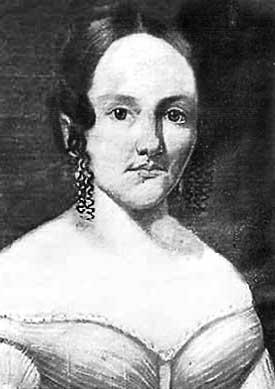
Sarah Jane Rousseau
Tuesday, November 8. A cold blustering morning, the wind blowing hard all night. Started from our camp rather late with an escort of from 10 to 15 Paiute Indians. Last night two of them stayed with us as prisoners. Our guide, Mr. Hatten, said it would not do to let them leave camp after dark, as they might get some other Indians, come back and do us some mischief. We started from camp with five, which increased to 15 of them. We crossed the Santa Clara this morning 14 times in after going 12 miles made a dry camp at Camp Springs, having filled our kegs the last crossing place. the Indian chief told the guide we must all give them something for traveling through their country, to renumerate them for using water and grass. We all gave them some flour. We intend to let them have the care of our horses tonight, they are going to take the cattle as well. The Chief with four others we kept as prisoners till morning when they bring back the stock. Then they will be free.
Virgin River
Wednesday, November 9. A pretty warm morning. Started from camp about sunup. The Indians brought back the stock safely back. Left camp with our escort, traveled over some rough roads till noon. This afternoon the road’s much better. Passed over the summit between the Clara and Virgin, went 5 miles in the canyon and camped. Some grass for the stock but no water.
Wagon Master Nicholas Earp
Thursday, November 10. A cool but pleasant morning. Last night the Indians were prisoners again. They left the stock go on to the mountains to feed. We fed five among us. All are willing to do so but Mr. Earp. He swears and cuts up about it, although he derives the same benefit as the rest of us. I fear he may cause us some trouble when we get to the Muddy. … “
Point of Van Dusen Road crossing Mojave River, Hesperia, CA. Looking toward Apple Valley and Marianas Mountains
The Van Dusen Road branched off from John Brown’s toll road heading east along the ridge after reaching the Cajon Summit. The road found its way down the Antelope Valley Wash to the Mojave River. At this point the trail crossed through the soft sand and ascended through a small canyon at the base of the mountains, finding its way east then southeast to Rock Springs. From the springs the road then branched to the left heading east to Holcomb Valley becoming what is now known as the Coxey Truck Trail.
Looking west up Antelope Valley Wash from the Mojave River toward Cajon Summit
As you whiz down the freeway in a well protected automobile, have you ever wondered what life was like in the good old days as the hardy pioneer planned the trip 50 miles into the desert with wagon and a team of horses?
Excerpts from ‘Water Supply Paper Number 224’ published in 1909 by the US Department of Interior states, “A party leaving a supply station to go 100 miles or more into an uninhabited part of the desert must take along everything needed, even to the most minute detail.”
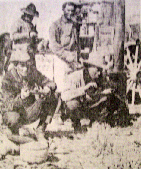
Cowpokes eating a hearty breakfast on the trail.
” This means if the trip is to last for two weeks enough hay and grain for each animal and enough provisions to last each man that length of time must be taken.
” For four horses, drawing a wagon that carries for persons and their bedding, provisions, and tools, another team of four horses must also be taken to all sufficient hay and grain to feed the eight horses for two weeks.
” There are but few places in the desert, away from the railroads, where grain or hay of any kind can be procured. As the teams are rarely able to travel faster than a walk, heavy horses that are good walkers should be selected. The tires should be as wide as can be procured. Desirable widths of tires for freight wagons are 6 to 9 inches; for light wagons 3 inches.”
The average Victor Valley pioneer took a week every six months to travel by horse and wagon to San Bernardino, to do his shopping and come back home. Leaving the desert and spending the first night in Cajon Pass at one of the campsites close to the junction of State Highway 138 or Interstate Highway 15 further on down at Cozy Dell Campgrounds. it was another day’s journey to San Bernardino, and after doing shopping and visiting for a couple of days, it was a two-day journey back to the desert Homestead. Now with our sleek automobiles, we whisk down to San Bernardino and 45 minutes, sometimes grumbling because it takes so long.
Cozy Dell, Cajon Pass – 1938
Drinking java from an old tin can was a way of life and not a song in the past century. Living in the open and eating cowboy beans were part of traveling through the desert before the advent of the auto. The trails of yesterday became our freeways of today. Our present freeway route from Victorville to Barstow parallels the one the freighters to quit their mule trains to sell supplies to the minors and Calico in the 1880s. Instead of having a well-built bridge to span the Mojave as we do today, they forded the river even when it was high.
from: Mohahve IV – Scrapbooks of History (c)1984, 2016
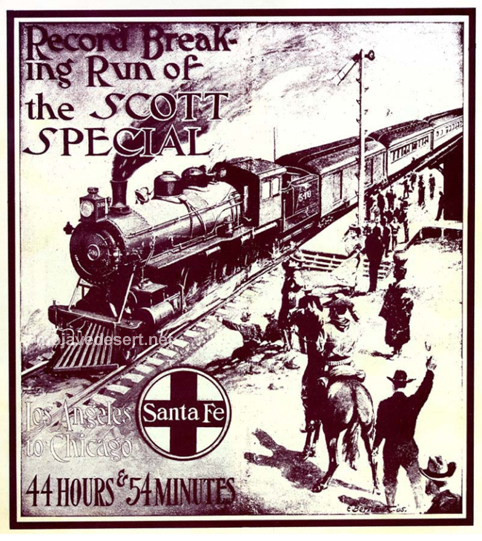
In 1905, in an attempt to break the speed record from Los Angeles to Chicago, Walter “Death Valley Scotty” Scott paid the Santa Fe Railroad a purported $5500 to rent a three car train pulled by 19 different steam locomotives. The trip began in Los Angeles on 9 July and arrived in Chicago 44 hours 54 minutes later, a record that stood until 1936 when it was broken by the Super Chief. The Barstow to Needles segment of the run took just three hours and 15 minutes. Also known as the Coyote Special.
Bill Sanger was known to have ridden the rails all over the map. In his time he had seen all there was to see. One day he was talking with Jim Craig about mirages. Mirages are common sites. You see a lot of them, millions of them, in the dry lake bed out there at Amboy.
Bristol Lake – Amboy, CA.
“Bill,” said Jim, “did you ever see the city that gleams out there on the lake in hot weather?”
“Yeah,” Bill replied.
“What you make of it?” said Jim.
Nothing,” Bill answered. “I do not hold with those dude scientists, that try to explain goes by saying the light rays pick up the picture hundreds of miles away and then bend it back and drop that same picture out there on the lake. It do not make sense. They’re ghosts, that is what they are. Just plain ghosts.
“One time,” Bill went on, “I nearly killed myself trying to hop a ghost train pulling out across Bristol Lake. I was walking out toward the salt works when along came a freight, not going very fast. I forgot where I was, and made a run for it. it started to pick up speed, so I gave a leap and grabbed on– nothing!
“I sprawled out flat on that dry lake bed. I looked up and saw the ghost train running in long as nice as you please– 42 cars and one caboose I counted. they road right smack over me and never even mussed my shirt. They are ghosts I tell you. Ghosts!”
from : Pioneer tales of San Bernardino County
WPA Writers Program – 1940
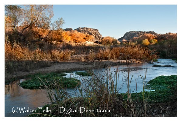
Leaving the headwaters of the Verde River in Arizona the party traveled to the Colorado River to the Mohave villages scattered along the east bank between what is now Topock and Bullhead City in Arizona. From there they traveled toward the middle of the desert, possibly on the route of either Fr. Garces in 1776, or further north on the trail taken by Jedediah Smith in 1826 and 1827, these converging at the mouth of the Mojave River east of Afton Canyon. It was two days before they found water after reaching the Mojave River. This may have placed them just east of today’s Barstow, California at a place that was known years later as Fish Ponds.
After four days travel we found water. Before we reached it, the pack mules were strung along the road for several miles. They smelled the water long before we had any hopes of finding any, it made all the best use of the strength left them after their severe sufferings to reach it as soon as they could. We remained here two days. It would have been impracticable to continue the march without giving the men and animals the rest which they so much required.
Colorado River at Moab across from Topock, Az.
After remaining in camp two days we resumed our expedition and for four days traveled over a country similar to that which we had traversed before our arrival at the last water. There was no water to be found during this time, and we suffered extremely on the account of it. On the fourth day we arrived on the Colorado of the West, below the great Canyon.
Mojave River fan
Our joy when we discovered the stream can better be imagined than described. We also had suffered greatly for want of food. We met a party of the Mojave Indians and purchase from them a mare, heavy with foal. The mare was killed and eaten by the party with great gusto; even the foal was devoured. We encamped on the banks of the Colorado three days, recruiting our animals and trading for provisions with the Indians, from home we procured a few beans and some corn. Then we took a southwestern course and in three days march struck the bed of the stream running northeast, which rises in the Coast Range and its lost in the sands of the great basin. We proceeded up the stream for six days, and two days after our arrival on it we found water. We then left the stream and traveled in a westerly direction, and in four days arrived at the of Mission San Gabriel.
San Gabriel Mission
At the mission there was one priest, 15 soldiers, and about 1000 Indians. They had about 80,000 head of stock, fine fields and vineyards, in fact, it was a paradise on earth. We remained one day at the mission, receiving good treatment from the inhabitants, and purchasing from them what deep we required. We had nothing but butcher knives to trade, and for four of these they would give us a beef.
“It looked a lot straighter on the map.” – Anonymous
The Mormon Road going south across the Oro Grande Wash would come up and head straight into the Joshua trees and juniper woodland. The slope was fair, the ground hard and the trail reasonably straight. There were variations, though. To the eyes of one, one way around a bush may look easier than it does to another. Trails evolve. If one branch is significantly better than another, that branch becomes wider and more popular. These branches and shortcuts may join together later. These variations due to mankind and weather begin a process I have heard to be called, “braiding.” It is quite possible for the main alignment, the busiest, the center-most version in the corridor to remain in use providing its continued existence to this very day.
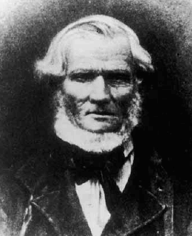
Captain Jefferson Hunt
b. January 20, 1803
d. May 11, 1879
Jefferson Hunt – LDS photo.
… Jefferson Hunt had rejoined his family at Salt Lake Valley after the close of his military service, and he was called by President Young in November of 1847 to return to California to purchase seed, livestock and supplies for the people of the Church. There were eighteen in the company, including his sons, Gilbert, John and Peter Nease. On this trip they suffered greatly for food, having to subsist for some days upon the flesh of their work mules, but through all such ordeals, Great Grandfather rose to the occasion and manifested the great strength of body and mind necessary for a wise father and leader of men to possess. The little boys, John and Peter, suffered greatly on this trip, being only 14 years old and not accustomed to starving. They returned to Salt Lake in May, 1848, bringing horses, mules, cattle, seed and provisions. During the following two or three years he acted as pilot and guide to companies of gold seekers going to California.
In 1851, Jefferson Hunt was called by the leaders of the Church to go with Apostle Amasa Lyman and Charles C. Rich to establish a Mormon colony in San Bernardino, California.
In the years that followed, he served his church as a member of the High Council of San Bernardino. He served his church and the State of California as a member of the legislature for six years, and he was appointed with a delegation of California lawmakers to go on a special mission to Washington D.C. Their trip from California to Independence Missouri was all accomplished on horseback.
With the coming of Johnston’s Army to Utah in 1857, Jefferson Hunt responded to the call of Brigham Young, and with the other loyal members of the church they left their homes in San Bernardino and came to Utah.
His service to the State of California was recognized in tribute paid to him by the California historian Ingersol: “Captain Hunt was a man of strong character, deeply religious by nature, he believed with his heart in the divine revelations of the Mormon Doctrines. Energetic, clear sighted and indomitable in will, he was especially fitted for the leadership, which he always acquired in whatever position he was placed. Generous to a fault, his home was open to his less fortunate brethren, and he gave a helping hand to many a needy man, saint and gentile alike for he was above petty distinction. He deserves a large place in the memory of the citizens of San Bernardino for he filled a large place in the early and vital events in the history of the town and country. While he served as legislator he introduced the bill to divide Los Angeles County from San Bernardino County, and has been known since as the Father of San Bernardino County.”
~
Adapted from a copy of an address given at the dedication of a monument erected at the grave of Captain Jefferson Hunt in 1950. The speaker was his great grandson, Jesse A Udall.
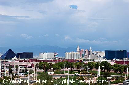
During the Spanish Colonial Period (1542-1821) in the American Southwest, the Spanish empire was competing for control over resources with the British, French, and Russian monarchies. They attempted to link colonies in the Spanish territories, later known as the New Mexico and California, by establishing trade routes to form a passageway across the entire Southwest desert region. The Old Spanish Trail was used commercially to link the towns that would later become Los Angeles, California, and Santa Fe, New Mexico, from 1829 until 1848. The abundant spring water available in the Las Vegas (meaning “the meadows” in Spanish) Valley made it an ideal resting point on the trail.
Las Vegas
The presence of the valley springs also drew the Southern Paiute Indians, a nomadic people moving frequently during the year, who made the valley their winter homeland. They raised small crops near the springs in the valley, which provided water and food for the Indians inhabiting the area and later for travelers making their way across the desert.
The Las Vegas Valley would become an attractive place for other European-American settlers as well. One group of settlers looking for a new home was the Mormons–also known as the Church of Jesus Christ of Latter-day Saints–a religious sect organized by Joseph Smith in New York in 1830. Based on the Book of Mormon, which Smith said was revealed to him by heavenly messengers, this religious body felt called to restore the authentic church established by Jesus and his Apostles. The history of the Mormons is dramatic–filled with persecution, an exodus from the eastern part of the United States, and ultimately successful establishment of a thriving religious society in a desert. The Mormons formed in upstate New York, an area where the Second Great Awakening was most popular as the United States underwent a widespread flowering of religious sentiment and unprecedented expansion of church membership. The group was forced to move several times because of conflicts with residents in various places where they settled, including Ohio, Missouri, and Illinois. They were accused of blasphemy and inciting slave insurrections. After Smith was killed by an angry mob in Illinois in 1844, it became necessary for the Mormons to find a new home once again.
A new leader emerged to guide the Mormons to a new Zion at the Great Salt Lake. Under the direction of Brigham Young, they began an arduous journey West to what would become Utah, where they arrived in July of 1847. In 1848, after the war with Mexico, the United States acquired the majority of what now constitutes the American Southwest. The Mormons petitioned Congress to become the State of Deseret, a word from the Book of Mormon signifying honeybee which was considered an industrious creature, but they were only allowed territorial status. Congress established the Territory of Utah, named for a local Indian tribe, and President Fillmore appointed Brigham Young governor in 1851. Young also became superintendent of Indian affairs. He oversaw the building of Salt Lake City and hundreds of other southwestern communities.
In the middle of the 19th century, the idea of “Manifest Destiny”–a phrase used to explain continental expansion by the U.S.–was embraced by many American people, including the Mormons. They began an industrious campaign to colonize Utah and beyond, establishing hundreds of settlements throughout the West and Southwest. As part of this process, Brigham Young called on volunteers to create a Las Vegas Mission, which would be strategically located alongside the Mormon Road (a portion of the Old Spanish Trail between New Mexico and California), halfway between the Mormon settlements of southern Utah and the San Bernardino Mission in southern California. There were eventually 96 settlements that included Lehi, Provo, Payson, Nephi, Fillmore, Beaver, Parowan and Cedar City. Meanwhile, the discovery of gold in California in 1848 made southern Nevada a corridor for westward emigrants and gold seekers. A gold seeker wrote in his diary on November 21, 1849 about stopping at the Las Vegas creek. Offering the only reliable supply of water for a 55-mile stretch along the Mormon Road, the Las Vegas Valley’s springs were important for watering the mules, horses and oxen of travelers crossing the region’s harsh desert environment. With the opening of the San Bernardino settlement in 1851, there was an additional need for a way station at the Las Vegas springs to provide supplies and rest. The mission the Mormons established as part of the Church’s westward expansion out of Utah became the first non-native settlement in the area, and the Mormons hoped to bring the American Indians into their flock. Although the Mormons occupied the site only from 1855 to 1858, it affected the development of what was to become southern Nevada.
Huntington’s Station was the first trading post in the area, and although Heber Huntington only owned it from 1873 to 1878, it remained known as Huntington’s Station until the the railroad came through and renamed it Victor. The river crossing with a few modern exceptions as the Narrows Bridge, Rainbow Bridge, and the cement plant looks much the same today as it did in 1872 when Mecham built what has become Stoddard Wells Road.
During this phase of the journey the wagon train was doing much of its traveling at night, owing to the great daytime heat of the desert and the long distances between water holes. At regular intervals during the night they would stop for a short rest. At one of these rest stops, eleven-year-old Ellen Baley, a daughter of Gillum and Permelia Baley, fell asleep and failed to awaken when the wagon train moved on. Somehow, she was not missed until the train traveled some distance. The poor girl awoke to find herself alone in the middle of a vast hostile desert. Filled with fright, she began running to catch up with the wagon train, but in her confusion she took off in the opposite direction. When she was discovered missing, her father and older brother, George, immediately rode back to where they had stopped. To their horror, she was not there! Captured by the Indians must have been their conclusion! Nevertheless, they continued their search by calling out the little girl’s name at the top of their voices as they rode back.Their efforts were soon rewarded when, far off in the distance, came a faint cry, “Papa, Papa.” Her father immediately answered and kept calling her name until he caught up with her.When reunited with her family and the other members of the wagon train, Ellen had a tale which would be told and retold by family members until the present day.
from –
Disaster at the Colorado
Beale’s Wagon Road and the First Emigrant Party
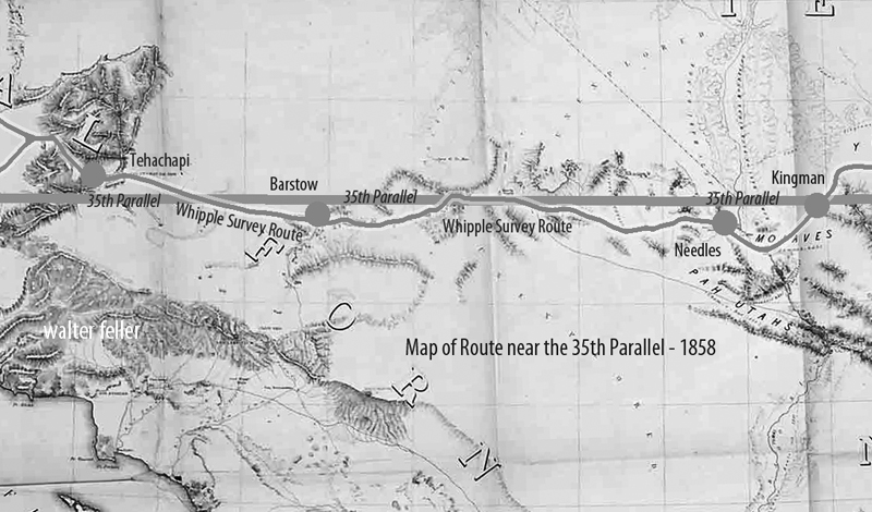
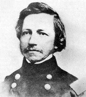
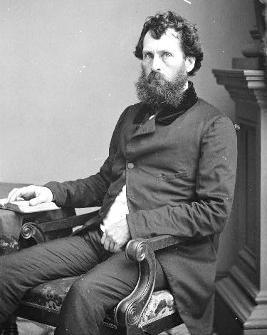
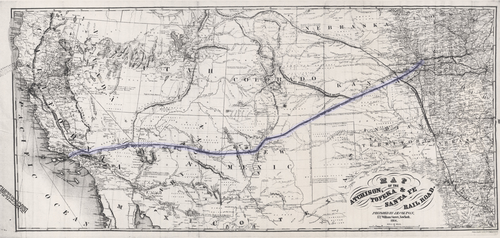

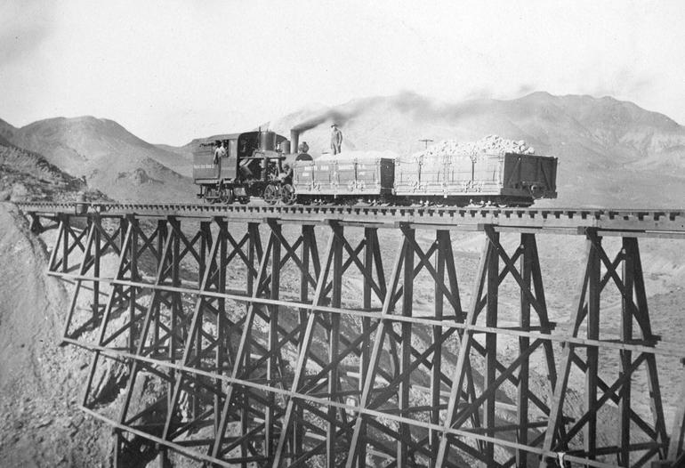
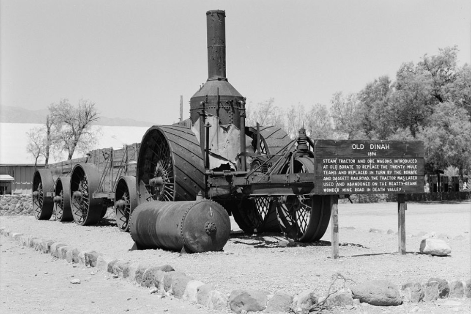

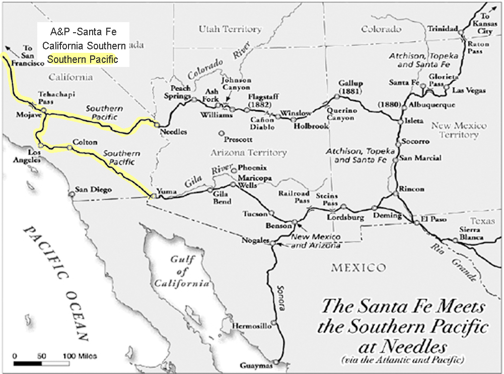
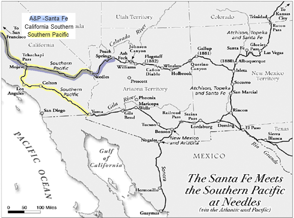
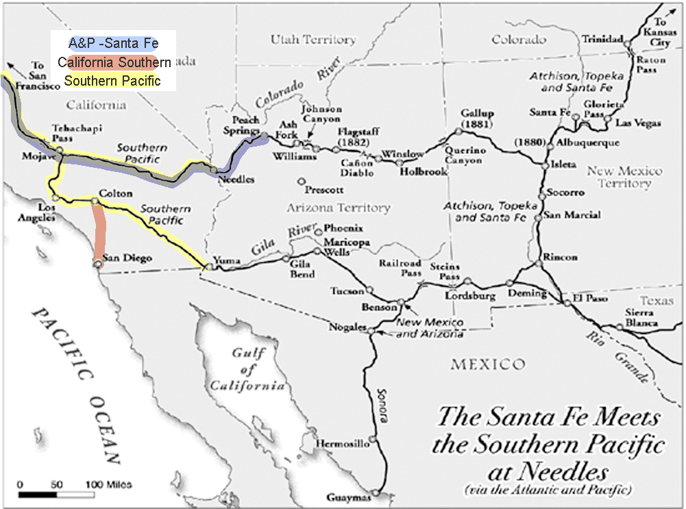
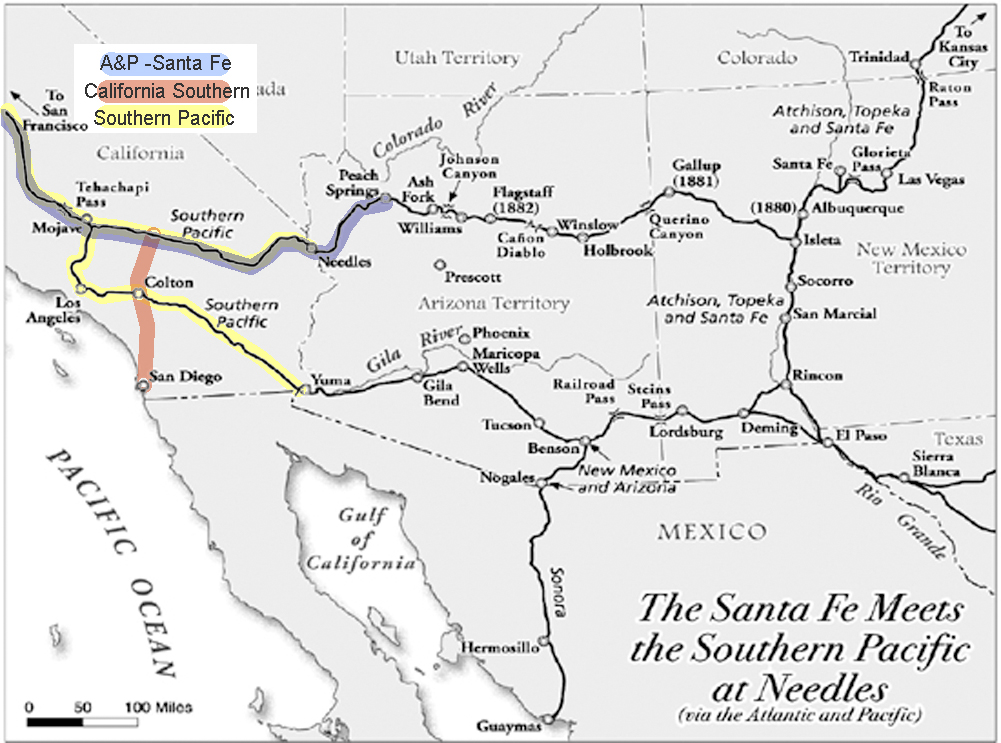
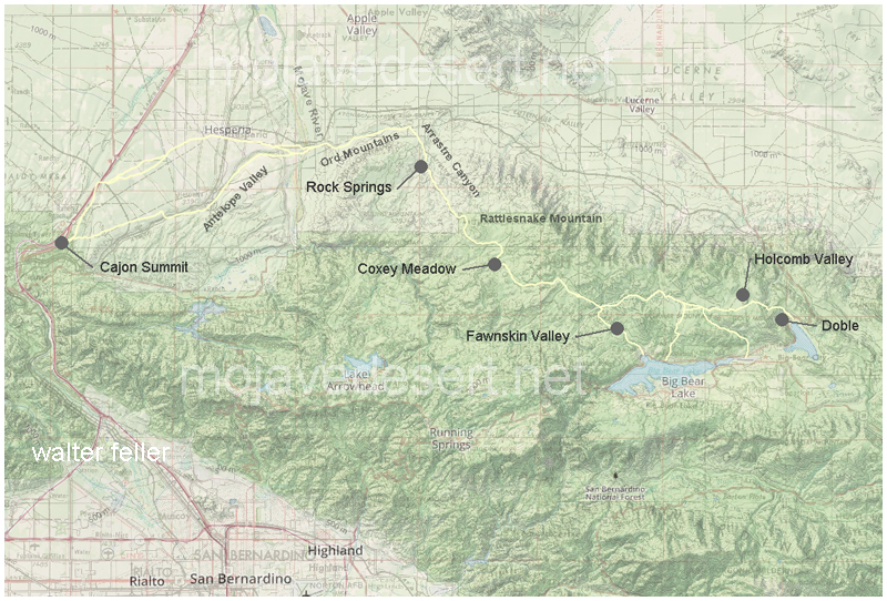
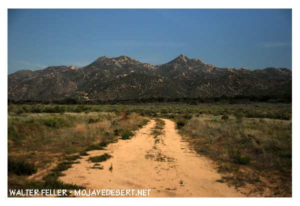
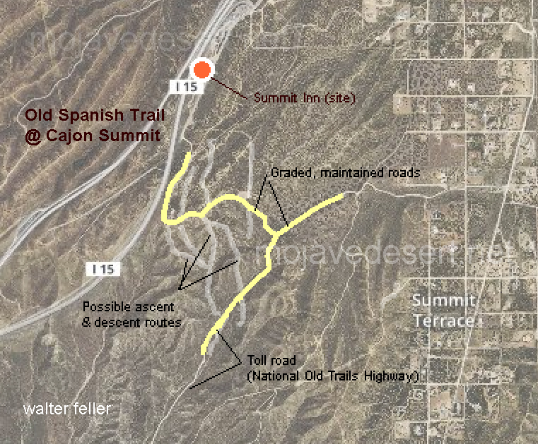
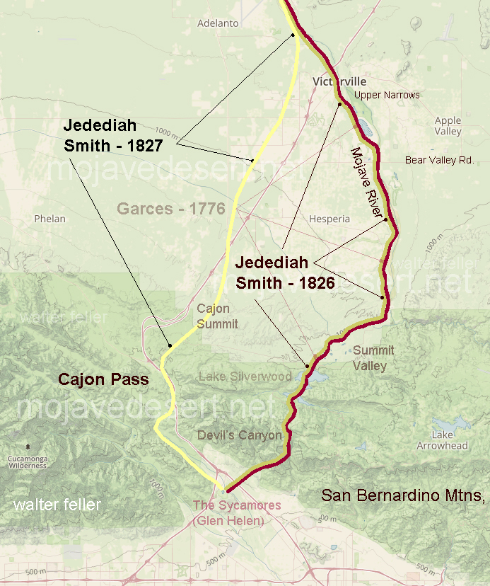
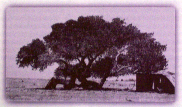
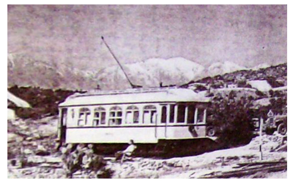
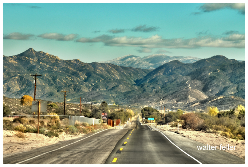
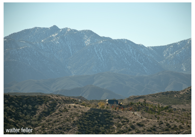
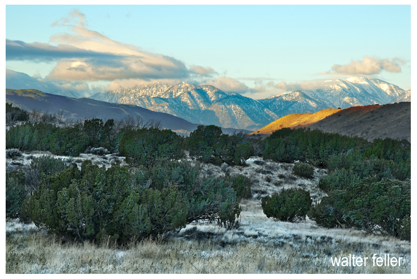
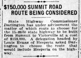
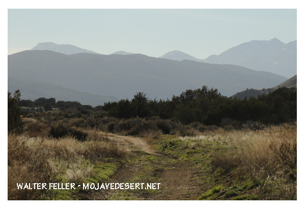
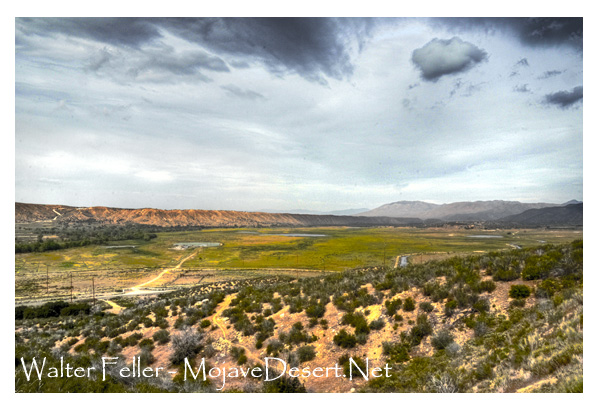
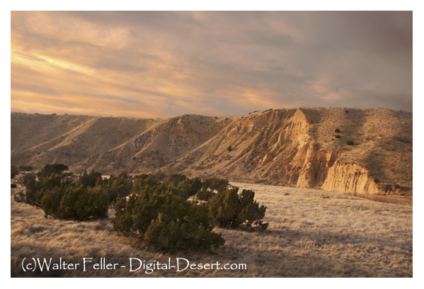
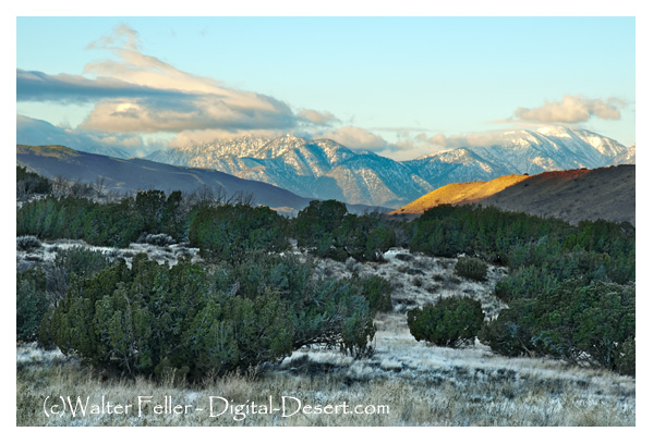
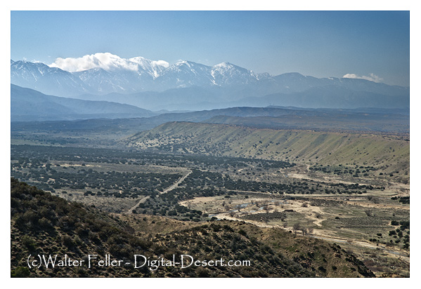
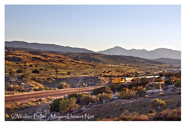
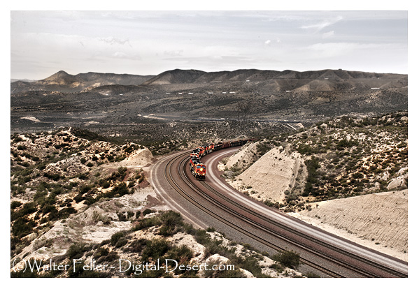
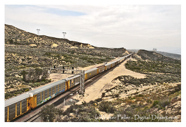
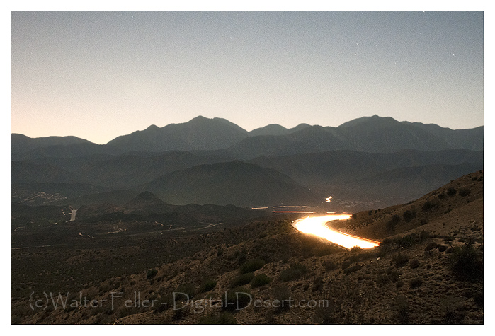
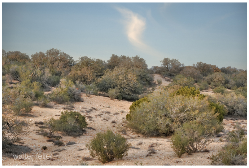


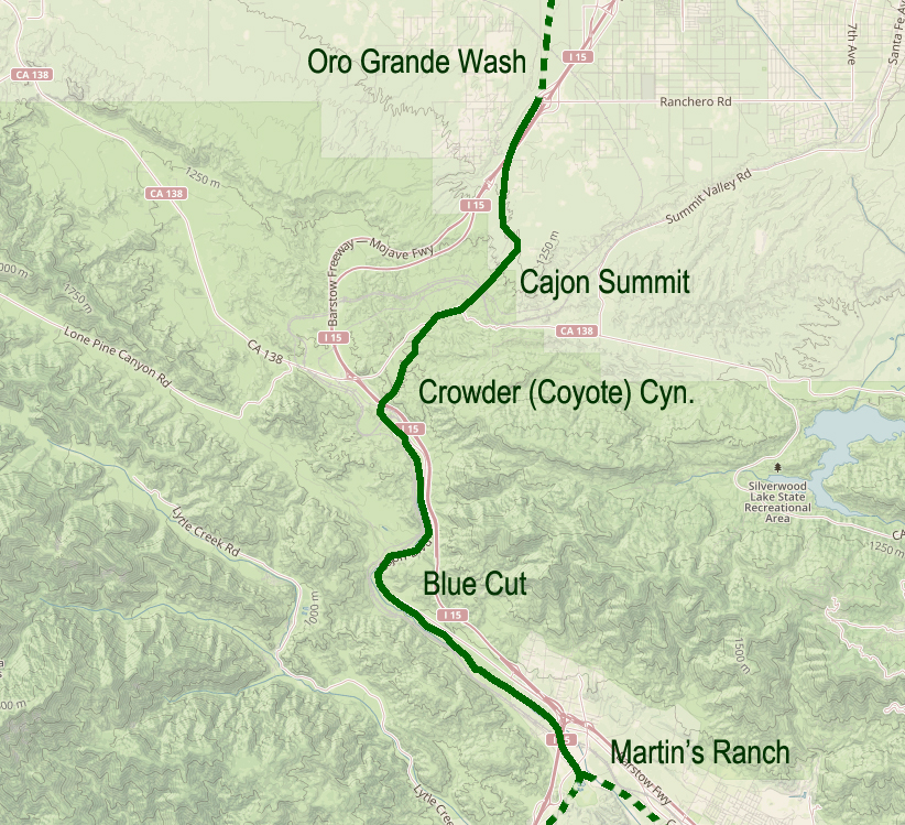
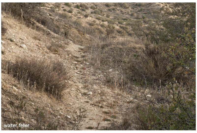
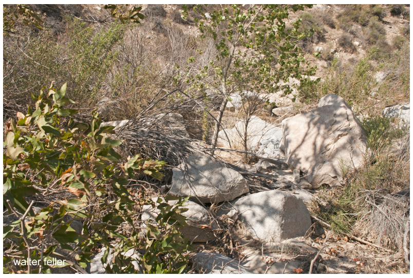
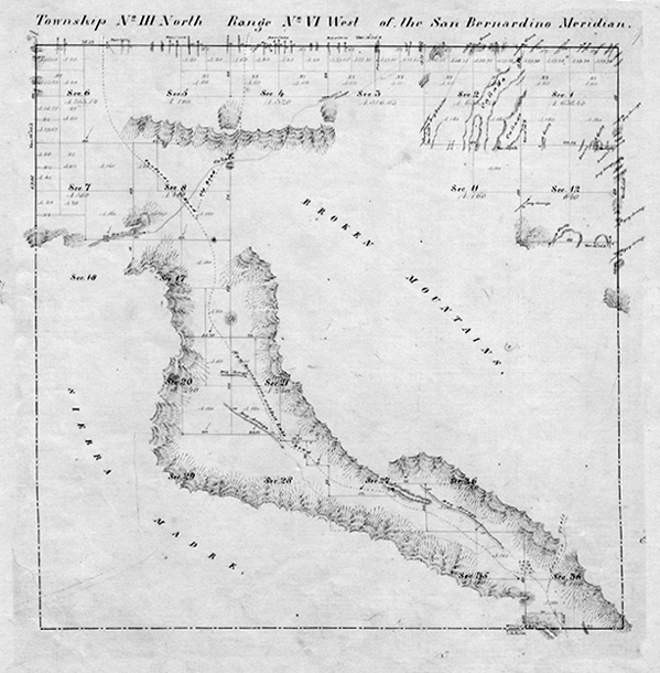
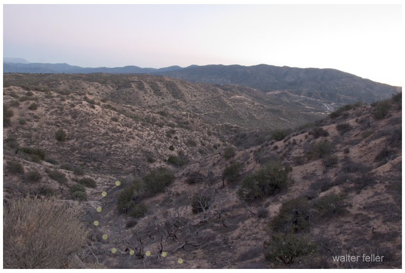
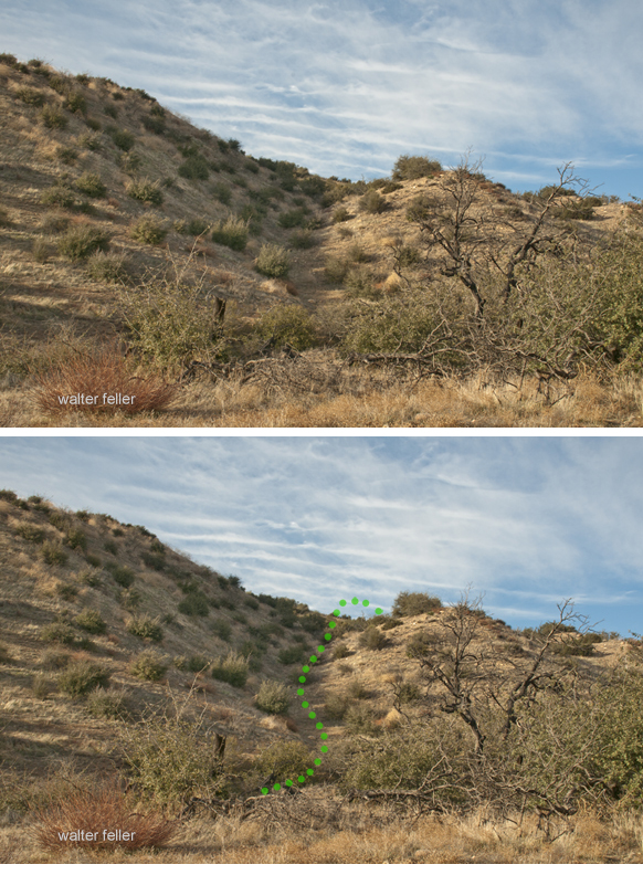
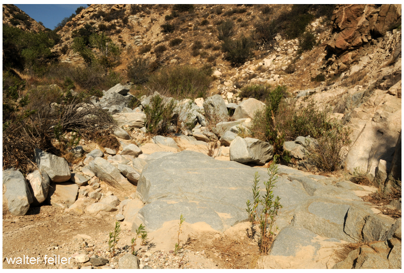
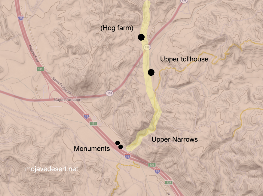
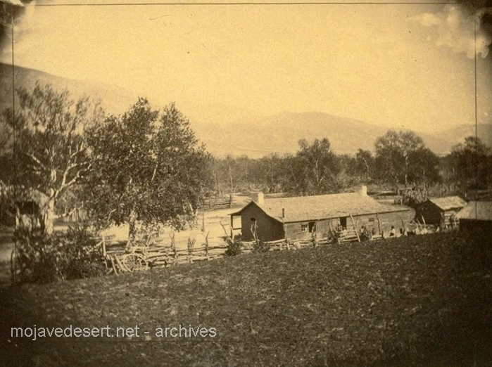
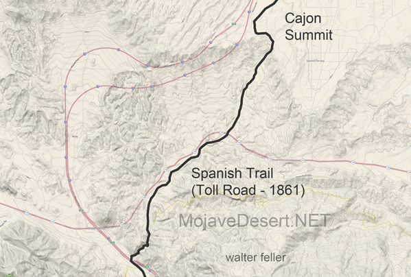
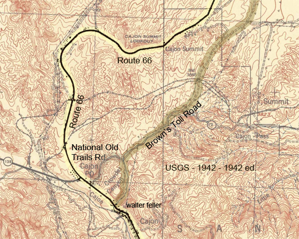
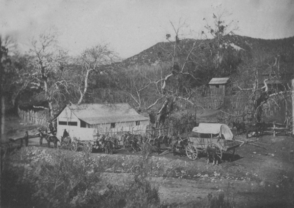
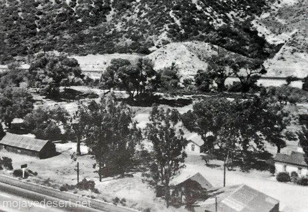
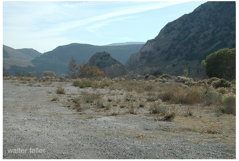
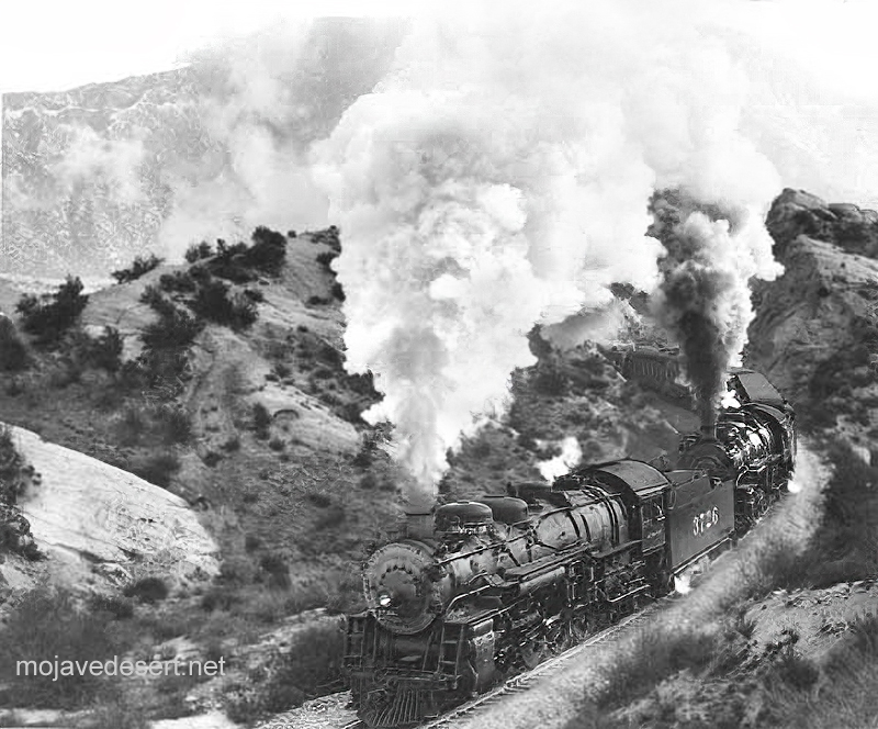

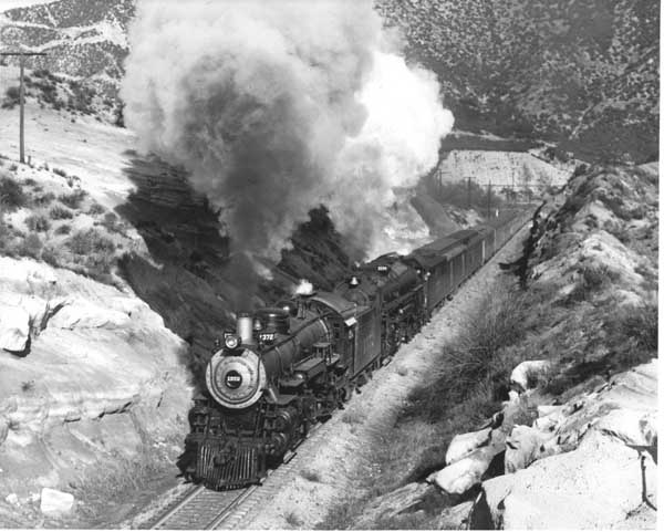
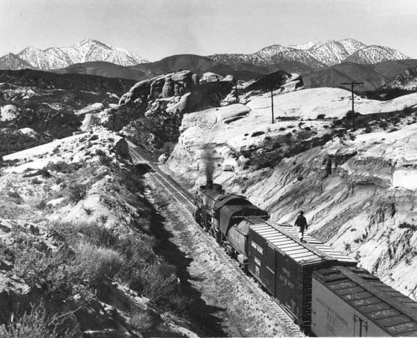
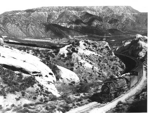

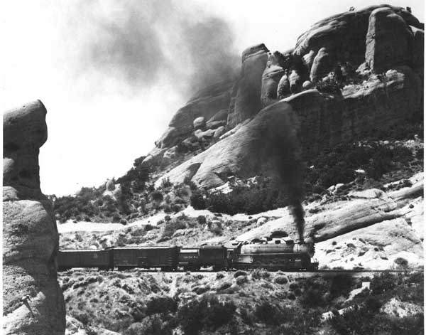
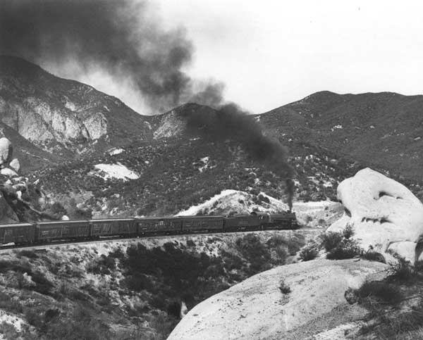
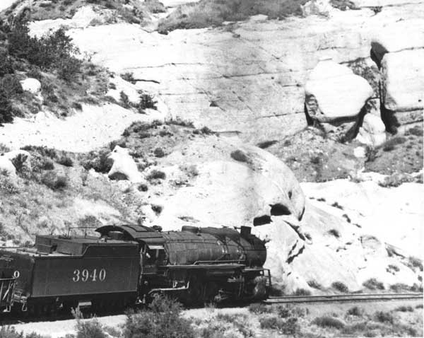
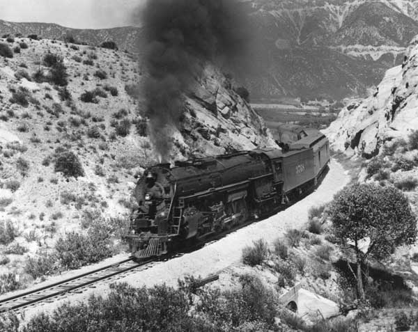
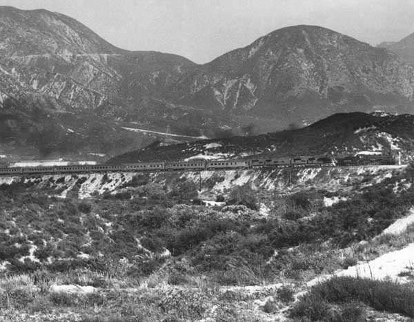
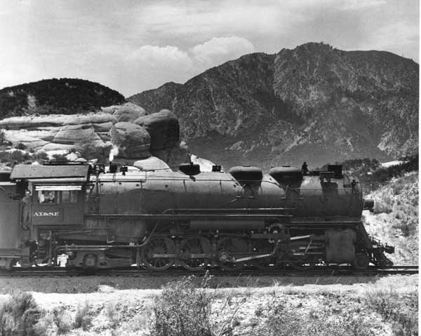
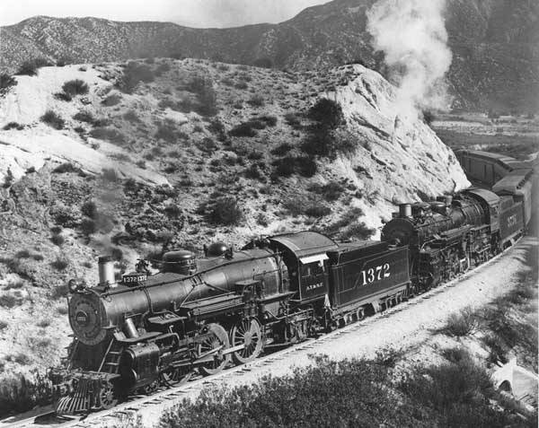
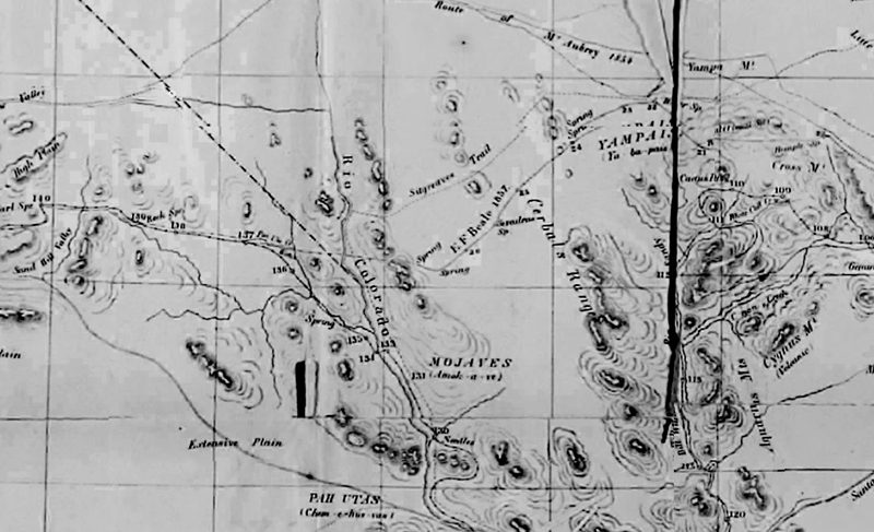
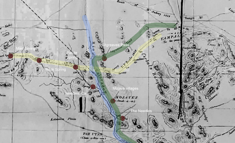
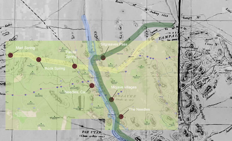
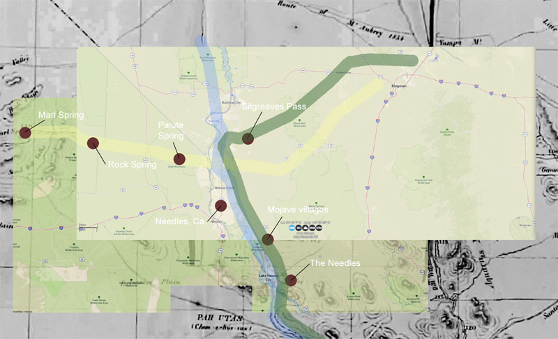
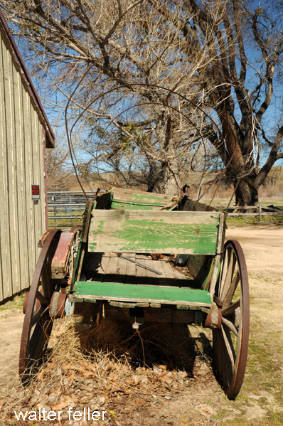
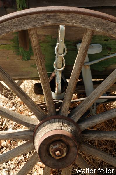
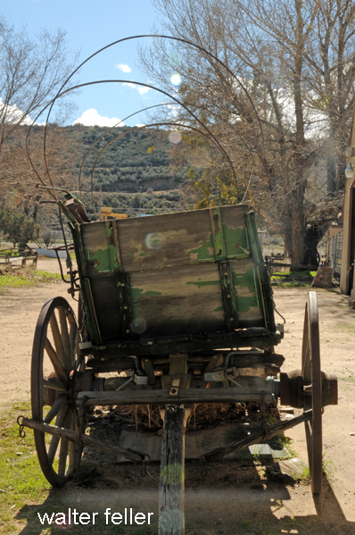
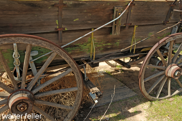
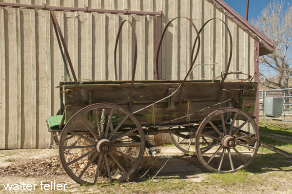
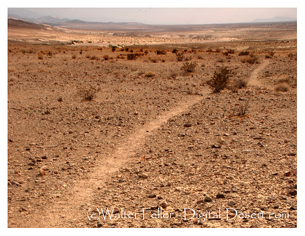
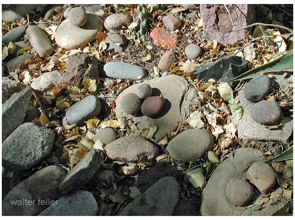
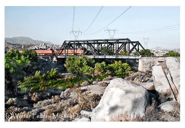
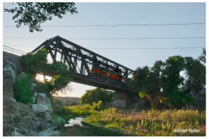 regarding recommendation from New England of another engineer-bridge
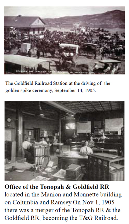
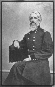
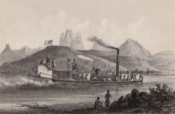
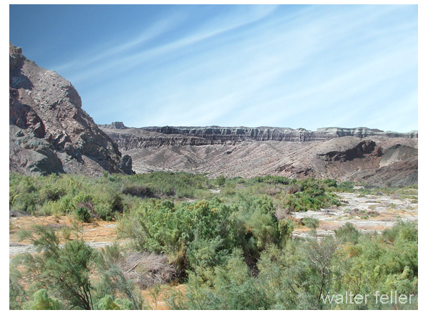
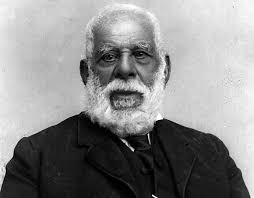
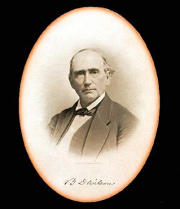


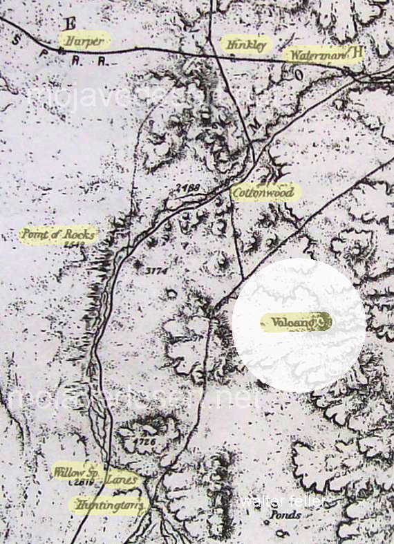
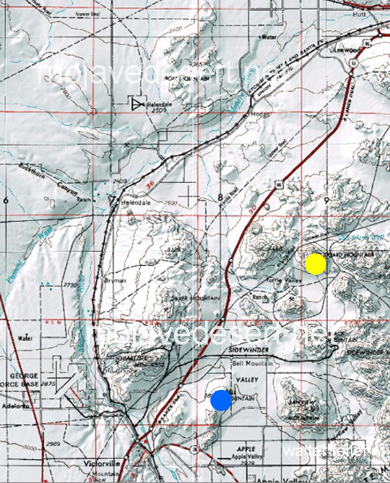
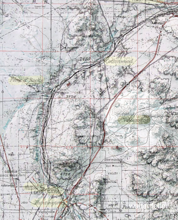
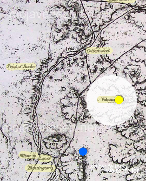
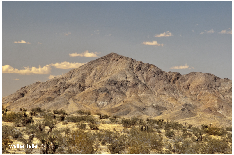
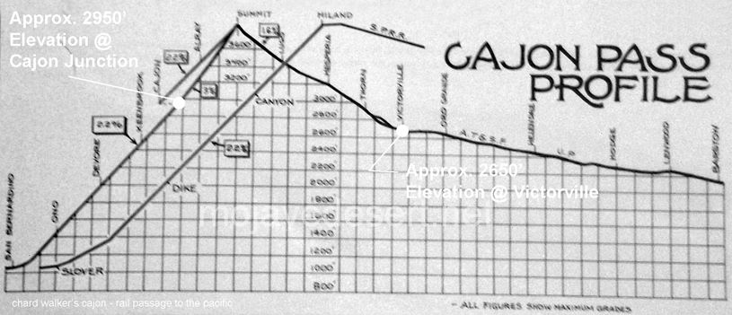
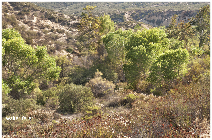

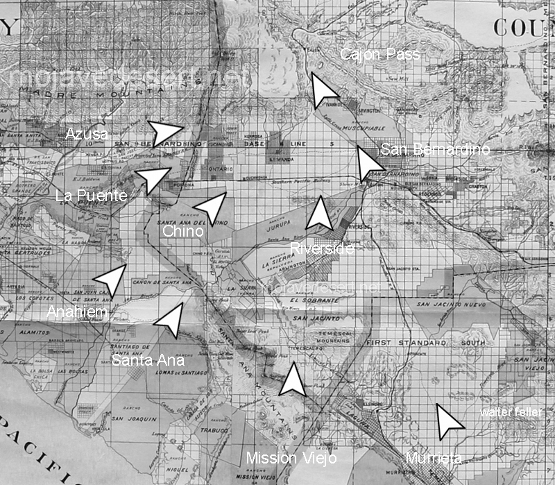
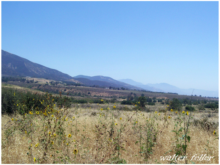
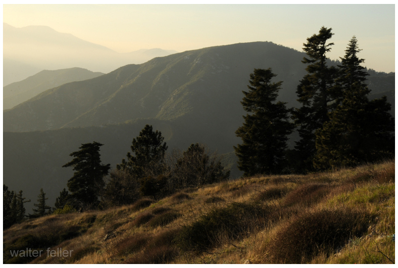
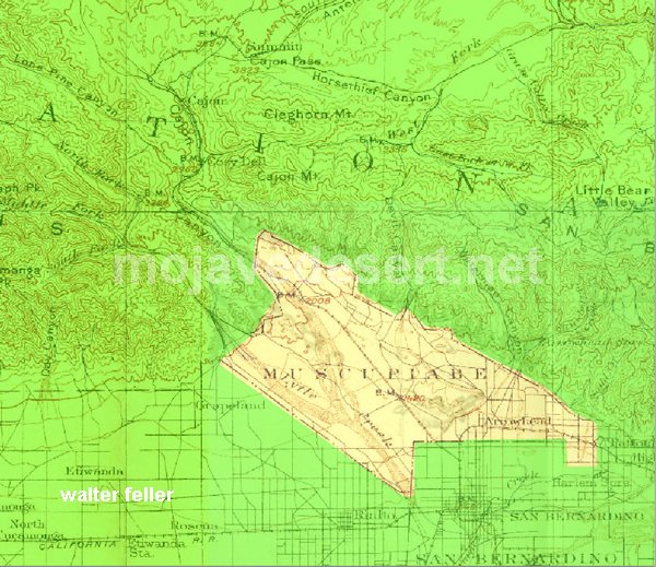
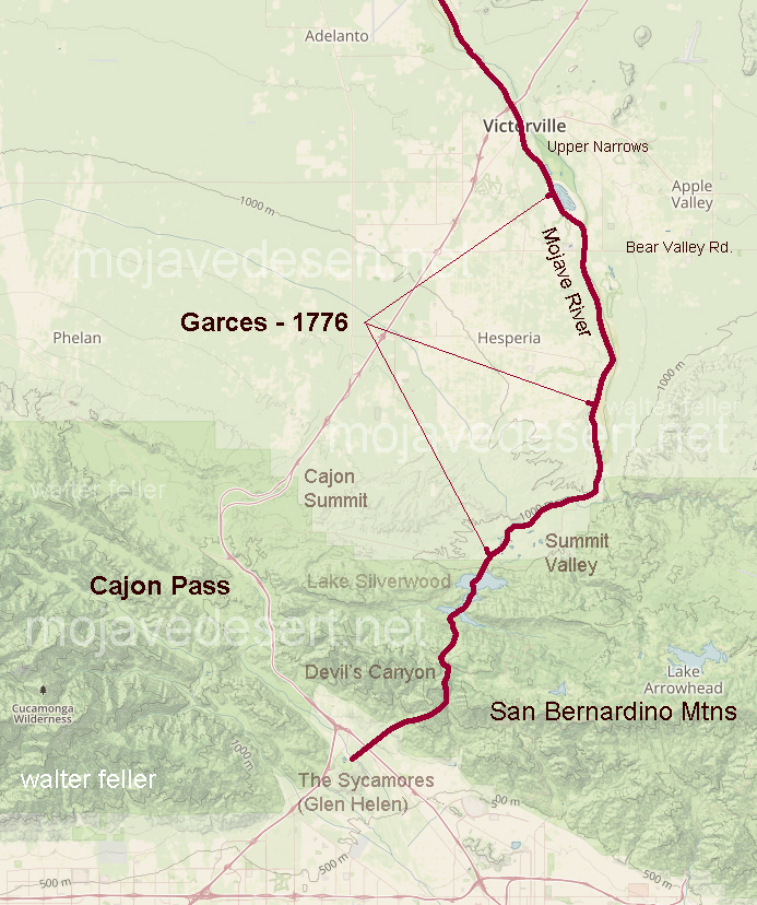

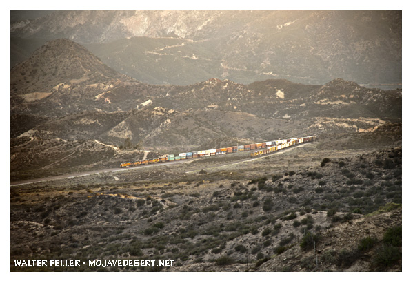
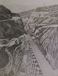 Then Perris, one certainly was not being followed, headed westward through