Pictorialism, an approach to photography that emphasizes beauty of subject matter, tonality, and composition rather than the documentation of reality.
The Pictorialist perspective was born in the late 1860s and held sway through the first decade of the 20th century. It approached the camera as a tool that, like the paintbrush and chisel, could be used to make an artistic statement. Thus photographs could have aesthetic value and be linked to the world of art expression.
Garlock fault located and highlighted on geology map
Step 2: Review alignment transfered to overlays
Garlock fault overlay on satellite imageGarlock fault overlay on terrain mapGarlock fault overlay on USGS topographic map
Step 3: Locate eastern end of fault.
By word of mouth and small scale maps the eastern end of the fault appears to be located just west of Salt Springs, which is on state highway 127 between Baker and Shoshone, California near Dumont Dunes.
The dream world was as important to the Mojave People as was the physical world. It was from this dream state instruction was given that would guide them to their destiny.
The Mojave Warrior was as brutal and violent in battle as his enemy. Even more so, not only because of strength and endurance but because those who had bad dreams; dreams of death and misfortune, were left behind in the villages with the women so not to bring a curse to the war.
Among the small and dangerous bands were mixed the Kwanamis. They were the elite warrior captains. The Kwanamis were said to have dreamed of war and the death of their opponents in the womb before their birth. Their dreams would be of ripping lion and bear creatures apart with bare hands and emerging from the dust victorious and unscathed.
The Kwanamis lived apart from the rest of the Mohave People, in the south of the valley where Mastamho, the God-son, fought with the serpent under the three peaks. It was here they would fast and meditate on the death of their opponents and the art of warfare.
These men who were stoic and impervious to heat, cold, hunger, and pain, would practice with their war bows and clubs in order to be the most effective in ministering death to their foes.
Death Valley was having one of its periodic wind storms when the tourists drove up in front of Inferno store to have their gas tank filled.
Hard Rock Shorty was seated on the bench under the lean-to porch with his hat pulled down to his ears to keep it from blowing away.
Desert wind storm
“Have many of these wind storms?” one of the dudes asked.
“Shucks, man, this ain’t no wind storm. Jest a little breeze like we have nearly every day. You have to go up in Windy Pass in the Panamints to find out what a real wind is like.
“Three-four years ago I wuz up there doin’ some prospectin’. Got together a little pile o’ wood an’ finally got the coffee to boilin’. Then I set it on a rock to cool while I fried the eggs.
“About that time one of them blasts o’ wind come along and blowed the fire right out from under the fryin’ pan. Blowed ‘er away all in one heap so I kept after it tryin’ to keep that fryin’ pan over the fire to git my supper cooked.
“I usually like my eggs over easy, but by the time 1 got one side done I wuz all tired out so I let ‘er go at that. Had to walk four miles back to the coffee pot.”
Once I asked Shorty Harris how he obtained his grubstakes. “Grubstakes,” he answered, “like gold, are where you find them. Once I was broke in Pioche, Nev., and couldn’t find a grubstake anywhere. Somebody told me that a woman on a ranch a few miles out wanted a man for a few days’ work. I hoofed it out under a broiling sun, but when I got there, the lady said she had no job. I reckon she saw my disappointment and when her cat came up and began to mew, she told me the cat had an even dozen kittens and she would give me a dollar if I would take ’em down the road and kill ’em.
“‘It’s a deal,’ I said. She got ’em in a sack and I started back to town. I intended to lug ’em a few miles away and turn ’em loose because I haven’t got the heart to kill anything.
“A dozen kittens makes quite a load and I had to sit down pretty often to rest. A fellow in a two-horse wagon came along and offered me a ride. I picked up the sack and climbed in.
“‘Cats, eh?’ the fellow said. ‘They ought to bring a good price. I was in Colorado once. Rats and mice were taking the town. I had a cat. She would have a litter every three months. I had no trouble selling them cats for ten dollars apiece. Beat a gold mine.’
Prospector with grubstake essentials
“There were plenty rats in Pioche and that sack of kittens went like hotcakes. One fellow didn’t have any money and offered me a goat. I knew a fellow who wanted a goat. He lived on the same lot as I did. His name was Pete Swain.
“Pete was all lit up when I offered him the goat for fifty dollars. He peeled the money off his roll and took the goat into his shack. A few days later Pete came to his door and called me over and shoved a fifty-dollar note into my hands. ‘I just wanted you to see what that goat’s doing,’ he said.
“I looked inside. The goat was pulling the cork out of a bottle of liquor with his teeth.
“‘That goat’s drunk as a boiled owl,’ Pete said. ‘If I ever needed any proof that there’s something in this idea of the transmigration of souls, that goat gives it. He’s Jimmy, my old sidekick, who, I figgered was dead and buried.’
“‘Now listen,’ I said. ‘Do you mean to tell me you actually believe that goat is your old pal, whom you drank with and played with and saw buried with your own eyes, right up there on the hill?’
“‘Exactly,’ Pete shouted, and he peeled off another fifty and gave it to me. So, you see, a grubstake, like gold, is where you find it.”
from: Loafing Along Death Valley Trails A Personal Narrative of People and Places Author: William Caruthers
During the great silver boom in the Calicos, a small community grew up around the Bismarck mine in the next canyon east of Calico camp. Together with the miners of the Garfield, Odessa, Occidental and other mines, there were perhaps 40 persons in the area, which was known as East Calico.
While Calico was less than a mile away, by airline, the direct trail was steep and rugged and the road roundabout. The government did not consider the population sufficient for a post office, and the miners didn’t care to hike into Calico for their mail. So they contributed to a fund to pay a boy named Dave Nichols to bring the mail over, by burro, from the mother camp. But Dave found a better job and no one else wanted to be mail man.
Calico 1884
About that time a man named Stacy, brother of the Stacy who was postmaster at Calico (their first names have variously been given as James, William, Everett and Alwin) opened a store at Bismark. The Stacys had a dog named Dorsey, a big Scotch collie who had come to them for shelter one stormy night. The Bismarck Stacy took the collie’ with him to East Calico.
Dorsey, the Dog Mail Carrier
But Dorsey’s affections were divided, and after a few days at Bismarck, he ran away back to Calico. Postmaster Stacy attached a note to his neck, switched him and sent him back to Bismarck. After a few such runaways, Postmaster Stacy conceived the notion of tying a sack with newspapers in it on Dorsey’s back when he sent him home. Dorsey delivered them successfully, and soon little saddlepacks labeled “U. S. Mail” were made and attached to the dog’s back and a regular mail service set up between the two camps on a thrice-weekly schedule.
Dorsey soon became one of Calico’s most famous characters, but success did not go to his head.
Though he was not a civil service employee and his mail route entirely unofficial, he was faithful in the completion of his appointed rounds. Though the miners enjoyed attempting to lead him astray or tamper with the mail, he managed to elude them, then resume his course.
There is only one instance of possible misuse of his office on record. One Christmas Herman Mellen was living in a cave near Bismarck and his mother sent him a box of candy and sweets. Stacy had tied this box under Dorsey’s neck, and when he arrived at Bismarck the bottom was out and the contents missing. Whether temptation had proven too strong, the goodies had been hijacked or whether the package had broken open, allowing the contents to spill out was never determined.
The famous dog mail carrier continued his route for two years, until a dip in the boom caused the mines of East Calico to close and mail service became unnecessary. When the Stacys left Calico, they gave Dorsey to John S. Doe, wealthy San Francisco man interested in Calico mines, and Dorsey spent the rest of his life in comfort and ease in the Bay City.
Calico Print- Established 1882 by Vincent & Overshiner Published at Calico Silver Camp San Bernardino County, California EDITED BY HAROLD AND LUCILE WEIGHT Copyright by THE CALICO PRESS
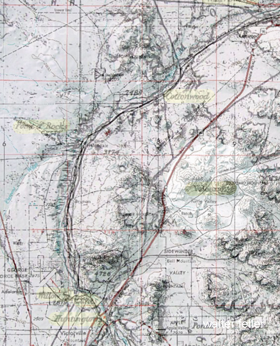
About 2009 I read an article titled “Cottonwood Springs” in the December 1959 Desert Magazine (50 years old) written by a gentleman named Walter Ford.
I wasn’t sure where the place was, although the photo included in the piece sparked some kind of vague memory. I couldn’t quite remember where it was though.
It is the same for many other places using common names; Arrastre Canyon, Grapevine Canyon, Round Mountain, etc. I have been told that there are 7 different ranges named “Granite Mountains.”
Old Woman Springs Ranch
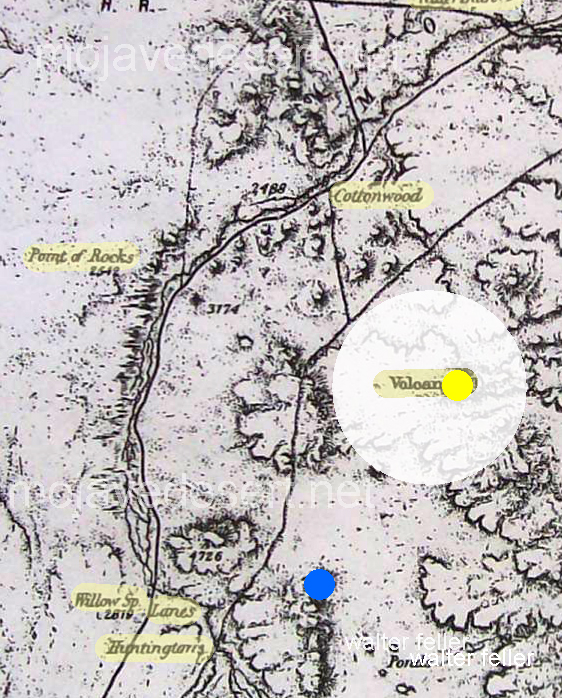
The springs were described as located along the Twentynine Palms–Victorville route. Mr. Ford mentioned speaking with A. W. Johnson, a long-time prospector of the area. Johnson said he was visiting the spring in 1914, and mention that you could find Indian artifacts such as grinding stones, broken pottery, and arrowheads being plentiful, and they were there for the taking. The author also mentioned a train running through the desert landscape and then making a sweeping, graceful turn near a sign that read Cottonwood Station. There’s only one place in the Mojave Desert that fit, and that was confirmed near the end of the article- Old Woman Springs. Eureka! I wondered though, why was the spring renamed Cottonwood Spring some 50 years ago, and again renamed Old Woman Springs?
In 1855 Colonel Henry Washington of the U.S. Army came through the then-unnamed Johnson Valley surveying the baseline. Near the west end of the valley, he found two elderly Indian women alone at a spring. Names of places came cheap, and I’m sure someone thought the name was appropriate, so the name was recorded for all posterity to ponder. The two Indian women may have been left there to watch young children traveling with the band. The rest were probably in the nearby mountains gathering piñon nuts and hunting, as hunter-gatherers were known to do. The children may have been hiding—watching, as the curious party passed through the valley. The springs, as far as anyone knows, were quiet for the next 40 or so years.
People & Places
The broad avenue leading into the OWSR
It is through the people, within the times they lived, interacting with the land and their relationship to each other that we learn of and possibly understand the unique character of places in our desert.
Charlie Martin is to Albert Swarthout as Albert is to Dale Gentry. Dale Gentry is to Cottonwood Springs as Swarthout is to Old Woman Springs Ranch and Martin to the Heart Bar. Now that all that is out of the way, let’s begin in the San Bernardino Mountains with Charlie Martin and the Heart Bar Ranch.
Charlie Martin
At over 200 pounds Charlie Martin was tough, as hard as a horseshoe, and ran with a dubious crowd. In Martha Wood Coutant’s book, Heart Bar Ranch, he was reported to have operated a resort for his criminal friends at his place in Glen Martin. Brothers Bill and Jim McHaney were frequent guests, and of the brothers, Jim would come to have his own gang after being run out of the mountains. Charlie, at one time a rustler and later a police chief of San Bernardino, is interesting to note that this apparent conflict in careers could have worked in the good citizen’s favor. Who else would better narrow the playing field of bad guys but the host of them all? Maybe that’s how Jim McHaney and his gang were forced to find a new range?
According to historian Willenna Hansen, Charlie killed at least two people. The first, after a loud argument, broke into a gunfight. Both combatants fired on each other. The victim kept missing Charlie and Charlie didn’t. The second killing was when Charlie was unarmed and approached a claim jumper known only as the Frenchman. He came after Charlie with a knife and started stabbing him. Charlie beat him off with his fists and made his way back to his wagon where he left his revolver. He shot the Frenchman square in the forehead without taking his gun out of the holster. There were no witnesses, so this time Charlie would be tried for murder. In court, his defense consisted only of him taking off his shirt for the jury to observe the 40-some, still-healing, stab wounds on his arms, chest, and back. The verdict returned was self-defense.
The Heart Bar Ranch
Charlie Martin had a number of irons in the fire. He came to believe that his fortune may lie in cattle ranching. He approached Mr. Button regarding a loan for $900. Button, possibly considering Charlie Martin’s reputation, decided he’d rather be his partner than loan him the money. It was in early 1884 when they registered the Heart Bar brand in San Bernardino. Over the next dozen years or so Martin had a variety of partners in the Heart Bar—however; nobody knows what may have come of Mr. Button.
Albert Swarthout
Albert “Swarty” Swarthout was born February 11, 1872, in San Bernardino, California. He was the youngest of five children born of George and Elizabeth Swarthout, Mormon pioneers who came to the area in 1851. George and his two brothers became cattlemen in the San Bernardino Valley. Albert never knew his father, because George died two months after he was born. It was too late; Albert already had cattle in his blood. He grew up dreaming of having his own cattle empire someday.
Box ‘S’ Ranch in Lucerne Valley, Ca.
Swarty married Lillie Furstenfeld of Hesperia on February 10, 1895, at her parent’s house in Alhambra, California. Soon afterward they moved to Lucerne Valley and homesteaded what became the Box S Ranch. It didn’t take long for Albert to figure out the area was no place for a cattle ranch. They moved back to San Bernardino where he used his family’s connections to get a job as a forest ranger. He used the opportunity to become familiar with the mountains and meadows in the San Bernardino Mountain Range.
The Old Woman Springs Ranch
Old Woman Springs Ranch
Al Swarthout, after giving up his claim to the Box S, homesteaded Old Woman Springs. With a 400 acre ranch and rights to 1600 acres of grazing being used as winter range for the Heart Bar in mind, Swarty was poised to begin his cattle empire. Martin and Swarthout entered into a partnership in 1907.
Corral and sheds
There were good years and bad years, and a few in-between years. The Swarthouts lived at the Heart Bar headquarters at Big Meadows during the summer and moved down to Old Woman Springs in the winter, driving stock back and forth through Rattlesnake Canyon between the two ranges. Charlie and Swarty seemed to get along pretty well, and Charlie took to Al’s son Donald becoming quite the uncle, taking him camping and riding often. Charlie tired of it all, and in 1914 sold off his share of the ranch to Albert’s next partner.
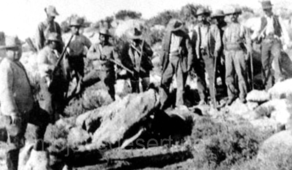
The Manhunt for Willie Boy
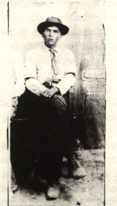
Willie Boy
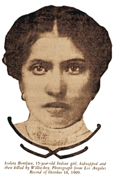
Swarthout kept a tight, hardworking outfit. Those who worked for Swarty liked and respected him, and he treated them as friends. Willie Boy, who in 1909 killed his fiance’s father and became the subject of the last manhunt in the area, according to V.C. Hemphill-Gobar in her book, Range One East, had worked for Swarty. She continues that it had been rumored he stopped by the ranch looking for help. Swarty said he wished he had been there for him. He felt he may have been able to talk Willie Boy into giving up without further bloodshed. Al wasn’t bragging, he knew and was friends with the ranch hand turned desperado. The reader should note that this subject in itself is controversial, with some believing that Willie Boy made good on his escape and lived to old age as a rancher in Nevada.
Steady Development through Tumultuous Times
West lake
After another series of partner changes in Heart Bar Ranch ownership, Swarty took an out in 1918. However, in 1922 Swarthout and Dale Gentry formed a partnership and bought the
ranch outright between them.
Over the years before, and during the years after this final partnership was formed, Swarty developed the ranch property; more buildings were built, springs and wells developed, and a field of alfalfa maintained. Even with this much water available, no more than 12 acres of alfalfa could be grown. Martha Wood Coutant states, “It would get so hot, and the crop would have to be harvested by hand quickly before it ‘shattered’ and became useless to cattle.”
Swarty and his friend Julian “Junie” Gobar from Lucerne Valley had figured out a clever irrigation system wherein the most productive spring produced roughly 150 miner’s inches (nearly 1700 gallons per minute) of water flow. The accomplishment was highly regarded by hydraulic engineers of the day.
The grotto
By 1938 the end of the Heart Bar was unavoidable. The price of beef was down and stack was getting mixed in with the herds of other ranches. Many cattle were dying from drinking water poisoned by the cyanide from gold recovery operations further up the mountain. Swarthout and Gentry were arguing and agreed to bring it all to an end. The ranch went into litigation. However, a decision regarding the properties wasn’t reached until 1947. It was decided Gentry would get the Big Meadows property in the mountains and Swarthout the Old Woman Springs property in the desert. Swarty thought it was fair—Gentry did not. Albert agreed to trade halves straight across. The deed was drawn up, done and both went their separate ways. Albert Swarthout at the time was in his mid-70s and still a very active individual. He and Lillie stayed at Big Meadows until 1952, after which they moved to San Bernardino.
Dale Gentry
Water tower and train depot
Throughout the 1950s Dale Gentry was the owner of the Old Woman Springs Ranch. There was plenty of water and 400 acres of land to do with as he wished. As a young man living in Hawaii, he had worked on a pineapple plantation. He admired the steam-powered locomotives that carried the product in from the fields. Now that he had the money and the room for it, he purchased an engine, tender, two flat cars a boxcar, and a caboose. They were brought to the ranch along with ten miles of narrow gauge track. Next, a water tower, depot, and roundhouse were built, and Gentry enjoyed giving rides to his visitors at the ranch.
Railroad ties from Dale Gentry’s Cottonwood Express
Other than six or so railroad ties found embedded in the dirt service road awhile back, there is no trace that Gentry’s “Cottonwood & Southern Railway”, ever existed. There are the buildings; the water tower, a depot, the engine room, but when I first toured the ranch in the late 1990s I figured they could be the result of another wild-eyed desert story—Of course they are.
Closing the Gate
From the highway, the ranch looks much the same as it could have 100 years ago when it was a part of Swarty’s dream brought to reality. It’s not a stretch imagining him among the cottonwoods with his friend Junie figuring ways of getting more water to more cattle on the range. Not long ago one may be able to imagine Dale Gentry’s steam engine gracefully rounding the curve, hauling a dozen or so happy passengers out to his station at the renamed Cottonwood Springs. Perhaps from there, with little effort, could look further back in time, hundreds, or maybe even a thousand years, when hunter-gatherers would leave their mothers to watch over the children while they went into the mountains for food.
Big red barn
Charlie Martin passed away in 1927 of cancer after serving several years as Chief of Police of the City of San Bernardino.
Albert Swarthout died November 10, 1963, at the age of 91.
Dale Gentry seems to have driven his train off into distant and dusty memories.
And, nobody knows what may have come of Mr. Button.
The Old Woman Springs Ranch is a private property located in the Johnson Valley, 15 miles east of Lucerne Valley on State Route 247, the Old Woman Springs Highway.
adapted from ~ Cottonwood Springs — Desert Magazine – April 1959 – Walter Ford
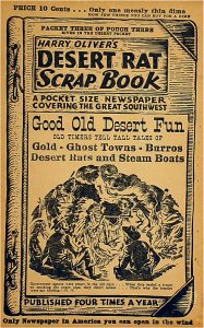
DESERT RAT TEN COMMENDENTS [sic] BY THE EDITOR (from Harry Oliver’s Desert Rat Scrapbook)
I
Thou shalt love the DESERT, but not lose patience with those who say it’s bleak and ornery (even when the wind is blowing).
Even when the wind is blowing ..
II
Thou shalt speak of the DESERT with great reverence, and lie about it with great showmanship, adding zest to Tall Tales and Legends.
Adding zest …
III
Thou shalt not admit other DESERTS have more color than the one on which you have staked your claim.
Amboy Crater
IV
Thou shalt on the Sabbath look to the Mountain Peaks so’s to know better your whereabouts, so’s you can help others to know the DESERT, dotting on the map the places where you have camped.
… on the Sabbath look to the Mountain Peaks …
V
Honor the Pioneers, Explorers and the Desert Rats who found and marked the water holes . . . they tell you about the next water hole and try to help you.
VI
Thou shalt not shoot the Antelope-Chipmunk, Kangaroo Rat or other harmless Desert friends. (Keep your shot for a snake.)
Don’t shoot these.
VII
Thou shalt not adulterate the water holes nor leave the campsite messed up. Be sure to take 10 gallons of water with you. Don’t have to ask the other fellow on the road for a quart, but be able to help the tenderfoot by giving him some water.
10 gallons of water ought to do it.
VIII
Thou shalt not steal (from the prospector’s shack), nor forget to fill the wood box and water pail.
Don’t be an asshole and mess up or steal stuff from some guy’s cabin.
IX
Thou shalt not bear false witness against thy neighbor; you know the mining laws; you know the whereabouts of his monuments.
Sign of the times.
X
Thou shalt not covet thy neighbor’s sleeping bag, his gun, nor the contents of his canteen.
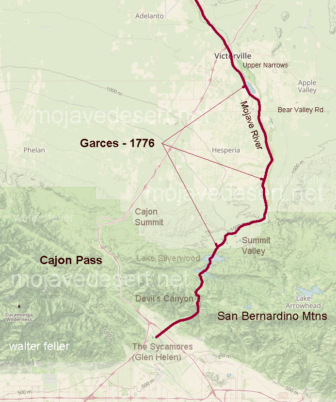
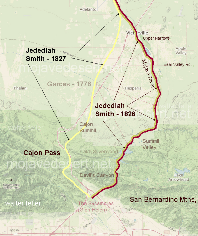
Fortifications along the western extension of the Santa Fe trail, route of the Whipple survey, were built initially because of Indian attacks on covered wagon trains of settlers. The Mojave War followed the massacre of one train by Indians at the Colorado River crossing a few miles above the present Needles.
Paiute Creek
The Army was not slow in punishing the Mojave tribes, and entire regiment being collected at Fort Yuma and going upstream. This was in the winter of 1858-59. The initial fort, Ft. Mojave, was established at the time. Supplying of this river outpost was both expensive and difficult.
Soldiers attacked
Lt. Col. William Hoffman
The road over the desert San Bernardino had been given a bad name by Lt. Col. William Hoffman would take in the company of mounted infantry in a small dragoon escort from the Cajon Pass to the river. Hoffman’s command had been attacked by Indians in route. The Col. was under orders to find a site for a desert fort. He saw nothing between Summit Valley in the river he considered a likely site. In fact, Hoffman condemned the entire route as unsuited for travel.
It is probable the Hoffman report influenced the Army in initially supplying Fort Mojave by steamer from Yuma. When the river was slow and supplies could not be taken at far upstream the fort garrison was desperate. At this juncture In Winfred Scott Hancock, the same officer who appeared in a recent issue of the series, called on the Banning stage and freight lines to take supplies through. Banning’s experience Teamsters had no trouble They drove again heavy freight wagons, each drawn by eight mule teams to the river in 16 days. The Fort Mojave garrison again had both food and ammunition.
Cady Old Site
Hancock at the time an assistant quartermaster, prove that not only the Mojave Valley road was practical. He also reduce the Army’s transport expense to Fort Mojave by two thirds. The hall from drum barracks at Wilmington to the Colorado River via Cajon Pass cost only a third as much per pound as the long water haul around Baja California and transfer shipment to river steamer.
Ives Expedition steamboat and crew heading up the Colorado River, 1857.
The site of Camp Cady was used as an Indian “fort” even before California became a part of the United States. Indians engaged in stealing horses from the Mexican ranchos built a crude sort of stronghold on the rocky hillsides of the Mojave River near that spot. It was a few miles East of the old Spanish Trail and also guarded the entrance to narrow Afton Canyon which could serve as an escape route if pursuit became too hot.
Afton Canyon
There is documentary evidence of the Indian use of their crude stronghold in 1845 point Benjamin Wilson, the Don Benito of Mexican rule, meeting Indians there in battle in 1845 a few days after the historic discovery of Bear Valley.
Governor Pio Pico
Wilson’s account of the pursuit of the horse thieves attributed depredations to renegade Indians from Mission San Gabriel but it is probable Sun desert tribes had Braves in the raiding parties. Wilson was alcalde at Jurupa and was called upon by Gov. Pico to punish the Indians. The acalde gathered a large posse including 22 young Californians mounted on fleet horses. The larger party in fact train went up Cajon Pass. Wilson in the young ranchers took the route up to Santa Ana Canyon, enjoyed hunting bear in what Wilson named Bear Valley, and joined the pack train somewhere near Rancho Verde in the present Apple Valley.
Wilson, wounded by a poisoned arrow, had his life saved by Lorenzo Trujillo. Trujillo, a New Mexican, was leader in the little colony of Agua Mansa and its twin town, Trujillo. In the Apple Valley fight the Indians were defeated in three of them killed. Wilson shot the notorious Joaquin, the ex-mission Indian, who was a ringleader among the horse thieves.
Don Benito Wilson
Several of Wilson’s Horseman pursued the remnant of the Indians down the Mojave though the wounded Wilson was forced to turn back. Nothing Indians halted in their crude fort near the site of Camp Cady. There, though the entrenched behind rocks, they were again defeated and dispersed.
In addition to the soldiers at the Mojave Desert forts there were a few civilians quartered at some of the posts. For instance, the returns of Camp Cady for December 1866 indicate an assistant wagon master was stationed there. He was paid $75 a month. Teamsters, their number not specified, received hundred and $75 a month, and herders $35 a month. Other notations would indicate the herders, at least some of them, were Indians. The Teamsters, whose work was the most skilled, where the aristocrats of the road whether they drove Concord stages and six horses or whipped along multiple freight teams. The Army officers themselves received far less pay.
There were also, at least at Cady and Mojave, sutler stores. The Army had no canteen or post exchange in that. And contractors, called settlers, were granted the privilege of establishing stores on military reservations and also, for that matter, with armies in the field. Suites that supplemented the monotonous menu, tobacco and whiskey as well as such notions as red, writing paper and ink were for sale at the sutler stores.
He (Hoffman) saw nothing between Summit Valley in the river he considered a likely site. In fact, Hoffman condemned the entire route as unsuited for travel.
Soldiers receiving $7.50 a month did not have much money to spend but there was no place to go and as a result the software store almost invariably raked in the Army man’s wages. Passing travelers also helps well the sutler income.
The system was a poor one, and the cause of continuous complaint. The soldier, at times was victimized both by high prices in shoddy material. At one juncture soldier resentment in Camp Cady passed the usual grumbling stage and the garrison simply looted the store.
Looting did not satisfy the enraged soldiery. They set fire to the store and literally drove the hated sutler from the camp. The sutler came to San Bernardino and swore out complaints. That was in August 1867 after Camp Cady was manned by regulars.
First Lieut. Manual Eyre Jr. in command at Cady, reported the affair to first Lieut. C. H. Shepherd, assistant adjutant general at Fort Mojave. He said:
“Yesterday the sheriff was here and took with him five of my men for preliminary examination under charges of arson and robbery. The case is stated in my letter addressed to a AAAG at your headquarters, dated August 8, 1867. I should, I think, be in San Bernardino during the trial of these men, if they are held for trial. I also desire to present before the grand jury’s citizens who have harbored deserters.
“The posted by you till will be established under superintendence of an officer from Mojave. Could not an officer be spared temporarily to relieved Lieut. Drum and allow him to relieve me for 10 days or two weeks? If the Rock Springs garrison is withdrawn, I can leave Lieut. Drum here in command until my return?
“The intention of this man Dead (the sutler) is evident to me. He will try to obtain money from these men to let them off. If so, I would like to be present to prosecute him for attempting to compound a felony. I am of the opinion that, as much as I dislike it, I should be in San Bernardino as soon as possible, even if the men are released after preliminary examination when, of course they would be turned loose 100 miles from camp to find their way as they see fit.”
Both because it served as a headquarters post, and because it was maintained long after the little way stations along the Old Government Road were abandoned, Fort Mojave is far better known than such points as Fort Piute, Rock Springs, Marl Spring, Fort Soda, Bitter Spring, Resting Springs or even Cady.
Fort Pah-ute ruins
Until recent years Fort Mojave was maintained as an Indian school. When it ceased to be an army post, however, it is records were moved. Some were taken to Whipple barracks in Prescott, others to the Presidio at San Francisco. For Mojave, however had a wealth of old records that escaped attention of the detail entrusted to their moving. Within the past few years the grounds of the old fort were converted to agricultural use. The remains of an old adobe building were bulldozed flat. In the process the bulldozer broke through an old wooden floor long covered with several inches of earth. The accident disclosed a long forgotten cellar. In it were scores of packing boxes containing more records. These were assembled and shipped to Washington. Stacked in a line these rediscovered records stretch 29 feet.
As yet this latest ” mine” of Pioneer Army records has not been made available to historical researchers. Presumably in a few years, however, they will have been cleaned, indexed and deposited in the national archives and will furnish a far more detailed commentary on conditions in the Southwest during the pre-railroad decades,, and on Army activities at a dozen or more all but forgotten published such as Las Vegas, Resting Springs, El Dorado Canyon, and numerous early Arizona camps. Frequent transfers of headquarters seem to have made Fort Mojave a convenient depository for numerous papers no one wanted to which, under regulations, could not be destroyed. Paperwork in the military was almost as involved in the mid-19th century as it is today. Doubtless the company clerk of the Battalion Sgt. major of 1867 rebelled inwardly at the detail required of his job and doubtless to adjutants were hard put to find storage space for the growing mountains of paper but to their credit it must be noted they observed the rules and did not indulge in the periodic bonfires that mark some of the other branches of the federal service. For instance, research on Colorado River steamers is difficult because the customs offices of registry made it a practice to destroy old records.
Two Gunmen ‘Shoot It Out’ when Cowpuncher Meets Up with Man Who Did Not Run’
One Found Sitting Against Wall, Legs Crossed, as Other Fell on Bed
WOMAN MAY BE INVOLVED
Another Dramatic Chapter of Desert History Is Written With Lead ~ By EARL E. BUIE
Matt Burts and Bill Roberts, feudists and two-gun men of Government Holes, met face to face Sunday-night.
True to the first law of the range, “shoot it out”–the law that the quickest on the draw lives–Burts and Roberts never flinched. It was fair; there was no advantage.
“Six-guns” flashed and two of the last of the gunmen of that weird vastness that centers around the water holes In the desert fell, each dying from the other’s bullets. Matt Burts and Bill Roberts died with their boots on: that is the unwritten but the immortal epitaph of the range.
Woman Likely To Be Involved
And even in this lonely desert a woman may he involved, for the wounds on Burts were washed clean and Roberts’ body was lying on a bed when the officers arrived, and woman was known to have been near the scene.
The duel spot is 260 miles by road from San Bernardino in the Ivanpah country, with its open cattle range, famed for lawlessness and gun fights. There last night Deputy Sheriffs Jack H. Brown and Jesus Amarias had not positively concluded that the tragedy with its two deaths was a closed crime. In a telegram to Sheriff Walter A. Shay, the officers bluntly told the story, partly dispelling the first theory that a murderer had slain the two men and fled across the desert hills. The telegram read:
“Bill Roberts and Matt Burts dead. Looks like duel between them, each killing the other. No arrests.”
Rock Springs Cattle Co.
The duel was but another chanter of Government Holes thrilling history. On the wide and rocky ranges run the herds of “a big cattle outfit” the Rock Springs Land & Cattle company–and those of the “little man.” It Is what is known to cattlemen as an open range, worthless without its water holes. And since beef cattle were driven into the country there has been a never-ending dispute as to water rights. Into the quarrels crept the charges of “rustling,” strong words that brought hard men.
Matt Burts Is Two Gun Man
Matt Burts was one of these men. He carried two guns, one on each hip. In the courts here two years ago when Burts appeared as a witness against Bob Holiman in a “rustling trial, Holiman openly charged that Burts had been imported from Arizona to kill him. During the case, Holiman’s attorney requested the court to have Burts searched for a gun. Burts was then an employe of the Rock Springs outfit, but lately has had his own herd of a few cattle.
Bill Roberts kept his job as foreman of the Rock Springs company because he was a “man who wouldn’t run.” Three foremen ahead of him at Government Holes had been run out of the country by gunmen, threats and by snipers who fired from behind the rocks on the hills overlooking the water hole and the foreman’s shack. Officers of the Rock Springs company charged that, rustlers’ were warring on the foremen, often alone at the holes while range riders were miles away.
Burts, since he left the cattle company, had been a quarrelsome character, drinking heavily and making his threats against his enemies in the district. He wouldn’t leave; that would be cowardly. Stories of his enmity toward Roberts have drifted into the sheriff’s office for weeks.
And in the country, wild and barren as it is, was a woman, a Mrs, Ridell, who lives on a lonely homestead In the Government Holes district. She once was arrested for moonshining when Burts was suspected. But she claimed that the still was hers and took her medicine in the Needles courts without whimpering.
Meanwhile, Roberts virtually lived by his guns. Three weeks ago, the cattle outfit foreman came to his shack after a day on the range and found 13 bullet holes through the house a mute warning that Government Holes was unhealthy for him. But Bill Roberts was, too, a man of the waste lands who wouldn’t leave.
Sunday, the story goes. Burts drove up to Roberts’ place with Mrs. Ridell and her grandson. Burts went up to the house, presumably to ask for a drink. Roberts met in the door. In an instant, their guns were in play, firing simultaneously, for neither Bill Roberts nor Matt Burts had a superior on the range for drawing in a hurry. It was the inevitable. Both shot straight and both died.
Two Men Are Found in Cabin
The bodies of Burts and Roberts were found in a ranch house. Burts had been shot squarely through the forehead. He was found in a sitting position, with his legs crossed and his hat on. All blood had been washed away from the wound. Roberts, shot through the abdomen, was found laid out on a bed. Both men were killed by .44 caliber bullets.
Sheriff Shay received word of the duel at midnight Sunday and immediately sent Deputies Brown and Amarias to the scene. The officers left San Bernardino at 1 o’clock Monday morning and six hours later they were in Goffs, 220 miles away an average of nearly 40 miles an hour across the desert. By 10 o’clock they were on the ground at Government Holes, 40 miles south and east of Lanfair.
Map of Government Holes area
The officers may return late today. They will conduct a thorough investigation of the case, however, as the sinister stories that first reached the city have not died down, and the position of bodies indicate a possible new angle in the case. Mrs. Ridell’s grandson was questioned for hours yesterday, but reiterated the duel story.
Government Holes, however, has had its gun duels before. Six years ago it was the scene of the spectacular gun fight between Pat and Roy Woods, father and son, and Bob Holiman. In the fight, Holiman emerged the victor, although not a drop of blood was lost.
Water Hole Was Cause of Feud
Pat Woods and his son, Roy, were cowboys employed by the Rock Springs company. And again it was the rights to the water holes and the enmity between the “little men” against the Rock Springs company that led to the duel. It was commonly known that Roy Woods practiced shooting by killing jack-rabbits with his six-shooter while riding in a flivver and on horse-back And Pat, the father, could break a beer, bottle with his six-shooter 50 yards away.
In the spring during the roundup, Pat and Roy Woods met Bob Holiman on the open range. Pat began shooting and, apparently rattled, missed Holiman. Then Holiman got into action. He shot Pat Woods’ horse out front under him and with a second shot knocked Roy’s hat off his head.
Fate probably saved the Woods from extermination. Holiman was shooting like a sharpshooter when his gun jammed. Holiman’s friends, who were spectators to the duel, shouted to Holiman to “tickle his horse”–sinking the spurs into his horse’s flanks. And Rob “tickled” his horse and galloped away without a return fire from the Woods.
Trial Resembled Movie Location
The trial in the courts here resembled a moving picture outfit on location. Scores of cowboys of the wide ranges attended and there were no convictions. The Woods, however, left Government Holes and so far as known never returned.
Two years ago, Holiman again figured in tho courts in a case involving the ownership of a calf that he killed. Burts, then one of the stout-hearted men hired by the Rock Springs company to protect their cattle, charged that Holiman killed a Rock Springs calf and sold the beef at Needles. Holiman offered no fight when Burts arrested him. In this case, Holiman was not convicted, the jury disagreeing and the charge dismissed.
It was In this case that Burts’ past life was revealed in open court. Burts, six feet tall, handsome, and with coal black hair, was a picturesque figure at the trial. On his right hip he wore a six-shooter. When he was called to testify against Holiman, Attorney Ralph E. Swing began a cross-examination
“Have you removed that revolver that you have been toting around?” asked the attorney.
Burts glared back silently.
Did Not Want Witness Armed
“I wish to interrogate this witness,” Attorney Swing told Judge J. W. Curtis, “and I don’t want him sitting there with a revolver on his hip.”
Burts then arose in his seat, held his coat under his shoulders and turned around slowly. “I took it off.” he explained.
Then the attorney began questioning Burts.
“Were, you ever convicted of a felony?” he asked.
“Yes, twice,” retorted Burts.
“What was the first offense you were convicted of?” Burts was asked.
“Train robbery.”
“And what were you convicted for the second time?”
“For shooting a fellow.”
Burts then explained that he was sentenced to serve five years for the train robbery and was pardoned after serving six months. This was in Arizona. On the second offense, he was sentenced to serve 10 years and was pardoned by the governor after serving five months, he said. That was years ago, Burts said.
His Brother Deputy Sheriff
Burts has a brother, Tom Burts, a deputy sheriff, living at Tucson. The brother yesterday wired Sheriff Shay asking that the body be forwarded to Tucson.
Little is known of Robert’s past history. Walter S. Greening, president of the Rock Springs company, said last night that he did not know where Robert came from, but that he was sent to Rock Springs “because he wouldn’t run.”
And he didn’t.
This story first appeared in The San Bernardino Daily Sun — November 10, 1925
In the early seventies, while the Southern Pacific Railway was building from San Francisco to
San José, some twelve or fifteen bandits, carousing at a country dance in the Mexican settlement, Panamá (about six miles south of Bakersfield) planned to cross the mountains and hold up the pay-car. They were unsuccessful; whereupon, they turned their attention to the village of Tres Pinos, robbed several store-keepers and killed three or four men. They were next heard of at little Kingston, in Tulare County, where they plundered practically the whole town. Then they once more disappeared.
Presently various clues pointed to the identity of the chief bandido as one Tibúrcio Vasquez, born in Monterey in the thirties, who had taken to the life of an outlaw because, as he fantastically said, some Gringos had insolently danced off with the prettiest girls at fandangos, among them being his sweetheart whom an American had wronged. With the exception of his Lieutenant, Chavez, he trusted no one, and when he moved from place to place, Chavez alone accompanied him. In each new field he recruited a new gang, and he never slept in camp with his followers.
Tiburcio_Vasquez
Although trailed by several sheriffs, Vasquez escaped to Southern California leading off the wife of one of his associates—a bit of gallantry that contributed to his undoing, as the irate husband at once gave the officers much information concerning Vasquez’s life and methods. One day in the spring of 1874, Vasquez and three of his companions appeared at the ranch of Alessandro Repetto, nine miles from town, disguised as sheep-shearers. The following morning, while the inmates of the ranch-house were at breakfast, the highwaymen entered the room and held up the defenseless household. Vasquez informed Repetto that he was organizing a revolution in Lower California and merely desired to borrow the trifling sum of eight hundred dollars. Repetto replied that he had no money in the house; but Vasquez compelled the old man to sign a check for the sum demanded, and immediately dispatched to town a boy working for Repetto, with the strict injunction that if he did not return with the money alone, and soon, his master would be shot.
When the check was presented at the Temple & Workman Bank, Temple, who happened to be there, became suspicious but could elicit from the messenger no satisfactory response to his questions. The bank was but a block from the Courthouse; and when Sheriff Rowland hurriedly came, in answer to a summons, he was inclined to detain the lad. The boy, however, pleaded so hard for Repetto’s life that the Sheriff agreed to the messenger’s returning alone with the money.
Soon after, Rowland and several deputies started out along the same trail; but a lookout sighted
the approaching horsemen and gave the alarm. Vasquez and his associates took to flight and were pursued as far as Tijunga Pass; but as the cut-throats were mounted on fresh horses, they escaped.
Even while being pursued, Vasquez had the audacity to fleece a party of men in the employ of
the Los Angeles Water Company who were doing some work near the Alhambra Tract. The well known Angeleño and engineer in charge, Charles E. Miles, was relieved of an expensive gold
watch.
Camel Corp
In April, 1874, Sheriff Rowland heard that Vasquez had visited the home of “Greek George”— the Smyrniot camel-driver to whom I have referred—and who was living about ten miles from Los Angeles, near the present location of Hollywood. Rowland took into his confidence D. K. Smith and persuaded him to stroll that way, ostensibly as a farmer’s hand seeking employment; and within two weeks Smith reported to Rowland that the information as to Vasquez’s whereabouts was correct. Rowland then concluded to make up a posse, but inasmuch as a certain clement kept Vasquez posted regarding the Sheriff’s movements, Rowland had to use great precaution.
Anticipating this emergency, City Detective Emil Harris-four years later Chief of Police-had been
quietly transferred to the Sheriff’s office; in addition to whom, Rowland selected Albert Johnson, Under Sheriff; B. F. Hartley, a local policeman; J. S. Bryant, City Constable; Major Henry M. Mitchell, an attorney; D. K. Smith; Walter Rodgers, proprietor of the Palace Saloon; and G. A. Beers, a correspondent of the San Francisco Chronicle. All these were ordered to report, one by one with their horses, shortly after midnight, at Jones’s Corral on Spring Street near Seventh. Arms and ammunition, carefully packed, were likewise smuggled in. Whether true or not that Vasquez would speedily be informed of the Sheriff’s whereabouts, it is certain that, in resolving not to leave his office, Rowland sacrificed, for the public weal, such natural ambition that he cannot be too much applauded; not even the later reward of eight thousand dollars really compensating him for his disappointment.
Greek George
By half-past one o’clock in the morning, the eight members of the posse were all in the saddle and silently following a circuitous route. At about daybreak, in dense fog, they camped at the mouth of Nichols’s Canyon-two miles away from the house of Greek George-where Charles Knowles, an American, was living. When the fog lifted, Johnston, Mitchell, Smith and Bryant worked their way to a point whence they could observe Greek George’s farm; and Bryant, returning to camp, reported that a couple of gray horses had been seen tied near the ranch-house. Shortly thereafter, a four horse empty wagon, driven by two Mexicans, went by the cañon and was immediately stopped and brought in. The Mexicans were put in charge of an officer, and about the same time Johnston came tearing down the ravine with the startling statement that Vasquez was undoubtedly at Greek George’s!
A quick consultation ensued and it was decided by the posse to approach their goal in the captured vehicle, leaving their own horses in charge of Knowles; and having warned the Mexicans that they would be shot if they proved treacherous, the deputies climbed into the wagon and lay down out of sight. When a hundred yards from the house, the officers stealthily scattered in various directions.
Harris, Rodgers and Johnston ran to the north side, and Hartley and Beers to the west. Through
an open door, Vasquez was seen at the breakfast table, and Harris, followed by the others, made a quick dash for the house. A woman waiting on Vasquez attempted to shut the officers out; but Harris injected his rifle through the half-open door and prevented her. During the excitement, Vasquez climbed through a little window, and Harris, yelling, “There he goes!” raised his Henry rifle and shot at him. By the time Harris had reached the other side of the house, Vasquez was a hundred feet away and running like a deer toward his horse. In the meantime, first Hartley and then the other officers used their shotguns and slightly wounded him again. Vasquez then threw up his hands, saying: “Boys, you’ve done well! but I’ve been a damned fool, and it’s my own fault!”
The identity of the bandit thus far had not been established; and when Harris asked his name, he answered, “Alessandro Martinez.” In the meantime, captors and prisoner entered the house; and Vasquez, who was weakened from his wounds, sat down, while the young woman implored the officers not to kill him. At closer range, a good view was obtained of the man who had so long terrorized the State. He was about five feet six or seven inches in height, sparely built, with small feet and hands-in that respect by no means suggesting the desperado-with a low forehead, black, coarse hair and mustache, and furtive, cunning eyes.
Not the Spanish Alejandro; a variation doubtless suggested by the Italian Repetto’s forename.
By this time, the entire posse, excepting Mitchell and Smith (who had followed a man seen to leave Greek George’s), proceeded to search the house. The first door opened revealed a young fellow holding a baby in his arms. He, the most youthful member of the organization, had been placed on guard. There were no other men in the house, although four rifles and six pistols, all loaded and ready for use, were found. Fearing no such raid, the other outlaws were afield in the neighborhood; and being warned by the firing, they escaped. One of Vasquez’s guns, by the way, has been long preserved by the family of Francisco Ybarra and now rests secure in the County Museum.
Underneath one of the beds was found Vasquez’s vest containing Charley Miles’s gold watch, which Harris at once recognized. The prisoner was asked whether he was seriously hurt and he said that he expected to die, at the same time admitting that he was Vasquez and asking Harris to write down some of his bequests. He said that he was a single man, although he had two children living at Elizabeth Lake; and he exhibited portraits of them. He protested that he had never killed a human being, and said that the murders at Tres Pinos were due to Chavez’s disobedience of orders.
Vasquez and his captors
The officers borrowed a wagon from Judge Thompson—who lived in the neighborhood—into which they loaded Vasquez, the boy and the weapons, and so proceeded on their way. When they arrived near town, Smith and Mitchell caught up with them. Mitchell was then sent to give advance notice of Vasquez’s capture and to have medical help on hand; and by the time the party arrived, the excitement was intense. The City Fathers, then in session, rushed out pellmell and crowds surrounded the Jail. Dr. K. D. Wise, Health Officer, and Dr. J. P. Widney, County Physician,administered treatment to the captive. Vasquez, in irons, pleaded that he was dying; but Dr. Widney, as soon as he had examined the captive, warned the Sheriff that the prisoner, if he escaped, would still be game for a long day’s ride. Everybody who could, visited him and I was no exception. I was disgusted, however, when I found Vasquez’s cell filled with flowers, sent by some white women of Los Angeles who had been carried away by the picturesque career of the bandido; but Sheriff Rowland soon stopped all such foolish exuberance.
Vasquez admitted that he had frequently visited Mexicans in Los Angeles, doing this against the
advice of his lieutenant, Chavez, who had warned him that Sheriff Rowland also had good friends among the Mexicans.
Among those said to have been in confidential touch with Vasquez was Mariano G. Santa Cruz, a prominent figure, in his way, in Sonora Town. He kept a grocery about three hundred feet from the old Plaza Church, on the east side of Upper Main Street, and had a curiously-assorted household. There on many occasions, it is declared, Vasquez found a safe refuge.
Five days after the capture, Signor Repetto called upon the prisoner, who was in chains, and
remarked: “I have come to say that, so far as I am concerned, you can settle that little account with God Almighty!” Vasquez, with characteristic flourishes, thanked the Italian and began to speak of repayment, when Repetto replied: “I do not expect that. But I beg of you, if ever you resume operations, never to visit me again.” Whereupon Vasquez, placing his hand dramatically upon his breast, exclaimed: “Ah, Señor, I am a cavalier, with a cavalier’s heart!”—¡Señor Repetto, yo soy un caballero, con el corazón de un caballero!
Sheriff Rowland
As soon as Vasquez’s wounds were healed, he was taken by Sheriff Rowland to Tres Pinos and there indicted for murder. Miller & Lux, the great cattle owners, furnished the money, it was understood, for his defense—supposedly as a matter of policy. His attorneys asked for, and obtained, a change of venue, and Vasquez was removed to San José. There he was promptly tried, found guilty and, in March, 1875, hanged.
Many good anecdotes were long told of Vasquez; one of which was that he could size up a man quickly, as to whether he was a native son or not, by the direction in which he would roll a cigarette—toward or away from himself! As soon as the long-feared bandit was in captivity, local wits began to joke at his expense. A burlesque on Vasquez was staged late in May at the Merced Theater; and the day the outlaw was captured, a merchant began his advertisement: VASQUEZ says that MENDEL MEYER has the Finest and Most Complete Stock of Dry Goods and Clothing, etc.”
from: Sixty years in Southern California, 1853-1913, containing the reminiscences of Harris Newmark. Edited by Maurice H. Newmark; Marco R. Newmark
L. Burr Belden San Bernardino Sun-Telegram September 6, 1959
In 1861 the county of San Bernardino contracted with John Brown to build a toll road through the Cajon Pass from Devore to Cajon Summit. That would do fine to get wagons and freight between San Bernardino and the Mojave Desert. At the same time the county also approved a subscription road to be built by Jed Van Dusen from near the summit through the mountains so equipment and supplies could be freighted to the mines in Holcomb Valley.
History in the Making
Mountain Road Cost Miners $2,000 in Gold
Brown’s Toll Road
Back in the early 1860s the gold rich but food poor miners of Holcomb Valley decided the number one need for their mountain metropolis was a road. in typical pioneer fashion instead of looking to San Bernardino, Sacramento or Washington these miners resolved to build the road.
At the time supplies for Holcomb Valley were brought up by way of a packed train trail up Santa Ana Canyon from the San Bernardino Valley and thence to Holcomb Valley by trails threading either Polique or Van Dusen Canyons. these trails served for burros, mules or horses but the only way to get a wagon to the gold mines was to take it apart and load its pieces on pack animals.
Toll Road up Cajon
John Brown Sr.
The Holcomb Valley mines were reputedly among the richest in California. Free gold, as the placers were known, was becoming hard to obtain in quantities up in the worked over streams of the Mother Lode and accordingly thousands of footloose miners poured into Holcomb Valley making an increasingly heavy strain on the thin supply line.
Down in San Bernardino John Brown Sr. a resourceful Rocky Mountain man, who was one of the leaders in the settlement both during and subsequent to the Mormon regime, had an experienced eye for trade routes. Brown was probably one of the first to vision San Bernardino as a trade center due to its central location and proximity of favorable mountain gateways.
Brown saw that San Bernardino could obtain an even better share of overland travel with better roads. Accordingly he planned to make the Cajon Pass gateway the preferable way east. He applied to the Board of Supervisors and was granted a toll road franchise. His road utilized the East Cajon route which he improved so it could accommodate wagons. Then Brown went farther and started a ferry over the Colorado River at Fort Mohave.
Builder Paid $2,000
Van Dusen Road/ Coxey Truck Trail from Cajon Summit to Holcomb Valley
The Brown Road diverted Holcomb Valley traffic away from the Santa Ana trail. A new trail was blazed down Holcomb Creek, Willow Creek and Arrastre Creek to reach the Mojave Desert floor in the vicinity of Deadman Point. From Deadman Point it was an easy open path to Brown’s road.
Van Dusen Road at east bank Mojave River
Miners and supply men who used the new trail saw that it could be widened to accommodate wagons. The usual method of making a road would have been for the Holcomb Valley miners to turn out with their picks and shovels, but that meant leaving their claims just when water was high enough for gold washing. Accordingly a person of $2,000 in gold dust was raised and Jed Van Dusen, the camp blacksmith, was hired to build the road. He did just that. Van Dusen was a resourceful fellow. He had assembled a wagon from parts brought up to Holcomb Valley by pack train. In between running his smithy he had some good claims he worked in the canyon that has been given his name. Van Dusen’s chief claim to fame, however, was neither his skill as a road builder, blacksmith or miner. it rested on the fact he was father of a very pretty little girl named Belle.
Dead Man’s Point
Daughter Honored
When the miners cast about for a name for their town in Holcomb Valley they found W. F. (Billy) Holcomb reluctant to have it named for him. Then someone had an idea. Why not name the camp for Jed Van Dusen’s little girl? So Belleville became the name of the big roaring mining camp that had almost as many residents as the rest of the county.
Lucky Baldwin’s Gold Mountain
For a dozen years or so the Van Dusen built road carried the heaviest traffic in the county. The travel to the mines, of course, was a great help to the Brown tollway. Heavy machinery needed for quartz mining was hauled over the road as gold veined ledges were discovered. The latter included two of the most famous gold mines San Bernardino County history, E. J. (Lucky) Baldwin’s Gold Hill property and Richard Garvey’s Greenlead.
During Civil War days the Van Dusen – built road carried a strange assortment of passengers and cargo. Liquors for Greek George’s notorious saloons and dance halls, staple goods, the inevitable blasting powder and large bullion shipments. Strangest of all travelers, however, was a ragged troop of filibusters recruited in Visalia who called themselves Confederate calvarymen and commanded by Mariposa County’s stormy Assemblyman Dan Showalter. Showalter and his motley horsemen were trying to reach southern lines in Texas but a few weeks later ran into California volunteers near Warner’s Ranch and were taken prisoner.
This was the same Showalter who had recently slain San Bernardino County’s Assemblyman Charles Piercy in a duel at San Rafael. The duel was fought with rifles at 40 paces. First shots of both antagonists went wild and Showalter allegedly jumped the gun and shot the second time at the count of two, killing Piercy. Showalter was a fugitive when he was in Holcomb Valley but secessionist sentiment plus that of roughs who wanted no government at all served to protect the fact it was San Bernardino County’s legislator he had slain.
The roughs around Belleville ran things with a high hand, at least until Greek George fell mortally wounded from the knife of ” Charlie the Chink” in the drunken aftermath of a Fourth of July celebration. In a reminiscent account written 35 years later Billy Holcomb told of that fatal July 4 and of George’s killing three men before his fatal combat with the celestial.
Van Dusen Road
It was members of George’s gang, left more or less leaderless, who held up an outgoing stagecoach and relieved the Wells Fargo messenger of $60,000. It was the disgusted miners, anxious to drive out the roughs, who pursued the highway men and killed them all. The last bandit was slain a bit too quick for he died while trying to tell where the $60,000 was hidden. As far as is known it has never been found, a sizable cache of gold bars that has lured treasure seekers unsuccessfully for something like 90 years.
Baldwin Garvey Feud
The Van Dusen Road carried the ballot boxes in the weird election when Belleville tried to become county seat, and probably succeeded in polling a countrywide majority but lost on the official count by the “accident” of a Belleville precinct’s box being lost in a bonfire down in San Bernardino.
After the richer placer deposits had been worked Belleville and upstream Beardstown dwindled in size. The emphasis’s one to hard rock mining which required less men more capital and tools. In the hard rock field the giant was Baldwin, who at one time was running a 40- stamp mill at Gold Hill and the operation was supporting a good-sized town, the town of Doble.
Elias Jackson “Lucky” Baldwin
Next in size to Baldwin’s operation were those of Garvey. Garvey had owned Gold Hill at one time and reportedly sold it to Baldwin for $200,000. The Garvey family always contended that Baldwin took a bill of sale for the mine but neglected to pay the Irish-born Garvey all the promised money. Garvey trusted his supposed friend.
Garvey held onto the Greenlead, which is almost at the side of the Van Dusen Road in lower Holcomb Valley. When hard times depressed Los Angeles real estate Garvey found he owed $300,000 on the land no longer worth the amount of the mortgages. Three shifts worked the Greenlead and Garvey paid all but $90,000 of the $300,000 debt. The family held onto the Greenlead. It had been leased, sold and worked from time to time. The new owner from Sherman Oaks was on the property a year ago with plans for reopening the long tunnels where there is still said to be quantities of ore rich enough to pay for mining even under current costs.
Long Cattle Drives
In the wake of the minors cattlemen moved into the San Bernardino Mountains. The old road to Holcomb Valley saw huge drives in both spring and fall as cattle were moved from desert ranges to the mountains and back again.
When the first dam was built at Bear Valley in the 1880s A. E. Taylor hauled supplies over the old road, then completed and used the road up Cushenbury direct to Bear Valley. Advent of the Cushenbury gateway, now Highway 18, and the later Mill Creek and crest routes serve to diminish the importance of the old route but it was not closed.
Coxey Meadows
Halfway down to the desert, at the well-known landmark of Coxey’s Ranch, the Forest Service had one of its early ranger stations. It was one of the picturesque log cabin structures typical of such stations 40 years ago. A search for the station earlier this summer disclosed that he had reverted to the status of a guard station and that two or three years ago it was burned when a gasoline lantern or stove exploded. The old corral remains Coxey’s. Today’s guards camp out and have telephone service.
The old road is a popular one with Forest visitors who like to get away from the pavement and camp out. There are public grounds at Horse Springs, Big Pine Flats, and that Hannah Flats. Numerous Springs make the route a well watered one that it is no place for a pavement driver with a low center car.
Sometimes the fastest way from point A to point B would be a straight line.
To the uninitiated, there is something rather uncertain about the reasons why a person will take time to view a location or an artifact. Ask the visitor why they make the trek or handle an object. The response may take the form of a smile, and perhaps the timeworn cliché ” because it was there.” That smile in phrase only does partial justice in explaining personal gratification.
Why should we visit sites where history of any magnitude happened? Perhaps it is because a fresh vista creates a more objective insight in pursuit of historical knowledge. Personal enjoyment and related benefits require one to approach a subject with a receptive and determined mindset.
In stories about stagecoaches and freight wagons we may be entertained or learn about animals, load, dust, storm, good, evil, driver, passenger, comedy, sadness and so forth – a whole range of emotions. a writer may have captured our imagination in words, but obtaining a complete and satisfying grasp of the event is a personal quest.
Salt Lake Wagon Road
Often our inquisitiveness may provide answers only by standing on the spot, embracing the environment, and getting the feeling of how it may have been back when. Imagine sound, the smell of man, equipment noise in animals doing the work. Anticipate the next riser dip the road and how it must have affected progress. Consider the impact on those traveling in good, bad, or indifferent weather. Envision people, dress, available tools, and reasons for passing this way. Think of small but important details, such as animal harnesses, conveyancing station construction. Perhaps the preceding thoughts may help create for you a new perspective and enjoyment of history.
from: Indian Wells Valley Stage and Freight Stops 1874 – 1906 Comments and Directions by Lou Pracchia Historical Society of the Upper Mojave Desert
The Walters family is an important part of Hesperia history. Starting with George Francis Walters, who moved his family from Illinois to California because his wife, Harriet C Finigan Walters had asthma.
Hesperia Hotel
The family first settled in the Riverside area where he went to work for the Santa Fe Railroad. According to Bolton Minister, son of George O Walters Minister, George was offered a transfer to Hesperia to manage the Hesperia Hotel.
The Walters family consisted of George and his wife Harriet, and their children, in birth order, Georgia Henry had to Walters Minister-Henry, Verial W. Walters Ormond and Roy Edward Walters.
According to Mr. Minister, both the daughters went to work in the hotel. They were later joined by Laura McClanahan who in 1921 transferred from the Goodsprings Hotel, in Goodsprings, Nevada.
Roy & Laura Walters
Verial was postmistress, until she moved away when she got married, and then her position was given to her brother Roy.
Roy ended up marrying Laura McClanahan and having a daughter, Geraldine Henrietta Walters. Geraldine married first, Yeager and second Schwartz.
According to Mr. Minister, George Francis Walters built the Walters house in the Walters general store according to Geraldine, her grandmother Harriet was the midwife in the delivery of 32 Hesperia babies.
When George passed away the store was handled over to Roy, who operated it for many years.
I do not know where George and area Walters or Barry. However, I do know that Roy and Laura are buried at the cemetery in Victorville.
With the passing of time, their store had deteriorated and will eventually disappear from Hesperia. As eventually, the Walters name will.
I had heard that the rocks in the Sawtooth area were of an unlikely composite origin. So, I asked a friend to send me an abstract of the geology (as if I would understand it).
The following abstract seems to indicate that the geologic complexity of this area is more intricate than even geologists previously thought. It looks as if there are several kinds of rocks introduced through widely varying events from as far back as 1.5 billion years up to as recently as 66 million years ago combining unlikely materials to form the obviously unique Stoddard Ridge.
Now, since I have mostly no idea on what I am talking about I will keep going out there and studying the area to see if I can ever understand it.
ABSTRACT GEOLOGY OF THE STODDARD RIDGE AREA, WEST CENTRAL MOJAVE DESERT, SAN BERNARDINO COUNTY CALIFORNIA — BROWN, Howard J. – Omya -Lucerne Valley, CA – May 2013
Stoddard Ridge is a prominent landmark south of Barstow California in the west central Mojave Desert area. The 35 square mile area was mapped in detail at a scale of 1:12,000. The geology is far more complex than depicted on all older published maps. The new mapping adds significant new data regarding the variety of rocks present, and adds new details on the geologic structure and complex geologic history of the area.Several packages of rocks are exposed. At the east end of the ridge the oldest rocks are exposed and include PreCambrian basement gneiss complex, metamorphosed intrusive rocks, and possible Late Proterozoic metasedimentary rocks (schist units). The central part of the ridge exposes several sequences of steeply dipping Mid Jurassic Lower Sidewinder volcanic (JLSV) rocks, and younger (JLSV) rhyolite dome complex that includes extrusive, flow banded and massive hypabyssal intrusives. The western portion of Stoddard Ridge is largely heterogeneous Mid Jurassic plutonic rocks (post JLSV) which form a steeply dipping sheeted intrusive complex, that includes diorite, granodiorite, quartz monzonite and felsite. Plutonic and to a lesser degree volcanic rocks are cut by numerous younger mafic and felsic dikes correlated with the Independence dike swarm of Late Jurassic age. The eastern part of the ridge has been intruded by homogeneous Mid Jurassic plutonic rocks, and Cretaceous granitic intrusive rocks are exposed along the southwestern base of Stoddard Ridge. Several ages of Late Cenozoic alluvial units were also differentiated in mapping.
Geologic structure is complex, the result of several deformational events including shearing, folding, faulting, intrusion and metamorphism of pre Mid Jurassic age, followed by multiple Mid Jurassic age volcanic, intrusive and deformation (folding and faulting) events, and younger Cenozoic age faulting. Most bedrock units have a northwest trending structural grain which likely formed in Jurassic time. Suspected concealed faults are present under alluvium. Several prominant young northwest trending high angle faults are present on the south side of the ridge and can be seen to cut alluvium.
The most famous lost mine in the Death Valley area is the Lost Breyfogle. There are many versions of the legend, but all agree that somewhere in the bowels of those rugged mountains is a colossal mass of gold, which Jacob Breyfogle found and lost.
Mesquite Flats Sand Dunes – Death Valley
Jacob Breyfogle was a prospector who roamed the country around Pioche and Austin, Nevada, with infrequent excursions into theDeath Valleyarea. He traveled alone.
Indian George, Hungry Bill, and Panamint Tom saw Breyfogle several times in the country around Stovepipe Wells, but they could never trace him to his claim. When followed, George said, Breyfogle would step off the trail and completely disappear. Once George told me about trailing him into the Funeral Range. He pointed to the bare mountain. “Him there, me see. Pretty quick—” He paused, puckered his lips. “Whoop—no see.”
Breyfogle left a crude map of his course. All lost mines must have a map. Conspicuous on this map are the Death Valley Buttes which are landmarks. Because he was seen so much here, it was assumed that his operations were in the low foothills. I have seen a rough copy of this map made from the original in possession of “Wildrose” Frank Kennedy’s squaw, Lizzie.
Breyfogle presumably coming from his mine, was accosted near Stovepipe Wells by Panamint Tom, Hungry Bill, and a young buck related to them, known as Johnny. Hungry Bill, from habit, begged for food. Breyfogle refused, explaining that he had but a morsel and several hard days’ journey before him. On his burro he had a small sack of ore. When Breyfogle left, Hungry Bill said, “Him no good.”
Incited by Hungry Bill and possible loot, the Indians followed Breyfogle for three or four days across the range. Hungry Bill stopped en route, sent the younger Indians ahead. At Stump Springs east ofShoshone, Breyfogle was eating his dinner when the Indians sneaked out of the brush and scalped him, took what they wished of his possessions and left him for dead.
Ash Meadows Charlie, a chief of the Indians in that area confided to Herman Jones that he had witnessed this assault. This happened on the Yundt Ranch, or as it is better known, the Manse Ranch. Yundt and Aaron Winters accidentally came upon Breyfogle unconscious on the ground. The scalp wound was fly-blown. They had a mule team and light wagon and hurried to San Bernardinowith the wounded man. The ore, a chocolate quartz, was thrown into the wagon.
Resting Springs
“I saw some of it at Phi Lee’s home, theResting Spring Ranch,” Shorty Harris said. “It was the richest ore I ever saw. Fifty pounds yielded nearly $6000.”
Breyfogle recovered, but thereafter was regarded as slightly “off.” He returned to Austin, Nevada, and the story followed.
Wildrose (Frank) Kennedy, an experienced mining man obtained a copy of Breyfogle’s map and combed the country around the buttes in an effort to locate the mine. Kennedy had the aid of the Indians and was able to obtain, through his squaw Lizzie, such information as Indians had about the going and coming of the elusive Breyfogle.
“Some believe the ore came from around Daylight Springs,” Shorty said, “but old Lizzie’s map had no mark to indicate Daylight Springs. But it does show the buttes and the only buttes in Death Valley are those above Stovepipe Wells.
“Kennedy interested Henry E. Findley, an old time Colorado sheriff and Clarence Nyman, for years a prospector for Coleman andSmith(thePacific Borax Company). They induced Mat Cullen, a rich Salt Lake mining man, to leave his business and come out. They made three trips into the valley, looking for that gold. It’s there somewhere.”
Francis Marion “Borax” Smith
At Austin, Breyfogle was outfitted several times to relocate the property, but when he reached the lower elevation of the valley, he seemed to suffer some aberration which would end the trip. His last grubstaker was not so considerate. He told Breyfogle that if he didn’t find the mine promptly he’d make a sieve of him and was about to do it when a companion named Atchison intervened and saved his life. Shortly afterward, Breyfogle died from the old wound.
Indian George, repeating a story told him by Panamint Tom, once told me that Tom had traced Breyfogle to the mine and after Breyfogle’s death went back and secured some of the ore. Tom guarded his secret. He covered the opening with stone and leaving, walked backwards, obliterating his tracks with a greasewood brush. Later when Tom returned prepared to get the gold he found that a cloudburst had filled the canyon with boulders, gravel and silt, removing every landmark and Breyfogle’s mine was lost again.
“Some day maybe,” George said, “big rain come and wash um out.”
Among the freighters of the early days was John Delameter who believed the Breyfogle was in the lower Panamint. Delameter operated a 20 mule team freighting service between Daggett and points in both Death Valley and Panamint Valley. He told me that he found Breyfogle down in the road about twenty-eight miles south of Ballarat with a wound in his leg. Breyfogle had come into the Panamint from Pioche, Nevada, and said he had been attacked by Indians, his horses stolen, while working on his claim which he located merely with a gesture toward the mountains.
Subsequently Delameter made several vain efforts to locate the property, but like most lost mines it continues to be lost. But for years it was good bait for a grubstake and served both the convincing liar and the honest prospector.
Nearly all old timers had a version of the Lost Breyfogle differing in details but all agreeing on the chocolate quartz and its richness.
That Breyfogle really lost a valuable mine there can be little doubt, but since he is authentically traced from the northern end of Death Valley to the southern, and since the chocolate quartz is found in many places of that area, one who cares to look for it must cover a large territory.
From: Chapter XXII Lost Mines. The Breyfogle and Others Loafing Along Death Valley Trails by William Caruthers
I was standing here one day taking some train shots and some guy told me this was where Say Davis Jr. had the accident where he lost his eye. I asked him if he knew if or not that it had been found? He told me it hadn’t and I told him I would look around before I left.
Strange, but not true … (or, All in favor, say “Eye.”) Oro Grande, Ca.
I knew better. I didn’t know the story or location in detail, so I looked it up on the ‘Google.’ Google has ‘everything’ (Dad was right).
This is not where Sammy Davis Jr. was in an auto accident and lost his eye–it would have been found by now if it were!
A MYSTERY FROM THE MYSTERIES OF THE MYSTERIOUS MOJAVE
Where did Sammy Davis Jr. Lose His Eyeball?
Bullet-shaped horn button on ’55 Caddy
As he was making a return trip home to Los Angeles from Las Vegas, Davis lost his left eye to the bullet-shaped horn button (a standard feature in 1954 and 1955 Cadillacs) in an automobile accident on November 19, 1954, in San Bernardino, California. The accident occurred at a fork in U.S. Route 66 at Cajon Boulevard and Kendall Drive (34.2072°N 117.3855°W).
Kendall Rd. & Cajon Blvd.
BTW; His eyeball is not there either–I looked. If the ‘Google’ says that’s it, that’s it!
They belong to the occupants while they live there, and the first man to move-in is the next owner. It is not a written law, but is a habit and custom of the country and is respected by rich and poor alike.
It started with Dobe Charley when he needed a home. A tent was too hot in summer and too cold in winter. he pondered the problem through one cold windy winter and one hot desert summer.
When “camping out” became too unbearable he took refuge in an old deserted mine tunnel a few miles from Shoshone, and was comfortable. He was protected from all weather hazards, but it was too isolated to suit his tastes.
Shoshone, Ca.
” Why not make a tunnel in a hill closer to town?” the idea grew, and he looked all over the hills close around. Finally he picked out what he considered an ideal place.
It was a cliff of hard adobe mud, within easy walking distance of the general store and post office. Not that he intended to walk, that is, that while his motorcycle would run.
He dug out a whole as big as a medium sized room and put a door on it. When it was finished to his satisfaction, he moved in and became the envy of all the loafers in the little desert oasis on the fringe of Death Valley.
Joe Volmer, a retiring, middle-aged man, got himself a dwelling nearby. His consisted of several rooms connected by tunnels. To enter one of the rooms one must pull aside a cupboard and go a short distance down a ladder through a narrow passageway.
Ashford Brothers
The Ashford brothers, Harold and Rudy, decided to follow suit. They were dapper little fellows, very English and very neat and clean. Their cliff dwelling reflected them, neat and across the gulch from the others. like its occupants, it stood a little apart from its companions.
Bill, big and lazy, liked Doublin Gulch, but hadn’t the ambition to dig a dwelling. He built his one-room shack on a level place against the cliff.
Crowly, aggressive and authoritative, look it over and chose the point of the hill, a position dominating all the other cliff houses. An imposing location, but like its builder, it was untidy.
Crowly appointed himself a sort of Mayor of Doublin Gulch. If the others resented it they gave no indications. Mostly they did not mind as long as no one interfered with their way of life.
Cool in the summer–and a great view!
Other men settled along the cliff. Thrown together by circumstances, these men were a variable lot. For the most part their past was a closed book. Some, no doubt, came to escape this or that, but on the whole they lived as they pleased, working at the nearby mines until they had saved a stake, returning to their cliff dwelling to live the leisurely until it was gone.
When one has finished with this life and needs his home no longer, another drifter, perhaps fleeing from his past or maybe just tired of the sorrows and troubles of the outside world and finding solace in the desert, moves in.
Thus these cliff dwellings of Doublin Gulch have passed from one occupant to another.
Who can tell what secrets they have hidden or what sorrows have been soothed by the quiet and solitude of these rugged refuges thrusting their doors from the face of the cliff like turtle’s heads from under their shells.
Ghost Town News Knott’s Berry Place Buena Park, Calif. December 1944
“Warm in the winter, cool in the summer, the caves carved into the soft material of the banks of this wash were home, at one time or another, to people … ”
Sandy Walker, Desert Rat, says that in the desert a Ford lives 3 years – a dog 3 times the age of the Ford – 9, a horse 3 times the age of a dog – 27, and a man 3 times the age of the horse – 81, and some say a burro 3 times the age of a man – 243, at least this is 4/5ths true.
Sandy Walker says you can’t find gold with Fords – have to have burros. Says he’s been out here in the desert 26 years, 6 years hunting gold and 20 years hunting burros. He didn’t find his mine while hunting gold. He found it while hunting his dadburned runaway burros.
Many prospectors will tell you that no one has ever seen a dead burro.
Uncommon to locally common in deserts of California. Range extends into eastern Lassen Co., and from extreme southern Mono Co. south to the Mexican border. Most are found in Inyo Co., northeastern San Bernardino Co., and in the vicinity of the Colorado River.
Much confusion and arguement have arisen from the two spellings of the word “Mojave.”
A ruling of the Geographical Board in Washington, D.C. however a few years ago simplified the problem some what. If you are in California, the name of the river, the city and the desert should be spelled with a “j”: Mojave. If, on the other hand, you happen to be in Arizona, then you must spell the name of the county and the Indian tribe with an “h”: Mohave.
Dr. A.L. Kroeber of the University of California, noted anthropologist, claims that only the “h” spelling should exist, since the word is an Indian one, not Spanish, and was only transliterated by the early Spanish, who gave all “h” sounds a spelling of “j”. The very same problem arose with the greatest Indian tribe of Northern Arizona: should it be Navaho or Navajo?
The word Mojave (or Mohave) itself is of Indian origin and is that tribe’s name for “three mountains,” referring to three distinctive landmarks near the present city of Needles, whose name also refers to this geological oddity.
Desert Rat Scrapbook Published by Harry Oliver Fort Commander, Publisher, Distributor, Lamp Lighter, Editor, Artist, Gardener, Janitor, Owner A paper that grows on you as you as you turn each page . . . excepting page 5
Pictures are by the author, many of them are woodcuts.
from; Death Valley Historic Resource Study A History of Mining – Volume I Linda W. Greene
Probably the most publicized event in the Wingate Pass area concerns one of Death Valley Scotty‘s most infamous hoaxes, referred to as the “Battle” of Wingate Pass. Conceived as a last-ditch effort to discourage further investigations by a mining engineer who was insisting on actually seeing Scotty’s bonanza gold mine before recommending that his employers invest any money in it, the attack turned out to have almost fatal consequences for one of Scotty’s brothers, put Scott himself in and out of jail several times during the ensuing months, and ultimately, six years after the incident, resulted in his confessing in a Los Angeles courtroom to long-term and full-scale fraud and deceit. (The most concise version of this tale appears in Hank Johnston, Death Valley Scotty: “Fastest Con in the West” and serves as the basis for the following account.)
Death Valley Scotty
The escapade had its beginnings in February 1906 when a New England mining promoter, A.Y. Pearl, whom Scott had met in New York, interested some bankers and businessmen in investing in Scott’s supposedly rich mining properties in Death Valley. Before committing any money, however, the Easterners insisted that Daniel E. Owen, a respected Boston mining engineer who happened to be in Nevada at this time, personally inspect the property and give his opinion of its worth.
Arrangements were accordingly made with all the parties involved, and by February 1906 Owen, Pearl, and Scott were in Daggett preparing for the journey into Death Valley. Other members of the expedition were: Albert M. Johnson, president of the National Life Insurance Company of Chicago (soon to become Scotty’s long-term benefactor), who had recently arrived from the East and, intrigued by the stories of Scotty’s untold wealth, asked to accompany the party; Bill and Warner Scott, brothers of Death Valley Scotty; Bill Keys, a half-breed Cherokee Indian who had prospected with Scott in the Death Valley region for several years, who had found the Desert Hound Mine in the southern Black Mountains, and who several years later, after the “ambush” incident, moved to a ranch in what is now Joshua Tree National Monument [park]; A.W. DeLyle St. Clair, a Los Angeles miner; and Jack Brody, a local desert character.
The entire trip, if carried out as planned, had the potential of proving extremely embarrassing for Scott, who, after all, did not have a mine to show in order to consummate this lucrative transaction. Desperate for a solution, he turned to his friend Billy Keys and persuaded him to let him show Owen the Desert Hound instead. Although not as large as Scott had reported his bonanza to be, at least the Hound was there on the ground for Owen to see. Papers of agreement were drawn up to the effect that Scott and Keys would split the proceeds from the mine sale.
Later, fearful that Owen would reject this mine as being too small a producer to warrant investment by his employers, Scott devised a scheme that he hoped might succeed in scaring Owen away from the area and dampening his enthusiasm for penetrating into the Death Valley region as far as the mine. A shootout would be staged and hopefully be authentic enough to disrupt Owen’s intended mission.
Starting out on 23 February 1906 with two wagons fully loaded with provisions, extra animal feed and fresh water, and a string of extra mules and horses, plus a liberal supply of whiskey, the party journeyed on to camp the next evening at Granite Wells. On Sunday, 25 February, the caravan pushed on twenty-six miles toward Lone Willow Spring, site of their next camp. In the morning Scott directed his brother Bill to stay at the spring with the extra animals and told Bill Keys and Jack Brody to proceed on ahead and look for any danger. After giving these two a reasonable head start, the rest of the party began the trek toward Wingate Pass and, surmounting that obstacle, proceeded on down the wash into the south end of Death Valley. Toward dusk that evening, as the party was trying to decide where to camp, shots were heard and a lone rider appeared from the north. He turned out to be an ex-deputy sheriff from Goldfield, Nevada, who excitedly reported that he had just been fired on from ambush and his pack train stampeded.
Receiving Scott’s assurances that he could fight off any outlaws, the party warily resumed its journey. A little further up the road beyond Dry Lake, near the site of the earlier shooting, Scotty suddenly drew his rifle and fired two shots. Startled, the mules pulling Warner Scott and Daniel Owen in the lead wagon began to buck, the force tipping Owen over backwards; a sudden shot from behind a stone breastwork on a cliff to the south hit Warner in the groin. It was at this point that Scotty made the fatal blunder that, in the recalling, forced Owen to doubt the authenticity of the ambush. Upon realizing that his brother had been seriously wounded, Scotty, nonplussed, galloped away toward the “ambushers” yelling at them to stop shooting.
Establishing camp quickly, an attempt was made to close Warner’s wounds. In the morning the party headed the wagons quickly back toward Bill Scott and Lone Willow Spring, and eventually toward Daggett, leaving their provisions behind by the side of the road. Keys and Brody never did rejoin the group. Reaching Daggett on 1 March, the group put Warner on a train for Los Angeles; Scotty hurriedly took off for Seattle where he was about to star in a play, “Scotty, King of the Desert Mine.” Johnson left immediately for Chicago and, due to some fast legal work by his lawyer, was not involved in any of the ensuing litigations.
Bill Keys
The incident struck the fancy of Los Angeles newspapermen, who, however, were hard put to locate the principals involved or determine the true facts of the case. Pearl circulated a good story of fighting off four outlaws, but Owen, disaffirming this tale, and evidently convinced that Scott had meant to kill him, reported the true facts to the San Bernardino County sheriff and later to the press. Two weeks later warrants were issued for the arrest of Walter Scott, Bill Keys, and Jack Brody on charges of assault with a deadly weapon. In an attempt to determine the identify of the party’s attackers, the San Bernardino County sheriff, John Ralphs, and an undersheriff entered the Death Valley country to find Keys and Brody. Although these two managed to elude the law this time, the provisions that had been hurriedly left at the scene of the attack by the Scott party were found at Scotty’s Camp Holdout; other incriminating evidence took the form of a statement by Jack Hartigan, the Nevada lawman who had also been shot at, that he had backtracked and seen Keys running from the scene after Scott’s plea to stop shooting.
Publicity given to Scotty and the incident was becoming unfavorable, many people now deciding it was time to show Scotty up for the fraud and liar he was believed to be Scotty, working in his play out of town while loudly condemning these attacks on his character and reputation, continued to propogate the story of a bona fide attack by outlaws who were after his life and his valuable claims. Sarcastic poems and invective cartoons began to appear in the Los Angeles Evening News his primary accuser, which had earlier asked in an editorial, “What is the truth about this desert freak? He has ceased to be a joke. People are getting shot and action must be taken. . . . ” [235]
In the midst of all this attendant publicity that for a while brought full houses to his play, Scotty was arrested around 24 March by order of the San Bernardino sheriff; he was released later that night on a writ of habeas corpus, his bail of $500 having been raised by Walter Campbell of the Grand Opera House. Seemingly true to the profile presented in the News commenting that “He [Scott] occupies the cheapest room in the Hotel Portland, drinks nickel beer, and leaves no tips!,” [236] after release from jail this time Scotty asked the crowd in attendance “to have a drink. Every body had visions of wine and popping of corks, but Scotty announced it was a case of steam beer or nothing.” [237]
Scotty was arrested again two days later and again released on bail, and then on 7 April 1906 Scott pleaded not guilty to two counts of assault with a deadly weapon. Out again on $2,000 bail, more bad luck was awaiting him in the form of a $152,000 damage suit filed by his brother Warner, now out of the hospital, in Los Angeles Superior Court against Walter and Bill Scott, Bill Keys, A.Y. Pearl, and a “John Doe.” Three days later Keys was arrested at Ballarat, and, also pleading not guilty to the two charges against him, was summarily slapped in jail. Luckily for Scotty, Keys kept silent on the whole matter.
On 13 April, for the fourth time in under three weeks, Scotty was arrested; this time A.Y. Pearl and Bill Scott were also taken into custody. All ended up in the San Bernardino County jail. Out again through habeas corpus proceedings the next day, Scott rejoined his acting troupe. Then, on 27 April, only four days before the preliminary hearing on the case was to start, all charges were dismissed by the San Bernardino County Justice at the request of the District Attorney. To the disappointment of many of Scott’s detractors, but true to the luck that seemed to always rescue him from tight places, a jurisdictional problem had arisen over the fact that the scene of the shooting was actually in Inyo County, which alone had jurisdiction to prosecute the case. Because Inyo County authorities seemed loathe to proceed, all prisoners were released from custody and the final act of the long, drawn-out affair seemed over.
One newspaper article published soon after Scotty’s death (besides stating erroneously that one of the “outlaws” in the fracas had been Bill Scott) charged that Scotty himself moved the surveyor’s post marking the Inyo-San Bernardino County line. [238] This seems to be borne out by Scotty’s own version of the whole affair, which of course pursues the theory that outlaws were trying to get title to his “claims” by permanently removing him from the scene. After several supposed attempts on his life (this most recent encounter not the only one that had taken place in Wingate Pass) from which he always recovered.
Our gang, including my brother Warner, who was working for me and spying for the other crowd, came into Death Valley through San Bernardino County. The two ‘frictions’ met in Wingate Pass. They thought we was the Apache gang. Somebody began to shoot.
I said to Johnson, ‘Get back where the bullets are thickest.’ That was in the ammunition wagon.
I knew something was wrong. When I hollered, ‘Quit shooting!’ things quieted down. The other gang disappeared. We look around and find Warner has been shot in the leg. The same bullet has gone around and lodged in his shoulder. Johnson took eighteen stitches in it. We hauled Warner a hundred miles to a doctor. Had him in a buckboard. Made it in ten hours.
At this time I had a show troop. While it’s playing in San Francisco, I am arrested. I get out on a two-thousand-dollar bond.
Later I was re-arrested, and this time the bond is five thousand, but between the two arrests, I’ve had time to get things fixed. You remember, the fight took place in San Bernardino County, and i don’t want to be tried there.
I decide I’ll move the county boundary monument. When I was a boy, I’d been roustabout for the crew. that surveyed that part of the country, so I know it like a book. I go back and move the pile of rock six miles over into San Bernardino County. That puts the shooting into Inyo County.
The trial starts in San Bernardino. I say, ‘If you investigate, I think you’ll find this affair occurred in Inyo and that this court has no jurisdiction.’ The trial stopped. They investigated. Sure enough, they found the boundary marker. According to the way the line ran, the battle occurred over the line in Inyo County.
Inyo County wasn’t interested. The case was dismissed. [239]
Location of Wingate Pass with county boundary lines.
The true nature of the whole affair was later revealed by Bill Keys who admitted before his death that he and a companion (possibly the teamster Jack Brody, although according to Keys it was an Indian named Bob Belt) had faked the ambush at Scotty’s behest. The shooting of Warner had been accidental, his partner being too drunk to aim his gun properly.[240]
Warner Scott dropped his damage suit against his brother on condition that he assume the medical bill of over $1,000 owed to a Dr. C.W. Lawton of Los Angeles. Scott agreed and then promptly left the city. Lawton obtained a judgement against Scotty, but the latter proceeded to ignore it, having no tangible assets anyway.
During the next few years, Scott still had some associations with Wingate Pass, a notice being found that in 1908 he interested Al D. Meyers of Goldfield and a couple of associates in a strike made there. Notwithstanding Scott’s earlier famous experience, the men outfitted in Barstow and accompanied him to inspect the property. There is no evidence that they encountered any difficulties, though nothing further was heard of the outcome of the proposition. Bill Keys was also mining for lead ore in Wingate Pass in 1908, in partnership with Death Valley Slim. [241]
Six years after the Wingate Pass incident, however, on 20 June 1912, the past caught up with Walter Scott, and in a rather spectacular trial in a Los Angeles courtroom, Scotty was forced to acknowledge a multitude of sins. In order to secure his release from jail where he had been confined for contempt of court for not paying the doctor’s bill for his brother Warner’s medical care, Scotty was forced to confess to the shams involved in the ambush in Wingate Pass, in the big rolls of money he always carried (which he confessed were “upholstered with $1 bills”), and in the reports concerning the vast amounts of money he was reputed to have received from the Death Valley Scotty Gold Mining and Development Company. He had, he continued, never located a mine or owned one, and was completely at the mercy of mining promoters and schemers who profited from the advertising his various stunts provided for them. Exposed as a fraud and a cheat, Scott was returned to jail pending further investigation by the District Attorney’s office–a long-awaited and seemingly conclusive finale to the strange affair known as the “Battle” of Wingate Pass. [242]
235. Los Angeles Evening News, 19 March 1906, quoted in Johnston, Death Valley Scotty, p. 68. 236. Los Angeles Evening News, no date, quoted in Johnston, Death Valley Scotty, p. 70. 237. Inyo Independent, 30 March 1906. 238. Ibid., 12 February 1954. 239. Eleanor Jordan Houston, Death Valley Scotty Told Me (Louisville: The Franklin Press, 1954), pp. 72-73. 240. Johnston, Death Valley Scotty, pp. 76-77; L. Burr Belden, “The Battle of Wingate Pass,” Westways (November 1956), p. 8. 241. Rhyolite Herald, 10 June, 30 September 1908. 242. Inyo Register, 20 June 1912.
by James A. Sandos and Larry E. Burgess
Review: Linda S. Parker – San Diego State University
Willie Boy – Desparado
The authors have written an enlightening historical ethnography of the Willie Boy episode. By illuminating the frontier myth and Indian-hating inherent in the dominant story of Willie Boy, and using Chemehuevi ethnographic literature and oral traditions, Sandos and Burgess have separated myth from fact. This permitted them to develop a new white version based on historical documents. Importantly, they also present a Chemehuevi version of Willie Boy’s tale. Additionally they present Willie Boy’s own story relating to the episode.
In examining the development of the Willie Boy tale, including the stories told in Harry Lawton’s book Willie Boy: A Desert Manhunt and Abraham Polonsky’s film Tell Them Willie Boy Is Here, Sandos and Burgess show how Indian hating “shaped” the talc into a “triumph” of civilization over savagery. The authors persuasively argue that Willie Boy was not drunk when he killed William Mike. The story of alcohol involvement was accepted because it fit the stereotype of Indians who turned to liquor to solve their problems. Sandos and Burgess also suggest that one of the Indian trackers accidently killed Carlota.
After determining that Willie Boy was a mixed blood Chemehuevi and raised in that culture, the authors were able to use Chemehuevi cultural data and oral tradition to explain certain elements of Willie Boy’s story. Knowledge of Chemehuevi culture and its impact on Willie Boy make his ability to outrun the posse understandable. Sandos and Burgess indicate that bride capture, an important component of the standard story, was not practiced by the Chemehuevi. They indicate that this practice and the alleged kidnapping of Carlota was an Anglo creation. Instead she accompanied Willie Boy as a free agent who loved him and was willing to break with her culture and family by violating the tribal kinship taboo prohibiting their marriage. Although both Lawton’s book and Polonsky’ film tell about the taboo and an earlier alleged abduction of Carlota, neither are seen as significant. Sandos and Burgess explain why.
Isoleta/Carlota/Lolita
Based on circumstantial evidence, Sandos and Burgess determine that Willie Boy was a Ghost Dancer. If one accepts their conclusion, which this reviewer found somewhat tenuous, then the authors’ reasoning that Willie Boy’s Ghost Dance beliefs influenced his behavior and the actions of William Mike is also plausible. In discussing the murder of William Mike, the authors suggest that one of the reasons Mike opposed the marriage of his daughter to Willie Boy was that Mike, a shaman, rejected the Ghost Dance. Acontest over spiritual power was involved. Sandos and Burgess also maintain that Willie Boy’s suicide is understandable given the influence of the Ghost Dance. Countering the myth surrounding the events occurring at Ruby Mountain, the authors convincingly argue that Willie Boy had no reason to surrender and that he that he could have easily escaped. They speculate that Willie Boy learned of Carlota’s death at Ruby Mountain and that he committed suicide that night in order to be with her. According to Ghost Dance teachings, the best time to join the dead was shortly before dawn.
Although the author’s historical analysis is critical to explaining Willie Boy’s story, the major contribution of The Hunt For Willie Boy is its integration of Chemehuevi culture and oral tradition.
Willie Boy’s body
Linda S. Parker, Department of American Indian Studies. San Diego State University.
The Hunt for Willie Boy: Indian Hating and Popular Culture. James A. Sandos and Larry E. Burgess. Norman: University of Oklahoma Press, 1994. Maps, photos, figures, and references. xviii + 182 pp. $21.95.
University of Nebraska – Lincoln DigitalCommons@University of Nebraska – Lincoln Great Plains Research: A Journal of Natural and Social Sciences Great Plains Studies, Center for
I went alone into the desert with only a fox terrier and a buckskin pony, for company. There was no one on the edge who knew about the interior and those that talked as though they knew did not care to go with me. I was promised plenty of trouble. Predecessors had been “caught up with” again and again. Their bodies, dried like Egyptian mummies, had been found in the sands long after by Indians. The heat and the drought were unbearable, there were sand storms, sulphurcous whirlwinds, poisonous springs, white gypsum wastes, bewildering mirages, desert wolves, rattlesnakes, tarantulas, hydrophobia skunks. I would never come out alive. But I went in, tempted Providence, off and on, for two and a half years, and still live to tell the tale. After all, the dangers were not great. I had had, as a boy, considerable experience in Indian life and was not afraid of the open. And I had no fear of being alone or getting lost. My sense of direction was as keen as that of a homing pigeon, and when I was equipped with food and had located a water hole it really made no difference to me whether I was lost or found. I always knew my general direction, and with the ever-constant sun and stars I could not lose the points of the compass There are two ways of outfitting for a trip into the unknown. The one usually followed is to pack every article of plunder that might be thought desirable. ‘chat generally results in wearing out the most enduring pack train. I preferred the other way, the Indian way, of carrying very little, going light-shod, and retaining ease of movement. So, for myself, I wore nothing but a cotton shirt and trousers, a flat straw hat, and, on my feet, moccasins. I made my own moccasins, Sioux style, with a pointed toe, of strong mule-deer hide. A pair of blankets, a small hatchet, a short-handled shovel, some rawhide picket ropes, several tin cups, a small frying pan, a rifle for large game, and a .22-caliber single-barrel pistol for birds—
“Las Vegas is a symbol, above all else, of the impermanence of man in the desert, and not least because one is never not aware of the desert’s all pervading presence; wherever man has not built nor paved over, the desert grimly endures – even on some of the pedestrian islands down the center of the Strip! The presence of such an enclave of graceless pleasures in such an environment is so improbable that only science fiction can manage it; the place is like the compound of an alien race, or a human base camp on a hostile planet. To catch this image you need to see Las Vegas from the air by night, or better still, late in the afternoon, as I first saw it, when there is just purple sunset light enough in the bottom of the basin to pick out the crests of the surrounding mountains, but dark enough for every little lamp to register. Then – and only then – the vision is not tawdry, but is of a magic garden of blossoming lights, welling up at its center into fantastic fountains of everchanging color. And you turned to the captain of your spaceship and said, ‘Look Sir, there must be intelligent life down there,’ because it was marvelous beyond words. And doomed – it is already beginning to fade, as energy becomes more expensive and the architecture less inventive. It won’t blow away in the night, but you begin to wish it might, because it will never make noble ruins . . . .”
Peter Reyner Banham. 1982. Scenes in America Deserta. Salt Lake City: Gibbs M. Smith. Pages 42-43.
Does this …
… Blow your mind? — Cajon Junction (el. 2950′) at I-15 and Hwy. 138 is actually at about a 300′ higher elevation than Victorville (el. 2650′). The slope from the summit to Victorville is gradual, not as noticeable, and provides us with the illusion that we are further up than we actually are.
The Old Spanish Trail had become increasingly used as a pack mule trail between New Mexico and California, and with this traffic came the opportunity for those to take advantage of the distance and desperate nature of the land.
Hundreds and sometimes even thousands of stolen horses from the ranchos would burst through Coyote Canyon beginning their ‘journey of death’ across the Mojave.
California horses were beautiful creatures, and the mules were taller and stronger than those in New Mexico and they were easy to steal. The rolling hills and plains presented clear paths to the Cajon where numerous hidden canyons and washes were available to slip into and prepare for the furious run across the desert. Horses would be stolen in herds from many different ranchos at once. Hundreds of horses, even thousands could be commandeered and driven by just a few experienced thieves.
Narrows, Crowder Cyn., Cajon Pass
Chief Walkara, ‘Hawk of the Mountains’ and the greatest horse thief in all of history along with his band of renegade Chaguanosos , and notables such as Jim Beckwourth and Pegleg Smith would work together in this illegal trade. During one raid they were said to have coordinated the theft of 3,000-5,000 horses, driving them to Fort Bridger to trade for more horses to run to New Mexico to trade again. Horses would fall from exhaustion every mile and the local bands of Paiute would feast on the remains.
The rich ranchos of southern California.
In 1843 Michael White was granted one league of land at the mouth of the Cajon Pass called Rancho Muscupiabe. At a point overlooking the trails leading into and away from the canyon he was expected to thwart the raiders and horse thieves that were plaguing the Southern California ranchos. In theory it was a good plan but in practice it did not work so well.
From the piedmont between Devil and Cable canyons, Miguel Blanco could keep an eye out for the horse thieves entering the Cajon.
He built his home of logs and earth and constructed corrals for his stock. However, the location between Cable and Devil Canyon only served as a closer and more convenient target for the Indian thieves. His family was with him, but after six weeks until it became too dangerous. He left after nine months without any livestock and in debt.
The Old Spanish Trail went down this slope to behind Miguel Blanco’s rough-hewn homestead. Indians would watch from this forest for Miguel to leave and they would slip down and steal everything that could be stolen.
Miguel sold his property, however, Miguel had misread the grant, letting the rancho go for much less than it was worth. The land described on the grant was roughly 5 times larger than Miguel thought. Blanco brought a suit but lost.
Muscupiabe Rancho
As the late 1840s and 1850s rolled by wagon roads were being developed in the canyon minimizing the effectiveness of the maze of box canyons being used to cover the escape of desperadoes on horseback. With California becoming a state frontiersmen such as Beckwourth and Peg Leg Smith would not steal from fellow Americans. Horse-thieving under U.S. law had become a crime where before it was just stealing horses from Mexicans. That was only serious if caught in the act. Americans would never extradite them. For the most part, that was the end of the horse stealing raids.
Fr. Francisco Hermenegildo Tomás Garcés (April 12, 1738 – July 18, 1781) was a Spanish priest who crossed the Mojave Desert in 1776. This map shows his route across the Victor Valley. Following the Mojave River after crossing at Oro Grande, he walked through downtown Victorville, bypassing the rocky narrows and connecting with the river near today’s Mojave Narrows Regional Park. Following the river to where the West fork and Deep Creek join to form the Mojave. He visited with the Indians and then went up Sawpit Canyon and over the mountain ridge, descending into the verdant sycamore grove known today as Glen Helen.
This map shows Fr. Garces’s route in 1776 during his crossing west. His diary describes him being taken to an Indian village in the mountains.
Fifty years after Fr. Garcés made his way across the Mojave from the Colorado River, in 1826, Jedediah Smith retraced the trail of Garcés along the river, then up and over the mountains. In 1827, one year after his first crossing, Smith had lost most of his men in a massacre at the Colorado River. Desperate for the safety of civilization, Smith, after crossing the Mojave River in Oro Grande, made his way directly to the Cajon Pass, bypassing the San Bernardino Mountains.
The direct route over the summit and down the pass eliminates the steep climb and descent over the San Bernardino Mountains.
Death Valley is perhaps the West’s most aptly named topographical feature and over years it has taken the lives of countless thousands of travelers, prospectors, treasure hunters and others who ventured into its tortured arid wilderness.
The circumstances of these deaths are roughly similar: horses died, they ran out of water, got lost, became delirious with the heat etc., but at least one of the valley’s victims left behind a more accurate account of his last hours on earth.
Al Williams’ body was found the morning of August 3, 1911 at Sharpe’s Camp, a sometime [ng] a few miles southeast of Darwin, California. A Nevada prospector who had traversed Death Valley many times in the [l,] Williams apparently lost his horse then lost himself on this trip. He had set out from [o] Springs on May 18 and nothing more was heard of him until his body was found, though his friends had searched for him earlier in the summer, sick and unable to leave his camp, Williams apparently waited day by day for someone to come and rescue him. As he waited, he recorded his condition and his thoughts in the following diary which was found on his body:
Thursday, May 18
Left Coso Springs.
Wednesday, May 24
Nothing to eat since Thursday.
Friday, May 26 —
week in sick, cannot walk 50 feet. Tried to get dove; no go.
Saturday, May 27
Hungry, hungry and so weak. Headache, sick. Will probably die soon.
Sunday, May 28
Very weak today. Nearly froze last night. Very hungry.
Monday, May 29
Cold: almost froze. Am much weaker; do not think I have will last two days more. Pain in my side.
Tuesday, May 30
Colder than ever last night. Did not sleep a minute. Very weak. Hello the headache. Very dizzy.
Wednesday, May 31
Am nearly all in; can scarcely breathe. Water getting low.
Thursday, June 1
Worse today, Sick; no sleep; too cold. Water is playing out fast it will not be long til the end.
Friday, June 2
Am about the same. No sleep; cold nights. This is a living hell. Very weak.
Saturday, June 3
No sleep; cold night. Am worse than ever. will hold out as long as I can.
Sunday, June 4
Vomit yellow, bitter stuff when I drink water. Second time now. Cold; no sleep; very weak.
Monday, June 5
Vomit when I drink. Very weak; legs sore; cold all night; no sleep. Cannot last much longer.
Tuesday, June 6
Vomited again. Getting weaker.
Wednesday, June 7
Don’t see how I can live much longer. I stagger like a madman. Feel drunk and dizzy.
Thursday, June 8
Worse; am nearly blind; very sick and dizzy. No sleep; gnats are eating me up.
Friday, June 9
Don’t believe I can get another canteen of water. Sick and dizzy: cannot see much. Think it will be all off soon.
In the back of the diary under the date of June 9, 1911, Williams wrote the following: “Have stood it 23 days without anything to eat. If I can get one more canteen of water I am satisfied it will be the last one. This is surely hell on earth. And so sick and dizzy I can scarcely see this in the gnats are eating me up.” Too weak to write and almost blind for the last three days of his life, Williams merely made his cross in the diary to show that he was still alive.
The men who found the body at first considered bringing it out to a nearby ranch and notifying the Inyo County coroner, but its condition was such that they decided against such a course. A shallow grave was dug on a high bench about 50 feet from the dry spring and Williams was laid away.
One of the men wrote a short account of his death from the diary and placed it in a tobacco can which was then stuffed into a crude monument built over the grave.
Williams diary itself was brought back to Darwin and given to the editor of the Inyo County Independent who subsequently might venture out unprepared or who might go out on a rescue mission and give up too soon, thus condemning another of their fellows to the awful sacrifice which the desert seems to periodically demand.
The Story of John Brown (1817 – 1899) By Edward Broadhead (Reprinted from The Pueblo Lore, January 1985)
Wrightwood Historical Society Wrightwood Roots Friday,March 4, 2005 A.D. Edited by George Tilitson Adapted by Walter Feller
John Brown (1817 – 1899)
One of the more unusual pioneers of the early nineteenth century was John Brown, born in Worcester, Massachusetts on December 22, 1817. He started west as a teenager making his way to St. Louis and getting a job rafting down the Mississippi River to New Orleans. He took a job sailing along the Gulf Coast and was shipwrecked off the coast of Galveston. We can not follow him too clearly during this period but he fought with Sam Houston in the Battle of San Jacinto in 1836. He spent two years at Fort Leavenworth and then became a trapper for some fourteen years in the Rocky Mountains. He was able to tell of his encounters with bears and with Indians in a most exciting way.
In 1842 it is believed that he helped physically to build Fort Pueblo. It is here that he made the acquaintance of such frontiersmen as James Waters, Tim Goodale, Dick Owens, Calvin Briggs, John Burroughs, and Old Bill Williams. He trapped from Colorado to the Yellowstone and met Kit Carson, James Bridger, the Bents, and the Sublettes.
Jim Beckworth, a former slave from Virginia whose father had freed him, was a noted trapper who spent several years as a member of the Crow Indian tribe, found himself a Mexican bride, Louisa Sandoval, in Taos and brought her and their small daughter, Matilda, to Fort Pueblo in October 1842. He set up as a trader with only limited success and when spring came, he set out for California, leaving his wife and daughter at the Fort. It was here that Louisa met John Brown and they decided to live together as a family. There were no clergy nearer than Taos. The marriage was certainly successful since they remained together for the rest of their long lives and had several children. Before John Brown settled down to a more quiet married life, he had had an experience with Nicolasa, apparently a fascinating young Mexican girl, and killed a Frenchman in a duel which took place in the early 1840s on a ranch of Jose Weis on the Greenhorn. It was the same Nicolasa, who incited Rube Herring to kill Henry Beer at Fort Lupton on July 4, 1843. Herring took Nicolasa to Fort Pueblo and lived with her there until James Waters stole her away from him. Not long after Waters killed Edward Tharp in a fight over the same girl. (When most of these men went to California a few years later, Nicolasa was left behind.)
From 1843 to 1845 John Brown made Fort Pueblo his headquarters. Can we speculate that he had a few successful trapping expeditions? At any rate, he moved to the Greenhorn in 1845 and opened a store. He must have found some money in order to invest in a store. It was his policy to trade chiefly with whites and not with Indians although there were times when he sold whiskey to the Indians under the counter since it was illegal to sell alcohol to Indians. The record of his accounts has been preserved in the Huntington Library in California. He noted the sales made and the names of the buyers. His first accounts appeared in April 1845. Brown stocked only what he called essentials, but did not at first include such items as coffee, sugar, and flour. He did carry whiskey and tobacco. Brown bought his goods mostly in Pueblo. With demand, he soon added flour, sugar, coffee, pants, shoes, etc. Among his customers was William Bent who sent E. Garry (Edmund Guerrier) to sell goods and to buy a steer from Brown in November 1846. William’s brother, George Bent, bought 1½ fanegas of corn. Other customers whose names appeared in his account book were Cosper (who worked for Alexander Barclay), James Grieves, William Adamson, one of Barclay’s foremen, Joseph Bridger and Rube Herring. No Indian names appear except those Indian wives of whites.
It is revealing to note that the species which Brown handled included doubloons, sovereigns, gelders, Mexican pesos, and gold pieces as well as American dollars.
Louisa was active in the store. Entries often appear in her handwriting. She also made candles and soap when a pig was slaughtered. The store was prosperous and Brown expanded his business into other projects such as farming. He built irrigation ditches and grew corn, watermelons, wheat, and hired Mexicans to herd cattle and horses. The Mexicans he hired became his customers. He built for them adobe houses and then added a grist mill between December 1846 and February 1847. The Mexicans were well treated. They were free employees, not like the peons on a Mexican hacienda who were paid only in supplies which kept them constantly in debt to the ranchero. Brown hired 3 men in 1845, 24 men in 1846, 8 men in 1847, and 2 men in 1848. Most stayed only a few months.
Not only did Brown mill his own flour, but he also accepted grain from others to be milled. He sold flour for 5 cents a pound or $8 per fanega. (One fanega was equal to 1.6 bushels.) Farmers from Hardscrabble and from Pueblo brought their wheat and corn to be ground at $1 per fanega. Barclay and Doyle rented yokes and harnesses from Brown.
Although it was illegal to sell whiskey to Indians, Brown did sell them whiskey, much watered down by four to nine times, and he even added drugs to keep the Indians quiet when they were drunk. We should not criticize Brown too severely for this practice since all traders did sell to the Indians illegally in spite of the attempts of such men as Fitzpatrick to put a stop to it. The Indians would get into brawls with one another. It has been estimated that in 1841 there were 120 Indians killed in drunken brawls and in 1842 up to 500.
One of the intriguing facts of the life of John Brown was his experience as a psychic. He had a Spirit Guide who came to him in his waking moments and gave him significant messages. On one occasion the Spirit Guide appeared to Brown and saved him and his friends Estes and Stone from a grizzly. Once when Brown was camped at the foot of Pikes Peak the Guide showed Brown an emigrant family named Washburn arriving at Pueblo along with a Mr. Waters who had a grey mare brought from the East for Tim Goodale. His friends made fun of Brown but took him seriously enough to send Goodale to Pueblo to learn whether the vision was accurate. Goodale returned with the report that every fact was correct.
On another occasion, while living in an Indian lodge with Briggs and Burroughs, the Guide told Brown that he would throw a stone and break his mule’s leg. In spite of his serious attempts to control himself, he threw a stone that broke the leg of the mule. Brown was literate and wrote a book about his spiritualist experiences called the “Mediumistic experience of John Brown, the medium of the Rockies.” The book was published in San Francisco and is very rare today.[1]
In Pueblo on February 2, 1848, in an argument over Candelaria, the wife of James Waters, Edward Tharp was killed by Waters. Waters hid out on the Fountain while his friends brought him food. He soon went to Greenhorn, where he stayed and hired a team to go to Pueblo to get his things and bring them to Greenhorn, where he stayed, grinding corn and herding cattle for John Brown. With no lawmen in the area at that time, the only crime which was recognized for punishment was that of murder. The accepted punishment was banishment.
On June 6, 1848, John Brown had a sale of all his goods and closed his store. California called! Brown started south with his wife Louisa and their son John, Jr., who had been born the previous October in Greenhorn. Those who went with them included Archibald Metcalf, James Waters, and Blackhawk leading 60 horses and mules packed with deerskins which they had traded from the Utes. They were joined by Lucien Maxwell, his servant Indian George, and Charles Town. Some Apaches attacked them and they raced to escape. Some friends (?) urged Louisa to throw down the child and escape. She clutched him tightly around the neck jumped her horse over a ravine and escaped back to Greenhorn. She held the boy’s neck so firmly that ever afterward he could not hold his head upright. All the horses and mules with the deerskins were lost to the Apaches. After this loss, some of the travelers were determined to get to Taos. Lucien Maxwell and his party decided to avoid the popular Raton Pass and take the next pass to the east of Raton, Manco Burro Pass. At the top, they were resting when the Apaches attacked. In quite a lengthy battle Indian George and Charles Town were killed. But Lucien Maxwell was one of those who managed to struggle down the south side of the pass where they were rescued by Dick Wooton who had come to look for them. Fortunately for the Browns, they did not travel with the group at that time.
Greenhorn was not completely abandoned. Kit Carson, Jesse Nelson, and ten others left Taos on June 25, 1848, and went through Greenhorn where they found only Bill New, Calvin Jones, and some Mexicans. But when they crossed St. Charles they found a few farmers including John Brown and his family, Charles White, James Waters, and Rube Herring cultivating the lowlands and living in some old houses that had been abandoned.
In June 1849 a large procession left Arkansas for California. John Brown and his family, now including three children, joined John Burroughs and Calvin Briggs and their Shoshoni wives, Lancaster Lupton with his Cheyenne wife and four children, Rube Herring without Nicolasa, Charles White, Alexis Godey, James Waters with Candelaria. They reached Salt Lake City on July 4 and arrived at Sutter’s Fort on September 1, 1849. Almost all of them decided to move south. Actually, John Brown was not comfortable in the climate of the Bay area and they all went to San Bernardino where they spent the rest of their lives as friends and became very wealthy. It was in 1851 that they boarded a schooner at San Francisco and sailed south to San Pedro where they landed in April 1852. Brown hired Sheldon Stoddard to take his goods to San Bernardino where he arrived on May 1.[2]
Brown bought a cabin from Marshall Hunt on the west side of the Mormon stockade. San Bernardino County was created on April 26, 1853. John Brown, Col. Isaac Williams, David Seeley and H. G. Sherwood were named county commissioners to supervise the first election. In 1854 Brown rented the vast Yucaipa Valley which was part of the San Bernardino Rancho of the Mormons. Brown occupied a large two-story house built of adobe in 1842 by Diego Sepulveda. He raised cattle and grain. In 1857 James Waters bought the Yucaipa Ranch lands and also Brown’s cattle. Brown moved to town in San Bernardino and built a two-story house at Sixth and D Streets. He became the Justice of Peace and Rube Herring became the first County Assessor and School Superintendent.
In 1857 when there was unrest in Utah and President Buchanan sent the army against theMormons, Brigham Young recalled all the settlers from San Bernardino. Brown and the non-Church faction now took over. With the Civil War coming on, Brown supported the Union. In 1861 the army established a string of five outposts along the Mojave Desert trails. Brown and Henry M. Willis and George L. Tucker obtained a 20-year charter from the California legislature tobuild and operate a toll road through Cajon Pass. Brown also built a ferry across the Colorado River at Fort Navajo and put Chief Sic-a-hoot in charge. The chief had trouble with money and the ferry was soon abandoned.
Brown had a contract for delivering mail to the mining camps at Holcomb and Bear Valley during 1873-74. In the 1880s Brown spent much of his time writing the treatise about his psychic experiences. His Spirit Guide had appeared to him often when he was in Colorado but failed to come to him in the latter part of his life. Nevertheless, he wished to preserve the memories of those times in the mountains. His book, which was published in San Francisco during his lifetime was entitled, “The Mediumistic Experiences of John Brown, the Medium of the Rockies.”
As one of the older residents of his area Brown became one of the founders of the San Bernardino Society of California Pioneers. He and James Waters were among the first vice presidents of the organization and John Brown, Jr. was the first secretary. Brown died on April 20, 1899. His funeral was held by the Spiritualist Society. His body was in a huge white casket with young women in flowing white robes surrounding it as an honor guard.
The obituary appeared in the San Bernardino Daily Sun in April 1899. He was survived by six daughters and four sons: Mrs. Sylvia Davenport, Mrs. Mary Denber, Mrs. Matilda White, Mrs. Laura Wozencraft, Mrs. Louisa Waters, and Mrs. Emma Royalty. The sons were John Jr., Joseph, James, and Newton.
John Brown was a man of at least three careers. As a teenager, he went west and joined the fur trappers at the height of the fur trade era. As this trade shrank he turned to the management of his store to sell goods chiefly to settlers and traders, branching out to agriculture and milling. At a time when the Indians were still a menace, he decided to move to California. Here he became a wealthy rancher and was a civil servant helping to organize the County of San Bernardino, still the largest county in the United States. He was a good business man and well liked by his fellows. It is interesting to note that several of the settlers in the Pueblo area became prominent and wealthy in California.
References 1. Editor’s note: A search for the book, published in 1897 by the Office of the philosophical Journal, found only 20 copies listed in library or university holdings. The nearest repository for a copy is the Denver Public Library, which will not release the book for inter-library loan because of its fragile condition. The book is available for examination by request at the library. 2. Editor’s note: Brown recorded in his book that when he arrived at San Bernardino he found his old friend Isaac Slover already living there. Slover’s story can be read in The Pueblo Lore, November 2001, pp. 6-10.
Bibliography Belden, L. Burr. “John Brown.” In Hafe, LeRoy R., ed. The Mountain Men and the Fur Trade of the Far West. Glendale, Calif., Arthur Clarke Co., 1965-1972. Hafen, LeRoy R. “Colorado mountain men.” In Colorado Magazine, 30:26. Hammond, George P. The Adventures of Alexander Barclay, Mountain Man. Denver, Old West Publishing Co., ca1976. Lecompte, Janet. “The Hardscrabble settlement.” In Colorado Magazine, 31:94. Lecompte, Janet. Pueblo, Hardscrabble, Greenhorn, the upper Arkansas, 1832-1856. Norman, University of Oklahoma Press, ca1978. Shaw, Dorothy Price. “The Cragin collection.” In Colorado Magazine, 25:176.
The Story of John Brown (1817 – 1899) By Edward Broadhead (Reprinted from The Pueblo Lore, January 1985) Wrightwood Historical Society Wrightwood Roots Friday,March 4, 2005 A.D. Edited by George Tilitson

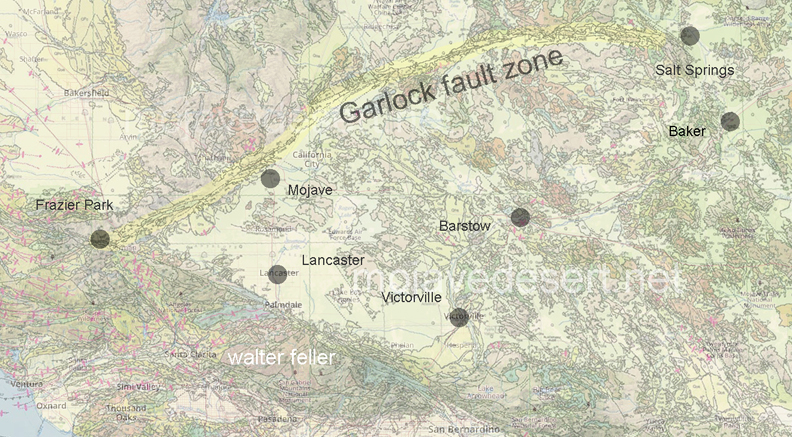
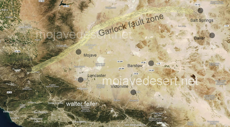


 Death Valley was having one of its periodic wind storms when the tourists drove up in front of Inferno store to have their gas tank filled.
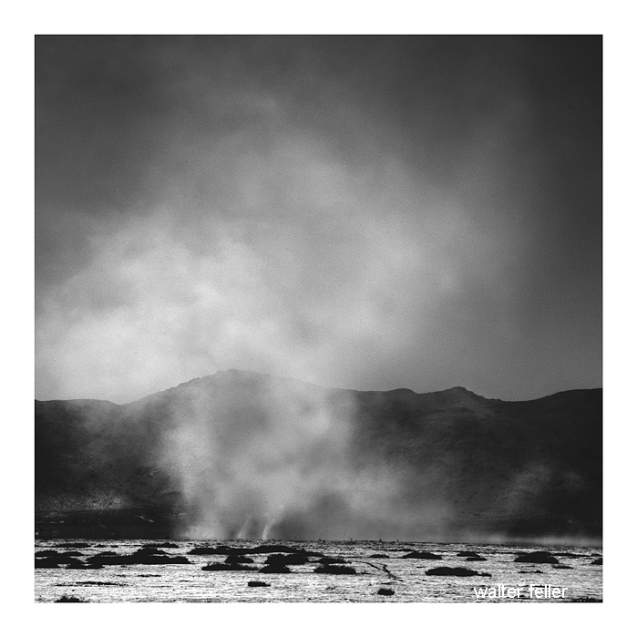
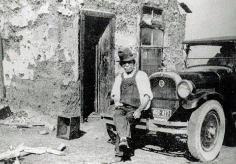
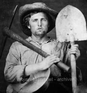
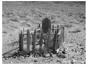
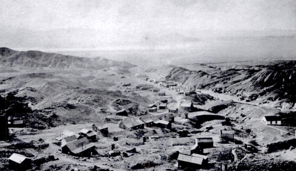
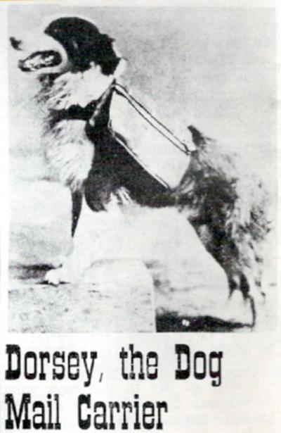
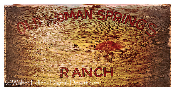
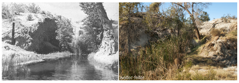
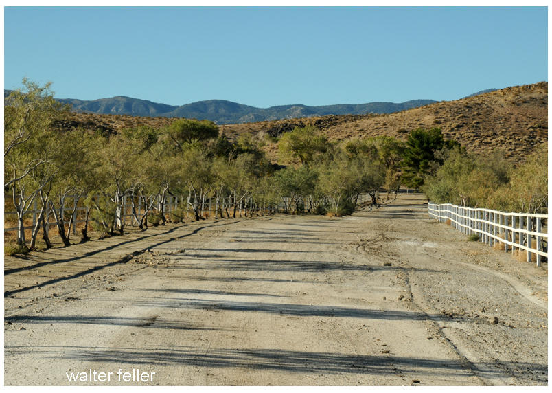
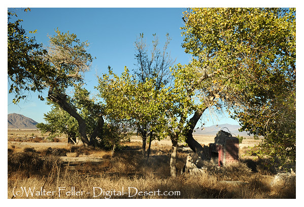
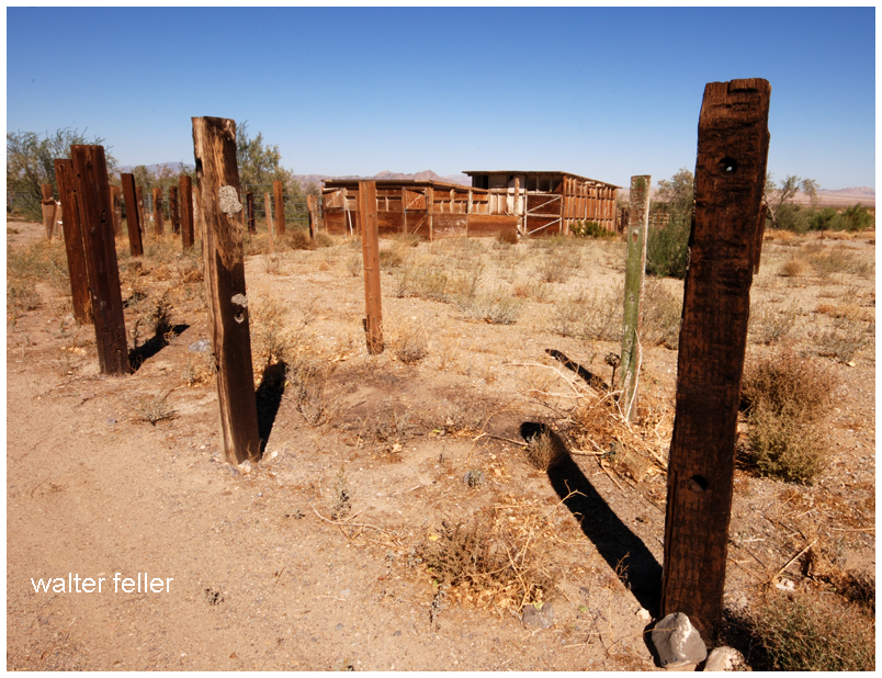
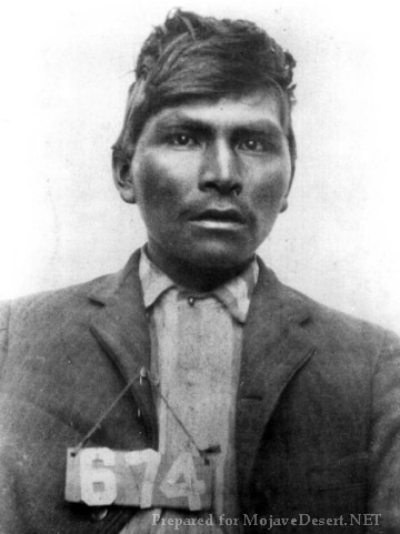

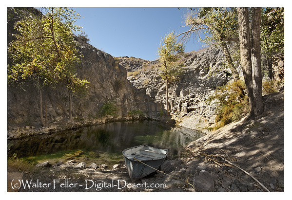
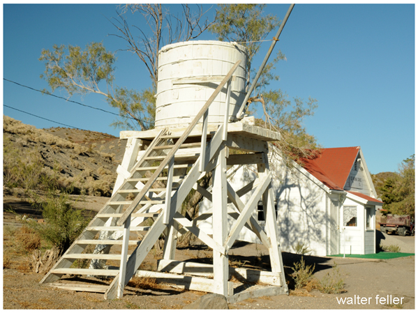
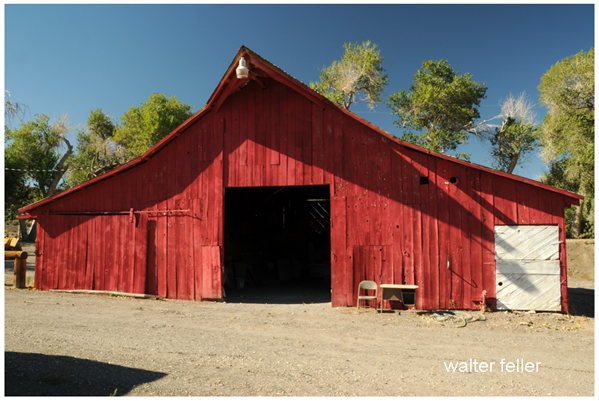
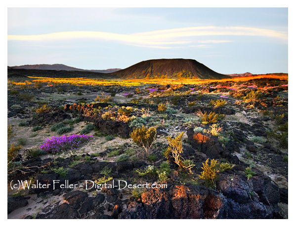

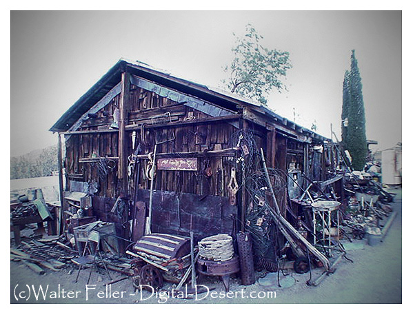
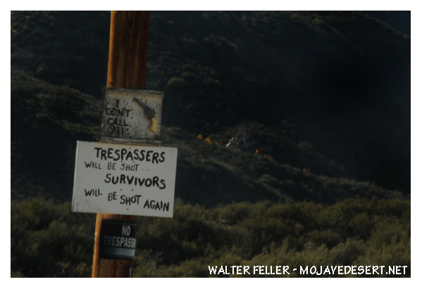
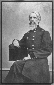
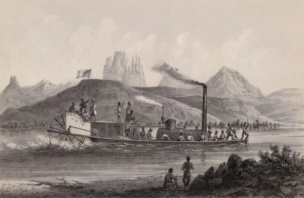
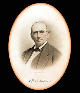
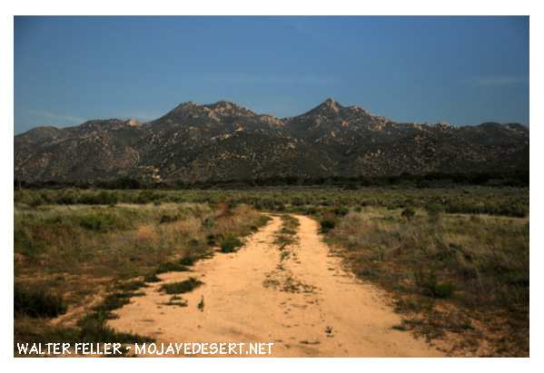

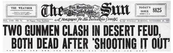
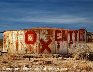

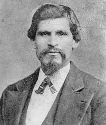
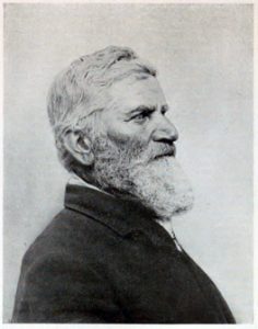
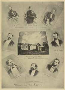

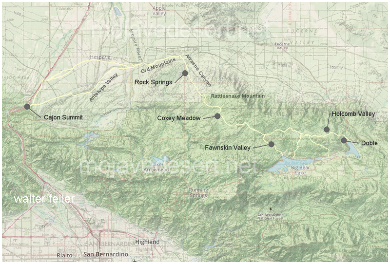
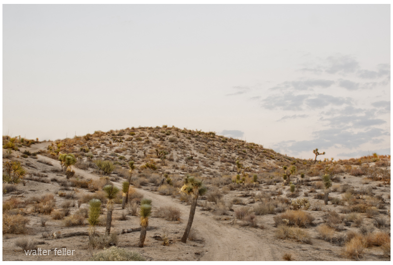
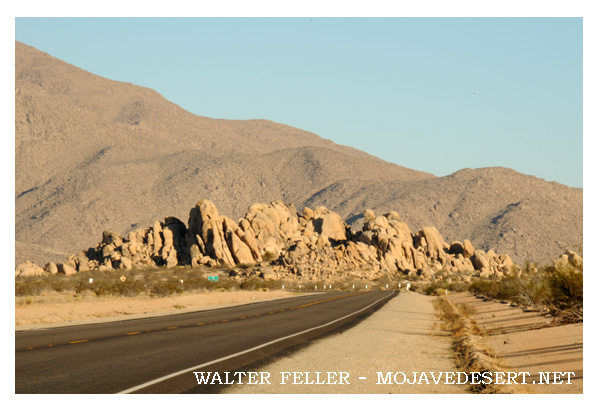
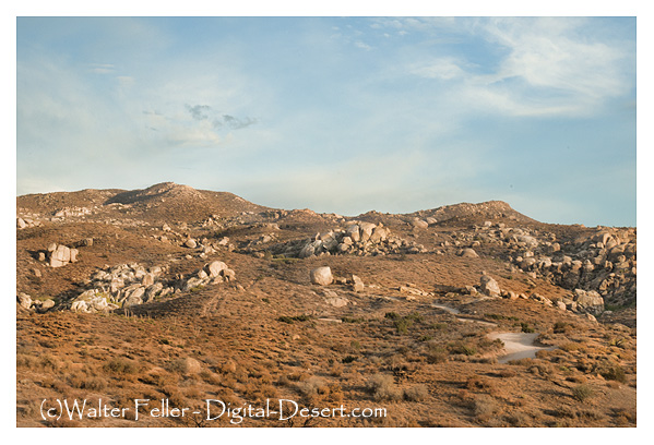


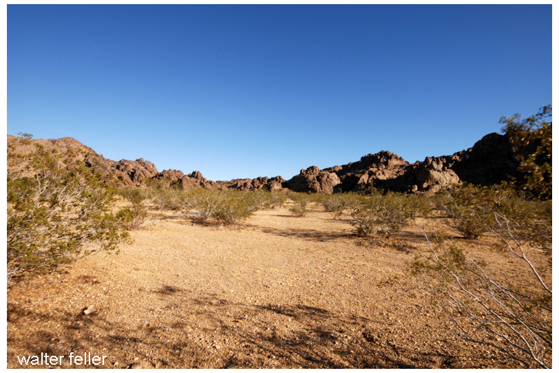
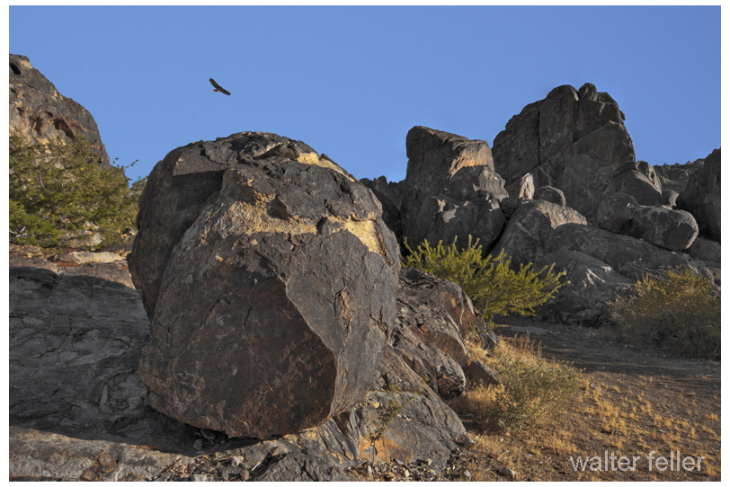
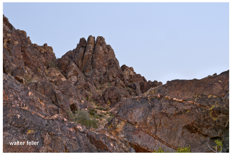
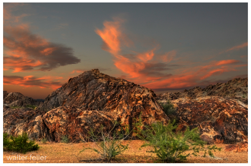
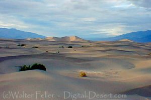
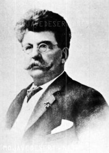
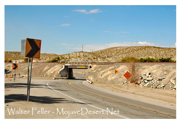
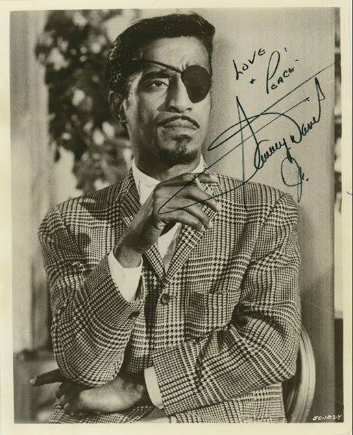

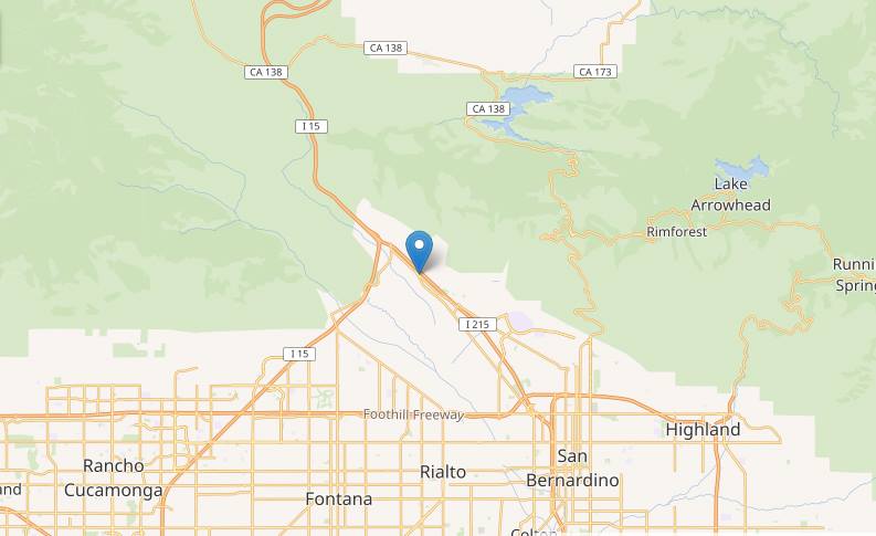
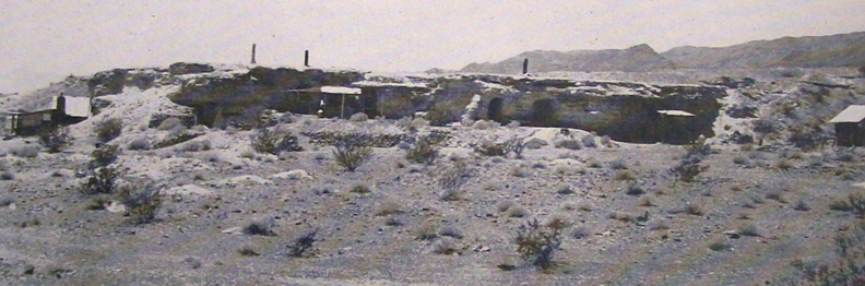
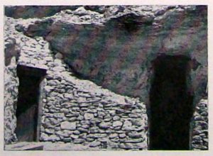

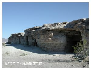
 Sandy Walker says you can’t find gold with Fords – have to have burros. Says he’s been out here in the desert 26 years, 6 years hunting gold and 20 years hunting burros. He didn’t find his mine while hunting gold. He found it while hunting his dadburned runaway burros.