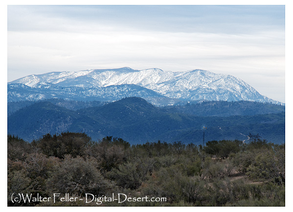
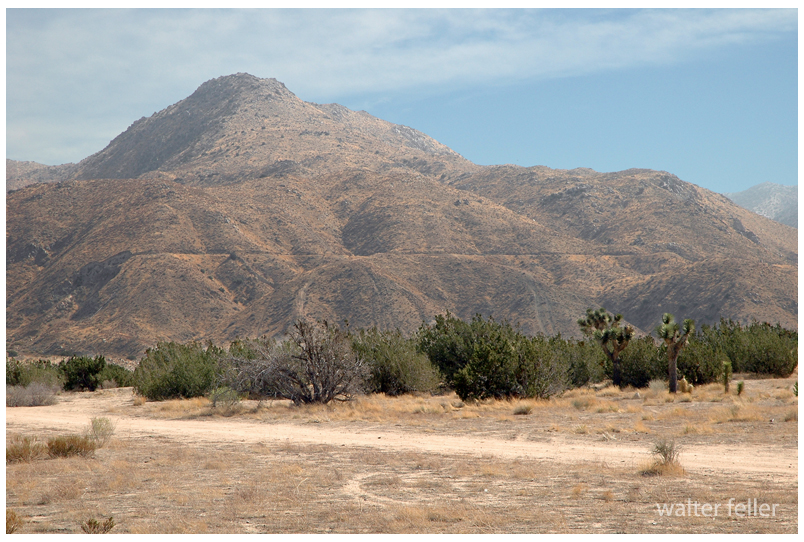
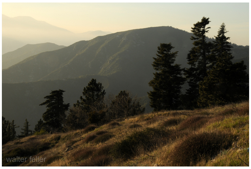
This subsection comprises the higher elevations and cooler parts of the San Bernardino Mountains. The mountains are a horst with faults and steep escarpments on the south-southwest, east-northeast, and west-northwest sides. The subsection is made up of steep and very steep mountains with narrow to rounded summits. The elevations range is from about 4000 feet up to 11,502 feet on Mount San Gorgonio. The predominant natural plant community is Ponderosa pine series. Precipitation is about 30 to 40 inches annually. Much of it is snow. All but the larger streams are dry through the summer. There have been natural lakes, but any lakes that persisted until historical times have been replaced by reservoirs.
Traders in the caravans coming to California did not just trade with those at the missions, but with any group or community they came across. The little settlement of Agua Mansa enjoyed the benefit of being the first village of any size once the mule trains dropped in from the mountains after crossing the deserts.
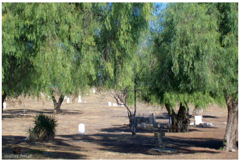
Agua Mansa cemetery
It was called Aqua Mansa, meaning Gentle Water, and was composed entirely of immigrants from New Mexico, numbering some 200 souls–simple, good souls they were, too, primitive in their style of living, kind and hospitable to strangers, rich in all that went to make people happy and content, never having been, up to that time, vexed by the unceremonious calls of the tax collector, owing allegiance to none save the simple, kindhearted old priest who looked after their spiritual welfare. With peace and plenty surrounding them, the good people of Aqua Mansa went to make as contented and happy of people as could be found in the universe.
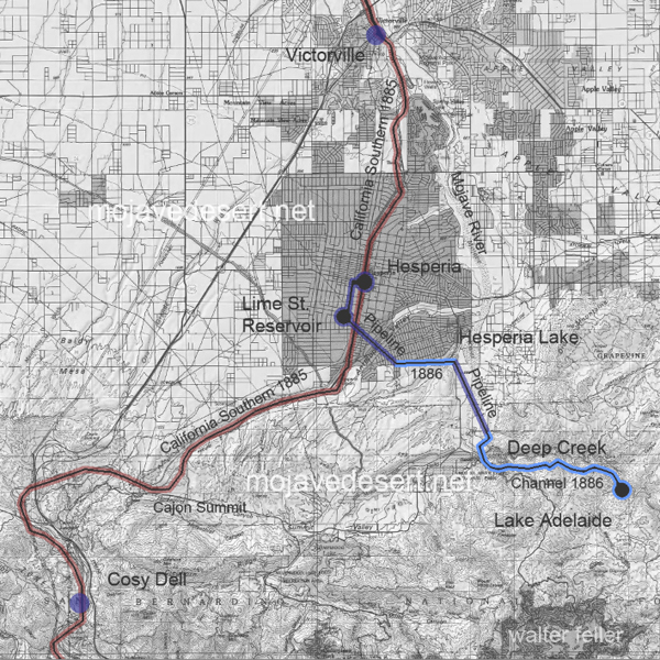
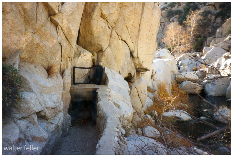
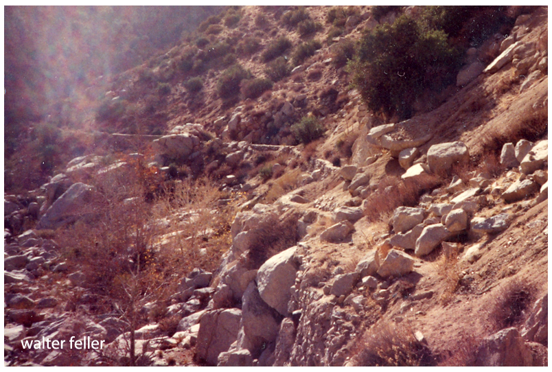
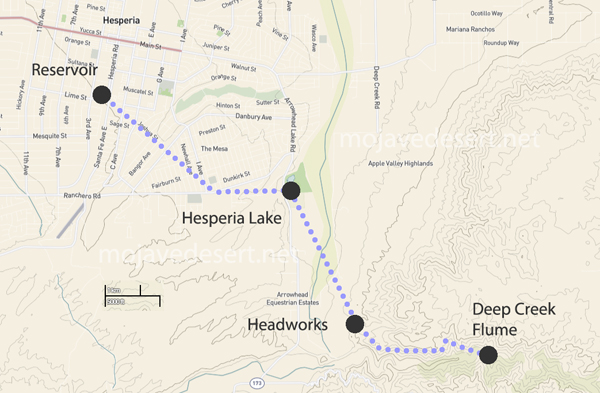
A small dam was erected to raise the water level up against a gate to a flume that could be opened letting water from Deep Creek flow into a stone-walled channel. This channel ran along a carefully continuous slope to a headwater, into a pipeline across theMojave River, then on to an open reservoir in what is now the City of Hesperia, Ca.
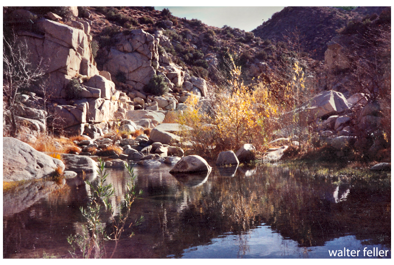
Lake Adelaide – Deep Creek – Hesperia’s water source of the late 1800s and onward . . .Gate at end of the flume. Looking upstream.Canal at flume looking downstream.
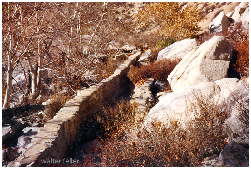
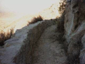
The slope along the canal has to be even to avoid turbulent flow. The walls need to be high enough all along the canal to maintain volume, accommodate hydraulic jump and prevent sloshing over the side. A smooth, even flow like that is called laminar flow.
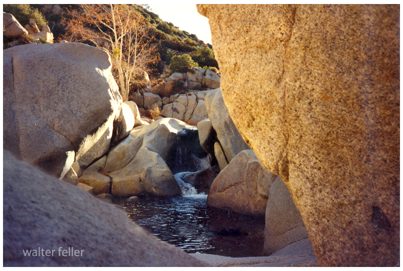
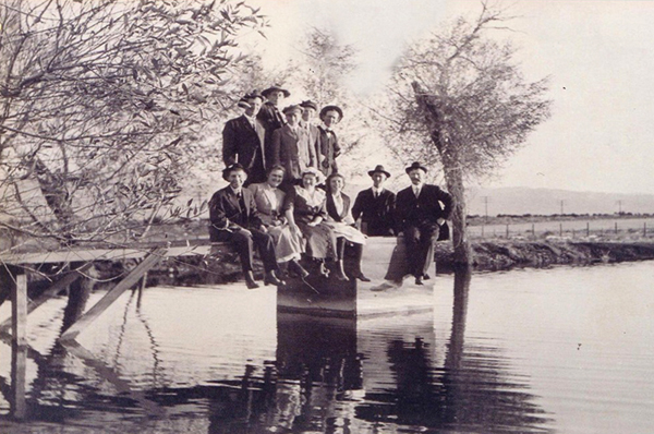
Stunning Lake Adelaide
The smooth flow we look for in an open channel aqueduct is called ‘laminar flow.’ As water passes through the 3 or 4 miles, if the flow is turbulent, all kinds of contaminants may become entrapped and entrained in the water, which is undesirable.
The floor of the channel needed to be flat and to hold a uniform, gentle, even slope for a long distance.
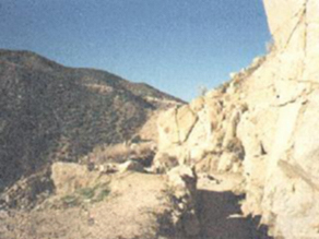
So, water diverted at the flume passes through the gate and into a specifically engineered channel to be delivered to the next step, the headworks.
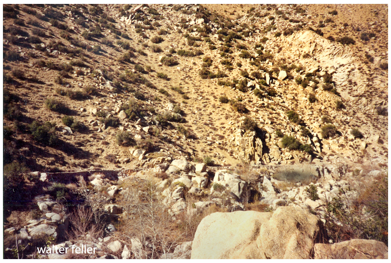
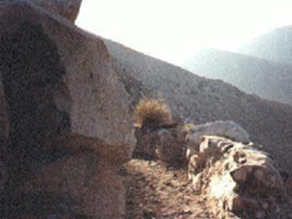
This is the last stretch before the water leaves the mountains. The headworks were at the washed out area to the left.
Think of the headworks as sort of a funnel with the water pouring from the channel into the top of the siphon. There most likely was a grate on there to keep large objects from falling into the pipeline and clogging it.
Headworks at the top of the siphonLooking north (downstream) at Mojave River from southern side of Deep Creek CanyonHesperia Lake, looking southeast toward mountains.
The pipeline changes direction at Hesperia Lake. The origin of the lake is not exactly clear. One story I have heard is that the lake began when the pipeline was leaking and the water did not drain. There is a shallow well in the park that empties into the lake. The spiral-coiled pipe that was used may very well have sprung a leak under the high pressure of being the lowest point of the siphon, as well as a turning point in the line.
Map of water transmission system.
The pipeline turned west at the lake and continued up the little canyon crawling up to the area locally known as ‘the mesa.’ The pipeline then terminated at an open reservoir at what is now Lime Street Park.
Reservoir at end of the pipeline. (courtesy Hesperia Old Time Museum)
All of this rather than dig a hole for a well.
Rotary drilling was being developed, still. Water was down 500-600′ below the surface at this specific location where the reservoir needed to be. Building this canal the 12-14 miles it was, was preferable to digging a well that deep by hand.
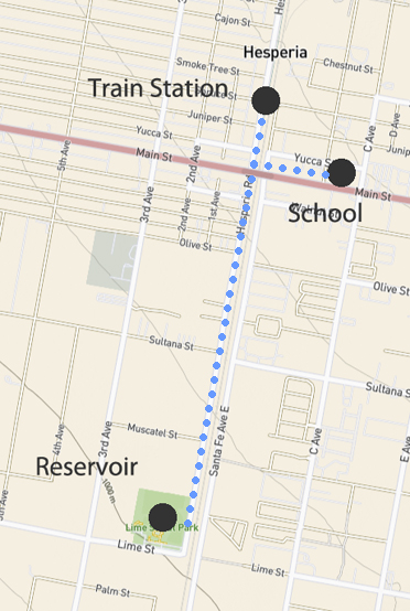
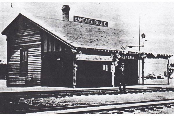
The location of the reservoir was well thought out. The water needed to be here for the community that was being developed. Also, water in an open reservoir that could be seen from a train window was a big attraction for those interested in the area.
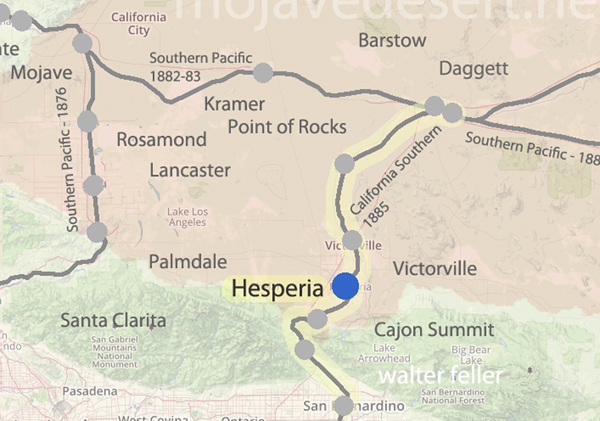
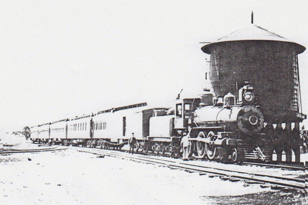
The canal and pipeline were completed in 1886 when the California Southern track was finished and trains began running.
The water in the reservoir would be fed into the water system to fill the tank at the little railroad station across the street from where Walters’ General Store and the Hesperia Hotel would be built, and at the school just over on the east side of the tracks. There at the little schoolhouse at the center of the little community the water that would be delivered at a pressure of 45 PSI, which is about the perfect pressure for use in a home or commercial business.
Water at this location was critical. 500 feet below the surface there was plenty of water, but the drilling technology to get to it was 30-40 years in the future.
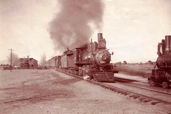
circa – 1900
So, hopefully, all things have been considered and that is the story of how and why water was brought to our mesas and providing our opportunity to grow into the collective mega-empire we are to this very day. IMO.
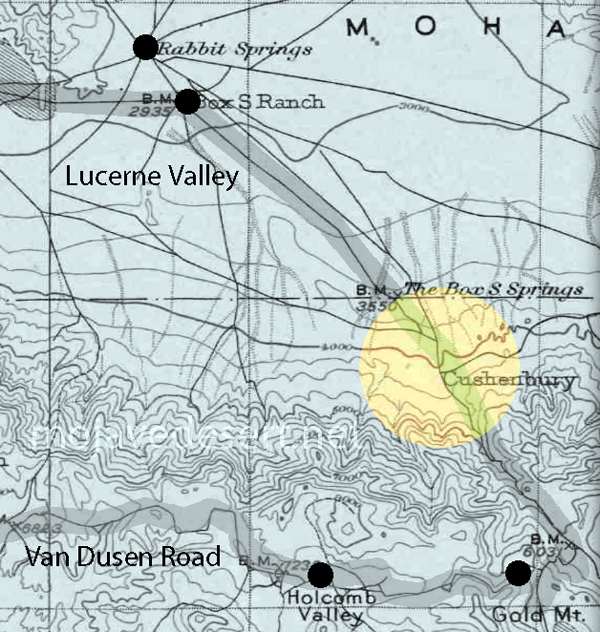
“As miners and ranchers moved into the area looking for wealth, the foothills quickly filled. The first of these documented miners was a man named John Cushenbury. In the 1860s he discovered silver and limestone near the spring, and thus began the rush of miners and “get-rich-quick” dreamers. However, like most get rich quick dreams this was also short-lived leaving ruminants of the small community scattered throughout the area today. This area was Cushenbury City and sported a healthy population for about a year or two.”
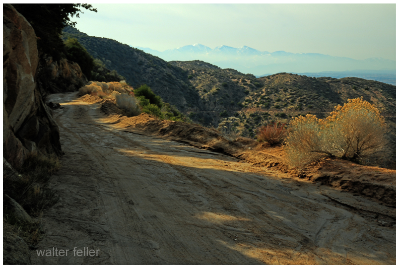
When the air has a bit of a chill and the days are short it feels good to spend time idling down a back road in that golden light with no intended time of arrival, anywhere.
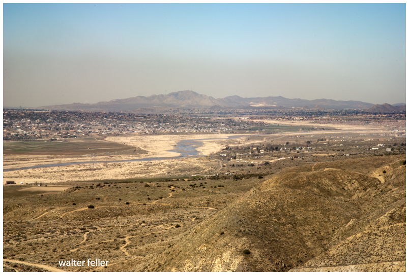
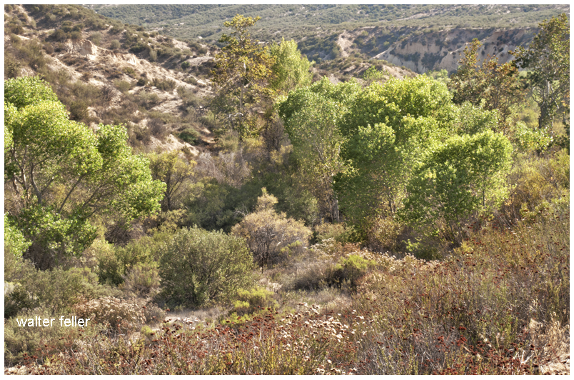
I suppose, if there is any hard and clear boundary to the Mojave Desert that this is where it is. Over time, the Mojave River has cut away the bluff in Summit Valley, east of the Cajon Pass, as the Mojave Desert moves with the rest of the Mojave Block as it separates from the San Bernardino mountain range.
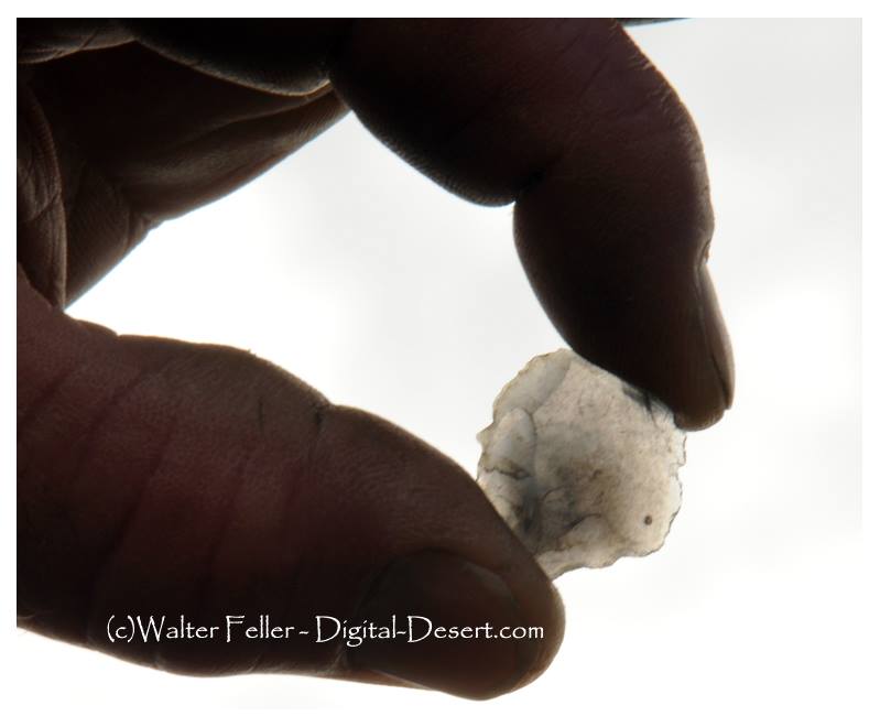
I suppose the cool thing about this flake is that it was found in a little spot in a large meadow at the bottom of a valley in a local mountain range hundreds of miles from the closest source of obsidian. This may mean it was part of a trade or series of trades between Indian groups maybe even thousands of years ago. With each trade, with each mile from the source the rock that this flake was part of became more and more valuable. With each trade the material became more precious and smaller flakes like this, which may have been discarded as debitage closer to the source, but used for smaller items and valued the further the distance away.
This flake was found in what could have been an ancient campfire, or fire pit as there was countless bit of charcoal the same color as the little rock. The difference in texture made the piece standout from the charcoal. The gentleman that found this noticed this difference from his experience, developing an eye for these types of relics while I stood there spacing out at the beautiful scenery. He held it up to the light so I could snap a picture showing its translucence. Amazing to me. He flipped it up into the air like a coin–it landed back on the midden. Then we went somewhere else.
by Van P. Wilkinson – Desert Magazine – July, 1971
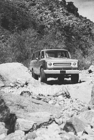
Relics lure as many folks into California’s wilderness today as did the precious ores of the 1800s. To get a piece of the action then, the needs were demanding and basic: a weatherproof disposition, an impenetrable faith against stark wilderness, and an inventive craftiness to second-guess nature. Today, it’s a mite simpler: a topographical map, an off-road vehicle, and a slight case of frenzied persistence.
Rattlesnake Canyon
Rattlesnake Canyon is a handy one-day hunting ground for the slightly-more than-motivated. Here, you’ll find noteworthy mining remains, a scattering of solder-top-age cans and purple glass, and many short 4WD excursions to seldom visited wild areas.
Historically, the San Bernardino Mountains were prospected and mined over a hundred years before the gold migration to the Mother Lode in 1849.
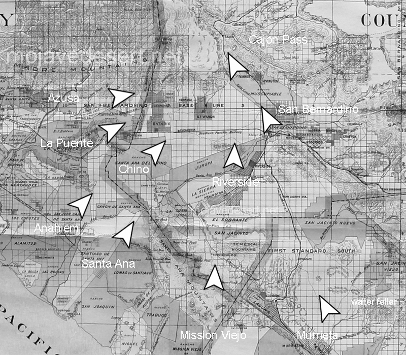
Indians and Spanish found in the San Bernardinos not only beauty and shelter, but trading commodities such as furs and minerals. Holcomb Valley gold, discovered in the early 1860s, created some new geographical problems peculiar to this northeasterly mountain location. The great Mojave Desert trough of Victor, Apple, Lucerne and Johnson valleys was closer than the southwesterly mountain slopes into the “civilized” basins of San Bernardino, Redlands and Riverside.
While selecting appropriate shipping routes from the Big Bear Lake vicinity, trailblazers and last-chance prospectors joined forces in the 1860s and began serious exploring and mapping of the canyons east and north down to the desert flatlands.
Like all venturers, these men named areas as often by whim as by rationale. Rattlesnakes are common in high desert canyons leading into the mountains, and there are no less than three canyons and three springs in this region which still bear that viperous name. The Rose Mine is located in another Rattlesnake Canyon (Burns Canyon to Pioneertown); the Balanced Rock Mine east of the Old Mormon Trail is located near another Rattlesnake Spring (between Apple Valley and Fawnskin).
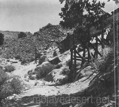
Once used to haul ore from the wooden chute the old wagon road is now covered with weeds and shouts of the wagon masters are no longer heard.
By 1870, the Black Hawk and Silver Reef Mining Districts had been established just a few miles west ofOld Woman Springs. It is safe to assume that the initial digs in our Rattlesnake Canyon were made between I860 and 1880. Generous samples of pre-automation cans and shallow tunnels marked with hand-hewn primitiveness hint at this.
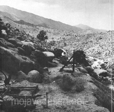
Looking west toward the Bighorn Mountains (below) are seen the shaft, headframe and tailings of the mining operation. Photos by Van P. Wilkinson
Getting into Rattlesnake Canyon today is not altogether simple. The westerly entrance, via Old Woman Springs, is through private property and prohibited. On Old Woman Springs Road toward Yucca Valley, a set of telephone poles flanks the road on the north side. At one point about three miles east of Old Woman Springs there is a support pole on the south side of the road, where the asphalt curves. At this bend, where a taut cable crosses over the road, is the dirt road leading southwesterly into the Bighorn Mountains.
Gentle, dipping and dusty, this road covers some four miles across the alluvial fan toward the mouth of Rattlesnake Canyon. The trail narrows and winds near two private corrals at Two Hole Spring. Then, abruptly, the road dives into the rocky, sandy wash of the canyon. From here to the major mining area (some five miles), it’s either high-clearance 2WD with non-slip differential or 4WD. Why? Because the tracks follow the granular riverbed and at times over breadbasket-sized boulders.
You’ll know you’re on the right path when you reach a cattle gate at the canyon mouth. A sign reads, “Close Gate.” Please do so—stray cattle yield lost revenue and irate ranchers.
Not more than 200 yards on up the southwesterly side of the canyon is Rattlesnake Spring, surrounded by a cattle shed and feed supplies. It was in this area that a couple of glaring bulls blocked the path of our truck while protecting a wary herd-Be careful.
The road dodges and cuts along the wide canyon floor for about two miles, narrow and sandy enough in many places to prohibit campers. Great banks of quartz sediment and loose conglomerate choke the canyon’s south side in a few places as the Bighorn Mountain slopes begin to near the road. The northerly canyon banks show random mineral prospects and dune-buggy scars.
Mica, quartz-veined granite and schist are common ingredients along Rattlesnake Canyon’s steep sides. Multi-colored quartz specimens lay eroded in various sizes, good for rock gardens or the rock tumbler.
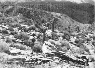
Ruins of a miner’s shack
Some three miles from the gate, the canyon walls move in and the road worsens. The tracks bend in several S’s; in this spot, rainfall or flooding would erase the path and trap a vehicle.
Then, the canyon widens at a gentle cluster of desert willows. Up the northeast canyon bank is a narrow 4WD trail leading to several shafts tunnels and collapsed out-buildings of the central mining activity. One quarter of a mile further up the canyon, another, almost identical trail (but wider) leads in the same direction to a flattened prospector’s shack.
About one-quarter of a mile along the canyon the road ends for all but the bravest with a very narrow 4WD vehicle; it is past this “road’s end” about 200 yards that a tunnel strikes west into the canyon wall. Here, in the tailings, is a collector’s “relic’in reward.”
The tailings of the 80-foot tunnel are small, but the abundance of undisturbed cans amidst the debris is amazing. Evidently, those who made it this far in the past were not after relics, just cattle or adventure.
However, the dumps and discards at the area of major activity have been partially investigated. The shafts were probably started in this region before 1900, but have been worked on and off since then—deepened and reinforced. The tunnels at this site are relatively new, and a nearby claim indicates that someone was still investing money in Rattlesnake Canyon as late as 1967.
A steep trail leads south from the flattened prospector’s shack, presumably paralleling the canyon trail to Mound Spring and the Rose Mine region. This is the direction from which explorers came in the 1860s. Another trail, marked on the map, heads southwesterly from Rattlesnake Canyon up a subsidiary wash toward Granite Peak. Neither of these is for amateurs.
Whether you find in the Bighorn Mountains a chance to test your off-road navigation, or whether you find a relic to add to your collection, there’s one certainty: you’ll be bitten by the lure of Rattlesnake Canyon.
-end-
The Old Spanish Trail had become increasingly used as a pack mule trail between New Mexico and California, and with this traffic came the opportunity for those to take advantage of the distance and desperate nature of the land.
Hundreds and sometimes even thousands of stolen horses from the ranchos would burst through Coyote Canyon beginning their ‘journey of death’ across the Mojave.
California horses were beautiful creatures, and the mules were taller and stronger than those in New Mexico and they were easy to steal. The rolling hills and plains presented clear paths to the Cajon where numerous hidden canyons and washes were available to slip into and prepare for the furious run across the desert. Horses would be stolen in herds from many different ranchos at once. Hundreds of horses, even thousands could be commandeered and driven by just a few experienced thieves.
Narrows, Crowder Cyn., Cajon Pass
Chief Walkara, ‘Hawk of the Mountains’ and the greatest horse thief in all of history along with his band of renegade Chaguanosos , and notables such as Jim Beckwourth and Pegleg Smith would work together in this illegal trade. During one raid they were said to have coordinated the theft of 3,000-5,000 horses, driving them to Fort Bridger to trade for more horses to run to New Mexico to trade again. Horses would fall from exhaustion every mile and the local bands of Paiute would feast on the remains.
The rich ranchos of southern California.
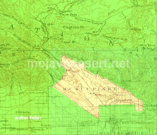
In 1843 Michael White was granted one league of land at the mouth of the Cajon Pass called Rancho Muscupiabe. At a point overlooking the trails leading into and away from the canyon he was expected to thwart the raiders and horse thieves that were plaguing the Southern California ranchos. In theory it was a good plan but in practice it did not work so well.
From the piedmont between Devil and Cable canyons, Miguel Blanco could keep an eye out for the horse thieves entering the Cajon.
He built his home of logs and earth and constructed corrals for his stock. However, the location between Cable and Devil Canyon only served as a closer and more convenient target for the Indian thieves. His family was with him, but after six weeks until it became too dangerous. He left after nine months without any livestock and in debt.
The Old Spanish Trail went down this slope to behind Miguel Blanco’s rough-hewn homestead. Indians would watch from this forest for Miguel to leave and they would slip down and steal everything that could be stolen.
Miguel sold his property, however, Miguel had misread the grant, letting the rancho go for much less than it was worth. The land described on the grant was roughly 5 times larger than Miguel thought. Blanco brought a suit but lost.
Muscupiabe Rancho
As the late 1840s and 1850s rolled by wagon roads were being developed in the canyon minimizing the effectiveness of the maze of box canyons being used to cover the escape of desperadoes on horseback. With California becoming a state frontiersmen such as Beckwourth and Peg Leg Smith would not steal from fellow Americans. Horse-thieving under U.S. law had become a crime where before it was just stealing horses from Mexicans. That was only serious if caught in the act. Americans would never extradite them. For the most part, that was the end of the horse stealing raids.